|
La Perouse; Buffon
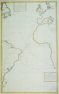
Atlantic Ocean map Carte des Declinaisons et Inclinaisons de l'Aiguille Aimantee redigee d'apres la table des observations Magnetiques faites par les Voyageurs depuis l'Annee 1775
Paris 1788. Very Good; laid on acid-free paper for long-term preservation. Notes: This handsome sea chart that indicates magnetic needle readings along various routes through the Atlantic. Size : 850x532 mm 33.46x20.94 Inches Coloring: Hand Colored in Outline Category: Maps Sea Chart; Maps Ocean Atlantic; unknown
Referentie van de boekhandelaar : M6850
|
|
|
LA PEROUSE, Jean Francois de Galaup
Atlas du Voyage de La Perouse
<p><strong>Atlas to the first edition of "Voyage de La Perouse"</strong></p><p>Folio. 17 ¼ x 11 ¼ inches.Frontis portrait engraved title page 69 engraved plates. Extra map from English edition.Contemporary binding of leather over marbled boards. Covers very worn front cover completely detached remnants of a hand-written label. Embossed stamp to corner of the title page. A few plates with minor discoloration in the gutter from old tape residue but the plates generally clean some trimmed a bit close. A good copy collated complete and with maps and plates in generally fine condition.</p><p>First edition. Atlas volume only. Bound into this copy is an additional map from the English version of the Atlas; Plate 3 "Chart of the Great Pacific Ocean" as well as a partial piece of the English Plate 4 "Plan of the Bay of Conception in Chili". La Perouse sailed to the Pacific and the west coast of North America to examine regions not explored by Cook; to seek the famous Northwest Passage; to obtain information about the fur trade and the Spanish settlements in California; to make scientific observations; and to promote French enterprise in the region. He made valuable contributions to the history of geographical discovery particularly in regard to the American coast. He sent his dispatches from Kamchatka and Botany Bay. After leaving Botany Bay his expedition disappeared and his ships' wrecks were not discovered for another 39 years on one of the Santa Cruz Islands.</p> [Imprimerie De La Republique] hardcover
Referentie van de boekhandelaar : 8615
|
|
|
LA PEROUSE
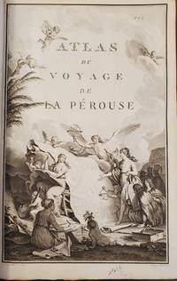
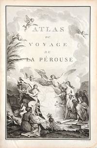
Atlas du Voyage de La Perouse.
Paris. c.1790. An extremely decorative title page featuring a huge scrolled map assorted angels and winged cherubs together with various seated and standing peoples of the world undoubtedly encountered during the La Perouse voyages. Size: 445 x 295 mm. Copperplate engraving. Good condition. unknown
Referentie van de boekhandelaar : 66877
|
|
|
LA PEROUSE, Jean Francois de Galaup
Carte d'une partie du Gran Ocean a l'E. et.SE. de la Nouvelle Guinee.
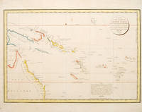
Paris: 1797. Interesting chart of part of the south-western Pacific showing the routes taken by the Spanish explorer Don Francisco Antonio Maurelle in 1781 along the northern coast of New Guinea and across the Pacific to Fiji and Tonga. Maurelle was credited with the discovery of the Hermit Islands on this voyage. The map includes the north-eastern coast of Australia and parts of the coast of New Guinea. The map shows the 1781 route of his ship "The Princesa" through the Bismarck Archipelago north of New Guinea through the Archipel de Salomos i.e. Solomon Islands and then east across the Pacific to the Iles de Amis i.e. the Friendly Islands now Tonga where he discovered I. Vavao i.e. Vava'u with one of the best anchorages in the South Pacific. The map includes the Iles de Navigateurs i.e. Samoa I. Fidji i.e. Fiji Iles de Esprit i.e. Vanuatu or the New Hebrides Isles and Nouvelle Caledonie i.e. New Caledonia. Many small islands are depicted with notes regarding their sightings by Abel Tasman William Bligh and Maurelle. A note on the chart states that the publisher has placed the islands according to the longitude of other navigators rather than on Maurelle's figures which were considered estimates only and also that Maurelles chart was based on a French chart by Jacques Nicolas Bellin published in 1742. The French cartographers at the time did not consider the Spanish charts to be sufficiently accurate so they preferred to make their own corrections. Size: 490 x 340 mm. Copper engraving. Hand coloured. Good condition. Watermark slight browning and an old repair to the central fold. Good margins. unknown
Referentie van de boekhandelaar : 55868
|
|
|
LA PEROUSE, Jean Francois de Galaup
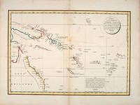
CARTE D'UNE PARTIE DU GRAND OCEAN a l'E et S.E. de la Nouvelle Guinee pour l'intelligence do Voyage de la Fregate Espagnole la Princessa commandee par D.Franco. Antonio Maurelle. en 1781
Atlas du Voyage de la Perouse. c.1785. Interesting chart of part of the south-western Pacific showing the routes taken by the Spanish explorer Don Francisco Antonio Maurelle in 1781 along the northern coast of New Guinea and across the Pacific to Fiji and Tonga. Maurelle was credited with the discovery of the Hermit Islands on this voyage. The map includes the north-eastern coast of Australia and parts of the coast of New Guinea. The map shows the 1781 route of his ship "The Princesa" through the Bismarck Archipelago north of New Guinea through the Archipel de Salomos i.e. Solomon Islands and then east across the Pacific to the Iles de Amis i.e. the Friendly Islands now Tonga where he discovered I. Vavao i.e. Vava'u with one of the best anchorages in the South Pacific. The map includes the Iles de Navigateurs i.e. Samoa I. Fidji i.e. Fiji Iles de Esprit i.e. Vanuatu or the New Hebrides Isles and Nouvelle Caledonie i.e. New Caledonia. Many small islands are depicted with notes regarding their sightings by Abel Tasman William Bligh and Maurelle. A note on the chart states that the publisher has placed the islands according to the longitude of other navigators rather than on Maurelle's figures which were considered estimates only and also that Maurelle's chart was based on a French chart by Jacques Nicolas Bellin published in 1742. The French cartographers at the time did not consider the Spanish charts to be sufficiently accurate so they preferred to make their own corrections. Copper engraving. Good condition. One light and one dark spot of foxing to the upper centre. A slight faint watermark. Later colour. Size: 49 x 34 cm. 19½ x 13½ inches unknown
Referentie van de boekhandelaar : 53439
|
|
|
La Perouse
Carte Des Decouvertes Faites en 1787 dans les Mers De Chine et De Tartarie par les Fregates Francaises.
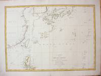
Paris c.1787. Very Good;. Size : 495x680 mm 19.49x26.77 Inches Coloring: Hand Colored in Outline Category: Maps Asia Far East China; Maps Asia Far East Japan & Korea; unknown
Referentie van de boekhandelaar : M7397
|
|
|
La Perouse; Cook
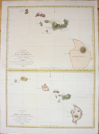
Carte Des Parties Des Iles Sandwich./ Carte Des Iles Sandwich.
Paris 1798. Very Good;small restoration at left margin. Size : 490x678 mm 19.29x26.69 Inches Coloring: Hand Colored Category: Maps United States West Hawaii; unknown
Referentie van de boekhandelaar : M7217
|
|
|
La Perouse, Jean FG F G
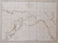
Carte des cotes de l'Amerique dt de l'Asie depuis la Californie jusqu a Macao d'apres les Decouvertes faites en 1786 et 1787 par le Fregates Francaises la Boussolle et L'Astrolabe. map
Paris: La Perouse 1797. Map. Very good condition. Unbound. First Edition. Folio. A large map in black and white. The map is included in the Atlas volume of La Perouse's Voyages. The west coast of North America is shown as south as Baja California and north to above 70 degrees latitude. Shows part of China and all of Japan and Kamtschatka and an attractive depiction of the Behring Straits and the Alaskan Archipelago. There are about a dozen small dark spots and dozens of others that are tiny but the map remains quite clean retaining large margins. La Perouse Paperback
Referentie van de boekhandelaar : 016791
|
|
|
LA PEROUSE, Jean Francois de Galaup
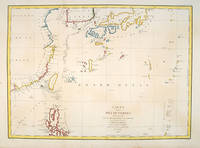
Carte des découvertes.
Paris:. 1797. From the Voyages of La Pérouse who set sail from France in 1785 to continue the discoveries of Captain Cook. He was shipwrecked in 1788 but his narrative maps and views survived and were published in 1797. Fine large chart shows the southern coast of China Japan Korea Formosa & the Philippines and the Marianas as well as many small islands in the region. Locates the tracks of the Boussoles the Astrolabe the ships of La Perouse on his voyage from Manila to Kamtschatka. Chart shows very detailed soundings and all known harbours straits and island chains. Engraved by BOUCLET. Atlas Du Voyage De La Pérouse Size: 675 x 490 mm. Copper engraving. Hand coloured. Fine condition. Slight browning to the lower margin. Good margins. unknown
Referentie van de boekhandelaar : 55879
|
|
|
LA PEROUSE, Jean Francois de Galaup
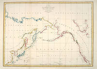
CARTE DES COTES DE L'AMERIQUE ET DE L'ASIE depuis la Californie jusqu'a Macao.
Paris: 1797. A large and imposing sea chart of the North Pacific ocean. From the Voyages of La Pérouse who set sail from France in 1785 to continue the discoveries of Captain Cook. He was shipwrecked in 1788 but his narrative maps and views survived and were published in 1797. Copper engraving. Very good condition. Watermarks. Good margins. Hand coloured. Size: 68.5 x 49.5 cm. unknown
Referentie van de boekhandelaar : 55870
|
|
|
LA PEROUSE, Jean Francois de Galaup
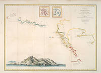
Carte des découvertes au Nord du Japon.
Paris: 1797. From the Voyages of La Pérouse who set sail from France in 1785 to continue the discoveries of Captain Cook. He was shipwrecked in 1788 but his narrative maps and views survived and were published in 1797. An attractive map of the regions North of Japan withs two inset maps: Extrait de la carte publiee par Scheuchzer -- Extrait de la carte de l'Histoire du Japon de Kampfer. Relief shown pictorially; depths by soundings. Oriented with north toward right. Atlas Du Voyage De La Pérouse. Size: 675 x 490 mm. Copper engraving. Hand coloured. Very good condition. A faint vertical waterstain. Good margins. unknown
Referentie van de boekhandelaar : 55878
|
|
|
LA PEROUSE, Jean Francois de Galaup
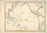
CARTE DU GRAND OCEAN OU MER DU SUD.
Paris: 1797. A splendid large chart of the Pacific Ocean and of those countries that border it. Only coastal information is given. From the Voyages of La Pérouse who set sail from France in 1785 to continue the discoveries of Captain Cook. He was shipwrecked in 1788 but his narrative maps and views survived and were published in 1797. Copper engraving. Very good condition. Faint waterstain along the left vertical fold. Very slight foxing not affectong the image. Hand coloured. Size: 68.5 x 49.5 cm. unknown
Referentie van de boekhandelaar : 55869
|
|
|
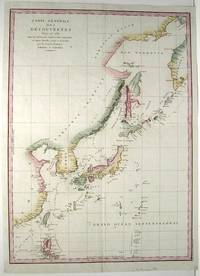
La Perouse
Carte Generale des Decouvertes faites in 1787 dans les Mers de China et de Tartarie ou depuis Manille jusqu'a Avatscha. par les Fregates Francaises la Boussolle el l'Astrolabe
Paris 1797. Excellent. Size : 685x495 mm 27x19.5 Inches Coloring: Hand Colored Category: Maps Asia Far East China; Maps Asia Far East Japan & Korea; unknown
Referentie van de boekhandelaar : M753
|
|
|
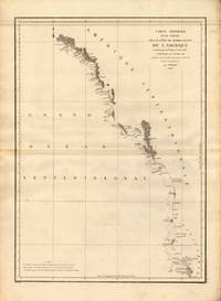
La Perouse, Jean-Francois de Galup
Carte Générale D `une Partie de la Cote du Nord-Quest. De L´Amérique reconnue parles Frégates Francaifes La Bousole et L`astrolabe Assujettie au point journalier de la Frégate la Boussole déterminé astronomiquement par M. Dageler. La Perouse Jean-Francois de Galup – Carte Générale D `une Partie de la Cote du Nord-Quest. · Antique Map Copper Engraving · 690 x 490mm · Paris 1797
Paris 1797. Other. In excellent condition. 690 by 490mm 27 by 19 inches. 690 by 490mm 27 by 19 inches. Copper Engraving uncolored by La Perouse Jean-Francois de Galup published 1797 by Paris. Image size: 690 by 490mm 27 by 19 inches. By Lapérouse — among the rarest and most historically important charts of the Northwest Coast ever produced. Jean-François de Galaup Comte de Lapérouse 1741–1788 was the foremost French navigator and explorer of the late 18th century. Commissioned by Louis XVI to lead a major scientific and commercial expedition to the Pacific he departed Brest in 1785 with two frigates — the Boussole and the Astrolabe — and spent three years charting the Pacific and North American coasts with extraordinary precision. His charts of the Northwest Coast of North America 1786 were the first scientific surveys of many sections of that coastline and were published posthumously in the celebrated four-volume Voyage de Lapérouse autour du monde 1797. The expedition disappeared without trace near Vanikoro in 1788. Lapérouse's charts are among the most historically important and rarest maps of the Pacific and Northwest Coast ever produced.This antique map of Carte Générale D `une Partie de la Cote du Nord-Quest. De L´ was published in 1797 by Paris 690 by 490mm 27 by 19 inches. It is printed as a copper engraving uncolored. The map documents the region with careful attention to rivers settlements roads and political boundaries reflecting the geographical knowledge available at the time of publication and offering an invaluable primary source for historians and collectors of North American antique cartography. In excellent condition. unknown
Referentie van de boekhandelaar : 24538
|
|
|
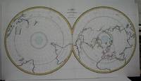
La Perouse; Buffon
Carte Magnetique des Deux Hemispheres
Paris 1788. Very Good folding map flattened and folds reinforced laid on acid free canvas for long term preservation. Notes: "Double hemispherical world map with each hemisphere shown on polar projection. Plate probably accompanied: Histoire naturelle generale et particulare / George Louis Leclerc Buffon. Paris 1749-1804. Plate "No. 8" of an 8 sheet map which was probably compiled from the reports of La Perouse’s last voyage in the Pacific and is by Jean-Charles Borda." National Library of Australia Digital Collection map-rm3253 Size : 480x940 mm 18.875x37 Inches Coloring: Hand Colored in Outline Category: ; Maps Polar Antarctic Regions; Maps Polar Arctic Regions unknown
Referentie van de boekhandelaar : M5521
|
|
|
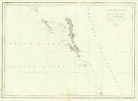
La Perouse, Jean-Francois de Galup
Carte Particuliere de la Cote du Nord-Quest de L´Amérique reconnue par les Frégates Francaises la Boussole et L`Astrolabe en 1786 2e Feuille.
Paris 1786. Other. In excellent condition. 490 by 860mm 19¼ by 33¾ inches. Copper engraving uncolored as published. unknown
Referentie van de boekhandelaar : 24580
|
|
|
La Perouse, Jean-Francois de Galup
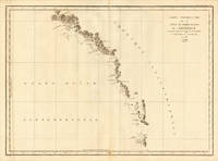
Carte Particuliere de la Còte du Nord-Quest de L Amerique reconnue par les Fregates Francaifes la Boussole et L Astrolabe en 1786 le Feuille. La Perouse Jean-Francois de Galup – Carte Particuliere de la Còte du Nord-Quest de L Ameri. · Antique Map Copper Engraving · 495 x 685mm · Paris 1786
Paris 1786. Other. In excellent condition. 495 by 685mm 19 by 27 inches. 495 by 685mm 19 by 27 inches. Copper Engraving uncolored by La Perouse Jean-Francois de Galup published 1786 by Paris. Image size: 495 by 685mm 19 by 27 inches. By Lapérouse among the rarest and most historically important charts of the Northwest Coast ever produced. Jean-François de Galaup Comte de Lapérouse 17411788 was the foremost French navigator and explorer of the late 18th century. Commissioned by Louis XVI to lead a major scientific and commercial expedition to the Pacific he departed Brest in 1785 with two frigates the Boussole and the Astrolabe and spent three years charting the Pacific and North American coasts with extraordinary precision. His charts of the Northwest Coast of North America 1786 were the first scientific surveys of many sections of that coastline and were published posthumously in the celebrated four-volume Voyage de Lapérouse autour du monde 1797. The expedition disappeared without trace near Vanikoro in 1788. Lapérouse's charts are among the most historically important and rarest maps of the Pacific and Northwest Coast ever produced.This antique map of Carte Particuliere de la Còte du Nord-Quest de L Amerique r was published in 1786 by Paris 495 by 685mm 19 by 27 inches. It is printed as a copper engraving uncolored. The map documents the region with careful attention to rivers settlements roads and political boundaries reflecting the geographical knowledge available at the time of publication and offering an invaluable primary source for historians and collectors of North American antique cartography. In excellent condition. 495 by 685mm 19 by 27 inches. unknown
Referentie van de boekhandelaar : 24536
|
|
|
La Perouse
Carte Particuliere de la Cote du Nord-Ouest de l'Amerique reconnue par les Fregates Francaises La Boussole et l'Astrolabe en 1786
Paris 1797. Very Good; light dampstain on lower margin. Size : 494x677 mm 19.375x26.625 Inches Coloring: Black & White Category: Maps Polar Arctic Regions Alaska Greenland Iceland; unknown
Referentie van de boekhandelaar : M2909
|
|
|
LA PEROUSE, Jean FranAois De Galoup, Comte de [1741-1788]
Carte Particuliere De La C‘te Du Nord-Ouest De LíAmÈrique reconnue par les FrÈgates Francaises La Boussole et LíAstrolabe en 1786. 1e Feuille. Atlas du Voyage de la PÈrouse. No. 17. HÈrault scrip
Paris: 1797. This map shows La PÈrouseís 1786 northwest coast exploration route from Mount St. Elias on the Alaska-Canada border to ëBaie de Clonardí a cove on the west side of Graham Island. La PÈrouse was appointed to lead a French expedition which would further the scientific and geographical exploration of the northwest. He was also charged with continuing the search for the North-West passage from the Pacific side. Wagner Cartography Of The Northwest Coast Of America 841. Phillips Atlases 688. Falk Alaskan Maps 1797-9. 19 ºî x 26 æî. engraving paper flaws below upper border & lower margin [Paris: 1797] unknown
Referentie van de boekhandelaar : elala4671
|
|
|
LA PEROUSE, Jean Francois de Galaup
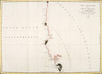
CARTE PARTICULIERE DE LA CÔTE DU NORD-OUEST DE L'AMÉRIQUE reconnue par les Frégates Françaises LA BOUSSOLE ET L'ASTROLABE en 1786 3e. Feuille.
Paris. 1797. From the Voyages of La Pérouse who set sail from France in 1785 to continue the discoveries of Captain Cook. He was shipwrecked in 1788 but his narrative maps and views survived and were published in 1797. Thirty-eight years later the scattered remains of La Boussole and L'Astrolabe was discovered wrecked on a vicious reef on an atoll in the New Hebrides. Attractive sea chart covering coast from Mt. St. Elias to Monterey Bay. Relief shown by hachures. Shows route of La Perouse. Published in 'Atlas Du Voyage De La Pérouse'. Size: 575 x 845 mm. Copper engraving. Hand coloured. Very good condition; some light stains along the lower horizontal fold; a tear and some foxing to the upper margin; wide margins. unknown
Referentie van de boekhandelaar : 56360
|
|
|
LA PEROUSE, Jean Francois de Galaup
Carte particuliere de la Cote du Nord-Ouest de l'Amerique.
Paris: 1797. From the Voyages of La Pérouse who set sail from France in 1785 to continue the discoveries of Captain Cook. He was shipwrecked in 1788 but his narrative maps and views survived and were published in 1797. Two watermarks one on each side of the islands. Engraved by Bouclet. Atlas Du Voyage De La Pérouse. Size: 680 x 495 mm. Copper engraving. Hand coloured. Very good condition. Faint waterstain on the left vertical fold and slight foxing to the upper horizontal fold not affecting the image. Good margins. unknown
Referentie van de boekhandelaar : 55871
|
|
|
LA PEROUSE, Jean-Francois de Galaup
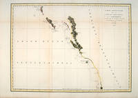
Carte Particuliere de la Côte du Nord-Ouest de l'Amérique Reconnue par les Frégates Françaises la Boussole et l'Astrolabe en 1786. 3e. Feuille
Paris: Imprimerie de la République 1797. First Edition. Folio Leaf. Very Good. Hérault / Bouclet. Elephant Folio. Leaf measures 33.25" x 23.25" while the printed chart is 26.5" x 19.5". Fold at center as issued. Condition is Very Good with very light foxing within the plate and slightly darker foxing in the top right margin. A dampstain the size of a fifty-cent piece at the lower right corner outside the border rule and not affecting print impression. La Pérouse was France's answer to Captain James Cook. Directed by King Louis XVI to explore and chart the Pacific in 1785 La Pérouse set sail from France with the frigates Boussole and Astrolabe . and never returned. After years of speculation and expeditions sent in search of the ships their 1788 shipwrecked-fate in the South Seas was finally ascertained. Prior to disappearing La Pérouse dispatched a courier homeward overland via Russia with his narrative charts and artist-depictions to-date. His achievements were published in 1797 including this chart.<p>This chart covering the coastline from Cape Rond Tillamook Head northward to the Baie de Clonard present-day Queen Charlotte Islands or Haida Gwaii was the only chart of the region other than works by or based on Cook's efforts. Three Spanish voyages and Cook's third voyage had visited the west coast of now-known Vancouver Island before La Pérouse. As depicted in this chart the land mass is not yet known by the place-name "Vancouver" nor is it recognized as an island. LADA-MOCARSKI 52 claims the best charting by La Pérouse is on the Asian side of the Pacific. Indeed it must be noted that La Pérouse like Cook missed both the Columbia River and the Strait of Juan de Fuca. See WAGNER Cartography of the Northwest Coast of America 840. Imprimerie de la République unknown
Referentie van de boekhandelaar : 151
|
|
|
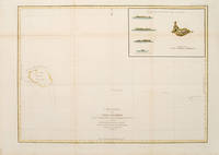
LA PEROUSE, Jean Francois de Galaup
Carte plate de l'Ile Necker.
Paris: 1797. From the Voyages of La Pérouse who set sail from France in 1785 to continue the discoveries of Captain Cook. He was shipwrecked in 1788 but his narrative maps and views survived and were published in 1797. Sea chart showing Necker Island a small island in the Pacific Ocean part of the Nortwestern Hawaiian Islands. La Perouse was the first European to visit the island in 1786. Map inset in the right top corner showing profiles of the island from different angles. Atlas Du Voyage De La Pérouse. Size: 680 x 485 mm. Copper engraving. Hand coloured. Very good condition. Faint waterstain to the left vertical fold. Good margins. Watermarks. Folds as issued. unknown
Referentie van de boekhandelaar : 55873
|
|
|
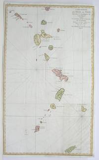
La Perouse
Carte Reduite des Isles du Vent Pour Servir a l'intelligence de cette Histoire; Copiee avec permission de Mgr. le Marechal de Castries Ministre et Secretaire d'Etat de la Marine et des Colonies Sur le No. 75 de l'Hydrographie Francoice Tom. II.
Paris 1796. Very Good; lower margin extended. Size : 606x362 mm 23.875x14.25 Inches Coloring: Hand Colored Category: ; Maps West Indies Whole unknown
Referentie van de boekhandelaar : M3355
|
|
|
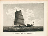
LA PEROUSE, Jean Francois de Galaup Blondela
Champan bateau chinois.
1797. From the Voyages of La Pérouse who set sail from France in 1785 to continue the discoveries of Captain Cook. He was shipwrecked in 1788 but his narrative maps and views survived and were published in 1797. Thirty-eight years later the scattered remains of La Boussole and L'Astrolabe was discovered wrecked on a vicious reef on an atoll in the New Hebrides. Engraved by Le Pagelet. Size: 250 x 180 mm. Fine condition. Some foxing to the lower margin not affecting the image. unknown
Referentie van de boekhandelaar : 55896
|
|
|
LA PEROUSE, Jean Francois de Galaup, comte de (1741-1788)
Chart of Part of the North West Coast of America explored by the Boussole & Astrolabe in 1786. 1st Sheet
London: G.G. & J. Robinson 1799. Original copper engraving. This detailed map shows the south eastern part of Alaska.<br/> <br/> A fine copy of this engraving from Robinson's edition "usually considered to be the best one in English . and is extremely rare" Hill picturing and charting La Perouse's ill-fated voyage round the world. "La Pérouse's expedition was one of the most important scientific explorations ever undertaken to the Pacific and the west coast of North America . The charge to the expedition which took place between 1785 and 1788 was to examine such parts of the region as had not been explored by Captain Cook; to seek for an interoceanic passage; to make scientific observations on the various countries peoples and products; to obtain reliable information about the fur trade and the extent of Spanish settlements in California; and to promote the inducements for French enterprise in that quarter . La Pérouse and his men did important geographical research . The voyage also included the first foreign scientific group ever to visit California. La Pérouse sent dispatches back to France from Kamchatka and Botany Bay. The two ships then set sail from Botany Bay in 1788 and were never heard from again" Hill. It was not until the 1820s that the wrecks of his ships were discovered on a reef in the Santa Cruz group. When it became clear that something had happened to the expedition a decision was made to publish the journals he had transmitted home.<br/> <br/> Cowan p.383; Ferguson 288; Hill 2004 975; Howes L93 'b'; Lada-Mocarski 52; Sabin 38962; TPL 596; Wagner Cartography of the Northwest Coast 837-848 pp.199-201; Zamorano 49. G.G. & J. Robinson unknown
Referentie van de boekhandelaar : 38451

|
|
|
LA PEROUSE, Jean FranAois De Galoup, Comte de [1741-1788]
Chart of the Northwest Coast of America. Explored by the Boussole and Astrolabe in 1786. 1st Sheet
London: G.G. and J.Robinson 1798. cfWagner 841 & Falk Alaskan Maps 1797-9 French edition. 16 ºî x 21 ºî 41.3 x 54.3 cm. engraving paper weakness at centre fold London: G.G. and J.Robinson, 1798 unknown
Referentie van de boekhandelaar : elala4672
|
|
|
LA PEROUSE, Jean FranAois De Galoup, Comte de [1741-1788]
Chart of the Northwest Coast of America. Explored by the Boussole and Astrolabe in 1786. 2nd Sheet
London: G.G. and J.Robinson 1798. cfWagner 842 & Falk Alaskan Maps 1797-9 French edition. London. 16 ºî x 20 æî 41.3 x 52.1 cm. engraving paper weakness at centre fold London: G.G. and J.Robinson, 1798 unknown
Referentie van de boekhandelaar : elala4673
|
|
|
La Perouse, Jean Francois de Galaup, Comte de
Charts and plates to La Pérouse's voyage.
<p><strong>Atlas to the English edition of the report of the famous voyage around the world by La Pérouse who - in addition to Bougainville and Cook - contributed decisively to the exploration of the Pacific region. Without the two text volumes.</strong></p><p><strong>Description:</strong> Contemporary quarter calf with marbled paper boards. Flat spine lettered and decorated in gilt. Quarto: 44 × 28.5 cm; unpag. 1 engr. frontispiece 1 engr. title page and 67 full-page copper-engraved plates thereof are: 37 plates and 30 maps 20 fold-outs.</p><p><strong>Ref.:</strong> Boucher i p. 149-54; Cox i 67; Sabin 3896</p><p><strong>Condition:</strong> Binding a bit scuffed and with a few surface abrasions at edges. Light waterstains to the gutter of first few leaves. Contents occasionally somewhat soiled more noticeable in the first few leaves slight tanning at edges. Three small brown spots on plate 29 visible between plates 27-37. Lacking plates 1 map of the world and 36 male and female Partridge of California. Some offsetting from plates. Despite the occasional minor blemish a good copy.</p><p><strong>Notes:</strong> La Pérouse 1741-1788 a French naval officer and explorer was appointed in 1785 to lead a scientific expedition to explore the Pacific. The expedition stopped in Chile Hawaii Alaska California Mauritius Réunion Macau Japan Russia and Australia. However his journey ended tragically. In January 1788 he reached Botany Bay. He sent his final notes to France from there before sailing on towards Tonga in March. When no further reports arrived in France for a long period of time the first search expedition was launched in 1791. However it remained unsuccessful. It was not until 1826 that Peter Dillon an Irish sea captain proved that the island of Vanikoro was the site of the accident where the expedition's ships met a tragic end on the reef.</p><p>The first English edition was published in two volumes in octavo format by John Stockdale in London in 1798. Two other translations were published by two different publishers in 1798 and 1799: J. Johnson's first edition appeared in 1798 and J. Robinson's in 1799. Regarding these editions Edward Cox writes in his Reference Guide to the Literature of Travel: "On the unexpected publication of this famous voyage at Paris in the previous year 1797 there was considerable competition among English publishers to bring out the English translation. Three different translations were made and published during 1798-99 and different engravers were employed for making the plates. Stockdale's appeared first in June 1798. Robinson's edition of 1799 is the most esteemed edition in English later editions being usually based on it."</p> G. G. & J. Robinson hardcover
Referentie van de boekhandelaar : 000252
|
|
|
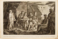
La Perouse, Jean Francois de
COSTUME DES HABITANS DU PORT DES FRANÇAIS SUR LA CÔTE DU NORD-OUEST DE L'AMÉRIQUE.
Paris. 1797. Scene showing inhabitants of Lituya Bay Alaska in native costume. From the Voyages of La Perouse who set sail from France in 1785 to continue the discoveries of Captain Cook. He was shipwrecked in 1788 but his narrative maps and views survived and were published in 1797. Atlas Du Voyage De La Pérouse. Copper engraving. Very good condition. slight browing around edges but not effecting image Uncoloured. Size: 40 x 25.5 cm. 15½ x 10 inches unknown
Referentie van de boekhandelaar : 55652
|
|
|
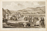
La PErouse, Jean Francois de
Costumes des habitans de la baie de Langle.
Paris. 1797. From the Voyages of La Perouse who set sail from France in 1785 to continue the discoveries of Captain Cook. He was shipwrecked in 1788 but his narrative maps and views survived and were published in 1797. Atlas Du Voyage De La Pérouse. Size: 400 x 255 mm. Copper engraving. Uncoloured. Very good condition. slight browing around edges but not effecting image. unknown
Referentie van de boekhandelaar : 55667
|
|
|
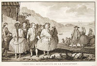
La Perouse, Jean Francois de Galaup
COSTUMES DES HABITANS DE LA CONCEPTION.
Paris. 1797. View of Chile showing the costumes of its inhabitants from the Voyages of La Perouse who set sail from France in 1785 to continue the discoveries of Captain Cook. He was shipwrecked in 1788 but his narrative maps and views survived and were published in 1797. Atlas Du Voyage De La Pérouse. Copper engraving. Very good condition. slight browing around edges but not effecting image Uncoloured. Size: 40 x 25.5 cm. unknown
Referentie van de boekhandelaar : 55650
|
|
|
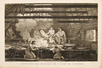
LA PEROUSE, Jean Francois de
Costumes de la Baie de Castries.
Paris. 1797. Scene showing people warming themselves by a fire in a log cabin. From the Voyages of La Pérouse who set sail from France in 1785 to continue the discoveries of Captain Cook. He was shipwrecked in 1788 but his narrative maps and views survived and were published in 1797. Atlas Du Voyage De La Pérouse. Size: 40 x 25.5 mm. Copper engraving. Uncoloured. Very good condition. slight browing around edges but not effecting image. unknown
Referentie van de boekhandelaar : 55669
|
|
|
La Perouse, Jean Francois de Galaup
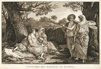
COSTUMES DES HABITANTS DE MANILLE.
Paris. 1797. A very beautiful print showing four elegant figures relaxing in a shady glade two women recline and two stand chatting. This print is from the Voyages of La Perouse who set sail from France in 1785 to continue the discoveries of Captain Cook. He was shipwrecked in 1788 but his narrative maps and views survived and were published in 1797. Atlas du Voyage de la Perouse Copper engraving. Good margins crisp clear impression very good condition. slight browning around edges but not effecting image Uncoloured. Size: 40 x 25.5 cm. unknown
Referentie van de boekhandelaar : 55644
|
|
|
LA PEROUSE, Jean Francois de Galaup
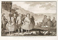
Costumes des Habitants de la Conception.
Atlas du Voyage de la Pérouse. c.1740. A beautiful picture with four people in the foreground and others in the background against a backdrop of the sea. Engraved by Thomas. Atlas du Voyage de la Pérouse. Original copper engraving. Fine condition. Black & white. Size: 39.6 x 26.5 cm. unknown
Referentie van de boekhandelaar : 52760
|
|
|
La Perouse, John Francis Galaup; Duche De Vancy, Jean Baptiste; Heath, James
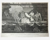
Dress of the Inhabitants of Baie De Castries: an engraving from Charts and Plates to La Perouse's Voyage 1798
G. G & J. Robinson. LA PEROUSE Jean Francois; DUCHÉ DE VANCY Jean Baptiste; HEATH James. Dress of the Inhabitants of Baie de Castries. An engraving from the atlas volume of plates of the voyage of Jean-François de Galaup comte de La Pérouse published in London by G. G. & J. Robinson Paternoster Row 1798. Copper-engraving plate no. 54 after a drawing by the Duché de Vancy engraved by Heath with the imprint "Published as the Act directs Nov. 1st 1798". 330x220mm light uniform toning mild marginal soiling a little show-through from the verso but a clean well-defined impression with good margins. Overall very good. Image depicting domestic life costume and material culture of the Indigenous inhabitants of Baie de Castries on the north-west coast of America then described as the eastern coast of "Tartary" in contemporary French and British geographical usage. This plate forms part of the celebrated series of engravings prepared for the posthumous publication of La Pérouse's voyage 1785-1788 documenting the French expedition's survey of the North Pacific including Alaska the Sea of Japan Kamchatka and the northwest coast of America. The draughtsman Jean-Baptiste Claude Duché de Vancy served as official artist to the expedition while Heath was one of the principal London engravers engaged for the English edition of the atlas. The scene records the built environment clothing and domestic practices observed at Baie de Castries during La Pérouse's brief but historically important visit in 1786 shortly before the expedition's disappearance in the South Pacific. . Very Good. Soft cover. 1st Edition. 1st Printing. 1798. G. G & J. Robinson paperback
Referentie van de boekhandelaar : 003682
|
|
|
LA PEROUSE, Jean Francois de
Femme du Port des Francais.
Paris. 1797. Scene showing local woman from Alaska. From the Voyages of La Pérouse who set sail from France in 1785 to continue the discoveries of Captain Cook. He was shipwrecked in 1788 but his narrative maps and views survived and were published in 1797. Atlas Du Voyage De La Pérouse. Size: 400 x 255 mm. Copper engraving. Uncoloured. Very good condition. Slight browing around edges but not effecting image. unknown
Referentie van de boekhandelaar : 55671

|
|
|
La Perouse; Buffon
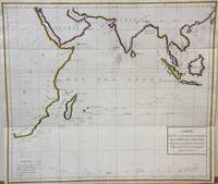
Indian Ocean map Carte des Declinaisons et inclinaisons de l'Aiguille Aimantee redigee d'apres la table des observations Magnetiques faites par les Voyageurs depuis l'Annee 1775.
Paris 1788. Very Good;. Notes: An 18th century mapping of the Indian Ocean. This handsome sea chart depicts magnetic needle readings along various routes in the ocean from the Cape of Good Hope le Cap des Aiguilles to the South East Asian archipelago. Size : 511x583 mm 20.12x22.95 Inches Coloring: Hand Colored in Outline Category: Maps Sea Chart; Maps Ocean Indian; unknown
Referentie van de boekhandelaar : M7032
|
|
|
La PErouse, Jean FranAois de :
La Perousen's Entdeckungsreisen in den Jahren 1785 86 87 und 88. Aus dem Franzˆsischen mit Anmerkungen von Forster und Sprengel. 2 B‰nde.
Berlin und Hamburg 1800. Bibliothek der neuesten und interessantesten Reisebeschreibungen Band 23. 8vo. 410 S. mit 1 gest. Frontispiz 1 Portraitvignette auf dem Titel 2 Kupfertafeln 1 gef. Karte; 344 S. mit gest Frontispiz 1 Titelvignette 1 gefalt. Karte. Halblederb‰nde der Zeit mit RSchild etwas berieben Rotschnitt guter Zustand. unknown
Referentie van de boekhandelaar : H492
|
|
|
LA PEROUSE, Jean-Francois de Galaup
La Perousens Entdeckungsreise in den Jahren 1785 1786 1787 und 1788 herausgegeben von M. C. A. Milet Mureau. Aus dem Französischen übersetzt und mit Anmerkungen begleitet von J. R. Forster und C. L. Sprengel. Mit 3 Kupfern und 1 Portrait 2 Theil: Mit 1 Kupfer 1 Vignette und 1 Karte. 1-2 Teil.
Berlin und Hamburg 1800. 2 Bde. 8°. Gest. Taf. gest. Titelbl. Titelbl. 1 nn. Bl. 410 S. mit 2 gest. Taf.; gest. Taf. gest. Titelbl. Titelbl. 344 S. mit e. gef. gest. Karte mit e. Porträtmedaillon des Perouse am Kupfertitel des ersten u. e. Illustrationsvignette am Kupfertitel des zweiten Teiles. Halblederbände d. Zeit mit je zwei Rückenschildchen u. Rückenzierlinien in Goldprägung Einbanddeckel mit Kiebitzpapier überzogen Vorsätze aus zweifärbig bedrucktem Buntpapier Ecken und Kanten bestoßen Ecken teilw. aufgespalten Einbanddeckel berieben fliegende Vorsatzblätter fehlen. Mit je e. Bibliotheksschildchen Joseph Bermann auf den vorderen Innendeckeln. Henze III146; vgl. Bibliotheca geographica 98; ADB 7166ff. Als zweiter und dritter Band der Reihe 'Bibliothek der neuesten und interessantesten Reisebeschreibungen' erschienene Ausgabe der 'Voyage de la Perouse autour du monde'. La Perouse 1741-1788 französischer Geograph und Weltumsegler unternahm diese umfassende Erforschung und Kartographierung des pazifischen Raums im Auftrag der französischen Krone. Am 1. August 1785 stachen die beiden Schiffe von Brest aus in See. Die erste Station war Teneriffa. Im Januar 1786 wurde Patagonien erreicht. Über Kap Hoorn und die Osterinsel ging es nach Hawaii und weiter nach Alaska. La Pérouse der sich zu den Aufklärern zählte verzichtete als erster Europäer bewusst auf die Inbesitznahme noch unerforschter Inseln. In Alaska knüpfte er wichtige Kontakte mit Indianern bevor er die Küste Kaliforniens bereiste. Beide Expeditionsschiffe 'Astrolabe' und 'Bousolle' mit ihrer Besatzung erlitten vermutlich im Bereich der Salomonen Schiffbruch und kehrten nicht nach Frankreich zurück. - Herausgegeben und redigiert wurde das Werk von Louis Marie Antoine Destouff de Milet-Mureau 1756-1825 die deutsche Übersetzung stammt von Johann Reinhold Forster 1729-1798 und C. L. Sprengel. Der vielseitige Naturwissenschaftler und Entdecker J. R. Forster hatte wenige Jahre zuvor James Cook auf dessen zweiter Südseereise begleitet. Erster Band mit nur zwei von drei Kupfertafeln. Berlin und Hamburg 1800. unknown
Referentie van de boekhandelaar : REIS0790
|
|
|
La Perouse, J F G, Comte de:
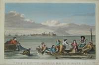
Manila Philippines Vue de Cavite dans la Baie de Manille.
Paris c. 1797. Copper engraving by Simonet after Duche de Vancy and J.M. Moreau le Jeune approx 29 x 42 cms trimmed to platemark left-hand margin extended hand-coloured blank verso. Map unknown
Referentie van de boekhandelaar : 3921
|
|
|
La Perouse, Jean Francois de Galaup
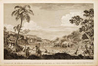
MASSACRE DE MM. DE LANGLE LAMANON ET DE DIX AUTRES DES DEUX ÉQUIPAGES
Atlas Du Voyage De La Pérouse. 1797. Scene showing the locals attacking voyagers as they disembark from their boats. From the Voyages of La Pérouse who set sail from France in 1785 to continue the discoveries of Captain Cook. He was shipwrecked in 1788 but his narrative maps and views survived and were published in 1797. Copper engraving. Very good condition. slight browing around edges but not effecting image Uncoloured. Size: 40 x 25.5 cm. 15½ x 10 inches unknown
Referentie van de boekhandelaar : 55648
|
|
|
LA PEROUSE, Jean Francois de
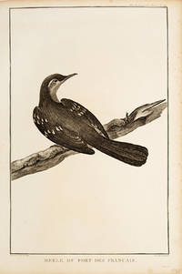
Merle de Port des Francais.
Paris. 1797. Print of an Alaskan Merle Bird. From the Voyages of La Pérouse who set sail from France in 1785 to continue the discoveries of Captain Cook. He was shipwrecked in 1788 but his narrative maps and views survived and were published in 1797. Atlas Du Voyage De La Pérouse. Size: 255 x 400 mm. Copper engraving. Uncoloured. Very good condition. Slight browing around edges but not effecting image. unknown
Referentie van de boekhandelaar : 55672
|
|
|
La Perouse; Buffon
North Pacific map Carte des Declinaisons et inclinaisons de l'Aiguille Aimantee redigee d'apres la table des observations Magnetiques faites par les Voyageurs depuis l'Annee 1775.
Paris 1788. Very Good; laid on acid-free canvas for long-term preservation. Notes: This handsome sea chart depicts magnetic needle readings along various routes in the North Pacific ocean.<br> Size : 590x1090 mm 23.23x42.91 Inches Coloring: Hand Colored in Outline Category: Maps Sea Chart; Maps Ocean Pacific; Maps United States West; unknown
Referentie van de boekhandelaar : M6851
|
|
|
La Perouse
Nouvelle Bibliothèque des Voyages ou Choix des Voyages les Plus Intéressans Vol. 2
paperback. Good. Access codes and supplements are not guaranteed with used items. May be an ex-library book. paperback
Referentie van de boekhandelaar : 0259332135.G ISBN : 0259332135 9780259332138

|
|
|
La Perouse
Part of the Great Pacific Ocean shewing the Route of the Spanish Frigate la Princesa commanded by D. Franc. Antonio Maurelle in 1781
London: G & T Robinson 1798. The English edition of a map published to accompany La Perouse' Voyage. G&T Robinson Nov. 1st 1798. Covers from the Gulf of Carpentaria to the Solitaire Islands to the Navigator Islands in the east and to above New Guinea. Charts Maurelle's tracks. G & T Robinson unknown
Referentie van de boekhandelaar : 496
|
|
|
LA PEROUSE, Jean Francois de Galaup
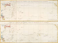
PARTIE DE LA MER DU SUD COMPRISE ENTRE LES PHILIPPINES ET LA CALIFORNIE.
Paris: 1797. An interesting large sheet with two maps covering the same area. The top chart shows the routes of the Spanish galleons from Acapulco to the Philippines. The bottom chart shows La Perouse's route from Monterey through Hawaii and the Marianas to Macao. From the Voyages of La Pérouse who set sail from France in 1785 to continue the discoveries of Captain Cook. He was shipwrecked in 1788 but his narrative maps and views survived and were published in 1797. Thirty-eight years later the scattered remains of La Boussole and L'Astrolabe was discovered wrecked on a vicious reef on an atoll in the New Hebrides. Full title: "Partie de la Mer du Sud comprise entre les Philippines et la Californie d'apres de Carte Espagnole trouvee sur le Galion pris par l'Amiral Anson en 1743 qui represente l'etat des connaissances a cette epoque et les routes que suivaient ordinairement les Galions dans leur traversee de Manille a Acapulco. Partie de la Mer du Sud comprise entre les Philippines et la California d'apres une autre Carte Espagnole communiquee a La Perouse dans sa relache a Monterey sur laquelle il avait trace sa route ainsi que les Iles qu'il avait reconnues avec des notes sur celles qu'il n'avait pas retrouvee." Copper engraving. Very good condition; some light stains along the lower horizontal fold; a tear and some foxing to the upper margin; wide margins. Hand coloured. Size: 79 x 55.5 cm. unknown
Referentie van de boekhandelaar : 56361
|
|
|
LA PEROUSE, J FG F G
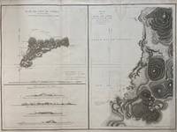
Plan de L'ile de Paque; Plan de la Baie de Cook; April 1786 by the Boussole and Astrolabe
Paris: L'Imprimerie de la Republique 1797. Map. Engraving with hand coloring. Sheet measures 21 1/4" x 28"<br/> <br/> This chart depicts Easter Island with a close-up of Cook's Bay. Relief is depicted by hachure and elevation is shown from several vantage points. Points and peaks of the elevation views correspond to labels on the map. The Bay shows depths and various structures are labeled. The map appeared as Plate 10 in "Atlas du Voyage de La Perouse." It is in very good condition. Stain to upper margin minor foxing marks.<br> <br> Jean Francois de Galaup 1741-c.1788 was a French Navy officer and explorer known for his travels in Oceania. In 1787 he explored the northeast and mainland Asian coasts in the area of Korea. Other voyages included Alaska Japan Australia and the South Pacific. This map demonstrates some of the many observations and findings made on his journeys.<br/> <br/> L'Imprimerie de la Republique unknown
Referentie van de boekhandelaar : 299774
|
|
|
La Perouse, Jean FG F G
PLAN DE L'ENTREE DU PORT DE BUCARELLI sur la Cote du Nord-Ouest de l'Amerique par 55 degrees 15' de Latitude Nord et 136 degrees 15' de Longitude a l'Ouest de Paris. map
Paris: La Perouse 1797. Map. Very good condition. Unbound. First Edition. Folio. A large map beautifully decorated with original outline color. The map is included in the Atlas volume of La Perouse's Voyages but was drawn from Spanish manuscripts as it was thought that it might be a part of the Northwest Passage. The map has an extra vertical crease from mis-folding but is quite clean and has large margins which are lightly soiled here and there. La Perouse Paperback
Referentie van de boekhandelaar : 016788
|
|
|
LA PEROUSE, Jean Francois de Galaup
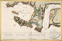
PLAN DE LA BAIE DE LA CONCEPTION.
Paris: 1797. Fine sea chart of the bay and Bio Bio River region with great topographical and hydrological detail. Villages and Fort St. Pierre are depicted. From the Voyages of La Pérouse who set sail from France in 1785 to continue the discoveries of Captain Cook. He was shipwrecked in 1788 but his narrative maps and views survived and were published in 1797. Thirty-eight years later the scattered remains of La Boussole and L'Astrolabe was discovered wrecked on a vicious reef on an atoll in the New Hebrides. Copper engraving. Very good condition; slight browning to the centrefold. Hand coloured. Size: 57 x 42 cm. unknown
Referentie van de boekhandelaar : 56362
|
|

 De zoekresultaten per email ontvangen
 Zoekresultaten downloaden als PDF
 RSS feed
 Permanente link
