|
Woerl, Joseph Edmund [1803-1865]:
Die Badischen Bäder. Baden, Rippoldsau, Griesbach, Hub, Petersthal, Erlenbad, Antogast, Freiersbach etc. oder Specialkarte der Gegend zwischen Strassburg, Carlsruhe, Offenburg und Freudenstadt. Maßstab 1 : 135 000.
Lithographierte Karte, auf Leinen aufgezogen in 15 Segmenten. 55 x 48 cm, gefaltet: 17 x 12 cm. In Orig.-Halbleinenmappe. *Datierung nach den Angaben zu dem Exemplar der Universitätsbibliothek Basel. Landkarten de
|
|
|
Wolbling, Jutta
Die Wesermarsch von Oben
No marks or inscriptions. Crease to lower corner of soft front cover. Rear cover is sunned stiff card. A very clean very tight copy with no bumping to corners. Single-sided with interleaved tissue. 16pp. Aerial views of Weser Marsh in northern Germany. All text in German.

|
|
|
Woldan, Erich
Die ältesten gedruckten modernen Karten Afrikas.
Wien, Verlag der Österreichischen Akademie der Wissenschaften, 1981. S. 252-257. Mit 8 Taf. (= Veröffentlichungen der Kommission für Geschichte der Mathematik, Naturwissenschaften und Medizin, H. 34 / Sonderabdruck aus dem Anzeiger der phil.-hist. Klasse der Österreichischen Akademie der Wissenschaften, Jg. 118, So. 15). Gr.-8vo. OBrosch.
Référence libraire : 60980
|
|
|
WOLFE, JAMES.
Sailing Directions for the Lower Shannon and the Lough Derg.
London, Admiralty, 1843 8vo. In recent half cloth with gilt stamp and lettering to front board. Small paper label pasted on to verso front board and two stamps to title-page. Internally fine and clean. 32 pp.
Référence libraire : 57129
|
|
|
WOLFE, JAMES.
Sailing Directions for the Lower Shannon and the Lough Derg.
London, Admiralty, 1843 8vo. In recent half cloth with gilt stamp and lettering to front board. Small paper label pasted on to verso front board and two stamps to title-page. Internally fine and clean. 32 pp.
|
|
|
WOLFF Jeremias (1633 - 1724)
Roma
Rara veduta panoramica della città edita dagli eredi di Jeremias Wollf ad Augsburg. La stampa, corredata da una legenda di 17 voci, mostra numerosi personaggi e animali sul primo piano. Il Tevere segue l'errato corso tipico di tutte le vedute della città di produzione nordica, tuttavia in questa incisione gli edifici sono disegnati in maniera molto più realistica e corrispondente al vero. Il prototipo iniziale per questa tipologia di panorami è identificabile nella veduta generale incisa da Israel SIlvestre nel 1642.Incisione in rame, coloritura coeva, in ottime condizioni. Rare panorama of the city edited by the heirs of Jeremias Wollf in Augsburg. The print, accompanied by a 17-item key-legend, shows numerous characters and animals in the foreground. The Tiber follows the wrong course typical of all city views of Nordic production, but in this engraving the buildings are drawn in a much more realistic way and correspond to reality. The initial prototype for this type of panorama can be identified in the general view engraved by Israel SIlvestre in 1642. Copper engraving, contemporary coloring, in very good condition. C. Marigliani, "Le Piante di Roma delle collezioni private", tav. 105.

|
|
|
Wonson, M. R.; Cowan, Georgina
Devon: Coast, countryside, forest and moors (A Geographia guide)
No marks or inscriptions. No creasing to covers or to spine. A very clean very tight copy with bright unmarked boards, minor traces of storage and no bumping to corners. Large fold-out map at rear in excellent condition. 128pp. Guide to the towns, cities, villages and places of interest in Devon.
|
|
|
Wood James A. ed/Wood Lyle maps
Army of the West: The Weekly Reports of German Army Group B from Normandy to the West Wall Stackpole Military History Series
Mechanicsburg: Stackpole Books 2007. 1st paperback printing. Fine. x 265 p. 13 page catalog of publisher other titles in series photos maps biblio index 8vo paperback; Stackpole Books paperback
Référence libraire : 70444 ISBN : 0811734048 9780811734042

|
|
|
Wood James A. ed/Wood Lyle maps
Army of the West: The Weekly Reports of German Army Group B from Normandy to the West Wall Stackpole Military History Series
Mechanicsburg: Stackpole Books 2007. 1st paperback printing. Fine. x 265 p. 13 page catalog of publisher other titles in series photos maps biblio index 8vo paperback; Stackpole Books paperback
Référence libraire : 42294 ISBN : 0811734048 9780811734042

|
|
|
Wood W. Raymond editor; Wood E. Stanley maps
Archaeology on the Great Plains
Lawrence Kansas U.S.A.: University Press of Kansas 1998. Book. Very Good. Paperback. 522 pages 8vo. Includes introduction index. Maps by E. Stanley Wood. Minor shelfwear: light rubbing along cover edges. Tightly bound with very clean and crisp pages. No marks. Volume is in Very Good condition. University Press of Kansas Paperback
Référence libraire : 42485 ISBN : 0700610006 9780700610006

|
|
|
Wood, W. B. ; Major Edmonds
Military History of the Civil War 1861 - 1865
10.5: wide x 13.5 tall book is in near fine condition with faint mark to front cover, light general scuffing. Binding is solid and square, covers have sharp corners, exterior shows no other blemishes in deep blue cloth, text/interior is clean and free of marking of any kind and is filled with full and double-page b&w and color illustrations, detailed maps, elaborate bright red illustrated endpapers. Unpaginated, about 250 pages. Dust jacket shows a closed tear 1", edge wear, general scuffing.

|
|
|
Woodcock, Tim
Classic Mountain Bike Rides in Britain
No inscriptions or marks. A lovely clean crisp very tight copy with bright unmarked boards and no bumping to corners. Dust jacket not price clipped or torn with very light creasing to upper edge and traces of shelf rubbing. 160pp.

|
|
|
Woods Frederick editor. Illustrated by ils. b/w photos. maps.
YOUNG WINSTON'S WARS. The Original Despatches of Winston S. Churchill War C orrespondent 1897-1900
NY: The Viking Press 1972 1973 no other date edition. d.j. lightly worn with crease in front flap. Covers stained else nice copy . NY: The Viking Press (1972, 1973) unknown
Référence libraire : 001893
|
|
|
Worcester Joseph Emerson; Maps Engraved by H. Morse Sc..
Worcester's Modern Atlas Comprising the Following Maps. 1. Heights of Mountains. 2. Lengths of Rivers . 3. The World I. 4. North America II. 5. United States III. 6. New England or Eastern States; 7. Middle States with Maryland Virginia Ohio &c. IV; 8. South America V; 9. Europe VI; 10. British Isles VII; 11. France Germany Belgium Holland &c. VIII; 12. Asia IX; 13. Turkey Arabia Persia Hindostan Afganistan Egypt Nubia &c. X; 14 Africa XI.
Boston: Published by Hilliard Gray and Co. 1838. Soft cover. Fair. Quarto. 14 leaves. Collates complete with all hand-colored copperplate maps. Most leaves have a separate map. The "Heights of Mountains" and "Lengths of Rivers" are together on one leaf. "North America" is on a single page and "United States" is a double-page map. "New England or Eastern States" and "Middle States with Maryland Virginia Ohio &c." are on a double-page map. Soft cover bound in quarter leather with printed paper covers. The binding is very worn and scuffed with some of the printed surface worn off the front and rear covers. Chipping to the edges of the binding with some damping especially visible on the rear cover. The top of the leather spine is also damped. Undated; Worldcat notes 4 examples of this atlas by Hillard and Gray with possible dates of 1831 1835 and 1838. The inside of the front cover has an early owner's label affixed reading "Jacob Mordecai / Hillsboro / North Carolina / August 22d 1838 / Raleigh No. C." ~~ Jacob Mordecai 1762-1838 was a businessman from Philadelphia Virginia and North Carolina who founded 1809 the Mordecai Female Seminary in what is now Warrenton North Carolina. He died on Sept. 4 1838 just weeks after this signature. In 1774 Jacob was part of a youth rifle corps and escorted the First Continental Congress from Frankford into Philadelphia. ~~ Some of the maps have short tears at the fore edge especially the last four maps. The rear cover is heavily chipped and stained. Photos for each map available on request. We have a photo album of this atlas on our bookshop's Facebook page Pages Past Used and Rare Books. <br/> <br/> Published by Hilliard, Gray and Co. paperback
Référence libraire : 037400
|
|
|
Work Projects Administration. Writer's Program and Illustrated by Endpapers maps b/w illus
Wyoming. a Guide to Its History Highways and People
Hardcover. Very Good. VG book/ no jacket. 5th ptg hardcover
Référence libraire : HS-ZF5W-KOPV
|
|
|
WORLD STANDARD OIL REFINING Harrison Richard Edes maps.
The World According to Standard N.J.
NY.: Time. 05 1940. Two page color pictorial map from May 1940 issue of Fortune magazine 14 x 22 1/2 inches. Very good clean condition. Map is spread over two separate sheets. Colorful map by Richard Edes Harrison showing "How a Great Oil Company Works in Time of Peace and How the War is Affecting It." . Time. unknown
Référence libraire : 56045

|
|
|
Wright Chris Texts and Maps Prepared by
Korea: Its History and Culture
Korean Overseas Information Ser. 1996. 138 pp. with numerous color photographs throughout which contain two separate texts - one dealing with history from pre historic time to the division and establishment of the Republic of Korea and the second dealing with culture philosophy religion language literature fine arts performing arts and crafts. As New. Softcover. Korean Overseas Information Ser. paperback
Référence libraire : 27632
|
|
|
Wright Chris PhD Text and Maps Prepared By
Korea: Its History and Culture
Korean Overseas Information Service 1996. Call numbers on label around edge of spine marked out bar code on front cover library name stamp on early page crease on lower rear corner abou 1/2" from tip. 137 pages. Soft Cover. Very Good. 8vo - over 7�" - 9�" tall. Ex-Library. Korean Overseas Information Service Paperback
Référence libraire : 020556 ISBN : 8973753029 9788973753024

|
|
|
Wright Stuart J./Wright Grant maps and formation plans
An Emotional Gauntlet: From Life in Peacetime America to the War in European Skies
Barnsley: Pen & Sword Aviation 2004. 1st British printing. Fine/Fine dust jacket. xxiv 334 p. photos maps diagrams appendix notes glossary biblio index 8vo; Pen & Sword Aviation hardcover
Référence libraire : 55927 ISBN : 1844151204 9781844151202

|
|
|
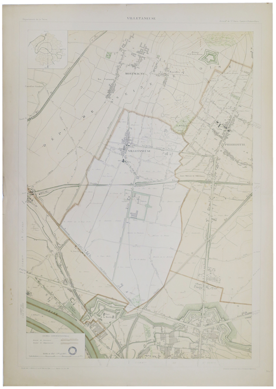
WUHRER (L.).
[VILLETANEUSE] Villetaneuse.
1895. 852 x 583 mm.
Référence libraire : LBW-5166
|
|
|
WW. Craig ; with maps and Illustrations W. W.
Moreton Bay settlement : or Queensland before separation 1770-1859 together with a brief account of the rise of the colonies of Australasia
Book. Fair. Original Cloth. 1st. Brisbane : Watson Ferguson 1925. 125 p. : ill. maps 2 folded ports. charts ; 22 cm. Reapired d/w better than a reader but still a bit shabby All of our books are in the shop and are 'real' books. We try to post the same day as the order. Descriptions are conservative. Postage rates may be lower than ABE estimate please use Ask Bookseller a Question to confirm availability and postage cost use Ask Bookseller a Question option below to confirm availability and get accurate postage quote for this item the amount quoted is for an 'average' hard-cover book of up to 1kg in weight. Hardcover
Référence libraire : 017091
|
|
|
WWII AMERICAN US. MAPS U. S.
9 World War II Maps EUROPEAN THEATER OF OPERATIONS
Archive of 9 large World War II Maps these maps were used by US troops during the liberation of Europe. RARE ORIGINAL WORLD WAR TWO VINTAGE ALLIED FORCES EUROPEAN THEATER OF OPERATIONS Maps of German cities and one of Paris France. Comes from a WW2 US Army Soldier. These 69 original maps are mostly in very good condition and as follows: <br/><br/>Magdeburg Germany map - US Army Air Map of Magdeburg "First Edition" Sheet M.53 1:250000. 1943. With handwriting in upper right corner. 30x26"<br/>KasselGermany map- US Printed Map of Kassel region of Germany. "Emergency Road Map." Color. First Edition. sheet L52 Based on 1938 map supplemented by other sources collected during the war. 22x28"<br/>Dusseldorf Germany map- same as above but faded and with some highlighting some writing. sheet k52<br/>Hanover Germany map- same as above sheet L53. Printed 1943.<br/>Berlin Germany map- similar to above but "Army/Air" not Emergency Road. Sheet N53. Published by War Office 1943<br/>Halle Germany map- Halle Saale is a city in the southern part of the German state Saxony-Anhal. Sheet M52. "War and Navy Department Agencies only. Not for sale or distribution." 1943. <br/>Wernigerode Germany- town in the district of Harz Saxony-Anhalt German 19x24. Sheet 4130. FIrst Edition. US "Published by War Office 1944." B&W. exposed to water. Hardened. y<br/>Julich Germany- town in the district of Düren in the federal state of North Rhine-Westphalia Germany "Published by War Office 1944." G.S.G.S. No. 4507. 35x30"<br/>Paris France map - 42x34 - U.S. 1944. The Liberation of Paris took place from 19 August 1944 until the German garrison surrendered on 25 August 1944. Paris had been ruled by Nazi Germany since the signing of the Second Compiègne Armistice on 22 June 1940. unknown books
Référence libraire : 14434

|
|
|
WWII Eastern European MAPS
Archive of 6 European World War II Maps
Archive of 6 large original World War II Maps these maps were used by US troops during the liberation of Europe. RARE ORIGINAL WORLD WAR TWO VINTAGE ALLIED FORCES EUROPEAN THEATER OF OPERATIONS Czech Republic cities and one Map of Hamburg - German . Comes from a WW2 US Army Soldier. These 6 original maps came from a US soldier that was in European theatre in WWII they are mostly in very good condition and as follows: <br/><br/>Mesto Tepla Czech Republic - size 19x24".<br/>Plzen Czech Republic 4151 - size24x19". Black and white with green overlay. <br/>Horsovsky Tyn Czech Republic 4150 - size24x19"<br/>Kralovice KraloviceCzech Republic 4051 - <br/>Czechoslovakia promotional map dated 1938. a very arge map size 34x22"<br/>Hamburg - German map. size 28x24". dated 1939 in print. <br/><br/>All maps are original and have some folds and wrinkling overall in Good Condition. unknown books
Référence libraire : 14433
|
|
|
WWII GERMAN MAPS
Collection of 10 German-made WWII-era maps of cities and Factories
Collection of 10 German-made WWII-era maps. All printed in German sometimes with foreign translations.<br/><br/>Includes arial bombing maps of Chesterfield Tube Works Great Britain Dec. 1942 showing a geographical arial photograph of the factory area and an overlay of roads bridges and potential targets. The German forces tried to bomb Chesterfield and the railway tracks nearby where the Tube Works produced important cylinders and compressors for the war effort. Instead their bomb fell on a golf course 4 miles away doing no harm. Bears the warning: "Nur fur den Diensfgebrauch" or "For Internal Use Only." 12"x12.5" 2 pg<br/><br/>Also includes a "Map of the Former Czechoslovakia" In German: "Karte der ehemaligen Tschechoslowakei". The German occupation of Czechoslovakia lasted from1938 to 1945 beginning with the Nazi annexation of the northern and western border regions known collectively as the Sudetenland under terms outlined by the Munich Agreement. Hitler's pretext for this effort was the alleged privations suffered by the ethnic German population living in those regions. Czechoslovakia was finally liberated with the Allied Victory in 1945. Map in black and white with red elevations. Bears the large tage at the top: "Sondersausgabe!" or "Special Edition!" Also includes a map of a Czech city which played an important part in World War II History. Situated at the very end of the Sudentenland the borders of the Third Reich were literally on Plzen's outer limits. Occupied by Nazi forces starting in 1939 and divided by the loyalties of its half-German population Plzen was finally liberated with the rest of Czechoslovakia in 1945. The map is written in German with Czech translation of each heading. It has seen substantial use and the key has been cut out of the upper left side. 37"x27"<br/><br/>Koln - German map - Near mint condition. 22x17". Translates to "Cologne" which is a city in Germany.<br/><br/>Umgebung von Wein - German. 44x34"<br/><br/>"Deutschesreich" translates to "German Empire"- western half- 56x42" extra large German map - over outline map - no date<br/><br/>Frankreich - same as German Empire. Shows paris and london. <br/><br/>Italien - same as above.<br/><br/> "Blatt Sudost" Translates to "Southeast Sheet" - Ubersichtskarte translates to "Overview Map" - 56x42". Color. Attractive gold pink and blue. 1:1000000.See photos. no date. Very nice condition on printed side. unknown books
Référence libraire : 14430

|
|
|
Wydawnictwo Sport i Turystyka.
Travel Guide Poland
Informative vintage guide to Poland for visitors fiinely packed with details of historic places and attractions. Includes :28 itineraries, 61 alternative routes and diversions, 52 schematic plans of towns, 6 diagrams of the regions, 30 diagrams of historical monuments,7 schemes of itineraries, car map of Poland about 8,500 miles of described routes, 877 localities. 439p. index.A pocket inside back cover has an unused folded detachable map of Poland, and also endpaper maps.Enought to deflates Michelin! [6 copies found in WorldCat] Book
|
|
|
Wyeth John Allan/Tremblay Jean maps
That Devil Forrest: Life of General Nathan Bedford Forrest
Baton Rouge: Louisiana State University Press 1992. 5th paperback printing. VG. xl 614 p. frontis illus maps notes index trade paperback; Louisiana State University Press paperback
Référence libraire : 26062 ISBN : 0807115789 9780807115787

|
|
|
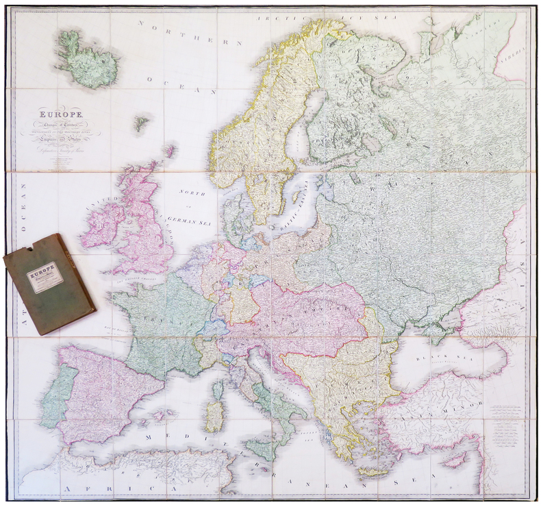
WYLD (James).
Europe, describing all the changes of territory, together with their deviations in the boundary lines of its several empires and states agreed to and confirmed by the definitive Treaty of Paris.
London, James Wyld, Jan. 1st 1829. En 60 sections bordées de soie verte, montées sur toile et pliées, formant une carte de 1,52 x 1,60 m ; plats extérieurs de papier vert ; sous étui recouvert de toile, avec étiquette de l'éditeur portant le titre Europe describing the boundaries of its empires and states as confirmed by the definitive Treaty of Paris, 1815.
Référence libraire : LBW-6415
|
|
|
WYLD'S MILITARY MAP OF ZULU LAND.
Wyld's Military Sketch of Zulu Land, the Transvaal and Adjoining Territories. Scale 4.5 inches to 50 miles. ZULU WAR: A RARE SURVIVAL
8vo., folding coloured map on cloth measuring 31.5 x 22.5 inches (approx. 80 x 57 cms) folding in 20 panels to 7 x 4 inches (approx. 18 x 10 cms); tragically wanting front pasted wrapper (rare wrapper intact), some mild age-soiling else a very good, clean copy. Produced specifically for British military staff; the map is overprinted in red denoting the Positions of British Advancing Columns. RARE.
|
|
|
Wyonch, Cathy: Editor
Hewers of the Forests, Fishers of the Lakes - The History of St. Edmonds Township
252 pages. Examines the social and economic aspects of life in St. Edmonds since its beginning. Contains a blend of information from a number of sources including newspapers, scrapbooks, diaries, letters, photos, and other authors' research. Includes a treasure trove of genealogical information. Numerous black-and-white illustrations. Black-and-white photographic endpapers. Other than some hand-written genealogical details hand-written upon the family tree on page 205, book is clean, bright and unmarked with negligible wear. Moderate wear and bit of sunning to colourful dust jacket. Excellent copy overall. Book
|
|
|
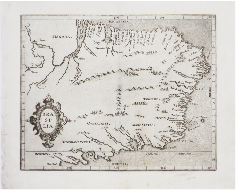
WYTFLIET (Cornelius).
[BRÉSIL] Brasilia.
[Douai, François Faber, 1607]. 228 x 286 mm.
Référence libraire : LBW-8130
|
|
|
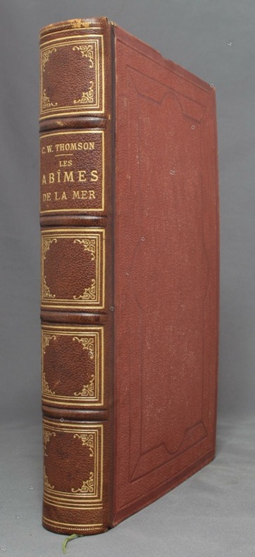
WYVILLE THOMSON [Charles]; LORTET Dr (trad.):
Les abîmes de la mer. Récits des expéditions de draguage des vaisseaux de S. M. le Porcupine & le Lightning pendant les étés de 1868, 1869 & 1870 sous la direction scientifique du Dr Carpenter, de M. J. Gwyn Jeffreys & du Dr Wyville Thomson.
Paris, Librairie Hachette, 1875. In-4 de XXVII-454-[2] pages, demi-chagrin marron, dos à 4 nerfs orné de fleurons, filets, encadrements et titre dorés, plats de percaline, gardes moirées. Dos légèrement frotté, rousseurs, un cahier très légèrement déboîté.
Référence libraire : 10028
|
|
|
Wörl, J. E.:
Karte der Umgegend von Mainz und der Taunusbäder. Entworfen im Maßstab 1 zu 130.000 herausgegeben von H. Malten.
16,5 x 12 cm, aufgefaltet: 55 x 64 cm. Auf Leinen aufgezogen, im orig. Kartonschuber mit handschriftl. Deckeltitel. *Karte von Worms bis Idstein (Süd-Nord) und von Bacherach im Westen bis Offenbach im Osten. - Sehr gut erhalten. Landkarten de
|
|
|
Württemberg:
Ducatus Würtenbergici cum Locis limitaneis, utpote maxima parte Circuli Suevici praesertim Utroq.Marchionatu Badn et Sylva vulgo Nigra Nova per M. Iohannem Majer operá Ioh. Baptiste Homanni. Altkolorierte Kupferstichkarte nach Johann Majer.
Von 2 Platten gestochen und zu einer Karte zusammengesetzt. Format (Karte): 58 x 94 cm. Blattgröße: 68 x 100 cm. *Großformatige Karte von Württemberg (auch große Teile von Baden) von zwei Platten gestochen mit dem Gebiet im Westen von Straßburg und Weissenburg im Norden von Mosbach bis Hohenlohe, im Osten bis Dinkelsbühl, Nördlingen und Burgau und im Süden bis zur oberen Donau. - Oben links eine figürliche kol. Kartusche mit Dedikation an Herzog Eberhard Ludwig sowie einer kleinen Gesamtansicht von Stuttgart und dem Porträt von Herzog Eberhard Ludwig. - Oben rechts eine kol. Kartusche mit dem Wappen Württembergs und einer Ansicht von Tübingen. - Die Ränder rechts und links mit je 38 kolorierter Stadtwappen württembergischer Städte. - Mit Kolorit in der Karte ist der Bereich "Comitatus Hohenberg" markiert (aus dem Vorbesitz des Grafen von Hohenberg). Die weißen Außenränder etwas angestaubt und mäßig gebräunt. Bei Interesse können Sie auch den bisherigen Rahmen dazu haben (dieser nur bei Abholung). Landkarten de
|
|
|
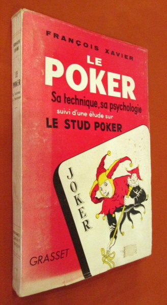
Xavier François
LE POKER. Sa technique , sa psychologie. Suivi d'une étude sur le stud poker.
Grasset, 1955. In-8 broché, couverture illustrée, 222 pages, pages non coupées, tableaux, figures. Très bon état de fraicheur.
Référence libraire : 20362
|
|
|
Xploreit Maps
Donegal Ireland: Xploreit County Map: 2018
Sheet map folded. New. This convenient and informative travel map is specifically designed for visitors to Donegal. With a heady mix of peninsulas promontories and sandy beaches it has some of the most spectacular scenery in Ireland. Further inland the attractions are just as enticing and include Glenveagh National Park - an all-time favourite destination. unknown
Référence libraire : A9780955265587 ISBN : 0955265584 9780955265587

|
|
|
Xploreit Maps Maps
Xploreit Map Of County Kerry Ireland
Fountain Software And Publications Ltd 2007. Map. New. 2 pages. 9.69x4.17x0.39 inches. Fountain Software And Publications Ltd unknown
Référence libraire : 2-0955265517 ISBN : 0955265517 9780955265518
|
|
|
Xploreit Maps
Xploreit Map of Counties Mayo and Sligo Ireland. 1:100000
Xploreit Maps 2013. Map. New. 2 pages. 9.84x4.25x0.63 inches. Xploreit Maps unknown
Référence libraire : 2-095526555X ISBN : 095526555X 9780955265556
|
|
|
Xploreit Maps Illustrated by M B Meagher
Xploreit Map of County Kerry Ireland
Sheet map. New. With spectacular coastal and mountain scenery County Kerry - "The Kingdom" - is one of the most enchanting counties of Ireland.This map is an invaluable tool to use to discover its magical treasures hidden beauty spots and world famous attractions."The Xploreit Map of County Kerry" includes the en unknown
Référence libraire : ria9780955265518_new ISBN : 0955265517 9780955265518
|
|
|
Xploreit Maps
Xploreit Map of County Kerry Ireland
Sheet map folded. New. With spectacular coastal and mountain scenery County Kerry - "The Kingdom" - is one of the most enchanting counties of Ireland. This map helps to discover its magical treasures hidden beauty spots and world famous attractions. It includes the entire 'Kingdom' of Kerry along with parts of counties Clare Limerick and a large part of County Cork. unknown
Référence libraire : A9780955265518 ISBN : 0955265517 9780955265518

|
|
|
Xploreit Maps
Xploreit Map of County Kerry Ireland 1:100K Xploreit County Series
2007-03-01. New. Ships with Tracking Number! INTERNATIONAL WORLDWIDE Shipping available. May be re-issue. Buy with confidence excellent customer service! unknown
Référence libraire : 0955265517n ISBN : 0955265517 9780955265518

|
|
|
Xploreit Maps
Xploreit Maps of County Clare Ireland 1:80K Xploreit County Series
2012-02-01. New. Ships with Tracking Number! INTERNATIONAL WORLDWIDE Shipping available. May be re-issue. Buy with confidence excellent customer service! unknown
Référence libraire : 0955265541n ISBN : 0955265541 9780955265549

|
|
|
Xploreit Maps Illustrated by M B Meagher
Xploreit Map of County Kerry Ireland
Sheet map. As New. With spectacular coastal and mountain scenery County Kerry - "The Kingdom" - is one of the most enchanting counties of Ireland.This map is an invaluable tool to use to discover its magical treasures hidden beauty spots and world famous attractions."The Xploreit Map of County Kerry" includes the en unknown
Référence libraire : ria9780955265518_rkm ISBN : 0955265517 9780955265518

|
|
|
XXX .
ACADEMIE DES JEUX
,contenant les principaux jeux de cartes et de combinaison ,par une Société d'Amateurs .Aumgmentée d'un traité complet du jeu de l'Ecarté et de l'abrégé du jeu des echecs par Philidor . 1832 . Libr.Fontaine , In 16 relié plein chagrin marron .Dos lisse .Pièce de titre noire .Couvertures conservées .(Rel.mod.) II,178 pp.
Référence libraire : 17032
|
|
|
YAGUEL DIDIER
Les grandes voyances de l'histoire.
France Loisirs, 1994, 311 pages, in 8 reliure éditeur cartonnée et toilée avec jaquette, très bon état.
Référence libraire : 8532
|
|
|
Yamamoto, Luci & Gorry, Conner
Hawaii: The Big Island
Appears unread. No marks or inscriptions. No creasing to covers or to spine. A very clean very tight copy with bright unmarked boards, minor traces of storage and no bumping to corners. 304pp. Lonely Planet guide to Hawaii with thirty-five themed itineraries for you to enjoy.

|
|
|
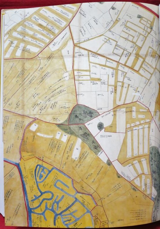
YAMASHITA KAZUMASA.
Japanese Maps of the Edo Period.
Kashiwashobo Publishing Co., Ltd, 1998, 1 volume de in-folio de 310x230 mm environ, 270 pages, reliure pleine toile de l'éditeur sous jaquette illustrée. Contient des illustrations des cartes et des plans en noir et en couleurs. Petits frottements sur le haut du dos de la jaquette sinon bon état. Bilingue. Texte en japonais avec la traduction anglaise en regard.
Référence libraire : 108923
|
|
|
Yandell, Michael D. (editor)
National Parkways: A Photographic and Comprehensive Guide to Grand Canyon National Park
Initials to front cover. No other marks or inscriptions and no creasing to covers. A very clean very tight copy with bright unmarked boards and no bumping to corners. Fold-out map in excellent condition. 118pp. Superbly illustrated photographic souvenir of Arizona's Grand Canyon with full history and detailed description.

|
|
|
Yeadon-Jones, Anne; Yeadon-Jones, Laurence
The Broughtons: Vancouver Island, Kelsey Bay to Port Hardy, Volume 5 (Dreamspeaker Series)
Book is in excellent condition. Binding is solid and square, covers have sharp corners, exterior shows no blemishes, text/interior is clean and free of marking of any kind. 192 pages with maps, tables, charts, soundings, very specific harbor entry info etc. for Jonstone Strait, Broughton Strait, Broughton Archipelago, Queen charlotte Strait, Drury Inlet, Grappler and Mackenzie Sound, Greenway Sound, cullen Harbour, Shawl Bay, Tribune Channel Kwatsi Bary, bond sound, Knight Inlet, Lagoon cover, and much more.
|
|
|
Yegul, Fikret
Baths and Bathing in Classical Antiquity
Book is in excellent condition, as new with bright red covers, white print at spine, map endpapers. Binding is solid and square, covers have sharp corners, exterior shows no blemishes, text/interior is clean and free of marking of any kind. Heavily illustrated throughout with architectural drawings, floorplans, maps, interiors, exteriors, landscape maps, b&w photos of elevations, facades, ruins, details, etc. Dust jacket shows the slightest signs of shelf wear only, no tears. Contents include: Greek gymnasium and the Greek bath, Bathing and baths in the Roman wold, Origins and early development of Roman baths, Thero-mineral baths, Thermae of Rome, Baths of North Africa, Baths and gymnasia in Asia Minor, Baths and bathing in the late antique and early Byzantine world, with four appendices, notes, etc. 501 pages. copyright Pistil Books, 2011

|
|
|
Young Otis E.; Lenon Robert
WESTERN MINING An Informal Account of Precious Metals Prospecting Placering Lode Mining and Milling on the American Frontier from Spanish Times to 1893
Oklahoma: University of Oklahoma Press 1970. pp xv 342; b/w illustrations throughout. Original dust jacket very good with some wear to edges not price-clipped now protected in a clear removable archival sleeve. Contents clean and tight unmarked. A very good copy of the first edition. First Edition. Hard Cover. Very Good/Very Good. 8vo. University of Oklahoma Press Hardcover
Référence libraire : 025236 ISBN : 0806109092 9780806109091

|
|
 Recevoir par e-mail
 Télécharger en PDF
 Flux RSS


