|
|
|
SANSON Nicolas
Carte "LA SUISSE" lieues de Suisse de 13 au degré (par N. Sanson le Fils, Géographe du Roy)
Amsterdam Chatelain 1745 une carte ancienne gravée sur cuivre (Copper etching) en noir . Format : 17 x 19,5 cm, Échelle au1:200,000,000ème, pli central vertical normal venant d'un atlas (vertical centerfold), avec note dans la marge en haut à droite : Tome IV Page 221, pour "l'introduction à l'histoire générale et politique de l'univers, Ou l'on voit l'Origine, les Révolutions, l'Etat présent, & les Intérêts des Souverains" ; Commencée par Mr. le Baron de Pufendorff ; complétée et continuée jusqu'à 1745 par Mr. Bruzen de la Martinière, 8 volumes in-12, 1745 à Amsterdam chez Zacharie Chatelain Editeur,
書籍販売業者の参照番号
: 18862
|
|
|
SANSON Nicolas
CARTE "LE GLOBE CELESTE, ou l'on voit, 1022 étoiles en 48 constellations, 12 dans le zodiaque et 36 hors du zodiaque, etc."
Amsterdam Chatelain 1745 une carte ancienne gravée sur cuivre (Copper etching) en noir . Format : 16 x 19,1 cm, Échelle au1:200,000,000ème, pli central vertical normal venant d'un atlas( horizontal centerfold), avec note dans la marge en haut à droite : Tome I Page I, pour "l'introduction à l'histoire générale et politique de l'univers, Ou l'on voit l'Origine, les Révolutions, l'Etat présent, & les Intérêts des Souverains" ; Commencée par Mr. le Baron de Pufendorff ; complétée et continuée jusqu'à 1745 par Mr. Bruzen de la Martinière, 8 volumes in-12, 1745 à Amsterdam chez Zacharie Chatelain Editeur,
書籍販売業者の参照番号
: 18848
|
|
|
SANSON Nicolas
Carte "MOSCOVIE" (par N. Sanson le Fils, Géographe du Roy)
Amsterdam Chatelain 1745 une carte ancienne gravée sur cuivre (Copper etching) en noir . Format : 17 x 19,5 cm, Échelle au1:200,000,000ème, pli central vertical normal venant d'un atlas ( vertical centerfold), avec note dans la marge en haut à droite : Tome V Page 37, pour "l'introduction à l'histoire générale et politique de l'univers, Ou l'on voit l'Origine, les Révolutions, l'Etat présent, & les Intérêts des Souverains" ; Commencée par Mr. le Baron de Pufendorff ; complétée et continuée jusqu'à 1745 par Mr. Bruzen de la Martinière, 8 volumes in-12, 1745 à Amsterdam chez Zacharie Chatelain Editeur,
書籍販売業者の参照番号
: 18866
|
|
|
SANSON Nicolas
Carte "PERSE" (par N. Sanson le Fils, Géographe du Roy)
Amsterdam Chatelain 1745 une carte ancienne gravée sur cuivre (Copper etching) en noir . Format : 17 x 19,5 cm, Échelle au1:200,000,000ème, pli central vertical normal venant d'un atlas ( vertical centerfold), avec note dans la marge en haut à droite : Tome I Page 5, pour "l'introduction à l'histoire générale et politique de l'univers, Ou l'on voit l'Origine, les Révolutions, l'Etat présent, & les Intérêts des Souverains" ; Commencée par Mr. le Baron de Pufendorff ; complétée et continuée jusqu'à 1745 par Mr. Bruzen de la Martinière, 8 volumes in-12, 1745 à Amsterdam chez Zacharie Chatelain Editeur,
書籍販売業者の参照番号
: 18875
|
|
|
SANSON Nicolas
Carte "POLOGNE" (par N. Sanson le Fils, Géographe du Roy)
Amsterdam Chatelain 1745 une carte ancienne gravée sur cuivre (Copper etching) en noir . Format : 17 x 19,5 cm, Échelle au1:200,000,000ème, pli central vertical normal venant d'un atlas ( vertical centerfold), avec note dans la marge en haut à droite : Tome IV Page 439, pour "l'introduction à l'histoire générale et politique de l'univers, Ou l'on voit l'Origine, les Révolutions, l'Etat présent, & les Intérêts des Souverains" ; Commencée par Mr. le Baron de Pufendorff ; complétée et continuée jusqu'à 1745 par Mr. Bruzen de la Martinière, 8 volumes in-12, 1745 à Amsterdam chez Zacharie Chatelain Editeur,
書籍販売業者の参照番号
: 18861
|
|
|
SANSON Nicolas
Carte "SCANDINAVIE ou sont les Estats de DANEMARK, de SUEDE etc." par le N. Sanson le Fils, Géographe du Roy
Amsterdam Chatelain 1745 une carte ancienne gravée sur cuivre (Copper etching) en noir . Format : 17 x 19,5 cm, Échelle au1:200,000,000ème, pli central vertical normal venant d'un atlas ( vertical centerfold), avec note dans la marge en haut à droite : Tome IV Page 309, pour "l'introduction à l'histoire générale et politique de l'univers, Ou l'on voit l'Origine, les Révolutions, l'Etat présent, & les Intérêts des Souverains" ; Commencée par Mr. le Baron de Pufendorff ; complétée et continuée jusqu'à 1745 par Mr. Bruzen de la Martinière, 8 volumes in-12, 1745 à Amsterdam chez Zacharie Chatelain Editeur,
書籍販売業者の参照番号
: 18857
|
|
|
SANSON Nicolas
Carte "TURQUIE EN ASIE" (par N. Sanson le Fils, Géographe du Roy)
Amsterdam Chatelain 1745 une carte ancienne gravée sur cuivre (Copper etching) en noir . Format : 17 x 19,5 cm, Échelle au1:200,000,000ème, pli central vertical normal venant d'un atlas ( vertical centerfold), avec note dans la marge en haut à droite : Tome V Page 177, pour "l'introduction à l'histoire générale et politique de l'univers, Ou l'on voit l'Origine, les Révolutions, l'Etat présent, & les Intérêts des Souverains" ; Commencée par Mr. le Baron de Pufendorff ; complétée et continuée jusqu'à 1745 par Mr. Bruzen de la Martinière, 8 volumes in-12, 1745 à Amsterdam chez Zacharie Chatelain Editeur,
書籍販売業者の参照番号
: 18868
|
|
|
SANSON Nicolas
Carte "TURQUIE EN EUROPE" (par N. Sanson le Fils, Géographe du Roy)
Amsterdam Chatelain 1745 une carte ancienne gravée sur cuivre (Copper etching) en noir . Format : 17 x 19,5 cm, Échelle au1:200,000,000ème, pli central vertical normal venant d'un atlas ( vertical centerfold), avec note dans la marge en haut à droite : Tome V Page 117, pour "l'introduction à l'histoire générale et politique de l'univers, Ou l'on voit l'Origine, les Révolutions, l'Etat présent, & les Intérêts des Souverains" ; Commencée par Mr. le Baron de Pufendorff ; complétée et continuée jusqu'à 1745 par Mr. Bruzen de la Martinière, 8 volumes in-12, 1745 à Amsterdam chez Zacharie Chatelain Editeur,
書籍販売業者の参照番号
: 18867
|
|
|
SANSON Nicolas
Carte "TURQUIE EN EUROPE" par N. Sanson le Fils, Géographe du Roy
Amsterdam Chatelain 1745 une carte ancienne gravée sur cuivre (Copper etching) en noir . Format : 17 x 19,5 cm, Échelle au1:200,000,000ème, pli central vertical normal venant d'un atlas ( vertical centerfold), avec note dans la marge en haut à droite : Tome V Page 117, pour "l'introduction à l'histoire générale et politique de l'univers, Ou l'on voit l'Origine, les Révolutions, l'Etat présent, & les Intérêts des Souverains" ; Commencée par Mr. le Baron de Pufendorff ; complétée et continuée jusqu'à 1745 par Mr. Bruzen de la Martinière, 8 volumes in-12, 1745 à Amsterdam chez Zacharie Chatelain Editeur,
書籍販売業者の参照番号
: 18871
|
|
|
SANSON Nicolas
Carte de "SUEDE, DANEMARK, ET NORVEGE" par le Sieur Sanson d'Abbeville, géographe du roy
Amsterdam Chatelain 1745 une carte ancienne gravée sur cuivre (Copper etching) en noir . Format : 17 x 20,5 cm, Échelle au1:200,000,000ème, pli central vertical normal venant d'un atlas ( vertical centerfold), avec note dans la marge en haut à droite : Tome IV Page 267, pour "l'introduction à l'histoire générale et politique de l'univers, Ou l'on voit l'Origine, les Révolutions, l'Etat présent, & les Intérêts des Souverains" ; Commencée par Mr. le Baron de Pufendorff ; complétée et continuée jusqu'à 1745 par Mr. Bruzen de la Martinière, 8 volumes in-12, 1745 à Amsterdam chez Zacharie Chatelain Editeur,
書籍販売業者の参照番号
: 18850
|
|
|
SANSON Nicolas Cartographe
Carte : "GEOGRAPHIA SACRAE EX VETER ET NOVO TESTAMENTO DE SUMPTAE TABULA IN QUA TERRA PROMISSA, SIVE JUDAEA IN SUAS TRIBUS PASTESQ. DISTINCTA" , autore N. Sanson,... 1662
1662 une carte ancienne gravée sur cuivre (Copper etching) en noir . Format : 46,5 x 58 cm, par Nicolas SANSON carthographe, 1662 [s.n.] Editeur,
書籍販売業者の参照番号
: 28097
|
|
|
SANSON Nicolas Cartographe
Carte : "GOUVERNEMENT GENERAL D'ORLEANS, suivant les derniers Estats Generaux, et qui Comprend : LE MAINE, LE PERCHE, LA BEAUCE, LE GASTINOIS, au deçà de la Loire; LE NIVERNOIS, L'ORLEANOIS, LE BLAISOIS, LA TOURAINE, et l'ANJOU, dessus de la Loire, LE POICTOU, L'AULNIS, L'ANGOUMOIS, et LE BERRY, au delà de la LOIRE" , par N. Sanson,... 1651
1651 une carte ancienne gravée sur cuivre (Copper etching) en noir . Format : 44 x 58 cm, par Nicolas SANSON carthographe, 1651 [s.n.] Editeur,
書籍販売業者の参照番号
: 28461
|
|
|
SANSON Nicolas . Auteur adapté Sanson, Guillaume (1633-1703). Auteur adapté Sanson et Gilles Robert De Vaugondy Cartographe - Delamarche
Carte des Voyages de Notre Seigneur Jesus-Christ et ceux des Apostres St. Pierre et St. Paul dans l'Asie et dans l'Europe . . . 1747 (dressée sur les ouvrages des Sieurs SANSON)
PARIS SANSON 1747 une carte dépliante sur papier ligné filigrané, reliure bradel cartonné in-octavo (12,6 x 19 cm) recouvert d'un papier velin saumon, titre à l'encre brune sur une etiquette de papier ligné blanc au trois quart centre de la première de couverture, carte ancienne colorée d'époque en vert , rouge et jaune, cartouche non coloré. Format total dépliée : 47 centimètres de haut par 60 centimètres de large (Size: 23 x 18 inches), 1747,
書籍販売業者の参照番号
: 20246
|
|
|
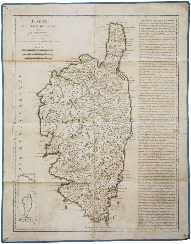
SANT'ANGELO.
[CORSE] Carte de l'isle de Corse divisée par jurisdictions, extraite de plusieurs cartes nationales.
Paris, Lattré, et chez le S.r de Vezou, 1768. 602 x 460 mm, montée sur toile.
書籍販売業者の参照番号
: LBW-8813
|
|
|
SANTIAGO ARANAS PHOTOGRAPHE à NANTES
1 album de cartes photos montées sur onglet : "BRETAGNE"
1930 1 album de cartes photos montées sur onglet, reliure demi-chagrin havane in-seize (binding half shagreen sextodecimo) (15 x 10,5 cm), dos 4 faux-nerfs (spine with raised bands), titre frappé or (gilt title) avec un filet "or" de part et d'autre, roulette "or" en place des nerfs avec un filet à froid et un filet "or" de part et d'autre des nerfs, entre-nerf central orné d'un fleuron "or" avec deux filets "or" verticaux se terminant par un cercle "or" de part et d'autre dans un encadrement d'un filet "or", double filets "or" en tête et en pied, papier peigné marron clair et marron foncé aux plats, album de 49 cartes photos montées sur onglet (Gélatine D. O. P. mate aux tons sépia foncés) + 4 pages manuscrites à l'encre violette de répertoire des photos prises, sans date (1930) sans nom du photographe mais acheté chez SANTIAGO ARANAS PHOTOGRAPHE à NANTES,
書籍販売業者の参照番号
: 25463
|
|
|
SANTIAGO ARANAS PHOTOGRAPHE à NANTES et à Norberto de la Riestra (Buenos Aires - Argentine)
1 albums de cartes photos montées sur onglet : "BRETAGNE"
1930 1 album de cartes photos montées sur onglet, reliure demi-chagrin havane in-seize (binding half shagreen sextodecimo) (15 x 10,5 cm), dos 4 faux-nerfs (spine with raised bands), titre frappé or (gilt title) avec un filet "or" de part et d'autre, roulette "or" en place des nerfs avec un filet à froid et un filet "or" de part et d'autre des nerfs, entre-nerf central orné d'un fleuron "or" avec deux filets "or" verticaux se terminant par un cercle "or" de part et d'autre dans un encadrement d'un filet "or", double filets "or" en tête et en pied, papier peigné marron clair et marron foncé aux plats, album de 50 cartes photos montées sur onglet (Gélatine D. O. P. mate aux tons sépia foncés) + 4 pages manuscrites à l'encre violette de répertoire des photos prises, dédicace manuscrite du photographe Santiago ARANAS au dos de la première carte photo et à l'encre violette : "...A Mon Trés Cher Ami, Monsieur LENET-DEBAY[E. Lennet-Debay - peintre Nantais], faible témoignage d'une amitié toujours grandissante, son tout Dévoué ...Santiago ARANAS...à gauche cachet encre brune : SANTIAGO ARANAS ROBERTO DE LA RIESTRA (F.C. SUD) Républica Argentina et à droite note manuscrite à l'encre violette NANTES Mars 1930"
書籍販売業者の参照番号
: 25019
|
|
|
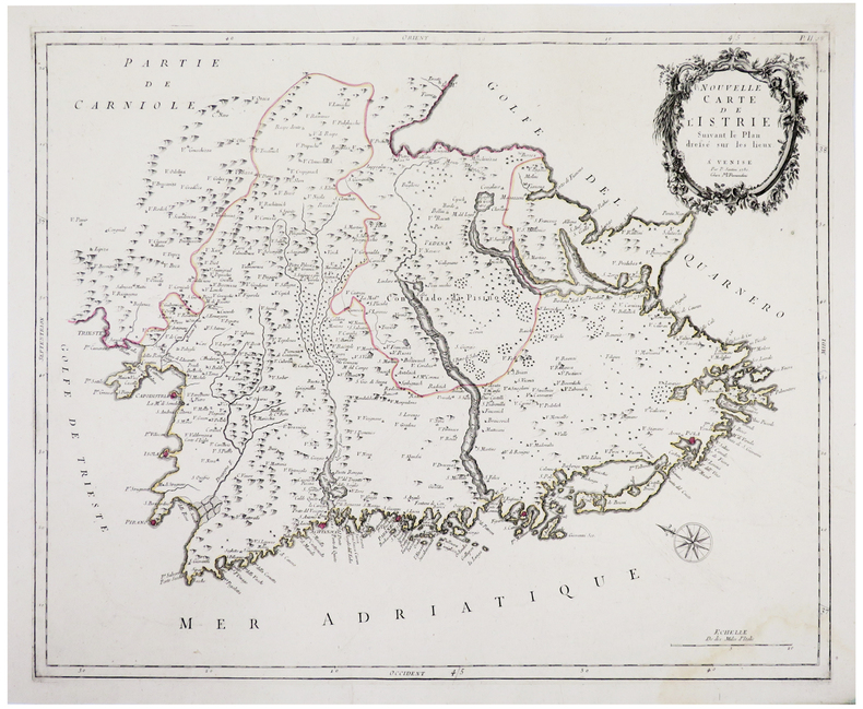
SANTINI (Paolo).
[CROATIE/ISTRIE] Nouvelle carte de l'Istrie.
Venise, M. Remondini, 1780. 458 x 571 mm.
書籍販売業者の参照番号
: LBW-4929
|
|
|
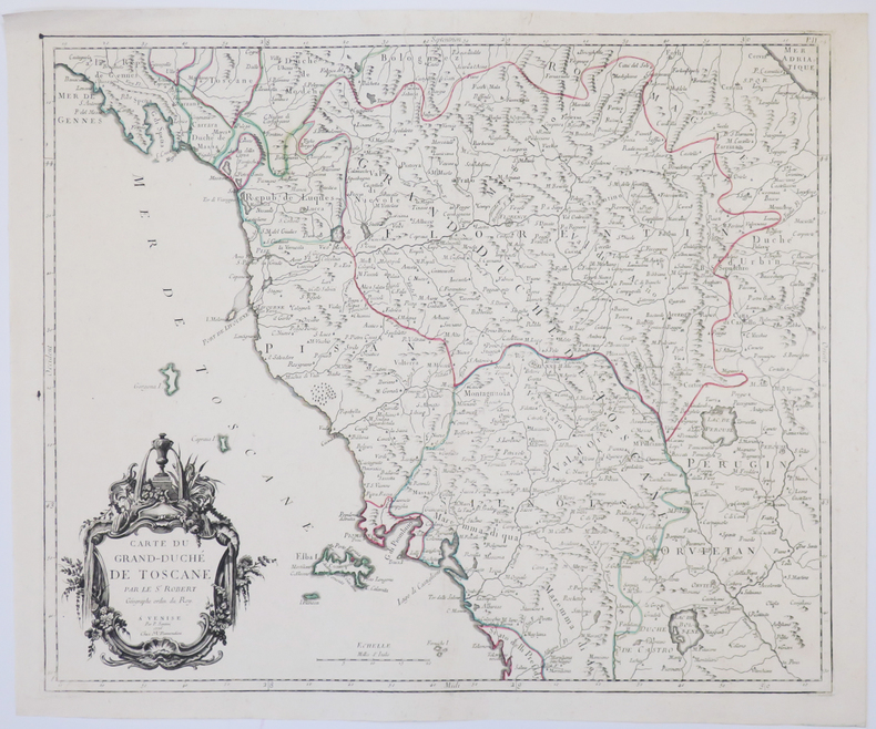
SANTINI (Paolo).
[TOSCANE] Carte du Grand-Duché de Toscane.
Venise, M. Remondini, 1776. 470 x 564 mm.
書籍販売業者の参照番号
: LBW-4927
|
|
|
SANTINI (Paolo).
Partie des gouvernemens d'Astrakhan et de Woronez : le Kabarda et partie du païs des cosaques du Don et du Jaik.
Venise, Remondini, 1778. 437 x 549 mm.
書籍販売業者の参照番号
: LBW-2638

|
|
|
SANZ, Carlos.
Cartografía histórica de los Descubrimientos Australes.
Madrid, Publicaciones de la Real Sociedad Geográfica, 1967. 4to. mayor; 96 pp., con 82 reproducciones de mapas a toda plana, tres de ellos plegados. Cubiertas originales

|
|
|
SAONE ET LOIRE
Carte d?partementale couleurs au 1/200 000e. D?but XXe.
Une feuille repli?e. 80 x 60 cm.
|
|
|
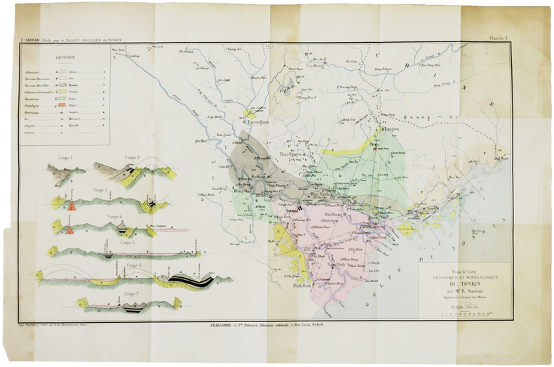
SARRAN (Émile).
[GÉOLOGIE/TONKIN] Essai de carte géologique et minéralogique du Tonkin.
[1888]. 243 x 433 mm.
書籍販売業者の参照番号
: LBW-5005
|
|
|
SARRAZIN (E. C.).
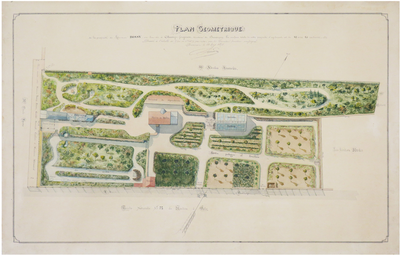
[DOUBS] Plan géométrique de la propriété de Monsieur Bossy, sise lieu-dit à Champ-Forgeron, territoire de Besançon.
1875. 45 x 70 cm ; monté sur carton fort.
書籍販売業者の参照番号
: LBW-7429
|
|
|
SARTIAUX Félix
Villes Mortes D'Asie Mineure Pergame, Ephese, Priene, Milet, Le Didymeion, Hierapolis.
1911 à Paris , chez Hachette , in-8 (200x130),relié pleine toile ,233pp avec 40 vues photographiques Hors texte prises par l'auteur ,3 reproductions de monuments, 8 cartes et plans .
書籍販売業者の参照番号
: PHO-926
|
|
|
Saul, John C.: Editor
A Complete Geography: Tarr and McMurry's Geographies
506 pages. Lovely vintage geography textbook authorized for use in the public schools of Manitoba. Many black and white photos plus lovely fold-out, double-hinged colour maps of Canadian provinces, regions of the U.S., and other areas of the world. Front free endpaper removed. Somewhat above-average wear. Binding somewhat shaken but still intact. The vintage illustrations make this volume a treat to peruse. Book

|
|
|
SAUSSINE (Léon).
Game of the skating-rink – Jeu du skating-rink.
Paris, Saussine, [entre 1876 et 1880]. 526 x 695 mm, sur papier à l'aspect glacé.
書籍販売業者の参照番号
: LBW-8543

|
|
|
SAUVALLE. MANUSCRIT.
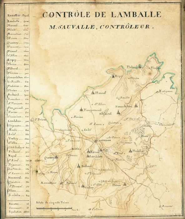
Contrôle de Lamballe. M. Sauvalle, contrôleur.
[fin XVIIIe]. 218 x 180 mm.
書籍販売業者の参照番号
: LBW-784
|
|
|
Savary (Claude-Etienne) :
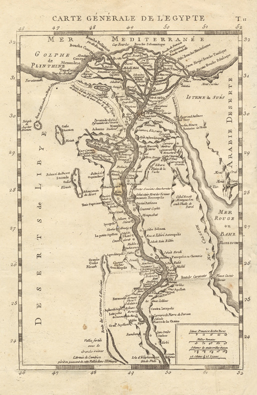
Lettres sur l’Egypte, où l’on offre le parallèle des mœurs anciennes et modernes de ses habitans, où l’on décrit l’état, le commerce, l’agriculture, le gouvernement, l’ancienne religion du pays, et la descente de S. Louis à Damiette, tirée de Joinville et des Auteurs Arabes, avec des Cartes Géographiques. Seconde édition revue et corrigée.
Paris, Onfroi, 1786 ; 3 tomes in-8 ; demi-veau havane, dos à faux-nerfs décoratifs et pièces de titre et tomaison vieux-rouge, tranches mouchetées ; IV, 351 ; 308 ; 308 pp. et 4 planches dépliantes dont 3 cartes géographiques.
書籍販売業者の参照番号
: 16502
|
|
|
SAVARY Claude-Etienne:
Lettres sur l'Egypte, où l'on offre le parallèle des moeurs anciennes & modernes et de ses habitans, où l'on décrit l'état, le commerce, l'agriculture, le gouvernement du pays, la descente de S. Louis à Damiette, tirée de Joinville des Auteurs arabes, avec des Cartes Géographiques.
Paris, Chez Onfroi, 1785, 1786. 3 volumes in-8 de X-395-[3]; [2]-310; [2]-310 pages. plein veau moucheté brun, dos à nerfs ornés de filets et fleurons dorés, pièces de titre et tomaison beige, tranches rouges.
書籍販売業者の参照番号
: 19222
|
|
|
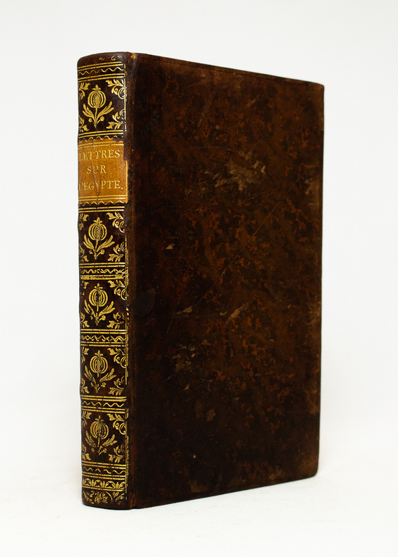
SAVARY Claude:
Lettres sur l'Egypte...
Paris, chez Onfroi, 1785. In-8 de [4]-IV-351 pages, pleine basane blonde, dos lisse orné de fleurons à la grenade et écoinçons végétaux, pièce de titre en cuir sable, filet simple et double estampés à froid en encadrement des plats, tranches rouges.
書籍販売業者の参照番号
: 18486
|
|
|
SAVERNE
Carte allemande au 1/80 000?. Fin XIXe.
1 feuille repli?e. 31,5x45 cm.
|
|
|
Savigny (G.-B. de)
Traité complet des jeux de cartes. Règles détaillées des Grands Cercles, commentaires sur la science des jeux, calcul des probabilités.
français Sans date. Fort in-12 de 538 pp.; broché de l'éditeur (plats de couverture renforcés de carton). Avec de nombreuses illustrations explicatives dans le texte. Petits transferts de scotch dans la première et dernière pages.
|
|
|
SAVIGNY G B (de)
La Manille règles complètes et séparées de tous les jeux de manille avec le calcul de probabilité et l’étude des coups difficiles,
in 12 broché couverture illustrée,94 pages,vignettes dans le texte Albin Michel éditeur sans date (1951)Manille parlée-Manille muette-Le dix-sept Manille à trois avec un mort-Manille à l'envers-Les Manilles aux enchères,simples et composées-Manille de misère-Manille à deux-Etude des coups
書籍販売業者の参照番号
: 3080
|
|
|
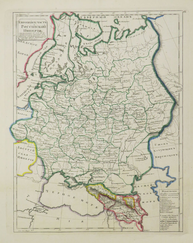
SAVINKOV (Aleksandr Dmitrievich).
[Carte de la Russie].
[St. Pétersbourg, 1835]. 291 x 231 mm.
書籍販売業者の参照番号
: LBW-3684
|
|
|
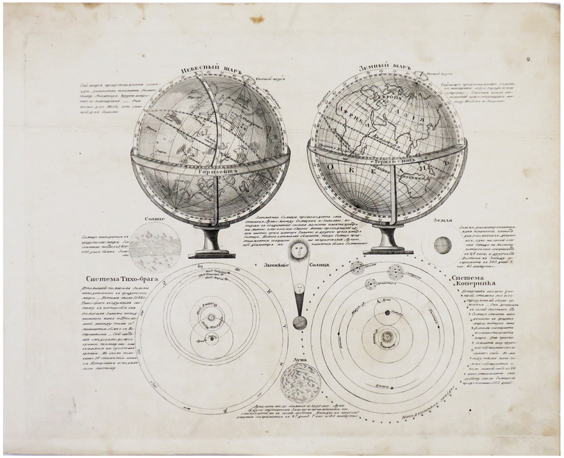
SAVINKOV (Aleksandr Dmitrievich).
[SPHÈRES].
[St. Pétersbourg, 1835]. 215 x 255 mm.
書籍販売業者の参照番号
: LBW-6181
|
|
|
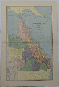
SCALLY, ALEX J
General Map of Queensland.
Sydney & Melbourne.: The Picturesque Atlas Publishing Company Limited Sydney & Melbourne. 1886-1888. Large printed colour map 60.9 x 37 cm 69.9 x 45.3 cm sheet central fold slight browning at the fold and to the generous margins in very good condition. Detailed map prepared for Andrew Garran's monumental "Picturesque Atlas of Australasia" 1886-1888 with the counties attractively coloured. New Guinea is shown to the North and borders with Northern Territory South Australia and New South Wales. The extent of the Great Barrier Reef is delineated along with the ocean "Border of Colony". Proposed and current railways are shown with an extensive place index printed on the verso of the map. . The Picturesque Atlas Publishing Company, Limited, Sydney & Melbourne. unknown
書籍販売業者の参照番号
: 175917
|
|
|
SCANDINAVIA IN OLD MAPS AND PRINTS
0390
Not in perfect condition. unknown
書籍販売業者の参照番号
: Erik van Mingroot and Edu
|
|
|
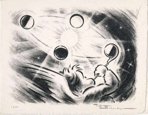
Schardner, Roger
Roger Schardner : carte de voeux pour 1961 et gravure originale
1961 Carte de voeux de Roger Schardner et Madame pour l'année 1961. 12 x 15 cm, 2ff., portant une gravure en noir signée et datée en page 1 et les voeux finement calligraphiés à la mine de plomb à l'attention de M. le député Michel Boscher.
書籍販売業者の参照番号
: 1478
|
|
|
SCHAUENBURG (Balthasar Alexis Henri Antoine de) - ENGELBERTS (Derck C. E.) dir.
Die Schauenburg-Sammlung der Eidgenössischen Militärbibliothek und des Historischen Dienstes. Beitrag zur Geschichte der Schweiz anhand von Karten des 17. und 18 Jahrhunderts. Hrsg. von Derck C. E. Engelberts- Texte von Prof. Dr. Georges Grosjean. - Alain F. Berlincourt - Derck C.E. Engelberts - Stuart Morgan - Dominic M. Pedrazzini.
Hauterive, Editions Gilles Attinger, 1989, elefant-Folio: 59 x 75 cm (Kassette). Papiergrösse 56 x 71 cm. 127 lose faksimilierte, farbige Blätter in 59 bedruckten Papierhüllen, leinen-überzogene Kassette, Lederetikette vorne, Verschluss mit 2 Lederriemen und Druckknöpfen.
書籍販売業者の参照番号
: 127536aaf
|
|
|
SCHEDEL Hartmann (Norimberga 1440 - ivi 1514)
Roma
Veduta panoramica della città tratta dal celebre Liber Cronicarum del 1493."E' la più nota immagine di Roma data alle stampe alla fine del '400. Essendo stata inserita nella fortunatissima opera di Hartman Schedel comunemente nota con il nome di Cronaca di Norimberga può dirsi senz'altro comune. Si tratta di una derivazione dal prototipo comune a tutte le piante medioevali di Roma e noto come panorama di Mantova, a sua volta ripreso da un presunto ma tuttora sconosciuto panorama inciso nella bottega di Francesco Rosselli verso il 1485. La città è vista da nord-est a volo dìuccello per porre in evidenza la zona Vaticana oggetto di vari lavori tra cui le spine di Borgo, il Belvedere (1485/87), il Santo Spirito ed il palazzo del Papa. Sono inoltre riconoscibili le realizzazioni di Santa Maria del Popolo e ponte Sisto. Tra le antichità spiccano il Pantheon, il Colosseo, la colonna Antonina ed in primo piano i Dioscuri nella originaria collocazione presso le terme di Diocleziano. Manca curiosamente l'Isola Tiberina" (cfr. Marigliani p. 117).La monumentale opera di Schedel, il Liber Cronicarum, rappresenta uno “dei più straordinari lavori mai realizzati” dall’editoria del XV secolo. Gli incisori erano Michael Wolgemut, famoso maestro di Albrecht Dürer, e il figliastro Wilhelm Pleydenwurff. Wolgemut fu il tutore di Albrecht Dürer tra il 1486 e il 1490; recenti studi hanno dimostrato come Durer abbia collaborato alla realizzazione di quest’opera, poiché alcuni dei tratti hanno somiglianze stupefacenti con quelli dell’Apocalisse; alcune opere sono infatti attribuite al maestro di Norimberga. La stampa venne supervisionata dal grande stampatore Anton Koberger, le cui opere erano famose in tutta Europa. Xilografia, finemente colorata a mano, consuete tracce di restauro alla piega centrale, nel complesso in ottimo stato di conservazione.BibliografiaA. P. Frutaz, "Le piante di Roma", XCVI; C. Marigliani, "Le Piante di Roma delle collezioni private", n. 8; M. Gori Sassoli (a cura di), "Roma Veduta" p. 139, n. 5; Scaccia Scarafoni, "Le Piante di Roma", n. 125. It is the most famous image of Rome given to the prints at the end of '400. Having been inserted in the very fortunate work of Hartman Schedel commonly known with the name of Chronicle of Nuremberg can be said without doubt common. It is a derivation from the prototype common to all the medieval map of Rome and known as the Mantua panorama, in turn taken from a presumed but still unknown panorama engraved in the workshop of Francesco Rosselli around 1485. The city is seen from the northeast in a bird's eye view to highlight the Vatican area which has been the subject of various works including the Borgo thorns, the Belvedere (1485/87), the Santo Spirito and the Pope's palace. Also recognizable are the realizations of Santa Maria del Popolo and Ponte Sisto. Among the antiquities stand out the Pantheon, the Colosseum, the Antonine column and in the foreground the Dioscuri in the original location near the Baths of Diocletian. The Tiber Island is curiously missing. (see Marigliani p. 117).Schedel's monumental Liber Cronicarum was “one of the most extraordinary works ever produced” The woodblock cutters were Michael Wolgemut, the well-known teacher of Albrecht Dürer, and his stepson Wilhelm Pleydenwurff. Wohlgemut was Albrecht Dürer's tutor between 1486-90 and recent scholarship has shown, Albrecht Dürer may also have collaborated, since some of the cuts bear a remarkably close resemblance to the Apocalypse illustrations. The printing was carried out under the supervision of the great scholar-printer Anton Koberger, whose printing were famous throughout Europe. Woodcut, fine hand colouring, in good condition.BibliografiaA. P. Frutaz, "Le piante di Roma", XCVI; C. Marigliani, "Le Piante di Roma delle collezioni private", n. 8; M. Gori Sassoli (a cura di), "Roma Veduta" p. 139, n. 5; Scaccia Scarafoni, "Le Piante di Roma", n. 125.

|
|
|
SCHEDEL Hartmann (Norimberga 1440 - ivi 1514)
Roma
Veduta fantastica della città posta nella parte inferiore del foglio che contiene anche il testo descrittivo, tratto dal "Liber cronicarum cum figuris et umaginibus ab initio mudi usus mit temporis" rarissima edizione "tascabile" della celebre cronaca del mondo, edita ad Ausburg presso Johann Schonsperger, nel 1496. Prima edizione in tedesco dello Schonsperger. Egli abbrevia sia il testo sia il formato dello Schedel per produrre un edizione che fosse più maneggevole a commerciabile di quella di A. Koberger. "Nel 1469 venne realizzata un'edizione delle Cronaca di Norimberga in formato ridotto a cura di J. Schonsperger in cui le immagini sono copie ridotte di quelle originali ed anche i testi sono sintetizzati. Questa edizione (la seconda in tedesco) è comunque assai più rara della prima. L'editore Schonsperger è noto in quanto impiegò a Norimberga un nuovo carattere gotico chiamato Fraktur nel poema composto per la morte di Massimiliano I" (cfr. Marigliani p. 117).Silografia finemente colorata a mano, in ottimo stato di conservazione. Molto rara.BibliografiaC. Marigliani, "Le Piante di Roma delle collezioni private", n. 10. Fantastic view of the city placed in the lower part of the sheet that also contains the descriptive text, taken from the "Liber cronicarum cum figuris et umaginibus ab initio mudi usus mit temporis", the very rare "pocket edition" of the famous chronicle of the world, published in Ausburg by Johann Schonsperger, in 1496. First German edition of the Schonsperger. He shortened both the text and the format of the Schedel to produce an edition that was more manageable and marketable than that of A. Koberger. "In 1469 an edition of the Chronicle of Nuremberg was produced in reduced format by J. Schonsperger in which the images are reduced copies of the original ones and also the texts are synthesized. This edition (the second one in German) is however much rarer than the first one. The publisher Schonsperger is known because he used in Nuremberg a new gothic character called Fraktur in the poem composed for the death of Maximilian I" (see Marigliani p. 117).Woodcut, with fine later hand colour, excellent condition. Very rare.BibliografiaC. Marigliani, "Le Piante di Roma delle collezioni private", n. 10.

|
|
|
Schedel, Hartmann (1440-1514)
Parisius & Maguncia - Paris und Mainz.
Nürnberg, Anton Koberger, 1493. Kol. Holzschnitt. Blattgrösse: 45 x 62 cm. + Wichtig: Für unsere Kunden in der EU erfolgt der Versand alle 14 Tage verzollt ab Deutschland / Postbank-Konto in Deutschland vorhanden +
書籍販売業者の参照番号
: 591DG

|
|
|
Schedel, Hartmann (1440-1514):
Parisius & Maguncia - Paris und Mainz.
Nürnberg, Anton Koberger, 1493. Kol. Holzschnitt. Blattgrösse: 45 x 62 cm.
書籍販売業者の参照番号
: 591DG
|
|
|
Schelbert, Leo (ed.)
Switzerland Under Siege 1939-1945: A Neutral Nation's Struggle for Survival
As new book in excellent condition in every respect. Binding is solid and square, covers have sharp corners, exterior shows no blemishes, text/interior is clean and free of marking of any kind. Many color detailed maps. 247 pages, institutional stamp on front end paper.
|
|
|
Schenk, Peter der Jüngere
Accurate Geographische Charte dar Graeflichen Stolbergl. als Hohnstein, Stolberg, Hayn, Berenroda, Ebersburg, Ufftrungen, Rosla, und Questen nebst unterschiedliche angräntzenden. [Altkolorierter Original-Kupferstich / original colored copper engraving].
o.J. Peter Schenk der Jüngere, geboren am 15. Februar 1693 in Amsterdam, gestorben am 14. Januar 1775 ebenda. Deutscher Kupferstecher und Kartenverleger, der als bedeutendster Verleger sächsischer Spezialkarten in der ersten Hälfte des 18. Jahrhunderts gilt. [4 Warenabbildungen]
書籍販売業者の参照番号
: 12029DB

|
|
|
Schenk, Peter der Jüngere
Accurate Geographische Delineation des Hochf. Sachß. Amtes Weissenfels. Nebst allen darzu gehörigen Städten Flecken Dorffschafften wie auch etlichen angraentzenden Orten. Gestochen von Peter Schenk in Amsterdam mit Königl. und Churfurstl. Sachss. Privilegio. [Altkolorierter Original-Kupferstich / original colored copper engraving].
o.J. Peter Schenk der Jüngere, geboren am 15. Februar 1693 in Amsterdam, gestorben am 14. Januar 1775 ebenda. Deutscher Kupferstecher und Kartenverleger, der als bedeutendster Verleger sächsischer Spezialkarten in der ersten Hälfte des 18. Jahrhunderts gilt. [4 Warenabbildungen]
書籍販売業者の参照番号
: 12033DB

|
|
|
Schenk, Peter der Jüngere
Geometrischer Genaral Ris des Stiffts Merseburg. Gestochen von P. Schenk in Amsterdam mit Königl. und Churfl. Sachss. Privilegio. [Altkolorierter Original-Kupferstich / original colored copper engraving].
o.J. Peter Schenk der Jüngere, geboren am 15. Februar 1693 in Amsterdam, gestorben am 14. Januar 1775 ebenda. Deutscher Kupferstecher und Kartenverleger, der als bedeutendster Verleger sächsischer Spezialkarten in der ersten Hälfte des 18. Jahrhunderts gilt. [4 Warenabbildungen]
書籍販売業者の参照番号
: 12034DB

|
|
|
SCHERER Henrick (Dilingen 1628 - Monaco 1704)
Globus Terraqueus Ecclesiastico Politicus In Suas Partes et Dominia Divisus.
La stampa decorativa mostra la mano di Dio che tiene sospeso il mondo attraverso una croce fissata sul Polo Nord. I cieli circostanti sono popolati di cherubini, alcuni dei quali reggono corone e capricapi di papi, cardinali e vescovi. Rappresentazioni allegoriche dei continenti d'Europa, Asia, Africa e America. Nel continente americano, la California è rappresentata come un'isola. Decorativa carta geografica pubblicata nell'opera di Heinrich Scherer Atlas Novus exhibens orbem terraguem per naturae opera, historiae navae acveterus monumenta, artistique geographicae leges et praecepta edita in 8 parti, stampate tra il 1702 e il 1710 a Monaco di Baviera. Heinrich Scherer, professore di matematica a Monaco di Baviera, era un gesuita devoto la cui opera sottolineava la gerarchia cattolica e la diffusione delle missioni gesuite in tutto il mondo. Il suo Atlas Novus contiene mappe di tutte le altre parti che mostravano la diffusione del cattolicesimo e delle missioni gesuite. Incisione in rame, finemente colorata a mano, in ottimo stato di conservazione. The page features the hand of God suspending the world from a cross attached at the Pole. The surrounding heavens are filled with winsome cherubs, some of whom hold crowns and the hats of popes, cardinals and bishops, with allegorical representations of the continents of Europe, Asia, Africa and America. All of the continental figures hold a map, with the one representing the Americas featuring California as an island. Heinrich Scherer, professor of mathematics at Munich, was a devout Jesuit whose work emphasized the Catholic hierarchy and the spread of Jesuit missions throughout the world. The important, large river systems are exceptionally well illustrated. Many placenames are included in the interior as well as on the coasts. Heinrich Scherer was a devout Jesuit, and professor of mathematics at Munich. Map taken from the Atlas Novus exhibens orbem terraguem per naturae opera, historiae navae acveterus monumenta, artistique geographicae leges et praecepta, published in 8 parts, printed between 1702 and 1710 in Munich. His 'Atlas Novus' contained maps of all other parts which showed the spread of Catholicism and Jesuit missions. Copperplate with later hand colour, very good condition.

|
|
|
SCHERER Henrick (Dilingen 1628 - Monaco 1704)
Imago Totius Orbis Terraquei cum suo apparatu Ab Auctore Naturae in Suas Partes Distributi Geographice Exhibita. Anno MDCC
Decorativa carta geografica pubblicata nell'opera di Heinrich Scherer Atlas Novus exhibens orbem terraguem per naturae opera, historiae navae acveterus monumenta, artistique geographicae leges et praecepta edita in 8 parti, stampate tra il 1702 e il 1710 a Monaco di Baviera. Questa insolita proiezione polare rappresenta il mondo intero, eccetto il Polo Sud. La California è mostrata come un'isola ed è rappresentata la suggestione del "Passaggio a Nord-Ovest" attraverso la Baia di Hudson. Raffigurata anche una parte distorta dell'Australia, nota come Nova Hollandia. La mappa ha deliziose raffigurazioni di uccelli e teste di vento nei cieli, così come pesci e mostri che nuotano nei mari. Il bellissimo cartiglio è pieno di animali e due piccoli diagrammi astronomici fiancheggiano la mappa. Heinrich Scherer, professore di matematica a Monaco di Baviera, era un gesuita devoto la cui opera sottolineava la gerarchia cattolica e la diffusione delle missioni gesuite in tutto il mondo. Il suo Atlas Novus contiene mappe di tutte le altre parti che mostravano la diffusione del cattolicesimo e delle missioni gesuite. Incisione in rame, in ottimo stato di conservazione. This unusual polar projection depicts the entire world except the South Pole. California is shown as an island and there is a suggestion of a Northwest Passage via Hudson Bay. There is a distorted portion of Australia noted as Nova Hollandia. The map has delightful depictions of birds and wind heads in the heavens as well as fish and monsters swimming the seas. The beautiful cartouche is filled with animals and two small astronomical diagrams flank the map. Heinrich Scherer, professor of mathematics at Munich, was a devout Jesuit whose work emphasized the Catholic hierarchy and the spread of Jesuit missions throughout the world.The important, large river systems are exceptionally well illustrated. Many placenames are included in the interior as well as on the coasts. Heinrich Scherer was a devout Jesuit, and professor of mathematics at Munich. Map taken from the Atlas Novus exhibens orbem terraguem per naturae opera, historiae navae acveterus monumenta, artistique geographicae leges et praecepta, published in 8 parts, printed between 1702 and 1710 in Munich. His 'Atlas Novus' contained maps of all other parts which showed the spread of Catholicism and Jesuit missions. Shirley #627.

|
|
|
SCHERER Henrick (Dilingen 1628 - Monaco 1704)
Repraesentatio Geographica itineris maritimi Navis Victoriae in qua ex personis CCXXXVII finita navigatione ... se voto exs
Splendida carta storico-geografica del mondo costruita con proiezione conica polare che mostra l'intero Mondo ad eccezione del Polo Sud; la California è rappresentata come un'isola. E' anche raffigurata una piccola parte, distorta, dell'Australia, indicata come Nova Hollandia.Sulla mappa è riportato il tracciato della circumnavigazione di Magellano. Sulla sinistra è illustrata la nave Vittoria, la sola nave che rimase dell'equipaggio che saklpò da Siviglia nel 1519 alla ricerca di un passaggio a ovest verso le Isole delle Spezie e le Indie.La vignetta a destra, rappresenta i pochi sopravvissuti - 18, dei 237 membri - in pellegrinaggio alla chiesa di Santa Marea di Siviglia, come ex voto per la grazia ricevuta. Il cartiglio in alto a destra, riporta anche la data del ritorno: 7 settembre 1522. Decorativa carta geografica pubblicata nell'opera di Heinrich Scherer Atlas Novus exhibens orbem terraguem per naturae opera, historiae navae acveterus monumenta, artistique geographicae leges et praecepta edita in 8 parti, stampate tra il 1702 e il 1710 a Monaco di Baviera. Heinrich Scherer, professore di matematica a Monaco di Baviera, era un gesuita devoto la cui opera sottolineava la gerarchia cattolica e la diffusione delle missioni gesuite in tutto il mondo. Il suo Atlas Novus contiene mappe di tutte le altre parti che mostravano la diffusione del cattolicesimo e delle missioni gesuite. Incisione su rame, in ottimo stato di conservazione. Map of the world, shown on a north polar projection and showing the entire world except the South Pole, California is shown as an island and the track of Magellan's voyage around the world is noted. There is a distorted portion of Australia noted as Nova Hollandia. On the left is an illustration of Victoria, the only remaining ship from Magellan's Armada de Molucca that sailed from Seville in 1519 in search of a westward route to the Spice Islands. On the right, the few expedition survivors (18 out of the original 237) are shown making their way to the Santa Marea de la Victoria church in Seville, where they went to give thanks for their safe return. The title cartouche includes the date of their return, September 7, 1522.By Heinrich Scherer for his Atlas Novus exhibens orbem terraguem per naturae opera, historiae navae acveterus monumenta, artistique geographicae leges et praecepta...published in eight volumes from 1702-1710 in Munich. Scherer, a devout Jesuit, produced this geographical compendium to depict the Catholic hierarchy and the spread of Jesuit missions throughout the world.Copper engraving, in very good condition. Tooley, R.V. (Amer) p.132, #88, pl.60; Shirley, World, 626

|
|
|

 検索結果のメールを受信する
 PDFファイルの検索結果をダウンロード
 RSSフィード
 パーマネントリンク


