|
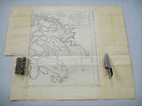
[BELLIN, JACQUES NICOLAS] (CARTOGRAPHER).
Carte de L'entree de la Riviere de Canton. Dressee sur les Observations les plus recentes.
Paris. circa1749. Black and white engraved map on laid paper showing entrance to Pearl/Canton river Macao and the area which would become Hong Kong Sinn-gan-hien folded designed by the prominent French cartographer Jacques-Nicolas Bellin. This map is No. 16 Vol. 5 from the impressive 15-volume "Histoire Generale des Voyages" compiled by French novelist Antoine François Prévost. The walled city of Canton upper section is divided into areas of Tartar and Chinese. <br> <br>Some light even browning on paper added at margins good copy. Map measures 25.7 x 20.5. . unknown
書籍販売業者の参照番号
: 136781
|
|
|
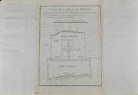
[BELLIN, JACQUES-NICOLAS]. (CARTOGRAPHER).
Plan De la Ville De Peking.
Paris. circa1749. Black and white engraved plan map of Peking on laid paper folded designed by the prominent French cartographer Jacques-Nicolas Bellin. This map is No. 18 Vol. 5 from the impressive 15-volume "Histoire Generale des Voyages" compiled by French novelist Antoine François Prévost. This city map shows two areas of walled cities: Ville Tartare Imperial city and the Forbidden City and Ville Chinoise ethnic Han residential area. <br> <br>Notes A and B represents buildings within the Forbidden City. A: Lieu de Plaisance ou l'on voit une Montagne faite a la main B: Grandes Cours du Palais de l'Empereur. Two missionary buildings French and Portuguese as well as the Tower of Mathematics illustrated within Ville Tartare. Two temples illustrated side by side near the south gate of the Ville Chinoise. <br> <br>Overall in good condition very light browning on edges and darker toning along the borders of the map. Text in French. Map measures 21 x 16.4cm. . unknown
書籍販売業者の参照番号
: 136794
|
|
|
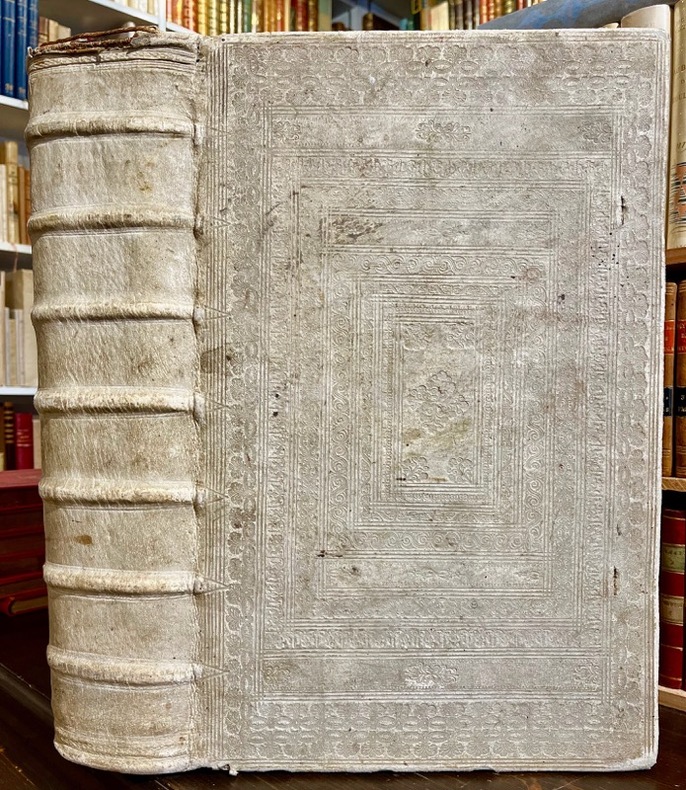
[BIBLE DE GENEVE]; DESMARETS Samuel:
La sainte Bible, qui contient le Vieux et le Nouveau Testament : édition nouvelle, faite sur la version de Genève, reveuë et corrigée, enrichie, outre les anciennes notes, de toutes celles de la Bible flamande, de la plus-part de celles de M. Diodati, et de beaucoup d'autres, de plusieurs cartes curieuses, et de tables fort amples, pour le soulagement de ceux qui lisent l'Escriture sainte. Le tout disposé en cet ordre, par les soins de Samuel des Marets […] et de Henry des Marest, son fils [...].
A Amsterdam, Chez Louys & Daniel Elsevier, 1669. 4 parties en 2 tomes reliés en un volume in-folio, plein vélin estampé à froid, sur ais de bois. Traces d'attaches. [42]-366 ; [2]-162 ; [2]-202 ; 70 feuillets imprimés sur deux colonnes. *4; a-e6 ; f8; A-Z6 ; Aa-Zz6 ; Aaa-Ppp6 [et] A-Z6 ; Aa-Cc6 ; Dd8 [et] *2 ; A-Z6 ; Aa-Kk6 ; Ll4 [et] A-L6 ; M4.
書籍販売業者の参照番号
: 18982
|
|
|
[BILLANCOURT].-
Sortie des ouvriers des Usines Renault.-
Carte postale E.M. 1431. Vers 1905. Carte postale (140 x 91mm) timbrée sur le recto (timbre presque entièrement déchiré). Vue très anîmée des bâtiments avec une grande foule d'ouvriers. Bon exemplaire.
書籍販売業者の参照番号
: ORD-1167
|
|
|
[BLOCQUEL (Simon)]
Les Tours de Cartes les plus amusans, rendus faciles par un grand nombre de figures gravées.
1840 cartonnage modeste. in-16, titre, p.15 à 100, 9 planches comprenant 49 figures plus une sur le titre comprises dans la pagination, gravées sur bois. P. Delarue Lille Castiaux (ca. 1840)
書籍販売業者の参照番号
: 14296
|
|
|
[BOURDIN] [CARTES POSTALES ANCIENNES]
Le Riz d'Indo-Chine
Sans lieu, 1931. 1 ensemble de 6 cartes postales anciennes représentant les activités liées à la culture du riz en Indo-Chine.
書籍販売業者の参照番号
: 12245
|
|
|
[BORDEAUX]. DELPECH (Ernest).
Nouveau plan de la ville de Bordeaux à l'usage des promeneurs. Dressé d'après les documents les plus récents fournis par les administrations publiques par Ernest Delpech, employé aux travaux publics
Bordeaux, Féret [Imprimerie centrale de Vve Lanefranque], 1870 in-12, [2] ff. n. ch. (réclames), 32 pp. de texte (tableau des voies), [3] ff. n. ch. (réclames), avec un grand plan dépliant (58 x 73 cm) aux contours rehaussés de couleurs, toile chagrinée cerise, dos lisse muet, encadrements à froid sur les plats, titre et armes de Bordeaux poussés au centre du plat supérieur (reliure de l'éditeur).
書籍販売業者の参照番号
: 242581
|
|
|
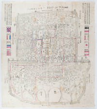
[BOXER REBELLION MAP OF BEIJING].
Map of Peking. 京城內外全圖 .Jing cheng nei wai quan tu.
Circa1900. Large illustrated map of Beijing showing the city in the period following the invasion of the military forces of the Eight National Alliance old folds scale not given. Some scattered light foxing particularly at edges short closed tear at fold lower edge neat non acidic tape repair short section upper edge wear along folds and a couple of small unobtrusive holes with minor image loss. Blocks of text in traditional Chinese right and left upper sections stating each nation's occupied zone Japanese text title accompanies the English title along the upper section of the map. 63.7 x 56.9cm. Very good overall. A rare and significant large Japanese woodblock map of Peking Beijing issued just after the suppression of the Boxer Rebellion. Centred on the Forbidden City the map depicts Peking following the multinational suppression of the Boxer Rebellion or Yihetuan Movement of 1900. The map was issued to illustrate the areas of occupation associated with each of the powers in the Eight Nation Alliance. <br> <br>The map gives measurements of the city walls detailed names of streets and buildings and the boundaries of the inner and outer city including the forbidden city are shown with demarcation lines in pink yellow and blue. The hand coloured eight national flags of the occupation powers are featured at the right and left. <br> <br>This map is essentially a later edition of 京城内外首善全圖 a map of Beijing issued by the Qing for administrative purposes in the mid-19th century. The Japanese seized the wood blocks during the suppression of the Rebellion and subsequently pulled new impressions overprinting them additional details including flags and demarcations of areas of the city held by members of the Alliance. Versions are known in French German Japanese and as with the present example English. An attractive map of great historical interest. . unknown
書籍販売業者の参照番号
: 169765
|
|
|
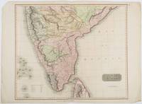
[BRITISH INDIA AND CEYLON - MAP] NEELE, SAMUEL JOHN (ENGRAVER)
British India Southern Part.
London.: Thomson. 1816. Engraved map with full handcolour 50.5 x 59.7 cms ; 53.9 x 73.8 cms sheet central fold a few minor edge tears one intruding into the top border the map unscathed marginal edgewear two corners with some loss but the map in very good crisp condition. An elegant map with great detail prepared for John Thomson's influential "New General Atlas" 1814-1821. Showing India from 20 degrees to 7 degrees north of the equator and includes the northern half of Ceylon with territorial interests attractively coloured. . Thomson. unknown
書籍販売業者の参照番号
: 185242
|
|
|
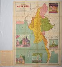
[BURMA - MAP]
Latest Map of Burma. Political showing relief of land.
Delhi.: S.B. Makhija & Brothers. circa1951. Printed colour map 98.6 x 69 cms folding into pictorial wrappers 25.3 x 19.5 cms five pictorial colour inserts of pagodas and the Shwethalyaung reclining Buddha wrappers a little chipped marginal wear and three small fold splits in the map but overall in very good condition. Attractive large map of Burma with the provinces coloured steamship routes shown in red and printed in the booklet a range of information printed based on the 1951 census including climate agriculture and form of government "Burma became an independent nation completely outside the British Empire on January 4 1948 and is now a sovereign independent republic known as the Union of Burma". . S.B. Makhija & Brothers. unknown
書籍販売業者の参照番号
: 214601
|
|
|
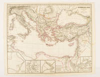
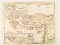
[BYZANTINE EMPIRE - MAP]. SPRUNER, KARL AND MENKE, THEODOR
Oströmisches Reich zu Justinians Zeit.
Gotha.: Justus Perthes. Map with original colour and outline hand-colour 32.2 x 40 cm text in German five inset maps central fold slight marginal toning and spotting on the verso but in very good condition. A most handsome and highly detailed map detailing the Eastern provinces of the Byzantine/Roman Empire in the time of the Roman Emperor Justinian 527-565. The inset maps depict Carthage Rome Constantinople Naples and a Western continuation of the main map originally issued for the "Hand-Atlas für die Geschichte des Mittelatters und die Neueren Zeit" . Justus Perthes. unknown
書籍販売業者の参照番号
: 174950
|
|
|
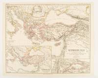
[BYZANTINE EMPIRE - MAP]. SPRUNER, KARL AND MENKE,THEODOR
Oströmisches Reich von der Einwanderung der Ungarn in Ponnonien um 895 bis zur Unterwerfung des Bulgarenreichs durch Kaiser Basilius im J. 1019.
Gotha: Justus Perthes. 1874. Map with original colour and outline hand-colour 32.2 x 40 cm three inset maps text in German central fold slight marginal toning in very good condition. A most handsome map detailing the Eastern Roman Empire from the immigration of Hungarians in Ponnonia around 895 to the subjugation of the Bulgarian Empire by Emperor Basilius in 1019. The inset maps depict Divisions of the Empire Palestine and the Themata around Propontis present day Sea of Marmara issued for the "Hand-Atlas für die Geschichte des Mittelatters und die Neueren Zeit". . Justus Perthes unknown
書籍販売業者の参照番号
: 174914
|
|
|
[BYZANTINE EMPIRE - MAP]. SPRUNER, KARL AND MENKE, THEODOR
Oströmisches Reich 1096-1204
Gotha: Justus Perthes. 1876. Map with original colour and outline hand-colour 32.2 x 40 cm text in German four inset maps central fold slight marginal toning and spotting on the verso but in very good condition. A most handsome and highly detailed map detailing the Eastern provinces of the Byzantine/Roman Empire before the Fourth Crusade. The inset maps depict Constantinople Divisions of the Empire and Antioch issued for the "Hand-Atlas für die Geschichte des Mittelatters und die Neueren Zeit" . Justus Perthes unknown
書籍販売業者の参照番号
: 174911
|
|
|
[CAMPAGNE DE 1757]:
1. Mémoires pour servir à l'histoire des campagnes de 1756 et 1757 en Allemagne, par L. O. H., rédigés et augmentés par M. D. V. [avec] 2. Mémoires pour servir à l'histoire de la campagne des troupes françaises, depuis la convention de Closter Seiven faite en septembre 1757. Augmentée d'un lettre communiquée par l'observateur hollandais par rapport à la ditte convention. [avec] 3. Histoire de la campagne de MDCCLVII. Où l'on voit les circonstances qui ont précédé, accompagné, et suivi la battaille de Rosbach, avec le détail de ce qui s'est passé d'important dans l'Éléctorat d'Hannovre, depuis la convention de Closter-Seven jusqu'au 1 janvier 1758.
A Francfort et Leipsig, aux dépens de la Compagnie, 1758. In-8 de [4]-48 ; 32; 96-64 pages, demi-vélin à coins, titre inscrit à la plume sur le dos. Non rogné.
書籍販売業者の参照番号
: 21322

|
|
|
[Cartes à jouer][Cartomagie] Anonyme
100 Jeux [de cartes]
s.n.l. 1980 In-8 23 x 16 cm. Broché, couverture illustrée, non paginé 158 pp., nombreuses figures explicatives, glossaire. Ouvrage en très bon état, exhausif sur les différents jeux de cartes.
書籍販売業者の参照番号
: 96389
|
|
|
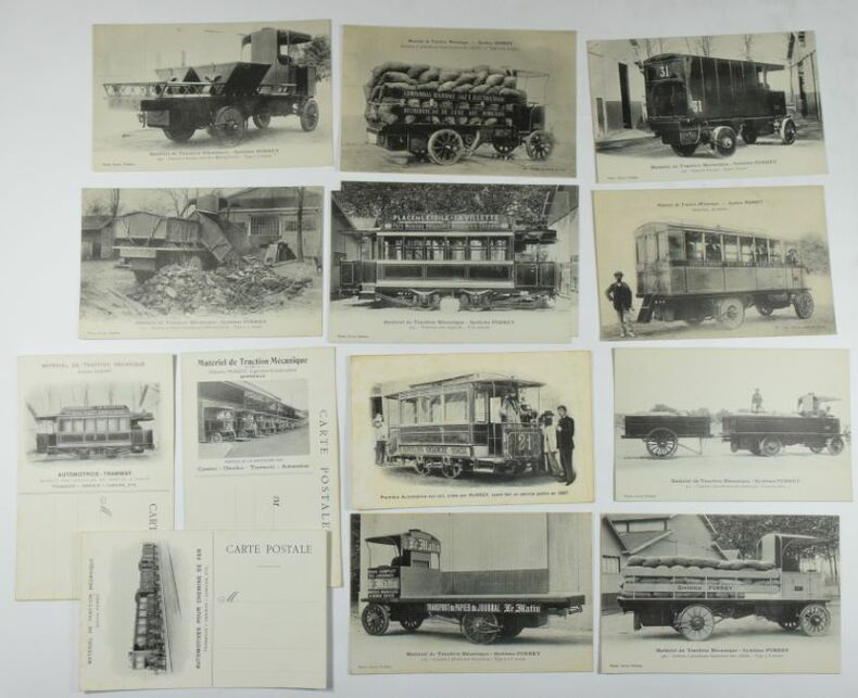
[CARTES POSTALES - AUTOMOBILES]
14 cartes postales "Matériel de Traction Mécanique - Système PURREY" : 1. et 2. 224- Tramway sans impériale - Voie normale ; 3. Omnibus, 30 places ; 4. Première Automotrice sur rail, créée par PURREY, ayant fait un service public en 1887 ; 5. 413 - Camion à plateforme avec remorque - 8 tonnes utiles ; 6. 316 - Camion à plateforme découverte - Type 5 à 8 tonnes ; 7. 469 - Camion à plateforme découverte avec ridelles - type 5 -8 tonnes ; 8. 259 - Camion Fourgon - Type 5 tonnes 9. Camion à plateforme découverte avec ridelles. Type 2-3 tonnes ; 10. 299 - Camion à bennes mobiles (Métropolitain) - Type 5-8 tonnes ; 11. 255 - Camion à bennes basculantes (Métropolitain) - Type 5-7 tonnes ; 12., 13. 14. cartes postales publicitaires avec illustration n/b.
14 cartes postales 142 x 90 mm, 11 avec une photo n/b, 3 blanches avec une photo au verso, carte n° 4. : claires rousseurs, très bel ensemble, très bel état.
書籍販売業者の参照番号
: 6429
|
|
|
[Cartes Taride]
A. Taride Éditeur de cartes cyclistes et automobiles. N°18Carte routière pour cyclistes et automobiles du sud de la France, section centrale.
Carte routière dépliante couleur, A. Taride, Paris, SD
書籍販売業者の参照番号
: 5828
|
|
|
[CARTES À JOUER ]
Album de cartes asiatiques
Asie, moitié du XIXe siècle. In-12 oblong, [48] ff., demi-percaline à coins chagrinée noire, plats de papier chagriné, étiquette "Carnet C2" au premier plat (reliure défraîchie mais solide, quelques taches, des cartes et/ou des ff. manquants).
書籍販売業者の参照番号
: 20410

|
|
|
[Cartes Bécherel]
Bergerac, Feuille 57, NordCarte Bécherel (État-Major au 200.000e) publiée avec l'autorisation du Ministre de la GuerreSystème breveté, seuls propriétaires : H. Guival et L. Theuveny
Carte couleur de type État-Major, avec répertoire des localités, Jules Rueff éditeur, Paris, SD
書籍販売業者の参照番号
: 5779
|
|
|
[carte]
Carte du DEPARTEMENT de l'ISERE
Une carte format 330 x 430 mm, en couleurs, réimpression d'une carte de 1857 (dessinée par L. Garçon - Grenoble)
書籍販売業者の参照番号
: LFA-126727071
|
|
|
[Carte MICHELIN]
CARTE MICHELIN n° 36
Une carte dépliable format fermé 105 x 215 mm, format ouvert 430 x 1230 mm, publiée en 1919, Librairie Ch. Delagrave, bon état
書籍販売業者の参照番号
: LFA01b23
|
|
|
[Cartes A. Taride]
CarteDe Reims à la Somme
Carte dépliante couleur, échelle : 1 : 200.000, A. Tarde éditeur, Paris, SD
書籍販売業者の参照番号
: 5787
|
|
|
[Cartes Taride]
Carte Taride 30 31 32Italie en 1 feuille Routière kilométriqueGrand tourisme échelle : 1/1.250.000 format 85 * 100, 6 couleurs
Carte dépliante couleur , Taride, Paris, 1956
書籍販売業者の参照番号
: 5816
|
|
|
[Carte d'Etat-Major]
CARTE d'ETAT-MAJOR : AUTUN
Carte géographique format ouvert 675 x 430 mm, éditée au début du XXe siècle, bon état
書籍販売業者の参照番号
: LFA-126714583
|
|
|
[Carte d'Etat-Major]
CARTE d'ETAT-MAJOR : RODEZ
Carte géographique format ouvert 675 x 430 mm, éditée au début du XXe siècle, bon état
書籍販売業者の参照番号
: LFA-126714593
|
|
|
[Carte de Dion-Bouton]
CARTE de DION-BOUTON II: NORD-EST PARIS + ALGERIE
Carte géographique toilée format ouvert 660 x 640 mm, éditée au début du XXe siècle, bon état
書籍販売業者の参照番号
: LFA-126714595
|
|
|
[Carte de Dion-Bouton]
CARTE de DION-BOUTON I : NORD-OUEST PARIS
Carte géographique toilée format ouvert 660 x 640 mm, éditée au début du XXe siècle, bon état
書籍販売業者の参照番号
: LFA-126714596
|
|
|
[Carte BLONDEL]
Carte FRANCE POLITIQUE, EMPIRE FRANCAIS, ZONE d'OCCUPATION en ALLEMAGNE
Une belle carte en couleurs, format ouvert 910 x 695 mm, éditée en 1931, Blondel La Rougery Editeur, bon état
書籍販売業者の参照番号
: LFA-126737235
|
|
|
[Carte MICHELIN]
CARTE MICHELIN n° 110 Zoom : ENVIRONS de LYON
Une carte dépliable, édition de 2004, Michelin, bon état
書籍販売業者の参照番号
: LFA-126740289
|
|
|
[CARTES] / [BELLIN]
Carte tirée du Petit Atlas Maritime de Bellin. Plan de la ville de Dieppe.
Paris, 1764. Planche gravée in-4° (22 x 32 cm) rehaussée de couleurs.
書籍販売業者の参照番号
: 16427
|
|
|
[CARTES] / [BELLIN]
Carte tirée du Petit Atlas Maritime de Bellin. Suite de la coste de Languedoc depuis Gruissan jusqu'à Brescon.
Paris, 1764 Planche gravée in-4° ( 22 x 32 cm) rehaussée de couleurs.
書籍販売業者の参照番号
: 16397
|
|
|
[CARTES] / [BELLIN]
Carte tirée du Petit Atlas Maritime de Bellin. Carte de la rade de Dunkerque et ses bancs.
Paris, 1764 Planche gravée in-4° (16 x 22 cm) rehaussée de couleurs.
書籍販売業者の参照番号
: 16398
|
|
|
[CARTES] / [BELLIN]
Carte tirée du Petit Atlas Maritime de Bellin. Dunkerque et canal de Mardick.
Paris, 1764 Planche gravée in-4° (16 x 22 cm) rehaussée de couleurs.
書籍販売業者の参照番号
: 16399
|
|
|
[CARTES] / [BELLIN]
Carte tirée du Petit Atlas Maritime de Bellin. Plan de Dunkerque.
Paris, 1764 Planche gravée in-4° (22 x 32 cm) rehaussée de couleurs.
書籍販売業者の参照番号
: 16400
|
|
|
[CARTES] / [BELLIN]
Carte tirée du Petit Atlas Maritime de Bellin. Plan de Gravelines à la coste de Flandres.
Paris, 1764 Planche gravée in-4° (22 x 32 cm) rehaussée de couleurs.
書籍販売業者の参照番号
: 16401
|
|
|
[CARTES] / [BELLIN]
Carte tirée du Petit Atlas Maritime de Bellin. Plan de la ville de Boulogne.
Paris, 1764 Planche gravée in-4° (16 x 22 cm) rehaussée de couleurs.
書籍販売業者の参照番号
: 16402
|
|
|
[CARTES] / [BELLIN]
Carte tirée du Petit Atlas Maritime de Bellin. Plan de Calais, coste voisine et environs.
Paris, 1764 Planche gravée in-4° (16 x 22 cm) rehaussée de couleurs.
書籍販売業者の参照番号
: 16403
|
|
|
[CARTES] / [BELLIN]
Carte tirée du Petit Atlas Maritime de Bellin. Plan de Calais.
Paris, 1764 Planche gravée in-4° ( 22 x 32 cm) rehaussée de couleurs.
書籍販売業者の参照番号
: 16404
|
|
|
[CARTES] / [BELLIN]
Carte tirée du Petit Atlas Maritime de Bellin. Fort de Nieulet près de Calais.
Paris, 1764 Planche gravée in-4° ( 16 x 22 cm) rehaussée de couleurs.
書籍販売業者の参照番号
: 16405
|
|
|
[CARTES] / [BELLIN]
Carte tirée du Petit Atlas Maritime de Bellin. Plan de Boulogne et des environs.
Paris, 1764. Planche gravée in-4° ( 16 x 22 cm) rehaussée de couleurs.
書籍販売業者の参照番号
: 16406
|
|
|
[CARTES] / [BELLIN]
Carte tirée du Petit Atlas Maritime de Bellin. Suite des costes de Picardie et partie de Normandie depuis la pointe de Groofiliers jusqu'à Criel.
Paris, 1764. Planche gravée in-4° ( 16 x 22 cm) rehaussée de couleurs.
書籍販売業者の参照番号
: 16407
|
|
|
[CARTES] / [BELLIN]
Carte tirée du Petit Atlas Maritime de Bellin. Plan de la ville et citadelle du Havre.
Paris, 1764. Planche gravée in-4° ( 16 x 22 cm) rehaussée de couleurs.
書籍販売業者の参照番号
: 16409
|
|
|
[CARTES] / [BELLIN]
Carte tirée du Petit Atlas Maritime de Bellin. Plan de Fécamp.
Paris, 1764. Planche gravée in-4° ( 16 x 22 cm) rehaussée de couleurs.
書籍販売業者の参照番号
: 16410
|
|
|
[CARTES] / [BELLIN]
Carte tirée du Petit Atlas Maritime de Bellin. Plan de Treport.
Paris, 1764. Planche gravée in-4° ( 16 x 22 cm) rehaussée de couleurs.
書籍販売業者の参照番号
: 16411
|
|
|
[CARTES] / [BELLIN]
Carte tirée du Petit Atlas Maritime de Bellin. Coste de Normandie depuis d'ance de Vauville et cap de la Hague jusqu'à Cherbourg.
Paris, 1764. Planche gravée in-4° (22 x 32 cm) rehaussée de couleurs.
書籍販売業者の参照番号
: 16412
|
|
|
[CARTES] / [BELLIN]
Carte tirée du Petit Atlas Maritime de Bellin. Plan du port et ville de Collioure en Roussillon.
Paris, 1764. Planche gravée in-4° (16 x 22 cm) rehaussée de couleurs.
書籍販売業者の参照番号
: 16420
|
|
|
[CARTES] / [BELLIN]
Carte tirée du Petit Atlas Maritime de Bellin. Plan du port et bourg de St Valery en Caux..
Paris, 1764. Planche gravée in-4° (16 x 22 cm) rehaussée de couleurs.
書籍販売業者の参照番号
: 16423
|
|
|
[CARTES] / [BELLIN]
Carte tirée du Petit Atlas Maritime de Bellin. Carte de la rade du Brusc.
Paris, 1764. Planche gravée in-4° (16 x 22 cm) rehaussée de couleurs.
書籍販売業者の参照番号
: 16424
|
|
|
[CARTES] / [BELLIN]
Carte tirée du Petit Atlas Maritime de Bellin. Port de Nagaye et costes voisines.
Paris, 1764. Planche gravée in-4° (16 x 22 cm) rehaussée de couleurs.
書籍販売業者の参照番号
: 16426
|
|
|
[CARTES] / [BELLIN]
Carte tirée du Petit Atlas Maritime de Bellin. Costes de Flandres et de Picardie depuis Nieuport jusqu'à Calais.
Paris, 1764. Planche gravée in-4° (22 x 32 cm) rehaussée de couleurs.
書籍販売業者の参照番号
: 16431
|
|

 検索結果のメールを受信する
 PDFファイルの検索結果をダウンロード
 RSSフィード
 パーマネントリンク


