|
[SEINE-ET-MARNE]
Carte de la Forêt de Fontainebleau. avec un plan de la ville à l'usage des promeneurs, des cyclistes et des automobilistes
Paris, A. Taride, s.d. in-8, broché. Petite mouillure à la couv.
書籍販売業者の参照番号
: 188829
|
|
|
[SERIZAWA KEIGO]. 芹澤馨吾
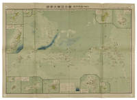
標準大東亞分圖・南洋群島 内南洋. Hyojun Daito-A bunzu: Nanyo gunto nai Nanyo. Standard Sectional Map of the Greater East Asia: the South Sea Islands Inner South Sea.
統正社 Tōseisha . Showa 18 1943. Colour folded map 54. x 76.5cm. Pinholes at corners light even browning good copy. This Japanese map of Micronesia shows the Mariana Islands Eastern and Western Caroline Islands Marshall Islands and Gilbert Islands. The separate maps around the edge are clockwise from the upper right corner: Jaluit Atoll Guam Island Rota Island Saipan Island Palau Islands Yap Island Hall Islands Pohnpei Island Truk Islands and Kusaie Island. . 統正社 [Tōseisha ]. unknown
書籍販売業者の参照番号
: 155215
|
|
|
[SERVICE HYDROGRAPHIQUE DE LA MARINE] BOUQUET DE LA GRYE - INGENIEUR HYDROGRAPHE
CÔTE OCCIDENTALE DE FRANCE : COURS DE LA LOIRE DEPUIS NANTES JUSQU'A SON EMBOUCHURE - 1891 -
Nantes SERVICE HYDROGRAPHIQUE DE LA MARINE 1891 in-8 une carte dépliante entoilée in-octavo, format plié : (24 x 16 cm), plats cartonnés recouvert de percaline bleu-marine, N° 4321 frappé "or" au centre du dos (N° de référence de la carte en bas à droite de la gravure ), divisée en 21 panneaux, format déplié : 105 centimètres de large par 68,5 centimètres de haut, Carte gravée par Emile DELANNE, 1891 Paris SERVICE HYDROGRAPHIQUE DE LA MARINE Editeur ,
書籍販売業者の参照番号
: 22306
|
|
|
[Shell]
CARTE REGIONALE SHELL N° 1 "NORD - BELGIQUE"
Carte géographique, format ouvert 910 x 660 mm, éditée en 1940, bon état
書籍販売業者の参照番号
: LFA-126737263
|
|
|
[SHIHAN GAKKŌ] 師範学校編輯.
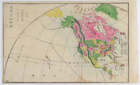
北亜米利加洲. Kita Amerika-shū. The States of North America.
Kyoto.: 村上勘兵衛 文部省刊行. Murakami Kanbē; Monbushō kankō. Meiji 10 1877. Colour woodblock map of North and Central America. From the Journal of World Geography 萬國地誌略 published in 1877. Printed area measures 33.5 x 21cm a good copy with occasional soiling. . 村上勘兵衛, 文部省刊行. [Murakami Kanbē; Monbushō kanko& unknown
書籍販売業者の参照番号
: 159812
|
|
|
[SHIPPING -- MAPS]. ROWAN, JF (Exec Secretary). J F
Household Goods Carriers’ Bureau agent mileage guide No. 4. Cancels mileage guide No. 3. Containing maps and charts of distances in miles for common contract and passenger carriers between points within the United States also. . . to and from points in Canada and Mexico. . . ; Supplement No. 10. . . cancels Supplement No. 9. . . Effective June 7 1947.
Washington D.C. & Chicago IL: Household Goods Carriers’ Bureau Rand McNally & Co. 1941; 1947. Two vols. 296 pp. including 22 large folding colour maps a few w/ minor toning to fore-edges some dustsoiling a few w/ minor tape repairs especially at a couple folds and near gutter margin. Quarter-green cloth over printed light green softcovers stapled as issued minor soiling some slight foxing & toning still VG copy; 9 3 pp. Stapled as issued minor toning light creasing at corners VG. First edition of this essential HHGCB mileage guide issued just weeks before Pearl Harbor and the entry of the United States into World War II. Originally established in 1936 after the passage of the Reed-Bulwinkle and Interstate Commerce Commission Acts the HHGCB organized to file the required mileage tariffs with the ICC and issued this guidebook. This mileage guide contained maps from the Rand McNally Co. together with charts to determine highway distances between principal points in the United States and allow transport charges to be computed. This guidebook offers an essential snapshot of not only the existing transportation network during World War II but also the vital routes of trucking goods across the country locally or into Canada and Mexico prior to the creation of the Interstate Highway System later authorized in 1956 by President Eisenhower. The supplement updated many of the mileage references following the War acknowledging the tremendous build-up of infrastructure during and in Post-War America. The HHGCB continued to operate in assorted consolidations and mergers until the 2007 decision eliminating all motor carrier rate bureaus. Worldcat locates 1 copy of No. 4 no copies located of Supplement No. 10 US Dept. of Transportation Library. Household Goods Carriers’ Bureau, Rand McNally & Co., paperback
書籍販売業者の参照番号
: 56936
|
|
|
[Siebenbürgen] - Tîrgu Mures.
Libera regiaque civitas siculica Maros Vasarhely. Targu Mures, [1822-]1827.
Kupferstich von Samuel Nagy nach Mikolai Tóth Istvan. 415:780 mm. Unter Passepartout. Prachtvolle und großformatige, als Einzelblatt erschienene Gesamtansicht der Stadt Targu Mures (dt. Neumarkt am Mieresch, ungar. Marosvásárhely) in Siebenbürgen. - Bei der in den Jahren 1822-25 entstandenen Ansicht der Stadt aus der Vogelschau handelt es sich um die bis dahin genaueste topographische Aufnahme der Stadt, die bis zum Beginn des 20. Jahrhunderts unübertroffen bleiben sollte. Vorangegangen waren dem vorliegenden Blatt lediglich zwei kleinere und recht ungenaue Veduten von 1736 bzw. 1750; die früheste bei Nebehay/Wagner genannte Ansicht der Stadt datiert überhaupt erst von 1840. Die eingedruckte Legende im unteren weißen Rand benennt die wichtigsten Gebäude und Monumente, dazwischen ein Adler das Stadtwappen haltend. - Breitrandig mit umlaufendem Plattenrand und sehr sauber. Minimale Randläsuren außerhalb des Passepartoutausschnittes fachmännisch restauriert. Von größter Seltenheit. Keresztes Gyula. Marosvásárhely látképe és házsorainak képe Mikolai Tóth István rajzai alapján, Milléniumi megemlékezés, Juventus Kiadó, Marosvásárhely, 2000, SS. 230-237.

|
|
|
[Societe des Cartes Folkloriques de France]
84 Costumes des Provinces de France
Vichy France: Société des Cartes Folkloriques de France 1950. Wraps. Near fine. R. MARGOTTON. FRENCH LANGUAGE POSTCARDS FASHION / TRADITIONAL DRESS. R. MARGOTTON illustrator. <br /> 6 1/8" x 4 1/8" ; 84 cards numbered; half-bound tweed cloth folder with ties marbled paper over board color paper label to front folder; 3 black cloth folder ties; hand-colored wood-engraved cards verso is a divided back postcard with labeling and numbering within the series and four printed lines on which to write an address; light age-toning of edges; near fine. OCLC locates 3 copies all in the U.S. The art on the post cards is signed R. Margotton and it is possible this was Rene Margotton 1915-2009 although by the early 1950s he was a major French painter and one of the cubists from the early part of the 20th century. The laid-in form in the rear pocket is a listing of the cards by area. Société des Cartes Folkloriques de France unknown
書籍販売業者の参照番号
: 1749

|
|
|
[SOUTH ASIA - MAP]. NEELE, SAMUEL JOHN
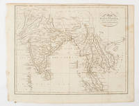
Map of the East Indies from the Best Authorities.
London & Glasgow.: W. and D. Brownlie. 1805. Engraved map 18.7 x 23.9 cm original folds age toned and spotted inner margin a trifle ragged paper thinning in a few spots in good condition. Attractive map engraved for "A System of Geography; or A Descriptive Historical and Philosophical View of the Several Quarters of the World" published in 1805. . (W. and D. Brownlie) unknown
書籍販売業者の参照番号
: 175148
|
|
|
[SOUTHEAST ASIA - WORLD WAR II ERA MAP]
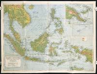
East Indies. Mercators Projection. Map No. 316.
Sydney.: H.E.C. Robinson Pty. Ltd. circa1940. Full colour folding map 71 x 97 cms; 76.2 x 10² cms sheet blank on verso save for a neat inked stamp "East Indies" inset map of New Guinea and Papua heights shown by colour very good clean condition. Large scale World War II era map by Sydney publisher H. E. C. Robinson. Extremely detailed map it is coloured according to height above sea level and showing naval bases railways shipping routes air routes. Includes smaller inset map of "New Guinea & Papua" showing the eastern part of the island. . H.E.C. Robinson Pty. Ltd. unknown
書籍販売業者の参照番号
: 211106
|
|
|
[Southern Palestine].
Seetzens Entwurf einer Original Charte von Dschebal (Gebalene) und Scharah- (Seir-) Gebirge. Nach mündlichen Nachrichten [...] mit Hinzufügung der alten Namen von Fr. Kruse. [Berlin, G. Reimer, 1859].
Lithographed map, single sheet. 455 x 560 mm (image size), 516 x 645 mm (sheet size). Scarce lithographed map of southern Palestine showing the travel route of the German orientalist Ulrich Jasper Seetzen (1767-1811), designating landmarks like Petra and Saint Catherine's Monastery on the Sinai Peninsula, as well as geological features. The main map shows Seetzen's itinerary from the Be'er Sheva area to its intersection with the Egyptian caravan road from Mecca to Cairo, flanked in the east by Al-Sharah mountains and the Gebalene region. An inset depicts the continuation of the route from there to Mount Sinai, while another contains a detailed plan of the mountain. Features comments on soil fertility as well as labels of notable settlements, mountains, streams, and wall remains encountered along the route. - Prepared by A. Bräunig, the map was issued as plate 3 in the fourth volume of Seetzen's posthumous travelogue series "Reisen durch Syrien, Palästina, Phönicien, die Transjordan-Länder, Arabia Petraea und Unter-Aegypten", published from 1855 to 1859. - Very well preserved. OCLC 5061964.
|
|
|
[SURVEYING BUREAU OF THE PEOPLE'S LIBERATION ARMY GENERAL STAFF DEPARTMENT]. 总参谋部测绘局.
抗震救灾专用地图: 四川省全图./汶川县及周边地势图. Sichuan sheng quan tu./Wenchuan xian ji zhou bian di shi tu. Special Maps for Earthquake Disaster Relief: Map of Sichuan Province./ Map of Wencuan County and Its Vicinity.
北京.Beijing.: 星球地图出版社.Xing qiu di tu chu ban she. May2008. Two large coloured maps printed on double sided on a single sheet folded issued shortly after the devastating 2008 Wenchuan Earthquake which was occurred on 12 May 2008. Small tears along folds mended by both non-acidic tape and cello tape some creasing generally good. Text in Chinese. Sheet measures 84.9 x 119.7cm. <br> <br>Map of Sichuan Province: scale 1: 1100000 inset map lower right corner showing the provincial capital city Chengdu a statistical chart lower section listing counties within Sichuan Province their population and territory size. <br> <br>Map of Wenchuan County and Its Vicinity: 1: 300000 various colour representing altitude differences inset map showing the position Wenchuan County within Sichuan Province a mileage chart listing the distance between Wenchuan County to nearby cities. A brief introduction of Wenchuan on left section accompanying the images of the rescue forces. The Great Wenchuan Earthquake was the biggest earthquake in Chinese history with a casualty over 69000 people. . 星球地图出版社.[Xing qiu di tu chu ban she]. unknown
書籍販売業者の参照番号
: 169215

|
|
|
[TAIWAN PROVINCE MAP].
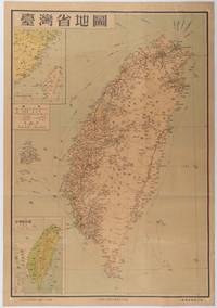
台灣省地圖. Taiwansheng ditu. Map of Taiwan Province.
地圖出版社. Reprint. 1954. Colour folding map of Taiwan showing all major cities towns and villages railways highways roads rivers and sea routes. Topographical inset map at lower left Taiwan Straits with mainland coast inset map at top left. Each map has its own scale. Text in traditional Chinese characters. Washi repairs along some folds on reverse pin marks at corners evenly browned and a little faded. A nice map of Taiwan in fair condition. 77 x 53.8cm. . 地圖出版社. unknown
書籍販売業者の参照番号
: 215869
|
|
|
[TALLIS, JOHN], RAPKIN, J, WARREN H, AND KERNOT JH J H
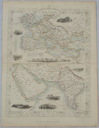
Overland Route to India and China
London.: The London Printing and Publishing Company. circa1850s. Lithographed map with original outline hand colour 33 x 24.5 cm including border and captions seven vignette illustrations two reference keys decorative border central fold light toning mainly at the central fold and to the verso of the sheet in very good condition preserved in a window mount. Attractive decorative map with fine vignettes of the London Post Office Suez Bombay Madras. Aden Malta Gibraltar and a wonderful camel train led by a carriage and horses crossing North Africa originally by the great mapmaker and publisher John Tallis. The two reference keys note steam packet routes railways electric telegraph and the Suez Canal. . The London Printing and Publishing Company. unknown
書籍販売業者の参照番号
: 177525
|
|
|
[TASSIN, Nicolas ; TASSIN, Christophe ]
Gouvernement de Bourdeaux [ Carte du Gouvernement de Bordeaux ] [ Edition originale ]
1 carte rehaussée en couleurs sous cadre vitré format 22 x 18,5 cm, gravure format (à vue) 19,5 x 14,5 cm, s.d. [ circa 1634 ]
書籍販売業者の参照番号
: 62936

|
|
|
[Texas]: [Maps]
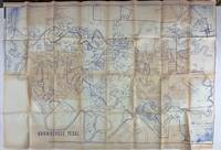
Brownsville Texas
N.p. probably Brownsville Tx 1980. Very good. Blue-line map 42 x 62 inches. Uneven toning minor overall wear. A large-format plat map of the Texas border town of Brownsville likely created in the early 1980s. The date is based on the appearance of the Sunrise Mall which opened its doors in 1979 and the name of the airport which was changed in 1983; as such the present map was printed sometime between those two dates. The present map shows the original city parcel as well as many other notable modern developments including the Airport Industrial Park the Fourteenth Street Commercial Plaza and the Amigoland Theme Park the latter of which was never built. The Rio Grande can be seen winding its way through the bottom portion of the map. We locate no other copies of this map anywhere. It was likely produced for local developers and as such is quite rare. An ideal decorative Texas map. unknown
書籍販売業者の参照番号
: 3562
|
|
|
[THE ASAHI SHIMBUN]. 朝日新聞社.
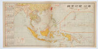
佛印・蘭印要圖. 朝日カレンダー・ニユース地圖版. Futsu-In Ran-In Yozu. Asahi Karenda Nyusu Chizuban. Detailed Map of Southeast Asia. Daily Calendar News Version.
No place of publication.: 朝日新聞社. The Asahi Shimbun. 昭和十五1940. Published by 朝日新聞社 The Asahi Shimbun Japanese folding coloured WWII map with a calendar from January to June Shōwa 15 at the left scale 1:300000. Map includes French Indochina Dutch East Indies and parts of the territory of Papua China and British India. Some light browning and foxing otherwise very good. Text in Japanese. 25.3 x 51cm. Legend at lower left lists the boundaries between continents countries and provincials or regions railways airline routes capitals and Japanese embassies and consulates. <br> <br>The natural resources are indicated across the map. The map also shows parts of the territory of Papua under Australia's administration " 濠洲委任統治領 Gōshū inin tōchiryō". . 朝日新聞社. [The Asahi Shimbun]. unknown
書籍販売業者の参照番号
: 160545
|
|
|
[Timbres Magazine]
TIMBRES MAGAZINE - L'OFFICIEL DE LA PHILATELIE n° 99 (Mars 2009)
Revue mensuelle concernant la philatélie : environ 110 pages en couleurs, format 300 x 210 mm, illustrée, brochée couverture couleurs + fiches détachables
書籍販売業者の参照番号
: LFA01da2
|
|
|
[Timbres Magazine]
TIMBRES MAGAZINE - L'OFFICIEL DE LA PHILATELIE n°60 (Septembre 2005)
Revue mensuelle concernant la philatélie : environ 110 pages en couleurs, format 300 x 210 mm, illustrée, brochée couverture couleurs + fiches détachables
書籍販売業者の参照番号
: LFA01804
|
|
|
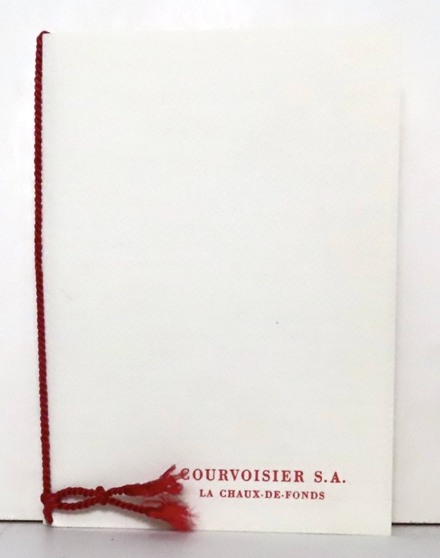
[Timbres]:
4 timbres Helvetia / Pro Juventute.
La Chaux-de-Fonds, Courvoisier, 1957. Ravissante petite plaquette de 4 pages et 2 serpentes, brochée sur cordon et au coeur de laquelle se nichent 4 timbres (non obliétérés) de 1957.
書籍販売業者の参照番号
: 16628
|
|
|
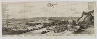
[TOKYO - ANTIQUE PRINT] VAN DER AA, PIERRE
Iedo. Capitale du Japon.
A Leide. Leiden.: Chez Pierre van der Aa. circa1720. Engraved panorama on watermarked laid paper 28.5 x 77.5 including captions; 31 x 79.5 cm sheet title cartouche engraved key in French and Dutch the upper margin trimmed to the platemark original folds edgewear and toning neat sealed tear to the outer edge barely visible 5mm intrusion to the image a very good dark impression. Finely composed and engraved panorama of Tokyo prepared for the monumental work "Galerie Agreable du Monde" by the master Dutch publisher Pieter Van de Aa 1659-1733. The detailed key in Dutch and French notes myriad buildings and temples on the horizon and in the foreground two processions converge: of nobles and their attendants dancers a trio of dogs and a priest or religious attending a suppliant. <br> <br>Pieter van der Aa 1659-1733 was born in Leiden Holland and started his own book publishing business when he was only twenty-three. His prolific output of highly decorated maps and atlases culminated in his magnum opus “Galerie Agreable du Monde” which illustrated the world known to Europeans in the early eighteenth century. Comprising 66 volumes it was the of plates published at that time it has been estimated that only 100 copies were published. . Chez Pierre van der Aa unknown
書籍販売業者の参照番号
: 180201
|
|
|
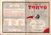
[TOKYO - TOURIST MAP] KING ASSOCIATES
Bilingual Map of Greater Tokyo.
Tokyo.: Charles E. Tuttle Company. 1954. Printed four colour map 92 x 71cm; 102.5 x 74.5cm sheet folding into pictorial wrappers 25.6 x 19 cms inset map of the Marounouchi District and on the verso an extensive grid reference in English and Japanese and over four panels a map of the streetcar railway and subway system scant spotting to cover two small fold splits without loss and toning most evident at the folds in very good condition. Comprehensive 1950s map of Tokyo by US publisher Charles E. Tuttle "Here at last is the map that makes order out of chaos.extending as far as Haneda Airport Grant Hights Harbor Area and Nakano Ward" blurb. . Charles E. Tuttle Company. unknown
書籍販売業者の参照番号
: 194113
|
|
|
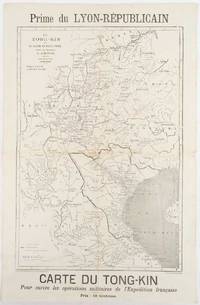
[TONKIN CAMPAIGN - MAP] MEYNIARD, CHARLES; HAUSERMANN, R (ENGRAVER)
Le Tong-Kin et le Bassin du Fleuve Rouge d'Apres les Documents de J. Dupuis
Lyon.: Lyon-Républicain. circa1883. Engraved map 40.5 x 27.5; 48.9 x 31.8 cm sheet original folds some browning to the fold and margins two small holes at the central fold without significant loss in good condition. Map issued as a supplement to "Le Lyon-Republicain" one of the great radical daily newspapers in Lyon. The map is after documents by French explorer and trader Jean Dupuis 1829-1912 who had explored regions along the Red River in the hopes of establishing trade routes within Vietnam and China and variously published. This supplement was issued on the eve of the Tonkin War in 1883 so that readers could follow the military movements of the French Expeditionary Force. It shows northern Vietnam and into south-western China with provinces marked and river systems in detail. . Lyon-Républicain. unknown
書籍販売業者の参照番号
: 180621
|
|
|
[TOULON]
Plan de la ville de Toulon indiquant les agrandissements au nord et à l'ouest.
Toulon, Rumèbe, s.d. (c. 1860) 48 x 56, replié au format in-12, sous couverture imprimée. Déchirure à la couverture.
書籍販売業者の参照番号
: 218540
|
|
|
[TOURIST MAP - JAPAN, KOREA AND TAIWAN].
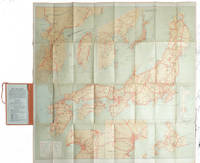
Travelers' Map of Japan Chosen Korea Taiwan Formosa with Brief Descriptions of the Principal Tourist Points in Japan. 1927.
Tokyo.: Japanese Government Railways. Circa1927. Large folding colour map 78.5 x 80 cm of Japan and Korea 6 inset maps one of which shows Taiwan scale 1:1640000 for Hondo Shikoku and Kyushu 1:2340000 for Chosen; tipped into the original orange cloth covered case with orange ties text in 31 panels on the verso one a little age-toned a few very small fold splits without loss a very good copy. Attractive tourist map for the English-speaking traveller issued by the Japanese Government Railways with extensive notes for tours and points of interest on the verso short descriptions of cities and sites to visit principal theatres with suggestions for cafes restaurants and department stores. . Japanese Government Railways. hardcover
書籍販売業者の参照番号
: 215711
|
|
|
[TOURIST MAP OF HANGZHOU].
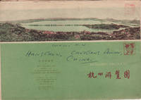
杭州游覽图. Hangzhou you lan tu. Tourist Map of Hangzhou.
杭州.Hangzhou.: 浙江人民出版社.Zhejiang renmin chu ban she. 2nd Edition 3rd Printing. 1962. Folding colour tourist brochure for Hangzhou. One side shows large map of Hangzhou the other 5 more detailed maps chops and previous owner's annotations upper cover small hole at one fold some light wear and browning good. Text in both traditional and simplified Chinese. Sheet size 53.9 x 38.3cm folded size 13.5 x 19.2cm. <br> <br>One side includes a legend an inset showing tourist spots surrounding Hangzhou a table shows lists of Hangzhou's hospitality industry e.g. hotels cinemas swimming pools restaurants department stores etc. The other side includes five individual tourist maps: Viewing Fish at Flower Pond 花港觀魚 Lingyin Temple 靈隱 Hangzhou Bus Map 杭州市公交路线图 Lonely Mountain 孤山 Dreaming of the Tiger Spring 虎跑. . 浙江人民出版社.[Zhejiang renmin chu ban she]. unknown
書籍販売業者の参照番号
: 160933
|
|
|
[TURKEY - ANTIQUE MAP] JOHNSTON, KEITH, FRSE F R S E
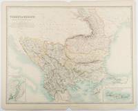
Turkey in Europe.with Rumania Servia Montenegro Bulgaria &c.
Edinburgh & London.: W. & A. K. Johnston. 1893. Engraved map with original outline hand-colour 44 x 57.4 cm map two inset maps of the Bosphorus and Crete; central fold corners chipped with loss lower edge with several small marginal tears neatly repaired head and foot clipped at the fold with loss to the margin but the map in very good condition. Detailed and finely engraved map also showing submarine telegraph lines and relief by hachures. Re-issue of the map first published in 1863 for "Keith Johnston's Royal Atlas of Modern Geography". . W. & A. K. Johnston unknown
書籍販売業者の参照番号
: 177055
|
|
|
[TWO INDIAN COASTAL CHARTS].
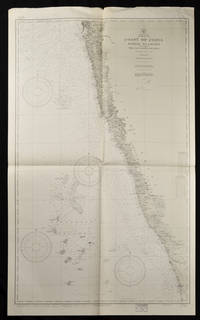
Coast of British India. #1589: Karachi to Bombay including the Gulfs of Cutch and Cambay. 7th. Edition 1922 # 1590: Bombay to Cochin including The Laccadive Islands.
Washington. D.C.: U.S. Navy Hydrographic Office. 10th edition. 1937. Two charts black and white folded as issued. #1589: sheet measures approx. 89 x 118cm #1590: 127 x 76cm little creased at upper edge. Very good. A great length of the coast is here charted with much detail marked along the coast including rivers towns and the topography. The charts mark soundings in fathoms or feet and various natural and man-made features of the coastal area. Both are stamped "Corrected Through Notice to Mariners Feb. 17 1951". . U.S. Navy Hydrographic Office. unknown
書籍販売業者の参照番号
: 65133
|
|
|
[TōKYō NICHINICHI SHINBUN]. 東京日日新聞.
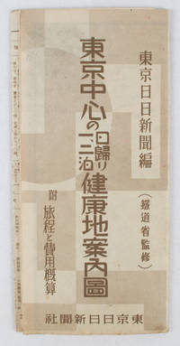
東亰中心の日歸り一、二泊健康地案内圖. Tōkyō chūshin no higaeri ichi ni-haku kenkōchi annaizu. Healthy Places - Birds-eye View Map around Tokyo
東京日日新聞社. Showa 14 19391939. Title on map :東京中心の健康地案内鳥瞰圖. Tōkyō chūshin no kenkōchi annai chōkanzu. <br>Colour map of region around Tokyo with inset map in lower right corner. Few closed tears along central fold larger tear repaired small holes at folds a little light browning. Measures 19.5 cm x 9.5 cm when folded and 38.7 cm x 54 cm when open. Bird's eye view map of the region around Tokyo showing places where the residents of the city can go for healthy one two or three day trips. The map published by the Tokyo Nichi Nichi Newspaper in 1939 highlights hot springs golf courses beaches parks fishing areas mountains shrines and ski areas. The mark ハ indicates hiking courses. On the reverse side the distance to each resort area the way to get there and the costs are detailed. Users of the map area are warned that the areas circled in red around the mouth of Tokyo Bay is a military area where photos cannot be taken without permission. Even with the rising tides of war in 1939 city people were clearly still looking for ways to escape the noise and dust of the city for health-giving recreation. . 東京日日新聞社. unknown
書籍販売業者の参照番号
: 163423
|
|
|
[United Arab Emirates].
United Arab Emirates 1:50,000 [and] 1:100,000. Abu Dhabi, Military Survey, Armed Forces, 1990-1992.
7 colour printed maps. Scale 1:50,000 and 1:1,000,000. In English and Arabic. Folded. First edition. A set of exceedingly rare UAE topographic maps, compiled from 1:30,000 scale aerial photography taken during 1986 and 1987, presumably based on UK versions. The maps show international boundaries, tracks and paths, bridges, historical landmarks, schools, tree and date plantations, mangroves, oil and gas injection wells, mosques and cemeteries, emergency telephones, water pipelines and tanks, cliffs and rocky areas, as well as other details encountered in the vast desert. Occasionally the average relative height of the dunes is given, reaching up to 45 metres at certain points. - The 6 maps of the 1:50,000 series are sheets number NF-40-01-14, NF-40-01-22, NF-40-01-34, and NF-40-02-11, as well as NG-40-13-54, and NG-40-13-63. The maps of this series "were used extensively for UTM [Universal Transverse Mercator projection coordinate system] Zone 39 rectification. These maps have a local UAE national grid which is equivalent to the UTM grid if a bias of 2,150,000 m in the y-dimension and 150,000 m in the x-dimension are added" (Jensen). The single map of the 1:100,000 series, dating from 1992, is sheet number NG-40-136. - Some pencil marks and circles. The 1:50,000 scaled maps have a stamped six-digit number and a round stamp in Arabic type on the reverse; the 1:100,000 scaled map has a square stamp in Arabic type on the reverse. A few small tears and creases; occasional adhesive tape; paper variously pierced. No copies traceable in libraries internationally. Jensen [et al.], Coastal Environmental Sensitivity Mapping for Oil Spills in the United Arab Emirates [...] 8.
|
|
|
[VACCINATION].-
Paris. Institut Pasteur, la Salle d'Inoculation.-
Carte postale sans nom d'éditeur. Beau plan, très animé, 9 personnes dont l'opérateur et un personnage en uniforme qui semble prendre des notes. Avant 1914. Carte postale (137 x 90mm), écrite au verso, non timbrée. Bel exemplaire.
書籍販売業者の参照番号
: ORD-10546
|
|
|
[VAUQUELIN (H.)].
Indicateur des rues et curiosités de Paris.
Paris, H. Vauquelin, s.d., (1815). In-16 oblong de (190) pp., 1 plan colorié replié (29 x 22 cm) basane havane marbrée, dos lisse orné, pièce de titre rouge (reliure de l'époque).
書籍販売業者の参照番号
: 44723

|
|
|
[VAUTRE (Le Général Bon de)]
Génie du whist méconnu jusqu'à présent, quoique joué avec une espèce de fureur par toute l'Europe avec ses explications et des maximes pour gagner.
Paris: Ledoyen, 1839 in-12, 2 ff. n.c., 136 pages. Demi rel veau glacé, dos avec usutes autrement bon état. EDITION ORIGINALE.
書籍販売業者の参照番号
: 13975462
|
|
|
[Venedig].
Rialtobrücke mit möbeltransportierender Gondel im Vordergrund. Venedig, um 1890.
Originalfotografie auf strukturiertem Papier. 315:570 mm. Hinter Glas gerahmt. Rahmen mit Originaletikett des Wiener Rahmenmachers Heinrich Klingseis in der Gumpendorferstraße.
|
|
|
[Viennensia - Harmonietheater].
Plan der Umgebung des Orpheum's im Masse 1:720. [Wohl Wien, um 1870].
725:590 mm. Lithogr. Faltplan in 30 Segmenten, auf Leinen aufgezogen. Im originaler goldgepr. Leinenmappe der Wiener Feuerwehr. Von der Feuerwehr der Stadt Wien gedruckter Straßenplan, der die Zufahrt zum Musiktheater "Orpheum" in der Wasagasse sowie die Lage der Hydranten und die Stellplätze für Mannschafts-, Schlauch-, Lösch-, Rüstwagen und Dampfspritze veranschaulicht. Zeigt auch Grundrisse aller Stockwerke des Hauses. Der dargestellte Bereich des 9. Bezirks reicht von der Beethovengasse bis zur Grünentorgasse. - Das 1864/65 von Otto Wagner erbaute Harmonietheater wurde 1866 eröffnet; in diesem Jahr hatte Ludwig Anzengruber unter dem Namen "Gruber" seinen erster Auftritt. Schon 1868 zum "Orpheum" umgestaltet, erlebte das Haus 1872 als "Danzers Orpheum" seine große Blüte. 1900 renoviert und in ein intimes Theater umgestaltet, wurde es 1908 als Sprechbühne mit dem Namen "Neue Wiener Bühne" eröffnet und 1928 geschlossen.

|
|
|
[VIETNAM LAOS CAMBODIA - WAR ERA MAP]
Rand McNally Official Map of Vietnam Laos and Cambodia.
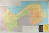
Chicago.: Rand McNally. circa1970. Very large folding colour map 136 x 89 cms folding to 30.5 x 22.8 cms legend and glossary with a gazetteer in an upper corner to North and South Vietnam Cambodia and Laos small fold split no loss in very good condition. Extremely detailed map of Indochina scale of 1 inch to approximately 20 miles with roads paths trails railroads airports marked and indexes to cities and towns and population totals in South Vietnam North Vietnam Cambodia and Laos. Includes a glossary of foreign terms and a brief gazetteer. . Rand McNally. unknown
書籍販売業者の参照番号
: 197689
|
|
|
[VIETNAM WAR - MAPS]
A Series of Five Adjoining Vietnam War Era Maps.
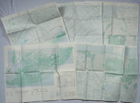
Washington D.C.: Army Map Service. 1967-1968. Five printed colour adjoining topographic maps folded legends to physical features including roads some including footpaths or trails railroads rivers streams lakes mountains boundaries and place names Route Markers Railroads airfields bridges and detailed terrain a few including tea plantations rice fields coffee and rubber plantations. glossary of Vietnamese terms in very good unused condition: <br> <br>1. Special Use S.E. Asia. Xuat-Banlan Thu. Sheet 6026. Series L607. <br>Map 57.3 x 73 cms sheet inset map of Hon Khoai Island; <br> <br>2. Special Use S.E. Asia. Sheet 5927. Series L607. Khoang Cach Deu Vong Cao-DQ. <br>Map 72.3 x 57.3 cms sheet. he Viet Cong stronghold of Quan Long Cà Mau is shown; <br> <br>3. Special Use S.E. Asia. Sheet 6027. Series L607. Vietnam. <br>Map 72.3 x 57.3 cms sheet legend showing boundaries villages elevation and hydrographic data glossary of Vietnamese terms in very good unused condition. Southeast Vietnam and the Mekong delta. The town of Vĩnh Lợi Bạc Liêu is at the mid right edge of map.; <br> <br>4. Special Use S.E. Asia. Sheet 6028. Series L607. Vietnam. Do Cao Toi-da Duoi 5 met. <br>Map 54.5 x 54.5 cms 73.3 x 56.6 cms sheet; <br> <br>5. Special Use S.E. Asia. Sheet 5928. Series L607. Vietnam. Hon Rai. <br>Map 55 x 55 cms 74.3 x 56.7 cms sheet inset map of Hon Rai. <br>The caption has the note: "Dense forest or jungle indicates more than 25% of ground is concealed by canopy with undergrowth generally impassable on foot". Detailed topographic maps in unusually fine condition of Central and Southern Vietnam issued during the Vietnam War by the United States Corps of Engineers. . Army Map Service. unknown
書籍販売業者の参照番号
: 203843
|
|
|
[VILA I DINARÉS, Pau].
Miscel·lània Pau Vila. Biografia. Bibliografia. Treballs d' Homenatge de la Societat Catalana de Geografia. Pròleg per Josep Iglésies.
Granollers, Editorial Montblanc-Martin, 1975. 4to. mayor; 2 hs., 546 pp. Numerosas ilustraciones fotográficas y mapas plegados fuera de texto. Cubiertas originales.

|
|
|
[VIN, CARTES POSTALES]
de Kintzheim à Cleebourg-La route du vin d'alsace, les plus belles cartes postales (die elsassische weinstrasse).
Strasbourg, DIFAL, 1991 ; in-4, 126 pp., cartonnage de l'éditeur. De Kintzheim à Cleebourg (tome 2) texte bilingue très bon état avec sa jaquette.
書籍販売業者の参照番号
: 202204346
|
|
|
[VIN, CARTES POSTALES]
La route du vin d'alsace, les plus belles cartes postales (die elsassische weinstrasse).
Strasbourg, DIFAL, 1991 ; in-4, 126 pp., cartonnage d'éditeur avec jaquette (neuf sous blister). De Kintzheim àà Cleebourg (tome 2) texte bilingue.
書籍販売業者の参照番号
: 200916116
|
|
|
[VIN, CARTES POSTALES]
La route du vin d'alsace, les plus belles cartes postales (die elsassische weinstrasse).
Strasbourg, DIFAL, 1991 ; in-4, 126 pp., cartonnage d'éditeur avec jaquette (neuf sous blister). De Kintzheim àà Cleebourg (tome 2) texte bilingue.
書籍販売業者の参照番号
: 200916114
|
|
|
[VIN, CARTES POSTALES]
La route du vin d'alsace, les plus belles cartes postales (die elsassische weinstrasse).
Strasbourg, DIFAL, 1991 ; in-4, 126 pp., cartonnage d'éditeur avec jaquette (neuf sous blister). De Kintzheim àà Cleebourg (tome 2) texte bilingue.
書籍販売業者の参照番号
: 200916113
|
|
|
[VIN, CARTES POSTALES]
La route du vin d'alsace, les plus belles cartes postales (die elsassische weinstrasse).
Strasbourg, DIFAL, 1991 ; in-4, 126 pp., cartonnage d'éditeur avec jaquette (neuf sous blister). De Kintzheim àà Cleebourg (tome 2) texte bilingue.
書籍販売業者の参照番号
: 200916112
|
|
|
[VIN, CARTES POSTALES]
La route du vin d'alsace, les plus belles cartes postales (die elsassische weinstrasse).
Strasbourg, DIFAL, 1991 ; in-4, 126 pp., cartonnage d'éditeur avec jaquette (neuf sous blister). De Kintzheim àà Cleebourg (tome 2) texte bilingue.
書籍販売業者の参照番号
: 200916111
|
|
|
[VIN, CARTES POSTALES]
La route du vin d'alsace, les plus belles cartes postales (die elsassische weinstrasse).
Strasbourg, DIFAL, 1991 ; in-4, 126 pp., cartonnage d'éditeur avec jaquette (neuf sous blister). De Kintzheim àà Cleebourg (tome 2) texte bilingue.
書籍販売業者の参照番号
: 200916110
|
|
|
[VIN, CARTES POSTALES]
La route du vin d'alsace, les plus belles cartes postales (die elsassische weinstrasse).
Strasbourg, DIFAL, 1991 ; in-4, 126 pp., cartonnage d'éditeur avec jaquette (neuf sous blister). De Kintzheim àà Cleebourg (tome 2) texte bilingue.
書籍販売業者の参照番号
: 200916109
|
|
|
[VIN, CARTES POSTALES]
La route du vin d'alsace, les plus belles cartes postales (die elsassische weinstrasse).
Strasbourg, DIFAL, 1991 ; in-4, 126 pp., cartonnage d'éditeur avec jaquette (neuf sous blister). De Kintzheim àà Cleebourg (tome 2) texte bilingue.
書籍販売業者の参照番号
: 200916108
|
|
|
[VIN, CARTES POSTALES]
La route du vin d'alsace, les plus belles cartes postales (die elsassische weinstrasse).
Strasbourg, DIFAL, 1991 ; in-4, 126 pp., cartonnage d'éditeur avec jaquette (neuf sous blister). De Kintzheim àà Cleebourg (tome 2) texte bilingue.
書籍販売業者の参照番号
: 200916107
|
|
|
[VIN, CARTES POSTALES]
La route du vin d'alsace, les plus belles cartes postales (die elsassische weinstrasse).
Strasbourg, DIFAL, 1991 ; in-4, 126 pp., cartonnage d'éditeur avec jaquette (neuf). De Kintzheim àà Cleebourg (tome 2) texte bilingue.
書籍販売業者の参照番号
: 200916105
|
|
|
[VIN] MONTORGUEIL Georges; FOREST Louis:
Monseigneur le vin.
Paris, Etablissements Nicolas, 1925-1927. 4 volumes in-8, reliés en 3 volumes, demi-toile lie-de-vin, pièces de titre verte, couvertures conservées; têtes grises.
書籍販売業者の参照番号
: 19045
|
|

 検索結果のメールを受信する
 PDFファイルの検索結果をダウンロード
 RSSフィード
 パーマネントリンク


