|
Cartes Taride
Carte Routiere No. 3 Paris - Champagne Nord - Ardennes Un Enfant Peut Guider Sa Mere Avec Les Cartes Taride Routieres
Paris: Cartes Taride. Very Good- with no dust jacket. Softcover. Several very small brown spots on rear cover. Tiny tears to left edge of front cover label. Written notations in pencil on a blank cloth panel. ; French text. Folded map issued with a cloth backing. Brentano's ink stamp on the front cover. . Cartes Taride paperback
Ссылка продавца : 263730
|
|
|
Cartes Taride
Carte Routiere No. 5 Bis Bretagne Ouest
Paris: Cartes Taride. Very Good- with no dust jacket. Softcover. Covers are somewhat darkened. Price sticker obscures part of front cover label. ; French text. Folded map issued with a cloth backing. . Cartes Taride paperback
Ссылка продавца : 263733
|
|
|
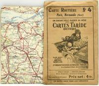
Cartes Taride
Carte Routiere No. 4 Paris Normandie Nord
Paris: Cartes Taride. Good with no dust jacket. Softcover. Front cover is soiled. Price sticker obscures part of front cover label. ; French text. Folded map issued with a cloth backing. . Cartes Taride paperback
Ссылка продавца : 263735
|
|
|
Cartes Taride
Carte Routiere No. 26 Les Bords Du Rhin Cologne A Mayence
Paris: Cartes Taride. Very Good- with no dust jacket. Softcover. Covers are somewhat darkened. Price sticker obscures part of front cover label. ; French text. Folded map issued with a cloth backing. . Cartes Taride paperback
Ссылка продавца : 263734
|
|
|
Cartes Taride
Carte Routiere No. 9 Bretagne Sud
Paris: Cartes Taride. Very Good- with no dust jacket. Softcover. Covers are slightly darkened. Price sticker obscures part of front cover label. ; French text. Folded map issued with a cloth backing. . Cartes Taride paperback
Ссылка продавца : 263732
|
|
|
Cartes Taride
Carte Routiere No. 2 Lorraine Luxembourg
Paris: Cartes Taride. Very Good- with no dust jacket. Softcover. Covers are somewhat darkened. ; French text. Folded map issued with a cloth backing. . Cartes Taride paperback
Ссылка продавца : 263731
|
|
|
Cartes Taride Paris.
Carte Taride. Routière No. 5. Normandie Ouest Bretagne Nord.
Cartes Taride Paris ca. 1925. Western Normandy & northern Brittany before World War II. Routes are numbered & measured. Shows the Channel Islands and ferry routes. Scale 1/250000; printed in four colors. 73x92 cm. accordion-folded to 19x12 cm. Protective folder is browned with age but the map has had little use & is VG. 28947 Fifi Cartes Taride, Paris [ca. 1925?] unknown
Ссылка продавца : 28947
|
|
|
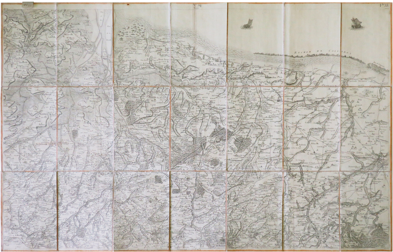
Cartes Taride No.
Cartes Taride No. 1 Routi�re Nord De La France Belgique Hotels Et Garages Recommands
Cartes Taride 18 Et 20 Boulevard St 1923. No binding. Used; Acceptable. French language. Map No One. Slipcase torn. <p><i><strong>Fast Dispatch. Expedited UK Delivery Available. Excellent Customer Service. </strong></i> <br/><br/>Bookbarn International Inventory #2795935</p> Cartes Taride 18 Et 20 Boulevard St unknown
Ссылка продавца : 2795935
|
|
|
Cartes Taride
Collection Des Cartes Taride Petite Carte De France
C. S. Hammond & Company. Circa 1920. Paperback. Good. Light shelf wear on the covers and map. 26.5 x 24 inches a map of France circa 1920 C. S. Hammond & Company paperback
Ссылка продавца : 14971

|
|
|
Cartes Taride
Grand Carte Routiere Centre De La France Section Est Bourgogne - Nivernais - Bourbonnais No. 1
Paris: A. Taride. Very Good- with no dust jacket. Softcover. Envelope is torn down one side and has general light wear. Map is clean. Price label and Brentano's ink stamp on the front of the envelope. ; French text. Folded map issued in a paper envelope. . A. Taride paperback
Ссылка продавца : 263741
|
|
|
Cartes Taride
Grand Carte Routiere Bretagne Nord No. 5
Paris: A. Taride. Very Good- with no dust jacket. Softcover. Envelope has general light wear. Map is clean. ; French text. Folded map issued in a paper envelope. . A. Taride paperback
Ссылка продавца : 263740
|
|
|
Cartes Taride
Guide Taride Paris Par Arrondissements Danlieue Desservie Par Le Metro Metro Autobus / Plan-Guide De Paris -- Includes Required Fold-out Maps
Cartes Taride Hard Cover - Good - No dust jacket if issued - Repair to interior hinge and cover wear otherwise clean and tight - Text in French - Includes required fold-out maps - 304 pages. - Circa 1950's. Hard Cover. Good. Cartes Taride Hardcover
Ссылка продавца : 247930
|
|
|
Cartes Taride
Lyonnais Savoie Dauphin� Carte Routi�re No. 14 bis 1:250000
Cartes Taride 1930. Book. Fair. Map. Folded map is a little tanned and has some loss to some of the folds otherwise would be in good condition; card sleeve rather tanned and shelfworn. Undated but cloche-hatted lady on front would imply 1920s or early 1930s. 'Un enfant peut guider sa m�re avec les Cartes Taride Routi�res - elles sont claires pr�cises faciles � lire et indiquent en rouge les meilleurs itin�raires.'. Cartes Taride Paperback
Ссылка продавца : 16061301-115

|
|
|
Cartes Taride:
Lyonnais: Savoie Dauphine
Cartes Taride Pour Cyclistes Et Automobilistes Paris no date: 1930's Cloth backed folding coloured map; No. 14 in the series; Some staining vg. Book. Cartes Taride Pour Cyclistes Et Automobilistes, Paris, no date: 1930's ? hardcover
Ссылка продавца : 7369

|
|
|
Cartes Taride:
Midi De La France: section centrale
Cartes Taride Pour Cyclistes et Autmobiles Paris no date : 1930's Linen-backed folding coloured map; No. 18 in the series; Somewhat dirtied 'Royal Automobile Club Touring Department' stamp also a previous private owner's signature vg. Book. Cartes Taride Pour Cyclistes et Autmobiles, Paris, no date : 1930's ? unknown
Ссылка продавца : 7368

|
|
|
Cartes Taride Firm
Paris par Arrondissement
Cartes Taride 1/1/1923. Paperback. Good. 127 pages : 24 color maps ; 15 cm. Bound in publisher's blue cloth. Silver lettering. Contents: Indicateur des rues --Autobus --Tramways --Metropolitain --Nord-Sud --Plans de Bois de Boulogne et de vincennes --Plan d'ensemble de Paris. Cartes Taride paperback
Ссылка продавца : 1612300002

|
|
|
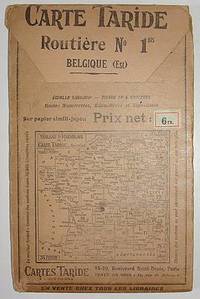
Cartes Taride
Road Map Belgium Carte Taride. Routiere No. 1. Belgique
Paris: Cartes Taride no date. Circa 1920s Large folding road map of Belgium. A detailed map showing routes distances signage and other features. Printed in four colors on heavy paper stock -- "sur papier simili-japon." Approx. 28.5 by 35.5 inches when unfolded. 4.75 by 7.5 inches in the protective folder. Front of the folder depicts a map of France and environs with other numbered routes from the Cartes Taride series. VG condition. Map is clean bright and unmarked. A few small pinholes at the folds and a couple of minor separations an inch or so also at the folds. unknown
Ссылка продавца : 000110
|
|
|
Cartes Taride
ROADMAP CARTE TARIDE - ROUTIERE NO. 4. PARIS NORMANDIE NORD
Paris: Imp. Gaillac. A roadmap of France. Measuring about 73.5 x 92.5 cm unfolded. Housed in the publisher's paper sleeve. Imp. Gaillac unknown
Ссылка продавца : 290392
|
|
|
Cartes Taride
ROADMAP CARTE TARIDE - ROUTIERE NO. 4. PARIS NORMANDIE NORD
Paris: Imp. Gaillac. A roadmap of France. Measuring about 73.5 x 92.5 cm unfolded. Housed in the publisher's paper sleeve. Imp. Gaillac unknown books
Ссылка продавца : 290392
|
|
|
CARTESIO, Renato (René Descartes)
Epistolae
Tre voll. I primi due sono stampati da Elzevirio nel 1668 (4 cc + 383 + 2 cc.; 2 cc. + 404 + 2 cc.; il terzo è stampato da Blaeu nell’83 (8 cc + 427). Piena pergamena, ottimi esemplari, raro e importante.
|
|
|
CARTESIO, Renato (René Descartes)
Meditationes De Prima Philosophia / Appendix, continens objectiones quintas & septimas in Renati Descartes Meditationes (+ Epistola ... Ad ... D. Gisbertum Voetium / Principia Philosophiae
In -4° P. Pergamena, tre volumi rilegati assieme: B, (12) 191 (1 b.); 164 (appendix), 88 (epistola a Voetius, la numerazione riparte); 18 cc., 222, 3 cc. B. Nelle “Meditationes”, opera volta a stabilire cosa possa essere conosciuto con certezza, Cartesio adopera per la prima volta l’espressione “Cogito ergo sum”. L’“Appendix” si trova solitamente rilegata con le “Meditationes” ma ha un frontespizio e numerazione autonoma delle pp. così come autonoma è la numerazione della successiva Epistola al teologo olandese Voetius, suo avversario. Volume a sé (ma rilegato con questi) è i “Principia”, che fu peraltro stampato nell’anno successivo.
|
|
|
CARTESIO, Renato (René Descartes)
Specimina philosophiae seu dissertatio de methodo ... Dioptrice et Meteora / Passiones Animae
In -4° P. Pergamena, due volumi rilegati assieme: 8 cc + 248; 92 + 2 cc (Passiones)
|
|
|
Caruso John Anthony. Maps by Neil E. Bolyard
Mississippi Valley Frontier: The Age of French Exploration and Settlement
Indianapolis: Bobbs-Merrill 1966. 423 pp. maps in text. With ownership name stamp of anthropologist Richard Erdoes. Covers a bit dull page edges tanned and dusty. Jacket stained at spine dustsoiled lightly edgeworn. First Edition. Hard Cover. Very Good/Good. 8vo. Bobbs-Merrill Hardcover
Ссылка продавца : C8430
|
|
|
Caruso John Anthony/Bolyard Neil E. maps
The Mississippi Valley Frontier: The Age of French Exploration and Settlement
Indianapolis: Bobbs Merrill Co. 1966. 1st printing. VG/VG dust jacket name on front endpaper/bottom fore-edge. xiv 423 p. maps notes biblio index 8vo; Bobbs Merrill Co. hardcover
Ссылка продавца : 51625

|
|
|
Carver Jonathan Robert Sayer and John Bennett Firm publisher Library of Congress. American maps ; v. no. .
A new map of the province of Quebec according to the Royal Proclamation of the 7th of October 1763. : From the French surveys connected with those made after the war. 1776 Leather Bound
2019. Leather Bound. New. Leather Binding on Spine and Corners with Golden Leaf Printing on round Spine extra customization on request like complete leather Golden Screen printing in Front Color Leather Colored book etc. Reprinted in 2019 with the help of original edition published long back 1776. This book is printed in black & white sewing binding for longer life Printed on high quality Paper re-sized as per Current standards professionally processed without changing its contents. As these are old books we processed each page manually and make them readable but in some cases some pages which are blur or missing or black spots. If it is multi volume set then it is only single volume if you wish to order a specific or all the volumes you may contact us. We expect that you will understand our compulsion in these books. We found this book important for the readers who want to know more about our old treasure so we brought it back to the shelves. Hope you will like it and give your comments and suggestions. Lang: - English. EXTRA 10 DAYS APART FROM THE NORMAL SHIPPING PERIOD WILL BE REQUIRED FOR LEATHER BOUND BOOKS. COMPLETE LEATHER WILL COST YOU EXTRA US$ 25 APART FROM THE LEATHER BOUND BOOKS. hardcover
Ссылка продавца : LB1111009007583
|
|
|
Carver Jonathan Robert Sayer and John Bennett Firm publisher Library of Congress. American maps ; v. no. .
A new map of the province of Quebec according to the Royal Proclamation of the 7th of October 1763. : From the French surveys connected with those made after the war. 1776 FULL LEATHER BOUND
2019. SUPER DELUXE EDITION. New. Antique look with Golden Leaf Printing and embossing with round Spine completely handmade bindingextra customization on request like Color Leather Colored book special gold leaf printing etc. Reprinted in 2019 with the help of original edition published long back 1776. This book is printed in black & white sewing binding for longer life Printed on high quality Paper re-sized as per Current standards professionally processed without changing its contents. As these are old books we processed each page manually and make them readable but in some cases some pages which are blur or missing or black spots. If it is multi volume set then it is only single volume if you wish to order a specific or all the volumes you may contact us. We expect that you will understand our compulsion in these books. We found this book important for the readers who want to know more about our old treasure in old look so we brought it back to the shelves. Hope you will like it and give your comments and suggestions. Lang: - English. EXTRA 10 DAYS APART FROM THE NORMAL SHIPPING PERIOD WILL BE REQUIRED. Normal Hardbound Edition is also available on request. unknown
Ссылка продавца : SD1111009007583
|
|
|
Carver Jonathan Robert Sayer and John Bennett Firm publisher Library of Congress. American maps ; v. no. .
A new map of the province of Quebec according to the Royal Proclamation of the 7th of October 1763. : From the French surveys connected with those made after the war. 1776
2019. Paperback. New. Lang: - English. Reprinted in 2019 with the help of original edition published long back 1776. This book is Printed in black & white sewing binding for longer life with Matt laminated multi-Colour Soft Cover HARDCOVER EDITION IS ALSO AVAILABLE Printed on high quality Paper re-sized as per Current standards professionally processed without changing its contents. As these are old books we processed each page manually and make them readable but in some cases some pages which are blur or missing or black spots. If it is multi volume set then it is only single volume if you wish to order a specific or all the volumes you may contact us. We expect that you will understand our compulsion in these books. We found this book important for the readers who want to know more about our old treasure so we brought it back to the shelves. Any type of Customisation is possible with extra charges. Hope you will like it and give your comments and suggestions. paperback
Ссылка продавца : PB1111009007583
|
|
|
Carver Jonathan Robert Sayer and John Bennett Firm publisher Library of Congress. American maps ; v. no. .
A new map of the province of Quebec according to the Royal Proclamation of the 7th of October 1763. : From the French surveys connected with those made after the war. 1776 Hardcover
2019. Hardcover. New. Lang: - English. Reprinted in 2019 with the help of original edition published long back 1776. This book is Printed in black & white Hardcover sewing binding for longer life with Matt laminated multi-Colour Dust Cover Printed on high quality Paper re-sized as per Current standards professionally processed without changing its contents. As these are old books we processed each page manually and make them readable but in some cases some pages which are blur or missing or black spots. If it is multi volume set then it is only single volume if you wish to order a specific or all the volumes you may contact us. We expect that you will understand our compulsion in these books. We found this book important for the readers who want to know more about our old treasure so we brought it back to the shelves. Any type of Customisation is possible with extra charges. Hope you will like it and give your comments and suggestions. hardcover
Ссылка продавца : 1111009007583
|
|
|
Cary, John
A new map of the circles of the upper and lower Rhine. 1799. [Original-Kupferstich / original copper engraving].
o.J. [3 Warenabbildungen] (John Cary, geb. ca. 1754, gest. 1835, englischer Kartograph, Graveur, Globenmacher und Verleger).
Ссылка продавца : 66506CB

|
|
|
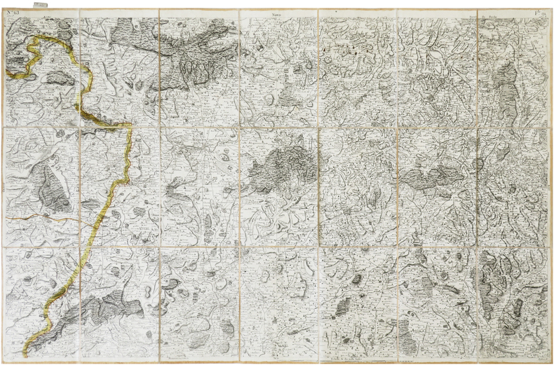
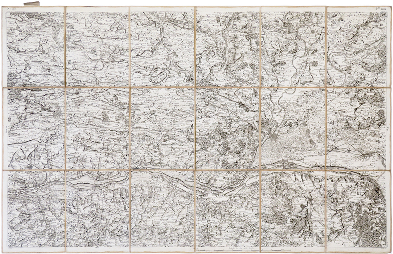
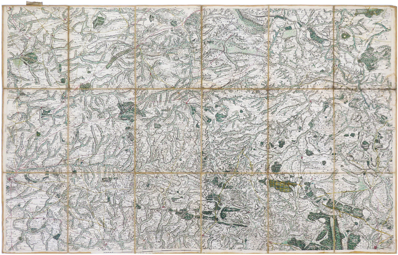
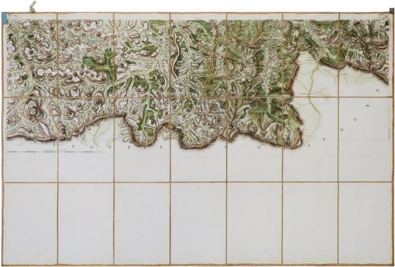
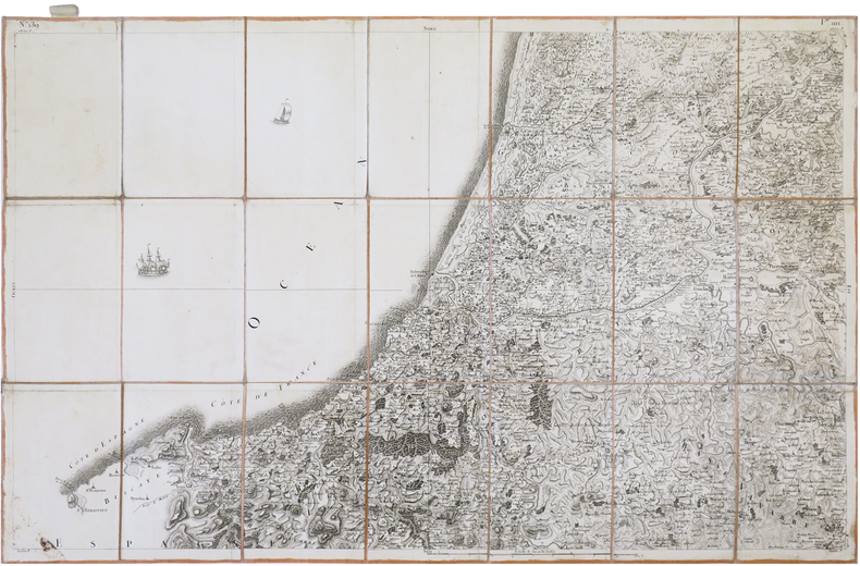
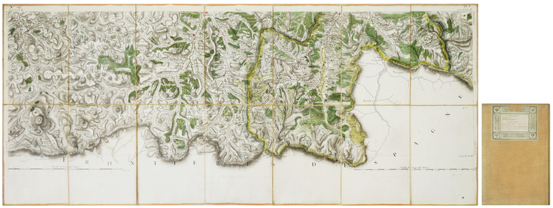
CASSINI de THURY (César-François).
[AGEN] Carte de Cassini. Feuille n°73/18.T. Agen.
[Paris, circa 1810]. En 21 sections montées sur toile et repliées, formant une carte de 593 x 925 mm ; onglet de vélin renseigné du numéro de la feuille en manuscrit ; étiquette au dos de l'éditeur parisien Charles Simonneau portant une légende de trois couleurs.
Ссылка продавца : LBW-7940
|
|
|
CASSINI de THURY (César-François).
[AIRE-sur-l'ADOUR/ORTHEZ] Carte de Cassini. Feuille n°107/99. Aire-sur-l'Adour.
[Paris, 1756-1789]. En 21 sections montées sur toile et pliées, formant une carte de 591 x 925 mm ; étiquette au dos portant le titre "Aire" et le numéro en manuscrit.
Ссылка продавца : LBW-7128
|
|
|
CASSINI de THURY (César-François).
[AIRE-sur-l'ADOUR/ORTHEZ] Carte de Cassini. Feuille n°107/19.E. Aire et Orthez.
[Paris, circa 1810]. En 21 sections montées sur toile et repliées, formant une carte de 594 x 923 mm ; onglet de vélin renseigné du numéro de la feuille en manuscrit ; étiquette au dos de l'éditeur parisien Charles Simonneau portant une légende de cinq couleurs.
Ссылка продавца : LBW-7942
|
|
|
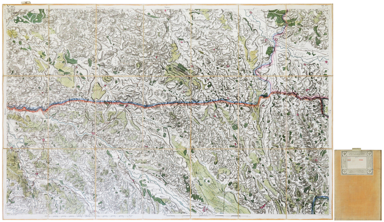
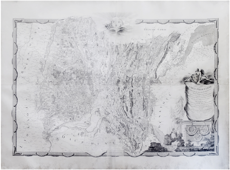
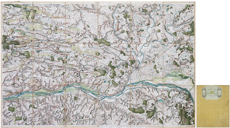
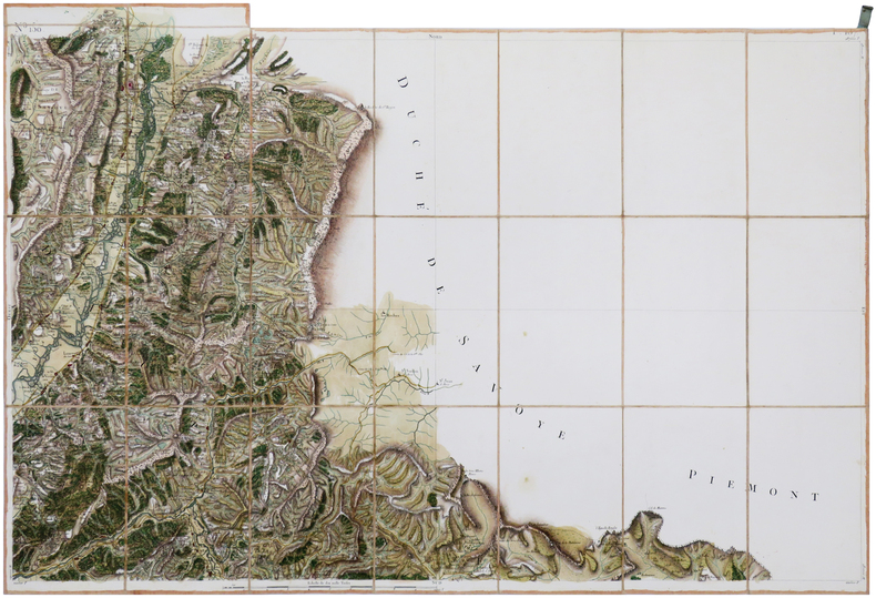
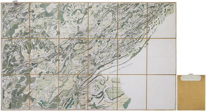
CASSINI de THURY (César-François) & SEGUIN (Jean).
[AIN/BRESSE] Carte particulière des Pays de Bresse, Bugey et Gex, levée géométriquement par les Ingénieurs Géographes du Roy, sous la directon de MM. Cassini de Thury, de Montigny et Camus de l'Académie Royale des Sciences... Exécutée par le S.r Seguin Ingénieur Géographe du Roy en 1766.
1766. En quatre feuilles jointes de 1,25 x 1,80 m ; montée sur toile.
Ссылка продавца : LBW-8121
|
|
|
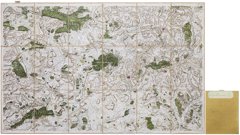
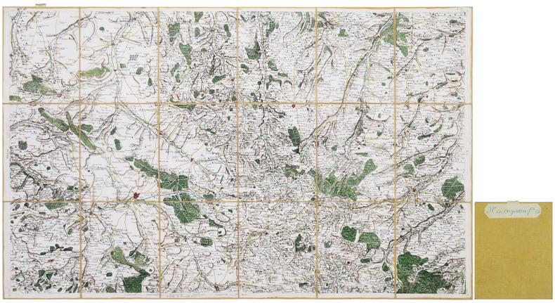
CASSINI de THURY (César-François).
[ALENÇON] Carte de Cassini. Feuille n°63/91. Alençon.
[Paris, 1756-1789]. En 21 sections montées sur toile et pliées, formant une carte de 592 x 920 mm ; étiquette au dos de l'éditeur Auvray, onglet de vélin renseigné du numéro de la feuille.
Ссылка продавца : LBW-7373
|
|
|
CASSINI de THURY (César-François).
[ALENÇON] Carte de Cassini. Feuille n°63/91. Alençon.
[Paris, 1769]. En 18 sections montées sur toile et repliées, formant une carte de 589 x 921 mm ; onglet de vélin renseigné du numéro de la feuille à l'encre verte, étiquette au dos portant le numéro et le titre de la feuille à l'encre verte.
Ссылка продавца : LBW-8589
|
|
|
CASSINI de THURY (César-François).
[AMBLETEUSE/WISSANT/MARQUISE] Carte de Cassini. Feuille n°21/17. Pas de Calais.
[Paris, 1756-1789]. En deux feuilles coupées en 21 sections montées sur toile et pliées, formant une carte de 592 x 920 mm ; étiquette au dos portant le titre "Pas de Calais" et le numéro en manuscrit.
Ссылка продавца : LBW-6997

|
|
|
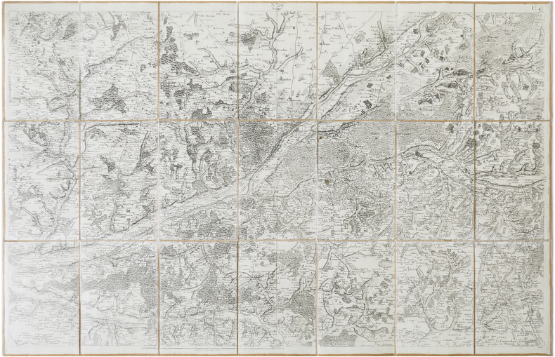
CASSINI de THURY (César-François).
[AMIENS] Carte de Cassini. Feuille n°3/11. Amiens.
[Paris, circa 1757]. En 16 sections montées sur toile et repliées, formant une carte de 587 x 985 mm ; onglet de vélin renseigné du nom et du numéro de la feuille ; étiquette au dos de l'éditeur parisien Goujon.
Ссылка продавца : LBW-8052

|
|
|
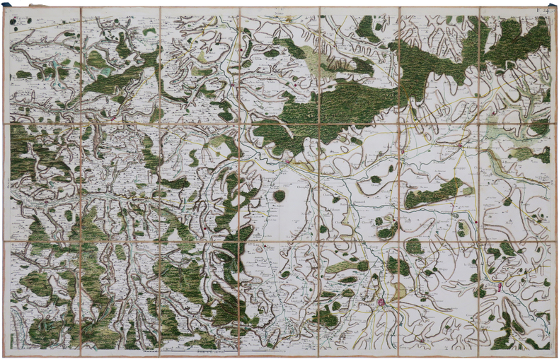
CASSINI de THURY (César-François).
[ANGERS] Carte de Cassini. Feuille n°98/100. Angers.
[Paris, 1771]. En 18 sections montées sur toile et pliées, formant une carte de 592 x 937 mm ; étiquette avec titre manuscrit au dos.
Ссылка продавца : LBW-7404
|
|
|
CASSINI de THURY (César-François).
[ANGERS] Carte de Cassini. Feuille n°98/100. Angers.
[Paris, 1771]. En 18 sections montées sur toile et repliées, formant une carte de 586 x 917 mm ; étiquette au dos de l'éditeur parisien Charles Picquet.
Ссылка продавца : LBW-8620
|
|
|
CASSINI de THURY (César-François).
[ARGENTAN/FALAISE] Carte de Cassini. Feuille n°62/57. Argentan.
[Paris, 1761]. En 18 sections montées sur toile et repliées, formant une carte de 584 x 934 mm ; onglet de vélin renseigné du numéro de la feuille à l'encre verte, étiquette au dos portant le numéro et le titre de la feuille à l'encre verte.
Ссылка продавца : LBW-8664
|
|
|
CASSINI de THURY (César-François).
[AUXERRE] Carte de Cassini. Feuille n°47/24. Auxerre.
[Paris, 1756-1789]. En 21 sections montées sur toile et pliées, formant une carte de 592 x 930 mm ; étiquette au dos portant le titre "Auxerre" et le numéro en manuscrit.
Ссылка продавца : LBW-6993
|
|
|
CASSINI de THURY (César-François).
[AUBUSSON] Carte de Cassini. Feuille n°13/66. Aubusson.
[Paris, 1756-1789]. En 21 sections montées sur toile et pliées, formant une carte de 593 x 928 mm ; étiquette au dos portant le titre "Aubusson" et le numéro en manuscrit.
Ссылка продавца : LBW-7014

|
|
|
CASSINI de THURY (César-François).
[AVRANCHES] Carte de Cassini. Feuille n°82/95.
[Paris, 1756-1789]. En 18 sections montées sur toile et pliées, formant une carte de 582 x 930 mm ; étiquette au dos portant Avranches en manuscrit, et onglet de tissu portant le numéro 51 en manuscrit.
Ссылка продавца : LBW-6499
|
|
|
CASSINI de THURY (César-François).
[BAGNÈRES-de-LUCHON] Carte de Cassini. Feuille n°76/141. Bagnères-de-Luchon.
[Paris, 1756-1789]. En 21 sections montées sur toile et pliées, formant une carte de 598 x 929 mm ; étiquette au dos portant le titre "Bagneres de Luchon" et le numéro en manuscrit.
Ссылка продавца : LBW-6976
|
|
|
CASSINI de THURY (César-François).
[BARRAUX] Carte de Cassini. Feuille n°150/137. Barraux.
[Paris, 1756-1789]. En 23 sections montées sur toile et pliées, formant une carte de 618 x 918 mm ; étiquette au dos portant le titre "Barraux" et le numéro en manuscrit, onglet de soie renseigné du numéro de la feuille.
Ссылка продавца : LBW-7036
|
|
|
CASSINI de THURY (César-François).
[BAYONNE] Carte de Cassini. Feuille n°139/101.
[Paris, 1756-1789]. En 21 sections montées sur toile et pliées, formant une carte de 595 x 933 mm ; étiquette au dos de l'éditeur Charles Picquet, onglet de vélin renseigné du numéro de la feuille.
Ссылка продавца : LBW-7363
|
|
|
CASSINI de THURY (César-François).
[BAYEUX] Carte de Cassini. Feuille n°94/38. Bayeux.
[Paris, 1756-1789]. En 21 sections montées sur toile et pliées, formant une carte de 590 x 915 mm ; étiquette au dos de l'éditeur Auvray, onglet de vélin renseigné du numéro de la feuille.
Ссылка продавца : LBW-7383
|
|
|
CASSINI de THURY (César-François).
[BAGNÈRES-de-LUCHON] Carte de Cassini. Feuille n°76/21.T. Bagnères-de-Luchon.
[Paris, circa 1810]. En 14 sections montées sur toile et repliées, formant une carte de 396 x 918 mm ; cachet à froid de l'éditeur géographe Charles Picquet dans la partie droite ; étiquette au dos de l'éditeur parisien Charles Simonneau portant une légende de trois couleurs.
Ссылка продавца : LBW-7941
|
|
|
CASSINI de THURY (César-François).
[BESANÇON] Carte de Cassini. Feuille n°146/60. Besançon.
[Paris, 1762]. En 18 sections montées sur toile et repliées, formant une carte de 577 x 933 mm ; onglet de vélin renseigné du numéro de la feuille à l'encre verte, étiquette au dos portant le numéro et le titre de la feuille à l'encre verte.
Ссылка продавца : LBW-8607
|
|
|
CASSINI de THURY (César-François).
[BLOIS] Carte de Cassini. Feuille n°29/47. Blois.
[Paris, 1756-1789]. En 21 sections montées sur toile et pliées, formant une carte de 600 x 924 mm ; étiquette au dos de l'éditeur Charles Picquet.
Ссылка продавца : LBW-7376
|
|
 Получить результаты поиска по электронной почте
 Загрузить результаты в формате PDF
  RSS-канал


