|
County Maps
CORYELL COUNTY TEXAS General Highway Map
Austin: State Dept. Of Highways 1981. 18" x 24.5" map of Coryell County in color. 1st. Fine. State Dept. Of Highways unknown
Referentie van de boekhandelaar : 015525
|
|
|
County Maps
FALLS COUNTY TEXAS General Highway Map
Austin: State Dept. Of Highways 1989. 18" x 25" black & white map of Falls County. 1st. Fine. State Dept. Of Highways unknown
Referentie van de boekhandelaar : 015533
|
|
|
County Maps
HILL COUNTY TEXAS General Highway Map
Austin: State Dept. Of Highways 1986. 18" x 25" black & white map of Hill County. 1st. Fine. State Dept. Of Highways unknown
Referentie van de boekhandelaar : 015521
|
|
|
County Maps
HILL COUNTY TEXAS General Highway Map
Austin: State Dept. Of Highways 1989. 18" x 25" black & white map of Hill County. 1st. Fine. State Dept. Of Highways unknown
Referentie van de boekhandelaar : 015532
|
|
|
County Maps
LIMESTONE COUNTY TEXAS General Highway Map
Austin: State Dept. Of Highways 1989. 18" x 24.5" black & white map of Limestone County. 1st. Near Fine. State Dept. Of Highways unknown
Referentie van de boekhandelaar : 015531
|
|
|
County Maps
McLENNAN COUNTY TEXAS General Highway Map
Austin: State Dept. Of Highways 1986. 18" x 24.5" black & white map of McLennan County. 1st. Fine. State Dept. Of Highways unknown
Referentie van de boekhandelaar : 015524
|
|
|
County Maps
SOMERVELL COUNTY TEXAS General Highway Map
Austin: State Dept. Of Highways 1976. 18" x 24.5" black & white map of Somervell County. 1st. Fine. State Dept. Of Highways unknown
Referentie van de boekhandelaar : 015522
|
|
|
County Maps
TEXAS QUADRANT MAP Featuring JOHNSON & HILL COUNTIES with McLENNAN & BOSQUE COUNTIES
Arlington: D & L MAP SERVICE 1986. 23" x 35" two sided map of four Texas counties. Very Good. D & L MAP SERVICE unknown
Referentie van de boekhandelaar : 015530
|
|
|
County Maps
WILLIAMSON COUNTY TEXAS General Highway Map
Austin: State Dept. Of Highways 1988. Two 18" x 24.5" black & white sheets showing map of Williamson County. 1st. Fine. State Dept. Of Highways unknown
Referentie van de boekhandelaar : 015527
|
|
|
Coupland, Douglas
Souvenir of Canada
book in as new condition. Soft covers with self-wraps. 143pp. An introduction to Canada, very well illustrated.

|
|
|
Courtauld George with Illustrations and Maps by David Heal:
An Axe A Spade And Ten Acres: The Story of a Garden and Nature Reserve.
London: Secker & Warburg 1983. . First Edition. 8vo. 219pp. Illustrated. Green cloth. Fine in price-clipped dust-jacket. An account of the making of the author's garden on the Essex/Suffolk border. The author's first book. . hardcover
Referentie van de boekhandelaar : 8415 ISBN : 0436108887 9780436108884

|
|
|
COURTAULD GEORGE; HEAL DAVID ILLUSTRATIONS & MAPS
An Axe A Spade & Ten Acres: The Story Of A Garden And Nature Reserve
Farrar Straus Giroux New York: 1985. Softcover. Good condition. Courtauld's style oscillates between the deliberately entertaining and the descriptively excellent. Farrar, Straus, Giroux, New York: 1985 paperback
Referentie van de boekhandelaar : 21047X1
|
|
|
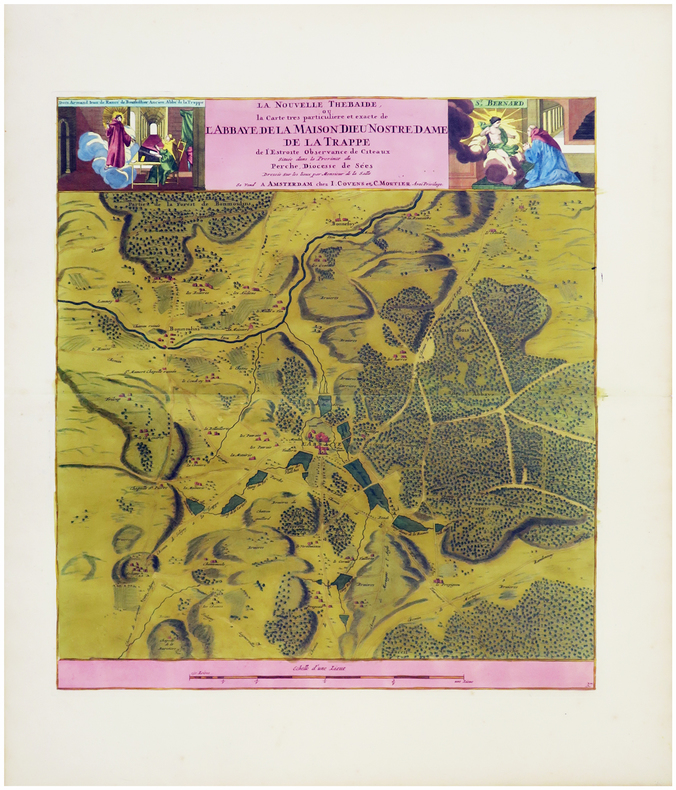
COVENS (Jean) & MORTIER (Pierre).
[NORMANDIE/LA TRAPPE] La nouvelle Thébaïde, ou la carte très particulière et exacte de l'abbaye de la Maison Dieu Nostre Dame de La Trappe de l'Estroite Observance de Citeaux située dans la province du Perche, diocesse de Sées.
Amsterdam, J. Covens et C. Mortier, [circa 1725]. 461 x 423 mm.
Referentie van de boekhandelaar : LBW-6173
|
|
|
COVENS (Jean) & MORTIER (Corneille).
Carte de la Terre Sainte divisée selon les douze tribus d'Israël, où sont exactement marquez les voyages de Jésus-Christ &c, dressée pour bien entendre les histoires de la Bible.
Amsterdam, J. Covens & C. Mortier, vers 1700. 399 x 467 mm.
Referentie van de boekhandelaar : LBW-1915

|
|
|
Covic, Boze [ed]
Roots of Serbian Aggression: Debates, Documents, Cartographic reviews
English translations of historic documents with illustrative maps that analyze the political, linguisitic and religious history of Serbia as seen from Croatia.426p.illus + 23 fold-out maps, illus. Book
|
|
|
Cowgill, John H.
Clitheroe : Heart of the Ribble Valley
No marks or inscriptions to contents. Very faint creasing to corner and near spine. A very clean very tight copy with bright unmarked boards and no bumping to corners. 84pp. A guide book with brief local history to the ancient borough of Clitheroe in Lancashire and the surrounding villages.

|
|
|
Cowles, Frederick I.
Not Far from the Smoke
Name to front end paper. No other marks or inscriptions. No creasing to covers or to spine. A very clean very tight copy with bright unmarked boards, very minor bumping to spine ends and no bumping to corners. 295pp. A series of adventures and excursions to outlying towns and villages around the cities Manchester, Sheffield, Nottingham, Leeds and Birmingham. A few photographs.

|
|
|
Cowley Deborah & Serour Aleya Eds
Cairo : A Practical Guide
Cairo Egypt: American University in Cairo Press 1984 Comprehensive local travel guide to Cairo full of fascinating facts.Includes a short English-Arabic 295p. bibliography.glossary.index. 272p. 3rd.ed. Soft Cover. Very Good. American University in Cairo Press paperback
Referentie van de boekhandelaar : 19044
|
|
|
Cowley Deborah & Serour Aleya Eds
Cairo : A Practical Guide
Cairo Egypt: American University in Cairo Press 1981 Comprehensive local travel guide to Cairo full of fascinating facts.Includes a short English-Arabic 295p. bibliography.glossary.index. 295p. the loose leaf maps are missing from this copy. 3rd.ed. Soft Cover. Very Good. American University in Cairo Press paperback
Referentie van de boekhandelaar : 16168
|
|
|
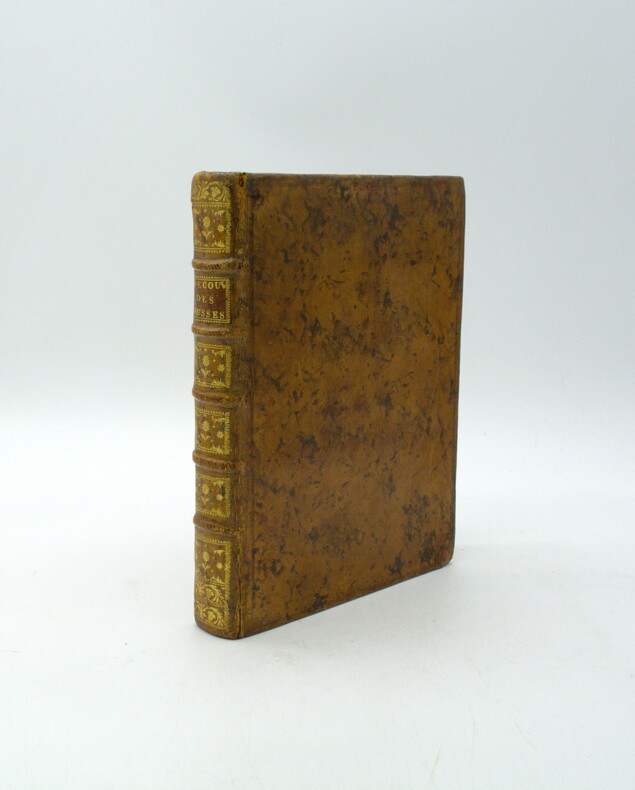
COXE (William).
Les Nouvelles découvertes des Russes, entre l’Asie et l’Amérique, avec l’histoire de la conquête de la Sibérie, & du commerce des Russes & des Chinois.
Paris, Hôtel de Thou, 1781. In-4, 2ff., xxii, 314 p., relié plein veau marbré époque, dos à nerfs ornés avec pièce de titre, tranches marbrées, coins usés, petits frottements aux charnières, quelques rousseurs, et brunissures en marges. Illustré de 4 cartes dépliantes (manque la vue dépliante de la ville de Maimatschin)
Referentie van de boekhandelaar : PHO-1928
|
|
|
COXE (William).
Les Nouvelles découvertes des Russes, entre l’Asie et l’Amérique, avec l’histoire de la conquête de la Sibérie, & du commerce des Russes & des Chinois.
Paris, Hôtel de Thou, 1781. In-4, 2ff., xxii, 314 p., relié plein veau marbré époque, dos à nerfs ornés avec pièce de titre, tranches marbrées, coins usés, petits frottements aux charnières, quelques rousseurs, et brunissures en marges. Illustré de 4 cartes dépliantes (manque la vue dépliante de la ville de Maimatschin)
Referentie van de boekhandelaar : PHO-1927

|
|
|
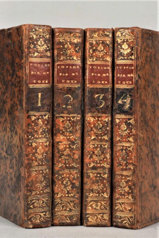
COXE (William) , MALLET (Paul-Henri ,traducteur )
Voyage en Pologne, Russie, Suède, Dannemarc, &c.
À Genève, chez Barde, Manget & Cie, 1787. 4 vol. in-8, veau havane moucheté époque, dos lisse orné avec pièce de titre rouge , pièce de titre rouge, tomaison dorée, tranches rouges (qq. défauts aux reliures dont épid. et des coins usés ,mouillures claires, etc ; 1 pl. en déficit).
Referentie van de boekhandelaar : PHO-1232
|
|
|
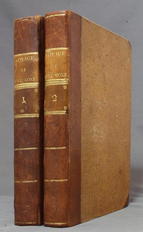
COXE William; MALLET [Paul-Henri]:
Voyage en Pologne, Russie, Suède, Dannemarc, &c. Traduit de l'anglais, enrichi de notes & des éclaircissemens nécessaires, & augmenté d'un Voyage en Norvège.
A Genève et à Paris, chez Barde, Manget & Comp./ chez Buisson, 1786. 2 volumes in-4 de [2]-VI-[2]-428 et [4]-382-[2] pages, demi-veau brun à coins, dos lisses ornés de filets, fleurons, roulettes, titre ("Voyage de Will: Coxe") et tomaison dorés, étiquettes de titre tabac, de tomaison brunes, tranches teintées vertes. Reliures un peu frottées, haut de 2 feuillets de table des matières déchirés, avec atteinte au texte, en fin du premier volume.
Referentie van de boekhandelaar : 11167
|
|
|
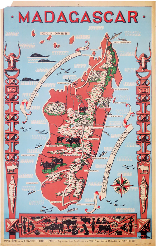
CRASTE (Léo).
[MADAGASCAR] Madagascar.
Paris, Affiches Gaillard, [vers 1950]. 1,16 x 0,74 m ; sur papier fin.
Referentie van de boekhandelaar : LBW-8591
|
|
|
CRANGA
Le canton de Tramayes en 1900... à travers les cartes postales.
Editions de Saint-Seine-l'Abbaye, 1984, 105 p., broché, bon état.
Referentie van de boekhandelaar : 87058
|
|
|
Craig William/Pitcher Donald T. maps
Enemy at the Gates: The Battle of Stalingrad
London: Hodder & Stoughton 1973. 1st British printing. VG/no dust jacket. xviii 459 p. photos maps map on endsheets biblio chapter notes index 8vo; Hodder & Stoughton hardcover
Referentie van de boekhandelaar : 71234 ISBN : 0340128631 9780340128633

|
|
|
Cram, Geo. F.
1889 Color Bar Graphs Comparing the Wealth, National Debt, Money Circulation, Commerce, and Army/Navy Size of the Nations of the World
Outer dimensions: 10.75" x 14.5". A fascinating and informative graphical presentation of the vital economic statistics of the world's nations in 1889. Offers a stunning contrast to the economic power displayed today by the nations of Asia. Suitable for mounting on the wall of any far-sighted investment professional. Clean and unmarked with light wear. A quality vintage copy. Book

|
|
|
Cram, Geo. F.
1889 Color Chart (Map) of the World on Mercator's Projection
Outer dimensions: 21.75" x 14.5". Ocean currents indicated. Clean and unmarked with light wear. A quality vintage copy. Book

|
|
|
Cram, Geo. F.
1889 Color City Map of Chicago, Illinois (IL)
Outer dimensions: 10.75" x 14.5". Includes many street names. Principal buildings, steam roads and horse roads indicated. Clean and unmarked with light wear. An attractive vintage copy. Book

|
|
|
Cram, Geo. F.
1889 Color City Map of Cleveland, Ohio (OH)
Outer dimensions: 10.75" x 14.5". Includes many street names. Clean and unmarked with light wear. An attractive vintage copy. Book

|
|
|
Cram, Geo. F.
1889 Color City Map of Detroit, Michigan (MI)
Outer dimensions: 10.75" x 14.5". Includes many street names. Steam roads indicated. Clean and unmarked with light wear. An attractive vintage copy. Book

|
|
|
Cram, Geo. F.
1889 Color Driving Map of Philadelphia, Pennsylvania (PA)
Outer dimensions: 21.75" x 14.5". Includes many street names and locations of interest. Clean and unmarked with light wear. An attractive vintage copy. Book

|
|
|
Cram, Geo. F.
1889 Color Map of New York City (Manhattan) and Vicinity
Outer dimensions: 21.75" x 14.5". Includes many street names, locations of interest, and list of steamships and their pier addresses. Clean and unmarked with light wear. An attractive vintage example of this marvelous Big Apple memento. Book

|
|
|
Cram, Geo. F.
1889 Color Map of Pittsburgh, Pennsylvania (PA) and Allegheny City
Outer dimensions: 21.75" x 14.5". Includes many street names. Clean and unmarked with light wear. An attractive vintage copy. Book

|
|
|
Cram, Geo. F.
1889 Color Map of the (North) Polar Regions - Showing the Recent Arctic Discoveries
Outer dimensions: 10.75" x 14.5". Unmarked with light wear. Interestingly, the North Pole and its immediate vicinity are labelled as "Unknown Regions." A quality vintage copy. Book

|
|
|
Cram, Geo. F.
1889 Color Map of the City of Montreal, Quebec
Outer dimensions: 10.75" x 14.5". Includes many street names and locations of interest. Clean and unmarked with light wear. An attractive vintage copy. Text in English. Book

|
|
|
Cram, Geo. F.
1889 Color Map of the City of Toronto, Ontario
Outer dimensions: 10.75" x 14.5". Includes many street names and locations of interest. Clean and unmarked with light wear. An attractive vintage copy. Book

|
|
|
Cram, Geo. F.
1889 Color Map of the Contiguous (Continental) United States of America (U.S.A.)
Vintage map with states individually colored. Of interest, modern day Oklohoma indicated as Indian Territory, and names such as Miami, Los Angeles and Seattle do not appear. Outer dimensions: 21.75" x 14.5". Unmarked with moderate wear. Center fold. 5" opening along top edge mended with archival tape. Book

|
|
|
Cram, Geo. F.
1889 Color Map of the Eastern Half of the State of Texas
Outer dimensions: 21.75" x 14.5". Counties individually colored. Clean and unmarked with light wear. An attractive vintage copy. Bonus: includes separate extensive list of Texas counties and cities/towns, complete with their (1889) populations. Book

|
|
|
Cram, Geo. F.
1889 Color Map of the State of Alabama
Outer dimensions: 10.75" x 14.5". Counties individually colored. Clean and unmarked with light wear. An attractive vintage copy. Book

|
|
|
Cram, Geo. F.
1889 Color Map of the State of Alaska
Outer dimensions: 10.75" x 14.5". Unmarked with light wear. A quality vintage copy. Book

|
|
|
Cram, Geo. F.
1889 Color Map of the State of Arizona
Outer dimensions: 10.75" x 14.5". Counties individually colored. Clean and unmarked with light wear. An attractive vintage copy. Bonus: includes separate extensive list of Arizona counties and cities/towns, complete with their (1889) populations. Book

|
|
|
Cram, Geo. F.
1889 Color Map of the State of California
Outer dimensions: 21.75" x 14.5". Counties individually colored. Clean and unmarked with light wear. An attractive vintage copy. Bonus: includes separate extensive list of California counties and cities/towns, complete with their (1889) populations. Book

|
|
|
Cram, Geo. F.
1889 Color Map of the State of Colorado
Outer dimensions: 10.75" x 14.5". Counties individually colored. Clean and unmarked with light wear. An attractive vintage copy. Book

|
|
|
Cram, Geo. F.
1889 Color Map of the State of Florida
Outer dimensions: 10.75" x 14.5". Counties individually colored. Clean and unmarked with light wear. An attractive vintage copy. Bonus: includes separate extensive list of Florida counties and towns/cities, complete with their populations in 1889. Book

|
|
|
Cram, Geo. F.
1889 Color Map of the State of Georgia
Outer dimensions: 10.75" x 14.5". Counties individually colored. Clean and unmarked with light wear. An attractive vintage copy. Book

|
|
|
Cram, Geo. F.
1889 Color Map of the State of Kansas
Outer dimensions: 10.75" x 14.5". Counties individually colored. Clean and unmarked with light wear. A quality vintage copy. Bonus: includes separate extensive list of Kansas counties and cities/towns, complete with (1889) population of each. Book

|
|
|
Cram, Geo. F.
1889 Color Map of the State of Louisiana
Outer dimensions: 10.75" x 14.5". Counties individually colored. Clean and unmarked with light wear. An attractive vintage copy. Bonus: includes separate list of Louisiana counties and cities/towns, complete with their (1889) populations. Book

|
|
|
Cram, Geo. F.
1889 Color Map of the State of Minnesota
Outer dimensions: 10.75" x 14.5". Counties individually colored. Clean and unmarked with light wear. An attractive vintage copy. Book

|
|
|
Cram, Geo. F.
1889 Color Map of the State of Missouri
Outer dimensions: 10.75" x 14.5". Counties individually colored. Clean and unmarked with light wear. A quality vintage copy. Bonus: includes separate extensive list of Missouri counties and cities/towns, complete with (1889) population of each. Book

|
|
 De zoekresultaten per email ontvangen
 Zoekresultaten downloaden als PDF
 RSS feed


