|
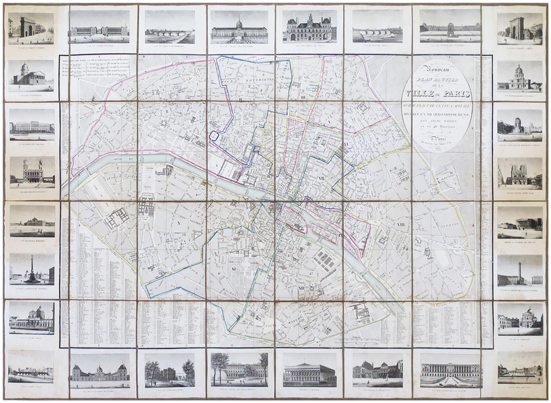
LOGEROT (Auguste).
Nouveau plan routier de la ville de Paris ou Guide exact de cette capitale divisée en XII arrondissemens avec leurs mairies et en 48 quartiers. Par A. L.
Paris, Rosselin, 1831. En 32 sections montées sur toile et pliées, formant un plan de 0,75 x 1,02 m.
Referentie van de boekhandelaar : LBW-6853
|
|
|
Logiadou-Platonos, Sosso
Crete : Archaeological and Historical Sites ,scenery, Traditional Costumes
Locally produced guidebook, well illustrated. French wraps 32p. text + 96 p. plates (with descriptions in Greek, English, German and French) No date (c. 1980?) Book
|
|
|
Lohéac-Ammoun Franck
Tous les jeux de cartes. règles techniques conseils
Solar 1987 294 pages 14 9cm x 23 2cm x 2 6cm. 1987. Cartonnage éditeur - illustratio. 294 pages.
Referentie van de boekhandelaar : 14564

|
|
|
LOIRE INFERIEURE
Carte routi?re d?partementale au 1/320 000?.
Une feuille 58x38 cm.
|
|
|
LOIRET
Atlas cantonal. Carte couleurs au 1/10 000e du canton de Chatillon sur Loire.
Une feuille. 55x75 cm. R?par?e.
|
|
|
LOIRET
Carte d?partementale au 1/200 000?. Sans date.
Une feuille repli?e. 75x56 cm.
|
|
|
LONDON - CRUCHLEY, (GEORGE FREDERICK).
Cruchley's New Plan of London Shewing all the New and Intended Improvements to the Present Time. Published May 1st 1827 - A new Edition, Improved to 1st January 1833.
London, Cruchley map Seller, (1833). (42,5 x 60 cm.) Fine engraved and handcoloured map of London. Updated to 1833. The street- indexes engraved in the margins. The map is in fine condition, plain and not folded.
|
|
|
LONDON - CRUCHLEY, (GEORGE FREDERICK).
Cruchley's New Plan of London Shewing all the New and Intended Improvements to the Present Time. Published May 1st 1827 - A new Edition, Improved to 1st January 1833.
London, Cruchley map Seller, (1833). (42,5 x 60 cm.) Fine engraved and handcoloured map of London. Updated to 1833. The street- indexes engraved in the margins. The map is in fine condition, plain and not folded.
Referentie van de boekhandelaar : 49661

|
|
|
LONDON.
Index to the Streets and Places contained in the Map of London published in the Post Office Directory for 1918. BRIGHT, CLEAN COPY IN PUBLISHER'S WALLET WITH RETAINER
8vo., Index of 68pp facing large folding coloured map mounted on linen, measuring 30 x 44 ins (approx. 76 x 112 cms) folding in 36 panels to 7.5 x 5.5 ins (19 x 14 cms); the whole housed in publisher's red cloth wallet, upper board framed in blind and lettered in gilt with black retaining band (stretched through use and somewhat loose), a very good, bright, clean copty The map (scale: 4 inches to 1 mile) extends to Hampstead and Hackney in the north, Bromley and Greenwich in the east, Kennington and Walham Green in the south, and Brondesbury and Kensal Green in the west. EXTREMELY SCARCE IN THIS CONDITION.

|
|
|
Long, Peter
Hidden Inns of East Anglia
Second edition. No inscriptions or marks. Minor crease to rear cover and last four pages, none to front or to spine. A lovely clean very tight copy with bright unmarked boards and no bumping to corners. 228pp. A fully illustrated guide to the more secluded traditional Inns and Pubs in Suffolk, Norfolk, Essex and Cambridgeshire.

|
|
|
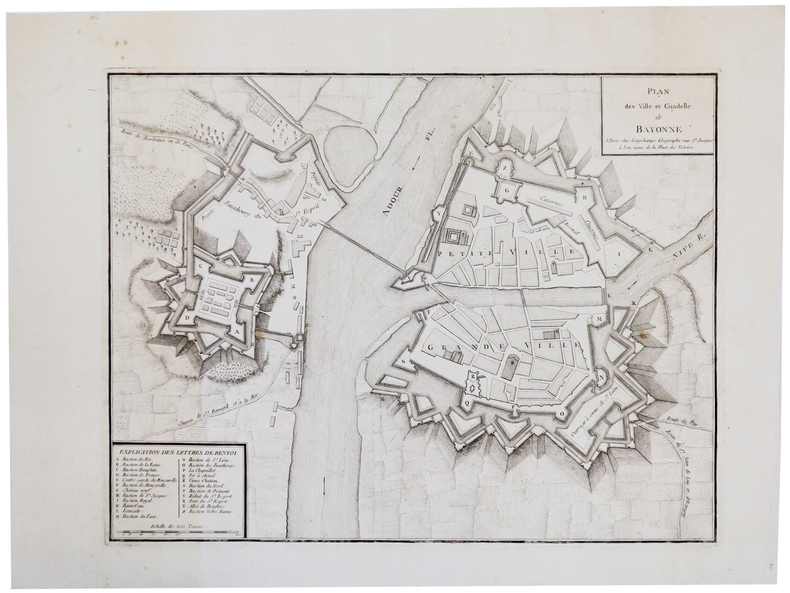
LONGCHAMPS (Sébastian G.).
[BAYONNE] Plan des ville et citadelle de Bayonne.
Paris, Longchamps, [circa 1750]. 355 x 457 mm.
Referentie van de boekhandelaar : LBW-5502
|
|
|
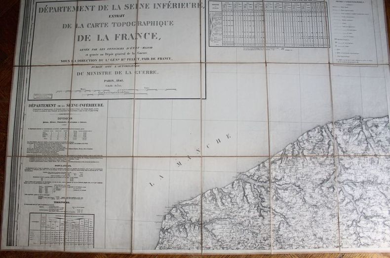
LONGUET.
Département de la Seine Inférieure - Extrait de la Carte topographique de la France, levée par les officiers d'Etat-Major et gravée au Dépôt général de la Guerre sous la direction du Lt. Général Baron Pelet, pair de France, publié avec l'autorisation du ministre de la Guerre.
Paris, Longuet, succ. de Simonneau, 1841. Ensemble complet de quatre grandes cartes (99 X 70 chacune) , échelle 1/80000e, en feuilles et contrecollées sur toile écrue (rousseurs à la toile). La première porte de grands cartouches : division, population, territoire; état indicatif du nombre et du tonnage des batiments entrés dans les ports du département (bureaux principaux des douanes, Le Havre, Rouen, Fécamp, Dieppe). Très bon état pour l'ensemble. Dans son étui de cartonnage en papier marbré, titre en long sur papier rouge. Usagé.
Referentie van de boekhandelaar : 20608
|
|
|
Loose, Hans-Dieter
Hamburg um 1690. NACHDRUCK nach einem kolorierten Kupferstich aus der Werkstatt von Peter Schenk für dem "Atlas Minor sive Tabulae Geographicae praecipuorum Regnorum Regionum, Insularum, Provinciarum etc. Per Carolum Allard", Amsterdam um 1696.
Braunschweig, Archiv-Derlag, [ca. 1985]. Mehrf. gefalt. farb. Plan über einem Panorama der Stadt, von der Elbseite gesehen (Blattgröße ca. 47 x 61 cm; Bildgröße ca. 45,5 x 59,5 cm).
Referentie van de boekhandelaar : 99391
|
|
|
LOPEZ (Don Tomas)
Mapa de la M.N.Y.M.L. Provincia de Guipuzcoa… Madrid, 1770. Une feuille pliée et toilée de 38 x 39 cm.
Madrid, 1770. Une feuille pliée et toilée de 38 x 39 cm
Referentie van de boekhandelaar : 8696
|
|
|
LOPEZ (Don Tomas)
Mapa geografico de una Parte de la provincia de Burgos. Madrid, 1784. Une feuille pliée et toilée de 84 x 87 cm.
Madrid, 1784. Une feuille pliée et toilée de 84 x 87 cm.
Referentie van de boekhandelaar : 8700
|
|
|
LOPEZ (Don Tomas)
Mapa geografico del Partido de Carrion.Madrid, 1785. Une feuille pliée et toilée de 37 x 40 cm.
Madrid, 1785. Une feuille pliée et toilée de 37 x 40 cm.
Referentie van de boekhandelaar : 8699
|
|
|
LOPEZ (Don Tomas)
Mapa geografico del Reyno de Granada.Madrid, 1795. Une feuille pliée et toilée de 75 x 87 cm.
Madrid, 1795. Une feuille pliée et toilée de 75 x 87 cm.
Referentie van de boekhandelaar : 8704
|
|
|
LOPEZ (Don Tomas)
Mapa geografico del Reyno de Jaen.Madrid, 1787. Une feuille pliée et toilée de 37 x 40 cm.
Madrid, 1787. Une feuille pliée et toilée de 37 x 40 cm.
Referentie van de boekhandelaar : 8703
|
|
|
LOPEZ (Don Tomas)
Mapa geografico que comprehende el partido de Santo Domingo de la Calzada y el de Logroño. Madrid, 1787. Une feuille pliée et toilée de 38 x 41 cm.
Madrid, 1787. Une feuille pliée et toilée de 38 x 41 cm.
Referentie van de boekhandelaar : 8701
|
|
|
LOPEZ y VARGAZ MACHUCA (Tomas).
[CASTILLE] Mapa geografico de la provincia de Soria.
Madrid, 1783. En 20 sections gravées, montées sur toile bleue et pliées, formant une carte de 845 x 865 mm.
Referentie van de boekhandelaar : LBW004df
|
|
|
LOSADA, Juan Cayetano (1766-1846).
Breves Tratados de Esfera y Geografía Universal, con algunas noticias históricas, en especial en lo perteneciente a España, y un Apéndice de Geografía Antigua y otro de Cronología, para instrucción de la juventud.
Madrid, Imprenta de Don Eusebio Aguado, 1839. 8vo. menor; 4 hojas, 246 pp., 1 h. Figuras entre el texto, un estado plegado "Distancia respectiva y número de habitantes de Madrid y de las principales capitales de provincia de España" y 6 mapas plegados coloreados de época. Encuadernación de época en piel.
|
|
|
LOT
Carte d?partementale couleurs au 1/200 000?me. Sans date.
Une feuille. 56x76 cm.
|
|
|
LOT ET GARONNE
Carte d?partementale.
Une feuille 60x80 cm repli?e.
|
|
|
LOT ET GARONNE
Carte d?partementale. Sans date.
1 feuille 50x65 cm repli?e.
|
|
|
LOT, Ferdinand - Plessis-Piquet, 20 septembre 1866, Fontenay-aux-Roses, 18 juillet 1952 - Historien médiéviste -- cartes établies par J.-J. Gruber
Les invasions barbares - Introduction à l'intelligence des derniers traités de paix - complet en 2 volumes - I) Arabes et Maures. Scandinaves. Slaves du Sud. Slaves du Centre - 16 cartes - II)slaves de l'Este, Finno-Ougriens, Turcs, Mongols, Etats issus de la décomposition des Empires du centre et de l'Est, 29 cartes
1937 PARIS, Payot ,Collection "Bibliothèque historique" - 1937 - 1 ère édition - 42 - In-8 - Broché - couverture illustrée - I) 349 pages & 16 cartes - II) 318 pages & 29 cartes - traces de scotch aux 2 ème & 3 ème plats du T. II, Sinon Propre - Envoi rapide et soigné - Réf. 49903
Referentie van de boekhandelaar : 49903
|
|
|
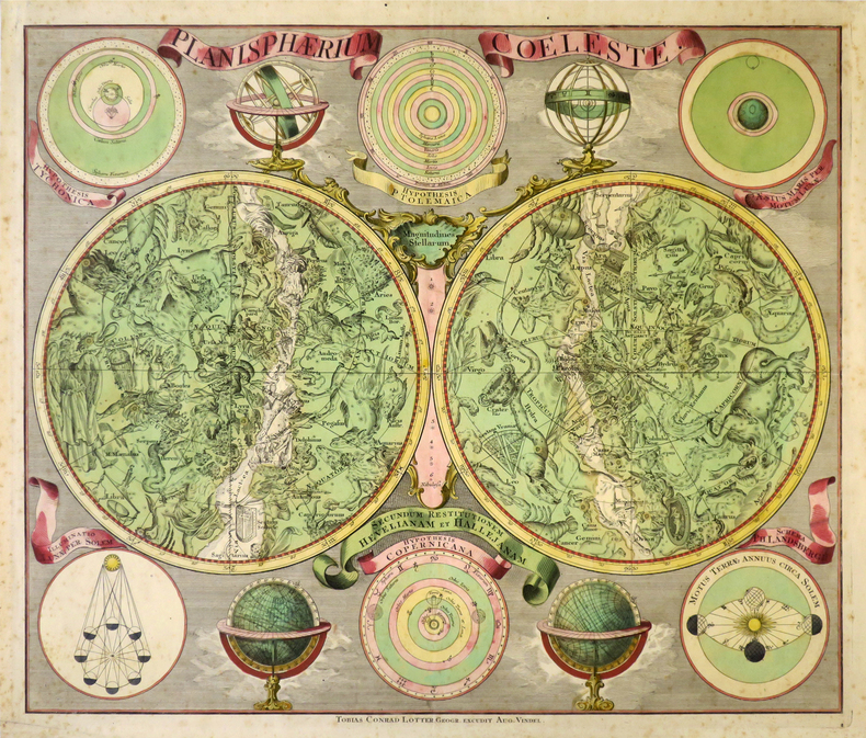
LOTTER (Tobias Conrad).
Planisphærium cœleste secundum restitutionem Hevelianam et Hallejanam.
Augsbourg, Tobias Conrad Lotter, [circa 1760]. 485 x 570 mm.
Referentie van de boekhandelaar : LBW-8679
|
|
|
LOTTER (Tobias Conrad);
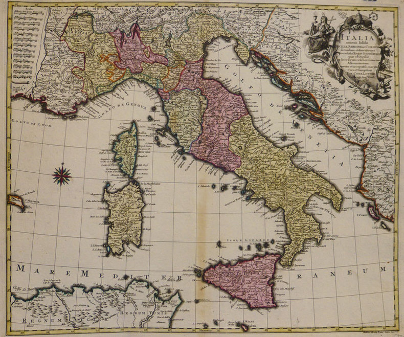
Italia annexis insulis Sicilia, Sardinia et Corsica.
Augsbourg 1758 476 x 568 mm.
Referentie van de boekhandelaar : LBW-935
|
|
|
Lotter, Gebr.:
Karte von West-Russland. Von 2 Platten gedruckt und in Hochformat zusammengesetzt. Altkolorierte Kupferstichkarte.
Format (Blattgröße): 69 x 48 cm. *Im linken unteren Viertel mit 2 alten Tintenflecken (1 weiterer am Unterrand). Ansonsten sauber und gut erhalten Landkarten de
|
|
|
Lotter, Tobias Conrad
Marchionatus Lusatiae Superioris Felicissimo Polaniae, Regis, Electoris Saxoniae, sceptro florens, Dynastiis et Praefecturis suis distributus nova accuratione Tob. Conradi Lotter Geogr. delineatus in Augusta. [Altkolorierter Original-Kupferstich / original colored copper engraving].
o.J. Tobias Conrad Lotter, geboren 1717, gestorben am 14. Juli 1777. Kupferstecher, Kartograph und Verleger in Augsburg. [2 Warenabbildungen]
Referentie van de boekhandelaar : 12064DB

|
|
|
Lotter, Tobias Conrad
Theatrum belli Rußorum Victoriis illustratum sive Nova et accurata Turcicarum et Tartaricum ... [Altkolorierter Original-Kupferstich / original colored copper engraving].
o.J. [2 Warenabbildungen] Tobias Conrad Lotter, geboren 1717, gestorben am 14. Juli 1777. Kupferstecher, Kartograph und Verleger in Augsburg.
Referentie van de boekhandelaar : 13188DB

|
|
|
Lotter, Tobias Conrad (1717 - 1777):
"Novissimum Astronomiae, Geographiae, ac Gnomonicae compendium theoreticum. Altkolorierter Kupferstich von M. Seutter.
49 x 58 cm. Blatt: 52 x 66 cm. Theoretische und pratische Erklärung: in der Unterhalfte zwei Abb. von einer "Quadranten Uhr" und einer "Äquinoctial oder dem Mittel=kreis gleich ebene Universal Uhr" (je 24:24 cm), daruber der umfangreiche gestochene Erläuterungstext (in Latein). Zwischen den Abb. und dem Text in 2 Kolumnen sind Abb. von Instrumenten. - Unterrand knapp beschnitten, sonst breitrandig. Sauber und sehr gut erhalten. Graphiken de
|
|
|
Lotter, Tobias Conrad:
Nova et accuratißima Ducatus Wurtenbergici cum territoris conterminis. Kupferstichkarte des Herzogtums Württemberg von Tobias Lotter.
Format 50 x 57,5 cm. Blattgröße: 52 x 66 cm. *Mit Grenzkolorit und Markierung der Städte - die Kartuschen nicht koloriert. - Gut erhalten. Landkarten de
|
|
|
Louis Catherine Feng Xiao-Min
Liu et l'oiseau
Picquier 2003 32 pages 25 1x25 2x1cm. 2003. Relié. 32 pages.
Referentie van de boekhandelaar : 500115595

|
|
|
Louis Dutens
Itinéraire des routes les plus fréquentées, ou Journal de plusieurs voyages aux villes principales de l'Europe, depuis 1768 jusqu'en 1783; où l'on a marqué en heures & minutes le temps employé à aller d'une poste à l'autre; les distances en milles anglois, mesurées par un Odomètre appliqué à la voiture; les productions des différentes contrées; les choses remarquables à voir dans les villes & sur les routes; les auberges,etc. On y a joint le rapport des monnoies & celui des mesures itinéraires, ainsi que le prix des chevaux de poste des différens pays. Septième édition, revue, corrigée & augmentée.
Paris Barrois 1791 In12 ( 17 x 11 cm ) - demi veau a coins - 4ff , XXXII + 285 pages - Carte du Lac Trasimène en frontispice et une très grande carte dépliant de l'Europe établie en 1783 par La Rochette . Ex Libris De Barante . Dutens a publié son itinéraire pour la première fois en 1775 . Toutes les éditions suivantes ont été remises à jour et augmentées .
Referentie van de boekhandelaar : Arm310
|
|
|
Louis Dutens
Itinéraire des routes les plus fréquentées, ou Journal de plusieurs voyages aux villes principales de l'Europe, depuis 1768 jusqu'en 1783; où l'on a marqué en heures & minutes le temps employé à aller d'une poste à l'autre; les distances en milles anglois, mesurées par un Odomètre appliqué à la voiture; les productions des différentes contrées; les choses remarquables à voir dans les villes & sur les routes; les auberges,etc. On y a joint le rapport des monnoies & celui des mesures itinéraires, ainsi que le prix des chevaux de poste des différens pays. Septième édition, revue, corrigée & augmentée.
Paris Barrois 1791 In12 ( 17 x 11 cm ) - demi veau a coins - 4ff , XXXII + 285 pages - Carte du Lac Trasimène en frontispice et une très grande carte dépliant de l'Europe établie en 1783 par La Rochette . Ex Libris De Barante . Dutens a publié son itinéraire pour la première fois en 1775 . Toutes les éditions suivantes ont été remises à jour et augmentées .
Referentie van de boekhandelaar : Arm310
|
|
|
LOUIS-LE-GRAND (rue). MANUSCRIT.
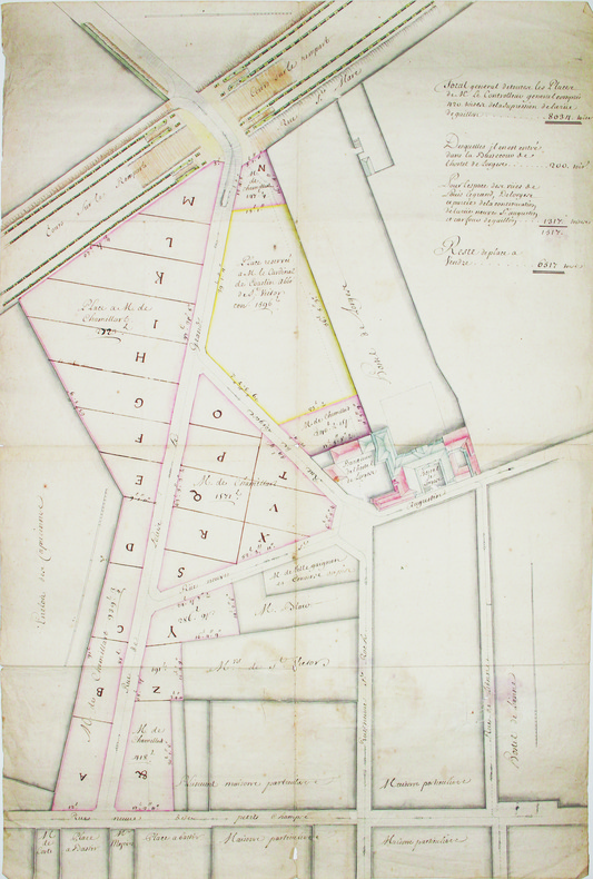
[Plan d'aménagement de la rue Louis-le-Grand].
[circa 1703]. En 4 feuilles jointes de 530 x 760 mm.
Referentie van de boekhandelaar : LBW-4190
|
|
|
Lourdes, S.A. Garcia
Cancun Life
No marks or inscriptions to contents. No creasing to covers or to spine. A very clean very tight copy with bright laminated boards, tiny rub to spine foot, fine indenting to rear and no bumping to corners. 329pp. Lavish tourist guide to Cancun and surrounding area in Mexico.

|
|
|
Loustal:
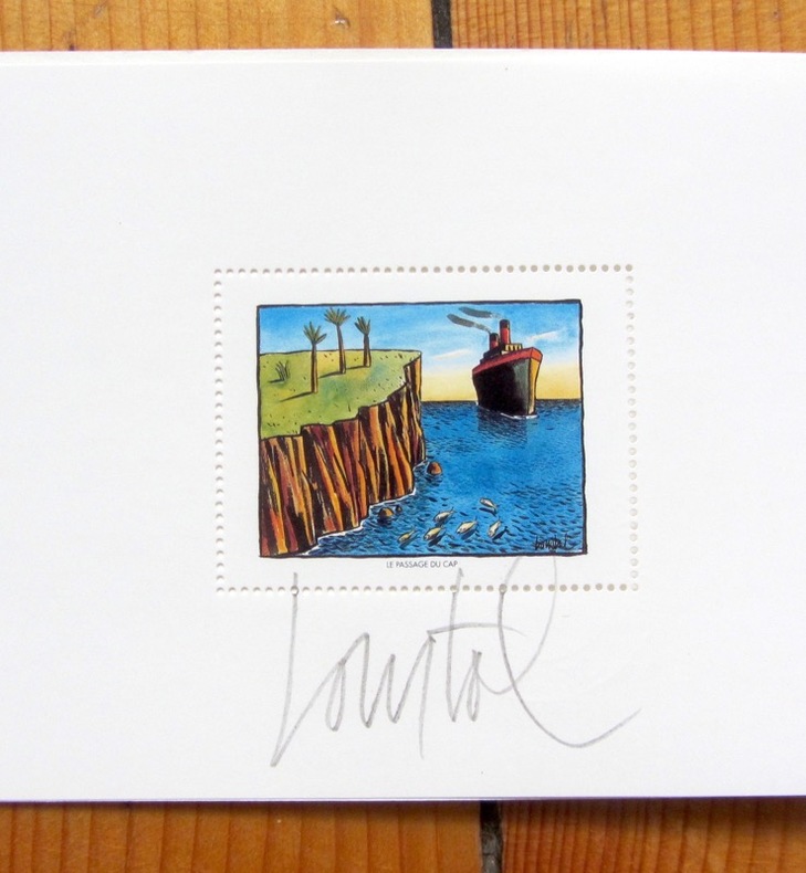
Assis debout couché.
Editions Christian Desbois, 1991. 7 aquarelles de Jacques Loustal presentées lors de l'exposition " assis, debout , couché " à la galerie Escale à Paris de 20 juin à 20 juillet 1991, présentées sous carte pliée et illustrée, sous forme de timbres.
Referentie van de boekhandelaar : 4342
|
|
|
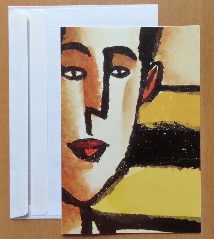
Loustal:
L'amateur d'Art.
Paris, Galerie Escale, 1992. Double carte au format 15 x 22, avec enveloppe, à l'état de neuf.
Referentie van de boekhandelaar : 26403
|
|
|
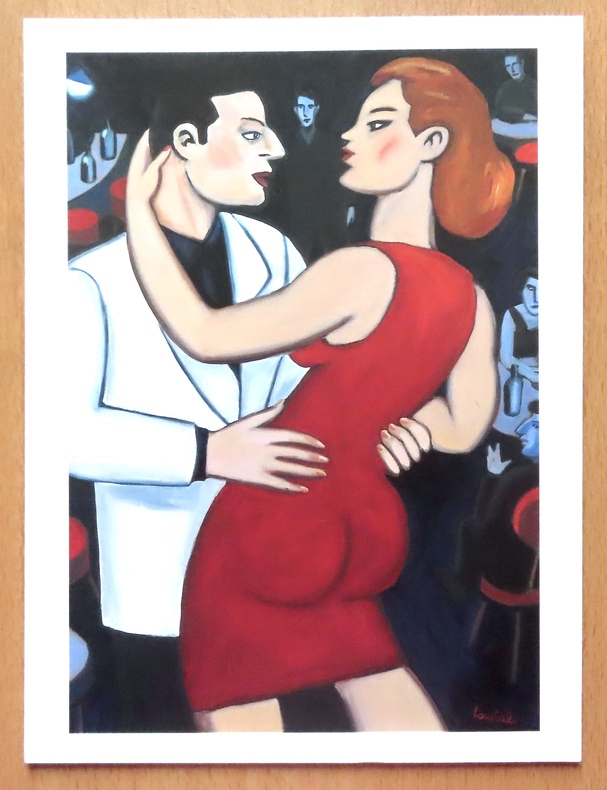
Loustal:
L'heure du rendez-vous.
Paris, Christian Desbois, 1993. Reproduction d'une huile sur toile de Loustal, au format 18 x 24 cm.
Referentie van de boekhandelaar : 26399
|
|
|
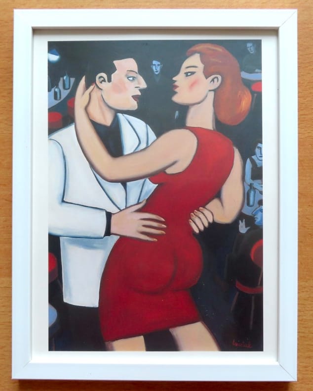
Loustal:
L'heure du rendez-vous.
Paris, Christian Desbois, 1993. Reproduction d'une huile sur toile de Loustal, sous cadre au format 20 x 26 cm.
Referentie van de boekhandelaar : 26695
|
|
|
LOVIE Jacques:
Savoie.
Paris, Librairie Arthaud, 1979. In-8 carré de 307 pages, pleine toile bleu ciel de l'éditeur sous jaquette à rabat illustrée d'une photographie en couleurs. Jaquette fatiguée, quelques accrocs.
Referentie van de boekhandelaar : 17258
|
|
|
LOZERE
Carte d?partementale couleurs au 1/200 000?me. Sans date.
Une feuille. 56x76 cm.
|
|
|
Luca Cerchiai, Fausto Longo, Lorena Jannelli
Greek Cities of Magna Graecia and Sicily
Book is in excellent condition but with lower corners bumped, one pretty hard, and impact marks at front fore edge, otherwise very clean. Binding is solid and square, covers have sharp corners, exterior shows no other blemishes, text/interior is clean and free of marking of any kind. Dust jacket shows the slightest signs of shelf wear only, no tears. 288 pages with a great many full color, often full page photos throughout of both current landscapes, with maps, floorplans, landscape drawings, detail maps of past and present cities, and art and architectural photos of the particular city, with a narrative from one of the four authors regarding the Greek colonization of southern Italy in the 8th and 7th centuries B.C., and the assimilation of Greek sensibilities and ideas into what eventually apppeared as the Roman Empire. Cities include: Those of the Fulf of Naples, Poseidonia, Paestum, Velia, Lokroi Epizephyrioi, Kroton, Sybaris, Thurii, Siris, Herakleia, Metapontion, Taranto, Naxos, Cela, Karmarina, Morcantina, Selinute, Herakleia Minoa, Segesta, Himera, Tindari, etc.

|
|
|
LUCA Gherasim
LE SORCIER NOIR. La Mise en formule d'une forme de Jacques Hérold.
Paris [l'auteur et l'artiste] 1962 In-8 En feuilles, sous emboitage de l'éditeur
Referentie van de boekhandelaar : 016229
|
|
|
Lucchesi Alexis Alor Josiane
Randonnées à pied et à VTT : Siou-Blanc Montrieux Les Morières
Editions Alain Barthélemy 2001 263 pages 13 4x1 8x20 4cm. 2001. broché. 263 pages. Ce guide pratique présente des itinéraires de randonnée pédestre et de VTT dans la région naturelle du Siou-Blanc Montrieux et Les Morières au nord de Toulon dans le Var. Il couvre un vaste quadrilatère s'étendant de la Méditerranée au massif de la Sainte-Baume incluant huit unités naturelles distinctes comme la montagne de la Loube et le plateau de Thêmes. L'ouvrage comprend des cartes pour orienter les randonneurs dans cette région préservée
Referentie van de boekhandelaar : 6424

|
|
|
Lucien Brun
Mont Dauphin Mon Village - recueil de cartes postales anciennes de la citadelle construite par VAUBAN
Editions de Fournel 2004 73 pages 21 4x0 8x21 4cm. 2004. broché. 73 pages.
Referentie van de boekhandelaar : 1732

|
|
|
Ludwig, Emil.
THE NILE. The Life-Story of a River. Translated by Mary H. Lindsay.
pp. xii, 619 + Maps and photographs. Paper beginning to brown but not brittle. 8vo. Original full cloth binding. Original dust jacket, very slightly worn. Hardbound. Reprint of the 1937 Viking Press edition. HOLY LAND BOX 1
|
|
|
LUFT Hans (1495 – 1584)
(Daniel's Dream Map)
Mappa intagliata in legno, contenuta in una pagina di testo di una Bibbia stampata a Wittenberg. Si tratta di una rara edizione di questa mappa un po' curiosa dell'Europa, dell'Africa e dell'Asia si trova nella letteratura apocalittica proveniente da Wittenberg nel 1530 o addirittura nel 1529. La mappa fu utilizzata per la prima volta dallo stampatore Hans Luft per illustrare due opere: una un commento sul profeta Daniele di Martin Lutero (1530) e un'altra che collega la visione di Daniele con gli assalti dei turchi ai confini dell'Europa cristiana dell'epoca. La mappa raffigura le quattro bestie del sogno di Daniele. La “mappa del mondo di Wittenberg”, più comunemente nota con il termine inglese di Daniel's Dream Map, è probabilmente la mappa del mondo più mistica di tutti i tempi. All'epoca della sua prima pubblicazione come il sessantunesimo mappamondo che andò in stampa, era, da un lato, una rappresentazione del Vecchio Mondo, basata sulla visione tolemaica del mondo, ma comprendente una serie di recenti scoperte spagnole e portoghesi, ma dall'altro, una visualizzazione del sogno apocalittico del profeta Daniele dei quattro regni. Ci sono quattordici diverse versioni della mappa del sogno di Daniele, tutte realizzate con la tecnica della xilografia. Secondo Ernst Gallner questa è la prima versione della mappa: “La prima menzione della mappa del sogno di Daniele viene fatta in un commento al profeta Daniele da parte di Justus Jonas e Philipp Melantone nel dicembre 1529 e subito dopo nel gennaio 1530 in una interpretazione del libro del profeta Daniele di Martin Lutero, entrambi pubblicati da Hans Lufft a Wittenberg. Da questo momento in poi, la mappa appare in una serie di Bibbie luterane, tedesche o di influenza tedesca e in libri teologici del XVI secolo fino alla metà del XVIII secolo, e in un libro sulla storia degli ebrei di Flavio Giuseppe. Queste varianti successive riproducono in parte l'originale, per cui alcuni degli artisti, contrariamente al desiderio di precisione geografica dell'epoca, alterano sempre più i contorni dei continenti, con aspetti visionari che hanno la precedenza sulla corretta rappresentazione cartografica. L'unica variante che si presenta in una Bibbia latina è una mappa schematica e astratta di Tobias Stimmer. Silografia, finemente colorata a mano, in ottimo stato di conservazione. Rara. Woodcut map with fine colouring, set in a text page of a Bible printed in Wittenberg. A rare edition of this somewhat curious map of Europe, Africa, and Asia is to be found in apocalyptic literature originally emanating from Wittenberg in 1530 or even 1529. The map was first used by the printer Hans Luft to illustrate two works: one a commentary on the prophet Daniel by Martin Luther (1530) and another linking the vision of Daniel with the assaults of the Turks on the perimeters of Christian Europe at the time. The wood cut map is showing the four beasts of Daniel's Dream Map. The Wittenberg World Map, more commonly known in English as Daniel’s Dream Map, is probably the most mystical world map of all time. At the time of its first publication as the sixty-first world map to go into print, it was, on the one hand, a depiction of the Old World, based on the Ptolemaic world view but including a number of recent Spanish and Portuguese discoveries, but on the other, a visualization of the prophet Daniel’s apocalyptic dream of the four kingdoms. There are fourteen different versions of Daniel’s Dream Map, with twenty printing blocks. All the versions are produced in woodcut technique. According to Ernst Gallner this is the first version of the map “The first mention of Daniel’s Dream Map is made in a commentary on the prophet Daniel by Justus Jonas and Philipp Melanchthon in December 1529 and immediately afterwards in January 1530 in an interpretation of the book of the prophet Daniel by Martin Luther, both published by Hans Lufft in Wittenberg. This version is referred to in the following as the original version. From this time on, the map appears in a number of Lutheran, German or German-influenced bibles and theological books of the 16th up to the mid.18th century, and in a book on the history of the Jews by Flavius Josephus. These later variants partially copy the original, whereby some of the artists, contrary to the wish of the time for geographical accuracy, increasingly alter the outlines of the continents, with visionary aspects taking precedence over correct cartographic depiction. The only variant to occur in a Latin bible is a schematic, abstract map by Tobias Stimmer” (cfr. The Wittenberg World Map). R. W. Shirley, "The Mapping of the world", 65A; Kaarten in Bijbels, W.C. Poortman and J. Augusteijn, 1995; Eine Wittenberger Weltkarte aus dem Jahr 1529, W. Bonacker und H. Volz, 1956.

|
|
|
Luis Alejos, textos, fotos y mapas
Rutas Pyrenaica, publicación de la Federación Vasca de Montaña N° 8 ; 1986 : Pica de Estats-Puigmal,
Eusk-322, Federación Vasca de Montaña, Bilbao 1986
Referentie van de boekhandelaar : 1725610687588
|
|

 De zoekresultaten per email ontvangen
 Zoekresultaten downloaden als PDF
 RSS feed
 Permanente link


