|
JAILLOT.
Postcharte von Frankreich auf das Jahr 1787 durch Jaillot.
(Paris ?), ca. 1800. 61,5x54 cm. Engraved postal-map, 2 cartouches and with German text. Place-names in French. Lightly browned. Traces of folding.
Referenz des Buchhändlers : 25396
|
|
|
JAILLOT Géographe Ordinaire du Roy
Généralité de La Rochelle divisée en Cinq Elections Sçavoir La Rochelle dans le Pays d'Aunis, St Jean d'Angély, Saintes, Marennes en Saintonges, Cognac en Angoumois. [ Carte 72 x 52 cm de 1722 ]
Dressée sur les Mémoires les plus nouveaux par le Sr. Jaillot Géographe Ordinaire du Roy 1722, 1 carte au format 72 x 52 cm, frontières rehaussées en couleurs, Chez l'Auteur, le Sr. Jaillot, Géographe ordinaire du Roy joignant les Grands Augustins, aux 2 Globes, Paris, 1722 Avec l'Isle de Ré et l'Isle d'Oléron (mouill. en tête, petit accroc sans mq. en marge en queue, petit frott. central). Français

|
|
|
JAILLOT, B.
Le Gouvernement Général d'Orléans [ Carte ] qui comprend l'Orléanois, le Blaisois, la Touraine, l'Anjou, le Maine, le Perche, la Beauce, le Vendosmois, le Gastinois, le Nivernois, le Berry, l'Angoumois, l'Aunis & le Haut et le Bas Poitou.
Le Gouvernement Général d'Orléans [ Carte ] qui comprend l'Orléanois, le Blaisois, la Touraine, l'Anjou, le Maine, le Perche, la Beauce, le Vendosmois, le Gastinois, le Nivernois, le Berry, l'Angoumois, l'Aunis & le Haut et le Bas Poitou, dedié à S.A.R. Monseigneur le Duc d'Orléans Regent du Royaume, carte au format 778 x 545 mm., frontière des provinces rehaussées en couleurs, Chez le Sieur Jaillot, joignant les Grands Augustins, Paris, 1721 Etat satisfaisant (anc. mouill. importante mais assez discrète). Rare. Prix en l'état. Français

|
|
|
JAILLOT, Bernard Antoine
Gouvernement Général de Guienne et Gascogne dédié au Roy, Dressé sur les Mémoires et Nouvelles Observations de Messieurs de l'Accadémie Royalle des Sciences. [ Carte - Partie Nord ]
Gouvernement Général de Guienne et Gascogne dédié au Roy, Dressé sur les Mémoires et Nouvelles Observations de Messieurs de l'Accadémie Royalle des Sciences, par son très humble et très Obeissant, très fidel sujet et Serviteur Bernard Antoine Jaillot, Geogr. Ordr. de Sa Majesté, Quay des Grands Augustins, carte au format 100 x 50,5 cm, en deux feuilles jointes, frontières et villes rehaussée à l'aquarelle, Paris, 1733 Partie Nord seule (en deux feuilles) de la Carte de la Gascogne en 4 feuilles. Elle se développe de l'Isle de Ré à Biscarosse et de Montluçon de Bourbonnais à Marvejols. Bon état. Français

|
|
|
JAILLOT.
Postcharte von Frankreich auf das Jahr 1787 durch Jaillot.
(Paris ?), ca. 1800. 61,5x54 cm. Engraved postal-map, 2 cartouches and with German text. Place-names in French. Lightly browned. Traces of folding.
|
|
|
JAIS Pierre - LEBEL Michel
Tout le monde peut jouer au Bridge. Illustr?.
Broch?. 190 pages.
|
|
|
Jakubicska, Stephan.
Neuester Grundriss der Haupt und Residenzstadt Wien und der Umliegenden Gegenden [...]. Vienne et ses Environs. Wien, Artaria und Comp., 1803.
635 x 1302 mm. Mehrfarbige Kupferstichkarte, 44 Segmente auf Leinen aufgezogen mit Legende auf der linken Seite. Gefaltet in marmoriertem Umschlag und Schuber der Zeit mit goldgepr. Rückenschildchen "Grundriss von Wien". Der "inhaltlich vorzügliche" (Austria Picta) Grundrissplan von Wien, hier im seltenen Mehrfarben-Kupferstichdruck. Erstmals 1789 erschienen und noch mehrfach wiederaufgelegt. "Unter den Karten, die Artaria und Comp. [...] verlegte, bildet die von Stephan Jakubicska gezeichnete und Sebastian Mansfeld gestochene Umgebungskarte von Wien zweifelsohne den qualitativen Höhepunkt [...] Als Grundlage für die Arbeit dienten zweifelsohne die entsprechenden Sektionen der sog. Josephinischen Landesaufnahme [...] Es handelt sich hiermit um die einzige Karte, die auf Grund der streng geheimgehaltenen Josephinischen Landesaufnahme entworfen und im gleichen Maßstab (1:28.800) und in der gleichen Ausführung (Geländedarstellung) wie diese an die Öffentlichkeit gelangte [...] Jakubicskas Karte stellt jedoch keine bloße Kopie der Josephinischen Landesaufnahme dar: zum einen sind die [...] eingetretenen Veränderungen in der Topographie berücksichtigt [...], zum anderen hat Jakubicska die Karte nach Südosten orientiert, um im üblichen Quer-(Imperialfolio-)Format auch die kaiserliche Sommerresidenz Laxenburg unterzubringen" (Dörflinger, S. 285f.). - Mit den oft fehlenden ergänzenden Kartensegmenten von Baden und Trumau, die die Karte ab der dritten Ausgabe 1799 nach Südwesten erweiterten. Die vorliegende Neuausgabe von 1803 unterscheidet sich "von ihrer Vorgängerin durch einen geringfügig geänderten Titel [...], durch den zusätzlichen französischen Titel [...] und durch die Einzeichnung der 'Cavallerie Lager' und 'Infanterie Lager' bei Münchendorf", die in der Folgeausgabe von 1805 wieder entfernt wurden (Dörflinger, S. 371). - Alte hs. Bibliothekssignatur auf der Karte verso sowie auf dem Umschlag. Der Schuber unbedeutend berieben; die Karte ausgezeichnet erhalten. Dörflinger, Österr. Karten im frühen 19. Jh., S. 371. Vgl. Dörflinger, Österr. Karten des 18. Jhs., Art 11. Austria Picta, 108.
|
|
|
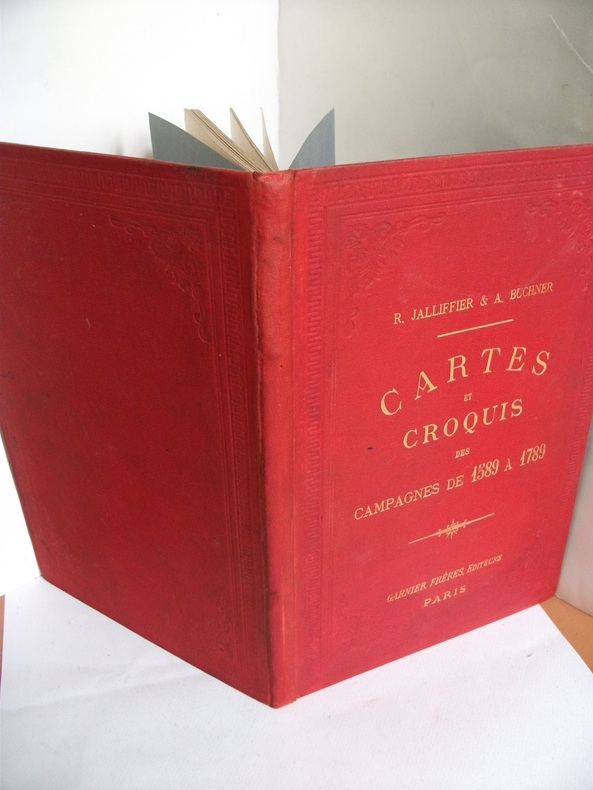
JALLIFFIER R & A BUCHNER
Cartes et croquis des campagnes de 1589 à 1789
Petit in 4 pleine toile rouge d’éditeur titre doré sur le premier plat faux-titre,titre illustré,30 cartes en couleurs,sommaires explicatifs en regard,texte sur 2 colonnes Garnier frères éditeur sans date, Bon exemplaire
Referenz des Buchhändlers : 6199
|
|
|
JALLIFFIER (R.), BUCHNER (A.)
Cartes et croquis des campagnes de 1789 à nos jours.. Avec sommaires explicatifs. 5e édition refondue et complétée.
Paris, Garnier Frères, s.d.; petit in-4, 61 pp., 60 cartes en coul., percaline ocre (rel. de l'éditeur).
Referenz des Buchhändlers : 96254
|
|
|
JAMAS (Abel).
[MARNE] Champagne. Département de la Marne.
[vers 1896]. 395 x 260 mm.
Referenz des Buchhändlers : LBW-8241

|
|
|
James E. Maps & Sketches By A. F. Becke Edmonds
Military Operations France and Belgium 1918 ; the German March Offensive And Its Preliminaries
1995-03-02. Good. Ships with Tracking Number! INTERNATIONAL WORLDWIDE Shipping available. May not contain Access Codes or Supplements. May be re-issue. May be ex-library. Shipping & Handling by region. Buy with confidence excellent customer service! unknown
Referenz des Buchhändlers : 1870423933 ISBN : 1870423933 9781870423939

|
|
|
James P. Warburg; Illustrator 11 Maps
Western Intruders: America's Role in the Far East
Atheneum 1967. Hardcover. Like New. Well-preserved UNREAD 1967 hardcover with dust jacket. Bright unmarked crisp-edged well-bound pages. Jacket shows only very minor shelf-rubbing to its face; no rips creases or bumps. NOT an ex-library book. Very nice copy! Atheneum hardcover
Referenz des Buchhändlers : 2615f
|
|
|
James, Henry
A Little Tour in France
A clean, unmarked book with a tight binding. Bluecover with pasted-down illustration. 9"w x 7 3/4"h. 256 pages.

|
|
|
James, Louis
Budapest (with free CD packed with travel tips)
No marks or inscriptions. No creasing to covers or to spine. A lovely clean crisp tight copy with bright covers and no bumping to corners. 192pp. The book comes with a free CD in a wallet attached to the rear cover, which is packed with practical travel tips - from hotels and eating out to foreign exchange and booking information.

|
|
|
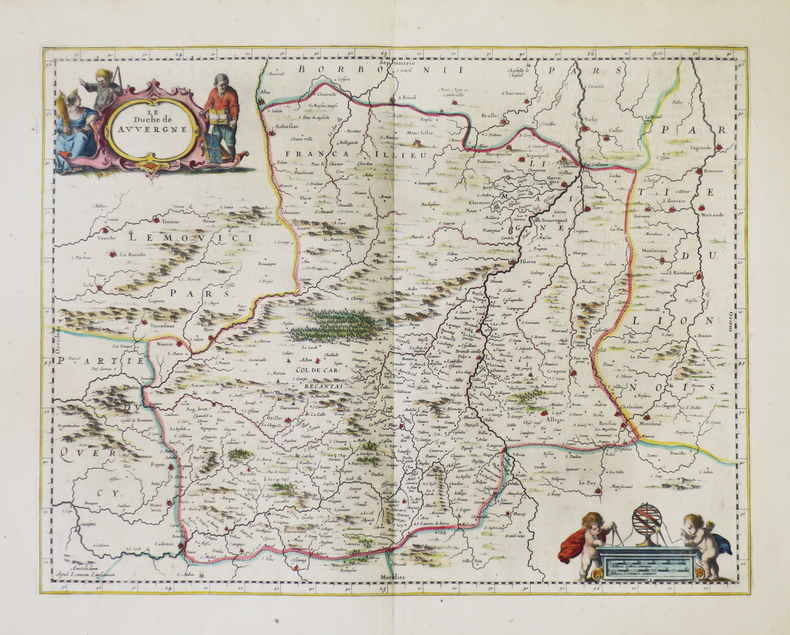
JANSSON (Johannes).
[AUVERGNE] Le duché de Auvergne.
Amsterdam, [1652-1658]. 380 x 494 mm.
Referenz des Buchhändlers : LBW-5000
|
|
|
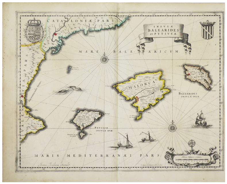
JANSSON (Joannes).
[BALEARES] Insulae Balearides et Pytiusae.
Amsterdam, [circa 1640]. 382 x 498 mm.
Referenz des Buchhändlers : LBW-1476
|
|
|
JANSSON (Johannes).
[CEYLAN/SRI LANKA] Ins. Ceilan quæ incolis Tenarisin dicitur.
[Amsterdam, 1639-1649]. 343 x 499 mm.
Referenz des Buchhändlers : LBW-4874

|
|
|
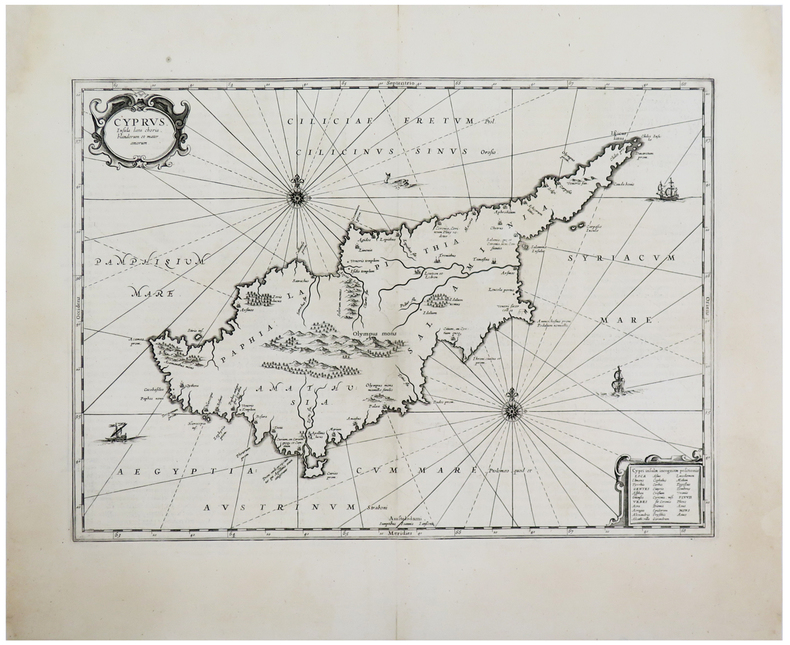
JANSSON (Johannes).
[CHYPRE] Cyprus, insula lœta choris, blandorum et mater amorum.
[Amsterdam, 1657-1658]. 344 x 475 mm.
Referenz des Buchhändlers : LBW-2932
|
|
|
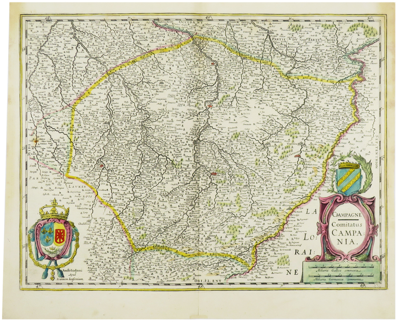
JANSSON (Johannes).
[CHAMPAGNE] Champagne - Comitatus Campania.
Amsterdam, [1633-1636]. 375 x 496 mm.
Referenz des Buchhändlers : LBW-6202
|
|
|
JANNOT (J.-B.).
[CHOCOLAT MENIER] Le Tour du Monde en 120 images. Grand concours du Chocolat Menier.
Paris, Agence Française de Propagande, [1956]. 712 x 720 mm.
Referenz des Buchhändlers : LBW-7927

|
|
|
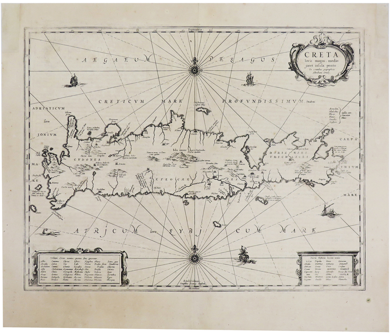
JANSSON (Johannes).
[CRETE] Creta iovis magni, medio jacet insula ponto.
[Amsterdam, 1657-1658]. 377 x 487 mm.
Referenz des Buchhändlers : LBW-2753
|
|
|
JANSSON (Johannes).
[CROATIE] Iadera, Sicum et Ænona vulgo Zara, Sibenico et Nona cum insulis adjacentibus in parte Dalmatiæ boreali.
Amsterdam, [1657]. 420 x 525 mm.
Referenz des Buchhändlers : LBW-2942

|
|
|
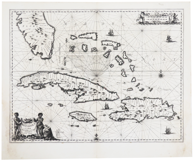
JANSSON (Johannes).
[CUBA/SAINT-DOMINGUE/FLORIDE] Insularum Hispaniolæ et Cubæ cum insulis circum jacentibus accurata delineatio.
[Amsterdam, 1657]. 412 x 533 mm.
Referenz des Buchhändlers : LBW-2937
|
|
|
JANSSON (Joannes).
[ESTONIE/LETTONIE] Nova totius Livoniae accurata descriptio.
[Amsterdam, 1658]. 389 x 514 mm.
Referenz des Buchhändlers : LBW-2759

|
|
|
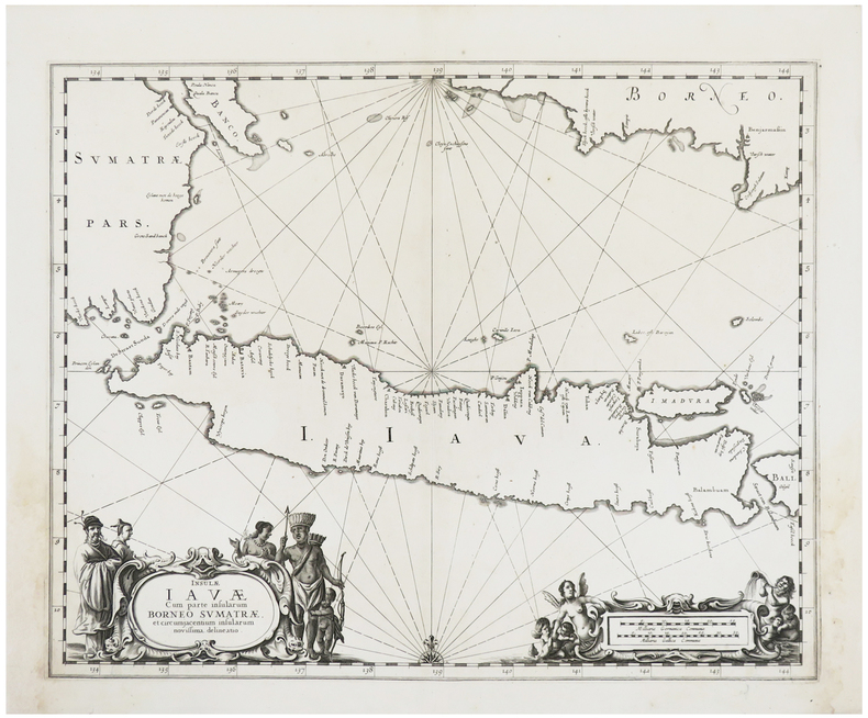
JANSSON (Johannes).
[JAVA] Insulæ Javæ cum parte insularum Borneo Sumatræ, et circumjacentium insularum novissima delineatio.
[Amsterdam, 1657-1658]. 420 x 516 mm.
Referenz des Buchhändlers : LBW-2961
|
|
|
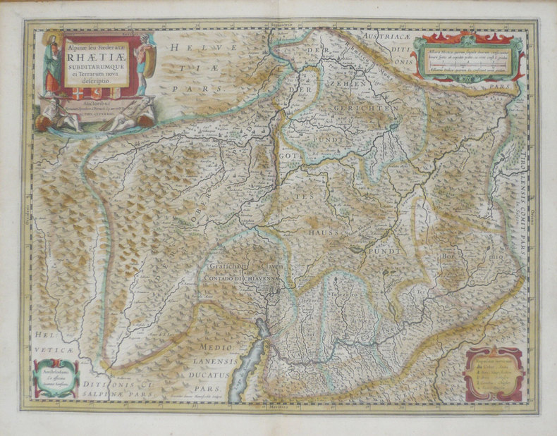
JANSSON (Joannes);
[LOMBARDIE] Alpinae seu foederatae Rhaetiae subditarumque ei terrarum nova descriptio.
Amsterdam vers 1640 397 x 488 mm.
Referenz des Buchhändlers : LBW-1393
|
|
|
JANSSON (Johannes).
[MALTE] Insulæ Melitæ vulgo Malte nova et accurata descriptio.
[Amsterdam, 1657]. 410 x 514 mm.
Referenz des Buchhändlers : LBW-2958

|
|
|
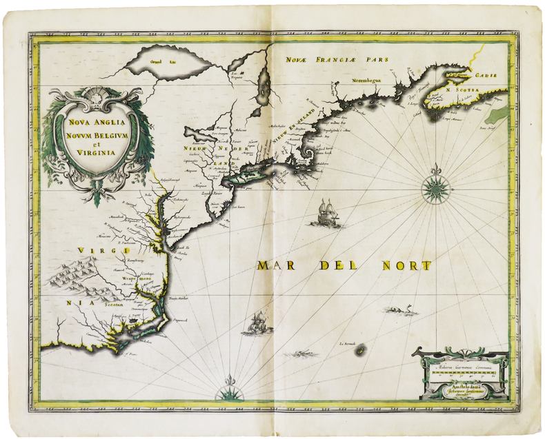
JANSSON (Johannes).
[MANHATTAN] Nova Anglia Novum Belgium et Virginia.
Amsterdam, [1636]. 387 x 503 mm.
Referenz des Buchhändlers : LBW-4982
|
|
|
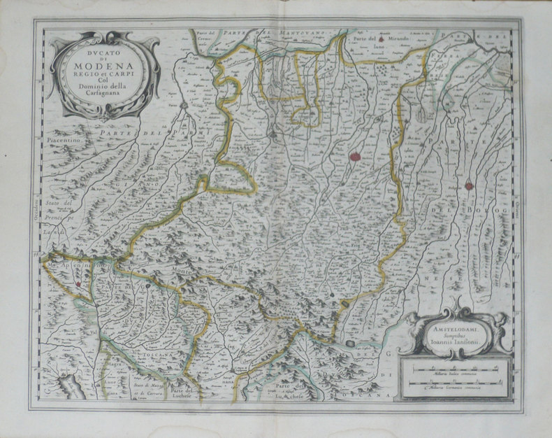
JANSSON (Joannes);
[MODENE] Ducato di Modena Regio et Carpi col dominio della Carfagnana.
Amsterdam 1638 397 x 488 mm.
Referenz des Buchhändlers : LBW-1397
|
|
|
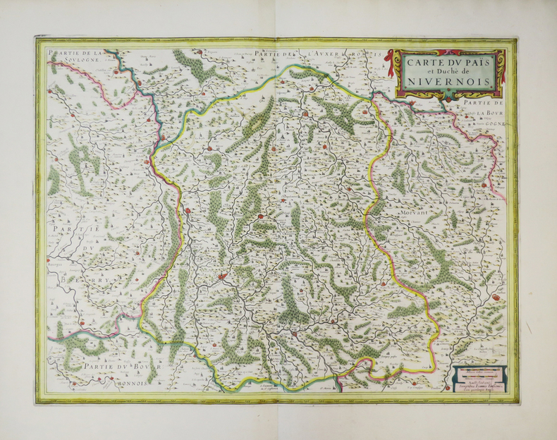
JANSSON (Joannes).
[NIVERNAIS] Carte du païs et duché de Nivernois.
Amsterdam, [circa 1650]. 376 x 495 mm.
Referenz des Buchhändlers : LBW-3815
|
|
|
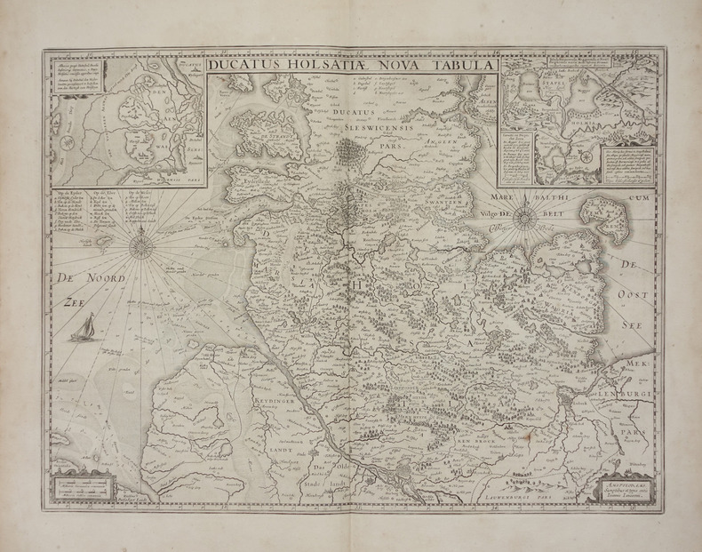
JANSSON (Joannes).
[SCHLESWIG-HOLSTEIN] Ducatus Holsatiae nova tabula.
Amsterdam, [1658]. 380 x 512 mm.
Referenz des Buchhändlers : LBW-2846
|
|
|
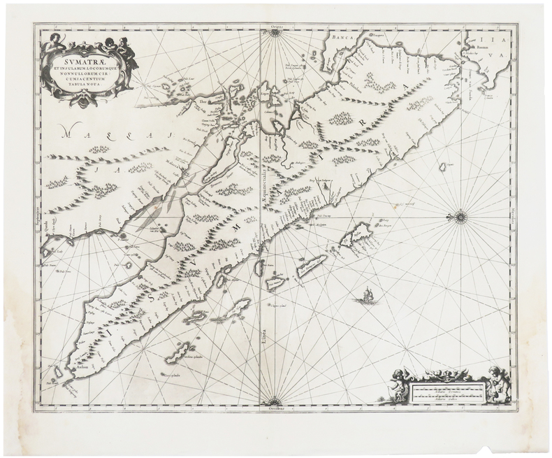
JANSSON (Johannes).
[SUMATRA] Sumatræ et insularum locorumque nonnullorum circumiacentium tabula nova.
[Amsterdam, 1657-1658]. 416 x 516 mm.
Referenz des Buchhändlers : LBW-2960
|
|
|
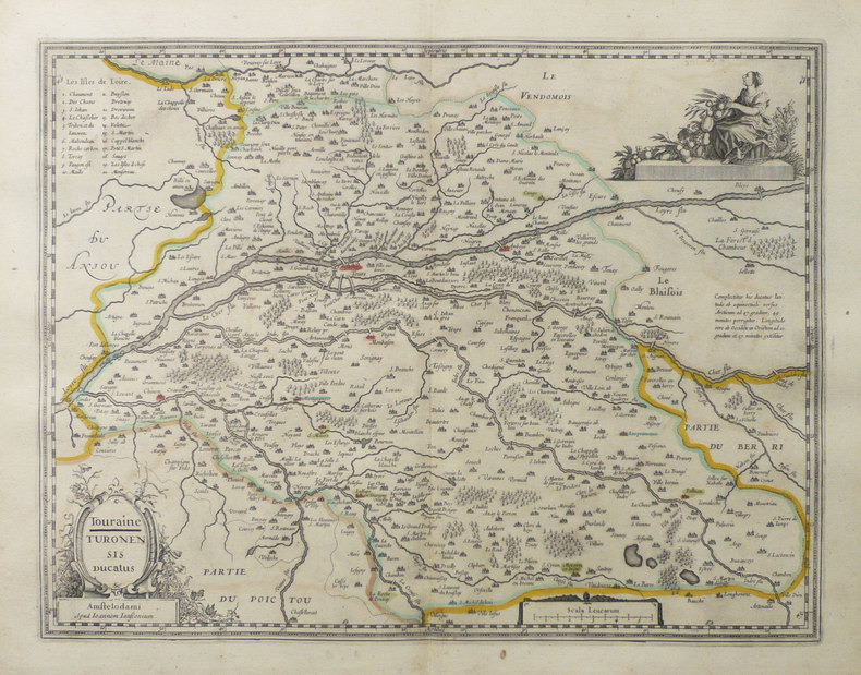
JANSSON (Joannes).
[TOURAINE] Touraine - Turonensis ducatus.
Amsterdam, [vers 1640]. 373 x 491 mm.
Referenz des Buchhändlers : LBW-1480
|
|
|
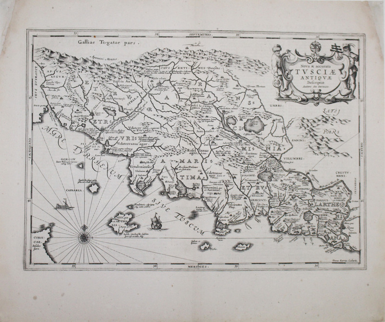
JANSSON (Johannes).
[TOSCANE] Nova & accurata Tusciæ antiquæ descriptio. Autore Ab. Ortelio.
[Amsterdam, 1657-1658]. 347 x 494 mm.
Referenz des Buchhändlers : LBW-2962
|
|
|
JANSSONIUS Joannes (cartographe) - DUVAL Pierre, secrétaire de Monseigneur lévesque dAire
Carte de "LÉVESCHÉ D'AIRE" tracé par le Sieur Pierre du Val, secrétaire de Monseigneur lévesque dAire [circa 1680]
Amsterdam JANSSONIUS Joannes 1658 une carte ancienne gravée sur cuivre (Copper etching) en noir et couleurs d'Epoque. Format : 44,5 cm de haut x 55 cm de large, pli central vertical normal venant d'un atlas( horizontal centerfold), texte en latin au verso, carte ornée de 4 cartouches richement ornés de 20 angelots et dun paysan entrain de ramasser des pommes. carte double page gravée et colorée à la main d'époque, provenance : "Atlas novus, sive theatrum orbis terrarum : In quo Galliae, Helvetiae(Volume II)", 1658 Amsterdam JANSSONIUS Joannes Editeur,
Referenz des Buchhändlers : 24912
|
|
|
JANVIER GÉOGRAPHE
CARTE DU ROYAUME DE HONGRIE DIVISÉ EN HAUTE ET BASSE HONGRIE,TRANSILVANIE, ESCLAVONIE ET CROATIE, dressé par le Sieur JANVIER GÉOGRAPHE - 1771
Paris Lattré 1771 carte ancienne colorée d'époque en vert , rouge et jaune, cartouche non coloré, gravée par Arrivet. Format total : 50 centimètres de haut par 39 centimètres de large, 1771 Paris Lattré Editeur,
Referenz des Buchhändlers : 27418
|
|
|
JANET (G.);
Chasse au lasso.
Paris circa 1860 124 x 165 mm.
Referenz des Buchhändlers : LBW-1256
|
|
|
JANTON Henri
Les emplois non postaux des timbres-poste des territoires français
Le Monde des Philathélistes 1956 1956, Le Monde des Philatélistes, in-12 agrafé de 8 pages, quelques figures noir et blanc exemplaire sur papier ordinaire n°232/500. | Etat : Bon état général (Ref.: J4097)
Referenz des Buchhändlers : 6787
|
|
|
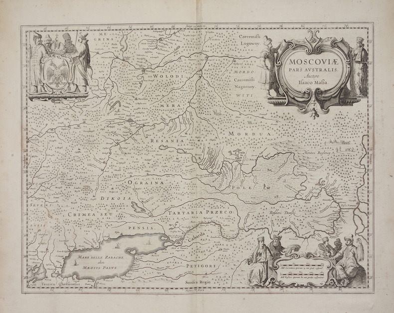
JANSSON (Joannes).
Moscoviae pars australis.
[Amsterdam, 1658]. 382 x 501 mm.
Referenz des Buchhändlers : LBW-2661
|
|
|
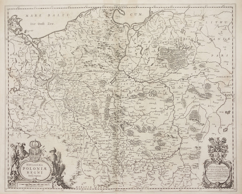
JANSSON (Joannes).
Novissima Poloniae regni descriptio.
[Amsterdam, 1658]. 432 x 539 mm.
Referenz des Buchhändlers : LBW-2739
|
|
|
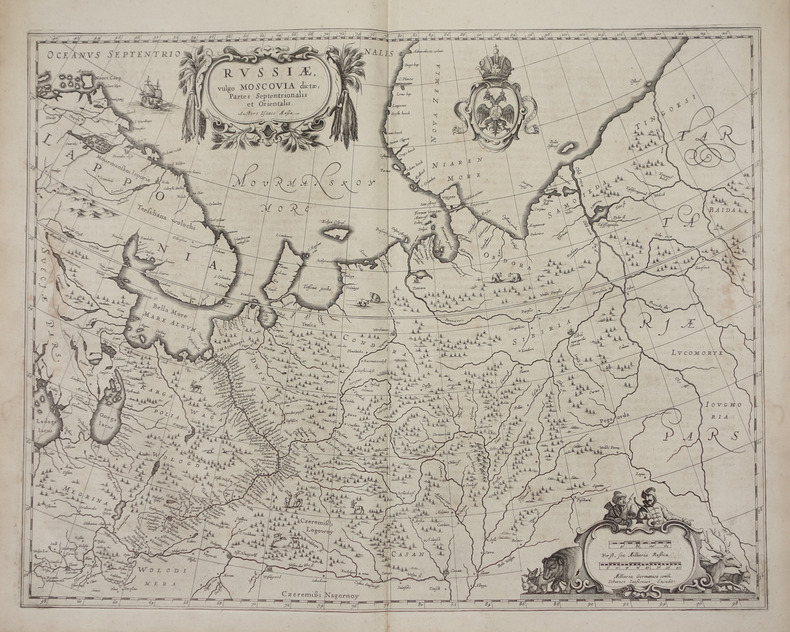
JANSSON (Joannes).
Russiae, vulgo Moscovia dictae, partes septentrionalis et orientalis.
[Amsterdam, 1658]. 438 x 540 mm.
Referenz des Buchhändlers : LBW-2722
|
|
|
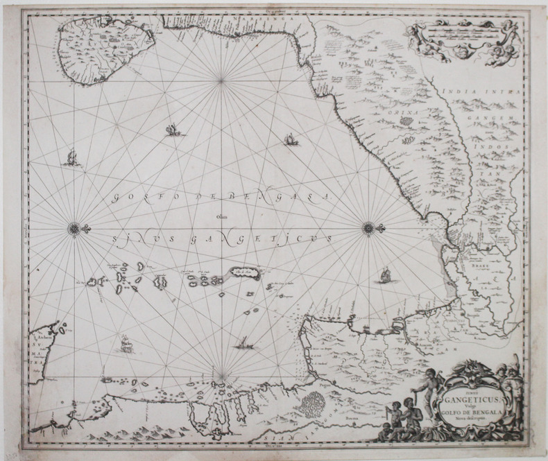
JANSSON (Johannes).
Sinus Gangeticus vulgo Golfo de Bengala nova descriptio.
[Amsterdam, 1657]. 470 x 542 mm.
Referenz des Buchhändlers : LBW-2938
|
|
|
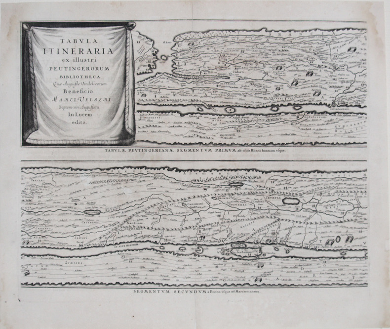
JANSSON (Johannes) & PEUTINGER (Konrad).
Tabula itineraria ex illustri Peutingerorum bibliotheca quæ Augustæ Vindelicorum beneficio Marci Velseri septem-viri Augustani in lucem edita.
[Amsterdam, 1657-1658]. En quatre feuilles, chacune d'environ 398 x 512 mm.
Referenz des Buchhändlers : LBW-2625
|
|
|
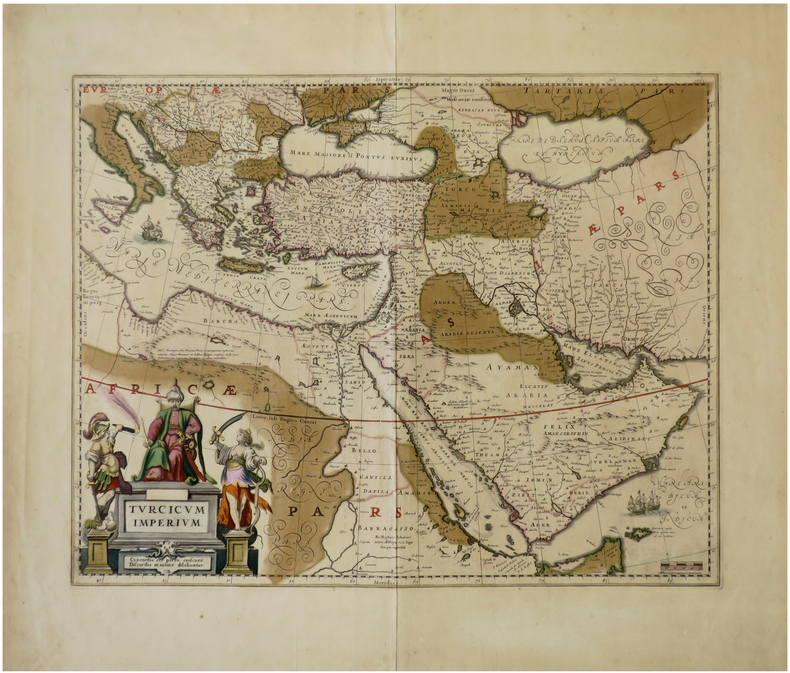
JANSSON (Johannes).
Turcicum Imperium.
[Amsterdam, circa 1640]. 410 x 517 mm.
Referenz des Buchhändlers : LBW-6792
|
|
|
Jan Kostura Charles Davis Maps by David Brawn Edited by Rosamund Brawn
Walk! La Palma
Paperback. New. Revised and updated 4th edition of Walk! La Palma including the latest Tour & Trail Mapping. Walk! La Palma includes 37 fully detailed walking route itineraries. Each walking route itinerary includes:- - walking route summary - ratings for Effort Time Distance Ascents/Descents Refreshments a paperback
Referenz des Buchhändlers : ria9781782750482_new ISBN : 1782750487 9781782750482
|
|
|
Jan Kostura Charles Davis Maps by David Brawn Edited by Rosamund Brawn
Walk! La Palma
Paperback. As New. Revised and updated 4th edition of Walk! La Palma including the latest Tour & Trail Mapping. Walk! La Palma includes 37 fully detailed walking route itineraries. Each walking route itinerary includes:- - walking route summary - ratings for Effort Time Distance Ascents/Descents Refreshments a paperback
Referenz des Buchhändlers : ria9781782750482_rkm ISBN : 1782750487 9781782750482
|
|
|
JANSSON Johann:
Österreich-Ungarn und Böhmen auf alten Landkarten aus dem Novus Atlas Absolutissimus. 15 farbige faksimilierte Karten davon 1 Donau gefaltet 488 x 106 cm sonst 488 x 60 cm.
München: Battenberg 1977. Gr. 2°. 54 x 62 cm. Halbleineneinmappe mit Klappen schwarzem Leinenrücken mehrfarbig marmorierten Überzugspapier sowie schwarzer Deckelvignette mit Golddruck. Faksimilierte Auswahl aus dem 92 Karten umfassenden Deutschland-Band von Janssons monumentalem Atlas dessen deutsche Ausgabe in 10 Bänden im Jahr 1658 in Amsterdam erschienen war. Beigelegt ist ein grossformatiges Textheft mit einer Einführung zum „historischen und kulturellen Hintergrund†von Traudl Seifert damalige Leiterin der Kartensammlung der Bayr. Staatsbibliiothek deren Exemplar als Vorlage für den Nachdruck verwendet wurde und den faksimilierten Texten aus Janssons Atlas zu den entsprechenden Karten. - Klappen mit leichten Knickspuren sonst sehr sauberes dekoratives Exemplar. München: Battenberg [1977]. unknown
Referenz des Buchhändlers : 1329
|
|
|
Jansson, Jan
Nobilis Fluvius Albis maximâ curâ, ex variis famosisque Auctoribus collectus, et in lucem editus. Zweigeteilte in Kupfer gestochene Elbkarte auf 1 Blatt.
[Frankfurt am Main, Merian, 1637]. Je Darstellung 17,5 x 51,5 cm. Fachmännisch gerahmt 56,5 x 65,5 cm (Flachgoldleiste 3,5 cm breit).
Referenz des Buchhändlers : 84923

|
|
|
JANSSONIUS Johannes (1588-1664)
Aegyptus Antiqua divisa in Nomos. Authore P. Duval Abbeviliense…
Orientata con il Nord a destra, la mappa raffigura nel dettaglio la regione compresa tra la valle del Nilo e il Mar Rosso. Dall'Atlas MajorDoppio cartiglio, uno per il titolo e uno per la dedica in francese a "A Monsieur Monsieur Doviat Sgr. de Montreuille, Con.er du Roy, et Maistre Ordinaire en sa Chambre des Comptes Par son Très humble et obéisant Serviteur P. Duval Géographe de sa Maiesté". Johannes Janssonius, figlio dell'editore di Arnhem Jan Janssen, sposò Elisabeth Hondius, figlia di Jodocus Hondius, ad Amsterdam nel 1612. Dopo il suo matrimonio, si stabilì in questa città come libraio ed editore di materiale cartografico. Nel 1618 si stabilì ad Amsterdam accanto alla libreria di Willem Jansz. Blaeu, entrando in una seria competizione. Le sue attività non riguardavano solo la pubblicazione di atlanti e libri, ma anche di mappe singole e un vasto commercio di libri con filiali a Francoforte, Danzica, Stoccolma, Copenaghen, Berlino, Koningsbergen, Ginevra e Lione. Nel 1631 iniziò a pubblicare atlanti insieme a Henricus Hondius. Nei primi anni 1640 Henricus Hondius lasciò l'attività di pubblicazione di atlanti completamente a Janssonius. La concorrenza con Joan Blaeu, figlio e successore di Willem, nella produzione di atlanti spinse Janssonius ad ampliare il suo Atlas Novus finalmente in un'opera di sei volumi, in cui furono inseriti un atlante marino e un atlante del Vecchio Mondo. Dopo la morte di Joannes Janssonius, il negozio e la casa editrice furono continuati dagli eredi sotto la direzione di Johannes van Waesbergen (c. 1616-1681), genero di Joannes Janssonius. Le matrici degli atlanti di Janssonius furono in seguito vendute a Schenk e Valck. Map oriented with north on the right. It presents a colorful and detailed picture of the region between the fertile Nile River valley and the Red Sea. The map is adorned with a strapwork title cartouche with a credit to Pierre du Val. Includes a note in a decorative cartouche: "A Monsieur Monsieur Doviat Sgr. de Montreuille, Con.er du Roy, et Maistre Ordinaire en sa Chambre des Comptes Par son Très humble et obéisant Serviteur P. Duval Géographe de sa Maiesté".Published in Janssonius' Atlas Major. Johannes Janssonius (Arnhem, 1588-1664), son of the Arnhem publisher Jan Janssen, married Elisabeth Hondius, daughter of Jodocus Hondius, in Amsterdam in 1612. After his marriage, he settled down in this town as a bookseller and publisher of cartographic material. In 1618 he established himself in Amsterdam next door to Blaeu’s book shop. He entered into serious competition with Willem Jansz. Blaeu.. His activities not only concerned the publication of atlases and books, but also of single maps and an extensive book trade with branches in Frankfurt, Danzig, Stockholm, Copenhagen, Berlin, Koningsbergen, Geneva, and Lyon. In 1631 he began publishing atlases together with Henricus Hondius. In the early 1640s Henricus Hondius left the atlas publishing business completely to Janssonius. Competition with Joan Blaeu, Willem’s son and successor, in atlas production prompted Janssonius to enlarge his Atlas Novus finally into a work of six volumes, into which a sea atlas and an atlas of the Old World were inserted. After the death of Joannes Janssonius, the shop and publishing firm were continued by the heirs under the direction of Johannes van Waesbergen (c. 1616-1681), son-in-law of Joannes Janssonius. The copperplates from Janssonius’s atlases were afterwards sold to Schenk and Valck. Van der Krogt 1

|
|
|
JANSSONIUS Johannes (1588-1664)
Antiqua Urbis Roma Imago Accuratissima…
Grande pianta della città stampata su due fogli, ispirata alla celebre carta del Pirro Ligorio del 1561.Questa straordinaria ricostruzione di Roma durante il regno di Augusto, arricchita da una cospicua legenda con 269 richiami, costituisce il lavorò più ambizioso contenuto nel Civitates Orbis Terrarum, del quale oltretutto è una delle sole tre mappe a doppio foglio. Incisione in rame, finemente colorata a mano, in eccellente stato di conservazione. Opera tratta dal "Theatrum praecipuarum urbium" celebre teatro delle città del Janssonius, sullo stile del "Civitates Orbis Terrarum" di Braun & Hogenberg. La raccolta, pubblicata ad Amsterdam tra il 1652 ed il 1657, contiene 500 tavole raffiguranti città di ogni parte del mondo. Contrariamente al lavoro degli acerrimi rivali Blaeu, Janssonius si servì per la realizzazione dell'opera delle lastre di precedenti cartografi ed editori. In particolare nel 1653 egli acquisto da Abraham Hogenberg le lastre del "Civitates orbis Terrarum" che incorporò nella sua opera, ristampandole, con alcune modifiche. Per le piante delle città olandesi, ordinò delle nuove lastre basate sull'atlante che Johannes Blaeu diede alla luce nel 1649. Per molte delle opere contenute nel 5° volume, quello dedicato all'Italia e denominato "Theatrum celebriorum urbium Italiae..", si servì delle lastre realizzate da Jodocus Hondius per l'opera "Italia Hodierna.." del 1627. Nella pianta di Roma antica cambia il decoro del cartiglio in alto, mentre in basso ai lati del cartiglio sono aggiunte dei personaggi. Incisione in rame, finemente colorata a mano, in ottimo stato di conservazione. Map of the city printed on two sheets, inspired by the famous work by Pirro Ligorio, printed by Michele Tramezzino in 1561. This extraordinary reconstruction of Rome during the reign of Augustus, enriched by a conspicuous legend with 269 references, constitutes the most ambitious work contained in the Civitates Orbis Terrarum, of which it is one of only three double-sheet maps. Work taken from the "Theatrum praecipuarum urbium" famous theatre of the cities of Janssonius, in the style of Braun & Hogenberg's "Civitates Orbis Terrarum". The collection, published in Amsterdam between 1652 and 1657, contains 500 plates depicting cities from all over the world. Janssonius used the plates of previous cartographers and publishers to create the work. In particular, in 1653 he bought the plates of the "Civitates orbis Terrarum" from Abraham Hogenberg, who incorporated them into his work and reprinted them with some modifications. For many of the works contained in the 5th volume, the one dedicated to Italy and called "Theatrum celebriorum urbium Italiae...", he used the plates made by Jodocus Hondius for the work "Italia Hodierna..." of 1627. In the map of ancient Rome the decoration of the cartouche at the top changes, while at the bottom at the sides of the cartouche are added characters. Copper engraving, finely coloured by hand, in excellent condition.

|
|
 Per e-mail erhalten
 Als pdf-Dokument herunterladen
 RSS feed


