|
MONGINOUX F.
Le bridge ( étude sur la méthode ALBARRAN et NEXON)La déclaration, le black wood, le jeu de la carte.
broché - 18x22,5 - sans date - 127 pp - éditionsdu CEPavec 2 illustrations dans le texte.
书商的参考编号 : 1923
|
|
|
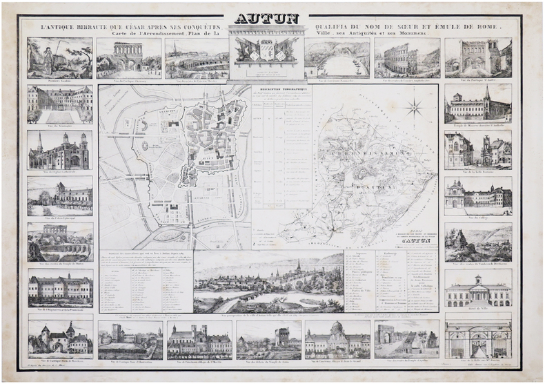
MONI (Claude).
[AUTUN] Autun. L'antique Bibracte que César, après ses conquêtes, qualifia du nom de sœur et émule de Rome. Carte de l'arrondissement, plan de la ville, ses antiquités et ses monumens.
Paris, 1834. 575 x 798 mm.
书商的参考编号 : LBW-7189
|
|
|
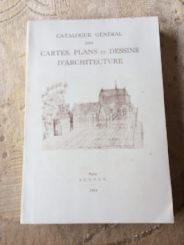
Monique HEBERT et Michel LE MOEL Conservateurs aux Archives Nationales
CATALOGUE général de s CARTES, PLANS et DESSINS D'ARCHITECTURE Tome II Série N Départements Ain à Nord
1964 Paris S.E.V.P.E.N. 1964. Ministère des Affaires Culturelles Direction des Archives de France. In 8° broché de 466 pp. illustré de 20 planches dépliantes. Menus défauts au dos, traces de pliure; Bon exemplaitre sur papier glacé.
书商的参考编号 : 2288
|
|
|
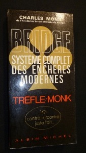
Monk Charles
Bridge, système complet des enchères modernes
Albin Michel Broché 1970 In-8, (21x10.5 cm), broché, couverture illustrée, 276 pages, préface de José le Dentu ; plats légèrement défraîchis, pliures sur le dos, bon état. Livraison a domicile (La Poste) ou en Mondial Relay sur simple demande.
书商的参考编号 : nf186
|
|
|
Monmarche Gaston editor; Fold out Maps Illustrator
Les Guides Bleus: Paris Versailles Saint-Germain Saint-Denis Chantilly Fontainebleau
Librairie Hachette 1934-01-01. Hardcover. Very Good. NICE CONDITION SOFTCOVER BOOK. NO WRITING OR MARKINGS IN TEXT. SIGNED BY PREVIOUS OWNER ON TITLE PAGE. ONLY LIGHT WEAR & MINIMAL FRAYING TO COVER. A CLEAN & SOLID BOOK. Librairie Hachette hardcover
书商的参考编号 : B-1978
|
|
|
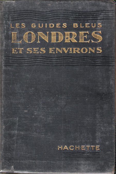
MONMARCHE Marcel et MUIRHEAD Findlay
Les Guides Bleus : LONDRES et Ses Environs . Complet De Sa Carte Dépliante et De Ses Cartes En Couleurs .
Paris Librairie Hachette 1929 In 16 Collection " Les Guides Bleus " . Excursions , nombreux plans de voyage et de villes en couleurs et noir et blanc . Une grande carte dépliante représentant Londres avant la 2° Guerre Mondiale . Index alphabérique . Les endroits et monuments visités sont entourés au crayon . Cartes et Plans .- 252 p. + plans , 400 gr.
书商的参考编号 : 021165
|
|
|
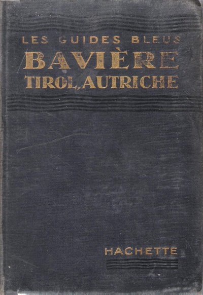
MONMARCHE Marcel , sous La Direction
Bavière , Tirol , Bains De Bohème , Salzbourg , Vienne et Les Alpes Orientales
Collection " Les Guides Bleus " . Excursions , nombreux plans de voyage et de villes en couleurs et noir et blanc . Index . Avec 38 plans et 15 cartes .- 520 p. + plans , 550 gr.

|
|
|
MONMARCHE Marcel , sous La Direction
Bavière , Tirol , Bains De Bohème , Salzbourg , Vienne et Les Alpes Orientales
Paris Librairie Hachette 1914 In 16 Collection " Les Guides Bleus " . Excursions , nombreux plans de voyage et de villes en couleurs et noir et blanc . Index . Avec 38 plans et 15 cartes .- 520 p. + plans , 550 gr.
书商的参考编号 : 015270
|
|
|
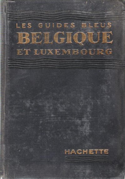
MONMARCHE Marcel , sous La Direction , TILLION Mme E. L.
Belgique et Luxembourg
Collection " Les Guides Bleus " . Excursions , nombreux plans de voyage et de villes en couleurs et noir et blanc , certains dépliants . Complet de sa carte dépliante en fin d'ouvrage . Index .- 444 p. + plans , 550 gr.

|
|
|
MONMARCHE Marcel , sous La Direction , TILLION Mme E. L.
Belgique et Luxembourg
Paris Librairie Hachette 1935 In 16 Collection " Les Guides Bleus " . Excursions , nombreux plans de voyage et de villes en couleurs et noir et blanc , certains dépliants . Complet de sa carte dépliante en fin d'ouvrage . Index .- 444 p. + plans , 550 gr.
书商的参考编号 : 015271
|
|
|
MONMARCHE Marcel et MUIRHEAD Findlay
Les Guides Bleus : LONDRES et Ses Environs . Complet De Sa Carte Dépliante et De Ses Cartes En Couleurs .
Collection " Les Guides Bleus " . Excursions , nombreux plans de voyage et de villes en couleurs et noir et blanc . Une grande carte dépliante représentant Londres avant la 2° Guerre Mondiale . Index alphabérique . Les endroits et monuments visités sont entourés au crayon . Cartes et Plans .- 252 p. + plans , 400 gr.

|
|
|
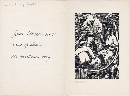
Monneret, Jean
Jean Monneret : carte de voeux pour l'année 1959 et gravure originale
1959 Carte de voeux de Jean Monneret pour l'année 1959. 27 x 18,5 cm, 2 ff., avec en page 3 une gravure sur bois originale en noir (18,5 x 12,5 cm) signée à la mine de plomb.
书商的参考编号 : 1062
|
|
|
MONNEY Jean-Jacques
Jean-Jacques Rousseau, sa vie, son oeuvre, racontées en un siècle de cartes postales.
Slatkine 1994 Slatkine, 1994, 130 p., broché oblong, environ 15x21cm, coins des plats légèrement cornés, un tampon d'appartenance et un ex-libris contrecollé sur la page de garde, bon état pour le reste.
书商的参考编号 : 103174
|
|
|
MONNIER (Paul).
[LA CIOTAT/CASSIS/PORT-MIOU] Plan des environs de La Ciotat, de Cassis et de Port-Miou (littoral du dép.t des Bouches du Rhône).
[Paris], Dépôt-Général de la Marine, 1843. 618 x 910 mm.
书商的参考编号 : LBW-8255

|
|
|
MONNIER (Paul).
[MARSEILLE & SAINT-TROPEZ] Carte des côtes méridionales de France. Partie comprise entre Marseille et S.t Tropez.
[Paris], Dépôt des Cartes et Plans de la Marine, 1868-1889. 622 x 944 mm.
书商的参考编号 : LBW-8312

|
|
|
MONNIER (Paul).
[MARSEILLE] Plan des ports de Marseille.
[Paris], Dépôt des Cartes et Plans de la Marine, 1874-1887. 925 x 620 mm.
书商的参考编号 : LBW-8313

|
|
|
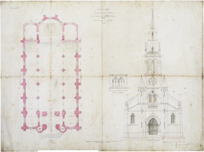
MONNIOT (Nicolas-Henri).
[HAUTE-SAÔNE] Haute-Saône. Arrondissement de Gray. Commune de Confracourt. Construction d'une église.
Châtillon-sur-Seine, 20 juillet 1858. 3 feuillets de toile à calquer de 51,4 x 67 cm.
书商的参考编号 : LBW-7423
|
|
|
Mont ATHOS par Fabian DA COSTA.
Florilège du Mont Athos. Richement documenté (héliogravures, cartes).
Presses de la Renaissance 2005. Bel exemplaire relié, reliure souple avec rabats, gd in-8 carré, 276 pages avec table.
书商的参考编号 : AUB-6823
|
|
|
MONT DORE. . .
Carte couleurs du Mont Dore au 1/40 000e. Sans date.
Une feuille 49x62 cm repli?e sous couverture.
|
|
|
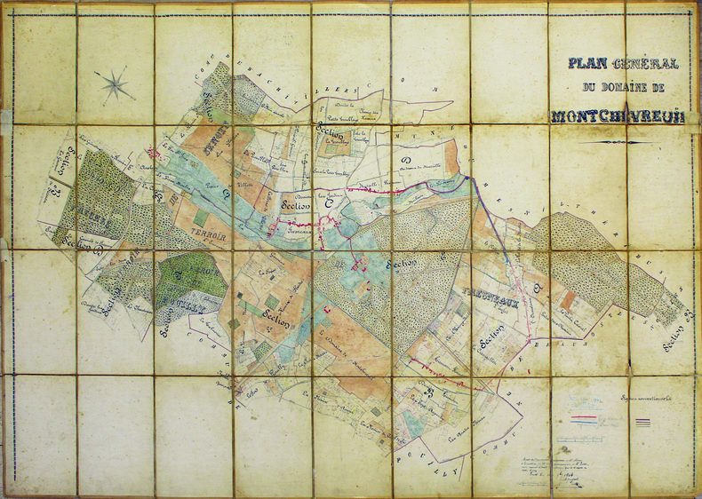
MONTCHEVREUIL. MANUSCRIT.
Plan général du domaine de Montchevreuil.
1904. En 36 sections sur toile à calquer, montées sur toile et pliées formant une carte de 1,03 x 1,55 m.
书商的参考编号 : LBW-4133
|
|
|
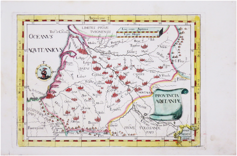
MONTECALERIO (Giovanni).
[AQUITAINE] Provincia Aquitaniæ.
[Milan, 1712]. 224 x 316 mm.
书商的参考编号 : LBW-8132
|
|
|
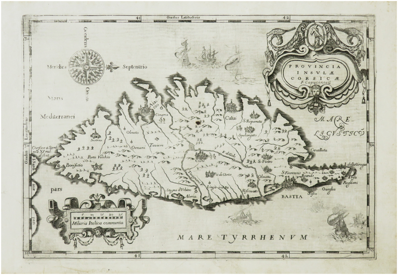
MONTECALERIO (Giovanni).
[CORSE] Provincia insulæ Corsicæ.
[Rome ou Turin, entre 1643 et 1654]. 220 x 318 mm.
书商的参考编号 : LBW-7406
|
|
|
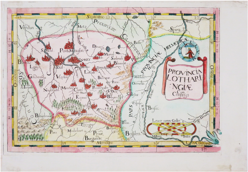
MONTECALERIO (Giovanni).
[LORRAINE] Provincia Lotharingiæ cum confinÿs.
[Milan, 1712]. 222 x 330 mm.
书商的参考编号 : LBW-8118
|
|
|
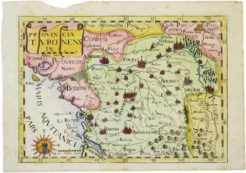
MONTECALERIO (Giovanni).
[TOURAINE] Provincia Turonensis.
[Milan, 1712]. 232 x 333 mm.
书商的参考编号 : LBW-4951
|
|
|
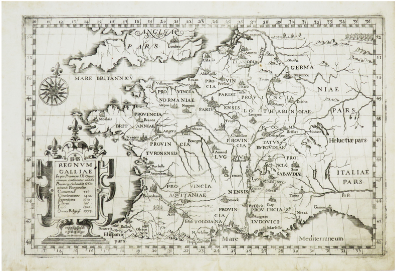
MONTECALERIO (Giovanni).
Regnum Galliæ in quo provinciæ IX Capucinorum continentur additis provincys Sabaudiæ & Comitatus Burgundiæ.
[Rome ou Turin, entre 1643 et 1654]. 213 x 325 mm.
书商的参考编号 : LBW-7253
|
|
|
MONTESQUIEU Charles Louis de Secondat:
Oeuvres de Monsieur de Montesquieu, nouvelle édition, revue, corrigée, et considérablement augmentée par l'auteur.
A Amsterdam, et à Leipsick, Chez Arkstée et Merkus, 1758. 3 volumes in-4 de [4]-LXXXVI-527; [4]-XVI-634; [4]-648 pages, plein veau marbré, dos à nerfs ornés de filets et fleurons dorés, étiquette de titre et tomaison rouge et brune, tranches marbrées.
书商的参考编号 : 20427
|
|
|
MONTESQUIEU Charles Louis de Secondat:
Oeuvres: De l'esprit des loix. Considérations sur les causes de la grandeur des romains, et de leur décadence. Lettres Persannes.
Londres 1757, Paris, Huart, 1755 et Cologne, Pierre Marteau, 1754. 6 volumes in-12 reliés en plein veau moucheté brun, dos à nerfs ornés de filets et fleurons dorés, pièce de titre en maroquin rouge, de tomaison en maroquin vert olive, tranches jaspées bleu.
书商的参考编号 : 21001

|
|
|
Montgomerie Captain T. G.; et al
INDIAN ATLAS Sheet No. 73 Scale 4 Miles= 1 inch. Parts of Districts Amraoti & Wim Indur & Sirpur Tandur Wardha Bandara Chanda Nagpur.
Bombay: John Walker Thacker & Co. ltd 1903. An original large antique engraved map Part of the Indian Atlas series first dated 1868 John Walker then 1875 Secretary of State for India but with a later date of 1904; with hand-colouring in outline boundaries. Dissected into 18 parts and mounted on linen 680mm x 1035mm. Marbled paper outer panels with Thacker and Co. label. Condition is very good with a little wear only a couple of very small holes at corner folds affecting linen only. An impressive map. Soft Cover. Very Good. John Walker (Thacker & Co. ltd) Paperback
书商的参考编号 : 017017

|
|
|
MONTGOMERY (maréchal, vicomte d'Alamein, K.G
Mémoires du maréchal Montgomery, vicomte d'Alamein, K.G. 14 cartes dans le texte.
Mémoires du maréchal Montgomery, vicomte d'Alamein, K.G. Cartes. 1958.
书商的参考编号 : AUB-6812
|
|
|
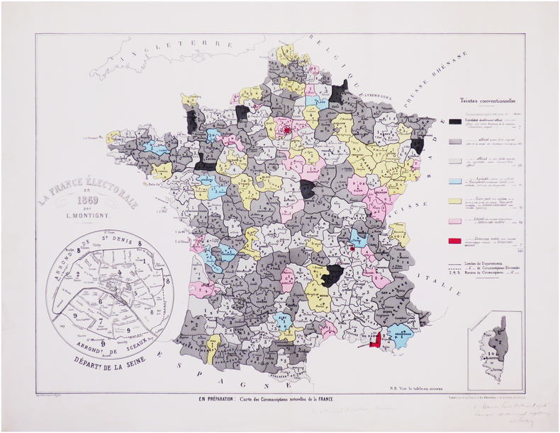
MONTIGNY (Léon).
[ÉLECTIONS LÉGISLATIVES de 1869] La France électorale en 1869.
Paris, Lanée & Le Chevalier, 1869. 418 x 560 mm.
书商的参考编号 : LBW-7599
|
|
|
Moon Nicholas & Sketch Maps by DL. Indge and CH. Edwards D. L. C. H.
Chilterns Walks for Motorists: Northern Area Warne walking guides
Frederick Warne Publishers Ltd 05/25/1979. Paperback. Used; Good. WE SHIP WITHIN 24 HRS FROM LONDON UK 98% OF OUR ORDERS ARE RECEIVED WITHIN 7-10 DAYS. We believe you will be completely satisfied with our quick and reliable service. All orders are dispatched as swiftly as possible! Buy with confidence! Frederick Warne Publishers Ltd paperback
书商的参考编号 : 3640416 ???????? : 0723221448 9780723221449
|
|
|
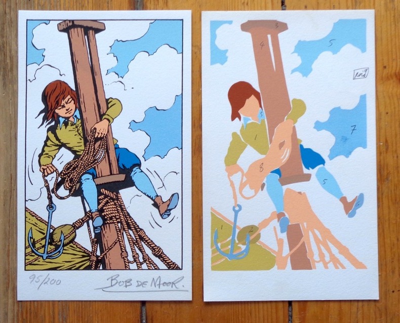
Moor Bob de:
Sérigraphie originale en 2 états.
Lausanne, La Marge. Sérigraphie au format 12 x 20 cm. En deux états, soit un essai des passages couleurs et la version définitive, au tirage limité à 200 exemplaires numérotés, la nôtre numéro 95.
书商的参考编号 : 6313
|
|
|
MOore, James
Sailing on Continental Lakes
No marks or inscriptions. Clean bright boards with no bumping to corners. Dust jacket not price clipped but crease on dust flap. A clean tight copy. Light foxing to page edges and end papers. 204pp. A scarce book. A complete guide to lake holidays on 30 of the large and small lakes in Switzerland, Germany and Austria.

|
|
|
Moore, W. G.
A Dictionary of Geography: Definitions and Explanations of Terms Used in Physical Geography
184 pages, illustrated, page edges browned, covers detached, spine faded, (Penguin Reference Books ; R2). eng
|
|
|
Moorehead Alan; Illustrated with maps and plates. Illustrator
Fatal Impact The; An Account of the Invasion of the South Pacific 1767-1840
The Reprint Society; London. Used - Good. Ships from the UK. Shows some signs of wear and may have some markings on the inside. 100% Money Back Guarantee. Your purchase also supports literacy charities. The Reprint Society; London unknown
书商的参考编号 : GRP97819731
|
|
|
Moorehead Alan; Illustrated with maps and plates. Illustrator
Fatal Impact The; An Account of the Invasion of the South Pacific 1767-1840
The Reprint Society; London 1967-01-01. Hardcover. Good/good. Binding: Hardback ---Publisher: The Reprint Society ---Date: 1967 ---Edition: ---Pages: 230 ---Condition: Good ---DJ Condition: Good ---Description: All of the internal pages are unmarked uncreased and tightly bound the dust jacket is unclipped and comes with a protective plastic cover over it no stamps or inscriptions the only flaws are some light marks to the dust jacket. MOST OF OUR BOOKS ARE SHIPPED WITHIN 1 WORKING DAY OF PURCHASE. . BUY WITH CONFIDENCE - WE UPLOAD A SELECTION OF HIGH QUALITY PHOTOGRAPHS WITH EACH LISTING HOWEVER IF NOT ALREADY PRESENT PHOTOGRAPHS OF ANY OF OUR TITLES CAN BE PROVIDED BY REQUEST VIA E-MAIL.B00200H6GE The Reprint Society; London hardcover
书商的参考编号 : SKU1030258

|
|
|
MORA P. E.
Tous les jeux de cartes et leurs règles.
Paris, Bornemann, Ulisse Editions, 1995. 15 x 21, 132 pp., quelques illustrations, broché, très bon état.
书商的参考编号 : 98586 ???????? : 285182516
|
|
|
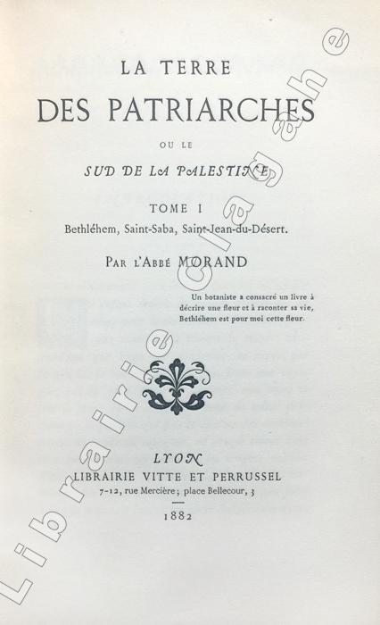
Morand (Abbé Louis) :
La Terre des Patriarches ou le sud de la Palestine.
Lyon, Vitte et Perrussel, (imprimerie Alf. Louis Perrin), 1882-1883 ; 2 tomes in-16 (184 mm), brochés ; XXV, 414, [1] marque d'imprimeur ; XII, 213 pp., 3 planches hors texte dont 2 dépliantes (plans et carte) ; couverture gris-bleu.
书商的参考编号 : 21824
|
|
|
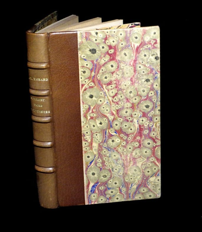
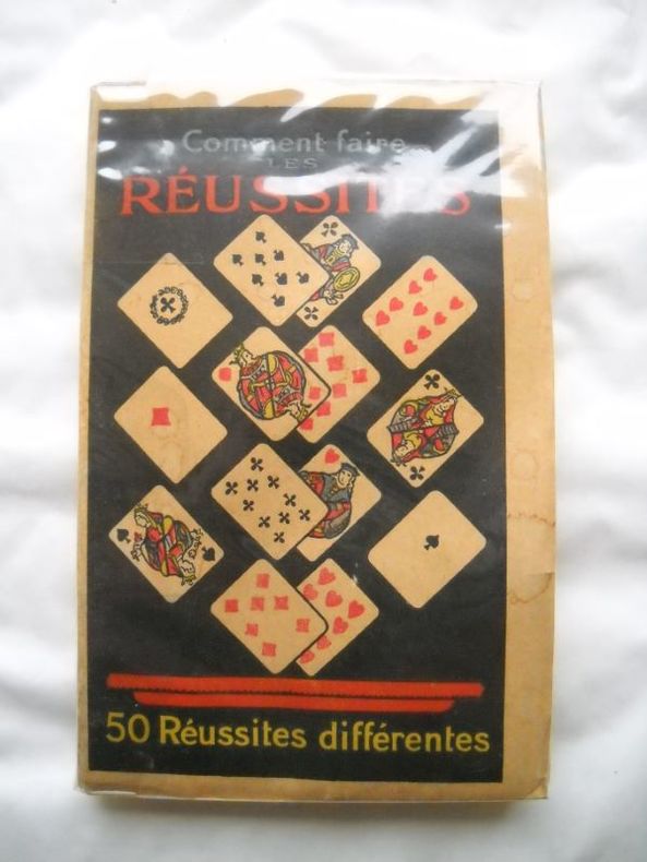
MORAND (P.-H.).
Comment faire les réussites - 50 réussites différentes.
Paris, Librairie Bernardin-Béchet, s.d. [circa 1950]. Un vol. au format in-16 (152 x 98 mm) de 111 pp. Reliure postérieure de demi-chagrin glacé havane, filet vertical à froid porté sur les plats, dos à nerfs orné de filets gras à froid, titre doré, premier plat de couverture conservé.
书商的参考编号 : 22450
|
|
|
MORAND P.-H.
Comment faire les réussites. 50 réussites différentes.
broché - 10x15 - 112 pp - 1928 - librairie BERNARDIN-BECHET, Paris. Illustrations hors texte.
书商的参考编号 : 7209
|
|
|
MOrath, Inge and Miller, Arthur
Chinese Encounters
Slight discoloration to corner of ffep. No other marks or inscriptions. Dust jacket price clipped and with a number of small tears to the edges. A clean tight copy. 255pp.

|
|
|
MORBIHAN. . .
Carte d?partementale couleurs. Sans date.
Une feuille 76x56 cm repli?e sous couverture.
|
|
|
MORBIHAN...
Carte du d?partement du Morbihan. Petit Atlas National. Sans date.
Carte 25x32 cm. Quelques rousseurs
|
|
|
Mordal Jacques - illustrations en couleurs G. de Sainte-Croix - cartes et silhouettes de Roseline Cras
Histoires de la flotte française de combat
Casablanca Publedit 1959 - in-8 - Reliure éditeur, avec jaquette illustrée - 445pages illustrations en couleurs G. de Sainte-Croix, cartes et silhouettes de Roseline Cras - Jaquette défraichie sinon très frais intérieurement - Envoi rapide et soigné
书商的参考编号 : 3147
|
|
|
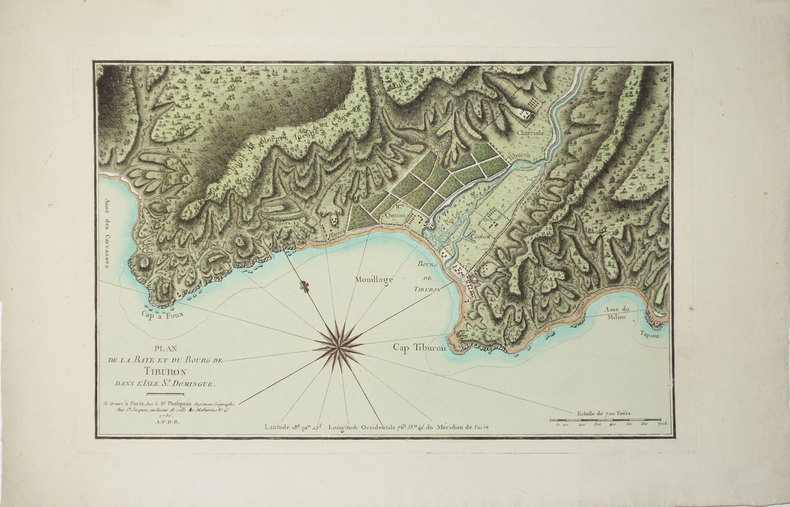
MOREAU DE SAINT-MERY (Médéric-Louis-Elie).
[HAITI] Plan de la baye et du bourg de Tiburon dans l'isle St. Domingue.
Paris, Sr. Phélipeau, 1786 [1791]. 242 x 371 mm.
书商的参考编号 : LBW024a1
|
|
|
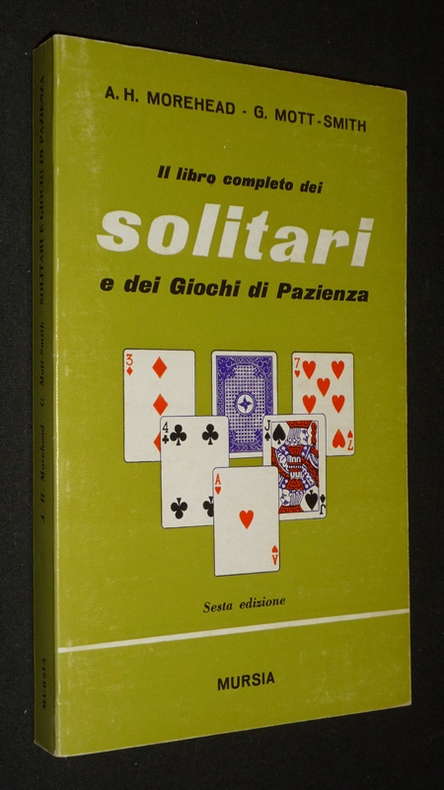
Morehead A. H.,Mott-Smith G.
Il libro completo dei solitari e dei giochi di pazienza
Mursia Dos carré collé 1975 In-8 (11,5 x 19 cm), dos carré collé, 223 pages, texte en italien ; marques de frottement au premier plat, traces au dos et quatrième plat, assez bon état général. Livraison a domicile (La Poste) ou en Mondial Relay sur simple demande.
书商的参考编号 : vb1767
|
|
|
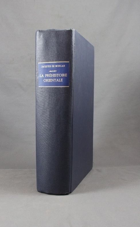
MORGAN Jacques de:
La préhistoire orientale.
Paris, Lib. orientaliste Paul Geuthner, 1925. 3 tomes en 1 vol. in-8 de XXXV-332-[2]-VI-438-VI-458 pages, reliure moderne pleine percaline bleue nuit, couverture conservée.
书商的参考编号 : 1591
|
|
|
Morgan Llywelyn Maps by Terry Foley
1014: Brian Boru & the Battle for Ireland
Paperback. New. The date was Good Friday April 23rd in the Year of Our Lord 1014. The most ferocious battle ever fought in Ireland was about to begin. In the three decades since Morgan Llyweyln wrote the bestselling novel Lion of Ireland she has studied the legendary life of Brian Boru High King of Ireland. Of paperback
书商的参考编号 : ria9781847175571_new ???????? : 1847175570 9781847175571

|
|
|
Morgan Llywelyn Maps by Terry Foley
1014: Brian Boru & the Battle for Ireland
Paperback. As New. The date was Good Friday April 23rd in the Year of Our Lord 1014. The most ferocious battle ever fought in Ireland was about to begin. In the three decades since Morgan Llyweyln wrote the bestselling novel Lion of Ireland she has studied the legendary life of Brian Boru High King of Ireland. Of paperback
书商的参考编号 : ria9781847175571_rkm ???????? : 1847175570 9781847175571
|
|
|
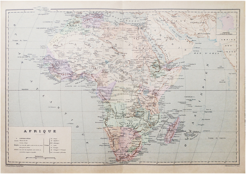
MORIEU (Émile).
Afrique.
Paris, [1890]. 275 x 405 mm.
书商的参考编号 : LBW-8651
|
|
 ?????????
 ?????PDF???
 RSS feed


