|
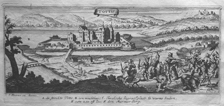
PEETERS (Jan);
[TATA] Tottis.
circa 1690 101 x 248 mm.
Referencia librero : LBW027a0
|
|
|
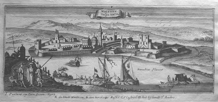
PEETERS (Jan);
[VAC] Waitzen vulgo Vacia.
circa 1690 105 x 256 mm.
Referencia librero : LBW0279a
|
|
|
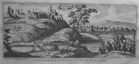
PEETERS (Jan);
[VESZPREM] Vesprin.
circa 1690 101 x 245 mm.
Referencia librero : LBW0279f
|
|
|
PEETERS (Jan);
[VISEGRAD] Vicegrad.
circa 1690 103 x 265 mm.
Referencia librero : LBW0279b

|
|
|
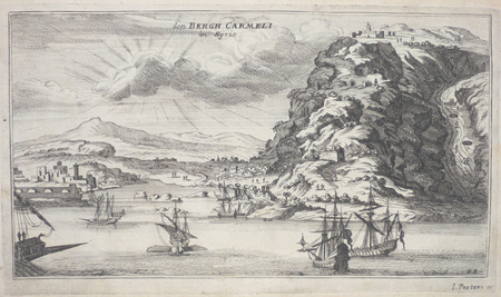
PEETERS (Jan);
Den Bergh Carmeli in Syrien.
circa 1690 133 x 239 mm.
Referencia librero : LBW02509
|
|
|
PEETERS (Jan);
Jerusalem.
circa 1690 115 x 258 mm.
Referencia librero : LBW024dc

|
|
|
PEETERS (Jan);
Ramma in Arabia.
circa 1690 115 x 256 mm.
Referencia librero : LBW024de
|
|
|
Peffer Nathaniel; Nevins Allan editor; Maps Illustrator
The Far East Hardcover Jan 01 1958 Peffer Nathaniel
The University of Michigan Press 1958-01-01. Hardcover. Like New. A used like new hardcover book no writing or marks in very good dust wrapper with light edge wear placed in sleeve 1958. The University of Michigan Press hardcover
Referencia librero : 3D-J2KG-0TNJ
|
|
|
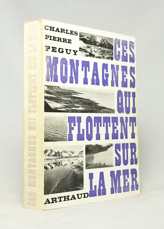
PEGUY Charles-Pierre:
Ces montagnes qui flottent sur la mer.
B. Arthaud, 1969. In-8 broché de 318-[4] pages, couverture imprimée en deux tons, dos passé.
Referencia librero : 16671
|
|
|
PEIGNOT (Gabriel)
Recherches historiques et littéraires sur les danses des morts et sur l'origine des cartes à jouer.
Dijon et Paris, Lagier, 1826. in-8 (13 x 20,8 cm), LXpp. -367 pages - 5 planches. Reliure demi-chagrin lie-de-vin, coins, dos à nerfs, fleurons dorés, couverture conservée. (Reliure postérieure).
Referencia librero : 26365
|
|
|
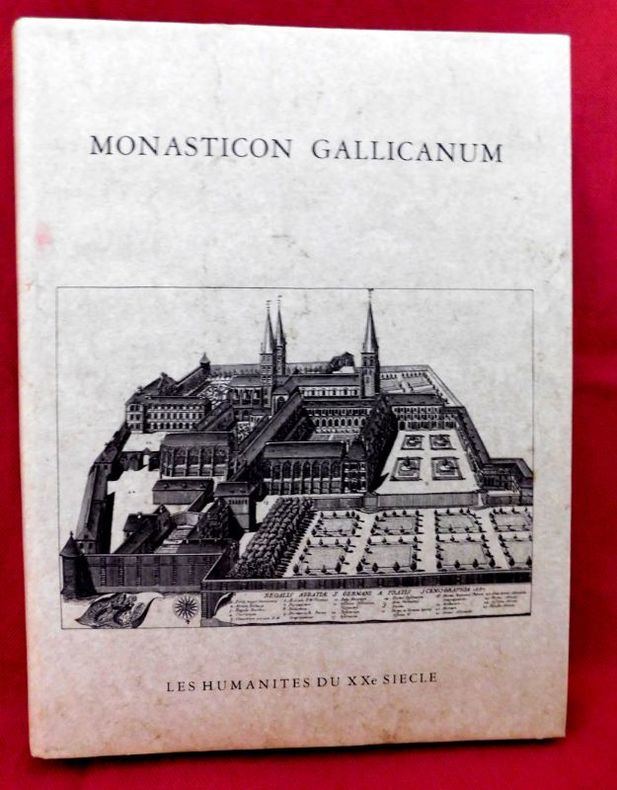
Peigné-Delacourt - Delisle ( Léopold )
Monasticon Gallicanum Collection de 168 Planches de vues Topographiques représentant Les Monastères de l'Ordre de Saint-Benoit Congrégation de Saint Maur Avec Deux Cartes des établissements Bénédictins en France
P., Les Humanistes du XXe siècle, 1983., Etat : Bon. Petit in-folio rel., pleine toile grise d'édition (sans jaq.), titre doré au 1er plat, 68 pp, 168 gravures (vues topograhiques) et 2 cartes doubles mobiles de la France. Très bonne condition. Réimpression anastasique de l'édition de Paris, parue chez Victor Palmé en 1871.
Referencia librero : 17053
|
|
|
PEIGNÉ-DELACOURT ; GERMAIN, Michel Dom.
Monasticon Gallicanum. Collection de 168 planches de vues topographiques des Monastères Bénédictins de la Congrégation de Saint-Maur. Avec deux cartes des établissements de l'Ordre de Saint-Benoît. COMPLET.
Paris, Librairie de Féchoz & Letouzey, 1882. 306 x 232 mm, (1) f. blanc, L-16 pp., 1 carte et 169 planches dont 1 carte : pl. N° 3. Reliure cartonnée restaurée, décharge et rousseurs sur premier et dernier feuillet blanc, pl. 89 : claires rousseurs dans les marges, claires rousseurs sur page de faux-titre, très bel état. COMPLET des 168 vues et 2 cartes. Bel exemplaire.
Referencia librero : 7917

|
|
|
PELET (Lt. Général)
[Carte géographique]. Sens.
Paris, Dépôt de la Guerre, Dumaine, (après 1852). 83 x 52,5 cm au cadre. Entoilée, repliée au format in-8.
Referencia librero : 19746

|
|
|
PELET (Lt. général)
Carte des environs d'Oran et de Mers-el-kébir dressée au Dépôt général de la Guerre par ordre de M. le Maréchal duc de Dalmatie.
1834 21 sections montées sur toile et pliées formant une carte de 630 x 940 mm. P. 1834
Referencia librero : 16320
|
|
|
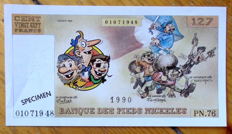
Pellos René:
Banque des Pieds Nickelés - Billet de 127 francs.
Editions Vent d'Ouest. Faux billet de banque, publié à l'occasion de l'intégrale chez Vent d'Ouest.
Referencia librero : 8571
|
|
|
Pennsylvania The Woman'S Club Of Mercersburg; Maps Photos Illustrator
Old Mercersburg Pennsylvania
Williamsport PA: Grit Publishing Co 1949. Hardcover. Near Fine/No Jacket as issued. 9.1 x 6.5 x 1.1. "Nice Firm Clean copy ! 219 pages. . ISBN: B000K5VPM2. Catalogs: History:. Grit Publishing Co hardcover
Referencia librero : 126392
|
|
|
Pennsylvania Maps Sanborn Map Company
Sanborn Map of Clarion PA for the Exclusive use of M. M. & Louis Kaufman Agents
New York: Sanborn Map Company 1906. Paperback. Very Good. Published 1906 folio 21 inches tall cloth backed gray printed original stiff wraps 8 double-page hand colored maps each measuring 24.5 x 21 inches very good condition and very rare. Sanborn Map Company paperback
Referencia librero : H4249

|
|
|
Pennsylvania Turnpike.
THE PENNSYLVANIA TURNPIKE.
13p. Pagination includes wraps. Illustrated with photographs, drawings and maps. Tall thin 8vo. Original pictorial wraps. Lists Interchanges, tunnels and service stations. PA PAMPH 20_1 BX7 x 3c.
|
|
|
Peper George; photographs by Brian D. Morgan James Moriarty and Anthony Roberts. Maps by Elizabeth Peper
The Courses of the PGA Tour
New York 1988. Updated Edition. Fine/Fine. Large 4to. 304pp index. 100s of colour photos. Almost as new gift condition. unknown
Referencia librero : 24949 ISBN : 0810909944 9780810909946

|
|
|
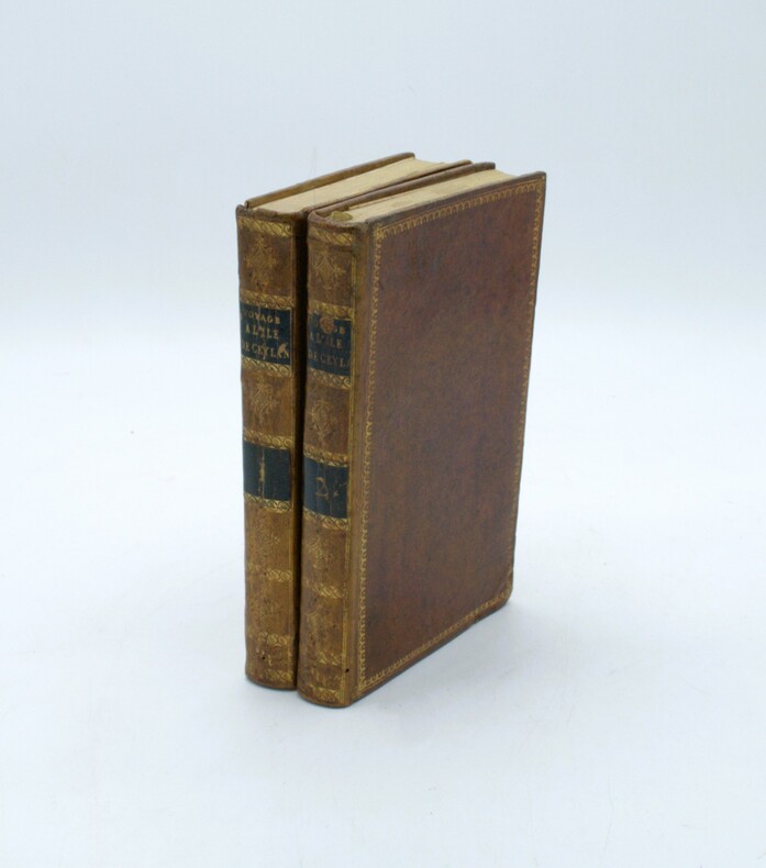
PERCIVAL, Robert.
Voyage à l'île de Ceylan fait dans les années 1797 à 1800; contenant l'histoire, la géographie et la description des moeurs des habitants, ainsi que celle des productions naturelles du pays...
Paris, Dentu, an XI (1803). 2 volumes in-8 (191 x 124 mm). 4 cartes et plans repliés hors texte : une carte de l'île de Ceylan par Arrowsmith et de la pêche des perles et les plans des ports de Trinquemale et Colombo, basane mouchetée de l'époque, dos lisses ornés avec pièces de titre et tomaison, dentelles dorées sur les plats, frottements et vieille épidermure au tome 2.
Referencia librero : PHO-1636
|
|
|
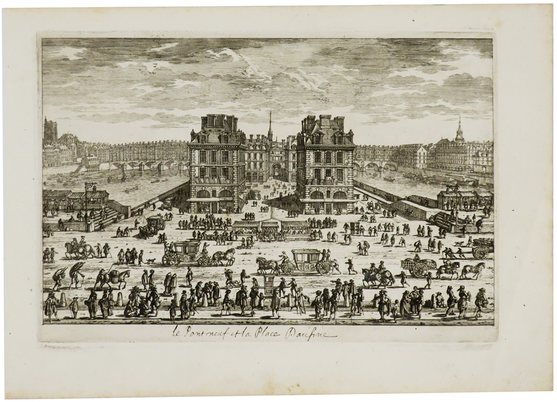
PERELLE (Gabriel).
[Le Pont Neuf et la place Daufine].
[Paris, circa 1690]. 183 x 274 mm.
Referencia librero : LBW-730
|
|
|
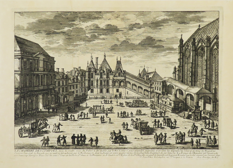
PERELLE (Gabriel).
[PALAIS DE JUSTICE] La Chambre des Comptes.
Paris, N. Langlois, [circa 1680]. 212 x 298 mm.
Referencia librero : LBW-4942
|
|
|
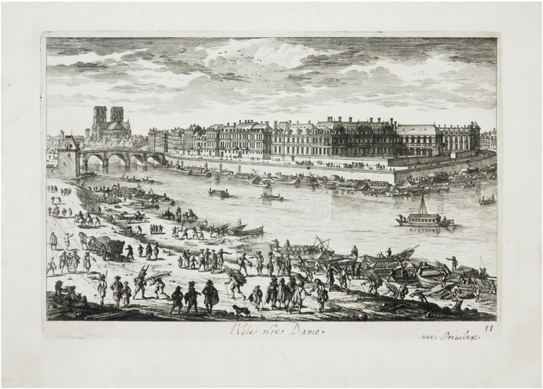
PERELLE (Gabriel).
[ÎLE SAINT-LOUIS] L'Isle nre Dame.
[Paris, N. Langlois, circa 1690]. 182 x 272 mm.
Referencia librero : LBW-7851
|
|
|
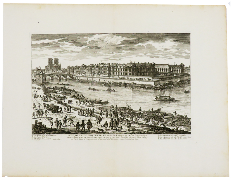
PERELLE (Gabriel).
Veue de l'isle Nostre Dame et de la maison de Mr. de Bretonvilier.
Paris, N. Langlois, [circa 1690]. 183 x 272 mm.
Referencia librero : LBW-727
|
|
|
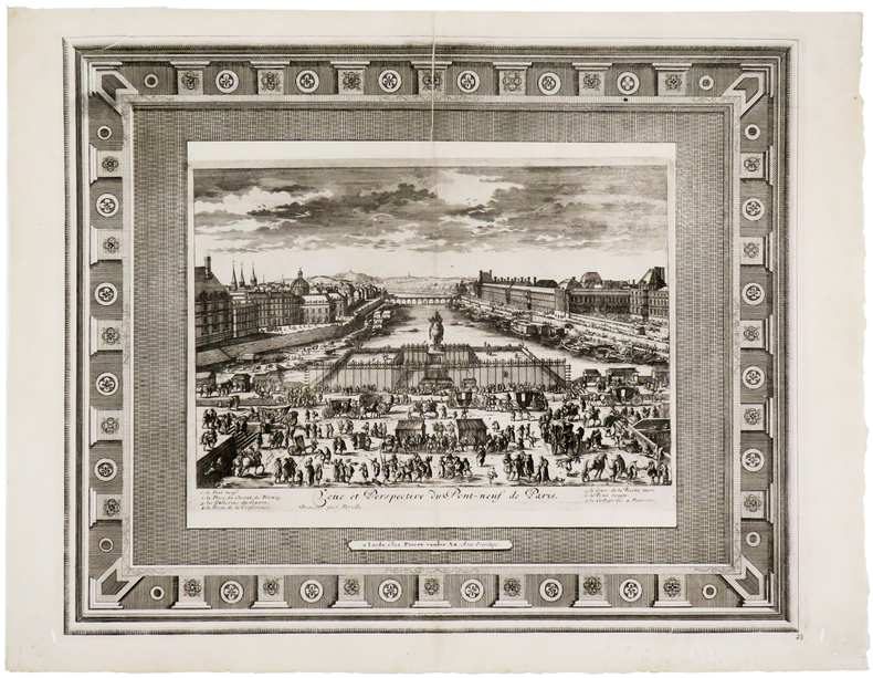
PERELLE (Gabriel).
Veüe et perspective du Pont-Neuf de Paris.
Leyde, Pierre Vander Aa, [circa 1710]. 336 x 412 mm.
Referencia librero : LBW-5724
|
|
|
Perignan
Prospect von dem inneren Theil der Stadt Zürch und des Zürcher Sees (...) Vue interieure de la ville du fond du lac de Zürch (...)
O. O., ca. 1770. Kolorierter Kupferstich von Balthasar Frederic Leizel nach Perignan. Bildgrösse: 38 x 25 cm. Blattgrösse: 39,5 x 28 cm. + Wichtig: Für unsere Kunden in der EU erfolgt der Versand alle 14 Tage verzollt ab Deutschland / Postbank-Konto in Deutschland vorhanden +, 278BG
Referencia librero : 278BG

|
|
|
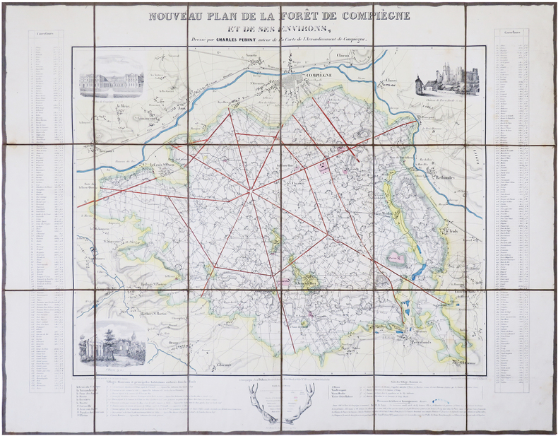
PERINT (Charles).
[FORÊT de COMPIÈGNE] Nouveau plan de la forêt de Compiègne et de ses environs.
Compiègne, Dubois, [circa 1845]. En 18 sections montées sur toile et repliées, formant une carte de 532 x 687 mm.
Referencia librero : LBW-7850
|
|
|
Perkins William & maps 8 b&w illustrations
Three Years in California William Perkins' Journal of Life at Sonora 1849-1852
University of California. 1964. Hardcover. First edition. Same date on title and copyright pages with no additional printings. HC Univ. of California Press 1964. DJ is in a protective mylar cover and has pieces missing along top and front side edge. DJ is scuffed and stained and is in acceptable condition. Covers have some fading along top edge and some edge wear. Front endpaper has some writing in red at lower corner and copyright page has some stampings.; 9.30 X 6.30 X 1.50 inches; 424 pages . University of California hardcover
Referencia librero : STP-00307
|
|
|
Perly's Maps Ltd
Perly's BJ Map of Metro Toronto
Seven Hills Book Distributors 1989. Hardcover. Acceptable. Disclaimer:A readable copy. All pages are intact and the cover is intact. Pages can include considerable notes-in pen or highlighter-but the notes cannot obscure the text. At ThriftBooks our motto is: Read More Spend Less.Dust jacket quality is not guaranteed. Seven Hills Book Distributors hardcover
Referencia librero : G0919205860I5N00 ISBN : 0919205860 9780919205864

|
|
|
Perly's Maps Ltd
Perly's Bluemap atlas metropolitan Toronto and vicinity
Perly's Maps Ltd 1989. Paperback. Good. Disclaimer:A copy that has been read but remains in clean condition. All pages are intact and the cover is intact. The spine may show signs of wear. Pages can include limited notes and highlighting and the copy can include previous owner inscriptions. At ThriftBooks our motto is: Read More Spend Less.Dust jacket quality is not guaranteed. Perly's Maps Ltd paperback
Referencia librero : G0919205461I3N00 ISBN : 0919205461 9780919205468

|
|
|
Perlys Maps Ltd
Perly's Toronto & Area Map Book
Michelin Travel Publications. Paperback. GOOD. Spine creases wear to binding and pages from reading. May contain limited notes underlining or highlighting that does affect the text. Possible ex library copy will have the markings and stickers associated from the library. Accessories such as CD codes toys may not be included. Michelin Travel Publications paperback
Referencia librero : 3199314730 ISBN : 1894720679 9781894720670
|
|
|
PERREIN (Paul)
Images d'autrefois de Bordeaux et de la Gironde - 506 cartes postales anciennes
Périgueux, Pierre Fanlac, 1984. Grand in-8 broché jaune, ill. sur plats, couv. à rabats, 310 p. Très nombreuses photos en noir. Préface de Jacques Chaban-Delmas. Très bon état. Prix du Livre cartophile 1981.
Referencia librero : 10048
|
|
|
PERREIN (Paul)
Images d'autrefois de la Gironde, de L'Amélie-sur-Mer à Virelade - Tome II, 552 cartes postales anciennes
Périgueux, Pierre Fanlac, 1982. Grand in-8 broché, couverture ill. "carte postale Pessac" à rabats, 334 p. Préface de Roger Galy. 552 cartes postales anciennes. Très bon état : couverture discrètement roussie.
Referencia librero : 6942
|
|
|
PERREIN Paul
Images d'autrefois de Bordeaux et de la Gironde. 506 cartes postales anciennes.
Pierre Fanlac, 1980. Grand in-8 broché, 306 pages, illustré de 506 vues de Bordeaux ancien. Excellent état.
Referencia librero : 15171
|
|
|
PERRIN (Maurice).
[ALGER] Plan d'Alger.
Paris, [1890]. 227 x 155 mm.
Referencia librero : LBW-8653

|
|
|
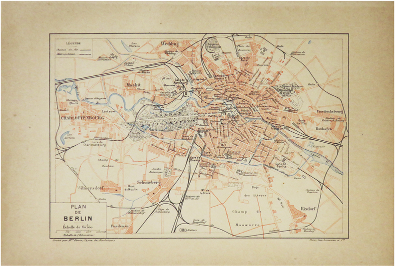
PERRIN (Maurice).
[BERLIN] Plan de Berlin.
Paris, [1890]. 157 x 226 mm.
Referencia librero : LBW-8600
|
|
|
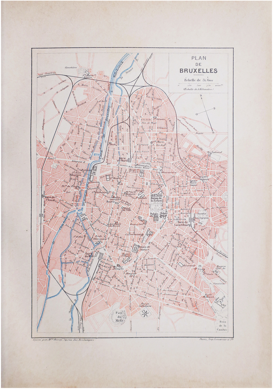
PERRIN (Maurice).
[BRUXELLES] Plan de Bruxelles.
Paris, [1890]. 228 x 156 mm.
Referencia librero : LBW-8612
|
|
|
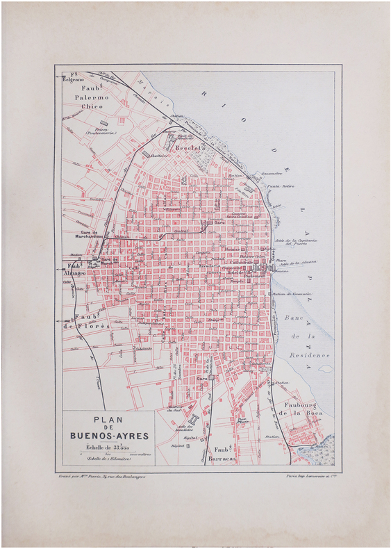
PERRIN (Maurice).
[BUENOS-AIRES] Plan de Buenos-Ayres.
Paris, [1890]. 229 x 156 mm.
Referencia librero : LBW-8637
|
|
|
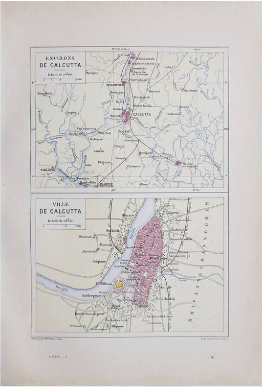
PERRIN (Maurice).
[CALCUTTA] Environs de Calcutta - Ville de Calcutta.
Paris, [1890]. 228 x 158 mm.
Referencia librero : LBW-8640
|
|
|
PERRIN (Maurice).
[INDOCHINE] Tonkin, Annam, Cochinchine et Cambodge.
[1890]. 239 x 158 mm.
Referencia librero : LBW-7248

|
|
|
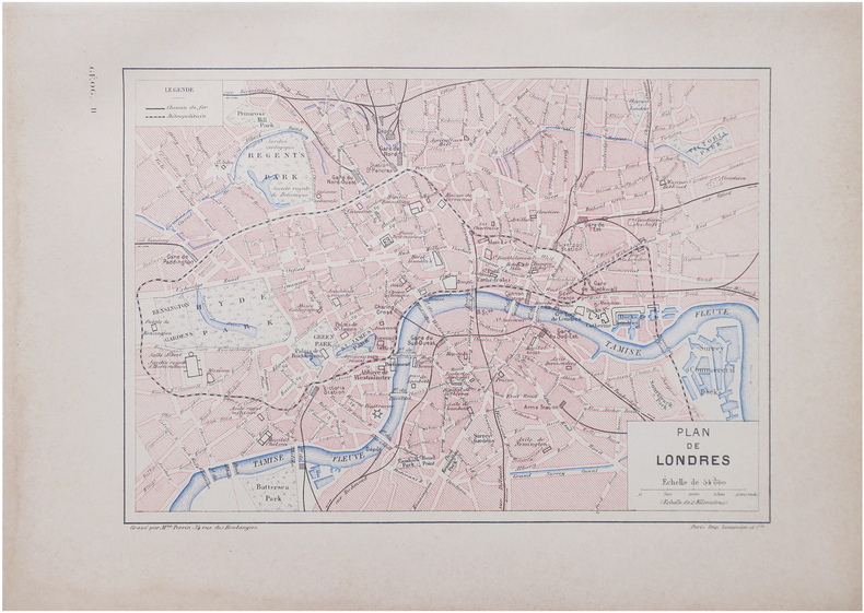
PERRIN (Maurice).
[LONDRES] Plan de Londres.
Paris, [1890]. 160 x 226 mm.
Referencia librero : LBW-8641
|
|
|
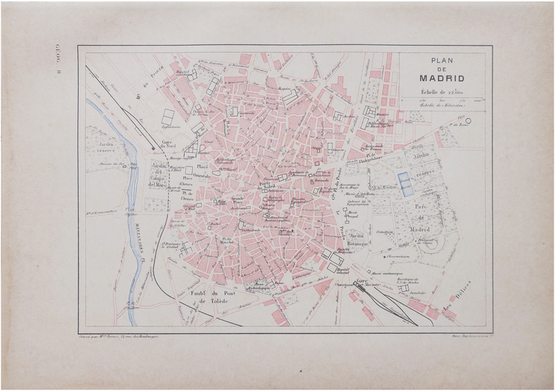
PERRIN (Maurice).
[MADRID] Plan de Madrid.
Paris, [1890]. 160 x 226 mm.
Referencia librero : LBW-8642
|
|
|
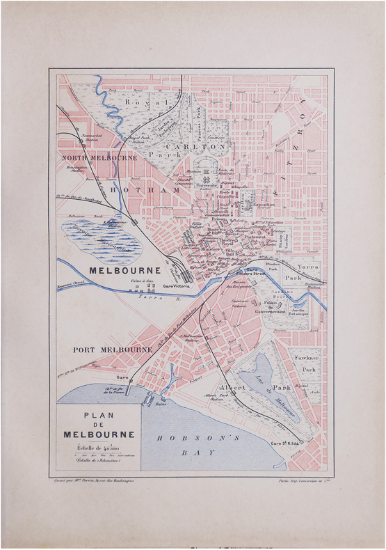
PERRIN (Maurice).
[MELBOURNE] Plan de Melbourne.
Paris, [1890]. 229 x 156 mm.
Referencia librero : LBW-8601
|
|
|
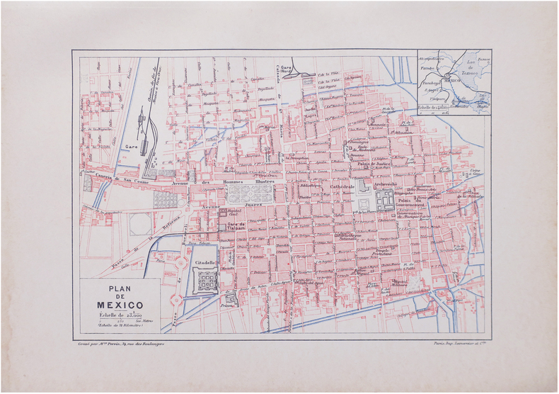
PERRIN (Maurice).
[MEXICO] Plan de Mexico.
Paris, [1890]. 159 x 226 mm.
Referencia librero : LBW-8625
|
|
|
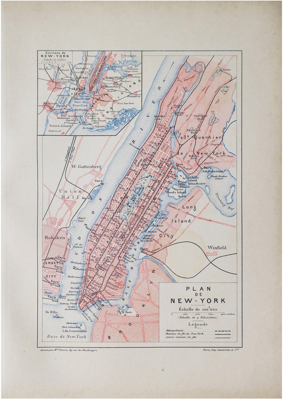
PERRIN (Maurice).
[NEW YORK] Plan de New-York.
Paris, [1890]. 227 x 155 mm.
Referencia librero : LBW-8610
|
|
|
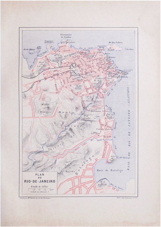
PERRIN (Maurice).
[RIO de JANEIRO] Plan de Rio-de-Janeiro.
Paris, [1890]. 228 x 156 mm.
Referencia librero : LBW-8639
|
|
|
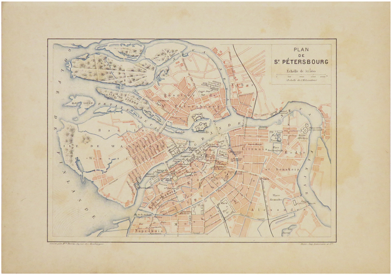
PERRIN (Maurice).
[SAINT-PÉTERSBOURG] Plan de Saint-Pétersbourg.
[1890]. 160 x 224 mm.
Referencia librero : LBW-7240
|
|
|
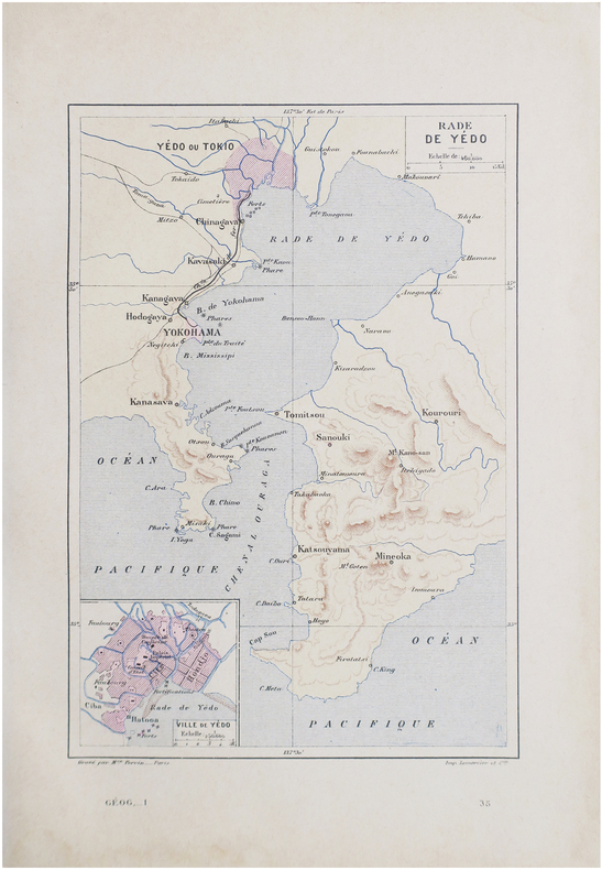
PERRIN (Maurice).
[TOKYO] Rade de Yédo.
Paris, [1890]. 229 x 156 mm.
Referencia librero : LBW-8644
|
|
|
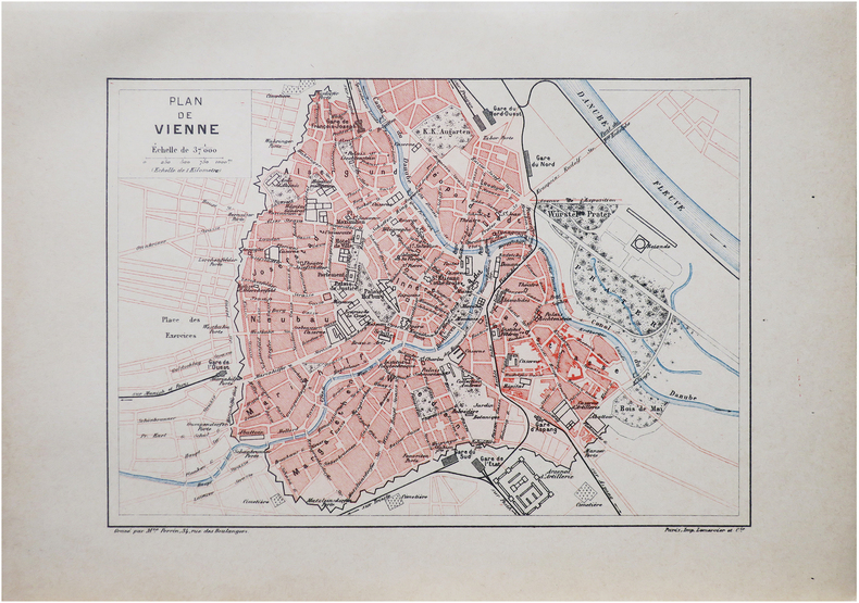
PERRIN (Maurice).
[VIENNE] Plan de Vienne.
Paris, [1890]. 159 x 225 mm.
Referencia librero : LBW-8618
|
|
|
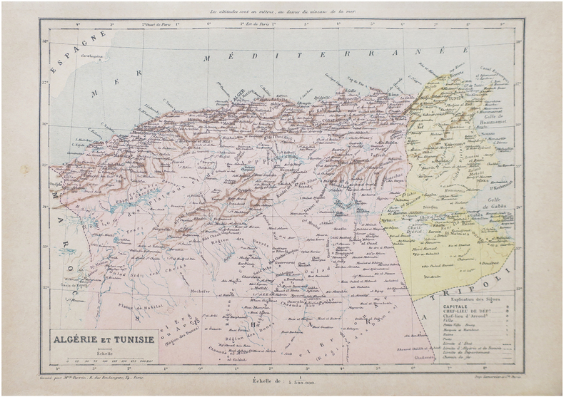
PERRIN (Maurice).
Algérie et Tunisie.
Paris, [1890]. 198 x 258 mm.
Referencia librero : LBW-8652
|
|
 Recibir por correo electrónico
 Descargar en documento PDF
 Flujo RSS


