|
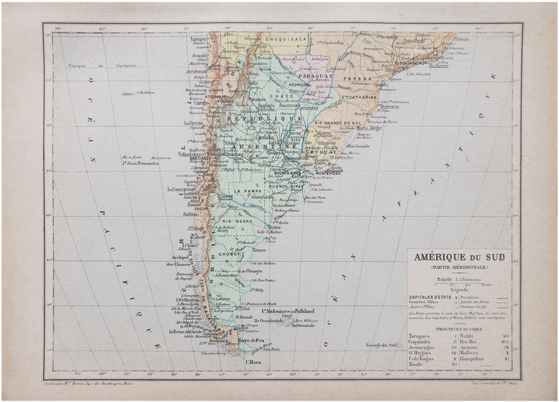
PERRIN (Maurice).
Amérique du Sud (Partie méridionale).
Paris, [1890]. 192 x 258 mm.
Referencia librero : LBW-8656
|
|
|
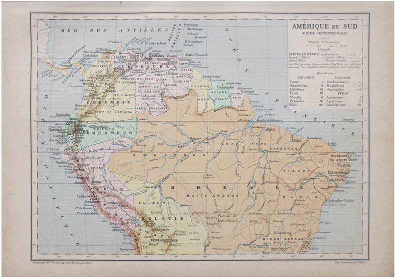
PERRIN (Maurice).
Amérique du Sud (Partie septentrionale).
Paris, [1890]. 192 x 258 mm.
Referencia librero : LBW-8655
|
|
|
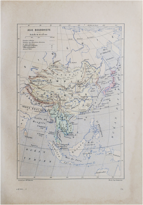
PERRIN (Maurice).
Asie bouddhiste.
Paris, [1890]. 230 x 158 mm.
Referencia librero : LBW-8646
|
|
|
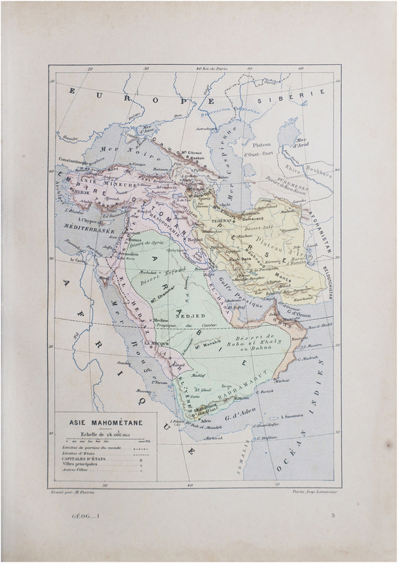
PERRIN (Maurice).
Asie mahométane.
Paris, [1890]. 230 x 157 mm.
Referencia librero : LBW-8645
|
|
|
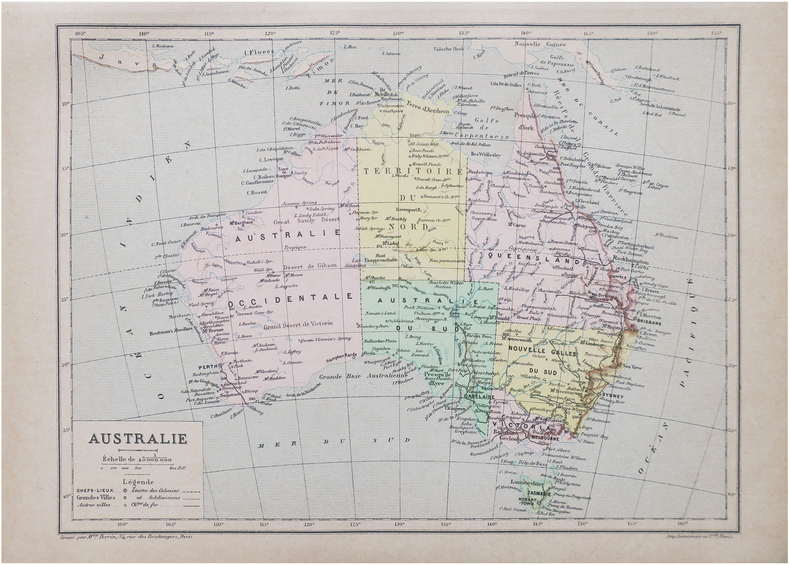
PERRIN (Maurice).
Australie.
Paris, [1890]. 193 x 260 mm.
Referencia librero : LBW-8647
|
|
|
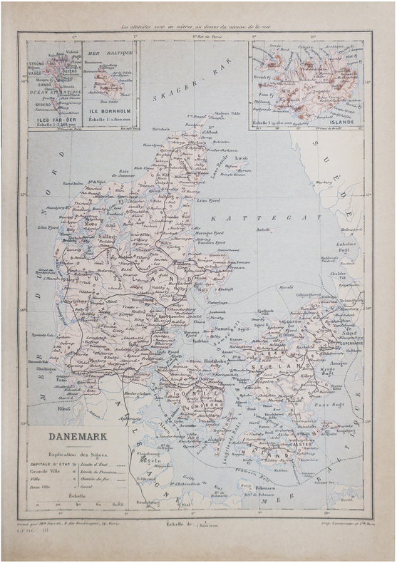
PERRIN (Maurice).
Danemark.
Paris, [1890]. 267 x 190 mm.
Referencia librero : LBW-8648
|
|
|
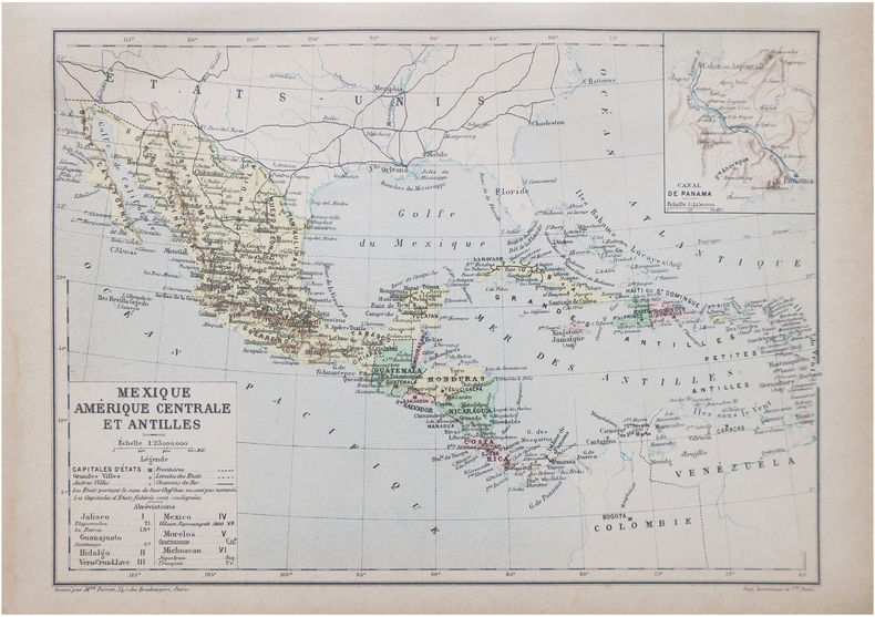
PERRIN (Maurice).
Mexique, Amérique centrale et Antilles.
Paris, [1890]. 192 x 265 mm.
Referencia librero : LBW-8649
|
|
|
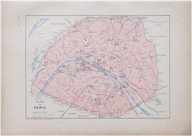
PERRIN (Maurice).
Plan de Paris.
Paris, [1890]. 163 x 225 mm.
Referencia librero : LBW-8638
|
|
|
PERROT (A.M.).
Carte pittoresque et maritime de la France. Revue et augmentée par A. Vuillemin.
Paris, Bulla Frères et François Delarue, s.d.(1860). Grande carte entoilée de 82 cm x 112 cm) formée de 32 panneaux , gravée et rehaussée en couleurs à l'aquarelle. Rempliée sous percaline brune ornée à froid de l'époque, marque du libraire Auguste Fontaine (Passage des panoramas) et titre doré au premier plat "Carte routière". Très bon état.
Referencia librero : 16163
|
|
|
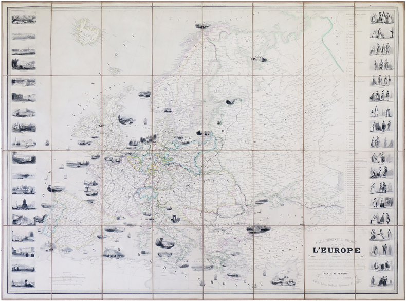
PERROT (Aristide Michel) & VUILLEMIN (Alexandre).
Carte pittoresque & maritime de l'Europe.
Paris, Fatout, 1861. 612 x 842 mm.
Referencia librero : LBW-7914
|
|
|
PERROT (Aristide Michel).
[MÉTÉOROLOGIE] Tableau de météorologie représentant les divers phénomènes de l'athmosphère, tels que le tonnerre, l'aurore boréale, aréolythes, l'arc-en-ciel, les trombes, le feu S.t Elme, les étoiles filantes et aréolythes, le halo, les parhélies, le mirage, les marées &.a &.a.
Paris, Langlois et Leclercq, Maison Basset, 1856. 491 x 627 mm.
Referencia librero : LBW-8423

|
|
|
PERROT (Aristide Michel).
[TOPOGRAPHIE] Topographie. Tableau des teintes et signes conventionnels, adoptés par le Ministère de la Guerre. Guide réel des ingénieurs civils et militaires, officiers d'État-major, &c.
Paris, Bouasse-Lebel, Édit. Imp., et Anc.ne M.on Basset réunies, [1863]. 497 x 613 mm.
Referencia librero : LBW-8426

|
|
|
PERROT (Aristide Michel).
Carte pour servir de tableau d'assemblage aux colonies françaises occidentales.
I. Duprat-Duverger, 1826. 296 x 293 mm.
Referencia librero : LBW-4800

|
|
|
PERROT (Aristide Michel).
Tableau des animaux et des végétaux existans avant le Déluge, rédigé d'après Cuvier, Buckland, de Humboldt, &.c ; par Perrot, Ingén.r-Géographe. Dessiné d'après les végétaux et les fossiles existants dans les divers cabinets de l'Europe.
Paris, Langlois et Leclercq, Maison Basset, [1842]. 491 x 627 mm.
Referencia librero : LBW-8431

|
|
|
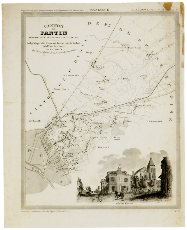
PERROT (Aristide-Michel) & MONIN (Charles V.).
[PANTIN] Canton de Pantin, arrond.t de St Denis, dép.t de la Seine.
[1834]. 305 x 240 mm, sur papier fin.
Referencia librero : LBW-5373
|
|
|
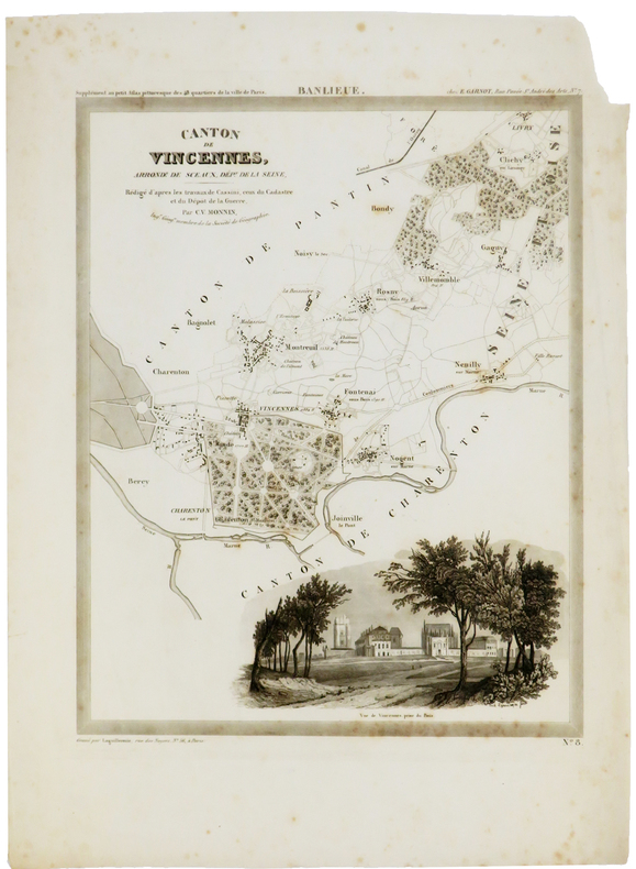
PERROT (Aristide-Michel) & MONIN (Charles V.).
[VINCENNES] Canton de Vincennes, arrond.t de Sceaux, dép.t de la Seine.
[1834]. 305 x 241 mm, sur papier fin.
Referencia librero : LBW-5374
|
|
|
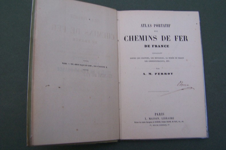
PERROT A.M.
Atlas portatif des Chemins de Fer de France.
P., Maison, s.d. In-12, carte des environs de Paris en frontispice, 37 pages de cartes, cartonnage.
Referencia librero : CF343
|
|
|
PERROT.
CAEN (Calvados).
Paris, Benard, [circa 1850]. 212 x 285 mm.
Referencia librero : LBW03d71
|
|
|
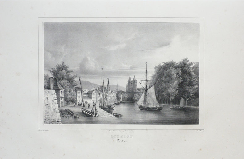
PERROT.
QUIMPER (Finistère).
Paris, Benard, [circa 1850]. 225 x 297 mm.
Referencia librero : LBW03d69
|
|
|
Pershing, John J.
My Experiences in the World War - Volume I
400 pages including 69 black and white reproductions from photographs and numerous maps. Gilt-edged top. Former owner's rubber stamp upon verso of half title page and upon front side of black and white photographic frontis of General Pershing. Small bookseller's sticker inside back board. "My primary purpose in writing this story of the American Expeditionary Forces in France is to render what I conceive to be an important service to my country. In that adventure there were many lessons useful to the American People, should they ever again be called to arms, and I felt it a duty to record them as I saw them." - from the Foreward. Book
|
|
|
Pestman, P. W
A Guide to the Zenon Archive (P.L. Bat. 21) Compiled by P. W. Pestman. (= Papyrologica Lugduno-Batava, vol. 21a and 21b). Volume 1: Lists and Surveys; Volume 2: Indexes and Maps. 2 volumes complete.
Leiden: E. J. Brill 1981. XX, 466; 467-748 Seiten. With two maps. 4° (28 x 22 cm) Orig.-Broschuren. [Softcover / Paperback].
Referencia librero : 2140746

|
|
|
Peter A. Price Sketch Maps by the Author
Wye Valley Walks for Motorists Warne walking guides
Frederick Warne Publishers Ltd 07/13/1979. Paperback. Used; Good. WE SHIP WITHIN 24 HRS FROM LONDON UK 98% OF OUR ORDERS ARE RECEIVED WITHIN 7-10 DAYS. We believe you will be completely satisfied with our quick and reliable service. All orders are dispatched as swiftly as possible! Buy with confidence! Frederick Warne Publishers Ltd paperback
Referencia librero : mon0001349818 ISBN : 0723221472 9780723221470
|
|
|
Peter Roper on cartographer George Hotchkiss Martin Murray on maps on cigarette cards David Smith on George Frederick Crutch
Map Collector Winter 1989 Issue No. 49
Map Collector Publications. Used - Like New. Like New condition. Map Collector Publications unknown
Referencia librero : S01M-00443
|
|
|
PETERMANN, A. (HRSG.).
Mittheilugen aus Justus Perthe's Geographischer Anstalt über wichtige neue Erforschungen auf dem Gebiete der Geographie. 1860 (= Bd. 6 der Reihe). (+) 3 Ergänzungshefte. (1. A. Vibe: Küsten und Meer Norwegens. 24 pp., 1 chromolithographed plate (with ...
Gotha, Julius Perthes, 1860. 4to. Contemp, hcalf. Gilt spine. A small stamp to titlepage. X,490 pp. and 19, partly folded, lithographed maps and plans. Internally clean. + Ergänzungshäfte.
|
|
|
PETERMANN, A. (HRSG.).
Mittheilugen aus Justus Perthe's Geographischer Anstalt über wichtige neue Erforschungen auf dem Gebiete der Geographie. 1861 (= Bd. 7 der Reihe). (+) 3 Ergänzungshefte. (1. G. Lejean: Ethnographie de la Turque D'Europe. Ethnographie der Europäisch...
Gotha, Julius Perthes, 1861. 4to. Contemp, hcalf. Gilt spine. A small stamp to titlepage. VIII,482 pp. and 16, partly folded, lithographed maps and plans. Internally clean. + Ergänzungshäfte.
|
|
|
PETERMANN, A. (HRSG.).
Mittheilugen aus Justus Perthe's Geographischer Anstalt über wichtige neue Erforschungen auf dem Gebiete der Geographie. 1858 (= Bd. 4 der Reihe).
Gotha, Julius Perthes, 1858. 4to. Contemp, hcalf. Gilt spine. A small stamp to titlepage. VIII,596 pp. and 20, partly folded, lithographed maps and plans. Text as well as maps fine and clean.
|
|
|
PETERMANN, A. (HRSG.).
Mittheilugen aus Justus Perthe's Geographischer Anstalt über wichtige neue Erforschungen auf dem Gebiete der Geographie. 1867 (= Bd. 13 der Reihe).
Gotha, Julius Perthes, 1867. 4to. Contemp, hcalf. Gilt spine. Spine somewhat rubbed. A small stamp to titlepage. VI,470 pp. and 19, partly folded, lithographed maps and plans. Textleaves with some browning and scattered brownspots. Maps clean.
|
|
|
PETERMANN, A. (HRSG.).
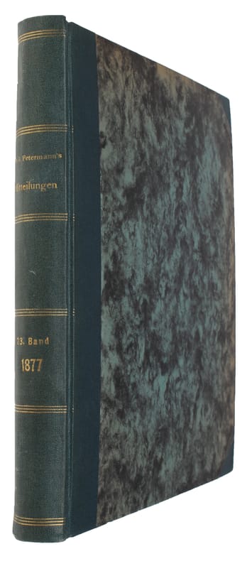
Mittheilugen aus Justus Perthe's Geographischer Anstalt über wichtige neue Erforschungen auf dem Gebiete der Geographie. 23. Bd.
Gotha, Julius Perthes, 1877. 4to. Later hcloth. Spine gilt. XII,476 pp. and 23, partly folded, lithographed maps and plans. Internally clean.
|
|
|
PETERMANN, A. (HRSG.).
Mittheilugen aus Justus Perthe's Geographischer Anstalt über wichtige neue Erforschungen auf dem Gebiete der Geographie. 1858 (= Bd. 4 der Reihe).
Gotha, Julius Perthes, 1858. 4to. Contemp, hcalf. Gilt spine. A small stamp to titlepage. VIII,596 pp. and 20, partly folded, lithographed maps and plans. Text as well as maps fine and clean.
Referencia librero : 46631
|
|
|
PETERMANN, A. (HRSG.).
Mittheilugen aus Justus Perthe's Geographischer Anstalt über wichtige neue Erforschungen auf dem Gebiete der Geographie. 1867 (= Bd. 13 der Reihe).
Gotha, Julius Perthes, 1867. 4to. Contemp, hcalf. Gilt spine. Spine somewhat rubbed. A small stamp to titlepage. VI,470 pp. and 19, partly folded, lithographed maps and plans. Textleaves with some browning and scattered brownspots. Maps clean.
Referencia librero : 46634
|
|
|
PETERMANN, A. (HRSG.).
Mittheilugen aus Justus Perthe's Geographischer Anstalt über wichtige neue Erforschungen auf dem Gebiete der Geographie. 23. Bd.
Gotha, Julius Perthes, 1877. 4to. Later hcloth. Spine gilt. XII,476 pp. and 23, partly folded, lithographed maps and plans. Internally clean.
Referencia librero : 46640
|
|
|
PETERMANN, A. (HRSG.).
Mittheilugen aus Justus Perthe's Geographischer Anstalt über wichtige neue Erforschungen auf dem Gebiete der Geographie. 1860 (= Bd. 6 der Reihe). (+) 3 Ergänzungshefte. (1. A. Vibe: Küsten und Meer Norwegens. 24 pp., 1 chromolithographed plate (with ...
Gotha, Julius Perthes, 1860. 4to. Contemp, hcalf. Gilt spine. A small stamp to titlepage. X,490 pp. and 19, partly folded, lithographed maps and plans. Internally clean. + Ergänzungshäfte.
Referencia librero : 46641
|
|
|
PETERMANN, A. (HRSG.).
Mittheilugen aus Justus Perthe's Geographischer Anstalt über wichtige neue Erforschungen auf dem Gebiete der Geographie. 1861 (= Bd. 7 der Reihe). (+) 3 Ergänzungshefte. (1. G. Lejean: Ethnographie de la Turque D'Europe. Ethnographie der Europäisch...
Gotha, Julius Perthes, 1861. 4to. Contemp, hcalf. Gilt spine. A small stamp to titlepage. VIII,482 pp. and 16, partly folded, lithographed maps and plans. Internally clean. + Ergänzungshäfte.
Referencia librero : 46642
|
|
|
PETERSEN Andrew. With contributions by MILWRIGHT Marcus. Drawings by NIXON Heather. Maps by LEACH Peter.
A GAZETTEER OF BUILDINGS IN MUSLIM PALESTINE Part 1. British Academy Monographs in Archaeology No.12.
Oxford: published for the Council for British Research in the Levant by Oxford University Press 2001. . 4to. pp.340 navy cloth gilt b/w illustrations; slight rubbing to extremities a fresh and near-fine copy in near-fine unclipped dust-jacket. Oxford: published for the Council for British Research in the Levant by Oxford University Press, 2001. hardcover
Referencia librero : 33114
|
|
|
PETERSON ROGER TORY Text and illustrations. Maps by PETERSON VIRGINIA MARIE
A FIELD GUIDE TO WESTERN BIRDS - PETERSON FIELD GUIDE Third Edition Completely Revised and Enlarged
BOSTON: HOUGHTON MIFFLIN COMPANY. VG IN WRAPS. LIGHTLY WORN. Pages: 432. . 1990. TRADE PAPERBACK. A COMPLETELY NEW GUIDE TO FIELD MARKS OF ALL SPEICES FOUND IN NORTH AMERICA WEST OF THE 100TH MERIDIAN & NORTH OF MEXICO. . HOUGHTON MIFFLIN COMPANY paperback
Referencia librero : MASTER259778I
|
|
|
Peterson Frederick A. Maps and Drawings by Jose Luis Franco
Ancient Mexico: An Introduction to the Pre-Hispanic Cultures
G. P. Putnam's Sons New York and George Allen & Unwin London 1959. 313 pp. line illus. Spine cocked head and heel of spine and corners of boards bumped covers stained page edges tanned previous owner name. No jacket. Size: 8vo. Hardcover. Good/No Jacket. G. P. Putnam's Sons, New York, and George Allen & Unwin, London Hardcover
Referencia librero : 281082
|
|
|
Peterson Frederick. Jose Luis Franco maps and drawings
Ancient Mexico: An Introduction to the Pre-Hispanic Cultures
New York: George P. Putnamís Sons 1959. First printing. Used - Very Good. . New York: George P. Putnamís Sons 1959. First printing. Cloth dj. 313 pp. illus with 6 maps 24 plates. Dj edge-worn with some chipping. Book is a bit cocked. Overall Very Sound. Subject: Archae/PreC. New York: George P. Putnamís Sons, 1959. First printing hardcover
Referencia librero : S22437
|
|
|
Peterson Charles E.; photographs/drawings/maps Illustrator
Colonial St. Louis Building a Creole Capital
Missouri Historical Society 1949-01-01. Paperback. Very Good. NICE CONDITION SLINDER SOFTCOVER BOOK. NO WRITING OR MARKINGS IN THE TEXT NO TORN OR MISSING PAGES. ONLY LIGHT WEAR MINIMAL CREASING & SOME BROWNING TO COVER. Missouri Historical Society paperback
Referencia librero : T-371
|
|
|
PETIT (Victor).
[CANNES] Vue de la ville de Cannes, publiée par les soins de la Société de l'Avenir de Cannes, d'après le projet de M.r F. Mouton.
Cannes, Société de l'Avenir de Cannes, [1865]. 310 x 925 mm ; lithographie sur Chine monté.
Referencia librero : LBW-7695

|
|
|
PETIT (Victor);
Palais de l'Exposition Universelle à Paris.
Paris Ch. Boivin 1855 235 x 411 mm.
Referencia librero : LBW-671
|
|
|
PETIT ATLAS NATIONAL
Carte d?partementale (noir) : Haute Sa?ne. Milieu XIXe.
Gravure 18x24 cm. Rousseurs.
|
|
|
PETIT ATLAS NATIONAL
Carte d?partementale (noir) : Loir et Cher. Milieu XIXe.
Gravure 18x24 cm. Rousseurs.
|
|
|
PETIT ATLAS NATIONAL
Carte d?partementale (noir) : Loiret. Milieu XIXe.
Gravure 18x24 cm. Rousseurs.
|
|
|
PETIT ATLAS NATIONAL
Carte d?partementale (noir) : Ni?vre. Milieu XIXe.
Gravure 18x24 cm. Rousseurs.
|
|
|
PETIT ATLAS NATIONAL
Carte d?partementale (noir) : Sa?ne et Loire. Milieu XIXe.
Gravure 18x24 cm. Rousseurs.
|
|
|
PETIT ATLAS NATIONAL
Carte d?partementale (noir). Bouches du Rh?ne. Fin XIXe.
Gravure 18x24 cm. Rousseurs.
|
|
|
PETIT ATLAS NATIONAL
Carte d?partementale (noir). Hautes Garonne. Milieu XIXe.
Gravure 18x24 cm. Rousseurs.
|
|
|
PETIT ATLAS NATIONAL
Carte d?partementale (noir). Var. Fin XIXe.
Gravure 18x24 cm. Rousseurs.
|
|
|
PETIT ATLAS NATIONAL
Carte d?partementale (noir). Vaucluse. Fin XIXe.
Gravure 18x24 cm. Rousseurs.
|
|
|
PETIT ATLAS NATIONAL
Carte du d?partement de la Somme. Milieu XIX?.
1 feuille 24x18 cm. Rousseurs.
|
|
 Recibir por correo electrónico
 Descargar en documento PDF
 Flujo RSS


