|
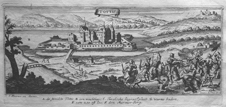
PEETERS (Jan);
[TATA] Tottis.
circa 1690 101 x 248 mm.
Référence libraire : LBW027a0
|
|
|
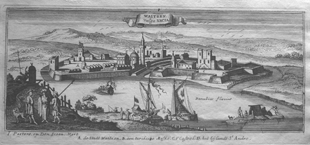
PEETERS (Jan);
[VAC] Waitzen vulgo Vacia.
circa 1690 105 x 256 mm.
Référence libraire : LBW0279a
|
|
|
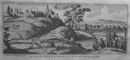
PEETERS (Jan);
[VESZPREM] Vesprin.
circa 1690 101 x 245 mm.
Référence libraire : LBW0279f
|
|
|
PEETERS (Jan);
[VISEGRAD] Vicegrad.
circa 1690 103 x 265 mm.
Référence libraire : LBW0279b

|
|
|
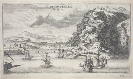
PEETERS (Jan);
Den Bergh Carmeli in Syrien.
circa 1690 133 x 239 mm.
Référence libraire : LBW02509
|
|
|
PEETERS (Jan);
Jerusalem.
circa 1690 115 x 258 mm.
Référence libraire : LBW024dc

|
|
|
PEETERS (Jan);
Ramma in Arabia.
circa 1690 115 x 256 mm.
Référence libraire : LBW024de
|
|
|
Peffer Nathaniel; Nevins Allan editor; Maps Illustrator
The Far East Hardcover Jan 01 1958 Peffer Nathaniel
The University of Michigan Press 1958-01-01. Hardcover. Like New. A used like new hardcover book no writing or marks in very good dust wrapper with light edge wear placed in sleeve 1958. The University of Michigan Press hardcover
Référence libraire : 3D-J2KG-0TNJ
|
|
|
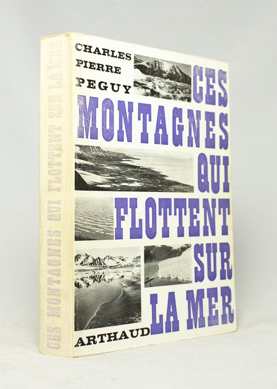
PEGUY Charles-Pierre:
Ces montagnes qui flottent sur la mer.
B. Arthaud, 1969. In-8 broché de 318-[4] pages, couverture imprimée en deux tons, dos passé.
Référence libraire : 16671
|
|
|
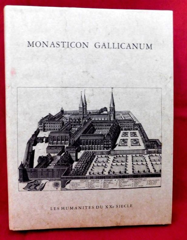
Peigné-Delacourt - Delisle ( Léopold )
Monasticon Gallicanum Collection de 168 Planches de vues Topographiques représentant Les Monastères de l'Ordre de Saint-Benoit Congrégation de Saint Maur Avec Deux Cartes des établissements Bénédictins en France
P., Les Humanistes du XXe siècle, 1983., Etat : Bon. Petit in-folio rel., pleine toile grise d'édition (sans jaq.), titre doré au 1er plat, 68 pp, 168 gravures (vues topograhiques) et 2 cartes doubles mobiles de la France. Très bonne condition. Réimpression anastasique de l'édition de Paris, parue chez Victor Palmé en 1871.
Référence libraire : 17053
|
|
|
PEIGNÉ-DELACOURT ; GERMAIN, Michel Dom.
Monasticon Gallicanum. Collection de 168 planches de vues topographiques des Monastères Bénédictins de la Congrégation de Saint-Maur. Avec deux cartes des établissements de l'Ordre de Saint-Benoît. COMPLET.
Paris, Librairie de Féchoz & Letouzey, 1882. 306 x 232 mm, (1) f. blanc, L-16 pp., 1 carte et 169 planches dont 1 carte : pl. N° 3. Reliure cartonnée restaurée, décharge et rousseurs sur premier et dernier feuillet blanc, pl. 89 : claires rousseurs dans les marges, claires rousseurs sur page de faux-titre, très bel état. COMPLET des 168 vues et 2 cartes. Bel exemplaire.
Référence libraire : 7917

|
|
|
PEIGNOT (Gabriel)
Recherches historiques et littéraires sur les danses des morts et sur l'origine des cartes à jouer.
Dijon et Paris, Lagier, 1826. in-8 (13 x 20,8 cm), LXpp. -367 pages - 5 planches. Reliure demi-chagrin lie-de-vin, coins, dos à nerfs, fleurons dorés, couverture conservée. (Reliure postérieure).
Référence libraire : 26365
|
|
|
PELET (Lt. Général)
[Carte géographique]. Sens.
Paris, Dépôt de la Guerre, Dumaine, (après 1852). 83 x 52,5 cm au cadre. Entoilée, repliée au format in-8.
Référence libraire : 19746

|
|
|
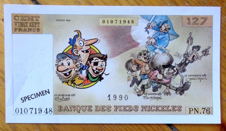
Pellos René:
Banque des Pieds Nickelés - Billet de 127 francs.
Editions Vent d'Ouest. Faux billet de banque, publié à l'occasion de l'intégrale chez Vent d'Ouest.
Référence libraire : 8571
|
|
|
PELET (Lt. général)
Carte des environs d'Oran et de Mers-el-kébir dressée au Dépôt général de la Guerre par ordre de M. le Maréchal duc de Dalmatie.
1834 21 sections montées sur toile et pliées formant une carte de 630 x 940 mm. P. 1834
Référence libraire : 16320
|
|
|
Pennsylvania The Woman'S Club Of Mercersburg; Maps Photos Illustrator
Old Mercersburg Pennsylvania
Williamsport PA: Grit Publishing Co 1949. Hardcover. Near Fine/No Jacket as issued. 9.1 x 6.5 x 1.1. "Nice Firm Clean copy ! 219 pages. . ISBN: B000K5VPM2. Catalogs: History:. Grit Publishing Co hardcover
Référence libraire : 126392
|
|
|
Pennsylvania Maps Sanborn Map Company
Sanborn Map of Clarion PA for the Exclusive use of M. M. & Louis Kaufman Agents
New York: Sanborn Map Company 1906. Paperback. Very Good. Published 1906 folio 21 inches tall cloth backed gray printed original stiff wraps 8 double-page hand colored maps each measuring 24.5 x 21 inches very good condition and very rare. Sanborn Map Company paperback
Référence libraire : H4249

|
|
|
Pennsylvania Turnpike.
THE PENNSYLVANIA TURNPIKE.
13p. Pagination includes wraps. Illustrated with photographs, drawings and maps. Tall thin 8vo. Original pictorial wraps. Lists Interchanges, tunnels and service stations. PA PAMPH 20_1 BX7 x 3c.
|
|
|
Peper George; photographs by Brian D. Morgan James Moriarty and Anthony Roberts. Maps by Elizabeth Peper
The Courses of the PGA Tour
New York 1988. Updated Edition. Fine/Fine. Large 4to. 304pp index. 100s of colour photos. Almost as new gift condition. unknown
Référence libraire : 24949 ISBN : 0810909944 9780810909946

|
|
|
PERRIN (Maurice).
[ALGER] Plan d'Alger.
Paris, [1890]. 227 x 155 mm.
Référence libraire : LBW-8653

|
|
|
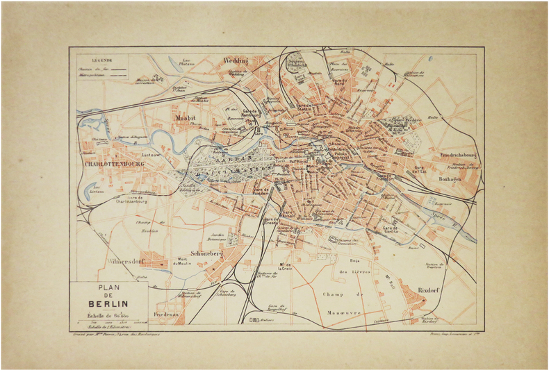
PERRIN (Maurice).
[BERLIN] Plan de Berlin.
Paris, [1890]. 157 x 226 mm.
Référence libraire : LBW-8600
|
|
|
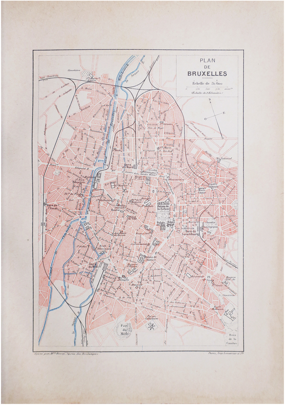
PERRIN (Maurice).
[BRUXELLES] Plan de Bruxelles.
Paris, [1890]. 228 x 156 mm.
Référence libraire : LBW-8612
|
|
|
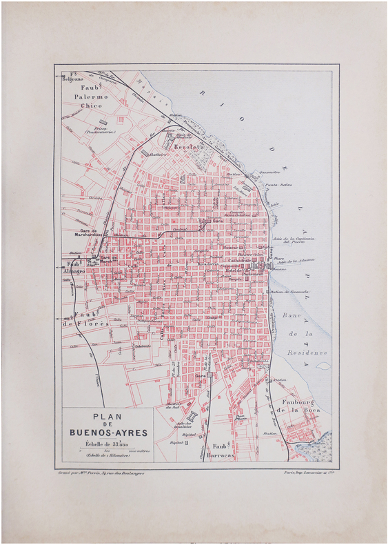
PERRIN (Maurice).
[BUENOS-AIRES] Plan de Buenos-Ayres.
Paris, [1890]. 229 x 156 mm.
Référence libraire : LBW-8637
|
|
|
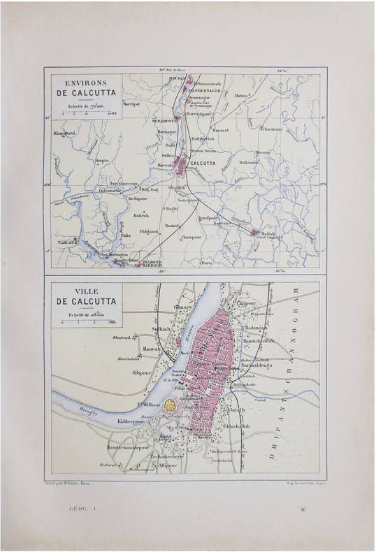
PERRIN (Maurice).
[CALCUTTA] Environs de Calcutta - Ville de Calcutta.
Paris, [1890]. 228 x 158 mm.
Référence libraire : LBW-8640
|
|
|
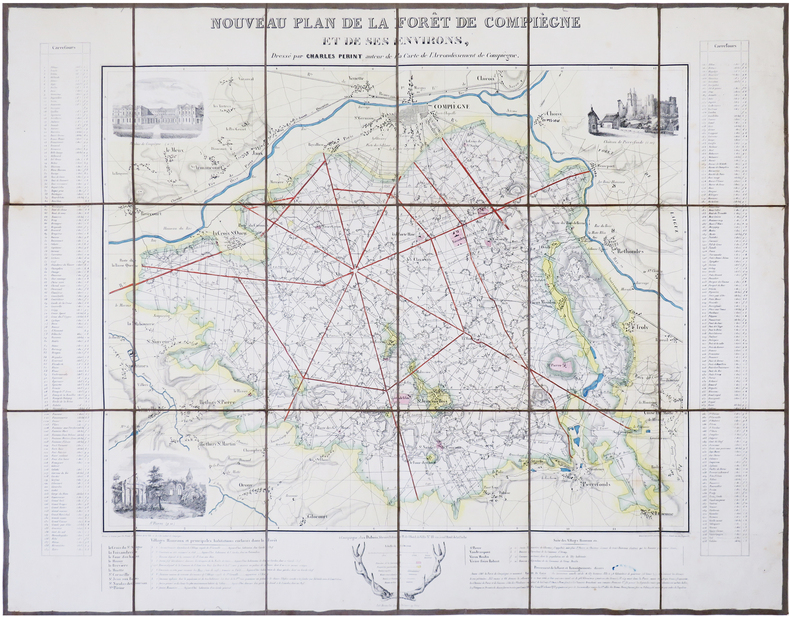
PERINT (Charles).
[FORÊT de COMPIÈGNE] Nouveau plan de la forêt de Compiègne et de ses environs.
Compiègne, Dubois, [circa 1845]. En 18 sections montées sur toile et repliées, formant une carte de 532 x 687 mm.
Référence libraire : LBW-7850
|
|
|
PERRIN (Maurice).
[INDOCHINE] Tonkin, Annam, Cochinchine et Cambodge.
[1890]. 239 x 158 mm.
Référence libraire : LBW-7248

|
|
|
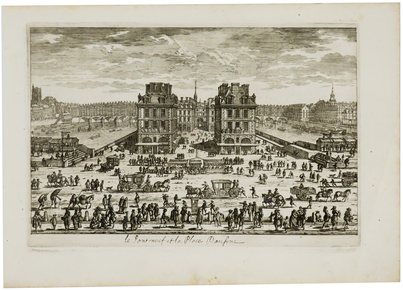
PERELLE (Gabriel).
[Le Pont Neuf et la place Daufine].
[Paris, circa 1690]. 183 x 274 mm.
Référence libraire : LBW-730
|
|
|
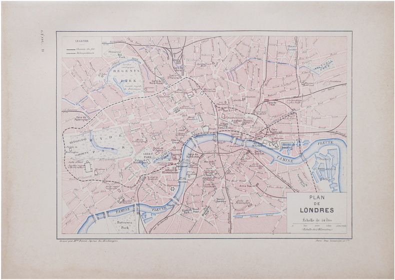
PERRIN (Maurice).
[LONDRES] Plan de Londres.
Paris, [1890]. 160 x 226 mm.
Référence libraire : LBW-8641
|
|
|
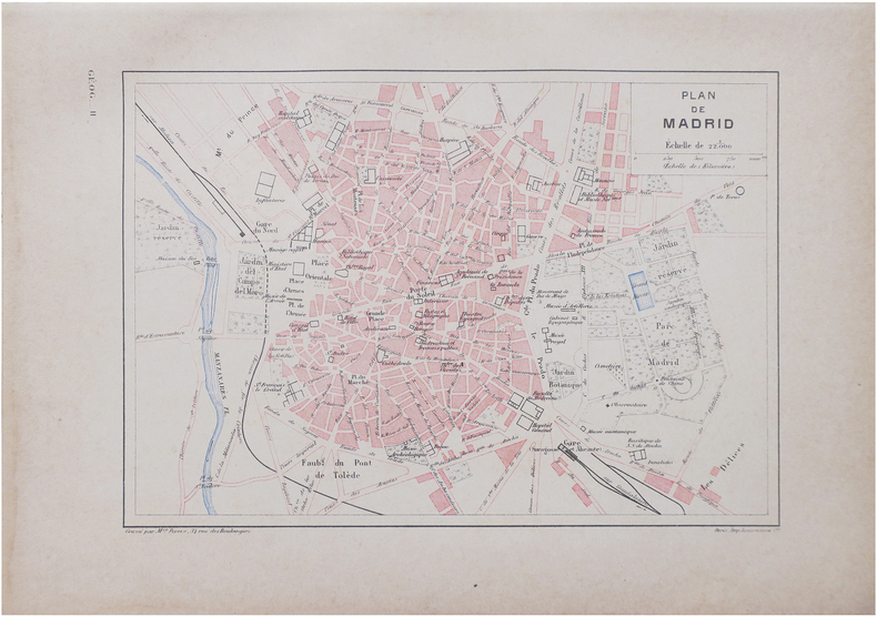
PERRIN (Maurice).
[MADRID] Plan de Madrid.
Paris, [1890]. 160 x 226 mm.
Référence libraire : LBW-8642
|
|
|
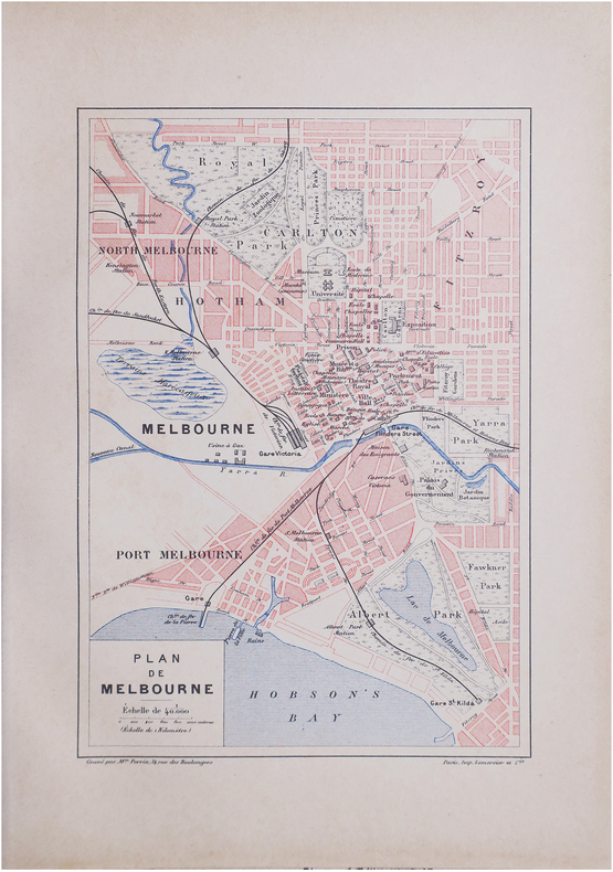
PERRIN (Maurice).
[MELBOURNE] Plan de Melbourne.
Paris, [1890]. 229 x 156 mm.
Référence libraire : LBW-8601
|
|
|
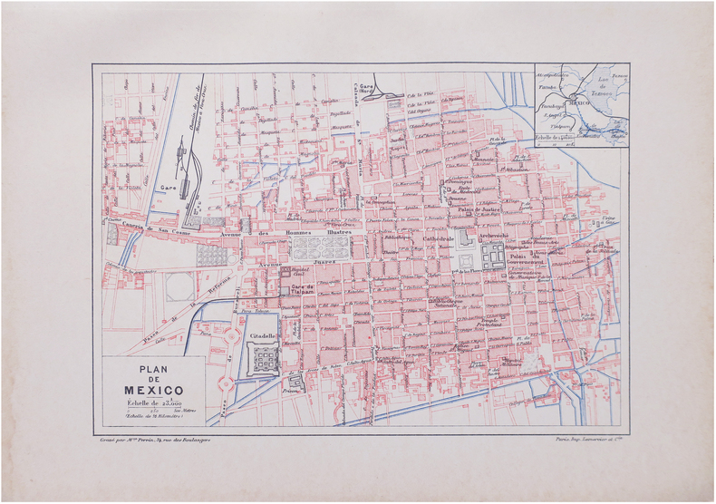
PERRIN (Maurice).
[MEXICO] Plan de Mexico.
Paris, [1890]. 159 x 226 mm.
Référence libraire : LBW-8625
|
|
|
PERROT (Aristide Michel).
[MÉTÉOROLOGIE] Tableau de météorologie représentant les divers phénomènes de l'athmosphère, tels que le tonnerre, l'aurore boréale, aréolythes, l'arc-en-ciel, les trombes, le feu S.t Elme, les étoiles filantes et aréolythes, le halo, les parhélies, le mirage, les marées &.a &.a.
Paris, Langlois et Leclercq, Maison Basset, 1856. 491 x 627 mm.
Référence libraire : LBW-8423

|
|
|
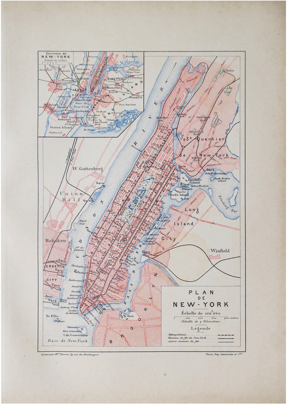
PERRIN (Maurice).
[NEW YORK] Plan de New-York.
Paris, [1890]. 227 x 155 mm.
Référence libraire : LBW-8610
|
|
|
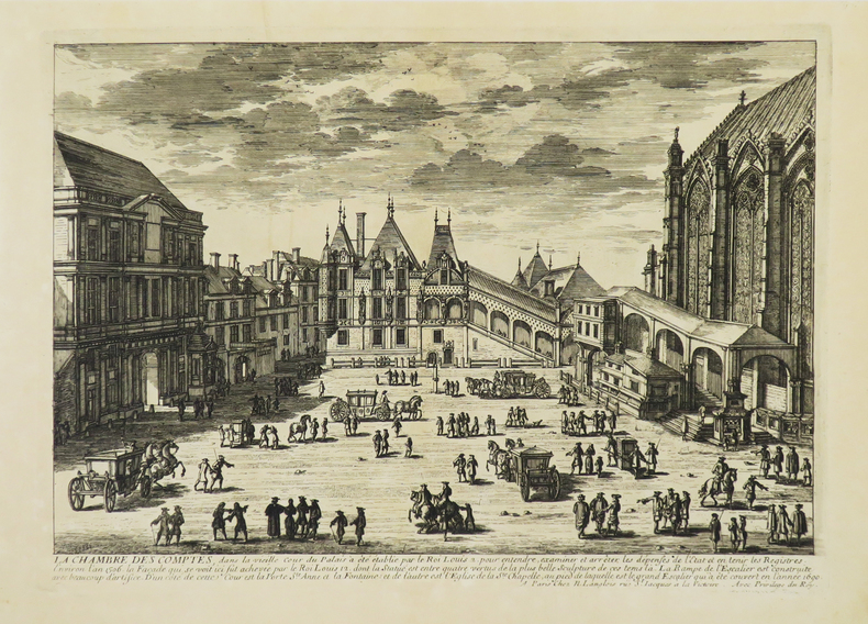
PERELLE (Gabriel).
[PALAIS DE JUSTICE] La Chambre des Comptes.
Paris, N. Langlois, [circa 1680]. 212 x 298 mm.
Référence libraire : LBW-4942
|
|
|
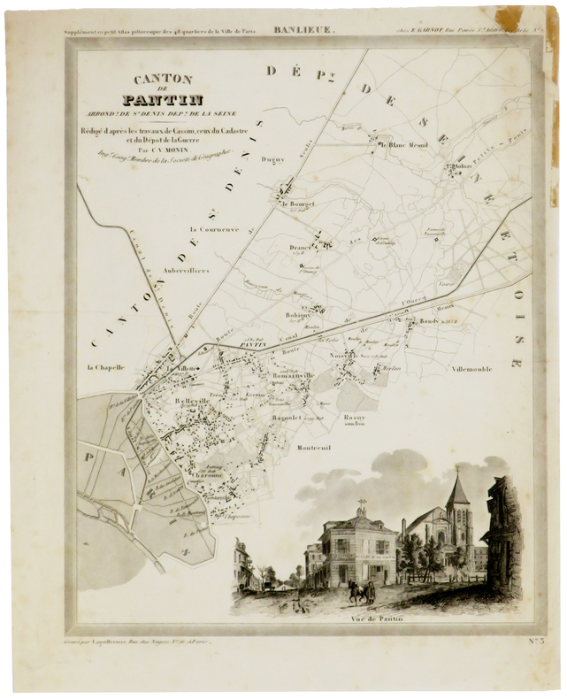
PERROT (Aristide-Michel) & MONIN (Charles V.).
[PANTIN] Canton de Pantin, arrond.t de St Denis, dép.t de la Seine.
[1834]. 305 x 240 mm, sur papier fin.
Référence libraire : LBW-5373
|
|
|
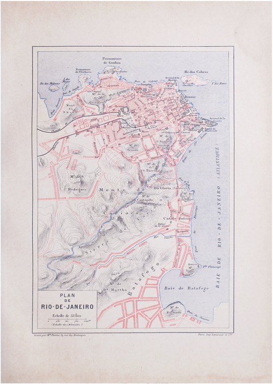
PERRIN (Maurice).
[RIO de JANEIRO] Plan de Rio-de-Janeiro.
Paris, [1890]. 228 x 156 mm.
Référence libraire : LBW-8639
|
|
|
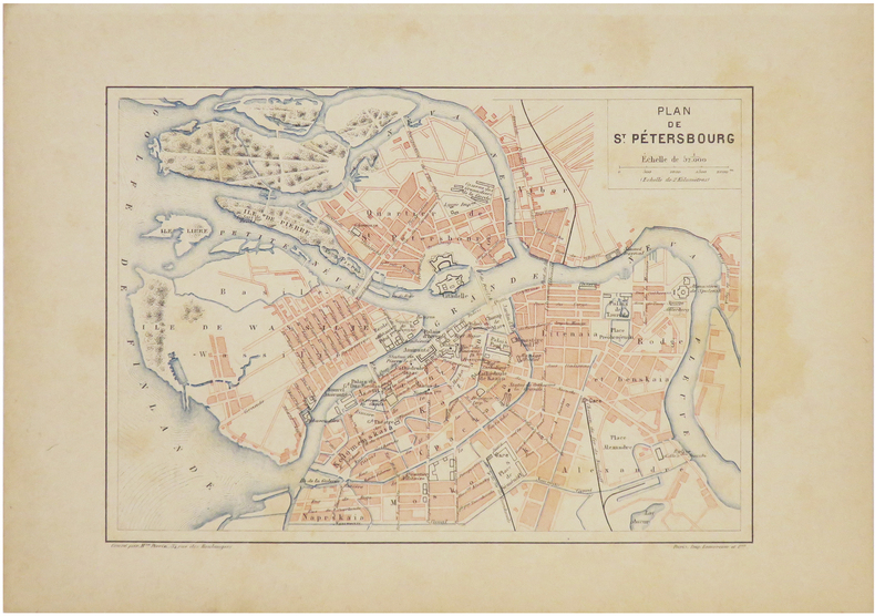
PERRIN (Maurice).
[SAINT-PÉTERSBOURG] Plan de Saint-Pétersbourg.
[1890]. 160 x 224 mm.
Référence libraire : LBW-7240
|
|
|
PERROT (Aristide Michel).
[TOPOGRAPHIE] Topographie. Tableau des teintes et signes conventionnels, adoptés par le Ministère de la Guerre. Guide réel des ingénieurs civils et militaires, officiers d'État-major, &c.
Paris, Bouasse-Lebel, Édit. Imp., et Anc.ne M.on Basset réunies, [1863]. 497 x 613 mm.
Référence libraire : LBW-8426

|
|
|
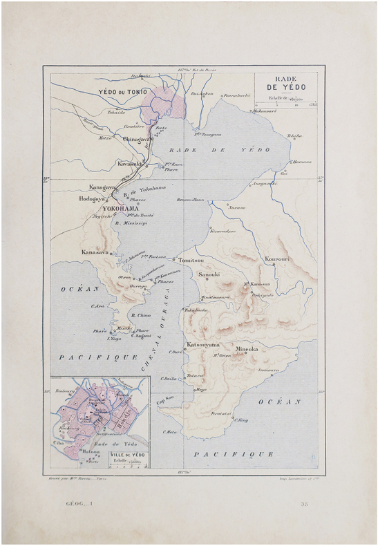
PERRIN (Maurice).
[TOKYO] Rade de Yédo.
Paris, [1890]. 229 x 156 mm.
Référence libraire : LBW-8644
|
|
|
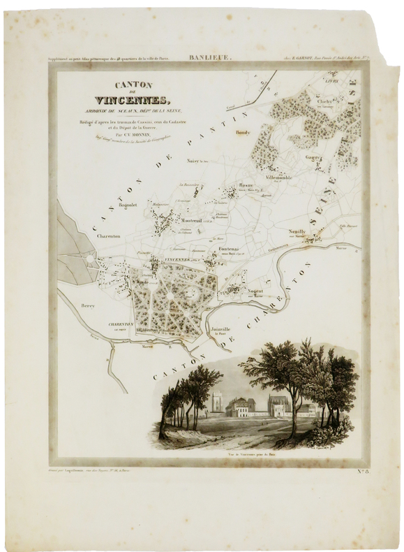
PERROT (Aristide-Michel) & MONIN (Charles V.).
[VINCENNES] Canton de Vincennes, arrond.t de Sceaux, dép.t de la Seine.
[1834]. 305 x 241 mm, sur papier fin.
Référence libraire : LBW-5374
|
|
|
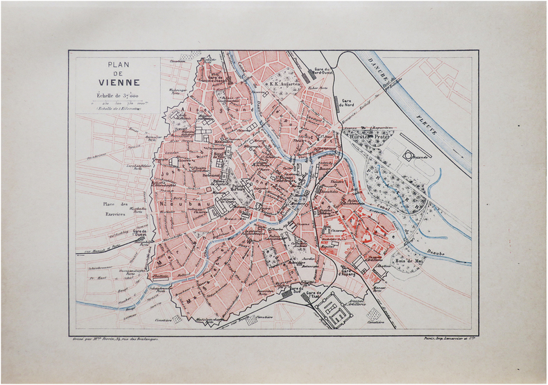
PERRIN (Maurice).
[VIENNE] Plan de Vienne.
Paris, [1890]. 159 x 225 mm.
Référence libraire : LBW-8618
|
|
|
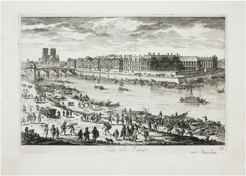
PERELLE (Gabriel).
[ÎLE SAINT-LOUIS] L'Isle nre Dame.
[Paris, N. Langlois, circa 1690]. 182 x 272 mm.
Référence libraire : LBW-7851
|
|
|
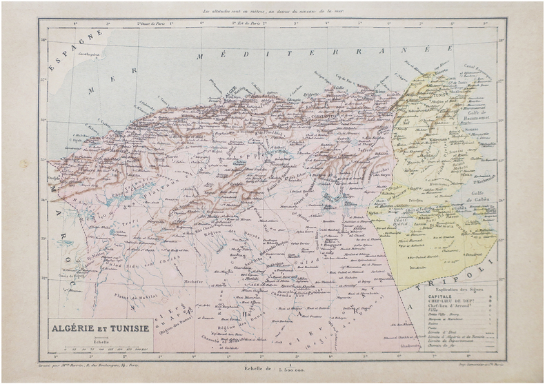
PERRIN (Maurice).
Algérie et Tunisie.
Paris, [1890]. 198 x 258 mm.
Référence libraire : LBW-8652
|
|
|
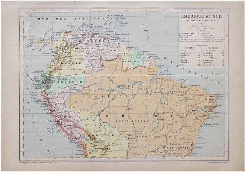
PERRIN (Maurice).
Amérique du Sud (Partie septentrionale).
Paris, [1890]. 192 x 258 mm.
Référence libraire : LBW-8655
|
|
|
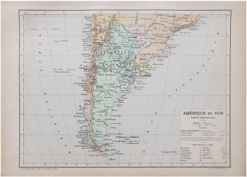
PERRIN (Maurice).
Amérique du Sud (Partie méridionale).
Paris, [1890]. 192 x 258 mm.
Référence libraire : LBW-8656
|
|
|
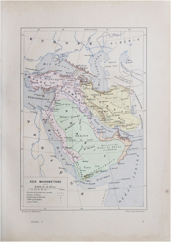
PERRIN (Maurice).
Asie mahométane.
Paris, [1890]. 230 x 157 mm.
Référence libraire : LBW-8645
|
|
|
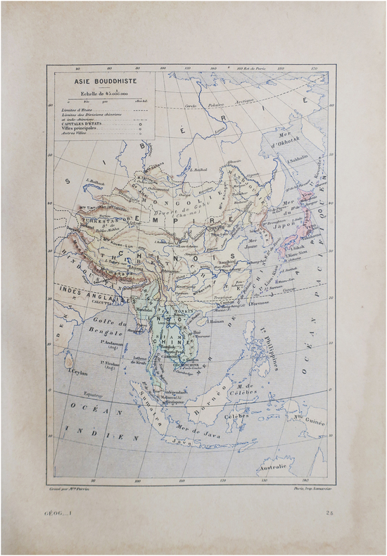
PERRIN (Maurice).
Asie bouddhiste.
Paris, [1890]. 230 x 158 mm.
Référence libraire : LBW-8646
|
|
|
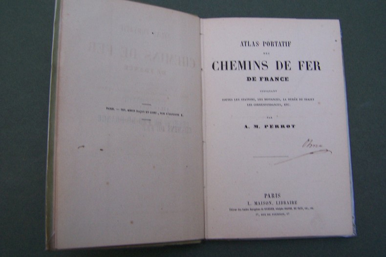
PERROT A.M.
Atlas portatif des Chemins de Fer de France.
P., Maison, s.d. In-12, carte des environs de Paris en frontispice, 37 pages de cartes, cartonnage.
Référence libraire : CF343
|
|
|
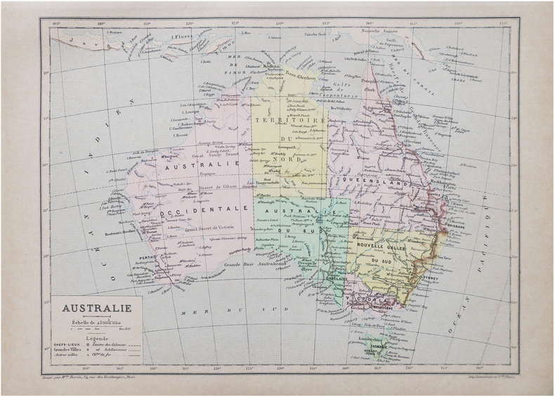
PERRIN (Maurice).
Australie.
Paris, [1890]. 193 x 260 mm.
Référence libraire : LBW-8647
|
|
|
PERROT.
CAEN (Calvados).
Paris, Benard, [circa 1850]. 212 x 285 mm.
Référence libraire : LBW03d71
|
|
 Recevoir par e-mail
 Télécharger en PDF
 Flux RSS


