|
Buvards - n°Amora
(Ref.: Ref98932)
Referencia librero : 9782845235867
|
|
|
Buvards - n°Novemail
(Ref.: Ref98932)
Referencia librero : 9782845235868
|
|
|
Buvards - n°Boussac (ballons)
(Ref.: Ref98932)
Referencia librero : 9782845235869
|
|
|
Buvards - n°Boussac (enfants)
(Ref.: Ref98932)
Referencia librero : 9782845235870
|
|
|
Buvards - n°Menier
(Ref.: Ref98932)
Referencia librero : 9782845235871
|
|
|
Buvards - n°Saphir
(Ref.: Ref98932)
Referencia librero : 9782845235872
|
|
|
Buvards - n°Cémoi
(Ref.: Ref98932)
Referencia librero : 9782845235873
|
|
|
Buvards - n°Poulain
(Ref.: Ref98932)
Referencia librero : 9782845235874
|
|
|
Buvards - n°Izarra
(Ref.: Ref98932)
Referencia librero : 9782845235875
|
|
|
Buvards - n°Teinture idéale
(Ref.: Ref98932)
Referencia librero : 9782845235876
|
|
|
Buvards - n°Util
(Ref.: Ref98932)
Referencia librero : 9782845235877
|
|
|
Buvards - n°Evian
(Ref.: Ref98932)
Referencia librero : 9782845235878
|
|
|
Buvards - n°Unicoop
(Ref.: Ref98932)
Referencia librero : 9782845235879
|
|
|
Buvards - n°Léonce Guyon
(Ref.: Ref98932)
Referencia librero : 9782845235880
|
|
|
Buvards - n°Ancel
(Ref.: Ref98932)
Referencia librero : 9782845235881
|
|
|
California points of interest and touring map
1 map in 6 segments : color ; on sheets 23 x 41 cm, folded to 23 x 10 cm Prepared exclusively for Standard Oil Company of California. || Map Info: Scale [ca. 1:1,267,200].; (W 124∞22í--W 114∞07í/N 42∞00í--N 32∞32í). || Cartgraph Code: Category of scale: a Constant ratio linear horizontal scale: 1267200 West longitude: W1242200 East longitude: W1140700 North latitude: N0420000 South latitude: N0323200 || Relief shown by shading and spot heights./ Panel title./ Also shows roads, trails, state and national parks and reserves, airports, drainage, etc./ Collated in booklet format (19 p.)./ Ancillary maps: Simplified touring map of California (p. 1-2) -- Road map of United States (p. 17-18) -- San Francisco and vicinity (p. 19). Scale [ca. 1:234,430] 1 in. = approx. 3.7 miles -- Los Angeles and vicinity (p. 19). Scale [ca. 1:304,130]. 1 in. = approx. 4.8 miles./ Includes index, mileage charts, text and ill./ "606-S-AA-1." || Roads -- California -- Maps. Tourist maps.
|
|
|
CAMP de Mr le duc d'Harcourt. près de Deckendorf en Bavière. Levé exactement sur les lieux par N.N
A Paris, chez le Sr Le Rouge, 1742 75 x 51,
Referencia librero : 168213
|
|
|
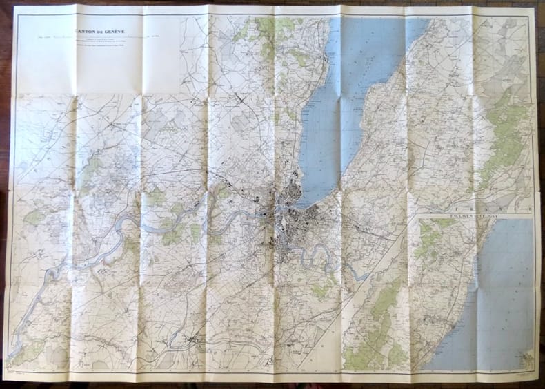
Canton de Genève, avec enclaves de Céligny.
Berne, Service topographique fédéral, 1946. Carte au 1:25 000, au format ouvert de 111 x 79 cm. Tampon au premier plat.
Referencia librero : 18657
|
|
|
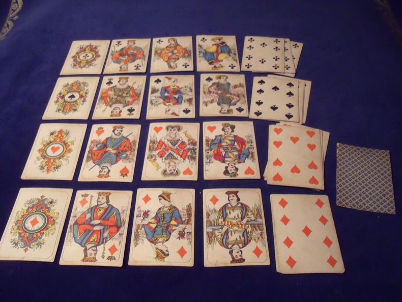
Cartes "Moyen-Age ".
32 cartes - complet - portrait de création originale - 1860 - lithographie couleur - fabricant : Daveluy Frères - Bruges -bon état - sans boite d 'origine .
Referencia librero : 9631860
|
|
|
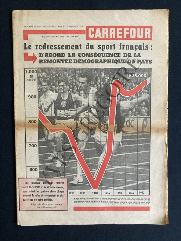
CARREFOUR-N°993-25 SEPTEMBRE 1963
24 PAGES-30,5 CM X 43 CM-LE POUVOIR D'UN SEUL, PAR ANDRE STIBIO, DE GAULLE-ARTHUR CONTE A VU ET ECOUTE L'ASIE A L'HEURE CHINOISE, 1P, UNE "GRANDE POLITIQUE CHINOISE" DE LA FRANCE?, PAR MAURICE NEGRE, 1P-APRES LES SPOLIATIONS QUI FRAPPENT LES FRANCAIS D'ALGERIE IL NE SUFFIT PAS DE PROTESTER IL FAUT REPARER, "EVIAN N'EST PAS LE CORAN", 1 PAGE-VICTIME DE L'ABANDON DE L'AFRIQUE DU NORD MARSEILLE N'EST PLUS LE PREMIER PORT FRANCAIS POUR LE TRAFIC PASSAGERS, 1P, PHOTO-POUR L'AMNISTIE I ANNIVERSAIRES PAR RENE CATHALA, 1P, SI L'ON REPARLAIT DE L'OAS.-L'ONU A 18 ANS ELLE A BIEN MAL TOURNE, 1P PAR BERNARD CABANES, DESSIN DE MOISAN-ON NE PEUT PAS (ENCORE) DECROCHER LA LUNE, 2P, 2 PHOTOS, FRANCE 1-APRES LE CRI D'ALARME DES HYGIENISTES ET DES MEDECINS: FAUT-IL SUIVRE LE BOEUF.ATTENDRI?, 2 PAGES-LA TROISIEME BIENNALE DE PARIS-LES CARTES A JOUER, 1 PAGE, 5 ILL-EN DERNIERE PAGE DESSIN D'ANGE MICHEL "LA LUNE PAR DESSUS LE MUR", MUR DE BERLIN
Referencia librero : ABE-1635033102530
|
|
|
CARTE MICHELIN de la FRANCE ( En 47 Feuilles ) N° 37 / GAP - CONI
Paris Librairie Charles Delagrave, sans date (vers 1910) 1 carte routière ancienne, imprimée en couleurs, sous couverture illustrée. Feuille: GAP-CONI, de format : 42,5 x 101 cms, de la France en 47 feuilles. Carte au 200.000e. Bel exemplaire ( Photographies sur demande / We can send pictures of this print on simple request )
Referencia librero : 40786
|
|
|
Carte du monde, par Hérisson format 35x17cm, bel état, vers 1820
format 35x17cm, bel état, vers 1820 ref/classeur 5
Referencia librero : CZC-12716

|
|
|
Carte du monde, par Hérisson format 35x17cm, bel état, vers 1820
format 35x17cm, bel état, vers 1820 ref/classeur 5
Referencia librero : CZC-12716
|
|
|
Carte du monde, par Hérisson format 24x19cm, bel état, vers 1820
format 24x19cm, bel état, vers 1820 ref/classeur 5
Referencia librero : CZC-12717

|
|
|
Carte du monde, par Hérisson format 24x19cm, bel état, vers 1820
format 24x19cm, bel état, vers 1820 ref/classeur 5
Referencia librero : CZC-12717
|
|
|
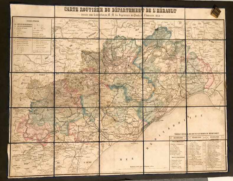
Carte routière du département de l'Hérault. Dressée sous la direction de MM. les Ingénieurs des Ponts & Chaussées.
Montpellier, Boehm, 1854. 72 x 56 cm à la feuille. Épreuve morcelée et marouflée sur une toile bleu nuit, repliée au format in-12.
Referencia librero : 31732
|
|
|
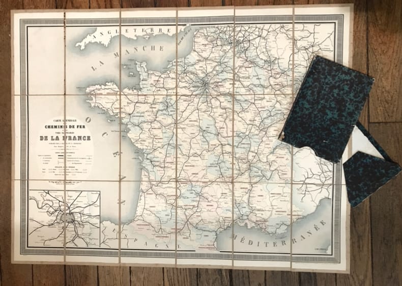
Carte générale des Chemins de Fer et des Voies navigables de la France.
Paris, Chaix, (vers 1860). 86 x 64,5 cm au cadre. Entoilée et repliée sous un étui-chemise de papier cuve.
Referencia librero : 8170
|
|
|
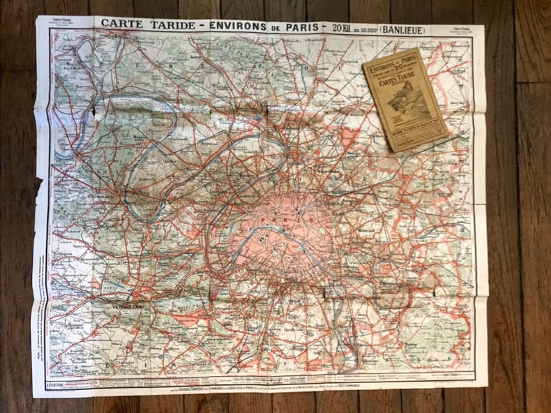
Carte Taride - Environs de Paris dans un rayon de 20 kilomètres (Banlieue).
Paris, Taride, (vers 1920). 95 x 80 cm à la feuille. Repliée sous une couverture de papier au format in-8
Referencia librero : 22742
|
|
|
Carte de la ligne du Mont Cenis. Ligne Londres-Paris-Rome. Echelle 1:120000,
Zurih, Orell Füssli & Co. s.d. , in-4to, 16 p. + carte géographique dessinée sur papier par G. Maggini d'après les cartes des Etats majors français et italiens, brochure originale illustrée avec dos toilé (petite perte au dos),
Referencia librero : 76774aaf
|
|
|
Carte nazionale d. Svizzera / Landeskarte d. Schweiz 1: 100 000. Verkauf pro Karte: Blatt: 32 Beromünster 1970 / 33 Toggenburg 1973 / 38 Panixerpass 1973 / 42 Oberwallis 1971 / 43 Sopa Ceneri 1972 / 48 Sotto Ceneri 1967.
Wabern, Eidg. Landestopogr., 1967 - 1973, 20x14 gefaltet, Unschlag Rotaufdruck Verkauf Pro Karte.
Referencia librero : 136254aaf
|
|
|
Cartes Taride - 80 kilomètres - Nord-Ouest Nouvelle Carte des Environs de Paris à l'usage des Cyclistes & Automobiles
0 Paris, Taride, s.d., Carte papier dépliable, 70 X90 cm, sous pochette papier, i
Referencia librero : 5921
|
|
|
Carte Taride. Routière n°8. Environs de Paris (Sud-Ouest)
0 Paris, Librairie Taride, s.d., Carte de papier, dépliable pliée sous pochette papier,
Referencia librero : 7787
|
|
|
Cartes Taride - 80 kilomètres - Sud-Est Nouvelle Carte des Environs de Paris à l'usage des Cyclistes & Automobiles
0 Paris, Taride, s.d., Carte papier dépliable, 70 X90 cm, sous pochette papier,
Referencia librero : 10362
|
|
|
CARTES ANCIENNES DE BRETAGNE
1988 1988 CARTES ANCIENNES DE BRETAGNE. Collection présentée par l' association "Saint Malo et la mer ". Tour des dames ,octobre-novembre 1988. In4° broché. Edition tapuscrite.
Referencia librero : M164387
|
|
|
Carte de Pontarlier.
Paris, Librairie Plon / Plon, Nourrit et Cie. Carte au 1/80'000, entoilée, au format ouvert de 49 x 59 cm., vignette de la Librairie plon contrecollée au premier plat.
Referencia librero : 18272

|
|
|
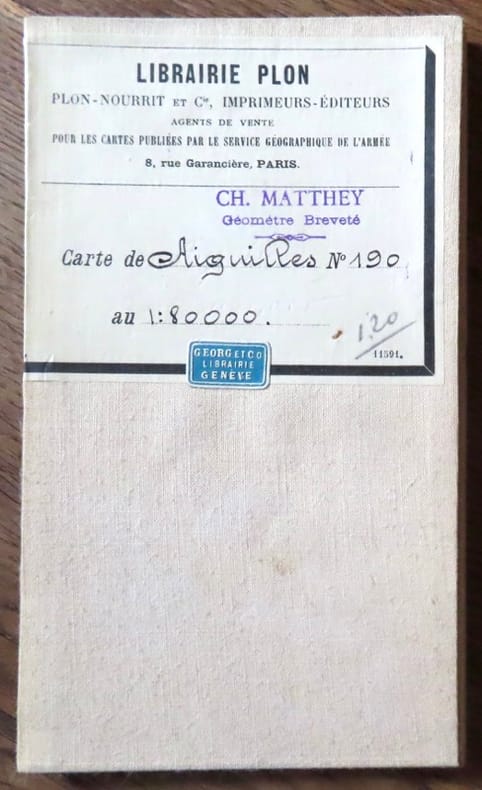
Carte d'Aiguilles.
Paris, Librairie Plon / Plon, Nourrit et Cie. Carte au 1/80'000, entoilée, au format ouvert de 46 x 32 cm., vignette de la Librairie plon contrecollée au premier plat. Tampon de géomètre.
Referencia librero : 18273
|
|
|
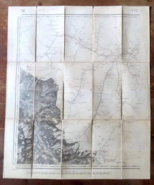
Carte de Tignes.
Paris, Librairie Plon / Plon, Nourrit et Cie. Carte au 1/80'000, entoilée, au format ouvert de 49 x 59 cm., vignette de la Librairie plon contrecollée au premier plat. Tampon de géomètre, un autre de libraire. En belle condition.
Referencia librero : 18276
|
|
|
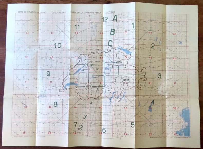
Carte de situation aerienne / Luftlagekarte / Carta deall situazione aerea.
Berne, Service topographique fédéral / Eidg. Landestopographie / Servizio topografico federale, 1963. Carte au 1:1.000.000, au format ouvert de 78 x 57 cm. En belle condition
Referencia librero : 18438
|
|
|
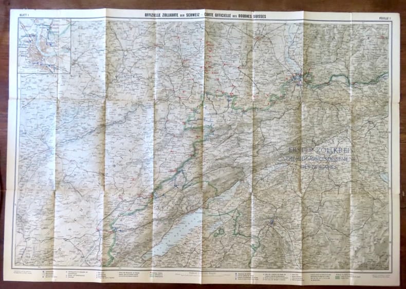
Carte officielle des douanes suisses, feuille 1 / Offizielle Zollkarte der Schweiz, Blatt 1.
Berne, Département des douanes suisses / Zollderpartement - Kümmerli & Frey, sans date. Carte entoilée au 1:200.000, au format ouvert de 93 x 65 cm.
Referencia librero : 18439
|
|
|
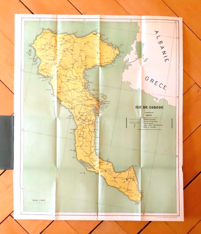
Carte géographique de l'île de Corfou.
Corfu, The greek graphic arts ltd / G. Aspiotis Brothers, sans date. Carte au format 53 x 64, sous couverture imprimée. En belle condition.
Referencia librero : 19035
|
|
|
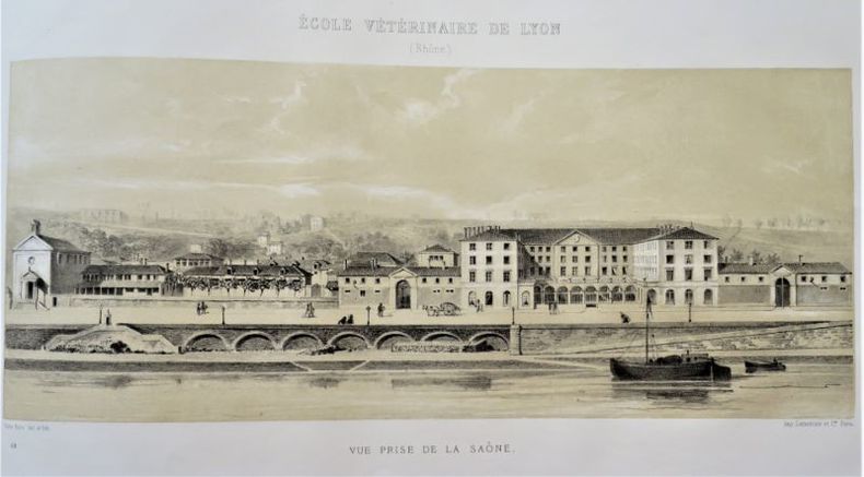
CARTES, DESSINS, PLANS, DOCUMENTS HISTORIQUES ET STATISTIQUES composant l'Exposition de la Direction de l'Agriculture Dans les Groupes 2 (Agriculture) et 26 (Enseignement).
Paris, Imprimerie Nationale, 1873, 1 volume grand in-folio oblong de 375x510mm environ, 1f.blanc, 2 faux-titre, 1 frontispice, 82 ff. (un numéro pour 2 pages) : 3 cates dépliantes couleurs, 8 planches couleurs (avec 2 cartes chacune), 11 planches de vaches et taureaux (héliogravures coloriées sous serpente), 5 planches de moutons (lithographies teintées sous serpente), 1 carte couleurs (Marche de la peste bovine dans les Etats de l'Europe Centrale, 1 carte déplainte des Vignobles des Pays à Cidre et des Pays à Bière, 3 planches de vigne comportant 46 figures (gravure sur bois), 6 planches lithographiées illustrant des .écoles dagriculture ou vétérinaires, 3 planches lithographiées représentant des vacheries et bergeries, 2 planches de prix et trophées, et quelques dessins dans le texte,dans un reliure demi-chagrin brun et toile chagrinée de léditeur frappée au centre du plat supérieur dune couronne de laurier et la mention Diplôme dhonneur, titre doré au dos. Frottements auréoles et petites taches sur les plats, épidermures et frottements sur le cuir, petite mouillure très claire sur les planches de moutons, 2 serpentes déchirées avec léger manque sur l'une d'elles (pl. de moutons), coins dénudés, une coupe accidentée, carte du typhus manquante (p. 50),sinon bon état.
Referencia librero : 106391
|
|
|
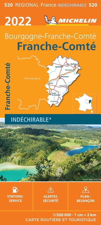
Carte Régionale Franche-Comté 2022
MICHELIN 2022 11 2x25x2 3cm. 2022. map.
Referencia librero : 500111091
|
|
|
Carte Régionale Franche-Comté 2022
MICHELIN 2022 11 2x25x2 3cm. 2022. map.
Referencia librero : 500120349

|
|
|
Carte Régionale Franche-Comté 2022
MICHELIN 2022 11 2x25x2 3cm. 2022. map.
Referencia librero : 500120350

|
|
|
Carte Régionale Franche-Comté 2022
MICHELIN 2022 11 2x25x2 3cm. 2022. map.
Referencia librero : 500120351

|
|
|
Carte Régionale Franche-Comté 2022
MICHELIN 2022 11 2x25x2 3cm. 2022. map.
Referencia librero : 500120353

|
|
|
CARTE ROUTIERE 722 FRANCE RECTO-VERSO 2009
MICHELIN 2009 16 pages 10 8x0 2x23 2cm. 2009. map. 16 pages.
Referencia librero : 500179372

|
|
|
carte postale publicitaire Soulié & Macé
Carte postale ancienne | Etat : Bon état (Ref.: ref97086)
Referencia librero : 9782845227149
|
|
|
Carte postale publicitaire Soulié & Macé
Carte postale ancienne | Etat : Bon état (Ref.: ref97087)
Referencia librero : 9782845227150
|
|
|
Carte postale publicitaire Soulié & Macé
Carte postale ancienne | Etat : Bon état (Ref.: ref97088)
Referencia librero : 9782845227151
|
|
 Recibir por correo electrónico
 Descargar en documento PDF
 Flujo RSS


