|
Baer, Edith; Wightman, Margaret
Signposts: German
No marks or inscriptions. No creasing to covers or to spine. A very clean very tight copy with bright unmarked boards and no bumping to corners. 104pp. Guide for visitors to Germany. How to understand the street/road signs.

|
|
|
Bagalwa Mapatano, Jules Maps
La décentralisation en Afrique au début du XXIe siècle: Réflexions à partir de l'expérience congolaise récente.
Editions L'Harmattan 2019. Paperback. New. 280 pages. French language. 8.46x5.31x0.70 inches. Editions L'Harmattan paperback
Referencia librero : 2-234315578X ISBN : 234315578X 9782343155784
|
|
|
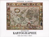
Bagrow, Leo / Skelton, Raleigh Ashlin
Meister der Kartographie. 6. Aufl.
Berlin Gebr. Mann 1994. . Von den Karten primitiver Völker bis ins 18. Jhdt. Mit Erläuterungen zu den Abbildungen von Heinrich Winter Anmerkungen Verzeichnis der abgebildeten Karten Verzeichnis der Kartographen u. ihrer Werke Literaturverzeichnis u. Sachregister mit ca. 1500 Stichworten. - Gutes sauberes Exempöar Berlin, Gebr. Mann, (1994). unknown
Referencia librero : 52158
|
|
|
BAILHE Claude - SACRISTE Alain
Touraine-Orléanais Au Temps Des Boulangers Ambulants , Portraits Scènes et Petits Métiers
Toulouse Milan 1988 Grand In-8 Oblong 131 pp. Nombreuses illustrations N&B in-texte
Referencia librero : 27529
|
|
|
BAILHE Claude / SACRISTE Alain
Paris au temps des marchands de Coco.
Milan, Portraits Scènes et Petits Métiers, 1989, 131 p., cartonnage éditeur oblong, bon état.
Referencia librero : 86403
|
|
|
BAILLE (Hervé).
Messageries Maritimes. Ligne de l'océan Indien. m.s. “Ferdinand de Lesseps” “Jean Laborde” “La Bourdonnais” “Pierre Loti”.
Paris, Messageries Maritimes, [1953]. 569 x 895 mm marges comprises ; replié 285 x 150 mm.
Referencia librero : LBW-8871

|
|
|
BAILLE (Hervé).
Messageries Maritimes. Ligne de Tahiti, Nouvelle Calédonie, Australie. m.s. “Calédonien” “Tahitien”.
Paris, Messageries Maritimes, [1953]. 571 x 895 mm marges comprises ; replié 285 x 147 mm.
Referencia librero : LBW-8835

|
|
|
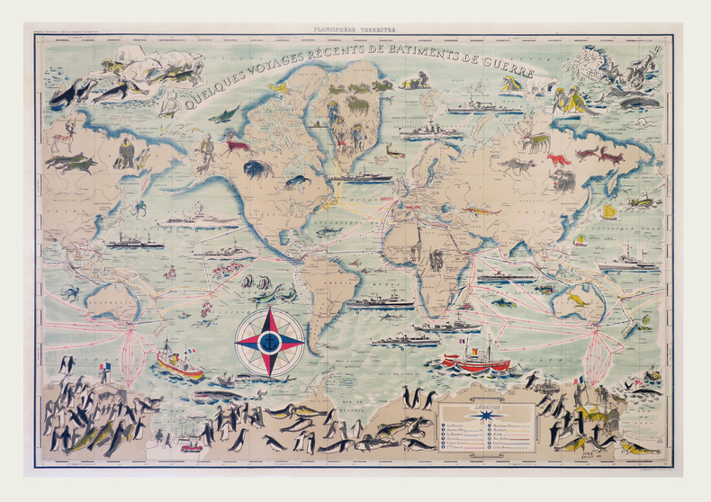
BAILLE (Hervé).
Planisphère terrestre. Quelques voyages récents de bâtiments de guerre.
Paris, G. Barbarin et Cie, [circa 1955]. 695 x 990 mm, monté sur toile.
Referencia librero : LBW-7920
|
|
|
BAILLEUL (Nicolas).
Évêché de Dijon.
Dijon, F. Desventes, 1746. 438 x 613 mm.
Referencia librero : LBW-570
|
|
|
Baillie, Kate and Salmon, Tim
The Rough Guide to Paris
No inscriptions or marks. No creasing to covers or to spine. A lovely clean crisp very tight copy with bright unmarked boards and no bumping to corners. Appears unread and unused. 478pp. Eighth edition. plus maps.

|
|
|
BAILLIEUL (Gaspard).
[FORÊT de COMPIÈGNE] Carte de la forest de Compiègne et ses environs.
Paris, Sr. Baillieul, 1728. 675 x 631 mm.
Referencia librero : LBW-6525

|
|
|
Bailly (Jean Sylvain ; 1736-1793) :
Lettres sur l'Atlantide de Platon et sur l'ancienne histoire de l'Asie. Pour servir de suite aux Lettres sur l'origine des Sciences, adressées à M. de Voltaire par M. Bailly.
Londres, chez M. Elmesly et Paris, Debure, 1779 ; in-8, demi veau marbré, dos à nerfs décoré et doré, titre doré, tranches rouges (reliure de l'époque) ; (4), 480 pp. , carte dépliante de l'Europe, Asie et l'Afrique du Nord, gravée sur cuivre par De la Gardette.
Referencia librero : 17625

|
|
|
BAINS par le dr A. JUNOD ...
Stations balnéaires suisses et leurs sources minérales. Richement illustré de gouaches de Paul KUTSCHA. 2 cartes.
Association des stations balnéaires suisses ... s.d. (vers 1930). Bel exemplaire broché, couverture ornée d'éd., gd in-8, 66 pages.
Referencia librero : AUB-6009
|
|
|
BAKER Sir Samuel White; VATTEMARE Hippolyte (trad.):
Ismailïa, récit d'une expédition dans l'Afrique Centrale pour l'abolition de la traite des Noirs.
Paris, Hachette, 1875. Grand in-8 de [6]-III-439 pages, demi-chagrin rouge, dos à 5 nerfs ornés de filets, fleurons, encadrements et titre dorés, plats de percaline, tranches dorées.
Referencia librero : 11380
|
|
|
Baker, SK
Rail Atlas of Great Britain & Ireland
No inscriptions or marks. A lovely clean crisp very tight copy with bright unmarked boards and no bumping to corners. Dust jacket not price clipped or torn with faint creasing to some edges. 119pp. This fully revised fifth edition details all operational railways - British Rail, London Transport, Tyne & Wear Metro, Irish rail, Northern Ireland Railways and the numerous independant preserved/tourist railways and tramways, standard gauge and narrow gauge.

|
|
|
BALBI, Adriano y MALTE - BRUN, Conrad.
Novísimo Atlas Geográfico Universal para la Escuela de Geografía.
Madrid-Barcelona, Librería de Locadio López-Librería de Juan Llordachs, 1879. 4to. mayor; 2 hs. y 17 mapas dobles coloreados. Pérdida de la mitad del mapa de América Latina. Encuadernación en tela estampada.

|
|
|
Baldwin, H.W.; Weller, J.; Loomis, D.G.; Williams, Samuel T.; Howell, D.W.; Carrington, G.W. Jr.; Brube, F.E.
Marine Corps Gazette - Professional Magazine for United States Marines, October (Oct.) 1962, Number 10, Volume 46 - Counter-Insurgent Operations in Indonesia, 1958
68 pages. Features: Photo ad for the Sikorsky S-61 helicopter; Excellent two-page photo ad for the Vigilant tank killing system by the British Aircraft Corporation, which is mounted on scout cars; Biological Agents in Future War; Small Unit Operations - Counterguerrilla War - Part 5 of a series; Nice photo ad for FMC's new LCA; No Need for Despair (part 1 of 2) - argues WWI combatants hurt each other more than in any war since; Russian Small Arms and Tactics - major photo-illustrated article (part 1 of 2); Counter-Insurgent Operations in Indonesia in 1958 - how Sukharno's government crushed the rebellion is a textbook example of counter-insurgency - major article with photos and maps; Reflections on Leadership; Let's Teach Discipline; Rawin - Our Electronic Weather Eye; Wheels, Tracks and Officer Mechs - making the case that all tank officers should be qualified mechanics; Transfers and Promotions; Back cover photo ad for the Kaman Huskie VMO helicopter; and more. Average wear. Unmarked. A sound vintage copy. Magazine

|
|
|
Balestriere François
Carte illustrée touristique Corse
CLEMENTINE 2019 1 pages 1x25x11cm. 2019. map. 1 pages.
Referencia librero : 500394053

|
|
|
BALINCOURT commandant [Raoul de]:
L'agonie d'un Cuirassé. Carnet de notes du commandant Semenoff de l'état-major de l'Amiral Rojestvensky. Sixième édition.
Paris, Augustin Challamel, 1911. Petit in-8 de 187 pages, pleine percaline bleue, fleuron, filets et titre au dos, couvertures conservées.
Referencia librero : 9929

|
|
|
BALKANS par Eugène PITTARD.
Les peuples des Balkans. Esquisses anthropologiques. Contient 4 cartes et quelques figures.
Neuchâtel, Attinger Frères, éd. s.d. (vers 1920). Bon exemplaire broché, couverture usagée, intérieur frais, gd in-8, 144 pages.
Referencia librero : AUB-8993
|
|
|
BALSLEV, SVEND og HANS EJNER JENSEN.
Landmåling og landmålere. Danmarks økonomiske opmåling. 2 bd.
Kbhvn., Den danske Landinspektørforening, 1975. Orig. halvlæder. 333 s. Illustr. + Mappe i folioformat med 14 farvereproduktioner.
|
|
|
BALSLEV, SVEND og HANS EJNER JENSEN.
Landmåling og landmålere. Danmarks økonomiske opmåling. 2 bd.
Kbhvn., Den danske Landinspektørforening, 1975. Orig. halvlæder. 333 s. Illustr. + Mappe i folioformat med 14 farvereproduktioner.
Referencia librero : 38906
|
|
|
Baltimore Division Road Maps VI
Baltimore and Ohio Railroad Lines Between Connellsville PA Including W&P and P&W and P&LE and other Branches
Baltimore: Safety Through Knowledge 1989. Other. Tall Octavo; VG-; Paperback with comb binding; Covers have moderate stains to the front and rear; Fore edge has minor foxing otherwise text block is clean; 116p. 1323176. FP New Rockville Stock. Safety Through Knowledge unknown books
Referencia librero : 1323176
|
|
|
Bancroft, Hubert Howe; Maps [Illustrator]
The Works of Hubert Howe Bancroft: History of Central America Three Volume Set
Arno Press 1967-01-01. Hardcover. Good. All 3 volumes hardbound copies without jackets Arno Press 1967. Vol. 1 Vol. 6 of Bancroft's Works 1501-1530: bookplate inside front cover marks on back cover no text markings noted. Vol. 2 Vol. 7 of Bancroft's Works 1530-1800: bookplate inside front cover small marks on top edge no text markings noted. Vol. 3 Vol. 8 of Bancroft's Works 1801-1887: bookplate inside front cover no text markings noted. Arno Press hardcover
Referencia librero : 32992set3
|
|
|
Bank of America
Map of Monterey County, California Circa 1937
Map of the county issued by the Bank of America. Includes vital statistics and points of interest. Back side provides a short history of the county and details of the bank. Average wear and soiling. Short openings to periphery. 21.5" x 16.75". Map

|
|
|
BAQUOL (Jacques)
Carte du Bas-Rhin faisant partie du Dictionnaire Géographique historique et statistique du Haut & du Bas Rhin.
1851 1 carte toilée en 12 sections, 560 x 450 mm., Strasbourg Lith. Simon 1851
Referencia librero : 16944
|
|
|
Barabas, Ildiko
Carte vom Hochadelichen Gute Wandsbeck und der dazu gehörige Meierhof Mühlenbeck den Dörfern Hinschenfelde Tonnendorf et Lohe. NACHDRUCK nach einer kolorierten Zeichnung von Lorentz Heinrich Boysen, anno 1805.
Braunschweig, Archiv-Verlag, [ca. 1985]. Mehrfachk gefalt. farb. Karte (Blattgröße ca. 48 x 83 cm; Bildgröße ca. 44 x 78 cm).
Referencia librero : 99384
|
|
|
Barber, Peter (Commentary)
King Henry's Map of the British Isles
A book on the early map of Great Britain and Ireland forming part of the collection assembled by the antiquary and administrator Sir Robert Cotton. 158 pages. With Notes. In slip-case. Slipcase has some light wear.
|
|
|
BARBEY Antonio (attivo tra il 1690 ed il 1714 circa)
Nuova Pianta della Citta di Roma coll'Indice de Tempij Palazzi et Altre Fabriche Antiche e Moderne...
Mappa di Roma del XVII secolo, incisa a Roma da Antonio Barbey e pubblicata da Domenico de Rossi.Si basa sulla grande pianta murale di Giovan Battista Falda, ma mostra con particolare cura gli interventi urbani sotto il pontificato di papa Innocenzo XII, tra i quali la dogana di mare a Ripa Grande (1694). Sono inoltre contenute nella pianta una serie di interessanti note e i nomi delle ville e vigne entro le mura della città.Comprende un elegante cartiglio con titolo e stemma in alto, e un secondo cartiglio con un lungo elenco che individua 464 luoghi di interesse nella Città Eterna.La mappa è orientata a nord-est in alto e comprende siti antichi e moderni. "I lotti edificati sono campiti con puntinato e vengono indicati i nomi di molte strade. L'impostazione generale e vari dettagli denotano la derivazione di questa pianta dalla grande del Falda cui il Barbey apportò però numerosi aggiornamenti. Sono infatti riportati i nuovi interventi di Innocenzo XII tra i quali la dogana di mare a Ripa Grande (1694). Sono inoltre contenute nella pianta una serie di interessanti note e i nomi delle ville e vigne entro le mura della città. In basso a sinistra è scritto Ant. Barbey Sculp. ed a destra Domenico de Rossi [...] l'anno 1697 il di 25 maggio. Sotto il titolo in alto è riportata la dedica a Mons. Ranuccio Pallavicino Governatore di quest'alma Città e vice Camerlengo [...] Innocenzo XII felicemente regnante. Sui due lati legenda con 464 numeri di rimando ed elenco dei XIV rioni, e, in basso a destra, l'indice delle chiese di Roma" (cfr. Marigliani p. 253). Incisione in rame con bellissima coloritura a mano, alcune pieghe di carta perfettamente restaurate, per il resto in buono stato di conservazione. Rara. Bibliografia Frutaz n. 162, Scaccia Scarafoni n. 206, Huelsen n. 135; Marigliani n. 159. Map of Rome from the 17th century, engraved in Rome by Antonio Barbey and published by Domenico de Rossi. It is based on the large wall map by Giovan Battista Falda, but shows with particular care the urban interventions under the pontificate of Pope Innocenzo XII, including the sea customs house at Ripa Grande (1694). The map also contains a number of interesting notes and the names of the villas and vineyards within the city walls. It includes an elegant cartouche with title and coat of arms at the top, and a second cartouche with a long list identifying 464 places of interest in the Eternal City. The map is oriented north-east at the top and includes ancient and modern sites. Built-up lots are dotted and the names of many streets are indicated. The general layout and various details indicate that this map derives from Falda's great map, to which Barbey however made numerous updates. In fact, the new interventions of Innocent XII are shown, including the sea customs house at Ripa Grande (1694). The map also contains a series of interesting notes and the names of the villas and vineyards within the city walls. At lower left is written Ant. Barbey Sculp. and on the right Domenico de Rossi [...] the year 1697 the 25th of May. Under the title at the top there is the dedication to Monsignor Ranuccio Pallavicino Governor of this great City and Vice Camerlengo. On both sides a legend with 464 reference numbers and a list of the XIV districts, and, at the bottom right, the index of the churches of Rome (cf. Marigliani p. 253). Copper engraving with fine later hand colour, few repaired paper folds, otherwise in good condition. Rare. Bibliografia Frutaz n. 162, Scaccia Scarafoni n. 206, Huelsen n. 135; Marigliani n. 159.

|
|
|
BARBIER (Claude) & SCHWARZ (Pierre-François)
Atlas historique au pays de Genève.
Volume 2: Communes Réunies , Communes Démembrées. Nombreuses illustrations de cartes. La Salévienne, 2017. In-4 (28x22cm) de cartonnage souples illustré. 179pp.
Referencia librero : WOC-1388

|
|
|
BARBIER (Claude) & SCHWARZ (Pierre-François)
Atlas Historique du Pays de Genève – Des Celtes au Grand Genève.
Ouvrage orné de cartes en dont 17 cartes hors-texte. La Salévienne, 2014. Petit in-4 (27,5x21,5cm) cartonnage souple illustré et plastifié. 134pp.
Referencia librero : WOC-687
|
|
|
BARBIÉ du BOCAGE, J.D.:
Plan de L’ Hellespont, de la Chersonèse de Thrace et d une grande partie de la Troade. Pour le Voyage du Jeune Anacharsis. Gravé par P.F. Tardieu / L. Aubert scripsit (les textes).
1782 - Germinal An VI, 34x23 cm, carte sous passepartout.
Referencia librero : 130920aaf
|
|
|
Barker, Felix
London from the Air
No marks or inscriptions. A very clean crisp very tight copy with bright unmarked boards and no bumping to corners. Dust jacket not price clipped or marked or torn or creased with light traces of storage. 144pp.

|
|
|
Barnes, Jeremy
The Pictorial History of the American Civil War
208 pages including index. From the first firing of guns at Fort Sumter to the ultimate surrender of the South, richly illustrated with many contemporary engravings and rare photographs as well as many colour illustrations and maps. A must for every Civil War Buff. Clean and unmarked. Very light wear. Gorgeous copy of this handsome work. Book
|
|
|
BARNEVILLE
Carte couleurs au 1/100 000?. Feuille VIII-11. Mise ? jour 1923.
Une feuille 57x45 cm.
|
|
|
Baron, Stanley
The Road to Rome
No marks or inscriptions. A very clean very tight copy with bright unmarked boards and no bumping to corners. Dust jacket not price clipped or marked, torn or creased with a little rubbing to bottom of spine. 307pp. The author follows a route from Boulogne by way of Reims, Colmar, Lucerne, the St Gotthard Pass, Milan, Lake Maggiore, Cremona, Ravenna, Florence and finally Rome where he continues his tour.

|
|
|
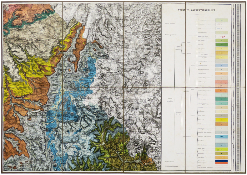
BAROTTE (Jules) & ROYER (Ernest).
Carte géologique du département de la Haute-Marne, exécutée sous les auspices du Conseil Général par MM. E. Royer et J. Barotte, membres de la Société Géologique de France, et publiée de 1859 à 1863 sous l'administration de MM. Girard de Villesaison et Rostan d'Ancezune, Préfets.
Nancy, Wiener Aîné Fils, 1859-1863. En six feuilles coupées en sections et montées sur toile brune, pouvant être jointes pour former une carte d'environ 1,72 x 1,63 m ; étiquette de l'éditeur Wiener Aîné Fils, papetier à Nancy, au dos de chaque carte ; sous emboîtage in-4 de papier marbré de l'époque.
Referencia librero : LBW-6191
|
|
|
BARRALIER (Emmanuel).
[GUERRE RUSSO-JAPONAISE] Carte du théâtre de la Guerre russo-japonaise.
1904. En 20 sections montées sur toile et repliées, formant une carte de 731 x 554 mm ; étiquette au dos de l'éditeur Maison Logerot V.P. Marin.
Referencia librero : LBW-8441

|
|
|
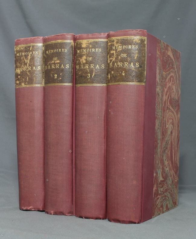
BARRAS Paul; DURUY George (intro):
Mémoires de Barras, membre du directoire.
Paris, Lib. Hachette, 1895-1896. 4 volumes in-8 de LXXXIII-372 / XVI-543 / XXXVI-526 et XXXII-548 pages, demi-percaline bordeaux, dos lisses, étiquettes de titre brunes, un brin frottées, couvertures conservées.
Referencia librero : 1723
|
|
|
BARRE, Josette - FEUGA, Paul
Morand et les Brotteaux
1998 - broché - Editions Lyonnaises d'Art et d'Histoire - Collection Vues de quartiers - 1998 - In-8 (22,5 x 16 cm) broché - 128 pages - Riche iconographie (plans, photographies) en noir et blanc - ISBN : 2-84147-060-1 / 9782841470600
Referencia librero : 981

|
|
|
BARRERE, Henry ; ANDRIVEAU-GOUJON
Empire Ottoman [ Carte de l'Asie Mineure - 1904 ]
Carte entoilée en couleur au format 94 x 68 cm, échelle 1 : 3500000, Maison Andriveau-Goujon, Henry Barrère, Paris, 1904 (mention rev. 1904), carte n° 15, atlas usuel n° 21 ; atlas universel n° 34, gravé : le trait par Smith, la topographie par Gérin, les Ecritures par Rousset, les Eaux par Mme Fontaine Belle grande carte entoilée de l'Empire ottoman (petites usures aux pliures, une petite annotation marginale). Français

|
|
|
BARRERE, Henry ; ANDRIVEAU-GOUJON
Empire Ottoman [ Carte de l'Asie Mineure - 1904 ]
Carte entoilée en couleur au format 94 x 68 cm, échelle 1 : 3500000, Maison Andriveau-Goujon, Henry Barrère, Paris, 1904 (mention rev. 1904), carte n° 15, atlas usuel n° 21 ; atlas universel n° 34, gravé : le trait par Smith, la topographie par Gérin, les Ecritures par Rousset, les Eaux par Mme Fontaine
Referencia librero : 26332

|
|
|
Barrett, Betty and Power, Frances
The Golden Book of Dublin
No inscriptions or marks. No creasing to covers or to spine. A very clean crisp tight copy with bright unmarked boards, very slight traces of handling and no bumping to corners. 64pp. A brief history of Dublin, a guide and map to the city.

|
|
|
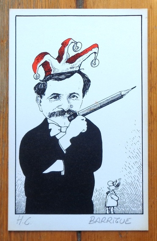
Barrigue:
[Autoportrait au crayon].
Sérigraphie en deux tons, au format 12,5 x 20 cm. Très légèrement jaunie en bord.
Referencia librero : 6306
|
|
|
Barrigue:
Etiquette Dôle de Sierre 1982.
Etiquette et bandeau pour une Dôle de Sierre Tavelli.
Referencia librero : 1899

|
|
|
BARROIS (Charles).
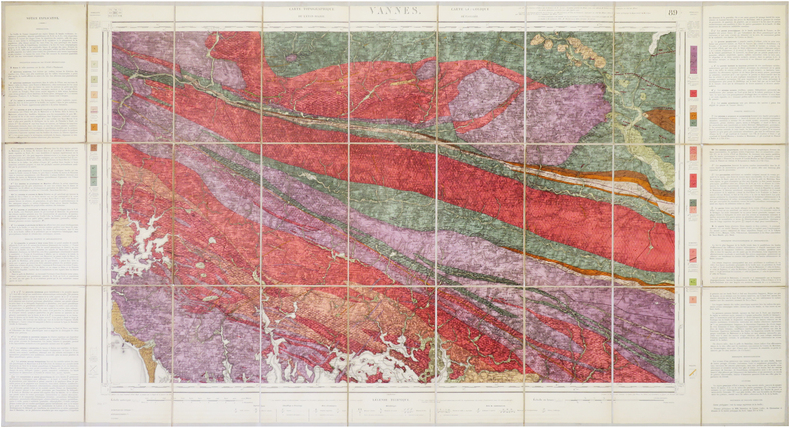
[VANNES/GÉOLOGIE] Carte géologique détaillée. Vannes. Feuille n°89.
Paris, Dépôt de la Guerre, 1890. En 27 sections montées sur toile et repliées, formant une carte de 0,61 x 1,14 m ; étiquette au dos de la carte de la Maison Andriveau-Goujon Henry Barrère, Éditeur Géographe.
Referencia librero : LBW-7857
|
|
|
BARROW, John.
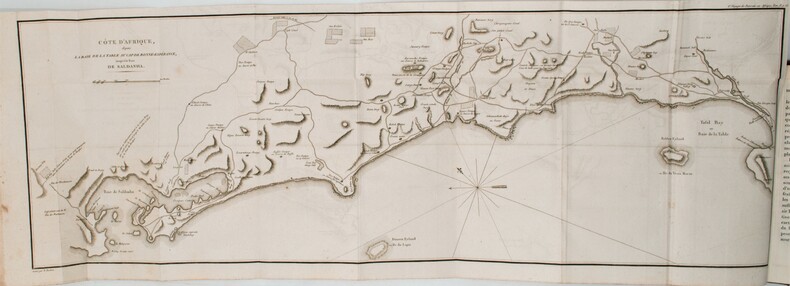
Nouveau voyage dans la partie méridionale de l'Afrique....
Dentu, Imprimeur - Libraire, Paris, 1806, 2 volumes in-8 , x-310pp. ,2ffnch.-312pp. ,illustré de 8 cartes dépliantes , relié plein cuir époque , dos lisse avec pièce de titre rouge et tomaison noire , tranches mouchetées bleues , coupes et coins usés , début de fentes , rares rousseurs , frottements.
Referencia librero : PHO-1285
|
|
|
Barry Gifford.
An Unfortunate Woman. ( Dédicacé par Barry Gifford sur carte postale )
Creative Arts Book Compagny / San Francisco 1984. In-8 cartonnage éditeur de 172 pages au format 14,3 x 22,5 cm. Couverture avec titre imprimé. Dos rond. Plats et intérieur faris. Complet de la belle jaquette illustrée, avec petits frottis aux coins et minuscule déchirure en haut du 1er plat. Edition originale. Exemplaire du service de presse accompagné du prière d'insérer et du carton hommage de l'éditeur ainsi que d'une carte postale, représentant un visage d'Indien Shaman, ornée d'une superbe dédicace autographe, de 13 lignes, signée, et datée de l'auteur. Celles-ci sont très rares.
Referencia librero : 8187

|
|
|
Barrère Henry
France 1 : 100.000. Brest
Maison Andriveau-Goujon Carte 1913 In-8 (12.5x23.5 cm), carte pliée, carte du Finistère reproduite en couleurs ; traces sur les plats, assez bon état. Livraison a domicile (La Poste) ou en Mondial Relay sur simple demande.
Referencia librero : jj5340
|
|
|
BARTHELEMY (Jean-Jacques).
Voyage du jeune Anacharsis en Grèce & Recueil de cartes géographiques, plans, vues, médailles de l'ancienne Grèce.
A Paris, chez E. A. Lequien / de l'Imprimerie de P. Didot l'Aîné, 1822 - A Paris, chez de Bure, 1839 (pour le volume d'Atlas). 7 vol. de texte au format in-8 (225 x 141 mm) de 1 f. bl., 2 ff. n.fol., 1 frontispice gravé n.fol., 451 pp. et 1 f. bl. ; 1 f. bl., 2 ff. n.fol., 488 pp. et 1 f. bl. ; 1 f. bl., 2 ff. n.fol., 462 pp., 1 f. n.fol. et 1 f. bl. ; 1 f. bl., 2 ff. n.fol., 474 pp., 1 f. n.fol. et 1 f. bl. ; 1 f. bl., 2 ff. n.fol., 466 pp., 1 f. n.fol. et 1 f. bl. ; 1 f. bl., 2 ff. n.fol., 423 pp., 1 f. n.fol. et 1 f. bl. ; 1 f. bl., 2 ff. n.fol., 438 pp., 1 f. n.fol. et 1 f. bl. 1 vol. d'Atlas au format pt in-4 (282 x 223 mm) de xlii pp et 31 planches gravées, sous couverture d'attente de l'époque de plein cartonnage gris-perle.
Referencia librero : 19077

|
|

 Recibir por correo electrónico
 Descargar en documento PDF
 Flujo RSS
 Link permanente


