|
Thomas Brothers Maps Editor
Thomas Guide 2003 Santa Barbara San Luis Obispo and Ventura Counties: Street Guide and Directory
Thomas Brothers Maps 2002-08-01. Spiral-bound. Used:Good. Thomas Brothers Maps unknown
Referencia librero : DADAX0528956612 ISBN : 0528956612 9780528956614

|
|
|
Thomas Brothers Maps Editor
Thomas Guide 2003 Tucson Metro Street Guide
Thomas Brothers Maps 2002-09-01. Paperback. Used:Good. Thomas Brothers Maps paperback
Referencia librero : DADAX0528956809 ISBN : 0528956809 9780528956805
|
|
|
Thomas Bros Maps
Thomas Guide 2004 Alameda Country: Street Guide Thomas Guide Alameda County Street Guide & Directory
Thomas Brothers Maps 2003-12. Paperback. Good. Thomas Brothers Maps paperback
Referencia librero : SONG052899946X ISBN : 052899946X 9780528999468

|
|
|
Thomas Brothers Maps
Thomas Guide 1998 Central Valley Cities: Street Guide and Directory Zip Code Addition
Thomas Brothers Maps 1998-01. Spiral-bound. Good. Thomas Brothers Maps unknown
Referencia librero : SONG0881308641 ISBN : 0881308641 9780881308648
|
|
|
Thomas Bros. Maps
Thomas Guide 2001 King County: Street Guide and Directory
Thomas Brothers Maps 2000-06. Paperback. Good. Thomas Brothers Maps paperback
Referencia librero : SONG1581742363 ISBN : 1581742363 9781581742367

|
|
|
Thomas Brothers Maps
Thomas Guide 2000 Los Angeles and Ventura Counties: Street Guide and Directory
Thomas Brothers Maps 1999-09. Paperback. Good. Thomas Brothers Maps paperback
Referencia librero : SONG158174126X ISBN : 158174126X 9781581741261

|
|
|
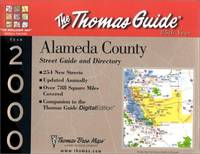
Thomas Bros. Maps
Thomas Guide 2000 Alameda: Street Guide and Directory
Thomas Brothers Maps 1999-10. Paperback. Good. Thomas Brothers Maps paperback
Referencia librero : SONG1581741057 ISBN : 1581741057 9781581741056
|
|
|
Thomas Brothers Maps
Thomas Guide 2000 Orange and Los Anleles Counties: Street Guide and Directory Thomas Guides Maps
Thomas Brothers Maps 1999-07. Paperback. Good. Thomas Brothers Maps paperback
Referencia librero : SONG1581741391 ISBN : 1581741391 9781581741391

|
|
|
Thomas Bros. Maps
Thomas Guide 2000 Metro Washington D.C.: Street Guide and Directory Thomas Guides Maps
Thomas Brothers Maps 2000-01. Map. Good. Thomas Brothers Maps unknown
Referencia librero : SONG1581741340 ISBN : 1581741340 9781581741346

|
|
|
Thomas Brothers Maps
Thomas Guide Santa Barbara San Luis Obispo and Ventura Counties: Street Guide and Directory
Thomas Brothers Maps 1999-09. Paperback. Good. Thomas Brothers Maps paperback
Referencia librero : SONG1581741634 ISBN : 1581741634 9781581741636

|
|
|
Thomas Bros. Maps
Thomas Guide 2001: Riverside and Orange Counties : Street Guide and Directory Thomas Guide Riverside/Orange Counties Street Guide & Directory
Thomas Brothers Maps 2000-08. Paperback. Good. Thomas Brothers Maps paperback
Referencia librero : SONG1581742711 ISBN : 1581742711 9781581742718

|
|
|
Thomas Bros. Maps
Thomas Guide Metropolitan Baltimore: Baltimore Carroll Harford Howard and Anne Arundel Counties Thomas Guides Maps
Thomas Brothers Maps 2000-01. Paperback. Good. Thomas Brothers Maps paperback
Referencia librero : SONG1581742126 ISBN : 1581742126 9781581742121

|
|
|
Thomas Bros. Maps
Thomas Guide 1999 San Diego and Orange County Thomas Guide San Diego/Orange Counties Street Guide & Directory
Thomas Brothers Maps 1998-09. Paperback. Good. Thomas Brothers Maps paperback
Referencia librero : SONG1581740565 ISBN : 1581740565 9781581740561
|
|
|
Thomas Bros. Maps
Thomas Guide 2000 San Bernardino and Riverside Counties: Street Guide and Directory : Zip Code Edition Thomas Guides Maps
Thomas Brothers Maps 1999-07. Paperback. Good. Thomas Brothers Maps paperback
Referencia librero : SONG1581741545 ISBN : 1581741545 9781581741544
|
|
|
Thomas Bros. Maps
Thomas Guide 2001 Riverside County: Street Guide and Directory Thomas Guide Riverside County Street Guide & Directory
Thomas Brothers Maps 2000-09. Paperback. Good. Thomas Brothers Maps paperback
Referencia librero : SONG1581742703 ISBN : 1581742703 9781581742701

|
|
|
Thomas Bros. Maps
Thomas Guide 2000 Napa and Sonoma Counties: Street Guide and Directory
Thomas Brothers Maps 1999-01. Paperback. Good. Thomas Brothers Maps paperback
Referencia librero : SONG1581741928 ISBN : 1581741928 9781581741926
|
|
|
Thomas Bros. Maps
Thomas Guide 2000 San Diego: Including Portions of Imperial County : Street Guide and Directory : Zip Code Edition San Diego County Street Guide and Zip Code
Thomas Brothers Maps 1999-08. Paperback. Good. Thomas Brothers Maps paperback
Referencia librero : SONG1581741561 ISBN : 1581741561 9781581741568
|
|
|
Thomas Brothers Maps
Thomas Guide 2003 Santa Clara County Street Guide SANTA CLARA COUNTY STREET GUIDE AND DIRECTORY
Thomas Brothers Maps. Used - Good. Shows some signs of wear and may have some markings on the inside. Thomas Brothers Maps unknown
Referencia librero : GRP37395880 ISBN : 0528956760 9780528956768

|
|
|
Thomas Bros Maps
Thomas Guide 2005 Santa Clara County: Street Guide and Directory
Thomas Brothers Maps 2004-09-10. Paperback. Good. Thomas Brothers Maps paperback
Referencia librero : SONG0528853910 ISBN : 0528853910 9780528853913

|
|
|
Thomas Brothers Maps
Thomas Guide 2005 Napa & Sonoma Counties Street Guide Napa and Sonoma Counties Street Guide and Directory
Thomas Brothers Maps 2004-10-15. Spiral-bound. Good. Thomas Brothers Maps unknown
Referencia librero : SONG0528854313 ISBN : 0528854313 9780528854316

|
|
|
Thomas Brothers Maps; Rand McNally
Thomas Guide California Road Atlas: Including Portions of Nevada : Spiral
Rand Mcnally 2004-03. Spiral-bound. Good. Rand Mcnally unknown
Referencia librero : SONG0528995715 ISBN : 0528995715 9780528995712

|
|
|
Thomas Bros Maps
Thomas Guide 2004 Los Angeles County Street Guide Thomas Guide Los Angeles County Street Guide & Directory
Thomas Brothers Maps 2004-01. Spiral-bound. Good. Thomas Brothers Maps unknown
Referencia librero : SONG052899932X ISBN : 052899932X 9780528999321

|
|
|
Thomas Bros Maps
Thomas Guide 2004 Bay Area Metro Street Guide: Metro Areas of Alameda Contra Costa Marin San Francisco San Mateo Santa Clara Counties
Thomas Brothers Maps 2003-12. Spiral-bound. Good. Thomas Brothers Maps unknown
Referencia librero : SONG0528999532 ISBN : 0528999532 9780528999536

|
|
|
Thomas Bros. Maps
Thomas Guide 1999 California Road Atlas and Driver's Guide California Road Atlas and Driver's Guide 1999
Thomas Brothers Maps 1999-03. Spiral-bound. Good. Thomas Brothers Maps unknown
Referencia librero : SONG0881309826 ISBN : 0881309826 9780881309829

|
|
|
Thomas Brothers Maps; Thomas Bros Maps
Thomas Guide 2000 Clark County Street Guide and Directory: Including: Las Vegas North Las Vegas Henderson Boulder City Misquite and Laughlin
Thomas Brothers Maps 1999-12. Spiral-bound. Good. Thomas Brothers Maps unknown
Referencia librero : SONG1581740700 ISBN : 1581740700 9781581740707

|
|
|
Thomas Bros. Maps
Thomas Guide 1999 Sacramento/Solando Street Guide and Directory: Placer El Dorado Napa and Yolo Counties
Thomas Brothers Maps 1998-11. Paperback. Good. Thomas Brothers Maps paperback
Referencia librero : SONG1581740476 ISBN : 1581740476 9781581740479
|
|
|
Thomas Bros. Maps
Thomas Guide 2000 San Diego and Orange Counties: Including Portions of Imperial County : Street Guide and Directory Thomas Guide San Diego/Orange Counties Street Guide & Directory
Thomas Brothers Maps 1999-10. Paperback. Good. Thomas Brothers Maps paperback
Referencia librero : SONG158174157X ISBN : 158174157X 9781581741575

|
|
|
Thomas Bros. Maps
Thomas Guide 1999 Metropolitan Bay Area
Thomas Brothers Maps 1998-11. Paperback. Acceptable. Thomas Brothers Maps paperback
Referencia librero : SONG1581740263 ISBN : 1581740263 9781581740264
|
|
|
Thomas Bros. Maps
Thomas Guide 1999 Los Angeles County: Street Guide and Directory
Thomas Brothers Maps 1998-10. Paperback. Good. Thomas Brothers Maps paperback
Referencia librero : SONG1581740158 ISBN : 1581740158 9781581740158
|
|
|
Thomas Brothers Maps
Thomas Guide 2000 Los Angeles and Orange Counties: Street Guide and Directory Los Angeles and Orange Counties Street Guide
Thomas Brothers Maps 1999-09. Spiral-bound. Good. Thomas Brothers Maps unknown
Referencia librero : SONG1581741243 ISBN : 1581741243 9781581741247

|
|
|
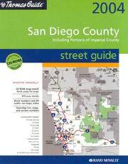
Thomas Bros Maps
Thomas Guide 2004 San Diego Including Portions of Imperial County: Street Guide San Diego County Including Portions of Imperial County Street Guide and Directory
acceptable. BOOK ONLY NO DISK spiral bound paperback. cover and corner wear. name on cover. cover edge is taped. creased covers. paperback
Referencia librero : B61102BxxxN14388 ISBN : 0528999303 9780528999307
|
|
|
Thomas Brothers Maps
Zip Los Angeles Orange Counties 1993
Thomas Brothers Maps 1992-10-01. Unbound. Good. . Thomas Brothers Maps unknown
Referencia librero : mon0002172550
|
|
|
Thomas Brothers Maps
Zip Los Angeles Orange Counties 1993
Thomas Brothers Maps 1992-10-01. Unbound. Good. . Cover/edges are worn and or have small tears otherwise good reading copy. Thomas Brothers Maps unknown
Referencia librero : mon0001759878
|
|
|
Thomas Bros. Maps
Marin County street guide and directory
Ring binding with stiff laminated paper wraps. 1 atlas (1 volume (various pagings)) : color maps ; 21 x 24 cm. Maps. Marin County (Calif.) -- Maps. California -- Marin County. Scale [1:15,840]. 1 in. to 1/4 mile. || Cover title: "The Thomas Guide."/ Table of contents page title: Marin County, the Thomas Guide./ Includes indexes and "northern California fold-out map."/ "TBM 3025."
|
|
|
Thomas DipPubPol PhD MAPS Shane A.
How to Write Health Sciences Papers Dissertations and Theses
Churchill Livingstone 2000. Paperback. Acceptable. Disclaimer:A readable copy. All pages are intact and the cover is intact. Pages can include considerable notes-in pen or highlighter-but the notes cannot obscure the text. At ThriftBooks our motto is: Read More Spend Less.Dust jacket quality is not guaranteed. Churchill Livingstone paperback
Referencia librero : G0443062838I5N00 ISBN : 0443062838 9780443062834

|
|
|
Thomas DipPubPol PhD MAPS Shane A.
How to Write Health Sciences Papers Dissertations and Theses 1e
Churchill Livingstone. annotated edition. Paperback. Used; Good. Simply Brit Shipped with Premium postal service within 24 hours from the UK with impressive delivery time. We have dispatched from our book depository; items of good condition to over ten million satisfied customers worldwide. We are committed to providing you with reliable and efficient service at all times. 05/04/2000 Churchill Livingstone paperback
Referencia librero : 1535536 ISBN : 0443062838 9780443062834

|
|
|
Thomas Maps Editors
CALIFORNIA Road Atlas & Driver's Guide
Thomas Bros. Maps Irvine 1989 Quarto softcover VG in orange and blue pictorial wraps. Gives state highways major metro highway maps selected detail street maps of cities points of interest and includes Las Vegas and Reno. 12 sensational driving tours. Takes you all over California. 307 pp. . Thomas Bros. Maps, Irvine, 1989 paperback
Referencia librero : 55651 ISBN : 0851303399 9780851303390
|
|
|
Thompson Jerry/Vandiver Frank E. foreword/Garza Jr. Leonel illus/Roach Oralia maps
Henry Hopkins Sibley: Confederate General of the West
Natchitoches: Northwestern State University Press 1987. 1st printing. VG/no dust jacket. xx 399 p. illus maps chapter vignettes footnotes biblio index 8vo; Northwestern State University Press hardcover
Referencia librero : 70595 ISBN : 091789815X 9780917898150

|
|
|
Thompson Ruth Plumly; Martin Dick; Haff James E. Maps
YANKEE IN OZ
Kinderhook IL: International Wizard of Oz Club 1972. First Edition. Hardcover. Quarto; VG hardcover; Blue cloth spine with no lettering; Boards are straight with some very minor wear at the edges and the corners; Binding is tight; Text block is bright and clean; First edition only appr. 100 copies printed in light blue cloth. 92 pages. Shelved in Netdesk office on shelf to the right of ephemera items. Rockville Non-Retail Listings. International Wizard of Oz Club hardcover
Referencia librero : 13-114-1228082

|
|
|
Thompson, Courtney
Lighthouses of Atlantic Canada: A Pictorial Guide - New Brunswick, Nova Scotia, Prince Edward Island, Newfoundland & Labrador
128 pages. Index. Profusely illustrated with wonderful colour photos of lighthouses from each province, plus maps and directions, history, legend, lore and descriptions. Printed upon glossy stock. Clean and unmarked with moderate external wear. A quality copy of this charming and informative work. Book

|
|
|
Thompson, John M. T. / Stewart, Hugh B
Nonlinear Dynamics and Chaos.
New York, John Wiley & Sons, 1991. Geometrical methods for engineers and scientists XVI, 376 S. (24 cm) illustrierter Pappband / gebundene Ausgabe
Referencia librero : 55373 ISBN : 471909602
|
|
|
THORNE Noël
Lyon à la belle époque
Bruxelles, Editions Libro-Sciences, 1973. In-12, format à l'italenne. Cartonnage éditeur toie verte avec une llustration en noir et blanc contre-collée sur le 1er plat. 137 pages de reproductions NB de cartes postales anciennes légendées. Une petite tache sur la couverture sans gravité. Bon état de l'ensemble.
Referencia librero : 5248

|
|
|
THURA D.
Répertoire des cartes postales dessinées.
SEDLI/Jacky Goupil, 1984. In-8 broché, 110 pages, illustré de nombreuses vignettes dessinées. Bon état, peu courant.
Referencia librero : 14982
|
|
|
THYS Commandant
NIEUPORT 1914 1918
Les inondations de l’Yser et la compagnie des sapeurs pompiers du génie Belge. In 4 demi cuir fauve raciné à nerfs, faux-titre, titre, portrait de Léopold CALBERG tué à l’écluse de l’Yser le 16 juillet 1917. XX-148 pages, 551 figures (photos) et plans, certains dépliants, table des gravures III tables des photographies et des croquis supplémentaires relatifs aux chapitres I à XII (photos 138 à 551) 1pgae lexique de la terminologie locale, errata, 2 table des matières. Grande carte dépliante des inondations de l’Yser et Wateringue du nord de Furnes. Paris Berger-Levrault-Liège, Henri Desoer- Londres, Constable & Cie 1922. L’ensemble sur papier couché, non rogné. Edition originale. Bon exemplaire, peu courant
Referencia librero : 10768

|
|
|
Tiffou Jacky
Commenter la carte topographique aux examens et concours
Armand Colin Dos carré collé 2001 In-8 (16 x 24 cm), dos carré collé, 187 pages, figures en noir et blanc ; légères pliures d'usage au premier plat, bande brunie le long du mors inférieur au quatrième plat, par ailleurs bon état général. Livraison a domicile (La Poste) ou en Mondial Relay sur simple demande.
Referencia librero : lr626
|
|
|
TILLEY, Roger
Cartes à jouer et Tarots
1969 Editions Hachette, collection " Plaisir des images". 1939. 1 vol in-8 format carré, cartonnage éditeur illustré. 120 pages. Illustrations en noir et blanc et en couleur en et hors texte
Referencia librero : 99061
|
|
|
Tilmont
Atlas Classique
Wesmael Charlier Claire Rigide Illustrée Namur 1971 grand livre format A3
Referencia librero : 057124
|
|
|
Time Traveler Maps Creator
The Colorado Plateau: Map & Guide to Public Lands on the Colorado Plateau & its Borderlands
Time Traveler Maps 2004-06-01. 2nd. Map. Used:Good. Time Traveler Maps unknown
Referencia librero : DADAX1892040166 ISBN : 1892040166 9781892040169
|
|
|
Tirion Isaak Pugsley William H. William Howard donor WH. Pugsley Collection of Early Canadian Maps W. H.
Nieuwe kaart van kanada : de landen aan de Hudsons-Baay en de noordwestelyke deelen van Noord-Amerika 1769 Leather Bound
2019. Leather Bound. New. Leather Binding on Spine and Corners with Golden Leaf Printing on round Spine extra customization on request like complete leather Golden Screen printing in Front Color Leather Colored book etc. Reprinted in 2019 with the help of original edition published long back 1769. This book is printed in black & white sewing binding for longer life Printed on high quality Paper re-sized as per Current standards professionally processed without changing its contents. As these are old books we processed each page manually and make them readable but in some cases some pages which are blur or missing or black spots. If it is multi volume set then it is only single volume if you wish to order a specific or all the volumes you may contact us. We expect that you will understand our compulsion in these books. We found this book important for the readers who want to know more about our old treasure so we brought it back to the shelves. Hope you will like it and give your comments and suggestions. Lang: - Dutch. EXTRA 10 DAYS APART FROM THE NORMAL SHIPPING PERIOD WILL BE REQUIRED FOR LEATHER BOUND BOOKS. COMPLETE LEATHER WILL COST YOU EXTRA US$ 25 APART FROM THE LEATHER BOUND BOOKS. hardcover
Referencia librero : LB1111007011002
|
|
|
Tirion Isaak Pugsley William H. William Howard donor WH. Pugsley Collection of Early Canadian Maps W. H.
Nieuwe kaart van kanada : de landen aan de Hudsons-Baay en de noordwestelyke deelen van Noord-Amerika 1769 FULL LEATHER BOUND
2019. SUPER DELUXE EDITION. New. Antique look with Golden Leaf Printing and embossing with round Spine completely handmade bindingextra customization on request like Color Leather Colored book special gold leaf printing etc. Reprinted in 2019 with the help of original edition published long back 1769. This book is printed in black & white sewing binding for longer life Printed on high quality Paper re-sized as per Current standards professionally processed without changing its contents. As these are old books we processed each page manually and make them readable but in some cases some pages which are blur or missing or black spots. If it is multi volume set then it is only single volume if you wish to order a specific or all the volumes you may contact us. We expect that you will understand our compulsion in these books. We found this book important for the readers who want to know more about our old treasure in old look so we brought it back to the shelves. Hope you will like it and give your comments and suggestions. Lang: - Dutch. EXTRA 10 DAYS APART FROM THE NORMAL SHIPPING PERIOD WILL BE REQUIRED. Normal Hardbound Edition is also available on request. unknown
Referencia librero : SD1111007011002
|
|
 Recibir por correo electrónico
 Descargar en documento PDF
 Flujo RSS


