|
American Drafting and Maps
East Texas Folded Map
2004-01-01. Good. Ships with Tracking Number! INTERNATIONAL WORLDWIDE Shipping available. May not contain Access Codes or Supplements. May be re-issue. May be ex-library. Shipping & Handling by region. Buy with confidence excellent customer service! unknown
Riferimento per il libraio : 1932105514 ISBN : 1932105514 9781932105513

|
|
|
Americana Maps Wyoming Yellowstone National Park
1935 Motorists Guide Yellowstone National Park
United States: National Park Service 1935. Folding map-pamphlet for this national park; approx. 21" x 25" size; the map portion printed in colors and is for Yellowstone and Grand Teton parks; the reverse provides a smaller black & white map of the western part of the U.S. with "Where to go from Yellowstone" travel hints; panels provide much information about the park and its rules protection of habitat & creatures description of amenities & sights accommodations services fishing automobile repair shops stores news stands park milepost system roads much more; some soiling wear at folds; in very good condition. First Edition. Soft Cover. Very Good. National Park Service Paperback
Riferimento per il libraio : 22907
|
|
|
AMIEUX-FRERES
CARTE TOURISTIQUE DE LA BRETAGNE EDITEE PAR AMIEUX-FRERES DANS LE BUT DE FACILITER AUX EXCURSIONNISTES L'ETABLLISSEMENT D'UN ITINERAIRE LES CONDUISANT AUX CURIOSITES LES PLUS INTERESSANTES DE LA BRETAGNE (1926)
Paris Draeger Imprimeur pour AMIEUX-FRERES 1926 -in-8 carte en couleurs , repliée petit in-octavo (20 x 14 cm) avec pochette editeur illustrée en bordeaux, dépliée : 56 x 75,5 cm, carte en orange et rouge avec une illustration photographique en noir dans le cartouche en bas à gauche et un dessin en rouge et orangé donnant la Situation Géographique des 16 conserveries AMIEUX-FRERES en france, sans date (1926) Paris Draeger Imprimeur pour AMIEUX-FRERES Editeur
Riferimento per il libraio : 22597
|
|
|
AMIENS
Carte au 1/200 000e. Sans date.
Une feuille 32x50 cm.
|
|
|
AMIENS
Carte au 1/80 000e des environs d'Amiens. R?vis?e en 1928-1931.
Une feuille 57x57 cm repli?e, annot?e.
|
|
|
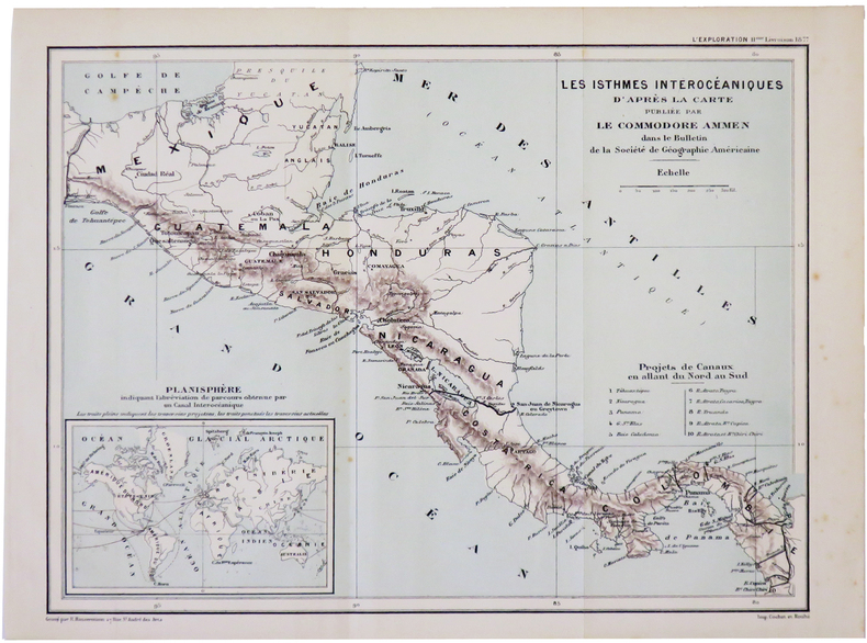
AMMEN (Daniel).
[AMÉRIQUE CENTRALE] Les isthmes interocéaniques d'après la carte publiée par le Commodore Ammen.
[1877]. 213 x 286 mm.
Riferimento per il libraio : LBW-5016
|
|
|
Amy Singer Amy Singer Editor historic ottoman prints and maps Illustrator
Starting with Food: Culinary Approaches to Ottoman History
Markus Wiener Publishing Inc 2011-01-15. Paperback. Used:Good. Markus Wiener Publishing Inc paperback
Riferimento per il libraio : DADAX155876514X ISBN : 155876514X 9781558765146
|
|
|
Amy Singer; Illustrator historic ottoman prints and maps
Starting with Food: Culinary Approaches to Ottoman History
Markus Wiener Publishing Inc 2011-01-15. Paperback. Good. Markus Wiener Publishing Inc paperback
Riferimento per il libraio : SONG155876514X ISBN : 155876514X 9781558765146
|
|
|
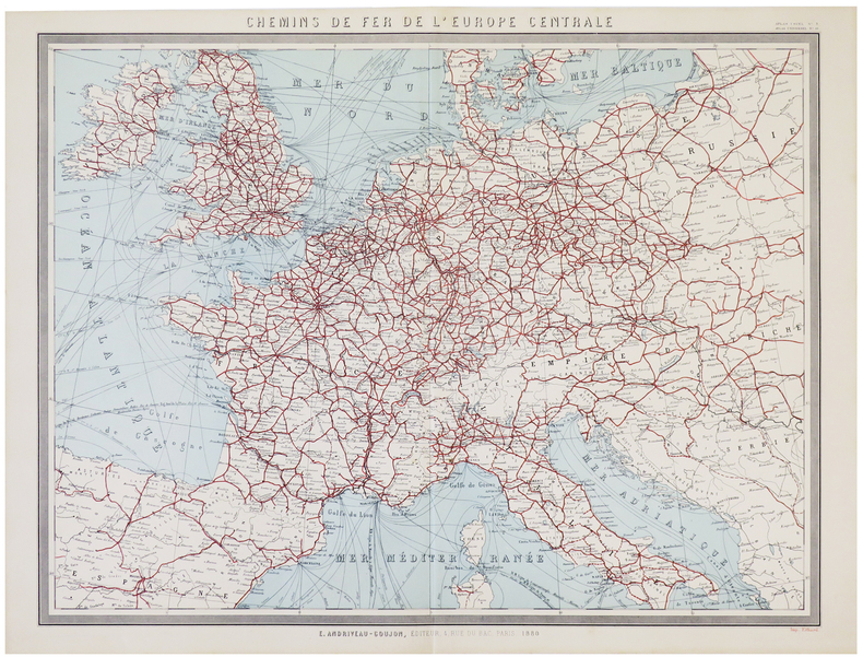
ANDRIVEAU-GOUJON (Eugène).
[CHEMINS de FER] Chemins de fer de l'Europe centrale.
Paris, E. Andriveau-Goujon, 1880. 503 x 637 mm.
Riferimento per il libraio : LBW-5785
|
|
|
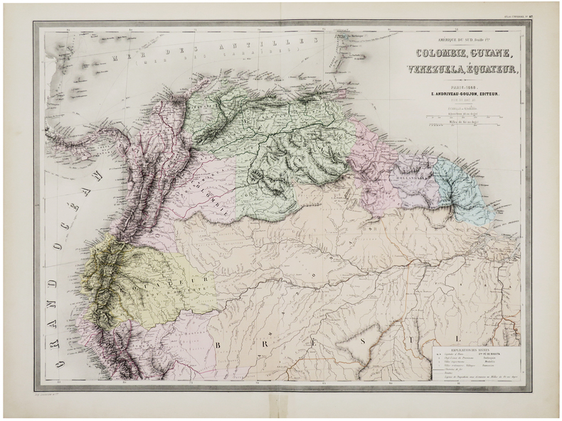
ANDRIVEAU-GOUJON (Eugène).
[COLOMBIE, GUYANE, VENEZUELA & ÉQUATEUR] Amérique du Sud. Feuille 1ère. Colombie, Guyane, Venezuela, Équateur.
Paris, E. Andriveau-Goujon, 1858. 470 x 635 mm.
Riferimento per il libraio : LBW-6095
|
|
|
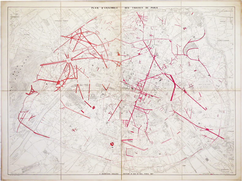
ANDRIVEAU-GOUJON (Eugène).
[TRAVAUX d'HAUSSMANN] Plan d'ensemble des travaux de Paris.
Paris, E. Andriveau-Goujon, 1867. En 8 sections montées sur toile et pliées, formant un plan de 0,99 x 1,30 m.
Riferimento per il libraio : LBW-6483
|
|
|
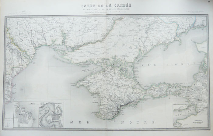
ANDRIVEAU-GOUJON (J.).
[UKRAINE] Carte de la Crimée et d'une partie de la Russie méridionale d'après les cartes de l'Etat-major russe et les documents les plus récents.
Paris, J. Andriveau-Goujon, 1856. 579 x 955 mm.
Riferimento per il libraio : LBW-1084
|
|
|
ANDREWS (Jonathan) & WREN (Matthew).
A Plan of Hartford.
London, A. Dury, 1766. 430 x 569 mm.
Riferimento per il libraio : LBW-764

|
|
|
ANDREWS (Jonathan) & WREN (Matthew).
A Plan of the town of St. Albans, in Hartfordshire.
London, A. Dury, 1766. 420 x 573 mm.
Riferimento per il libraio : LBW-765
|
|
|
ANDREWS (John).
A Plan of the city of Paris.
Londres, J. Stockdale, 1800. 230 x 255 mm.
Riferimento per il libraio : LBW-6863

|
|
|
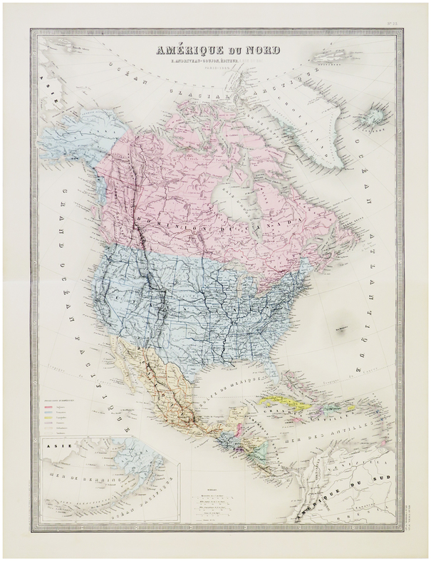
ANDRIVEAU-GOUJON (Eugène).
Amérique du Nord.
Paris, E. Andriveau-Goujon, 1880. 624 x 460 mm.
Riferimento per il libraio : LBW-5799
|
|
|
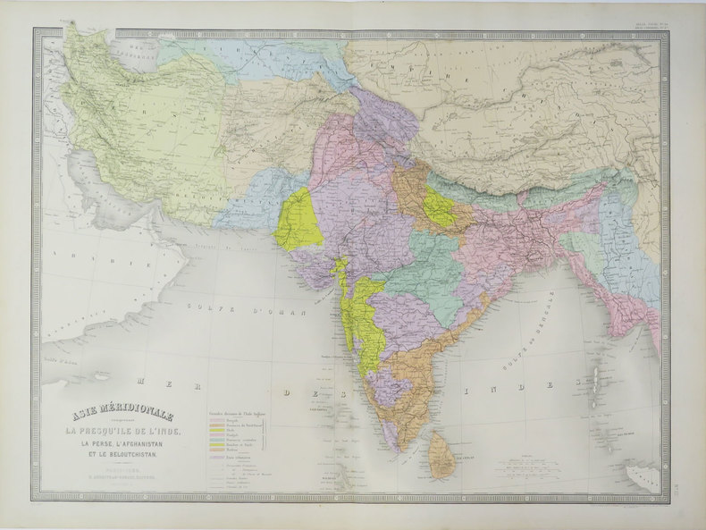
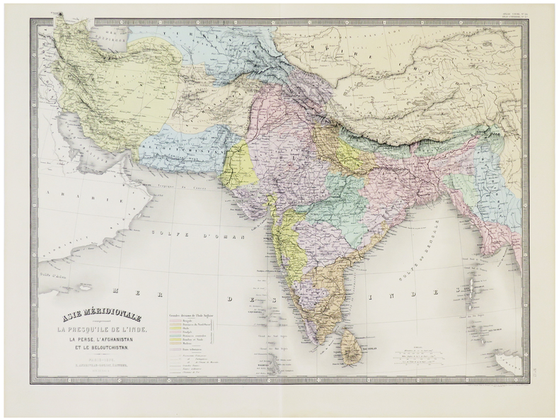
ANDRIVEAU-GOUJON (Eugène).
Asie méridionale comprenant la presqu'île de l'Inde, la Perse, l'Afghanistan et le Beloutchistan.
Paris, E. Andriveau-Goujon, 1889. 462 x 622 mm.
Riferimento per il libraio : LBW-3621
|
|
|
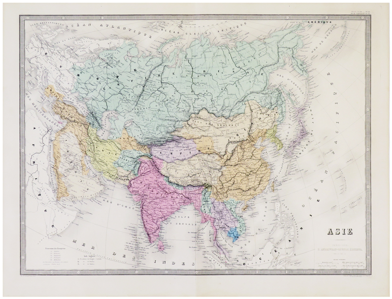
ANDRIVEAU-GOUJON (Eugène).
Asie.
Paris, E. Andriveau-Goujon, 1879. 463 x 627 mm.
Riferimento per il libraio : LBW-5792
|
|
|
ANDRIVEAU-GOUJON (Eugène).
Asie méridionale comprenant la presqu'île de l'Inde, la Perse, l'Afghanistan et le Beloutchistan.
Paris, E. Andriveau-Goujon, 1876. 463 x 628 mm.
Riferimento per il libraio : LBW-5793
|
|
|
ANDRIVEAU-GOUJON (Eugène).
Carte de l'Europe orientale comprenant la Russie d'Europe, l'empire ottoman et la Grèce.
Paris, E. Andriveau-Goujon, 1863. En deux feuilles, chacune de 618 x 464 mm.
Riferimento per il libraio : LBW061e9
|
|
|
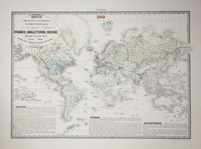
ANDRIVEAU-GOUJON (J.).
Carte comparative et synchronique de l'étendue territoriale des trois grandes puissances France, Angleterre, Russie, pendant le dernier siècle 1740-1840.
Paris, J. Andriveau-Goujon, 1840. Deux mappemondes de 432 mm x 592 mm et 430 x 605 mm.
Riferimento per il libraio : LBW-2620
|
|
|
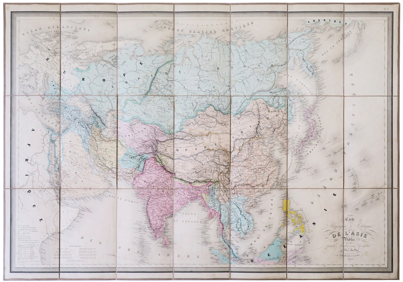
ANDRIVEAU-GOUJON (Eugène).
Carte physique & politique de l'Asie.
Paris, E. Andriveau-Goujon, 1861. En 21 sections montées sur toile et pliées, formant une carte de 673 x 943 mm, sous chemise et étui de papier marbré bleu, étiquette illustrée de l'éditeur E. Andriveau-Goujon au dos.
Riferimento per il libraio : LBW-5129
|
|
|
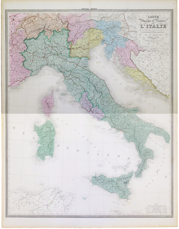
ANDRIVEAU-GOUJON (J.).
Carte physique et routière de l'Italie indiquant les distances d'un relais à l'autre et les dernières divisions politiques.
Paris, E. Andriveau-Goujon, 1863. En deux feuilles pouvant être jointes pour former une carte de 1,19 x 0,96 m.
Riferimento per il libraio : LBW-5227
|
|
|
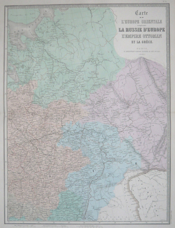
ANDRIVEAU-GOUJON (Eugène).
Carte de l'Europe orientale comprenant la Russie d'Europe, l'Empire ottoman et la Grèce.
Paris, E. Andriveau-Goujon, 1877. En quatre feuilles pouvant être jointes pour former une carte de 1,24 x 0,90 m.
Riferimento per il libraio : LBW-5791
|
|
|
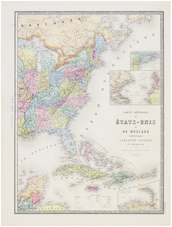
ANDRIVEAU-GOUJON (Eugène).
Carte générale des États-Unis et du Mexique comprenant l'Amérique Centrale et les Antilles.
Paris, E. Andriveau-Goujon, 1876. En deux feuilles pouvant être jointes pour former une carte de 623 x 900 mm.
Riferimento per il libraio : LBW-5800
|
|
|
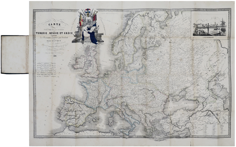
ANDRIEU (J. B.).
Carte [du] théâtre de la guerre en Turquie, Russie et Grèce donnant les royaumes neutres qui bordent la mer Baltique.
Paris, chez l'auteur, 1854. 571 x 856 mm, replié et monté dans une reliure en percaline verte avec étiquette illustrée sur le premier plat.
Riferimento per il libraio : LBW-6420
|
|
|
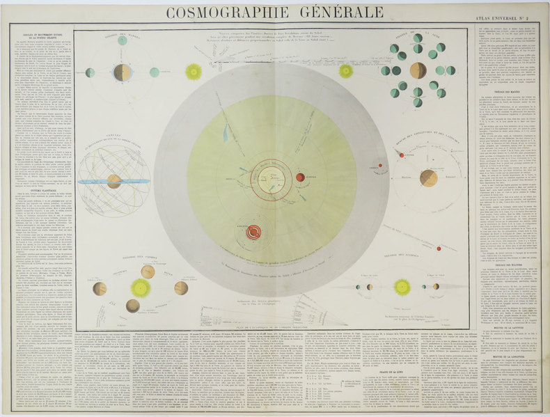
ANDRIVEAU-GOUJON (Eugène).
Cosmographie générale.
[circa 1880]. 513 x 669 mm.
Riferimento per il libraio : LBW-3532
|
|
|
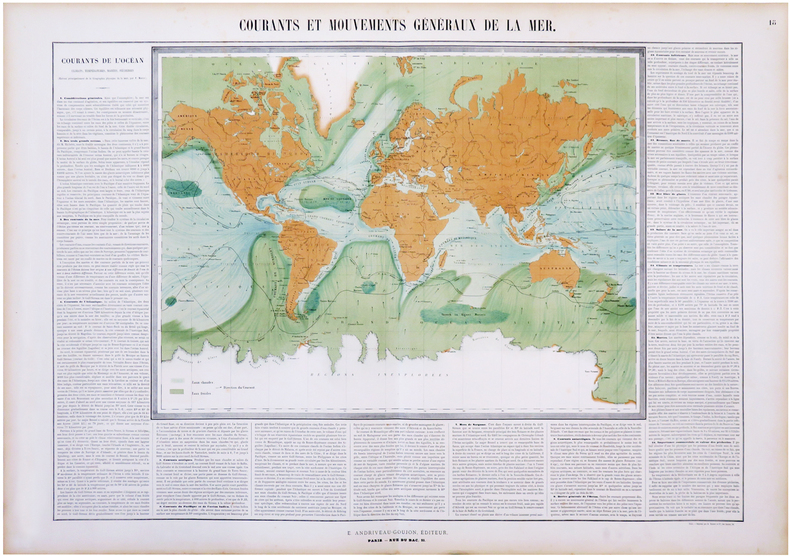
ANDRIVEAU-GOUJON (Eugène) & MAURY (Matthew Fontaine).
Courants et mouvements généraux de la mer.
Paris, E. Andriveau-Goujon, 1864. 660 x 886 mm.
Riferimento per il libraio : LBW-6828
|
|
|
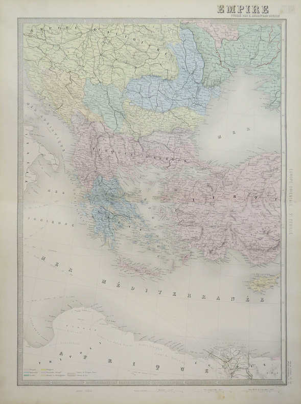
ANDRIVEAU-GOUJON (Eugène).
Empire Ottoman.
Paris, E. Andriveau-Goujon, 1889. En deux feuilles pouvant être jointes pour former une carte de 655 x 900 mm.
Riferimento per il libraio : LBW-3622
|
|
|
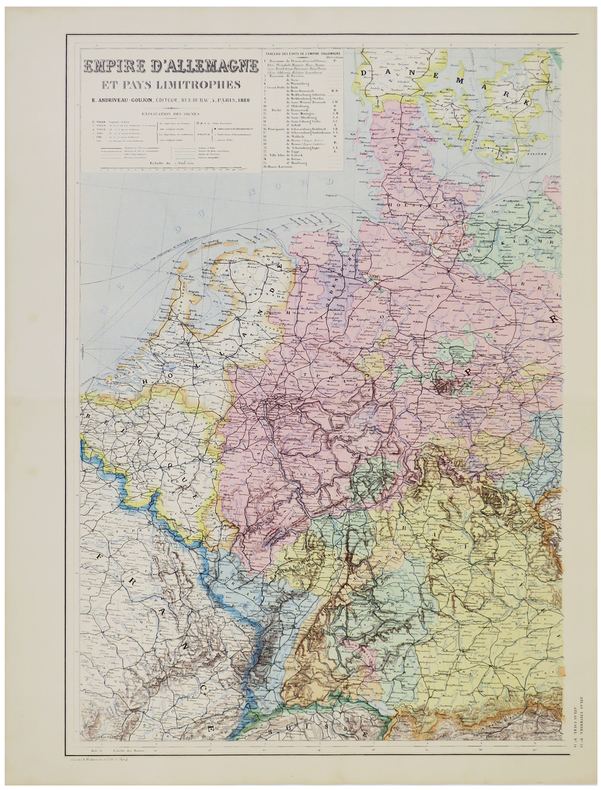
ANDRIVEAU-GOUJON (Eugène).
Empire d'Allemagne et pays limitrophes.
Paris, E. Andriveau-Goujon, 1880. En deux feuilles pouvant être jointes pour former une carte de 645 x 880 mm.
Riferimento per il libraio : LBW-5790
|
|
|
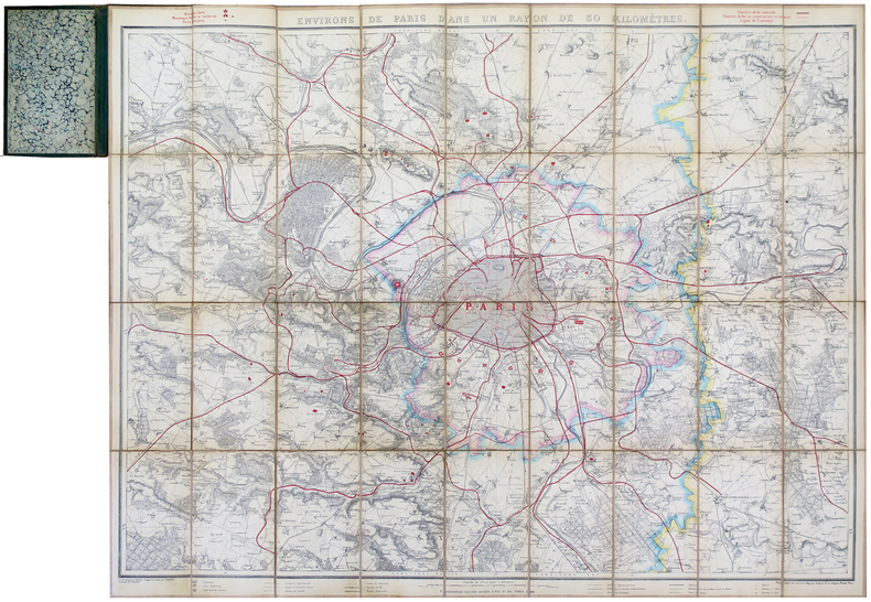
ANDRIVEAU-GOUJON (Eugène).
Environs de Paris dans un rayon de 30 kilomètres.
Paris, E. Andriveau-Goujon, 1881. En 36 sections montées sur toile et pliées, formant une carte de 0,83 x 1,05 m, monté dans une reliure en percaline de couleur verte avec titre en lettres dorées sur le premier plat ; étiquette de l'éditeur au dos du plan.
Riferimento per il libraio : LBW-5659
|
|
|
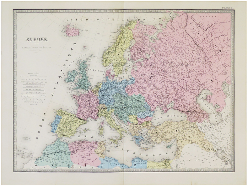
ANDRIVEAU-GOUJON (Eugène).
Europe.
Paris, E. Andriveau-Goujon, 1879. 462 x 626 mm.
Riferimento per il libraio : LBW-5784
|
|
|
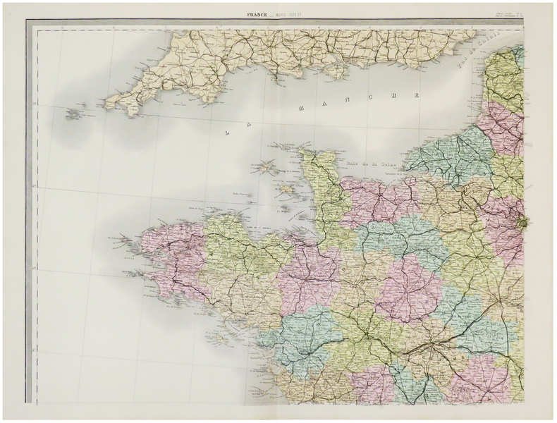
ANDRIVEAU-GOUJON (Eugène).
France.
Paris, E. Andriveau-Goujon, 1880. En quatre feuilles pouvant être jointes pour former une carte de 0,97 x 1,26 m.
Riferimento per il libraio : LBW-5788
|
|
|
ANDRIVEAU-GOUJON (Eugène).
Italie.
Paris, E. Andriveau-Goujon, 1881. 622 x 460 mm.
Riferimento per il libraio : LBW-5789

|
|
|
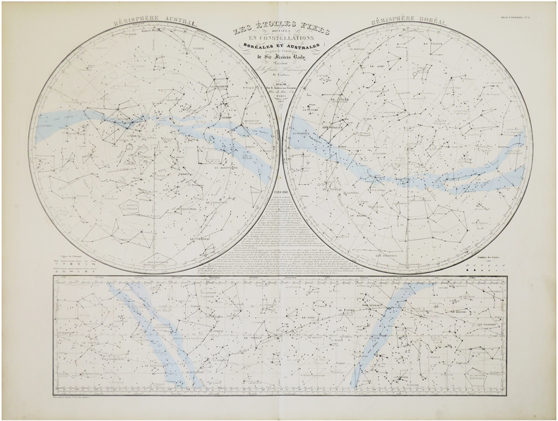
ANDRIVEAU-GOUJON (Eugène).
Les étoiles fixes divisées en constellations boréales et australes d'après le catalogue de Sir Francis Baily, Président de la Société Astronomique de Londres.
Paris, E. Andriveau-Goujon,. 1860 478 x 632 mm.
Riferimento per il libraio : LBW-7847
|
|
|
ANDRIVEAU-GOUJON (J.)
Les Etoiles fixes divisées en constellations Boréales et Australes d'après le catalogue de Sir Francis Baily
1830 pliée. carte 63 x 88 cms. P. Andriveau-Goujon (ca. 1830)
Riferimento per il libraio : 11804
|
|
|
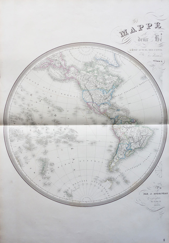
ANDRIVEAU-GOUJON (J.);
Mappemonde en deux hémisphères suivant l'état actuel des connaissances géographiques et les derniers voyages autour du monde.
Paris J. Andriveau-Goujon 1854 En deux feuilles non jointes pouvant former une carte d'environ 870 mm x 1,31 m.
Riferimento per il libraio : LBW-1798
|
|
|
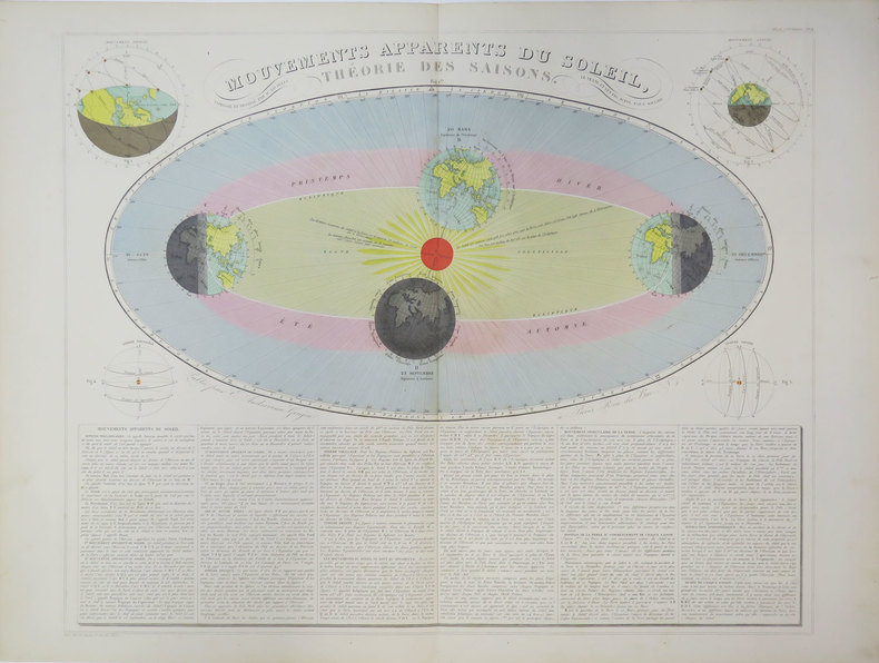
ANDRIVEAU-GOUJON (Eugène).
Mouvements apparents du Soleil, théorie des saisons.
Paris, E. Andriveau-Goujon, [circa 1880]. 470 x 587 mm.
Riferimento per il libraio : LBW-3624
|
|
|
ANDREUX Jean-Louis
Namur à La Belle Epoque.
Bruxelles, Editions Libro-Sciences, 1972. 21 x 15, sans pagination, 120 illustrations en N/B (cartes postales), reliure d'édition pleine toile, bon état.
Riferimento per il libraio : 79062
|
|
|
ANDRIVEAU-GOUJON (Eugène).
Pavillons et cocardes des principales puissances du globe d'après des documens officiels.
Paris, E. Andriveau-Goujon, 1860. 460 x 582 mm.
Riferimento per il libraio : LBW-5148

|
|
|
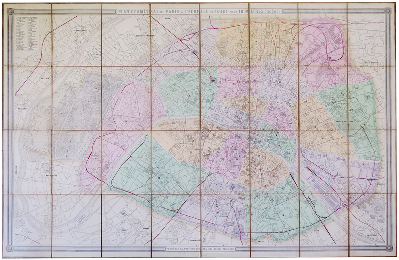
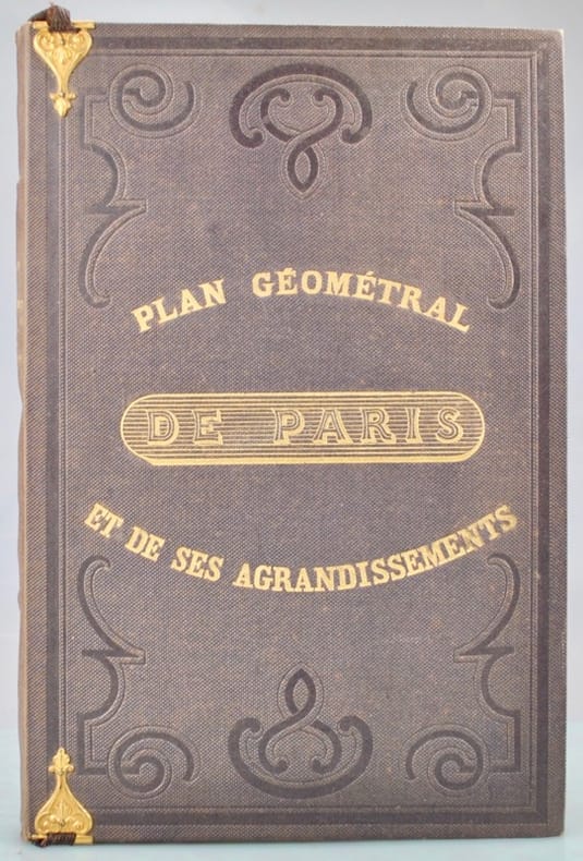
ANDRIVEAU-GOUJON (Eugène).
Plan géométral de Paris et de ses agrandissements à l'échelle d'un millimètre pour 10 m (10,1000).
Paris, E. Andriveau-Goujon, 1860. En 36 sections jointes et montées sur toile, de 1 x 1,49 m.
Riferimento per il libraio : LBW-3410

|
|
|
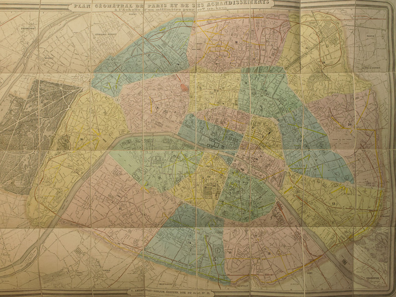
ANDRIVEAU-GOUJON (Eugène).
Plan géométral de Paris à l'échelle de 0.001 pour 10 mêtres (1/10,000).
Paris, E. Andriveau-Goujon, 1879. En 32 sections jointes et montées sur toile de 1,05 x 1,56 m ; étiquette de l'éditeur au dos.
Riferimento per il libraio : LBW-5725
|
|
|
ANDRIVEAU-GOUJON (Eugène).
Plan géométral de Paris et de ses agrandissements à l'échelle d'un millimètre pour 10 m (10,1000).
Paris, E. Andriveau-Goujon, 1862. En 36 sections jointes et montées sur toile, formant un plan de 1,04 x 1,54 m ; étiquette de l'éditeur au dos ; plan placé dans une chemise en percaline verte de l’éditeur avec une pochette contenant la liste des rues sur 27 pages, titre en lettres dorées sur le premier plat et sur le dos, marque de l’éditeur sur le second plat figurant un globe terrestre centré sur Paris, petites pinces métalliques retenant un ruban (détaché) sur le premier plat.
Riferimento per il libraio : LBW-6294

|
|
|
ANDRIVEAU-GOUJON, E.
Plan géométral de Paris et de ses agrandissements à l'échelle d'un millimètre pour 10 m (1/10 000). [ Plan de Paris en couleurs - 1869 ]
1 carte entoilée dépliante sous chemise cartonnée et étui au format 104 x 156 cm, en couleurs, E. Andriveau-Goujon, Paris, 1867
Riferimento per il libraio : 34688
|
|
|
ANDRIVEAU-GOUJON (Eugène).
Plan géométral de Paris et de ses agrandissements, à l'échelle de 1 millimètre pour 10 mètres.
Paris, Andriveau-Goujon, 1861. 1 plan colorié, replié et entoilé de 154 x 104 cm, et 1 livret in-8 de 28 pp., couverture imprimée, percaline brune de l'éditeur.
Riferimento per il libraio : 42235
|
|
|
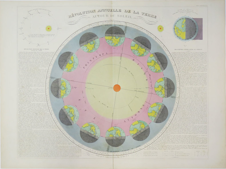
ANDRIVEAU-GOUJON (Eugène).
Révolution annuelle de la Terre autour du Soleil.
Paris, E. Andriveau-Goujon, [circa 1880]. 469 x 586 mm.
Riferimento per il libraio : LBW-3623
|
|
|
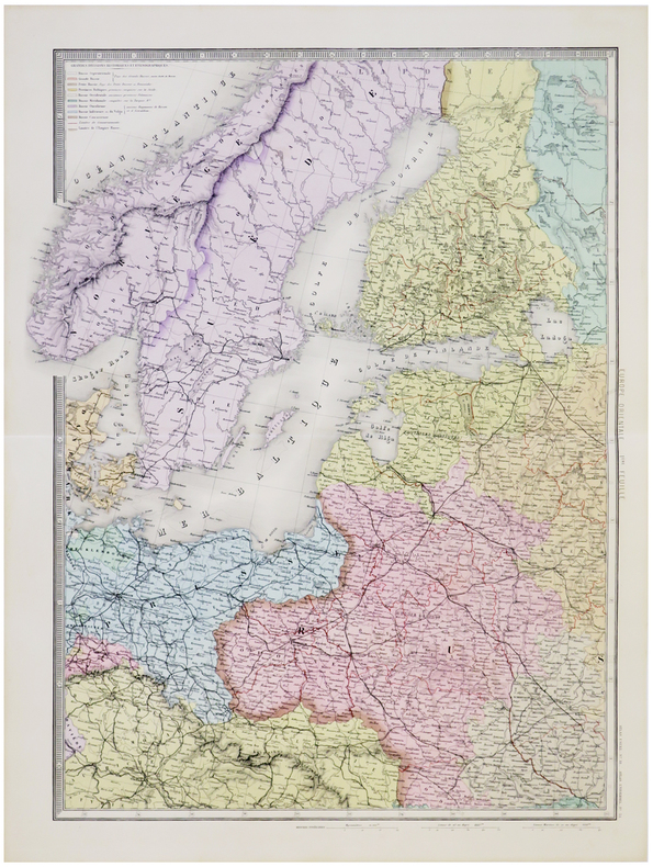
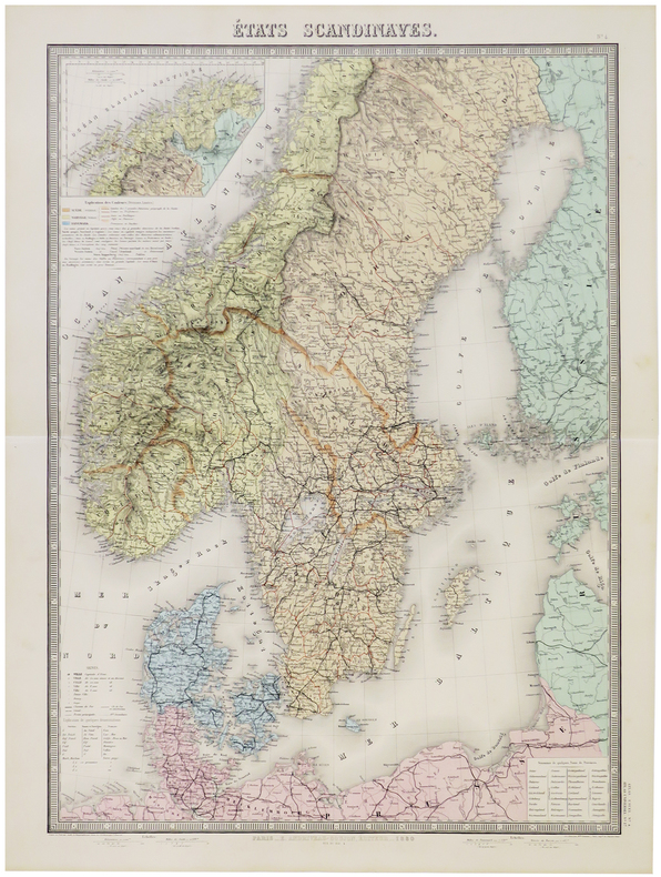
ANDRIVEAU-GOUJON (Eugène).
États scandinaves.
Paris, E. Andriveau-Goujon, 1880. 660 x 462 mm.
Riferimento per il libraio : LBW-5786
|
|
|
Anderson Brian and Eileen Anderson photographs by the authors maps and plans by Robert Smith
ALGARVE AND SOUTHERN PORTUGAL PASSPORT'S REGIONAL GUIDES OF PORTUGAL
Lincolnwood: Passport Books / NTC Publishing Group 1996. Very Good. 1996. First Edition. Trade Paperback. 0844245453 . Presumed first edition no statement of printing. 199 pages illustrated index. VG copy with some bumping to a portion of the rear spine edge. . Passport Books / NTC Publishing Group [1996] paperback
Riferimento per il libraio : 28681 ISBN : 0844245453 9780844245454

|
|
|
ANDERSON LORRAINE & ABBY PHILLIPS METZGER WITH MAPS BY MONICA DROST
Wild In The Willamette: Exploring The Mid-valley's Parks Trails And Natural Areas
Oregon State University Press Corvallis: 2015. Softcover. Brand new book. Located between the population centers of Portland and Eugene Oregon's Willamette Valley boasts rich opportunities for outdoor recreation that are too often overlooked. Wild in the Willamette is a guidebook to the natural treasures of the mid-Willamette Valley extending far beyond the familiar I-5 corridor. Sprinkled with natural history sidebars and infused with essays by notable local authors it aims to connect residents and visitors with the best hiking biking and paddling opportunities the mid-Valley offers. With a special focus on seven watersheds�the Marys Calapooia South Santiam North Santiam Luckiamute Yamhill and Pudding�as well as the middle portion of the main stem Willamette River the book describes a range of outings at different levels of challenge. Families with young children day hikers long-distance backpackers kayakers canoeists bird watchers and cyclists alike will find ideas for spending a satisfying afternoon or venturing outside for a multiday trip. Whether choosing a wheelchair-accessible trail a rugged hike in a wilderness area a dip in a rocky swimming hole a paddle on the broad Willamette or a bike ride through farmland�whether lifetime residents or week-long visitors�outdoor enthusiasts will benefit from detailed notes on the history and ecology of this special place. Armchair travelers will also find reward in the book's literary and natural history offerings. Generously illustrated with maps and keys to the area's many attractions Wild in the Willamette a companion volume to the Portland-Vancouver region's Wild in the City is an essential guide to the natural wonders of Oregon's mid-Willamette Valley. 6 � 9 100 two-color maps and illustrations 384 pages. Oregon State University Press, Corvallis: 2015 paperback
Riferimento per il libraio : 88504X1
|
|
|
Anderson, Brian and Eileen
Landscapes of Turkey around Antalya
Appears unread in virtually mint condition Large pull-out map in excellent condition. 133pp. Walking tours in Rhodes plus car trips and picnic places.

|
|
 Ricevere i risultati per e-mail
 Scaricare i risultati in PDF
 RSS feed


