|
Carey Brian Todd; tactical maps illustrated by Joshua B. Allfree; regional maps illustrated by John Cairns
Hannibal's Last Battle: Zama and the Fall of Carthage
Yardley Pennsylvania: Westholme Publishing 2008. 1st. Hardcover. Book fine Dust jacket fine. <br/><br/> Westholme Publishing hardcover books
Ссылка продавца : 9009390 ISBN : 1594160759 9781594160752

|
|
|
Caribbean Maps: Edwards Bryan: Humphreys James publisher: Seymour Joseph H. engraver
A NEW ATLAS OF THE BRITISH WEST INDIES WITH A WHOLE SHEET GENERAL MAP OF THE WEST INDIA ISLANDS AND A WHOLE SHEET MAP OF THE ISLAND OF HISPANIOLA OR ST. DOMINGO
Philadelphia: James Humphreys 1806. Two leaves of text and eleven maps three folding. Quarto. Original marbled boards neatly rebacked in antique calf spine gilt leather label. Text leaves lightly toned scattered foxing to maps. Slight separation at folds of Hispaniola map. A few small tears at edges. About very good. A rare early American atlas published to accompany the Philadelphia edition of Bryan Edwards' HISTORY OF THE WEST INDIES 1806 first published in London in 1793. Edwards 1743-1800 was a British politician and sometime Jamaica planter. "Edwards was a diligent and able writer of West Indian history. Of his literary works the most important is his two-volume HISTORY CIVIL AND COMMERCIAL OF THE BRITISH COLONIES IN THE WEST INDIES published in London in 1793. According to Elsa Goveia its scope is large providing 'a complete account of the British islands - their origin and progress their political system their inhabitants customs institutions agriculture and commerce.' Edwards wrote that he attempted 'to describe the manners and dispositions of the present inhabitants as influenced by climate situation and other local causes.an account of the African slave trade some observations on the negro character and genius and reflections on the system of slavery established in our colonies.' This classic work ran into five editions was expanded to five volumes in the last edition which appeared in 1819 and was translated into French German Dutch Portuguese and Italian" - DNB. This production is notable as a piece of early American cartography. The first American atlas of any kind was produced in 1794 by Mathew Carey also of Philadelphia. James Humphreys 1748-1810 was an ambitious Philadelphia printer who began printing prior to the Revolution. His unwillingness to openly side with the American cause during the war resulted in his being labeled as a Loyalist which had a somewhat negative impact on his later career. He left Philadelphia with the British moving to New York and then later to England and Nova Scotia before returning to Philadelphia in 1797 to reestablish his press. This handsome atlas is one of the most important of his publications from his later career. The maps were engraved by Joseph H. Seymour an American- trained engraver who began working for Isaiah Thomas in Worcester Massachusetts as early as 1791. He worked for Thomas extensively until relocating to Philadelphia from about 1803 to 1822 where he continued his trade as an engraver producing this atlas among his other works. The maps are as follows: "A General Map of the West Indies" as well as individual maps of Jamaica Barbados Grenada St. Vincent Dominica St. Christopher and Nevis Antigua the Virgin Islands Tobago and Hispaniola. The "General Map" as well as the maps of Jamaica and Hispaniola are larger folding sheets. SHAW & SHOEMAKER 10342. DNB online. James Humphreys hardcover
Ссылка продавца : WRCAM46236

|
|
|
Caribbean Maps: Norie J. W.
THE ISLAND OF ANTIGUA. Revised by J.W. Norie 1827
Antigua but actually Philadelphia: R.B. Eldridge & Co. 1860. Lithographic sheet map 20 1/2 x 26 1/2 inches. Backed with contemporary blue paper. Light foxing and toning. A few small tears in margins. Very good. An unusual lithographic edition of Norie's 1827 revision of this handsome chart lithographed by Wagner & McGuigan in Philadelphia. A statement in the cartouche reads: "Presented by R.B. Eldridge Antigua to Captain Andrew Tyler." The captain's name is accomplished in manuscript. R.B. Eldridge is not listed in Tooley's DICTIONARY OF MAPMAKERS and appears to be unrelated to publisher of charts George Eldridge. It seems most likely that he was rather an Antigua merchant who commissioned a reprint of the chart for complimentary distribution to sea captains. A handsome piece. R.B. Eldridge & Co. unknown
Ссылка продавца : WRCAM48522

|
|
|
Caribbean Maps: Norie J. W.
THE ISLAND OF ANTIGUA. Revised by J.W. Norie 1827
Antigua but actually Philadelphia: R.B. Eldridge & Co. 1860. Lithographic sheet map 20 1/2 x 26 1/2 inches. Backed with contemporary blue paper. Light foxing and toning. A few small tears in margins. Very good. An unusual lithographic edition of Norie's 1827 revision of this handsome chart lithographed by Wagner & McGuigan in Philadelphia. A statement in the cartouche reads: "Presented by R.B. Eldridge Antigua to Captain Andrew Tyler." The captain's name is accomplished in manuscript. R.B. Eldridge is not listed in Tooley's DICTIONARY OF MAPMAKERS and appears to be unrelated to publisher of charts George Eldridge. It seems most likely that he was rather an Antigua merchant who commissioned a reprint of the chart for complimentary distribution to sea captains. A handsome piece. R.B. Eldridge & Co. unknown books
Ссылка продавца : WRCAM48522
|
|
|
Carlson Loraine; maps by Neil Carlson
MEXICO: an Extraordinary Guide
Chicago: Rand McNally 1971. Stated 1st printing. Hardback in orange cloth boards in color illus jacket. VG ex-library copy else unmarked in VG unclipped jacket in Brodart. Comprehensive reference and time capsule. <br/><br/>6-1/4 x 9-1/4 416 pp index appendix b/w maps. Rand McNally hardcover
Ссылка продавца : 35079
|
|
|
CARMICHAEL, Joel
Histoire illustrée de la Russie
1960 Editions NRF Gallimard, Collection "L'Oeil" - 1960 - In-4, cartonnage rouge illustré - 303 p. - Illustrations et reproductions photographiques en N&B in et hors-texte
Ссылка продавца : 109620
|
|
|
carnet de cartes postales
SAIL-SOUS-COUZAN.
Sail-sous-Couzan, Robert-Bonneton, s.d. (fin XIXème ou début Xxème), 1 br. carnet in-12 oblong de 10 cartes postales détachables, serpentes ;
Ссылка продавца : 15196
|
|
|
carnet de cartes postales
Souvenir d'une visite à Notre-Dame de Fourvière. Lyon.
Paris, Levy, s.d. (fin XIXème ou début XXème), 1 br., couverture illustrée. carnet in-12 oblong de 12 cartes postales détachables, 1 feuillet de texte, serpentes ;
Ссылка продавца : 15197
|
|
|
carnet de cartes postales.
Souvenir de Fourvière.
Lyon, Magasin de l'Oeuvre de Fourvière, s.d. (fin XIXème ou début XXème), 1 br., couverture illustrée. carnet oblong de 20 cartes postales, serpentes ;
Ссылка продавца : 15202
|
|
|
CARNEVALE-MAUZAN Mirande
Achille Mauzan. 1883-1952. L'oeuvre Complet (Catalogue raisonné).
2001 Fort in-4 Cartonnage et étui illustrés de l'éditeur
Ссылка продавца : 009577
|
|
|
Caro Ina; Cain maps David
Paris to the Past: Traveling Through French History by Train
W.W. Norton. Caro Ina. Paris to the Past: Traveling Through French History by Train. Cain maps David. New York: W.W. Norton 2012. 381pp. Indexed. Bibliography. 8vo. Paperback. Book condition: Near fine. . Fine. 2012. W.W. Norton paperback
Ссылка продавца : UCARPAR00TM
|
|
|
Caro Ina; Cain maps David
Paris to the Past: Traveling Through French History by Train
W.W. Norton 2012. Fine. Caro Ina. Paris to the Past: Traveling Through French History by Train. Cain maps David. New York: W.W. Norton 2012. 381pp. Indexed. Bibliography. 8vo. Paperback. Book condition: Near fine. W.W. Norton paperback books
Ссылка продавца : UCARPAR00TM
|
|
|
CAROCCI (Giuseppe).
[FLORENCE] Vue de l'I. et R. Palais Pitti.
[circa 1830]. 152 x 210 mm.
Ссылка продавца : LBW-8428

|
|
|
CAROCCI (Giuseppe).
[FLORENCE] Vue de la métropolitaine de Florence.
[circa 1830]. 166 x 215 mm.
Ссылка продавца : LBW-8417

|
|
|
CAROCCI (Giuseppe).
[FLORENCE] Vue de la place de S. Croce.
[circa 1830]. 145 x 190 mm.
Ссылка продавца : LBW-8421

|
|
|
CAROCCI (Giuseppe).
[FLORENCE] Vue de la place du Grand Duc.
[circa 1830]. 153 x 186 mm.
Ссылка продавца : LBW-8416

|
|
|
CARPENTRAS
Carte au 1/100.000 de l'arrondissement de Carpentras.
1893 cartonnage toilé rouge éditeur. carte repliée, 450 x560mm., en couleurs, P. Hachette 1893
Ссылка продавца : 17166
|
|
|
Carr John
A STRANGER IN IRELAND OR A TOUR IN THE SOUTHERN AND WESTERN PART OF THAT COUNTRY IN THE YEAR 1805
London: Printed for Richard Phillips Sold By Souter No. 1 Pater-noster-row. 1806. A very good "large paper" copy with uncut edges leaf size approximately 285mm x 225mm with a few additional items bound in. Pp. xiv 2 530 ii ii. 16 hand-tinted aquatints of which several folding map plus an additional contemporary hand-coloured map of Ireland as frontispiece. Contents: frontispiece quarto format map - engraved for the Poem of Erin. The folding plate of Dublin shown as the frontispiece in the "Directions for Placing the Plates" has been bound in opposite the first page of text title page dedication prefacecontents errata directions for placing the engravings main body of the text additional page on St. Patrick from "Guide to Knowledge" bound in at rear before the Publisher's adverts cutting from the Times 1842 entitled "Robert Emmet and the Gaoler of Kilmainham" pasted to rear paste-down. Original paper-covered boards with recent pebbled cloth spine to match original with the original paper title-label applied to the spine binding in very good condition. Contents very good the uncut edges are a little worn in places and a couple of a small near-contemporary oval stamps of the "Baptist College Bristol" to the front end paper no other marks. Paper in very good condition without any obvious staining minimal foxing almost completly confined to the tissue guards maps and plates all very good clean and crisp short repaired tear to the edge of page 318 not nearly affecting the text. A very good to fine copy. First Edition. Hardcover. Very Good/No Dust Jacket. Large 4to. Book. Printed for Richard Phillips, Sold By Souter, No. 1, Pater-noster-row. Hardcover
Ссылка продавца : 009589

|
|
|
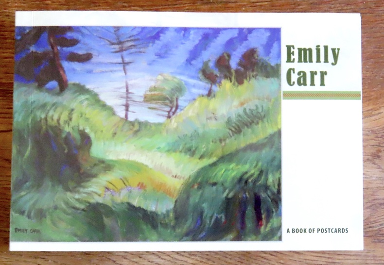
Carr Emily:
Emily Carr - A book of postcards.
Portland, Pomegranate, 2008. Livret composé de 30 cartes postales au format 18 x 12. Un carte détachée, les autres reliées encore mais détachables bien sûr, le book est complet des 30 cartes.
Ссылка продавца : 15602
|
|
|
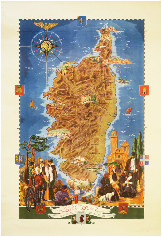
CARRIAT-ROLANT (Gabriel).
[CORSE] La Corse.
Casablanca, Éditions A.F.R.I.P., [circa 1950]. Lithographie en couleurs de 815 x 520 mm.
Ссылка продавца : LBW-8062
|
|
|
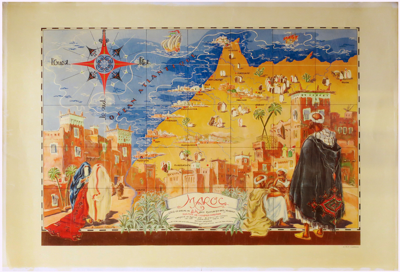
CARRIAT-ROLANT (Gabriel).
Maroc sous le règne de S.M. Sidi Mohamed Ben Yousef, sultan de l'Empire chérifien, composé et dessiné par G. Carriat-Rolant l'an 1947, Hégire 1366.
Casablanca, A.F.R.I.P., 1947. Lithographie en couleurs de 650 x 907 mm.
Ссылка продавца : LBW-6867
|
|
|
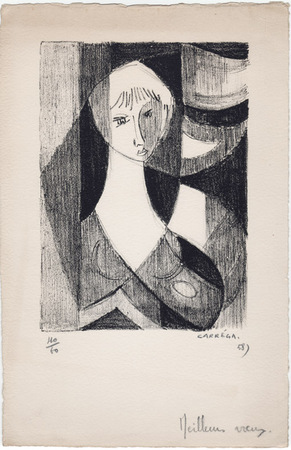
Carréga, Nicolas
Nicolas Carréga : carte de voeux pour 1958 et lithographie originale
1958 Carte de voeux de Nicolas Carréga pour 1958. 25 x 16,5 cm, une lithographie originale en noir (16,5 x 12 cm), numérotée 40/60, signée et datée à la mine de plomb. Avec un ajout autographe ("meilleurs voeux") en pied.
Ссылка продавца : 1058
|
|
|
CARTE BLONDEL
Carte couleurs : Bords de Loire au 1/320 000?. Sans date.
Une feuille 44x64 cm.
|
|
|
CARTE BLONDEL
Carte couleurs de la Vend?e au 1/200 000?. Sans date.
1feuille 75x56 cm.
|
|
|
CARTE DEPARTEMENTALE
D?partement de la Somme. Carte couleurs au 1/200 000e.
1 feuille 50x70 cm.
|
|
|
CARTE DEPARTEMENTALE
Is?re. Cartes couleurs au 1/200 000e. Sans date.
1 feuille repli?e sous chemise. 55x75 cm.
|
|
|
CARTE DEPARTEMENTALE
Savoie. Cartes couleurs au 1/200 000e. Sans date.
1 feuille repli?e sous chemise. 55x75 cm.
|
|
|
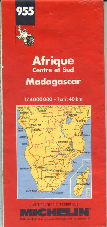
CARTE MICHELIN
Afrique Centre et Sud. Madagascar.
Ссылка продавца : 143308
|
|
|
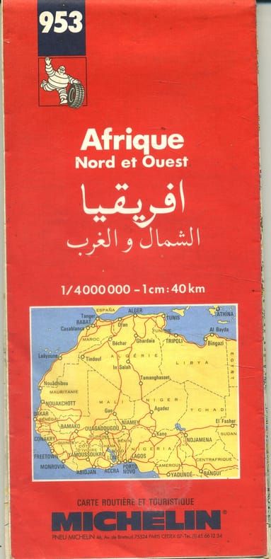
CARTE MICHELIN
Afrique Nord et Ouest.
Ссылка продавца : 143307
|
|
|
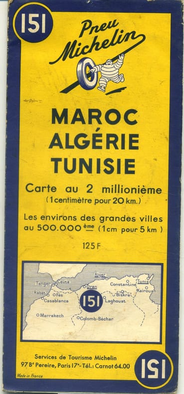
CARTE MICHELIN
Maroc, Algérie, Tunisie. Carte à l'échelle 1/2000 000e. Environs des grandes villes au 1/50 000e.
- Une feuille 110x50 cm, repliée sous couverture orange et bleue.
Ссылка продавца : 143306
|
|
|
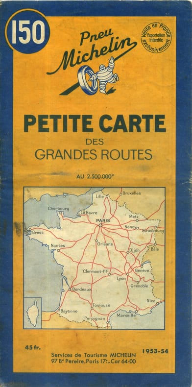
CARTE MICHELIN
Petite carte des grandes routes. Carte à l'échelle 1/2 500 000e.
Ссылка продавца : 143304
|
|
|
CARTE MICHELIN - 1-Belgique
Anvers-Rotterdam. Carte au 1/200 000e.
1 feuille repli?e 109,5 x 50 cm.
|
|
|
CARTE MICHELIN - 100
Sorties de Paris. Carte Michelin au 1/50 000e.
Feuille repli?e.
|
|
|
CARTE MICHELIN - 120
Carte cycliste. 50 km autour de Paris. L'?tat des routes, les c?tes, les curiosit?s, le pittoresque, les r?parateurs de v?los.
Couerture orange. R?par?e, traces de scotch.
|
|
|
CARTE MICHELIN - 163
Allemagne-Est. Carte Michelin au 1/1000 000e.
Feuille repli?e.
|
|
|
CARTE MICHELIN - 2-Belgique
Bruxelles-Ostende. Carte au 1200 000e.
1 feuille repli?e 109,5 x 50 cm.
|
|
|
CARTE MICHELIN - 205
Pays Rh?nans. Carte Michelin au 1/200 000e. Couverture orange et bleue. Edition provisoire avec limites de zones d'occupation.
Feuille repli?e.
|
|
|
CARTE MICHELIN - 206
Pays Rh?nans. Carte Michelin au 1/200 000e. Couverture orange et bleue. Edition avec limites de zones d'occupation.
Feuille repli?e.
|
|
|
CARTE MICHELIN - 21
Basel- St Gallen. Carte Michelin au 1/200 000e. Couverture orange et bleue.
Feuille repli?e.
|
|
|
CARTE MICHELIN - 23
Gen?ve-Berne. Carte Michelin au 1/200 000e. Couverture orange et bleue.
Feuille repli?e.
|
|
|
CARTE MICHELIN - 24
Andermatt-Bolzano. Carte Michelin au 1/200 000e. Couverture orange et bleue.
Feuille repli?e.
|
|
|
CARTE MICHELIN - 26
Martigny-Milan. Carte Michelin au 1/200 000e. Couverture orange et bleue.
Feuille repli?e.
|
|
|
CARTE MICHELIN - 3-Belgique
Bruxelles-Li?ge. Carte au 1/200 000e.
1 feuille repli?e 109,5 x 50 cm.
|
|
|
CARTE MICHELIN - 33
Grenoble-Torino. France en 48 feuilles au 1/200 000e.
Une feuille 42x100 cm. Sous couverture.
|
|
|
CARTE MICHELIN - 4-Belgique
Mons-Luxembourg. Carte au 1/200 000e. .
1 feuille repli?e 109,5 X 50 cm.
|
|
|
CARTE MICHELIN - 5-Hollande
Groningen-Alkmaar. carte au 1/200 000e. Bilingue fran?ais-hollandais.
1 feuille repli?e 98 x 49 cm.
|
|
|
CARTE MICHELIN - 51
Boulogne-Lille. Carte routi?re michelin au 1/200 000?me. Ponts ou bacs d?truits, localit?s gravement endommag?es.
Carte 100X50 cm. Repli?e.
|
|
|
CARTE MICHELIN - 52
Le Havre-Amiens. Carte Michelin au 1/200 000e. Couverture orange et bleue.
Feuille repli?e.
|
|
|
CARTE MICHELIN - 53
Arras-M?zi?res. Carte routi?re michelin au 1/200 000?me. Couverture orange. Indications des dommages de guerre.
Carte 100X50 cm. Repli?e.
|
|
|
CARTE MICHELIN - 57
Verdun - Wissembourg. Couverture orange.
|
|
 Получить результаты поиска по электронной почте
 Загрузить результаты в формате PDF
  RSS-канал


