|
GUIDE Hachette
HAUTE-VIENNE: Nature Du Sol et Population . Agriculture , Mines , Industrie . Communications et Commerce . Histoire , Art , Archéologie . Tourisme
Collection " Guide-Hachette " avec 1 Carte dépliante en couleurs , 1 carte schématique en noir et blanc et 22 gravures . A l'époque où l'automobile se développe ainsi que les voies de chemins de fer , Hachette lance une série de guides invitant à découvrir tous les départements de France . De très belles cartes réalisées par L'Institut Géographique de Paris permettent d'entreprendre les voyages . Actuellement très utiles aux généalogistes et historiens car nombres de villages ont disparus . Elles permettent de recenser les bois et forêts de l'époque , les lignes de chemins de fer , les petits et grands chemins et donnent de précieuses indications sur l'économie et la population . ( Commandez plusieurs départements dans notre librairie et ne payez qu'un seul frais de port ) . Cartes et plans .- 56 p. + Carte , 150 gr.

|
|
|
GUIDE Hachette
HAUTE-VIENNE: Nature Du Sol et Population . Agriculture , Mines , Industrie . Communications et Commerce . Histoire , Art , Archéologie . Tourisme
Paris Librairie Hachette 1925 In 16 Collection " Guide-Hachette " avec 1 Carte dépliante en couleurs , 1 carte schématique en noir et blanc et 22 gravures . A l'époque où l'automobile se développe ainsi que les voies de chemins de fer , Hachette lance une série de guides invitant à découvrir tous les départements de France . De très belles cartes réalisées par L'Institut Géographique de Paris permettent d'entreprendre les voyages . Actuellement très utiles aux généalogistes et historiens car nombres de villages ont disparus . Elles permettent de recenser les bois et forêts de l'époque , les lignes de chemins de fer , les petits et grands chemins et donnent de précieuses indications sur l'économie et la population . ( Commandez plusieurs départements dans notre librairie et ne payez qu'un seul frais de port ) . Cartes et plans .- 56 p. + Carte , 150 gr.
Referenz des Buchhändlers : 022425

|
|
|
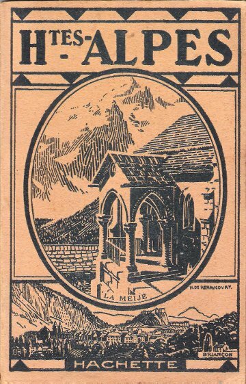
GUIDE Hachette
HAUTES-ALPES : Nature Du Sol et Population . Agriculture , Mines , Industrie . Communications et Commerce . Histoire , Art , Archéologie . Tourisme
Collection " Guide-Hachette " avec 1 Carte dépliante en couleurs , 1 carte schématique en noir et blanc et 28 gravures . A l'époque où l'automobile se développe ainsi que les voies de chemins de fer , Hachette lance une série de guides invitant à découvrir tous les départements de France . De très belles cartes réalisées par L'Institut Géographique de Paris permettent d'entreprendre les voyages . Actuellement très utiles aux généalogistes et historiens car nombres de villages ont disparus . Elles permettent de recenser les bois et forêts de l'époque , les lignes de chemins de fer , les petits et grands chemins et donnent de précieuses indications sur l'économie et la population . ( Commandez plusieurs départements dans notre librairie et ne payez qu'un seul frais de port ) . Cartes et plans .- 56 p. + Carte , 150 gr.

|
|
|
GUIDE Hachette
HAUTES-ALPES : Nature Du Sol et Population . Agriculture , Mines , Industrie . Communications et Commerce . Histoire , Art , Archéologie . Tourisme
Paris Librairie Hachette 1925 In 16 Collection " Guide-Hachette " avec 1 Carte dépliante en couleurs , 1 carte schématique en noir et blanc et 28 gravures . A l'époque où l'automobile se développe ainsi que les voies de chemins de fer , Hachette lance une série de guides invitant à découvrir tous les départements de France . De très belles cartes réalisées par L'Institut Géographique de Paris permettent d'entreprendre les voyages . Actuellement très utiles aux généalogistes et historiens car nombres de villages ont disparus . Elles permettent de recenser les bois et forêts de l'époque , les lignes de chemins de fer , les petits et grands chemins et donnent de précieuses indications sur l'économie et la population . ( Commandez plusieurs départements dans notre librairie et ne payez qu'un seul frais de port ) . Cartes et plans .- 56 p. + Carte , 150 gr.
Referenz des Buchhändlers : 022418
|
|
|
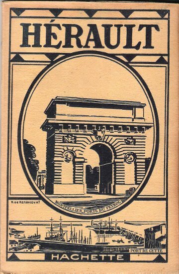
GUIDE Hachette
HERAULT : Nature Du Sol et Population . Agriculture , Mines , Industrie . Communications et Commerce . Histoire , Art , Archéologie . Tourisme
Collection " Guide-Hachette " avec 1 Carte dépliante en couleurs , 3 cartes en noir et blanc et 27 gravures . A l'époque où l'automobile se développe ainsi que les voies de chemins de fer , Hachette lance une série de guides invitant à découvrir tous les départements de France . De très belles cartes réalisées par L'Institut Géographique de Paris permettent d'entreprendre les voyages . Actuellement très utiles aux généalogistes et historiens car nombres de villages ont disparus . Elles permettent de recenser les bois et forêts de l'époque , les lignes de chemins de fer , les petits et grands chemins et donnent de précieuses indications sur l'économie et la population . ( Commandez plusieurs départements dans notre librairie et ne payez qu'un seul frais de port ) . Cartes et plans .- 64 p. + Carte , 150 gr.

|
|
|
GUIDE Hachette
HERAULT : Nature Du Sol et Population . Agriculture , Mines , Industrie . Communications et Commerce . Histoire , Art , Archéologie . Tourisme
Paris Librairie Hachette 1930 In 16 Collection " Guide-Hachette " avec 1 Carte dépliante en couleurs , 3 cartes en noir et blanc et 27 gravures . A l'époque où l'automobile se développe ainsi que les voies de chemins de fer , Hachette lance une série de guides invitant à découvrir tous les départements de France . De très belles cartes réalisées par L'Institut Géographique de Paris permettent d'entreprendre les voyages . Actuellement très utiles aux généalogistes et historiens car nombres de villages ont disparus . Elles permettent de recenser les bois et forêts de l'époque , les lignes de chemins de fer , les petits et grands chemins et donnent de précieuses indications sur l'économie et la population . ( Commandez plusieurs départements dans notre librairie et ne payez qu'un seul frais de port ) . Cartes et plans .- 64 p. + Carte , 150 gr.
Referenz des Buchhändlers : 022436
|
|
|
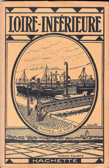
GUIDE Hachette
LOIRE-INFERIEURE : Nature Du Sol et Population . Agriculture , Mines , Industrie . Communications et Commerce . Histoire , Art , Archéologie . Tourisme
Collection " Guide-Hachette " avec 1 Carte dépliante en couleurs , 3 cartes schématiques en noir et blanc et 23 gravures . A l'époque où l'automobile se développe ainsi que les voies de chemins de fer , Hachette lance une série de guides invitant à découvrir tous les départements de France . De très belles cartes réalisées par L'Institut Géographique de Paris permettent d'entreprendre les voyages . Actuellement très utiles aux généalogistes et historiens car nombres de villages ont disparus . Elles permettent de recenser les bois et forêts de l'époque , les lignes de chemins de fer , les petits et grands chemins et donnent de précieuses indications sur l'économie et la population . ( Commandez plusieurs départements dans notre librairie et ne payez qu'un seul frais de port ) . Cartes et plans .- 64 p. + Carte , 150 gr.

|
|
|
GUIDE Hachette
LOIRE-INFERIEURE : Nature Du Sol et Population . Agriculture , Mines , Industrie . Communications et Commerce . Histoire , Art , Archéologie . Tourisme
Paris Librairie Hachette 1925 In 16 Collection " Guide-Hachette " avec 1 Carte dépliante en couleurs , 3 cartes schématiques en noir et blanc et 23 gravures . A l'époque où l'automobile se développe ainsi que les voies de chemins de fer , Hachette lance une série de guides invitant à découvrir tous les départements de France . De très belles cartes réalisées par L'Institut Géographique de Paris permettent d'entreprendre les voyages . Actuellement très utiles aux généalogistes et historiens car nombres de villages ont disparus . Elles permettent de recenser les bois et forêts de l'époque , les lignes de chemins de fer , les petits et grands chemins et donnent de précieuses indications sur l'économie et la population . ( Commandez plusieurs départements dans notre librairie et ne payez qu'un seul frais de port ) . Cartes et plans .- 64 p. + Carte , 150 gr.
Referenz des Buchhändlers : 022427
|
|
|
GUIDE Hachette
LOZERE: Nature Du Sol et Population . Agriculture , Mines , Industrie . Communications et Commerce . Histoire , Art , Archéologie . Tourisme
Collection " Guide-Hachette " avec 1 Carte dépliante en couleurs , 2 cartes schématiques en noir et blanc et 27 gravures . A l'époque où l'automobile se développe ainsi que les voies de chemins de fer , Hachette lance une série de guides invitant à découvrir tous les départements de France . De très belles cartes réalisées par L'Institut Géographique de Paris permettent d'entreprendre les voyages . Actuellement très utiles aux généalogistes et historiens car nombres de villages ont disparus . Elles permettent de recenser les bois et forêts de l'époque , les lignes de chemins de fer , les petits et grands chemins et donnent de précieuses indications sur l'économie et la population . ( Commandez plusieurs départements dans notre librairie et ne payez qu'un seul frais de port ) . Cartes et plans .- 56 p. + Carte , 150 gr.

|
|
|
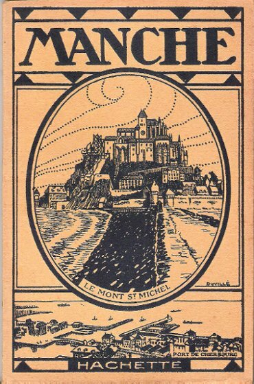
GUIDE Hachette
MANCHE : Nature Du Sol et Population . Agriculture , Mines , Industrie . Communications et Commerce . Histoire , Art , Archéologie . Tourisme
Collection " Guide-Hachette " avec 1 Carte dépliante en couleurs , 2 cartes schématiques en noir et blanc et 28 gravures . A l'époque où l'automobile se développe ainsi que les voies de chemins de fer , Hachette lance une série de guides invitant à découvrir tous les départements de France . De très belles cartes réalisées par L'Institut Géographique de Paris permettent d'entreprendre les voyages . Actuellement très utiles aux généalogistes et historiens car nombres de villages ont disparus . Elles permettent de recenser les bois et forêts de l'époque , les lignes de chemins de fer , les petits et grands chemins et donnent de précieuses indications sur l'économie et la population . ( Commandez plusieurs départements dans notre librairie et ne payez qu'un seul frais de port ) . Cartes et plans .- 64 p. + Carte , 150 gr.

|
|
|
GUIDE Hachette
MANCHE : Nature Du Sol et Population . Agriculture , Mines , Industrie . Communications et Commerce . Histoire , Art , Archéologie . Tourisme
Paris Librairie Hachette 1924 In 16 Collection " Guide-Hachette " avec 1 Carte dépliante en couleurs , 2 cartes schématiques en noir et blanc et 28 gravures . A l'époque où l'automobile se développe ainsi que les voies de chemins de fer , Hachette lance une série de guides invitant à découvrir tous les départements de France . De très belles cartes réalisées par L'Institut Géographique de Paris permettent d'entreprendre les voyages . Actuellement très utiles aux généalogistes et historiens car nombres de villages ont disparus . Elles permettent de recenser les bois et forêts de l'époque , les lignes de chemins de fer , les petits et grands chemins et donnent de précieuses indications sur l'économie et la population . ( Commandez plusieurs départements dans notre librairie et ne payez qu'un seul frais de port ) . Cartes et plans .- 64 p. + Carte , 150 gr.
Referenz des Buchhändlers : 022411
|
|
|
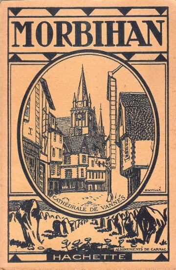
GUIDE Hachette
MORBIHAN : Nature Du Sol et Population . Agriculture , Mines , Industrie . Communications et Commerce . Histoire , Art , Archéologie . Tourisme
Collection " Guide-Hachette " avec 1 Carte dépliante en couleurs , 1 carte schématique en noir et blanc et 28 gravures . A l'époque où l'automobile se développe ainsi que les voies de chemins de fer , Hachette lance une série de guides invitant à découvrir tous les départements de France . De très belles cartes réalisées par L'Institut Géographique de Paris permettent d'entreprendre les voyages . Actuellement très utiles aux généalogistes et historiens car nombres de villages ont disparus . Elles permettent de recenser les bois et forêts de l'époque , les lignes de chemins de fer , les petits et grands chemins et donnent de précieuses indications sur l'économie et la population . ( Commandez plusieurs départements dans notre librairie et ne payez qu'un seul frais de port ) . Cartes et plans .- 64 p. + Carte , 150 gr.

|
|
|
GUIDE Hachette
MORBIHAN : Nature Du Sol et Population . Agriculture , Mines , Industrie . Communications et Commerce . Histoire , Art , Archéologie . Tourisme
Paris Librairie Hachette 1924 In 16 Collection " Guide-Hachette " avec 1 Carte dépliante en couleurs , 1 carte schématique en noir et blanc et 28 gravures . A l'époque où l'automobile se développe ainsi que les voies de chemins de fer , Hachette lance une série de guides invitant à découvrir tous les départements de France . De très belles cartes réalisées par L'Institut Géographique de Paris permettent d'entreprendre les voyages . Actuellement très utiles aux généalogistes et historiens car nombres de villages ont disparus . Elles permettent de recenser les bois et forêts de l'époque , les lignes de chemins de fer , les petits et grands chemins et donnent de précieuses indications sur l'économie et la population . ( Commandez plusieurs départements dans notre librairie et ne payez qu'un seul frais de port ) . Cartes et plans .- 64 p. + Carte , 150 gr.
Referenz des Buchhändlers : 022414
|
|
|
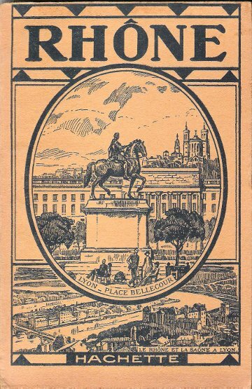
GUIDE Hachette
RHÔNE : Nature Du Sol et Population . Agriculture , Mines , Industrie . Communications et Commerce . Histoire , Art , Archéologie . Tourisme
Collection " Guide-Hachette " avec 1 Carte dépliante en couleurs , 3 cartes schématiques en noir et blanc et 29 gravures . A l'époque où l'automobile se développe ainsi que les voies de chemins de fer , Hachette lance une série de guides invitant à découvrir tous les départements de France . De très belles cartes réalisées par L'Institut Géographique de Paris permettent d'entreprendre les voyages . Actuellement très utiles aux généalogistes et historiens car nombres de villages ont disparus . Elles permettent de recenser les bois et forêts de l'époque , les lignes de chemins de fer , les petits et grands chemins et donnent de précieuses indications sur l'économie et la population . ( Commandez plusieurs départements dans notre librairie et ne payez qu'un seul frais de port ) . Cartes et plans .- 64 p. + Carte , 150 gr.

|
|
|
GUIDE Hachette
RHÔNE : Nature Du Sol et Population . Agriculture , Mines , Industrie . Communications et Commerce . Histoire , Art , Archéologie . Tourisme
Paris Librairie Hachette 1930 In 16 Collection " Guide-Hachette " avec 1 Carte dépliante en couleurs , 3 cartes schématiques en noir et blanc et 29 gravures . A l'époque où l'automobile se développe ainsi que les voies de chemins de fer , Hachette lance une série de guides invitant à découvrir tous les départements de France . De très belles cartes réalisées par L'Institut Géographique de Paris permettent d'entreprendre les voyages . Actuellement très utiles aux généalogistes et historiens car nombres de villages ont disparus . Elles permettent de recenser les bois et forêts de l'époque , les lignes de chemins de fer , les petits et grands chemins et donnent de précieuses indications sur l'économie et la population . ( Commandez plusieurs départements dans notre librairie et ne payez qu'un seul frais de port ) . Cartes et plans .- 64 p. + Carte , 150 gr.
Referenz des Buchhändlers : 022435
|
|
|
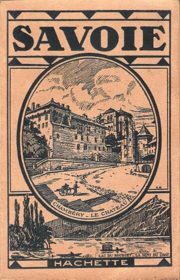
GUIDE Hachette
SAVOIE : Nature Du Sol et Population . Agriculture , Mines , Industrie . Communications et Commerce . Histoire , Art , Archéologie . Tourisme
Collection " Guide-Hachette " avec 1 Carte dépliante en couleurs , 1 carte schématique en noir et blanc et 30 gravures . A l'époque où l'automobile se développe ainsi que les voies de chemins de fer , Hachette lance une série de guides invitant à découvrir tous les départements de France . De très belles cartes réalisées par L'Institut Géographique de Paris permettent d'entreprendre les voyages . Actuellement très utiles aux généalogistes et historiens car nombres de villages ont disparus . Elles permettent de recenser les bois et forêts de l'époque , les lignes de chemins de fer , les petits et grands chemins et donnent de précieuses indications sur l'économie et la population . ( Commandez plusieurs départements dans notre librairie et ne payez qu'un seul frais de port ) . Cartes et plans .- 64 p. + Carte , 150 gr.

|
|
|
GUIDE Hachette
SAVOIE : Nature Du Sol et Population . Agriculture , Mines , Industrie . Communications et Commerce . Histoire , Art , Archéologie . Tourisme
Paris Librairie Hachette 1925 In 16 Collection " Guide-Hachette " avec 1 Carte dépliante en couleurs , 1 carte schématique en noir et blanc et 30 gravures . A l'époque où l'automobile se développe ainsi que les voies de chemins de fer , Hachette lance une série de guides invitant à découvrir tous les départements de France . De très belles cartes réalisées par L'Institut Géographique de Paris permettent d'entreprendre les voyages . Actuellement très utiles aux généalogistes et historiens car nombres de villages ont disparus . Elles permettent de recenser les bois et forêts de l'époque , les lignes de chemins de fer , les petits et grands chemins et donnent de précieuses indications sur l'économie et la population . ( Commandez plusieurs départements dans notre librairie et ne payez qu'un seul frais de port ) . Cartes et plans .- 64 p. + Carte , 150 gr.
Referenz des Buchhändlers : 022421
|
|
|
GUIDE Hachette
SEINE-INFERIEURE : Nature Du Sol et Population . Agriculture , Mines , Industrie . Communications et Commerce . Histoire , Art , Archéologie . Tourisme
Collection " Guide-Hachette " avec 1 Carte dépliante en couleurs , 3 cartes schématiques en noir et blanc et 31 gravures . A l'époque où l'automobile se développe ainsi que les voies de chemins de fer , Hachette lance une série de guides invitant à découvrir tous les départements de France . De très belles cartes réalisées par L'Institut Géographique de Paris permettent d'entreprendre les voyages . Actuellement très utiles aux généalogistes et historiens car nombres de villages ont disparus . Elles permettent de recenser les bois et forêts de l'époque , les lignes de chemins de fer , les petits et grands chemins et donnent de précieuses indications sur l'économie et la population . ( Commandez plusieurs départements dans notre librairie et ne payez qu'un seul frais de port ) . Cartes et plans .- 72 p. + Carte , 150 gr.

|
|
|
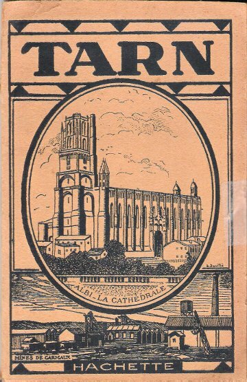
GUIDE Hachette
TARN : Nature Du Sol et Population . Agriculture , Mines , Industrie . Communications et Commerce . Histoire , Art , Archéologie . Tourisme
Collection " Guide-Hachette " avec 1 Carte dépliante en couleurs , 1 carte schématique en noir et blanc et 24 gravures . A l'époque où l'automobile se développe ainsi que les voies de chemins de fer , Hachette lance une série de guides invitant à découvrir tous les départements de France . De très belles cartes réalisées par L'Institut Géographique de Paris permettent d'entreprendre les voyages . Actuellement très utiles aux généalogistes et historiens car nombres de villages ont disparus . Elles permettent de recenser les bois et forêts de l'époque , les lignes de chemins de fer , les petits et grands chemins et donnent de précieuses indications sur l'économie et la population . ( Commandez plusieurs départements dans notre librairie et ne payez qu'un seul frais de port ) . Cartes et plans .- 56 p. + Carte , 150 gr.

|
|
|
GUIDE Hachette
TARN : Nature Du Sol et Population . Agriculture , Mines , Industrie . Communications et Commerce . Histoire , Art , Archéologie . Tourisme
Paris Librairie Hachette 1925 In 16 Collection " Guide-Hachette " avec 1 Carte dépliante en couleurs , 1 carte schématique en noir et blanc et 24 gravures . A l'époque où l'automobile se développe ainsi que les voies de chemins de fer , Hachette lance une série de guides invitant à découvrir tous les départements de France . De très belles cartes réalisées par L'Institut Géographique de Paris permettent d'entreprendre les voyages . Actuellement très utiles aux généalogistes et historiens car nombres de villages ont disparus . Elles permettent de recenser les bois et forêts de l'époque , les lignes de chemins de fer , les petits et grands chemins et donnent de précieuses indications sur l'économie et la population . ( Commandez plusieurs départements dans notre librairie et ne payez qu'un seul frais de port ) . Cartes et plans .- 56 p. + Carte , 150 gr.
Referenz des Buchhändlers : 022423
|
|
|
GUIDE POL
Plan de Grenoble et liste des rues de la ville. Sans date.
Broch?. 8 pages.
|
|
|
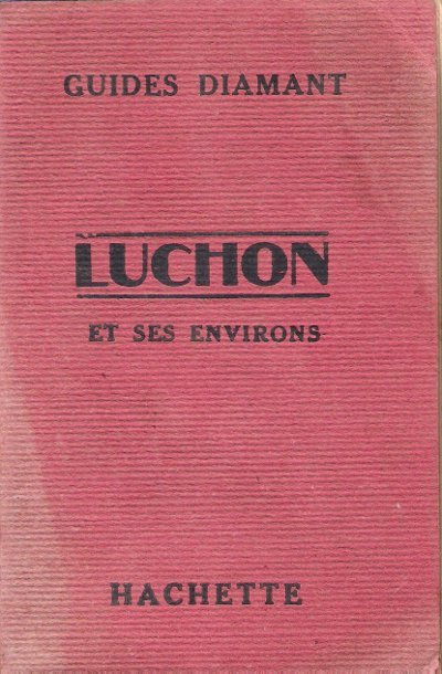
GUIDES DIAMANT
LUCHON et Ses Environs
Collection " Les Guides Diamant " . Excursions , plusieurs plans de voyages et de promenades en noir et blanc . Légère décoloration sur la couverture .- 154 p. , 300 gr.

|
|
|
GUIDES DIAMANT
LUCHON et Ses Environs
Paris Librairie Hachette 1927 In 16 Collection " Les Guides Diamant " . Excursions , plusieurs plans de voyages et de promenades en noir et blanc . Légère décoloration sur la couverture .- 154 p. , 300 gr.
Referenz des Buchhändlers : 015580
|
|
|
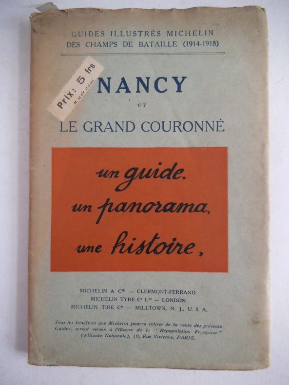
Guides illustrés MICHELIN des champs de batailles 1914-1918
NANCY et le grand couronné
in 8 reliure d’éditeur illustrations photographiques avec sa jaquette
Referenz des Buchhändlers : 2379
|
|
|
GUIDES JOANNE
Dauphiné et savoie.
Hachette, collection Diamant 1879 ; 528 pages. 1 volume cartonnage éditeur vert, pleine toile. in-16 Nombreuses illustrations, cartes, publicités.
Referenz des Buchhändlers : 1990
|
|
|
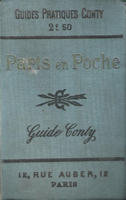
Guides Pratiques CONTY
PARIS en poche . Complet de ses 5 plans dépliants hors-texte . de son carnet bleu des établissements recommandés
Paris Administration des Guides Conty 1899 in-12° Collection " Guides Pratiques Conty " Dix-neuvième édition Nombreuses gravures en noir et blanc , plans des musées dépliants , plan spécial du bois de Boulogne en couleurs dépliant plan dépliant du Jardin des plantes , plan dépliant du cimetière du Père Lachaise Cahier bleu indiquant les établissements recommandés avec plans des théâtres 88 p. et 84 p. de renseignements généraux pour les voyages . Cartes et Plans .- 392 p. +. 88 p. + 84 p. , 450 gr.
Referenz des Buchhändlers : 023809
|
|
|
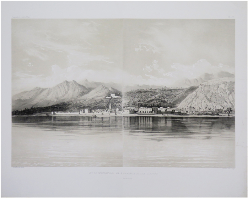
GUILLAIN (Charles) & CARAGUEL (Léon Exupère Hippolyte).
[COMORES/ANJOUAN] Vue de Moutsamoudou, ville principale de l'île d'Anjouan.
Paris, Arthus Bertrand, [1856-1857]. En deux feuilles pouvant être jointes pour former un panorama de 430 x 606 mm.
Referenz des Buchhändlers : LBW-8034
|
|
|
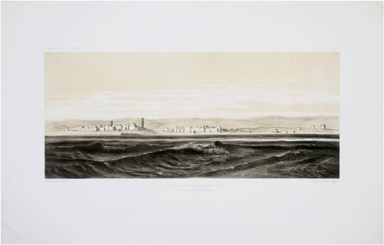
GUILLAIN (Charles) & CARAGUEL (Léon Exupère Hippolyte).
[SOMALIE/MOGADISCIO] Vue de la ville de Moguedchou prise du mouillage en dehors du récif.
Paris, Arthus Bertrand, [1856-1857]. 225 x 420 mm.
Referenz des Buchhändlers : LBW-8058
|
|
|
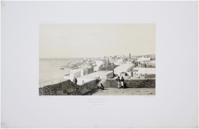
GUILLAIN (Charles).
[SOMALIE/MOGADISCIO] Panorama de Moguedchou. Vue prise de la terrasse de notre maison.
Paris, Arthus Bertrand, [1856-1857]. 235 x 325 mm.
Referenz des Buchhändlers : LBW-8030
|
|
|
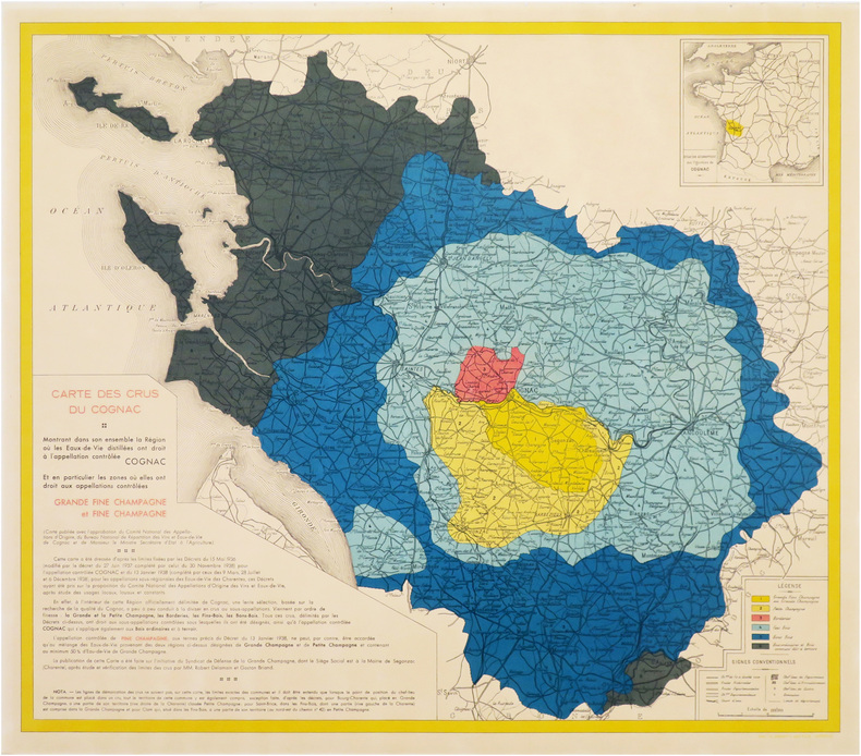
GUILLON (Jean-Marie).
[COGNAC] Carte des crus du Cognac, montrant dans son ensemble la région où les eaux-de-vie distillées ont droit à l'appellation contrôlée Cognac, et en particulier les zones où elles ont droit aux appellations contrôlées Grande Fine Champagne et Fine Champagne.
Segonzac, Syndicat de Défense de la Grande Champagne, 1938. 600 x 696 mm.
Referenz des Buchhändlers : LBW-8616
|
|
|
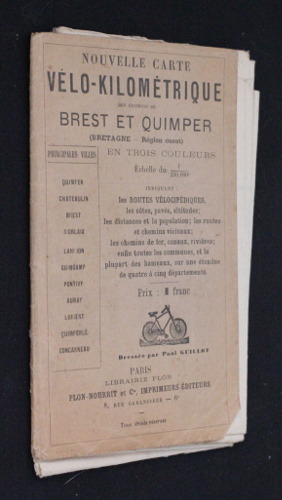
Guillot Paul
Nouvelle carte vélo-kilométrique des environs de Brest et Quimper (Bretagne - régions Ouest), en trois couleurs, échelle du 1/250000e, indiquant les routes vélocipédiques, les côtes, pavés, altitudes ; les distances et la population ; les routes et chemis
Plon-Nourrit & Cie Carte de France en couleurs par départements Dépliant In-12 (11x17.5 cm), livre dépliant, carte en trois couleurs, une des cartes de France en couleurs par départements, dressée par Paul Guillot ; dos et coiffes légèrement frottés, coins pliés, bon état. Livraison a domicile (La Poste) ou en Mondial Relay sur simple demande.
Referenz des Buchhändlers : nf953
|
|
|
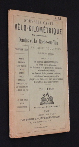
Guillot Paul
Nouvelle carte vélo-kilométrique des environs de Nantes et La Roche-sur-Yon en trois couleurs, échelle du 1/250000e, indiquant : les routes vélocipédiques, les côtes, pavés, altitudes ; les distances et la population ; les routes et chemins vicinaux ; les
Plon-Noury et Cie Carte de France en couleurs par départements Dépliant In-12 (11.5x17.5 cm), livre dépliant, une carte en trois couleurs dressée par Paul Guillot, carte n°12 de la France en couleurs par départements ; dos, coiffes et coins légèrement frottés, dos et plats en partie insolés, carte en bon état, bon état général. Livraison a domicile (La Poste) ou en Mondial Relay sur simple demande.
Referenz des Buchhändlers : nf942
|
|
|
GUILLOU - CHORON - LE BRETON - RANNOU.
PLEUBIAN ET LA PRESQU ' ILE SAUVAGE . Cartes postales et photos anciennes.
Pleubian et son passé , 1991 , in8 à l' italienne br ,
Referenz des Buchhändlers : M14278
|
|
|
GUIOT J. - MANE Fr. 140 gravures et cartes.
Histoire de France et notions d'histoire générale et d'histoire de la civilisation. Histoire ancienne - Révision de l'histoire de France - Notions d'histoire générale et d'histoire de la civilisation.
Couverture rigide. Cartonnage de l'éditeur. 396 pages. Papier bruni. Couverture légèrement défraîchie.
Referenz des Buchhändlers : 76681
|
|
|
GUIRAMAND (Paul).
Carte de voeux illustrée d'une gravure originale signée.
Paris Société des peintres-graveurs français 1985 1 vol. Broché Grande carte de voeux dépliante sur Arches illustrée d'une lithographie en couleurs (19 x 22 cm) signée par Paul Guiramand. En parfait état.
Referenz des Buchhändlers : 109091
|
|
|
GULF- STREAM par Hans LEIP.
Le roman du gulf-stream. Contient 6 documents in-texte, 32 planches en héliogravure dont 8 cartes.
Club des Libraires de France 1956. Bel exemplaire relié, reliure pleine toile ornée d'éd., fort in-8, 389 pages + planches.
Referenz des Buchhändlers : AUB-4162
|
|
|
GUNAY, REHA
Tradition of the Turkish house and Safranbolu Houses
Book is in excellent condition. Binding is solid and square, covers have sharp corners, exterior shows no blemishes, text/interior is clean and free of marking of any kind. 358 pages with a great many photos in full color, charts, tables, architectural drawings, floorplans, detail photos, elevations, exteriors, interiors, stonework, wood work, woodworking tools, maps, interior layouts, framing details, etc. Includes laid-in map of Baghlar and Izzetpasa mah. areas with 31 buildings identified. Very detailed study. Contents include: Tradition of the Turkish house: Influences (with five subsections: Climate, Earthquakes, Building materials, Historical influences, Social influences), Forms (with five subsections), Methods (with two subsections) Safranbolu houses: Influences, Geography, Historical influences, Way of life, Family structure, Daily life, Forms, Methods, etc., each with many subsections. Copyright 2011 Pistil Books

|
|
|
Gunn, J.
Orkney : The Magnetic North
No marks or inscriptions. No creasing to covers or to spine. A very clean very tight copy with bright unmarked boards, very slight foxing to page edges and no bumping to corners. 286pp. Detailed guide to the Orkney Islands, to the north of Scotland's mainland.

|
|
|
Gunter Schilder on speed military maps Peter Meurer on Ortelius' map of France Mary Pedley on mapping Brittany in 18th c. K
Map Collector Autumn 1989 Issue No. 48
Map Collector Publications. Used - Very Good. Very Good condition. Autumn 1989 Issue No. 48. Map Collector Publications unknown
Referenz des Buchhändlers : S13J-00402
|
|
|
GUSSEFELD François-Louis
Représentation du Cercle de Basse-Saxe selon la description géographique de Monsieur Busching et d’autres.
Sans lieu, Héritiers d’Hoffman, 1784. Une feuille en couleurs de 50 x 55 cm pliée et toilée.
Referenz des Buchhändlers : 9675
|
|
|
GUTHRIE
Abrégé de la nouvelle géographie de GUTHRIE
in 8 demi-cuir marron à coins pièce de titre cuir clair, roulette, filets dorés.faux-titre,titre,736 pages,onze cartes dépliantes en couleurs H.Langlois éditeur 1808.Bon exemplaire
Referenz des Buchhändlers : 6619
|
|
|
GUYOT Charly:
Neuchâtel. Histoire d’une cité.
Neuchâtel, La Neuchâteloise, 1946. In-8 de 299 pages, demi-maroquin rouge, dos à 4 nerfs, couvertures et dos conservés. Nom de possesseur sur garde.
Referenz des Buchhändlers : 1127
|
|
|
GUÉRIN , Victor
Voyage Archéologique dans la Régence de Tunis exécuté en 1860 et publié sous les auspices et aux frais de M. H. d'Albert Duc de Luynes
Paris, Henri Plon, 1862. 2 volumes in-8, brochage éditeur Édition originale, accompagnée d'une grande carte de Tunisie, par Vuillemin, et d'une planche reproduisant l'inscription bilingue de Thugga.
Referenz des Buchhändlers : PHO-1527
|
|
|
Gvirtzman, Haim
Israel Water Resources: Chapters in Hydrology and Environmental Sciences
Contains pictures. 22x28 cm. ç(8) + 287 pages. Hard cover. Good condition.
|
|
|
Gwendolen M. Editor *SIGNED by author* Carter~5 Maps
Five African States Responses to Diversity
Cornell U.P 1963. Hardcover. VERY GOOD. Very good DJ chipped 643pp. Cornell U.P hardcover
Referenz des Buchhändlers : 83136
|
|
|
GWL. Nicholson with CCJ. Bond maps G. W. C. C.
Official History of the Canadian Army in the Second World War; The Canadians in Italy vol II
Ottawa: Queen's Printer 1957 . Hard bound volume two only of three volumes second printing corrected dealing with the Canadians in Italy 1943-45. Numerous large fold-out maps in colour of the war against fascism as it took place in Italy. 807pp. A very good or better copy in red cloth no dust jacket. 1.74 kilograms unpacked -- extra shipping charges will be requested! All books in stock and available for immediate shipment from Winnipeg Manitoba. Ottawa: Queen's Printer, 1957 hardcover
Referenz des Buchhändlers : 24315
|
|
|
Gyatso Palden; Lama Dalai foreword; Shakya Tsering translator; Piggott Reginald maps.
The Autobiography of a Tibetan Monk.
New York: Grove Press 1997. Reprint ed. Paperback trade good condition a few black & white photos corner tips covers lightly creased minor edgewear few scuffs light stain bottom edge few tiny spots top edge old tape mark front cover. 232 pp. The author was born in a Tibetan village in 1933 and became an ordained Buddhist monk at 18. In 1967 the Chinese destroyed monasteries across Tibet and thousands of monks were put in labor camps and prisons. Gyatso spent the next 25 years enduring torture and interrogation because of the strength of his beliefs. Reveals the resilience of the human spirit and the strength of Tibet's proud civilization. Since his release in 1992 the author has continued to struggle for freedom for the hundreds of political prisoners behind bars in Tibet. Grove Press paperback
Referenz des Buchhändlers : 29956 ISBN : 0802135749 9780802135742

|
|
|
GÉRARD (Augustin).
[Asie].
[milieu du XIXe siècle]. 44 x 55 cm.
Referenz des Buchhändlers : LBW-7435
|
|
|
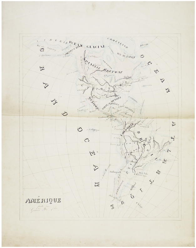
GÉRARD (Augustin).
Amérique.
[milieu du XIXe siècle]. 45 x 38,5 cm.
Referenz des Buchhändlers : LBW-7433
|
|
 Per e-mail erhalten
 Als pdf-Dokument herunterladen
 RSS feed


