|
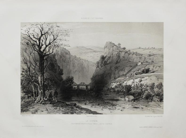
HASTREL (Adolphe d').
[RÉUNION] Album de l'Île Bourbon. Le Syphon. Canal traversant la rivière et ravine d'Abord - Quartier St Pierre.
Paris, Victor Delarue et Ce, [circa 1850]. 240 x 308 mm.
書籍販売業者の参照番号
: LBW-4494
|
|
|
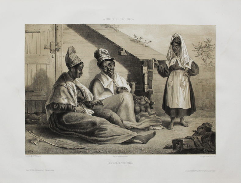
HASTREL (Adolphe d').
[RÉUNION] Album de l'Île Bourbon. Négresses yambanes.
Paris, Victor Delarue et Ce, [circa 1850]. 250 x 305 mm.
書籍販売業者の参照番号
: LBW-4501
|
|
|
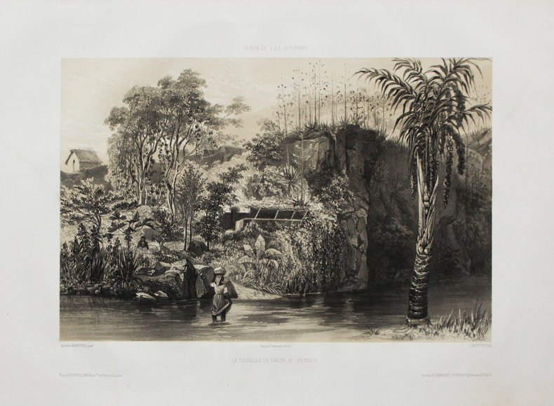
HASTREL (Adolphe d').
[RÉUNION] Album de l'Île Bourbon. La tonnelle de Parny au Bernica.
Paris, Victor Delarue et Ce, [circa 1850]. 245 x 320 mm.
書籍販売業者の参照番号
: LBW-4513
|
|
|
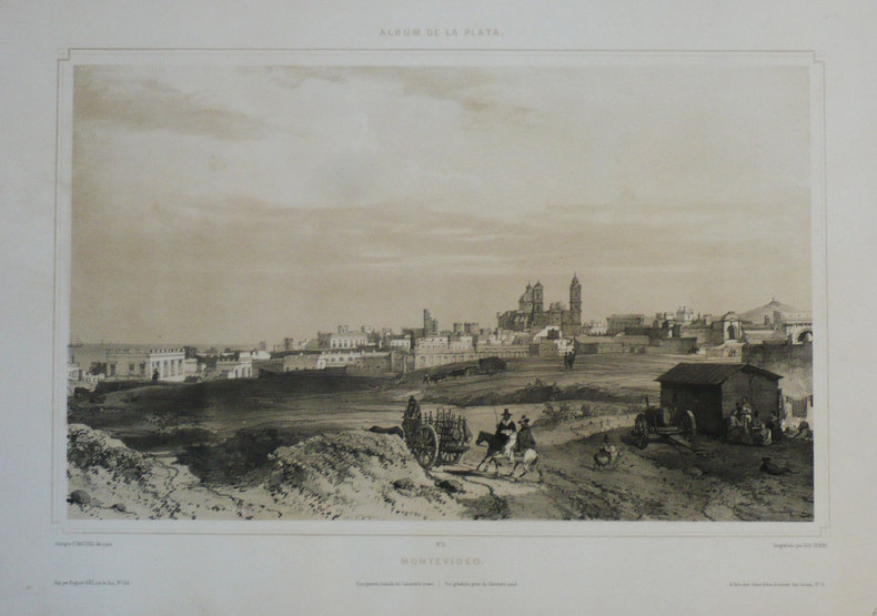
HASTREL (Adolphe d');
[URUGUAY] Montevideo. Vista general, tomada del cimenterio nuevo - Vue générale, prise du cimetière neuf.
Paris Gihaut frères 1846 305 x 423 mm.
書籍販売業者の参照番号
: LBW-1209
|
|
|
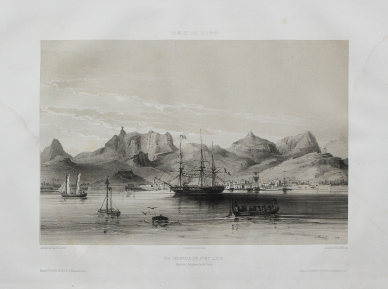
HASTREL (Adolphe d').
[ÎLE MAURICE] Album de l'Île Bourbon. Vue générale de Port Louis ( Mauritius - ancienne Île de France.
Paris, Victor Delarue et Ce, [circa 1850]. 245 x 310 mm.
書籍販売業者の参照番号
: LBW-4488
|
|
|
HASE (Johann Matthias).
Imperium Francicum.
1746. 167 x 212 mm.
書籍販売業者の参照番号
: LBW-3152

|
|
|
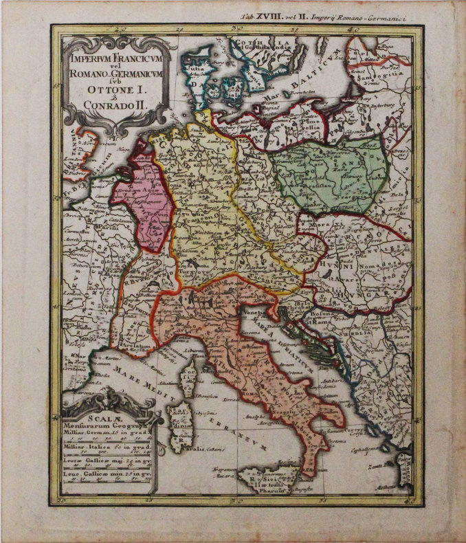
HASE (Johann Matthias).
Imperium Francicum vel Romano-Germanicum sub Ottone I & Conrado II.
1746. 217 x 168 mm.
書籍販売業者の参照番号
: LBW-3174
|
|
|
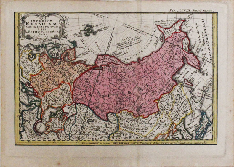
HASE (Johann Matthias).
Imperium Russicum tam in Europa quam Asia a Petro M constitutum.
1746. 166 x 253 mm.
書籍販売業者の参照番号
: LBW-3319
|
|
|
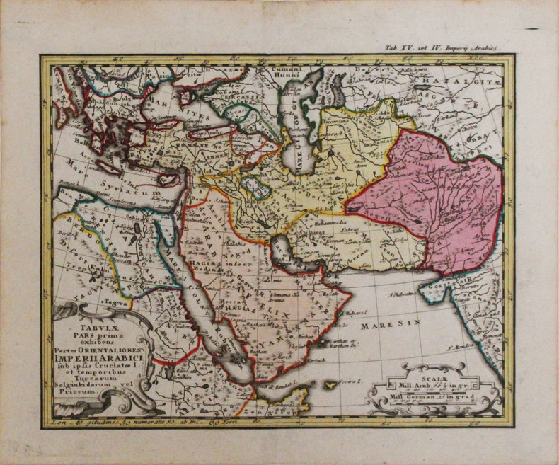
HASE (Johann Matthias).
Tabulae pars prima exhibens partes orientaliores Imperii Arabici.
1746. 168 x 212 mm.
書籍販売業者の参照番号
: LBW-3318
|
|
|
Hassell Hank ; Line Drawings & Maps R. Sean Evans
RAINBOW BRIDGE An Illustrated History
Utah State University Press Logan 1999. First Edition. . Soft cover. Very Good. B&W Photographs; Small 4to 9" - 11" tall; 173 pages; Pictorial glossy cover. One of the nation's first national monuments - near the Navajo Mountain now accessible by way of Lake Powell. The author discusses the controversy over building the Glen Canyon Damn and the bridge's significance for Native Americans. Scenic photos and informative maps and drawings help tell the bridge's tale. ISBN: 0874212669. ISBN/EAN: 9780874212662. Pictures of this item not already displayed here available upon request. Inventory No: 8243. <br/> <br/> Utah State University Press, Logan paperback
書籍販売業者の参照番号
: 8243 ISBN : 0874212669 9780874212662

|
|
|
Hatter, Dr. James; Sayman, Al
Northwest Sportsman Magazine - Fishing, Hunting and Boating in B.C., August [Aug.] 1960 - Cover Photo of Einar Norman of Vancouver
34 pages. Features: Quick Reference 1960-61 Hunting Regulations and Game Management Maps; Mailbag; Dr. James Hatter and his Game Outlook; Nice one-page Old Vienna ad features large photo of hunter with deer and B.C. deer hunting statistics; One-page Crown Zellerbach ad with illustration of hunter says "Hunting Not Prohibited Here"; 2/3-page ad for the "Cariboo Dayliner" rail service offered by the Pacific Great Eastern Railway; One-page ad for Harkley & Haywood Sporting Goods Ltd. features fireamrs and accessories; Trout Fishing For Sport and a Delightful Recreation; Clay Chips - includes photos of Harvey Mackie, Colin Peacock, George Walker, R. Weatherhead, Rudy Wiley, Arnie Homewood, Henry Remple, Verne Greensword, Col. N.C. Sherman, Arnie Homewood, Aldon Hanson, Cy Bourne, Ken Bodwell, Tom Held, Russ Young and Jack Pratt; One-page ad by the Department of Recreation and Conservation gives tips for hunting on private lands; Back cover Pilsener beer ad; Many additional nostalgic ads. Unmarked with moderate wear. A quality vintage copy. Book

|
|
|
Hatter, Dr. James; Sismey, Eric
Northwest Sportsman Magazine - Fishing, Hunting and Boating in B.C., August [Aug.] 1961 - 1961-1962 Simplified Hunting Regulations and Game Management Maps
34 pages. Features: 1961-1962 Simplified Hunting Regulations and Game Management Maps; Dr. James Hunter explains changes to Game Regulations and predicts hunter success for the fall; Carcass Care - illustrated guide to processing a deer carcass; Clay Chips - article with photos of shooters Doug. Reynolds, Laurie Parkes, Alex Shymkowich, Dick Hornby, and Jim "Reliable" Mathieson; Many nostalgic ads; Two at the Same Time - article on Tyee fishing, with photo of Eric Sismey with Mrs. Elsie Ahlquist and two large Tyee; One-page ad by the Department of Recreation and Conservation entitled "Ready for the Field?" provides six tips - suitable for framing; Many additional nostalgic ads. Unmarked with moderate wear. A nice vintage copy. Book

|
|
|
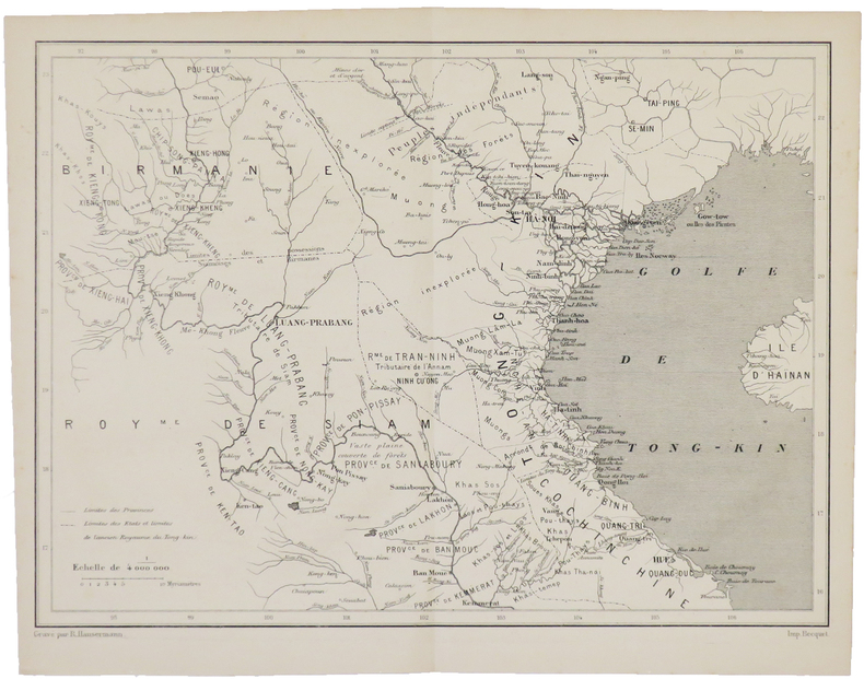
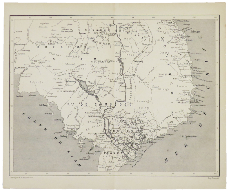
HAUSERMANN (Rémi).
[BIRMANIE/THAÏLANDE/INDOCHINE] [Sans titre].
[1880]. 211 x 280 mm.
書籍販売業者の参照番号
: LBW-5003
|
|
|
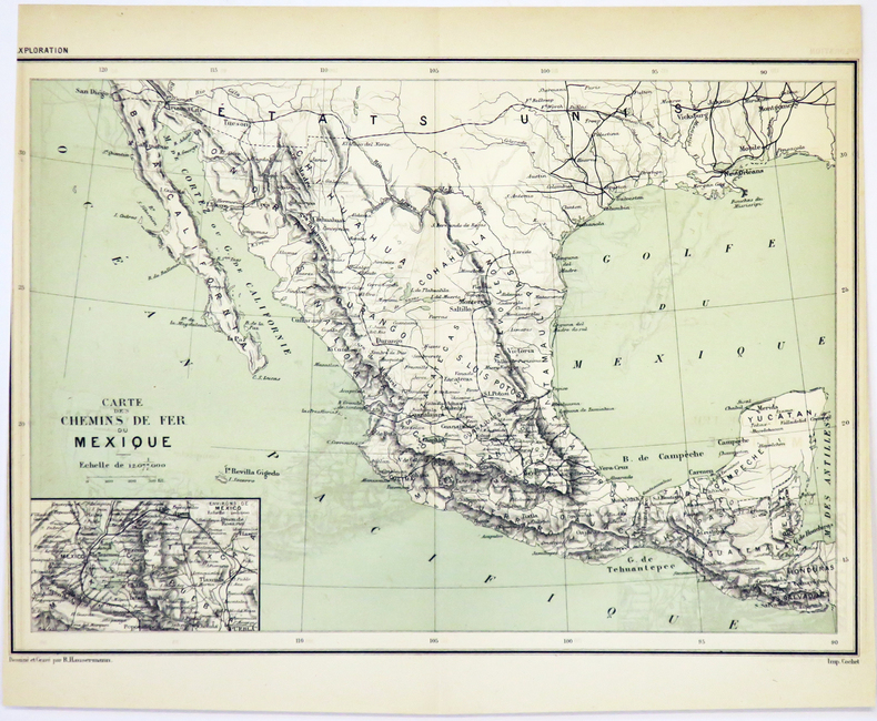
HAUSERMANN (Rémi).
[MEXIQUE/CHEMINS de FER] Carte des chemins de fer du Mexique.
[1881]. 204 x 290 mm.
書籍販売業者の参照番号
: LBW-5018
|
|
|
HAUSERMANN (Rémi).
[NEW YORK] Plan de New-York (États-Unis).
[1878]. 265 x 427 mm.
書籍販売業者の参照番号
: LBW-5011

|
|
|
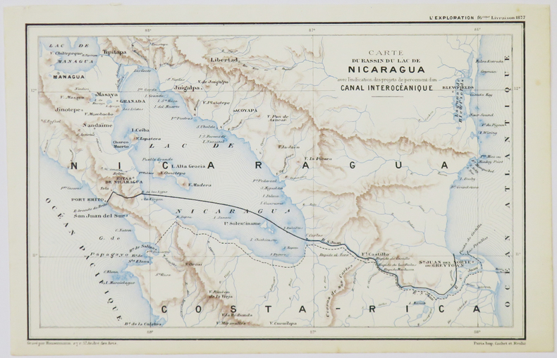
HAUSERMANN (Rémi).
[NICARAGUA] Carte du bassin du lac de Nicaragua avec l'indication des projets de percement d'un canal interocéanique.
[1877]. 140 x 220 mm.
書籍販売業者の参照番号
: LBW-5027
|
|
|
HAUSERMANN (Rémi).
[PATAGONIE] Carte de la Patagonie (Confédération argentine).
[1877]. 287 x 213 mm.
書籍販売業者の参照番号
: LBW-5020

|
|
|
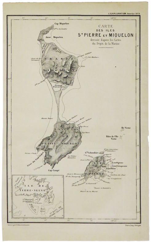
HAUSERMANN (Rémi).
[SAINT-PIERRE-et-MIQUELON] Carte des îles St Pierre et Miquelon.
[1879]. 210 x 135 mm.
書籍販売業者の参照番号
: LBW-5013
|
|
|
HAUSERMANN (Rémi).
[TERRE SAINTE] Carte de la Terre Sainte (Palestine moderne).
1914. 935 x 676 mm.
書籍販売業者の参照番号
: LBW-8331

|
|
|
HAUSERMANN (Rémi).
[THAÏLANDE/INDOCHINE] [Sans titre].
[1880]. 207 x 274 mm.
書籍販売業者の参照番号
: LBW-5002
|
|
|
HAULARD (Charles).
Nouveau plan de la ville de Rouen et de ses faubourgs.
Paris, Logerot s.d. (1856). Grand plan entoilé repliable ( 60cm x 81cm) en noir et blanc, en très bon état. Dans son étui de carton de papier marbré, , titre au dos.
書籍販売業者の参照番号
: 21053
|
|
|
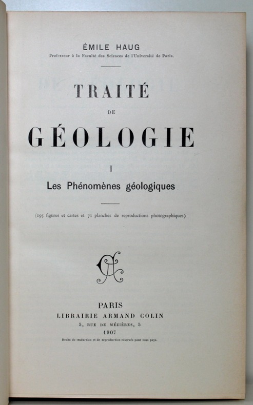
HAUG Emile:
Traité de géologie. Les phénomènes géologiques. Les périodes géologiques.
Paris, Lib. Armand Colin, 1907. In-8 de [4]-536-[2] + [4]-1488 pages chiffrées 2024 p. Demi-maroquin noir, dos à nerfs ornés de fleurons dorés, tête jaspée. Très belle condition.
書籍販売業者の参照番号
: 2541
|
|
|
Hauptvermessungsabt. XIII München
Wanderkarte: Wetterstein-Gebirge. Bearbeitet vom Bayer. Topographischen Bureau 1927.
München 1947. Maßstab: 1:50.000. Mehrfarb. Karte. 62 x 89 cm. Gefaltet. Faltmaß 16 x 12 cm.
書籍販売業者の参照番号
: 23719
|
|
|
HAUTE GARONNE
Carte couleurs d?partementale au 1/200 000?me. Sans date.
Une feuille. 56x76 cm.
|
|
|
HAUTE-GARONNE
Carte couleurs d?partementale. Sans date.
Une feuille. 60x70 cm.
|
|
|
HAUTE-MARNE
Carte en couleurs du d?partement au 1/200 000e.
Une feuille 60x80 cm.
|
|
|
HAUTE-SAONE
Carte en couleurs du d?partement au 1/200 000e.
Une feuille 60x80 cm.
|
|
|
HAUTES PYRENEES
Carte d?partementale en couleurs . Sans date.
Une feuille 60x80cm repli?e sous couverture illustr?e.
|
|
|
HAUTES-PYRENEES
Carte d?partementale en couleurs des Hautes- Pyr?n?es au 1/200 000e. Sans date.
Une feuille 60x80 cm repli?e sous couverture. Cachets.
|
|
|
Havard William C. and Floyd LCorty; Tables maps L. Co
Rural-Urban Consolidation: the Merger of Governments in the Baton Rouge Area
Louisiana State University 1964. Hardcover. Acceptable. Disclaimer:A readable copy. All pages are intact and the cover is intact. Pages can include considerable notes-in pen or highlighter-but the notes cannot obscure the text. At ThriftBooks our motto is: Read More Spend Less.Dust jacket quality is not guaranteed. Louisiana State University hardcover
書籍販売業者の参照番号
: GB001VH4JFII5N00

|
|
|
Havard William C. and Floyd LCorty; Tables maps L. Co
Rural-Urban Consolidation the Merger of Governments in the Baton Rouge Area
Louisiana State University. Very Good with no dust jacket. 1964. Hardcover. 8vo 8" - 9" tall . Louisiana State University hardcover
書籍販売業者の参照番号
: 160859
|
|
|
Haverstock & Hoover; Illustrator Photographs And Maps
Uruguay In Pictures
Sterling Publishing 1975. Hardcover. Good. Sterling Publishing hardcover
書籍販売業者の参照番号
: SONG080691193X ISBN : 080691193X 9780806911939
|
|
|
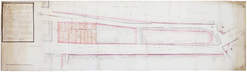
HAYERE.
Plan des tereins incendiez dans la ville de Fougères, la nuit du 29 au 30 aoust 1762, et du reste de l'islot entre les rues Derière et de St Léonard.
3 octobre 1762. 46,5 x 165 cm, sur trois feuilles jointes montées sur toile de lin.
書籍販売業者の参照番号
: LBW-6576
|
|
|
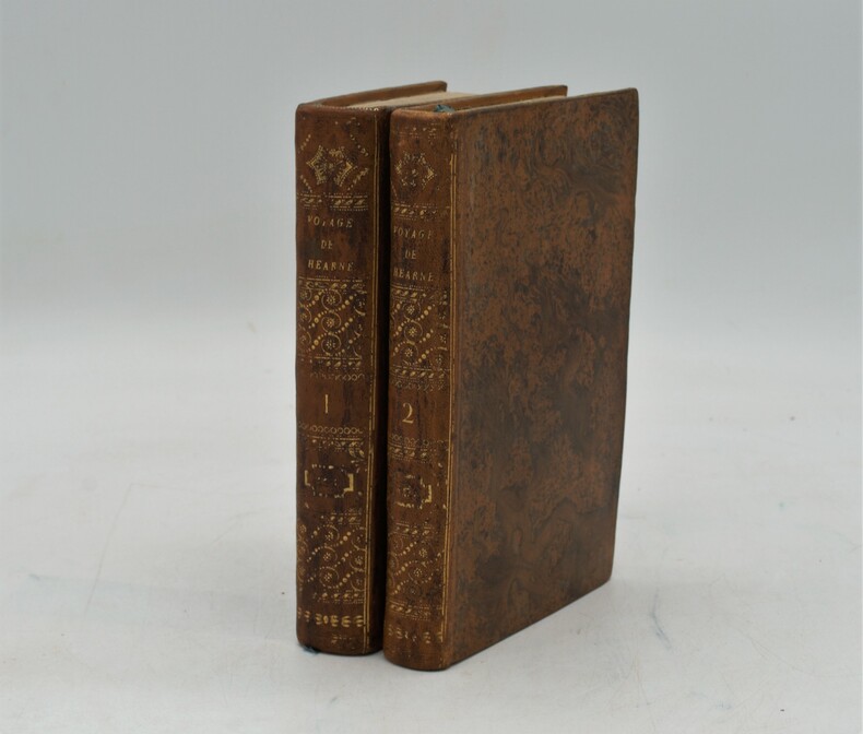
HEARNE , Samuel
Voyage de Samuel Hearne , du fort du Prince de Galle , situé dans la baie de l’Hudson à l’océan nord
Paris, chez Patris , an VII (1799), 2 volumes in-8, lviii-373 pp ,332 pp.-xix , relié plein basane raciné , dos lisse orné avec titre et tomaison , tranches jaunes mouchetées ,T1, titre , extrait du 3eme voyage du capitaine Cook , A la Pérouse , préface , grande carte de la route de Samuel Hearne (60x80cm)déchirure sans manque , introduction, 2 planches et 2 cartes ,T2 , 3 cartes et 2 planches , table des chapitres , errata et placements des planches , intérieur très frais. Complet des 9 planches et cartes , 1 carte volante , manque page 17 à 32 .
書籍販売業者の参照番号
: PHO-1184
|
|
|
HEBERT Monique, LE MOEL Michel
CATALOGUE GENERAL DES CARTES , PLANS, ET DESSINS D'ARCHITECTURE
ARCHIVES NATIONALES TOME II SERIE N (dim 20cm/ 30cm), Departement AIN A NORD , preface d'André CHAMSON PARIS, S.E.V.P.E.N. , 1964, 466 pages ,illustré de nombreuses planches depliantes, certaines en couleurs , inventaire de plans de chateaux ,edifices et autres de divers departements
書籍販売業者の参照番号
: 2704
|
|
|
HEBERT (MONIQUE), LE MOËL (MICHEL)
Catalogue général des cartes, plans et dessins d'architecture.
Tome 2, série N. Départements Ain à Nord. Préface d'André Chamson., Paris, SEVPEN, 1964. In-8 br, XVIII-466 pp, 20 planches dépliantes de reprod, dont 4 en coul. parfait etat
書籍販売業者の参照番号
: 4969
|
|
|
HEBERT Monique THIRION Jacques
Catalogue général des CARTES, PLANS et DESSINS D'ARCHITECTURE Tome Premier Série N PARIS et le département de la SEINE
1958 Paris, Imprimerie Nationale 1958. Direction des Archives de France. In 8° broché de 427 pp. sur papier glacé. Huit planches H.T. en noir et en couleurs. 19 figures in texte + les plans des 20 arrondissements de Paris. Dos slégèrement insolé, bon exemplaire
書籍販売業者の参照番号
: 2296
|
|
|
Heckel, Vilem
Krasy Ceskoslovenska
No marks or inscriptions. A very clean very tight copy with unmarked white cloth boards, slight foxing to upper end lower boad edges and no bumping to corners. Dust jacket not price clipped or marked or torn or creased with rubbing to top of spine, upper corners and lower rear edge. 191pp. The beauty of Czechoslovakia in 164 full page black & white photographs. Collected captions at the rear in five languages including English.

|
|
|
Hedberg Maps Inc
1999 North American baseball travel map: Location and contact information for every major league minor league and independent professional baseball team in the US and Canada
White Star Press. Used - Good. Shows some signs of wear and may have some markings on the inside. White Star Press unknown
書籍販売業者の参照番号
: GRP87466946 ISBN : 1885508395 9781885508393
|
|
|
Hedberg Maps Inc
Central Minnesota: Brainerd Lakes Detroit Lakes Leech Lake Park Rapids Alexandria Area Otter Tail Lake
Hedberg Maps Inc 2009-11-06. Map. Used:Good. Hedberg Maps Inc unknown
書籍販売業者の参照番号
: DADAX1593530455 ISBN : 1593530455 9781593530457
|
|
|
Hedberg Maps Inc
Central Minnesota: Brainerd Lakes Detroit Lakes Leech Lake Park Rapids Alexandria Area Otter Tail Lake
2009-07-03. New. Ships with Tracking Number! INTERNATIONAL WORLDWIDE Shipping available. May be re-issue. Buy with confidence excellent customer service! unknown
書籍販売業者の参照番号
: 1593530455n ISBN : 1593530455 9781593530457

|
|
|
Hedberg Maps Inc Nat Case Editor
Denver Downtown
Hedberg Maps Inc 2010-10-01. Sixth. Map. Good. Hedberg Maps Inc unknown
書籍販売業者の参照番号
: SONG1593530498 ISBN : 1593530498 9781593530495
|
|
|
Hedberg Maps Inc
Duluth Area Street Map: Includes Downtown Superior North Shore and Iron Range
2010-03-15. Good. Ships with Tracking Number! INTERNATIONAL WORLDWIDE Shipping available. May not contain Access Codes or Supplements. May be re-issue. May be ex-library. Shipping & Handling by region. Buy with confidence excellent customer service! unknown
書籍販売業者の参照番号
: 1593530471 ISBN : 1593530471 9781593530471

|
|
|
Hedberg Maps Inc
Duluth Area Street Map: Includes Downtown Superior North Shore and Iron Range
2010-03-15. New. Ships with Tracking Number! INTERNATIONAL WORLDWIDE Shipping available. May be re-issue. Buy with confidence excellent customer service! unknown
書籍販売業者の参照番号
: 1593530471n ISBN : 1593530471 9781593530471

|
|
|
Hedberg Maps Inc
Duluth MN: North Shore; Superior WI; Downtown Duluth; UMD
2008-03-07. New. Ships with Tracking Number! INTERNATIONAL WORLDWIDE Shipping available. May be re-issue. Buy with confidence excellent customer service! unknown
書籍販売業者の参照番号
: 1593530390n ISBN : 1593530390 9781593530396

|
|
|
Hedberg Maps; Hedberg Maps Editor; Hedberg Maps Illustrator;
Madison: UW & Capitol Area
Hedberg Maps 2011-05-30. Map. Used:Good. Hedberg Maps unknown
書籍販売業者の参照番号
: DADAX1593530595 ISBN : 1593530595 9781593530594
|
|
|
Hedberg Maps
Madison: UW & Capitol Area
2011-04-08. New. Ships with Tracking Number! INTERNATIONAL WORLDWIDE Shipping available. May be re-issue. Buy with confidence excellent customer service! unknown
書籍販売業者の参照番号
: 1593530595n ISBN : 1593530595 9781593530594

|
|
|
Hedberg Maps Inc Nat Case Editor
Mankato-New Ulm-St Peter-Waseca MN
Hedberg Maps Inc 2008-02-12. Map. Good. Hedberg Maps Inc unknown
書籍販売業者の参照番号
: SONG1593530277 ISBN : 1593530277 9781593530273
|
|
|
Hedberg Maps Inc; Nat Case Editor
Minneapolis and Saint Paul Downtown
Hedberg Maps Inc 2010-10-15. Map. Used:Good. Hedberg Maps Inc unknown
書籍販売業者の参照番号
: DADAX1593530501 ISBN : 1593530501 9781593530501
|
|
|
Hedberg Maps; Hedberg Maps Editor; Hedberg Maps Illustrator;
Minneapolis and St Paul Street Map
Hedberg Maps 2011-05-30. Map. Used:Good. Hedberg Maps unknown
書籍販売業者の参照番号
: DADAX1593530579 ISBN : 1593530579 9781593530570
|
|
 検索結果のメールを受信する
 PDFファイルの検索結果をダウンロード
 RSSフィード


