|
LANNETTE Claude.
EVREUX EN CARTES POSTALES ANCIENNES.
Bibliothèque europeenne-Zaltbommel / Pays-bas, sans date ( vers1975), un volume in-8 oblong , 20,5 x15 cm, cartonnage editeur illustré, 76 reproductions de cartes postales anciennes. Bon état.
書籍販売業者の参照番号
: 6821
|
|
|
LANGLOIS E.
SAINT-QUENTIN EN CARTES POSTALES ANCIENNES.
Bibliothèque europeenne-Zaltbommel / Pays-bas,sans date ( vers1975), un volume in-8 oblong , 20,5 x15 cm, cartonnage editeur illustré, 116 reproductions de cartes postales anciennes. Petite tache sur le dos, peu visible, sinon bon état.
書籍販売業者の参照番号
: 6805
|
|
|
LANGDON-DAVIES, John:
The Armada. A collection of contemporary documents. Jackdaw N° 5.
London, Jonathan Cape, 1964, in-4to, 10 loosely inserted documents (maps, portraits, engravings, broadsheets), orig. illustr. portfolio
書籍販売業者の参照番号
: 94064aaf

|
|
|
Landeshut (Schlesien):
Landeshut. Schlesien. "Plan der Action welche d. 23. Juny 1760 zwischen einem Corps der Kayserlich Königlich Ungarischen und einem Corps der Königlich Preussischen Armee bei Landeshutte in Schlesien vorgefallen". Schlachtenplan von Landshut/Schlesien. Kupferstich mit farbigen Truppenaufstellungen aus "Neues Kriegs-Theater ...", No. 28.
Format: 18 x 29,5 cm. *Leicht gebräunt, insgesamt gut erhalten. Landkarten de
|
|
|
Lands, Neil
Visitor's Guide to the Dordogne
Book appears unread in virtually mint condition. 160pp. Travel guide to the Dordogne region of France.

|
|
|
Landshut (Schlesien):
"Plan der Action welche d. 23. Juny 1760 zwischen den Kayserl. Königl. General Feld Zeugmeister Freyherr von Laudon und den Königl. Preussischen General von Fouquet. Schlachtplan, teilkolorierter Kupferstich.
Format: 17,5 x 30,5 cm. *Ränder gebräunt, insgesamt gut erhalten. Landkarten de
|
|
|
Langlois Hyacinthe Louis Hyacinthe Langlois Avril Charles ill.
Atlas universel illustr� � l'usage des institutions et des gens du monde pour suivre les cours de g�ographie et d'histoire d'apr�s Bru� Balbi Maltebrun Lapie etc. etc. Le Monde illustr�. Atlas universel 1841-1842 en couverture / Atlas g�ographique portatif sur les cartes
Paris: H. Langlois 1842. Atlas. Illus. by Charles Avril. Tr�s bon. Cartonnage Editeur. Ed. originale. Paris H. Langlois 1842 imp. de Simon. 215 x 155 cm R 1 f. bl. - 1 f. titre et table - 36 cartes � double page toutes mont�es sur onglets chaque planche : 27 x 205 cm cartonnage de l'�diteur de demi-percaline prune portant au premier plat une large pi�ce de titre sur papier enti�rement illustr�e en noir. Atlas rare publi� par Louis-Hyacinthe Langlois et dessin� par Charles Avril. Toutes les cartes sauf la premi�re sont avec rehauts de couleurs � la main et sont enrichies d'une vignette grav�e dans la cartouche. Elles portent toutes les mentions "dessin� et grav� par Ch. Avril" "atlas de g�ographie portatif" "ann�e 1841" "prix 10 centimes en couleur". Liste des cartes : 1. Cosmographie 2. Mappemonde 3. Europe 4. Asie 5. Afrique 6. Am�rique nord 7. Am�rique sud 8. Oc�anie 9. France 10. Monde connu des anciens 11. Iles britanniques 12. Allemagne 13. Espagne et Portugal 14. Italie 15. Turquie d'Europe et Gr�ce 16. Russie d'Europe 17. Belgique et Hollande 18. Su�de Norw�ge sic et Danemark 19. Suisse 20. Prusse 21. Autriche 22. Asie centrale 23. Indes 24. Chine et Japon 25. Russie d'Asie 26. Afrique septentrionale 27. Afrique orientale 28. Afrique occidentale 29. Afrique m�ridionale 30. Etats-Unis 31. Mexique 32. Antilles 33. Colombie 34. Br�sil 35. P�rou et Bolivia 36. Plata Chili et Paraguay. Rousseurs au titre bel exemplaire. H. Langlois Hardcover
書籍販売業者の参照番号
: 3841

|
|
|
LANGRES
Carte au 1/200 000e. Sans date.
Une feuille 32x50 cm.
|
|
|
Lanzas, Pedro Torres
Relacion descriptiva de los Mapas, Planos, etc. De las antiguas audencias de Panama, Santa Fe y Quito.
Madrid, Revista de Arch. Bibl., y Museas 1904. In Spanisch.
書籍販売業者の参照番号
: BIBG0062
|
|
|
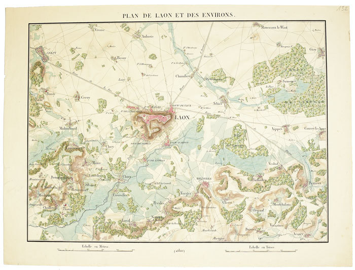
LAON. MANUSCRIT.
Plan de Laon et des environs.
[circa 1835]. 368 x 500 mm.
書籍販売業者の参照番号
: LBW-511
|
|
|
LAON
Carte au 1/50 000?me. type 1837, r?vis?e en 1912
Une feuille 60x84 cm. Plis r?par?s.
|
|
|
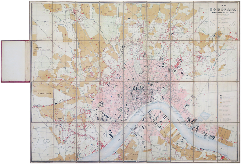
LAPIERRE (Alfred).
[BORDEAUX] Plan de Bordeaux et de sa banlieue Sud & Ouest.
Bordeaux, Féret et Fils, 1883. En 36 sections montées sur toile et repliées, formant une carte de 0,87 x 1,15 m, montée dans une relire éditeur de percaline bordeaux.
書籍販売業者の参照番号
: LBW-7869
|
|
|
LAPLACE (Cyrille Pierre Théodore).
[CANTON/CHINE] Une rue de Canton.
Paris, 1833-1839. 270 x 368 mm.
書籍販売業者の参照番号
: LBW-1990

|
|
|
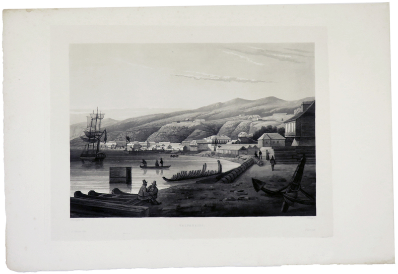
LAPLACE (Cyrille Pierre Théodore).
[CHILI] Valparaiso.
Paris, 1833-1839. 272 x 363 mm.
書籍販売業者の参照番号
: LBW-1981
|
|
|
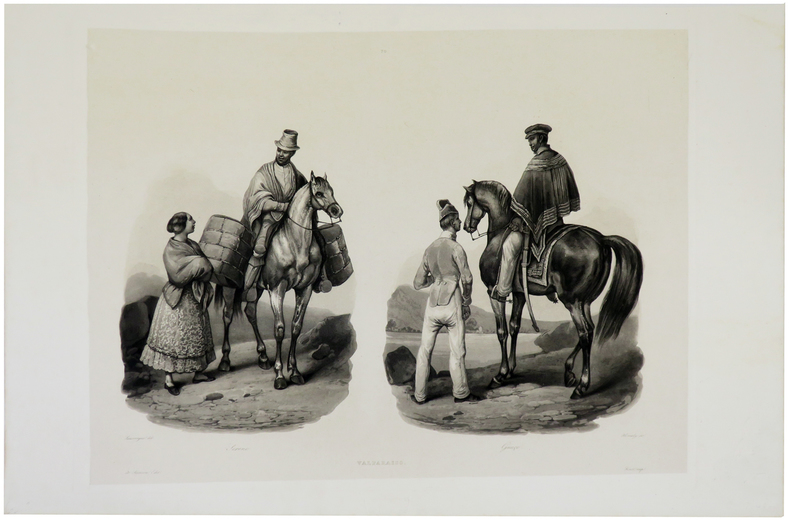
LAPLACE (Cyrille Pierre Théodore).
[CHILI] Valparaiso. Sereno - Guaço.
[Paris, 1833-1839]. 275 x 372 mm.
書籍販売業者の参照番号
: LBW-5503
|
|
|
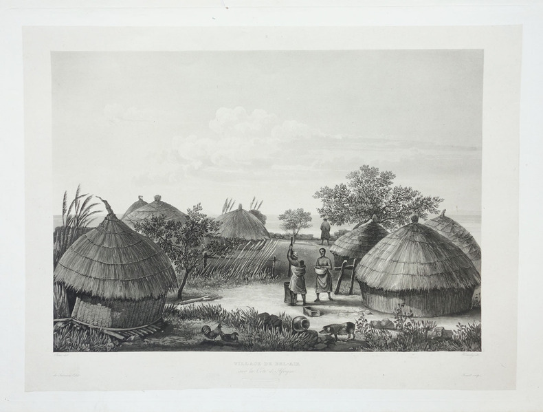
LAPLACE (Cyrille Pierre Théodore).
[GUINEE] Village de Bel-Air sur la côte d'Afrique.
Paris, 1833-1839. 272 x 370 mm.
書籍販売業者の参照番号
: LBW-1983
|
|
|
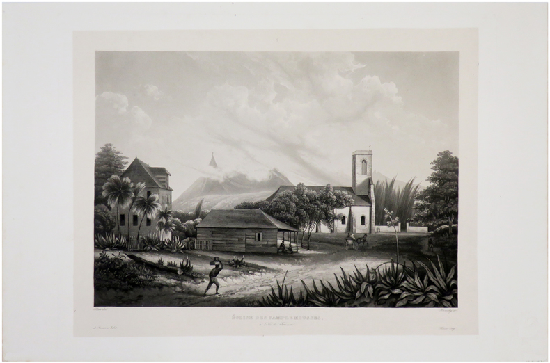
LAPLACE (Cyrille Pierre Théodore).
[ILE MAURICE] Eglise des Pamplemousses, à l'Ile de France.
Paris, 1833-1839. 267 x 356 mm.
書籍販売業者の参照番号
: LBW-1982
|
|
|
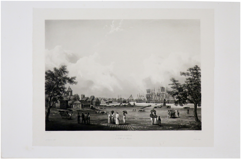
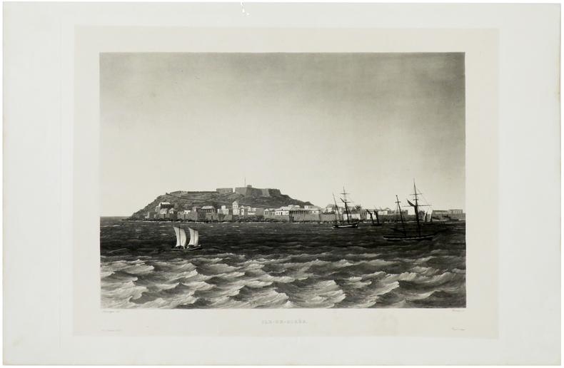
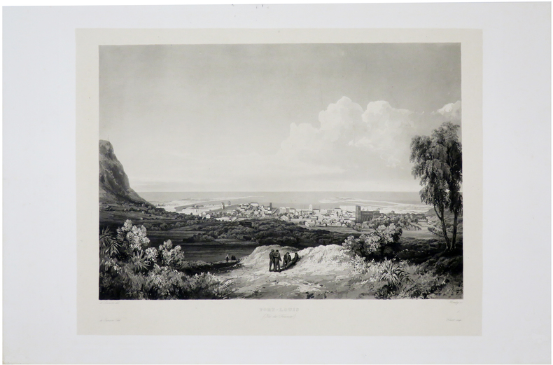
LAPLACE (Cyrille Pierre Théodore).
[ILE MAURICE] Port-Louis à l'Île de France.
[Paris, 1833-1839]. 268 x 354 mm.
書籍販売業者の参照番号
: LBW-1985
|
|
|
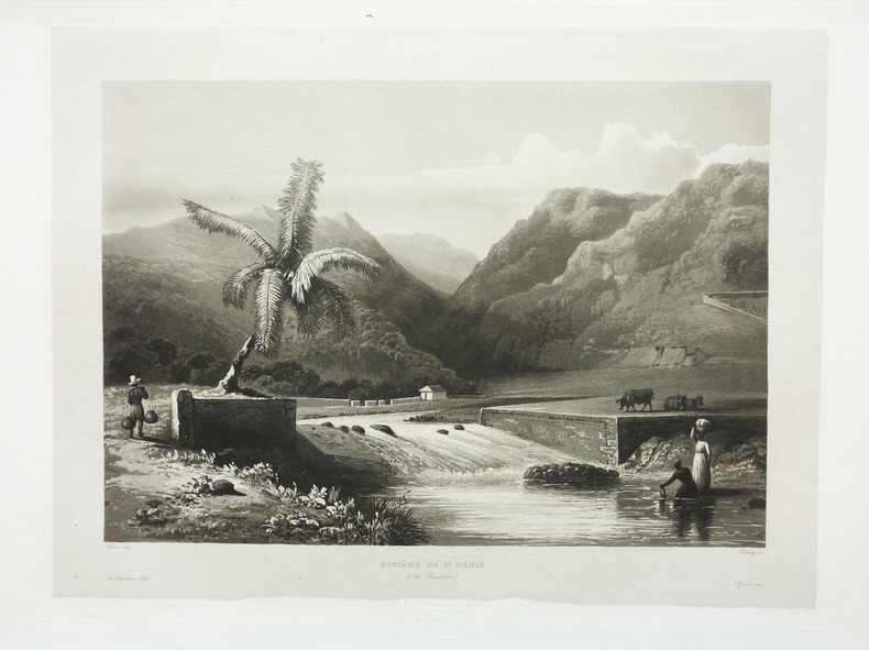
LAPLACE (Cyrille Pierre Théodore).
[ILE DE LA REUNION] Rivière de St. Denis (Ile Bourbon).
Paris, 1833-1839. 272 x 365 mm.
書籍販売業者の参照番号
: LBW-1987
|
|
|
LAPLACE (Cyrille Pierre Théodore).
[ILE de GOREE/SENEGAL] Ile-de-Gorée.
Paris, 1833-1839. 266 x 367 mm.
書籍販売業者の参照番号
: LBW-1989
|
|
|
LAPLACE (Cyrille Pierre Théodore).
[ILE MAURICE] Port-Louis (Île de France).
[Paris, 1833-1839]. 266 x 340 mm.
書籍販売業者の参照番号
: LBW-6522
|
|
|
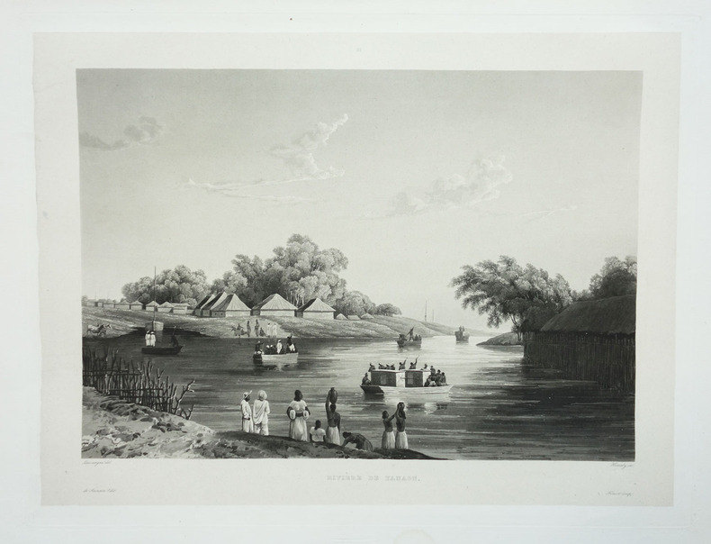
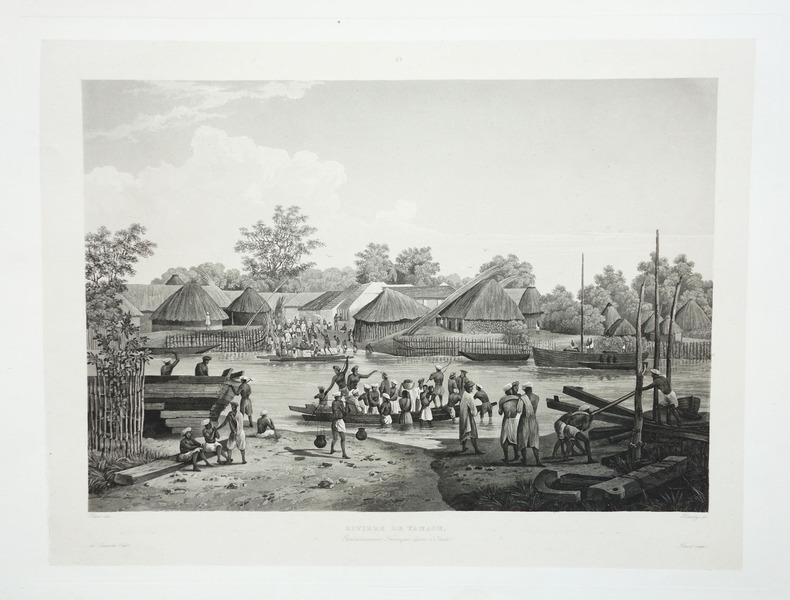
LAPLACE (Cyrille Pierre Théodore).
[INDE] Rivière de Yanaon.
Paris, 1833-1839. 270 x 363 mm.
書籍販売業者の参照番号
: LBW-1993
|
|
|
LAPLACE (Cyrille Pierre Théodore).
[INDE] Rivière de Yanaon. Etablissement français dans l'Inde.
Paris, 1833-1839. 272 x 362 mm.
書籍販売業者の参照番号
: LBW-1994
|
|
|
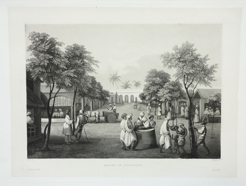
LAPLACE (Cyrille Pierre Théodore).
[INDE] Marché de Pondichéry.
Paris, 1833-1839. 275 x 370 mm.
書籍販売業者の参照番号
: LBW-1997
|
|
|
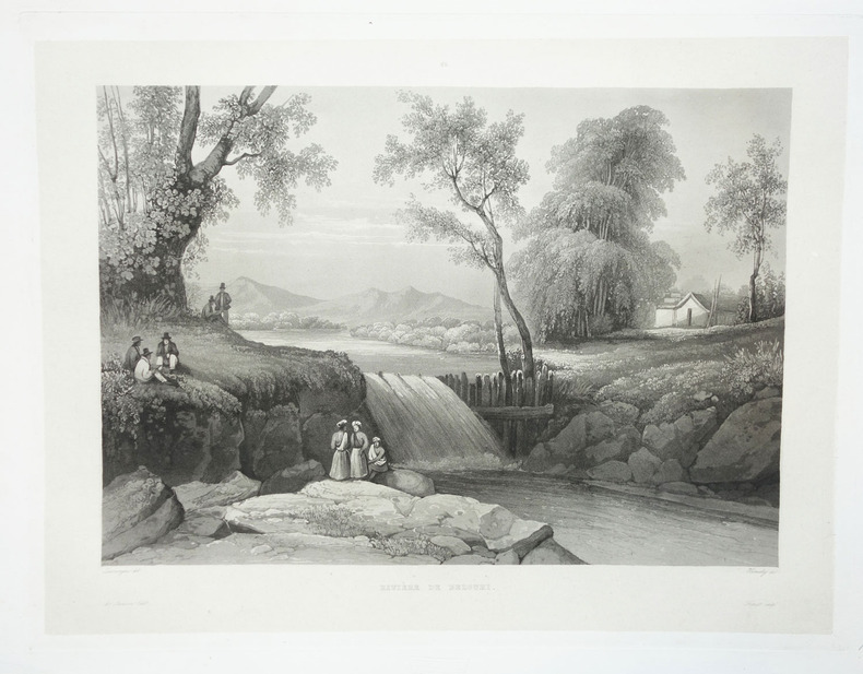
LAPLACE (Cyrille Pierre Théodore).
[JAVA] Rivière de Bezouki.
Paris, 1833-1839. 272 x 340 mm.
書籍販売業者の参照番号
: LBW-1969
|
|
|
LAPLACE (Cyrille Pierre Théodore).
[JAVA] Rivière de Bezouki à Java.
Paris, 1833-1839. 268 x 354 mm.
書籍販売業者の参照番号
: LBW-1970

|
|
|
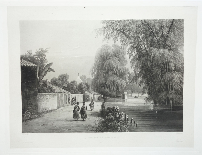
LAPLACE (Cyrille Pierre Théodore).
[JAVA] Rivière de Sourabaya.
Paris, 1833-1839. 268 x 354 mm.
書籍販売業者の参照番号
: LBW-1971
|
|
|
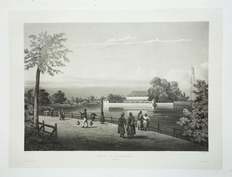
LAPLACE (Cyrille Pierre Théodore).
[JAVA] Maison du gouverneur à Sourabaya.
Paris, 1833-1839. 274 x 368 mm.
書籍販売業者の参照番号
: LBW-1972
|
|
|
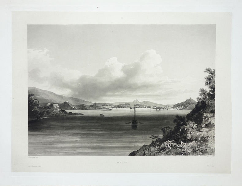
LAPLACE (Cyrille Pierre Théodore).
[MACAO] Macao.
Paris, 1833-1839. 272 x 369 mm.
書籍販売業者の参照番号
: LBW-1991
|
|
|
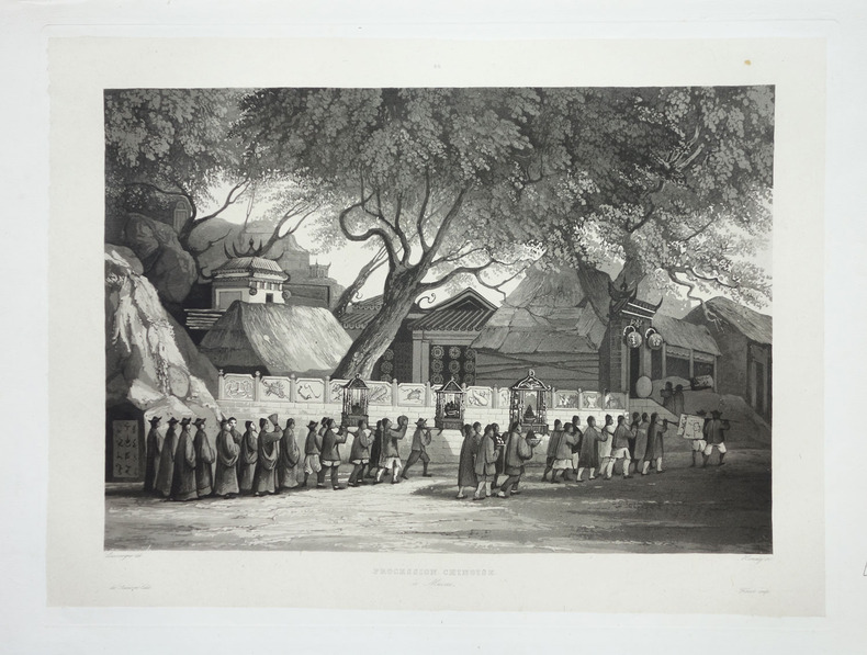
LAPLACE (Cyrille Pierre Théodore).
[MACAO] Procession chinoise à Macao.
Paris, 1833-1839. 271 x 367 mm.
書籍販売業者の参照番号
: LBW-1992
|
|
|
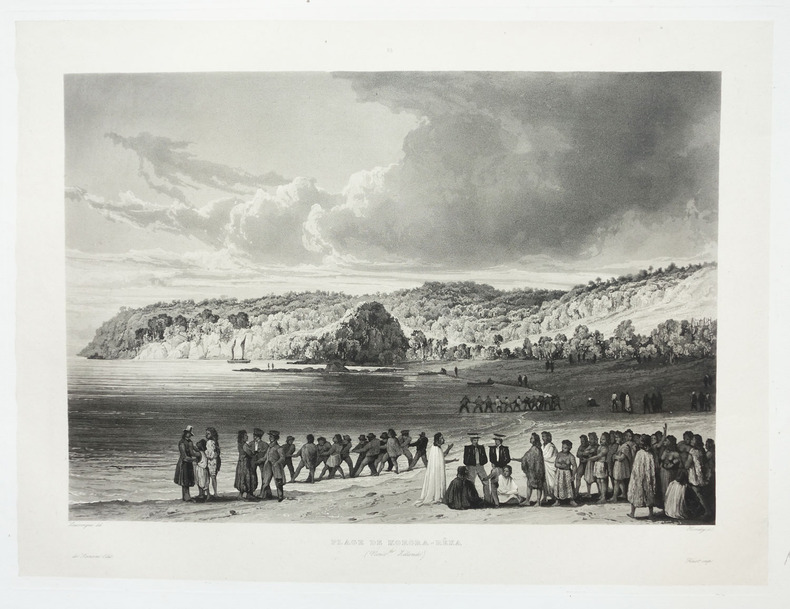
LAPLACE (Cyrille Pierre Théodore).
[NOUVELLE-ZELANDE] Plage de Korora-Rêka (Nouv.lle Zélande).
Paris, 1833-1839. 275 x 371 mm.
書籍販売業者の参照番号
: LBW-1980
|
|
|
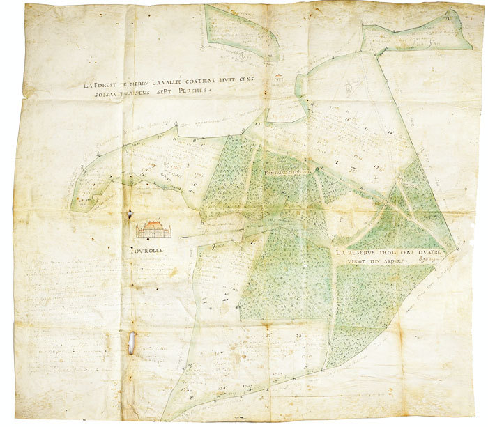
LAPIERRE. MANUSCRIT.
[Plan de la forêt et du domaine de Fourolles].
1724. 633 x 702 mm, sur peau de vélin.
書籍販売業者の参照番号
: LBW-539
|
|
|
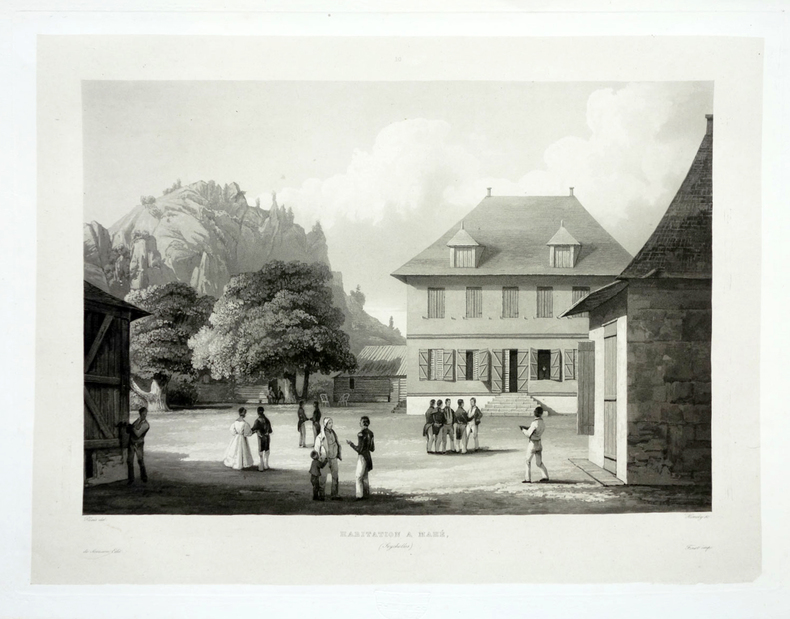
LAPLACE (Cyrille Pierre Théodore).
[SEYCHELLES] Habitation à Mahé (Seychelles).
Paris, 1833-1839. 272 x 362 mm.
書籍販売業者の参照番号
: LBW-1986
|
|
|
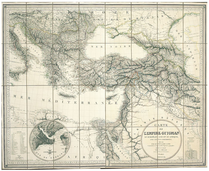
LAPIE (Pierre, Capitaine);
Carte de l'Empire Ottoman en Europe, en Asie et en Afrique, avec les pays limitrophes.
Paris J.A. Orgiazzi 1822 En 32 sections montées sur toile et pliées, formant une carte de 874 x 1091 mm ; étui de papier marbré.
書籍販売業者の参照番号
: LBW-681
|
|
|
LAPIE (Pierre, Capitaine);
Carte d'une partie des royaumes de Naples d'Etrurie et de l'Etat de l'Eglise.
An XIII - 1805 427 x 679 mm.
書籍販売業者の参照番号
: LBW-929

|
|
|
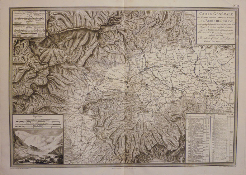
LAPIE (Pierre, Capitaine);
Carte générale des marches, positions, combats et batailles, de l'armée de réserve, depuis le passage du Grand St. Bernard, le 24 floréal An 8. Jusqu'à la victoire complette & décisive remportée à Marengo, le 25 prairial suivant. Faite à Turin, en l'An 8 par Lapie, Ingénieur Géographe employé à cette armée, par ordre du généraP. Dupont, chef de l'Etat Major Général.
An XII - 1803 439 x 630 mm.
書籍販売業者の参照番号
: LBW-934
|
|
|
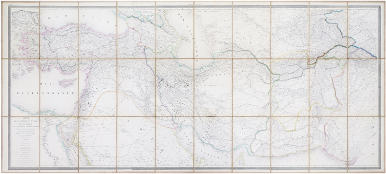
LAPIE (Pierre, Capitaine).
Carte de la Turquie d'Asie, de la Perse, de l'Afghanistan, du Belouchistan et de la grande Boukharie ; avec une partie des états voisins.
Paris, C. Picquet, 1848. En 30 sections montées sur toile et pliées, formant une carte de 0,64 x 1,43 m ; étiquette au dos de l'éditeur E. Andriveau-Goujon.
書籍販売業者の参照番号
: LBW-6680
|
|
|
LAPIE (Capitaine P.)
Carte de la Russie d'Europe avec l'Empire d'Autriche, la Suède, le Danemark et la Norwege, la Prusse, le Grand Duché de Varsovie, les Provinces Illyriennes, et une partie de la Confédération du Rhin et de la Turquie d'Europe, dressée par P. Lapie, Capitaine de Iere Classe au Corps Impérial des Ingénieurs Géographes.
1812 toile saumon. (un manque de qq. cms à 1 des pliures de la f. 4). Carte en 6 feuilles, 164x 164 cms, P. P.A.F. Tardieu, 1812,
書籍販売業者の参照番号
: 11796
|
|
|
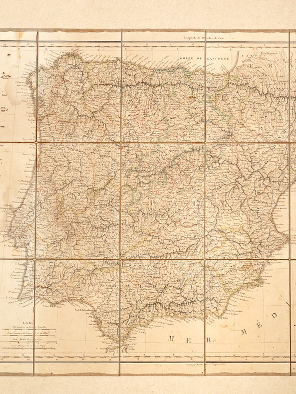
LAPIE, le Chev.
Espagne et Portugal [ Cartes ] dressées par le Chev. Lapie Géographe 1822
Dédiées et Présentées au Roi à Paris chez Basse, 1822, 1 carte dépliante entoilée au format 790 x 545 mm, frontières des provinces rehaussées en couleurs, gravé par Berthe
書籍販売業者の参照番号
: 26458
|
|
|
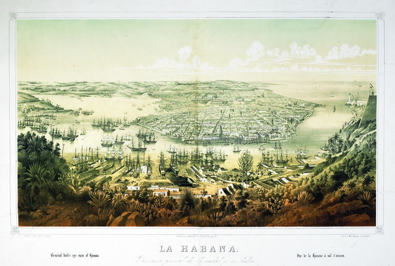
LAPLANTE (Edouard).
La Habana. Panorama general de la ciudad y su bahia.
La Habana, L. Marquier y Laplante, [circa 1850]. Lithographie originale (49,9 x 71,5 cm, hors marges).
書籍販売業者の参照番号
: LBW-5280
|
|
|
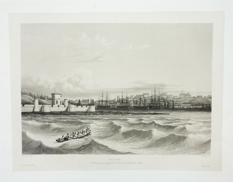
LAPLACE (Cyrille Pierre Théodore).
Sydney. Etablissement principal de la Nouvelle Galles du Sud.
Paris, 1833-1839. 267 x 354 mm.
書籍販売業者の参照番号
: LBW-1979
|
|
|
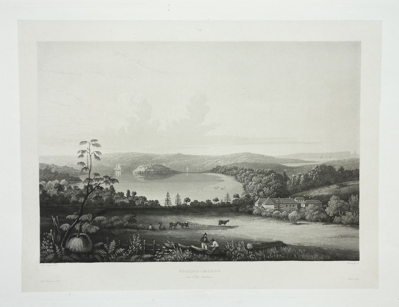
LAPLACE (Cyrille Pierre Théodore).
Vooloo-Moloo au Port Jackson.
Paris, 1833-1839. 268 x 358 mm.
書籍販売業者の参照番号
: LBW-1978
|
|
|
LAPIE, le Chev.
Espagne et Portugal [ Cartes ] dressées par le Chev. Lapie Géographe 1822
Dédiées et Présentées au Roi à Paris chez Basse, 1822, 1 carte dépliante entoilée au format 790 x 545 mm, frontières des provinces rehaussées en couleurs, gravé par Berthe Etat satisfaisant (qq. mouill., petits accrocs en coin sup. gauche) Français

|
|
|
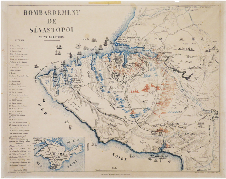
LAROCHETTE (Charles).
[CRIMÉE/SÉBASTOPOL] Bombardement de Sévastopol. Nouvelle édition. Septembre 1855.
Chez tous les M.ds de cartes & d'estampes de Paris & de la province, 1855. 457 x 564 mm, sur papier fin.
書籍販売業者の参照番号
: LBW-8025
|
|
|
LARMAT (Louis).
Atlas de la France vinicole L. Larmat. "les Eaux-de-vie de France". Carte générale. "Le Cognac".
Paris, Louis Larmat, 1947. 488 x 688 mm.
書籍販売業者の参照番号
: LBW-6796

|
|
|
LAROUSSE MENSUEL 1911-1913 (Sous la direction de Claude AUGE) 2340 gravures - 112 tableaux - 82 cartes et plans.
Larousse mensuel illustré Tome deuxième : 1911 à 1913. Revue encyclopédique universelle.
Couverture rigide. Reliure verte de l'éditeur. 914 pages + Bulletin mensuel (4 pages dont une de récréationsx36 mois).
書籍販売業者の参照番号
: 43271
|
|
|
LAROUSSE MENSUEL 1914-1916 (Sous la direction de Claude AUGE) 2560 gravures - 120 tableaux - 122 cartes et plans.
Larousse mensuel illustré Tome troisième : 1914 à 1916. Revue encyclopédique universelle.
Couverture rigide. Reliure rouge de l'éditeur. 958 pages + 4 pages de Bulletin mensuelx36 mois (à partir du 15 juillet 1914 : Bulletin de la guerre). Coins des plats usés. Il manque la moitié de la page 893.
書籍販売業者の参照番号
: 47974
|
|
|
LAROUSSE MENSUEL 1907-1910 (Sous la direction de Claude AUGE) 2812 gravures - 98 tableaux - 103 cartes et plans.
Larousse mensuel illustré Tome premier : 1907 à 1910. Revue encyclopédique universelle.
Couverture rigide. Reliure verte de l'éditeur. 842 pages. Reliure frottée.
書籍販売業者の参照番号
: 47975
|
|
|
LAROUSSE MENSUEL 1907-1910 (Sous la direction de Claude AUGE) 2812 gravures - 98 tableaux - 103 cartes et plans.
Larousse mensuel illustré - Tome premier : 1907 à 1910. Revue encyclopédique universelle.
Couverture rigide. Reliure verte de l'éditeur. (Dos brun) 842 pages.
書籍販売業者の参照番号
: 75322
|
|
|
LAROUSSE MENSUEL 1914-1916 (Sous la direction de Claude AUGE) 2560 gravures - 120 tableaux - 122 cartes et plans.
Larousse mensuel illustré Tome troisième : 1914 à 1916. Revue encyclopédique universelle.
Couverture rigide. Reliure verte de l'éditeur légèrement défraîchie. 958 pages + 4 pages de Bulletin mensuelx36 mois (à partir du 15 juillet 1914 : Bulletin de la guerre). Coiffe supérieure manquante. Mors supérieur fendu sur 5 cm.
書籍販売業者の参照番号
: 75323
|
|
 検索結果のメールを受信する
 PDFファイルの検索結果をダウンロード
 RSSフィード


