|
|
|
BERTELLI Ferrando (attivo a Venezia seconda metà del XVI secolo)
Rodi
Carta geografica dell’isola di Rodi. In alto all’interno dell’isola il titolo RODI. Mappa priva di scala grafica, orientazione e graduazione ai margini.Questa mappa dell’isola di Rodi ha radici ancora sconosciute, si tratta di una mappa abbastanza chiara della città all’epoca dell’assedio del sultano Solimano, quando i cavalieri di San Giovanni intervennero per liberarla. Ben tracciata è la fortificazione del porto che circonda la città; la scena riportata sul lato destro della mappa, con grande probabilità vuole raffigurare i cavalieri di San Giovanni che trasportano il corpo di Sant’Eufemia ed altri valori dell’Ordine a bordo di una nave. La stampa, tuttavia, non è coeva alle scene rappresentate e può essere attribuita, senza grandi dubbi, alla mano di Ferrando Bertelli. L’unico esemplare conosciuto di questa carta è quello descritto da Peter Meurer nello ‘Strabo Atlas’, atlante appartenuto alla famiglia Bertelli, ora conservato alla Bayerische StaatsBibliothek di Monaco di Baviera.Acquaforte e bulino, in buono stato di conservazione. Map of Rhodes, lettered RODI within the map at top. Without graphic scale.The only one example known is described by Peter Meurer in "The Strabo Illustratus Altlas": "The publishing background of this hitherto unrecorded map awaits further research. The view of the town of Rodhes is rather good, see details like the chain closing the strongly fortified harbour. The outlines of the island are only sketchy. Some group of figures seem to allude to the evnts of 1 January 1523, when the Knights of St. John honourably surrendered Rhodes to Sultan Solyman after a long siege. The scenary on the right coast probably shows the knights bringing teh body of Saint Euphemia and other valuables of the Order on board of a ship."This engraving is however not contemporary to the scenes, and can be attribued to Ferrando Bertelli.The Strabo atlas, came from the House of Bertelli in Venice, is kept by Bayerische StaatsBibliothek - Bavarian State Library.Copperplate, in good condition. Meurer (2002): n. 133.

|
|
|
BERTELLI Ferrando (attivo a Venezia seconda metà del XVI secolo)
Sardinia jnsula inter africu[m] et tirrenum pelagus sita magnitudine 562 mil. Pas..
Rarissima carta geografica dell'isola edita a Venezia da Ferrando Bertelli. Magnifico esemplare, rifilato al rame e con margini coevi aggiunti, in perfetto stato di conservazione.Descrizione della mappa presa da Bifolco & Ronca "CARTOGRAFIA RARA ITALIANA: XVI SECOLOL'ITALIA E I SUOI TERRITORI Catalogo Ragionato delle Carte a Stampa"http://www.antiquarius-sb.com/cartografiarara.aspTITOLO & ISCRIZIONIAl centro dell’isola, la scritta Sardegna; in alto, a sinistra, in una targa, una breve descrizione della regione, lafirma dello stampatore e la data, Sardinia jnsula inter africu[m] et tirrenum pelagus sita magnitudine 562 mil. pas: fertilis admodu[m] animaliuq varij generis abu[n]da[n]s metallis stagnis argentareijs fontibus salubris prestantissima. Fer. Ber. Exc. 1562. Orientazione nei quattro lati al centro, con il nome dei venti Tramontana, Mezzo di, Levante, Ponente. Carta priva di graduazione ai margini e di scala grafica.NOTIZIE STORICO-CRITICHELa carta del Bertelli è una derivazione della carta del Gastaldi-Licinio stampata qualche anno prima. Rispetto aquesta, non apporta novità dal punto di vista geo-cartografico. L’opera appartiene ad una serie di mappe delle isole del Mediterraneo occidentale (Sardegna, Corsica, Maiorca, Minorca) che Bertelli realizzò nel 1560 circa. È plausibile che il Camocio abbia usato la mappa, inserendola in una copia del suo Isolario.STATI & EDIZIONINon sono note ristampe.BIBLIOGRAFIA & CENSIMENTOR. Almagià, Monumenta Italiae Cartographica, 1929, p. 22; R. Almagià, Monumenta Cartografica Vaticana, 1948, pp. 103, 42; F. Borroni Salvadori, Carte Piante e Stampe Storiche delle raccolte Lafreriane della Biblioteca Nazionale di Firenze, 1980, p. 23, n. 61; Christie’s Londra, Cartography, 2006, 496; Christie’s New York, Books & Manuscripts, 2001, 54; Christie’s Roma, Libri, Autografi, Carte Geografiche, Ricordi familiari dei Duchi di Windsor, 2004; A. Ganado, Description of an early Venetian sixteenth century collection of maps at the Casanatense Library in Rome, pp. 26-47, 38; L. Lago, Imago Italiae, 2002, fig. 490; P.H. Meurer, The Strabo Illustratus Atlas, 2002, p. 6l, 47; L. Piloni, Carte geografiche della Sardegna, 1974, XXV, p. 58; R. Shirley, Maps in Atlases of the British Library. A descriptive Catalogue, pp. 381-384, 104; P. Tavernari, M. Donattini, Totius orbis descriptio: la collezione di carte geografiche delcardinale Alessandro d’Este, 61; R.V. Tooley, Maps in Italian Atlases ofthe Sixteenth Century, 1939, p.12-47, n. 510- 511; V. Valerio, L’Italia e le sue regioni nella bottega dell’incisore, 2008, p. 104-105, 43. Very rare map of the island, published in Venice by Ferrando Bertelli . Magnificent example, trimmed at the copperplate and with coeval margins added, in a perfect state of preservation.The map is a derivation of the work by Gastaldi & Licinio printed some years before, with some geographical news. The work belongs to a series of maps of the islands of the western Mediterranean (Sardinia, Corsica , Majorca, Menorca), that Bertelli realized around 1560. It is plausible that Giovanni Francesco Camocio have used the map, putting it in a copy of his Isolario.Literature: R. Almagià, Monumenta Italiae Cartographica, 1929, p. 22; R. Almagià, Monumenta Cartografica Vaticana, 1948, pp. 103, 42; F. Borroni Salvadori, Carte Piante e Stampe Storiche delle raccolte Lafreriane della Biblioteca Nazionale di Firenze, 1980, p. 23, n. 61; Christie’s Londra, Cartography, 2006, 496; Christie’s New York, Books & Manuscripts, 2001, 54; Christie’s Roma, Libri, Autografi, Carte Geografiche, Ricordi familiari dei Duchi di Windsor, 2004; A. Ganado, Description of an early Venetian sixteenth century collection of maps at the Casanatense Library in Rome, pp. 26-47, 38; L. Lago, Imago Italiae, 2002, fig. 490; P.H. Meurer, The Strabo Illustratus Atlas, 2002, p. 6l, 47; L. Piloni, Carte geografiche della Sardegna, 1974, XXV, p. 58; R. Shirley, Maps in Atlases of the British Library. A descriptive Catalogue, pp. 381-384, 104; P. Tavernari, M. Donattini, Totius orbis descriptio: la collezione di carte geografiche delcardinale Alessandro d’Este, 61; R.V. Tooley, Maps in Italian Atlases ofthe Sixteenth Century, 1939, p.12-47, n. 510- 511; V. Valerio, L’Italia e le sue regioni nella bottega dell’incisore, 2008, p. 104-105, 43. Bifolco & Ronca, L'Italia e le sue regioni, p.346, tav. 147.

|
|
|
Bertelli Giuseppe.
DISEGNO TOPOGRAFICO. Con 12 tavole e 10 incisioni.
(Codice OS/0238) In 16° VI-156(24)-64 pp. Quarta edizione. Tela editoriale, tagli rossi. Come nuovo. ~~~ SPEDIZIONE IN ITALIA SEMPRE TRACCIATA

|
|
|
BERTELLI Orazio
(Morea)
Carta della Morea a firma di Orazio Bertelli. Sebbene priva di data l’opera può essere ricondotta a prima del 1568, in quanto compare occasionalmente in alcune copie della raccolta di carte di piccolo formato della famiglia Bertelli, il Civitatum aliquot insignorum et locorum magis monitorum exacta delineation cum additione aliquot Insularum principalium. Disegni di alcune più illustri città et fortezze del mondo con aggionta di alcune Isole principali edito da Ferrando Bertelli nel 1568. Ma la carta circolava già prima, come dimostra la sua presenza in alcune raccolte cinquecentesche di grande formato. Dal punto di vista cartografico la carta deriva dall’opera di Giacomo Gastaldi del 1560.La carta conosce una seconda stesura, anonima, profondamente modificata dalla scomparsa del cartiglio con il titolo. Esaminando bene gli esemplari di secondo stato si intravedon le scritte che compaiono nel primo. Tali prove, più comuni, sono inserite nella ristampa Civitatum aliquot insignorum et locorum curata da Donato Bertelli nel 1574.Stati & edizioni: 1°: come descritto.2°: abraso il cartiglio in basso a sinistra e la nave più grande; sono ancora visibili le tracce delle iscrizioni. Nel posto del cartiglio si legge ora MARE MEDITERRANEO. SECOND STATE, WITHOUT THE IMPRINTMap of Morea from the very rare Civitatum Aliquot insignorum et locorum… of Bertelli. The book, which describes the main cities, isles and remarkable places of the world, followed after only one year the analogous work published by Forlani (1567). It bears also the plates engraved by Forlani himself, by Zenoi and Bertelli. The first state of the map is with a cartouche ta the lower left, with the title "OREA peninsula anticame[n]nte detta poloponesso, apia, e pelagia. oratio berteli.". This second state have the cartouche (and some of the ships) erased where is now the inscription "Mare Mediterraneo".Copper engraving, with margins, in excellent condition. Meurer (2002): n. 65; Tavernari (2014): n. 116; Gallo (1950): p. 99, n. 25; Nordenskiöld (1981): n. 12 (62); Zacharakis (1992): nn. 197 & 2558; Zacharakis (2009): nn. 325-326

|
|
|
Bertino Serge
L'Isola del Vento. Sulle tracce della vita in Terra del Fuoco [CILE]
16 tavole in nero fuori testo

|
|
|
BERTOLANI MARCHETTI Daria -
Note per la stesura di paleocarte della vegetazione dell'Appennino modenese nel postglaciale.
Modena, 1979, 8vo punto metallico, pp. 15/26 con 2 grafici.

|
|
|
BERTOLINI G. L. -
Per la Carta storica della Patria del Friuli al cadere della Repubblica Veneta.
Roma, Società Geografica Italiana, 1910, 8vo stralcio con copertina posticcia muta, pp. 592/606. - !! ATTENZIONE !!: Con il termine estratto (o stralcio) intendiamo riferirci ad un fascicolo contenente un articolo, completo in se, sia che esso sia stato stampato a parte utilizzando la stessa composizione sia che provenga direttamente da una rivista. Le pagine sono indicate come "da/a", ad esempio: 229/231 significa che il testo è composto da tre pagine. Quando la rivista di provenienza non viene indicata é perché ci è sconosciuta. - !! ATTENTION !!: : NOT A BOOK : “extract” or “excerpt” means simply a few pages, original nonetheless, printed in a magazine. Pages are indicated as in "from” “to", for example: 229/231 means the text comprises three pages (229, 230 and 231). If the magazine that contained the pages is not mentioned, it is because it is unknown to us.

|
|
|
Bertrand,Léon.
Histoire géologique du sol français. Tome I: Les matériaux et les types structuraux du sous - sol. Tome II: Le plan architectural et l'édification des nos grandes régions géologiques.
2 voll., completo <br/> TITOLO: Histoire géologique du sol français. Tome I: Les matériaux et les types structuraux du sous-sol. Tome II: Le plan architectural et l'édification des nos grandes régions géologiques. <br/> AUTORE: Bertrand,Léon.<br/> EDITORE: Flammarion<br/> DATA ED.: 1944-1946,<br/>
|
|
|
BESSET Capitaine
AMPLIFICATION de la carte au 80000e.
Paris Charles-Lavauzelle 1913. In-8 broché 68pp. Orné de 28 figures dans le texte et 12 planches volantes dépliantes sous rabat spécial. Exemplaire en bon état, bien complet de toutes ses planches.
書籍販売業者の参照番号
: GITc088

|
|
|
Besana,Roberto. Castelli,Vittorio. Vaghi,Maria. (a cura di).
Nova Enciclopedia UTET. Grande Atlante Geografico d'Italia.
<br/> TITOLO: Nova Enciclopedia UTET. Grande Atlante Geografico d'Italia. <br/> AUTORE: Besana,Roberto. Castelli,Vittorio. Vaghi,Maria. (a cura di).<br/> EDITORE: UTET<br/> DATA ED.: 2007,<br/> EAN: 9788802077260
|
|
|
Betta,Paolo.
Le basi geografiche di formazione della civiltà europea.
<br/> STATO: NUOVO.<br/> TITOLO: Le basi geografiche di formazione della civiltà europea. <br/> AUTORE: Betta,Paolo.<br/> EDITORE: Edizioni Zara<br/> DATA ED.: 1986,<br/>

|
|
|
Bettini M Calabrese O
Voi non siete qui estetica dei non luoghi

|
|
|
Betts John
MAP OF NORTH AMERICA
London: John Betts 1839. Lithographic double page folding map with original outline colour and wash with an inset of Jamacia to the left of California the atlas 'THE LONDON SERIES OF MODERN MAPS' of c1839. Attractive decorative floral border with Texas still an independant state. A fine copy of a scarce map from John Betts Modern Altas of c1839.Nice original colour unfaded and a near mint copy of the map. PLEASE EMAIL FOR PHOTOS.14x16 inches 34x41cms. 1st edition. Fine. Folio. Printed Map. John Betts unknown
書籍販売業者の参照番号
: Map908
|
|
|
BEUDANT F.-S.
Cours élémentaire d'histoire naturelle - Géologie
Paris Masson & Garnier 1874 Bon relié, demi-cuir, gilt lettering on spine 348 pp. Illustrations. 12x18cm
書籍販売業者の参照番号
: 18740002
|
|
|
Bevilacqua,Eugenia (a cura di).
Le immagini dell'Isola di Creta nella cartografia storica raccolte e illustrate da Antonio Ratti.
<br/> STATO: NUOVO.<br/> TITOLO: Le immagini dell'Isola di Creta nella cartografia storica raccolte e illustrate da Antonio Ratti. <br/> AUTORE: Bevilacqua,Eugenia (a cura di).<br/> EDITORE: Istituto Veneto di Scienze, Lettere ed Arti<br/> DATA ED.: 1997,<br/> COLLANA: Coll.Varie.<br/> EAN: 9788886166478

|
|
|
Bialko A.
NUESTRO PLANETA, LA TIERRA.
(Codice SF/1232) In 16° 205 pp. Tapa blanda, etiqueta. Muy buen estado. ~~~ SPEDIZIONE IN ITALIA SEMPRE TRACCIATA

|
|
|
BIANCHI D'ESPINOSA R. -
La partecipazione dell'Istituto Geografico Militare all'Esposizione e al IV Congresso di Fotogrammetria di Parigi (1934) .
Firenze, 1935, 8vo stralcio con copertina posticcia muta, pp. 8. - !! ATTENZIONE !!: Con il termine estratto (o stralcio) intendiamo riferirci ad un fascicolo contenente un articolo, completo in se, sia che esso sia stato stampato a parte utilizzando la stessa composizione sia che provenga direttamente da una rivista. Le pagine sono indicate come "da/a", ad esempio: 229/231 significa che il testo è composto da tre pagine. Quando la rivista di provenienza non viene indicata é perché ci è sconosciuta. - !! ATTENTION !!: : NOT A BOOK : “extract” or “excerpt” means simply a few pages, original nonetheless, printed in a magazine. Pages are indicated as in "from” “to", for example: 229/231 means the text comprises three pages (229, 230 and 231). If the magazine that contained the pages is not mentioned, it is because it is unknown to us.

|
|
|
BIANCHI D'ESPINOSA R. - MASSERANO Guido -
Guerra e cartografia in Africa Orientale. L'attività topocartografica in sincronismo con le operazioni militari.
Milano, 1937, stralcio con copertina posticcia muta, pp. 331/348 con 14 illustrazioni. - !! ATTENZIONE !!: Con il termine estratto (o stralcio) intendiamo riferirci ad un fascicolo contenente un articolo di rivista, sia che esso sia stato stampato a parte utilizzando la stessa composizione sia che provenga direttamente da una rivista. Le pagine sono indicate come "da/a", ad esempio: 229/231 significa che il testo è composto da tre pagine. Quando la rivista di provenienza non viene indicata é perchè ci è sconosciuta. - !! ATTENTION !!: : NOT A BOOK : “estratto” or “stralcio” means simply a few pages, original nonetheless, printed in a magazine. Pages are indicated as in "from” “to", for example: 229/231 means the text comprises three pages (229, 230 and 231). If the magazine that contained the pages is not mentioned, it is because it is unknown to us.

|
|
|
Bianchi S. (cur.)
Valtellina Valchiavenna e Grigioni. Antica cartografia dal XVI al XVIII secolo-Veltin Valchiavenna und Graubünden. Alte Karten aus dem 16. bis 18. Jahrhundert. Ediz. bilingue
ill. Lo studio oggetto di questo volume è la cartografia antica dei territori della Valtellina, dei contadi di Chiavenna e Bormio, dei Grigioni. Data l'importanza dell'argomento e il pregio delle carte raccolte in una grande mostra tenutasi a Sondrio, è nata l'iniziativa di questo volume per il quale, se da un lato i limiti temporali del periodo storico considerato sono stati contratti entro il XVIII secolo, dall'altro è stata ampliata l'offerta del materiale cartografico mediante la ricerca di ulteriori esemplari presso alcune importanti collezioni pubbliche italiane e straniere. Ne risulta il tentativo di offrire una panoramica adeguatamente ampia, anche se certamente non esaustiva, della storia della cartografia della Valtellina, della Valchiavenna e dei Grigioni: il volume infatti, pur costituendo un'opera di grande interesse per la cartografia di questa regione grazie al ricco e in parte inedito apparato iconografico di cui è dotata e alle schede descrittive corredate da numerose informazioni, non intende proporsi come un "corpus documentale assestato" e non ulteriormente incrementabile. Nel volume vengono presentate centosessantotto carte, esaminate utilizzando un metodo storico-artistico integrato da una precisa analisi iconografica.
|
|
|
Bianco,Lucien.
La Cina.
<br/> STATO: NUOVO.<br/> TITOLO: La Cina. <br/> AUTORE: Bianco,Lucien.<br/> EDITORE: Ediz.Il Saggiatore<br/> DATA ED.: 1997,<br/> COLLANA: Coll.Due Punti31.<br/> EAN: 9788842804413

|
|
|
Biancotti,A. Bianucci,P. Dragoni,M. altri.
Atlante della Terra.
<br/> STATO: NUOVO.<br/> TITOLO: Atlante della Terra. <br/> AUTORE: Biancotti,A. Bianucci,P. Dragoni,M. altri.<br/> EDITORE: UTET<br/> DATA ED.: 1999,<br/> COLLANA: Coll.Atlanti Tematici.<br/> EAN: 9788802054001 ESEMPLARE CON SOPRACOPERTA TRASPARENTE
|
|
|
Biasini A. - Galetto R. - Mussio P. - Rigamonti P.
La cartografia e i sistemi informativi per il governo del territorio
pp. 598, in 8°, bross.
|
|
|
BIASUTTI RENATO
CONTRIBUTI ALLA STORIA DELLA CARTOGRAFIA D'ITALIA. IL "DISEGNO DELLA GEOGRAFIA MODERNA" DELL'ITALIA DI GIACOMO GASTALDI 1561.
In 8vo, br. ed., pp. 66, con 5 figure intercalate nel testo ed una tavola f.t,.del "disegno schematico della Geographia particolare d'una gran parte dell'Europa" di G.Gastaldi (1560)". (Timbretto privato della Biblioteca Botanica "R. Pichi Sermolli", sul piatto anteriore). Esemplare perfetto. Codice inv.1020551
|
|
|
Bibliographical Society of America; Kenneth Nebenzahl; G. Thomas Tanselle; George N. Belknap
The Papers of the Bibliographical Society of America Volume Fifty-Five Vol. 55 LV Fourth 4th Quarter 1961 : A STONE THROWN AT THE MAP MAKER
New York: The Bibliographical Society of America 1961. Fine condition. The spine is square and flat with NO creases. NO owner's name or bookplate. NOT a library discard. Pages are clean and unmarked. NO foxing. THE PAPERS OF THE BIBLIOGRAPHICAL SOCIETY OF AMERICA Volume Fifty-Five Vol. 55 LV Fourth 4th Quarter 1961. 1300 copies printed. Contains: A STONE THROWN AT THE MAP MAKER by Kenneth Nebenzahl; plus contributions by G. Thomas Tanselle; George N. Belknap; etc. Includes the title-page laid-in and index bound-in for the whole of Volume 55. Composed and printed by the Anthoensen Press Portland Maine. Bound in the original wraps. 6.25" wide by 9.5" tall. First Edition. Softcover. Fine condition. xiv pp. 283-426. Great Packaging Fast Shipping. The Bibliographical Society of America Paperback
書籍販売業者の参照番号
: 020975
|
|
|
Bibliographical Society of America; Bradford F. Swan; Boyd B. Stutler; Lawrence C. Wroth
The Papers of the Bibliographical Society of America Volume Forty-Five Vol. 45 XLV Third 3rd Quarter 1951 : EARLY WEST VIRGINIA IMPRINTS
New York: The Bibliographical Society of America 1951. Very Good condition. The spine is square and flat with NO creases. NO owner's name or bookplate. NOT a library discard. Pages are clean and unmarked. NO foxing. THE PAPERS OF THE BIBLIOGRAPHICAL SOCIETY OF AMERICA Volume Forty-Five Vol. 45 XLV Third 3rd Quarter 1951. 1300 copies printed. Contains: THE RUYSCH MAP OF THE WORLD 1507-1508 by Bradford F. Swan; EARLY WEST VIRGINIA IMPRINTS by Boyd B. Stutler; a contribution by Lawrence C. Wroth; etc. Composed and printed by the Anthoensen Press Portland Maine. Bound in the original wraps. 6.25" wide by 9.5" tall. First Edition. Softcover. Very Good condition. iv pp. 191-272. Great Packaging Fast Shipping. The Bibliographical Society of America Paperback
書籍販売業者の参照番号
: 020965
|
|
|
Biblioteca Civica Bertoliana
Vicenza citta bellissima : iconografia vicentina a stampa dal XV al XIX secolo
In-8° quadrato, cm 24, pp. 404, con illustrazioni fuori testo. A cura di Attilio Carta, Mariella Magliani, Adele Scarpari, Renato Zironda e con un saggio di Giuliana Mazzi.

|
|
|
Biedermann, Couto, J.L. Bacque-Grammont, M. Taleghani
Atlas historique du golfe Persique (XVIe-XVIIIe siecles). Historical Atlas of the Persian Gulf (Sixteenth to Eighteenth Centuries) Historical Atlas of the Persian Gulf (Sixteenth to Eighteenth Centuries), Couto, Bacque-Grammont, Taleghani, Biedermann.
, Brepols - Harvey Miller, 2006 Hardback, 492 p., 75 b/w ill. 75 colour ill., 210 x 270 mm, Languages: French, English, Persian. ISBN 9782503522845.
書籍販売業者の参照番号
: 42513
|
|
|
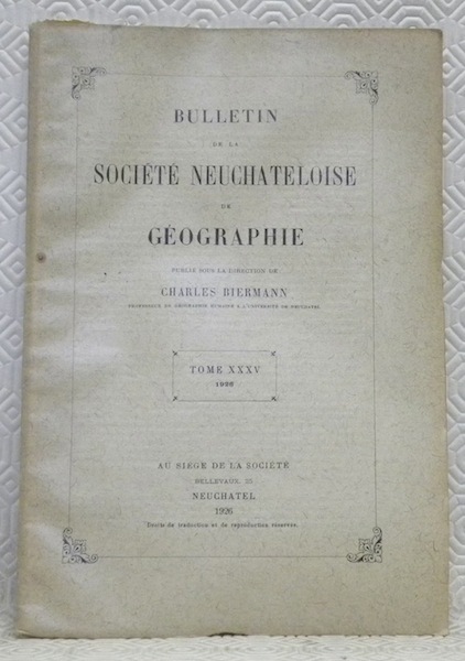
BIERMANN, Charles. - JEQUIER, Gustave. - GUILLARMOD, Dr. Jacot. - MATHEY-DUPRAZ, A. - FORNEY, Robert.
Bulletin de la société Neuchâteloise de Géographie. Publié sous la direction de Charles Biermann. Tome XXXV. 1926.Le Congrès International de Géographie au Caire.Les fouilles archéologiques en Egypte. Sur le Haut-Nil, photographies prises par le Dr. Jacot Guillarmod.La culture du coton.Les nouvelles cartes topographiques d’Egypte.Les aspirations de l’ouest canadien.Les sources de la Diaz et de la Raisse, près de Concise (Vaud).
Neuchâtel, Au Siège de la Société 1926, 240x160mm, 77pages, broché.
書籍販売業者の参照番号
: 65599
|
|
|
BIEUVILLE.-
Carte des Environs de Versailles.-
Edition de Poche imprimée en quatre couleurs. Versailles. Bernard. 1892. Grande carte (75x56cm) au 30000°, plusieurs fois repliée sous pochette de papier de l'éditeur. Qq.rousseurs essentiellement dans le creux des plis horizontaux. Traces d'un pliage supplémentaire. Jolie carte à la typographie élégante. Extrait de la grande carte de Bieuville.
書籍販売業者の参照番号
: ORD-1162
|
|
|
Biedermann, Couto, J.L. Bacque-Grammont, M. Taleghani
Atlas historique du golfe Persique (XVIe-XVIIIe siecles). Historical Atlas of the Persian Gulf (Sixteenth to Eighteenth Centuries) Historical Atlas of the Persian Gulf (Sixteenth to Eighteenth Centuries), Couto, Bacque-Grammont, Taleghani, Biedermann.
Hardback, 492 p., 75 b/w ill. 75 colour ill., 210 x 270 mm, Languages: French, English, Persian. ISBN 9782503522845. The Historical Atlas of the Persian Gulf is a joint initiative of the Ecole Pratique des Hautes Etudes in Paris, the University of Tehran, and the Documentation Centre of the Ministry of Foreign Affairs of Iran. The aim of this trilingual (French, English and Persian) publication is to trace the evolution of the cartographical representations of the Gulf between 1500 and 1750. About a hundred printed and manuscript maps from libraries and archives all over Europe, the United States and Iran have been gathered, some of them being published for the first time. The maps and charts are presented in five sections dedicated to Portuguese, Dutch, French, English and German cartography. Each item is published with enlarged detail reproductions showing the Gulf, and accompanied by brief commentaries as well as transcriptions of the place names and legends. The authors make numerous suggestions as to how the maps and charts developed in the context of international scientific exchange during the Early Modern age. Hence, the Atlas shows new perspectives on the genealogy of Gulf maps and provides an excellent working tool for future research on the cartography and the history of one of the World?s great strategic areas. Editors: Dejanirah Couto, Jean-Louis Bacque-Grammont, Mahmoud Taleghani Coordinator: Zoltan Biedermann Further contributors: Elio Brancaforte, Patrick Gautier Dalche L?Atlas historique du golfe Persique est une initiative conjointe de l?Ecole pratique des hautes etudes (Paris), de l?Universite de Teheran et du Centre de documentation du Ministere des affaires etrangeres d?Iran. L?objectif de cette publication trilingue (francais, anglais et persan) est de retracer l?evolution des representations du golfe entre 1500 et 1750. Une centaine de cartes imprimees et manuscrites provenant de bibliotheques et d?archives d?Europe, des Etats-Unis et d?Iran ont ete rassemblees, dont certaines publiees pour la premiere fois. Elles sont presentees en cinq sections consacrees aux cartographies portugaise, hollandaise, francaise, anglaise et allemande. Chacune d?elles est publiee avec une reproduction agrandie de la partie montrant le golfe et accompagnee d?un bref commentaire ainsi que de la transcription des toponymes et des legendes. Les contributions de plusieurs specialistes etudient en detail le developpement de la cartographie dans le contexte des echanges scientifiques de l?epoque moderne. Mettant ainsi en evidence de nouvelles perspectives sur la genealogie des cartes du golfe, l?Atlas constitue un outil de travail indispensable pour de futures recherches sur l?histoire de l?une des plus importantes zones strategiques du monde.

|
|
|
Bifolco Stefano - Ronca Fabrizio
Cartografia rara italiana: XVI secolo - L'Italia e i suoi territori - Catalogo ragionato delle carte a stampa.
Ril. in tela con sovr., cm 32 X 25, pp 405, molt. cartine a colori e in b/n. - ISBN: 9788890937606

|
|
|
BIGNARDELLI I. Oreste -
“Buscar el Levante por el Poniente” .
Milano, 1929, 8vo stralcio con copertina posticcia muta, pp. 943/950 con un'illustrazione e 3 cartine. - !! ATTENZIONE !!: Con il termine estratto (o stralcio) intendiamo riferirci ad un fascicolo contenente un articolo, completo in se, sia che esso sia stato stampato a parte utilizzando la stessa composizione sia che provenga direttamente da una rivista. Le pagine sono indicate come "da/a", ad esempio: 229/231 significa che il testo è composto da tre pagine. Quando la rivista di provenienza non viene indicata é perché ci è sconosciuta. - !! ATTENTION !!: : NOT A BOOK : “extract” or “excerpt” means simply a few pages, original nonetheless, printed in a magazine. Pages are indicated as in "from” “to", for example: 229/231 means the text comprises three pages (229, 230 and 231). If the magazine that contained the pages is not mentioned, it is because it is unknown to us.

|
|
|
BIHOT Charles
Table des matières du Bulletin et des Mémoires de la Société Royale de Géographie d'Anvers (octobre 1876 à décembre 1926) publiée à l'occasion du Cinquantenaire de la Société
Anvers, Flor Burton 1928 [8] + 301pp., 25cm., brochure originale (restaurée et bien protégée par une couv. de papier cristal), pour la plupart non coupé, texte et intérieur en très bon état, A98707
書籍販売業者の参照番号
: A98707
|
|
|
BIHOT Charles
Table des matières du Bulletin et des Mémoires de la Société Royale de Géographie d'Anvers (octobre 1876 à décembre 1926) publiée à l'occasion du Cinquantenaire de la Société
[8] + 301pp., 25cm., brochure originale (restaurée et bien protégée par une couv. de papier cristal), pour la plupart non coupé, texte et intérieur en très bon état, A98707
|
|
|
Binder Hartmut
Praga. Passeggiate letterarie nella città d'oro
illustrazioni

|
|
|
Binding Paul
IMAGINED CORNERS Exploring The World's First Atlas
London: Headline Book Publishing 2003. 314pp. An account of Ortelius's atlas of 1570. No clipping fading or wear. No inscriptions. 1st Edition. Hardback. Fine/Fine. large 8vo. Headline Book Publishing Hardcover
書籍販売業者の参照番号
: S243 ISBN : 0747230404 9780747230403

|
|
|
Binini Partners (a cura di)
500 anni dopo Leonardo. La messa in sicurezza del bacino idrografico di Cervia e Cesenatico
Mm 285x290 Volume cartonato rigido con sovraccoperta in acetato opaco, 239 pagine con 210 illustrazioni a colori. Opera in condizioni pari al nuovo. SPEDIZIONE IN 24 ORE DALLA CONFERMA DELL'ORDINE.
|
|
|
BIRARDI Giuseppe
RAPPRESENTAZIONE di GAUSS-BOAGA e RETICOLATO CHILOMETRICO nella NUOVA CARTOGRAFIA ITALIANA. Corposo stralcio da "L'Universo", sett.-ott. 1950.
In-8é (cm. 24x17), pp. 24 (da p. 669 a p. 692) + una carta esemplificativa ripiegata fuori testo di cm. 59,8x49,4 (di TALSANO, scala 1:25.000) e con 12 FIGURE tecniche di cui una ripiegata e due in rosso e nero (grafici, sovrapposizioni ecc.). "Diretto a colori che, pur avendo qualche nozione di matematica, non hanno la preparazione specialistica necessaria per segfuire le trattazioni esistenti sull'argomento". In tre parti: 1) Richiamo alla teoria delle Carter. 2) Rappresentazione din Gauss-Boaga. 3) Reticolato chilometrico.
|
|
|
BIRARDI Giuseppe -
I satelliti artificiali nell'impiego geodetico e cartografico.
Firenze, 1969, 8vo stralcio con copertina posticcia muta, pp. 605/620 con 4 figure in nero e a colori, 12 illustrazioni fotografiche in nero ed una tavola fotografica a colori. - !! ATTENZIONE !!: Con il termine estratto (o stralcio) intendiamo riferirci ad un fascicolo contenente un articolo, completo in se, sia che esso sia stato stampato a parte utilizzando la stessa composizione sia che provenga direttamente da una rivista. Le pagine sono indicate come "da/a", ad esempio: 229/231 significa che il testo è composto da tre pagine. Quando la rivista di provenienza non viene indicata é perché ci è sconosciuta. - !! ATTENTION !!: : NOT A BOOK : “extract” or “excerpt” means simply a few pages, original nonetheless, printed in a magazine. Pages are indicated as in "from” “to", for example: 229/231 means the text comprises three pages (229, 230 and 231). If the magazine that contained the pages is not mentioned, it is because it is unknown to us.

|
|
|
BIRARDI Giuseppe -
Recenti sviluppi della tecnica dei rilievi cartografici e ambientali eseguti da satelliti artificiali e da altri mezzi spaziali.
Firenze, IGM, 1972, 8vo stralcio con copertina posticcia muta, pp. 923/934 con 8 illustrazioni. - !! ATTENZIONE !!: Con il termine estratto (o stralcio) intendiamo riferirci ad un fascicolo contenente un articolo, completo in se, sia che esso sia stato stampato a parte utilizzando la stessa composizione sia che provenga direttamente da una rivista. Le pagine sono indicate come "da/a", ad esempio: 229/231 significa che il testo è composto da tre pagine. Quando la rivista di provenienza non viene indicata é perché ci è sconosciuta. - !! ATTENTION !!: : NOT A BOOK : “extract” or “excerpt” means simply a few pages, original nonetheless, printed in a magazine. Pages are indicated as in "from” “to", for example: 229/231 means the text comprises three pages (229, 230 and 231). If the magazine that contained the pages is not mentioned, it is because it is unknown to us.

|
|
|
BISSELIUS Johannes
Argonauticon americanorum, sive, historiae periculorum Petri de Victoria, ac sociorum eius. Libri XV
In 24, cm 8 x 13, pp. (32) + 405 + (17) con 1 antiporta allegorica e 1 carta raffigurante il continente americano. Timbro di estinta biblioteca al frontespizio. Piena pergamena coeva con unghie. Ottimo esemplare di questa rara seconda edizione (la prima fu pubblicata a Monaco nel 1647) della traduzione latina dell'opera di Pedro Gobeo de Victoria, Su naufragio y peregrinacion en la costa del Peru', pubblicata nel 1610. La versione latina e' opera del gesuita tedesco J. Bissel e narra le vicende legate ai viaggi e alle avventure di questo navigatore spagnolo utilizzando moduli romanzeschi. Molte le informazioni sulle missioni dei gesuiti in Sud America, sono inoltre descritti il Nicaragua, la California, il Messico, l'isola di Cuba ecc. ecc. Particolarmente fascinosa la carta presente all'antiporta che raffigura, oltre al continente americano, la Nuova Guinea, il Giappone, le Filippine le terre Australi. Stevens, American bibliographer, V. 1, p. 36. Sabin, 99444. Palau, 102964
|
|
|
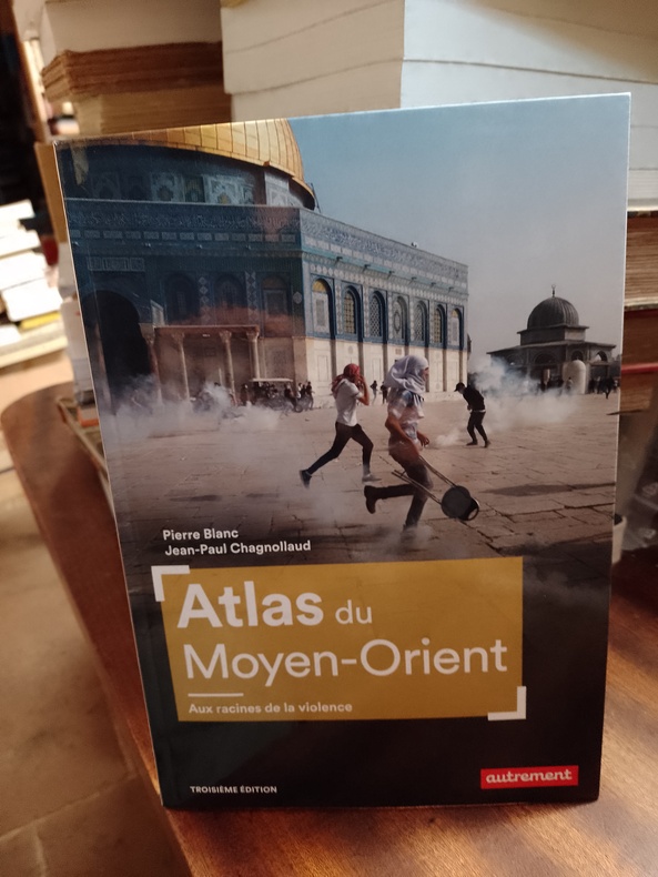
BLANC Pierre & CHAGNOLLAUD Jean-Paul
Atlas du Moyen-Orient. Aux racines de la violence
Paris, Autrement, "Atlas/Monde", juin 2023, 17,5 x 25, 95 pages cousues sous couverture illustrée. Iconographie couleurs, - cartographie : Claire Levasseur. Troisième édition.
書籍販売業者の参照番号
: MOYORIENT55550623
|
|
|
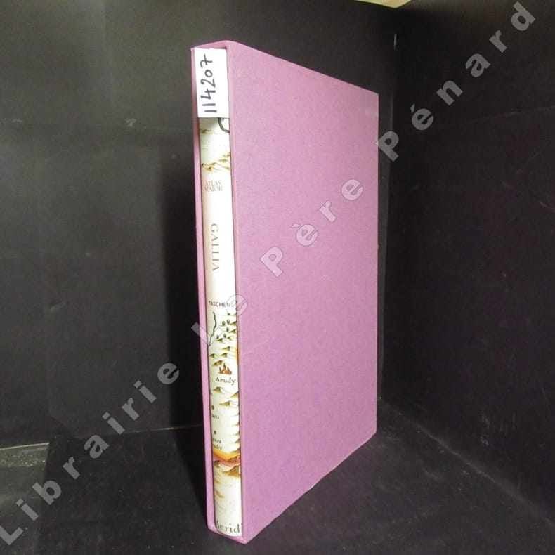
BLAEU, Joan - Intrduction et textes de Peter Van Der Krogt
Atlas Maior of 1665. Gallia. France, France, Frankreich. La totalité des 64 cartes de la France et des textes originaux de Joan Blaeu, extraits de son Atlas Maior de 1665, "l'Atlas le plus grand et le plus admirable jamais publié".
2006 Editions Taschen - 2006 - In-folio, cartonnage blanc illustré en couleurs sous jaquette illustrée en couleurs, dans son emboîtage cartonné toilé rose de l'éditeur - 207 p. - Très riche iconographie in, hors texte et pleine page en couleurs - Ouvrage trilingue français / anglais / allemand
書籍販売業者の参照番号
: 114207
|
|
|
Blaeu.-- DONKERSLOOT-DE VRIJ, Marijke.
Drie Generaties Blaeu. Amsterdamse cartographie en boekdrukkunst in de zeventiende eeuw.
Amsterdam & Zuthpen, Scheepvaartmuseum & Walburg Pers, (1992). 83, [i, blank] pp. Small 4to (21,5 x 20 cm.). Original printed limp boards. With numerous illustrations in colour and black & white.
書籍販売業者の参照番号
: 2248

|
|
|
BLAEU, Willem (Guillaume), Jansz - HORNIUS, Georges.
Georgii Hornii Historiae Philosophicae. Libri Septem. Quibus De origine, successione, sectis & vita Philosophorum ab orbe condito ad nostram aetatem agitur - Institution Astronomique de l'Usage des Globes et Spheres Celestes & terrestres, Comprise en deux parties, L'une, Suivant l'hypothese de Ptolemee, Qui veut que la terre soit immobile ; L'Autre, Selon l'intention de N. Copernicus, Qui tient que la terre est mobile : Par Guillaume BLAEU.
Lugduni Batavorum Apud Johannem Elzevirium, Academ. Typograph. 1655/ A Amsterdam, chez Jean & Corneille Blaeu, 1642, 2 parties reliées en 1 volume in-8 de 202x150x45 mm environ, en tête : Historiae Philosophicae, Georges HORNIUS, 1f.blanc, 8-387 pages, 10ff. (index), (texte en latin) - suivi de : L'Usage des Globes et Spheres, de Willem BLAEU : 18 ff. (titre, préface, argument)-277 pages, 1f.blanc, reliure de l'époque, pleine basane brune, dos à nerfs orné de caissons à motifs dorés, tranches mouchetées de brun et rouge. Quelques rousseurs, une coiffe ébréchée, galeries de ver sur un mors et le dernier plat, cuir frotté et épidermé, sinon bon état pour cet important traité illustré de figures sur bois dans le texte,notre exemplaire est la traduction originale de ce texte paru pour la première fois en hollandais en 1620.
書籍販売業者の参照番号
: 106094
|
|
|
BLANCHARD, Raoul
Grenoble, étude de géographie urbaine
sd Ed. Didier & Richard - sd - In-8 broché avec couverture rempliée - 234 p. - Reproductions photographiques et cartes en N&B hors-texte
書籍販売業者の参照番号
: 101999
|
|
|
BLAEU
LANGUEDOC
Amsterdam Guilielmus Blaeuw excudit. En feuille Très bon Amsterdam Guilielmus Blaeuw XVIIè 50 x 60 cm.
書籍販売業者の参照番号
: 6007
|
|
|
BLAEU
LANGUEDOC
Amsterdam Guilielmus Blaeuw excudit. En feuille Très bon Amsterdam Guilielmus Blaeuw XVIIè 44,5 x 55,5
書籍販売業者の参照番号
: 6008
|
|
|
BLAEU
LE GRAND ATLAS - Le Monde au XVIIè siècle. Introduction, descriptions et choix des cartes par John Goss.
Jaquette Couverture rigide P, Grund , 1992 , in folio relié , jaquette illustrée , 224pp Reproduction de 100 cartes couleur sur double page avec texte explicatif dans les marges. Etat neuf.Magnifique ! ! Langue: Français
書籍販売業者の参照番号
: M12341
|
|
|
BLANCHARD Raoul.
LES ALPES OCCIDENTALES. Tome cinquième. Les Grandes Alpes françaises du Sud.
1949 1949 Edité chez Arthaud à Grenoble. 1949. broché. un volume in 8. contenant 514 pages, LIX planches et 4 cartes hors texte et 57 figures in texte. Premier volume seul. complet des hors texte et cartes.
書籍販売業者の参照番号
: 2036

|
|
|
 検索結果のメールを受信する
 PDFファイルの検索結果をダウンロード
 RSSフィード


