|
Par le S.r ROBERT JANVIER (1746 - 1776)
L'ITALIE divisée en ses differents etats, ROYAUMES ET REPUBLIQUES
Carta geografica acquerellata con dim. L. 49,2 X 37,2 cm. l'intero foglio compreso i margini (L. 44 x 30,8 cm. la sola parte incisa) - All'interno del cartiglio al centro a sx.: L'ITALIE divisée es ses differents etats ROYAUMES ET REPUBLIQUES dressée Par le S.r JANVIER Geographe / A PARIS / Chez Lattré Graveur rue St. Jacques au dessus de la Fontaine St. Severin a la Ville de Bordeaux / Avec Priuilege du Roy... in basso a dx entro cartiglio semplice: ECHELLE / Milles communs d'Italie / Milles communs de Piemont / Milles Romains et de Milan / Milles de Venise / Lieues Marines ou Grandes Lieues de la France / Lieues Communes de France... - In buone condizioni. Carta appartenente all'opera: ATLAS MODERNE ou Collection de Cartes sur Tous les Parties du Globe Terrestre Par Plusieurs Auteurs, Paris 1762 e derivante dalla carta del D'Anviulle del 1743.
|
|
|
Par: R. H. Touwaide
La Description de tous les Pays-Bas par Lodovico Guicciaridini. Complement à la bibiographie de Boele van Hensbroek.

|
|
|
Paribeni, Roberto
Il museo alle terme di Diocleziano
18 cm, pp. XVI, 59 illustrazioni fuori testo con didascalia esplicativa, brossura editoriale illustrata da Cisari, titolo al piatto e dorso, ex libris privato applicato al contropiatto. esemplare molto buono

|
|
|
Parker Katherine; Ruderman Barry
Lungo le rotte del mare. Cartografia marina attraverso i secoli
ril. Un viaggio affascinante attraverso l'arte e la storia, dal Medioevo al Ventesimo secolo. Questo volume unico e prezioso riproduce alcuni splendidi esemplari di carte e mappe nautiche, descrivendone l'evoluzione tecnica nel tempo, la ricercatezza dei contenuti, le effettive applicazioni pratiche e, naturalmente, le caratteristiche estetiche e stilistiche. Un intreccio di linee, colori, immagini che raccontano al lettore come sia cambiata nei secoli la percezione del mondo.

|
|
|
PARSCH Rudolph (Altstadt 1883 - 1971)
DOLOMITI - Carta geografica PLASTICOGRAFICA a COLORI delle zone dolomitiche dal Lago d'Iseo al Cadire, da Verona al Colle Isarco.
Grande e CARTA di cm. 69,5x50, disegnata a COLORI da R. PARSCH e impressa dall'Istituto d'Arti Grafiche di Bergamo. Strade in bianco, ferrovie in nero, funicolari e cremagliere in rosso. lA GEOPLASTIGRAFIA è firmata da PARSCH, pittore e illustratore tedesco, attivo tra 1898 e 1971 in Austria e Italia. Al verso, virate in verde, 7 FOTO, tra cui un grande PANORAMA di cm. 65x23 con indicazioni a margine delle CIME e con indicazioni turistiche sovrapposte alla veduta. Lievi mende all'incontro di certe pieghe, senza perdite, ma scenografica.
|
|
|
PASTOUREAU Mireille
Voies océanes, cartes marines et grandes découvertes.
Paris, Bibliothèque Nationale, 1992. 21 x 30, 187 pp., 164 illustrations en couleurs et en N/B, broché, couverture à rabats, très bon état (sauf 1 cachet d'ex-propriétaire).
Référence libraire : 90574
|
|
|
Pasini,Claudio.
Trattato di Topografia.
<br/> NOTE: lacuna restaurata all'angolo sup. del frontesp. e del primo occhietto, con parziale perdita di testo.<br/> TITOLO: Trattato di Topografia. <br/> AUTORE: Pasini,Claudio.<br/> EDITORE: Nicola Zanichelli Editore<br/> DATA ED.: 1921,<br/> COLLANA: restaurata all'angolo sup. del frontesp. e del primo occhietto, con parziale perdita di testo.)<br/> Quarta edizione.
|
|
|
PASQUALE M. D'ELIA -
Un dotto missionario italiano in Cina. Padre Matteo Ricci S. I. e il suo mappamondo cinese.
Milano, 1938, stralcio con copertina posticcia muta, pp. 385/396 con illustrazioni e tavole in nero e a colori. - !! ATTENZIONE !!: Con il termine estratto (o stralcio) intendiamo riferirci ad un fascicolo contenente un articolo di rivista, sia che esso sia stato stampato a parte utilizzando la stessa composizione sia che provenga direttamente da una rivista. Le pagine sono indicate come "da/a", ad esempio: 229/231 significa che il testo è composto da tre pagine. Quando la rivista di provenienza non viene indicata é perchè ci è sconosciuta. - !! ATTENTION !!: : NOT A BOOK : “estratto” or “stralcio” means simply a few pages, original nonetheless, printed in a magazine. Pages are indicated as in "from” “to", for example: 229/231 means the text comprises three pages (229, 230 and 231). If the magazine that contained the pages is not mentioned, it is because it is unknown to us.

|
|
|
Pasquaré,Giorgio.
Geology of the Cenozoic volcanic area of Central Anatolia.
<br/> STATO: COME NUOVO.<br/> TITOLO: Geology of the Cenozoic volcanic area of Central Anatolia. <br/> AUTORE: Pasquaré,Giorgio.<br/> EDITORE: Accademia Naz.dei Lincei<br/> DATA ED.: 1968,<br/> COLLANA: Coll.Memorie. Scienze Fisiche, Matematiche e Naturali. Serie VIII, Vol.IX, Fasc.3.<br/>
|
|
|
Passarelli,Alfredo (a cura di).
Cartografia.
<br/> STATO: USATO, MOLTO BUONO.<br/> TITOLO: Cartografia. <br/> AUTORE: Passarelli,Alfredo (a cura di).<br/> EDITORE: Ist.Enciclopedico Italiano<br/> DATA ED.: 2007,<br/> COLLANA: Coll.Comuni d'Italia.<br/>
|
|
|
PASTOUREAU Mireille -
Les atlas français XVIe-XVIIe siècles: Répertoire bibliographique et étude.
Paris, Bibliothèque National, 1984, 4to (cm. 30,5 x 22) piena pelle editoriale con fregi e titoli dorati al piatto anteriore e al dorso, pp. VIII-695 con 166 illustrazioni, tavole e carte nel testo. Fondamentale catalogo ragionato dei cartografi francesi dei secoli XVI e XVII.

|
|
|
PASTOUREAU Mireille -
Voies Océanes de l'ancien aux nouveaux mondes.
Paris, Hervas, 1990, 4to (cm. 30,5 x 21,5) piena pelle editoriale con fregi e titoli dorati al piatto anteriore e al dorso, sovraccopertina illustrata a colori e cordoncino in seta, pp. 185 con 164 illustrazioni e carte a colori (anche ripiegate) ed una carta sciolta, a colori, di grande formato, più volte ripiegata.

|
|
|
Pater, Ben de. Schoenmaker, B. Braam, R. C. M.
Grote Atlas van Nederland 1930-1950 = Comprehensive Atlas of the Netherlands 1930-1950
Zierikzee, Uitgeverij Asia Maior/Atlas Maior, 2005 Hardcover, 584 pag. NL / ENG, 490 x 355 x 50 mm, dustjacket, stevig foedraal / sturdy slipcase, after 18 years in Perfect Condition !!!, marine blue cover with silver imprint, Very big and Very heavy !,(close to 20 lb) eerste druk / first print, rare, Original publishers paper-covered boards, very richly illustrated with coloured illustrations Including an index. Hardcover. in zeer goede staat !. ISBN 9789074861250.
Référence libraire : 62627
|
|
|
Patrick Gautier Dalch
Mappae mundi (VIIIe-XIIe si cle)
, Brepols, 2024 Hardback, 2 vols, 1237 pages, Size:230 x 315 mm, Illustrations:684 col., Language: French. ISBN 9782503597249.
Référence libraire : 65019
|
|
|
PAUWELS Carl
Afrika in de Grooten Atlas van Joan Blaeu (1665) Onderzoek naar de genese en invulling van tekst en kaart [2 volumes, I: tekst, II: bijlagen]
Leuven, 2003 2 delen: xvi,222 + [176] pp.met enige afbeeldingen (kaarten, plannen, grafieken), in-4, onuitgegeven verhandeling tot het behalen van de graad van licentiaat in de geschiedenis (KUL, 2003, promotor: prof.dr. E.Van Ermen), mooie staat, B83281
Référence libraire : C83281
|
|
|
PAUL MORAND
Hiver, Caraïbes.
Ernest Flammarion, 1927, état moyen, in12 broché, dechirure sur le 1er plat, coins cornés, tranches usées, papier jauni, quelques rousseurs.
Référence libraire : 5120
|
|
|
PAUL LECHAT
Italie (italie piémont rome vénétie émilie-romagne lombardie abruzze latium sicile calabre toscane ombrie sardaigne campanie lucanie ligurie).
Seuil, Petite Planète, 1967, 192 pages, in 12 broché, état d'usage, légèrement sali, usures et frottements sur coins tranches et bords des plats, accrocs sur le 1er plat, calligrammes de Remo Forlani.
Référence libraire : 12508
|
|
|
PAUL VI
Le developpement des peuples (popularum progressio).
1967 Encyclique du 26 mars 1967 éditions du centurion 1967 état d'usage in 12 broché.
Référence libraire : 7647
|
|
|
PAUL DE CASSAGNAC
Les vins de France.
Librairie Hachette, 1927, 212 pages, in 8 broché, état d'usage, insolé et jauni, rousseurs, coins cornés, dos et coiffes abimés.
Référence libraire : 8025
|
|
|
PAUL MOUSSET
Les albums des Guides Bleus : Japon.
Hachette, 1958, 127 pages, in 8 reliure éditeur cartonnée percaline bleue, avec jaquette, très bon état.
Référence libraire : 13062
|
|
|
PAUL MORIN
Nantes, Ile de Loire.
1979 Chêne Hachette, bon état, 111 pages, avec illustrations, in4° reliure editeur cartonnée avec jaquette illustrée.
Référence libraire : 9127
|
|
|
PAUL STEINMANN (redaction)
Notre terre: des sommets de la montagne aux bords de la mer.
Editions Faunus S.A Bâle, bon etat, 590 pages, papier legerement jauni, insolé, jaquette en etat d'usage comportant quelques traces d'usures, et de salissures, in4°reliure editeur cartonnée toilée verte.
Référence libraire : 9267
|
|
|
PAUL CHAULOT
Rome.
Editions Rencontre, l'Atlas des Voyages, collection dirigée par Charles Henri Faurod, nombreuses photos dont certaines de Cartier-Bresson, 259 pages, 1963, état correct, grand in 8 reliure éditeur cartonnée, mors et dos fatigués, mors légèrement fendus.
Référence libraire : 8223
|
|
|
PAUL GUICHONNET, MAURICE MOREL, HENRI MENABREA,EMILE VESCO
Visages de la Savoie.
1947 Horizons de france collection provinciales 1947 bon état 206 pages grand in 8 broché petit manque sur un coin d'une page de garde .
Référence libraire : 7510
|
|
|
Paul F. Griffin Editor; Cartography: JVanderford Illustrator; J. Va
Geography of Population: A Teacher's Guide for Geographic Education
Fearon 1969-01-01. Hardcover. Very Good. Hardcover. Very Good. Clean tight. Name inside. Fearon hardcover
Référence libraire : UTD14-0698
|
|
|
Paula van Gestel-van het Schip en Peter van der Krogt
MAPPAE ANTIQUAE
Gebonden, 696pp. ISBN 9789061944799. Liber Amicorum Gunter Schilder. Vriendenboek ter gelegenheid van zijn 65ste verjaardag. Essays on the occasion of his 65th birthday. Festschrift zur Vollendung seines 65. Lebensjahres. Melanges offerts pour son 65ieme anniversaire. Utrechtse Historisch-Cartografische Studies, Utrecht Studies in the History of Cartography, vol. 6. Nieuw.
|
|
|
PAUWELS Carl
Afrika in de Grooten Atlas van Joan Blaeu (1665) Onderzoek naar de genese en invulling van tekst en kaart [2 volumes, I: tekst, II: bijlagen]
2 delen: xvi,222 + [176] pp.met enige afbeeldingen (kaarten, plannen, grafieken), in-4, onuitgegeven verhandeling tot het behalen van de graad van licentiaat in de geschiedenis (KUL, 2003, promotor: prof.dr. E.Van Ermen), mooie staat, B83281
|
|
|
Pazzini Carlo
L'avventuroso navigare di Giovanni da Verrazzano
illustrazioni

|
|
|
Peattie Roderick.
LA GEOGRAFIA NEL DESTINO UMANO.
(Codice ST/1253) In 8° (20,5 cm) 296 pp. Storia dell'umanità in relazione all'habitat. Con 26 figure. Timbrino. Brossura editoriale, buono stato. ~~~ SPEDIZIONE IN ITALIA SEMPRE TRACCIATA

|
|
|
PEDROTTI Franco -
Cartografia geobotanica e sue applicazioni.
Firenze, Accademia Italiana di Scienze Forestali, 1983, 8vo punto metallico, pp. 317/363 con 12 carte.

|
|
|
Peeperkorn van Doselaar / A Loes
speelkaarten collectie van het belastingmuseum .Met los errata
, belastingmuseum / prof van der Poel , 1993 softcover, 86 pagina's, 22x22cm.
Référence libraire : 62458
|
|
|
PEINER Werner (disegno) / EDSCHMID Kasimir (testo)
Shell-RHEINKARTE: Der RHEIN von Köln - Bingen. 1:150.000. [Kartonierte Mappe]. (Mehrfarbige Faltkarte mit figürlichen Abb. von örtlichen Sehenswürdigkeiten).
CARTA GEOGRAFICA ILLUSTRATA a COLORI con centinania di bellissimi disegni delle attrattive turistiche monumenti animali stemmi (e stazioni Shell) ripiegata 11 vlte a fisarmonica, cm. 91,5x22.3. in cartellina di cartoncino di cm. 22,5x11,9. Timbro di officina in cop. Ottimo es.
|
|
|
Peisson Edouard
Poli [ARTIDE - ANTARTIDE]
tavole in bianco e nero fuori testo

|
|
|
PELLETIER Monique, et autres
"A la découverte de la Terre; dix siècles de cartographie; trésor du Département des Cartes et Plans (mai-juillet 1979)."
Paris, Bibliothèque Nationale, 1979. 27 x 21 , 122 pp., nombreuses illustrations, 8 planches en couleurs, broché, très bon état.
Référence libraire : 90572
|
|
|
PELET (J.-J.-G.)
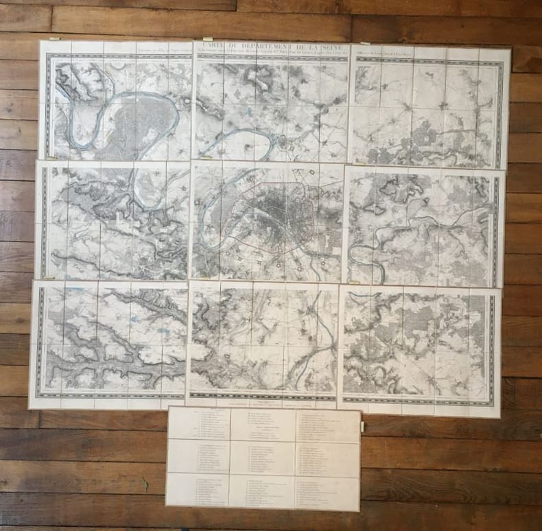
Carte du département de la Seine
Paris, Ch. Piquet, 1839. 9 plans, 30 x 58,7 cm et 40 x 50 cm, étui de l'éditeur de papier marbré.
Référence libraire : 19428

|
|
|
PELLETIER, Monique & OZANNE,Henriette
Portraits de la France. Les cartes, temoins de l'histoire.
Paris, Hachette, 1995, in-4to, 259 p. richement illustré + 7 ff. (recto’s seul) Note sur la grande carte de Savoie, reliure en toile originale. Jaquette en couleur.
Référence libraire : 124472aaf
|
|
|
PENNEC Alain
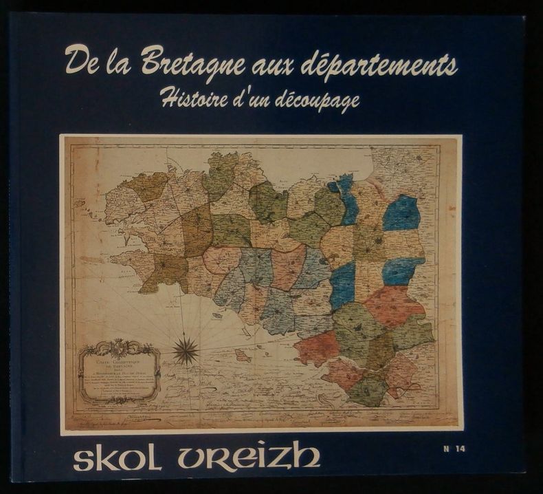
DE LA BRETAGNE AUX DEPARTEMENTS , HISTOIRE D'UN DECOUPAGE.
Revue trimestrielle, Editions Skol Vreizh, numéro 14, Décembre 1989, format oblong ( 22x20cm) , broché, 84 pages, nombreuses illustrations in et hors-texte, exemplaire en bon état.
Référence libraire : 2948

|
|
|
PENTHER Joh[ann] Friedr[ich]:
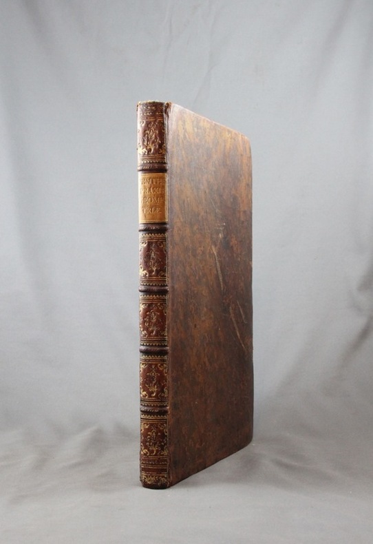
Praxis Geometriae, worinnen nicht nur alle bey dem Feld-Messen vorkommende Fälle, mit Stäben, dem Astrolabio, der Boussole, und der Mensul, in Ausmessung eintzeler Linien, Flächen und gantzer Revier welche, wenn deren etliche angräntzende zusammen genommen/ eine Land-Karte... sondern auch eine gute Ausarbeitung der kleinesten Risse bis zum grösten, neben ihren Neben-Zierathen...
Augsburg, Johann Michael Probst, 1768. In-folio de [112]-[54]p. (outre les planches mentionnées en illustration), plein veau raciné, dos à nerfs orné de filets et fleurons dorés, pièces de titre beige, coiffes, coins et coupes un peu frottés, intérieur parfait (notamment les planches qui sont parfaitement pliées).
Référence libraire : 5973

|
|
|
Penguin Cartography
Explore Tasmania
Penguin Books Australia Ltd. Used - Very Good. Ships from the UK. Former Library book. Great condition for a used book! Minimal wear. 100% Money Back Guarantee. Your purchase also supports literacy charities. Penguin Books Australia Ltd unknown
Référence libraire : GRP88671521 ISBN : 0140271244 9780140271249
|
|
|
Penguin Cartography
Explore Victoria
Explore Australia. Used - Very Good. Ships from the UK. Former Library book. Great condition for a used book! Minimal wear. 100% Money Back Guarantee. Your purchase also supports literacy charities. Explore Australia unknown
Référence libraire : GRP88671037 ISBN : 0140271252 9780140271256
|
|
|
Penguin Cartography
Fish Australia
Viking Cartographic. Hardcover. Used; Good. Simply Brit Shipped with Premium postal service within 24 hours from the UK with impressive delivery time. We have dispatched from our book depository; items of good condition to over ten million satisfied customers worldwide. We are committed to providing you with reliable and efficient service at all times. 11/01/1995 Viking Cartographic hardcover
Référence libraire : 1932454 ISBN : 0670860409 9780670860401

|
|
|
Penguin Cartography
Melbourne City Map Guide
Explore Australia. Used - Very Good. Ships from the UK. Former Library book. Great condition for a used book! Minimal wear. 100% Money Back Guarantee. Your purchase also supports literacy charities. Explore Australia unknown
Référence libraire : GRP88657625 ISBN : 014028771x 9780140287714
|
|
|
Penguin Cartography
Official Sydney 2000 Olympic Pack
Penguin Books Australia. Used - Very Good. Ships from the UK. Former Library book. Great condition for a used book! Minimal wear. 100% Money Back Guarantee. Your purchase also supports literacy charities. Penguin Books Australia unknown
Référence libraire : GRP88657279 ISBN : 0140289577 9780140289572

|
|
|
Penguin Cartography
Penguin Road Map: New South Wales
Explore Australia 2000-07-28. Map. Very Good. Not an ex-library copy. Light use wear. Explore Australia unknown
Référence libraire : 021717015 ISBN : 0140289933 9780140289930

|
|
|
Penguin Cartography
Penguin Road Map: Melbourne
Explore Australia. Used - Very Good. Ships from the UK. Former Library book. Great condition for a used book! Minimal wear. 100% Money Back Guarantee. Your purchase also supports literacy charities. Explore Australia unknown
Référence libraire : GRP88654916 ISBN : 0140289917 9780140289916
|
|
|
Penguin Cartography
Penguin Road Map: Adelaide
Explore Australia. Used - Very Good. Ships from the UK. Former Library book. Great condition for a used book! Minimal wear. 100% Money Back Guarantee. Your purchase also supports literacy charities. Explore Australia unknown
Référence libraire : GRP88654920 ISBN : 0140289879 9780140289879
|
|
|
Penguin Cartography
Sydney 2000 Olympic Games: Official Map
Penguin Books Australia Ltd. Used - Good. Shows some signs of wear and may have some markings on the inside. Penguin Books Australia Ltd unknown
Référence libraire : GRP82292184 ISBN : 0140289534 9780140289534
|
|
|
Penguin Cartography & Explore Australia
The New South Wales Fishing Atlas
Penguin. Paperback. Used; Good. Simply Brit Shipped with Premium postal service within 24 hours from the UK with impressive delivery time. We have dispatched from our book depository; items of good condition to over ten million satisfied customers worldwide. We are committed to providing you with reliable and efficient service at all times. 03/27/1997 Penguin paperback
Référence libraire : 2683956 ISBN : 0140263373 9780140263374

|
|
|
Penguin Cartography; Explore Australia
The New South Wales Fishing Atlas
Explore Australia 1997-02-15. Paperback. Very Good. Pages unmarked modest wear. Explore Australia paperback
Référence libraire : 33859aoz ISBN : 0140263373 9780140263374

|
|
|
PEPRATX-SAISSET HENRY
La sardanne, la danse des catalans : son symbole, sa magie, ses énigmes.
1956 Imprimerie Labau à Perpignan, 1956, l'ouvrage comprend une lettre liminaire de Pablo Casals, 211 pages plus illustrations, illustration du 1er plat par Pablo Picasso grand in 8 broché bon état .Edition numérotée 000079 hors commerce réservée aux amis de la société Bartissol .
Référence libraire : 13172
|
|