|
Strabo / Jones, Horace Leonard [Trans.]
The Geography of Strabo: Based in Part upon the Unfinished Version of John Robert Sitlington Sterrett - In Eight Volumes [VOLUME VII IS MISSING] [SERIES]: The Loeb Classical Library
VOLUME VII IS MISSING. VOL. II, III, IV, V, VIII Contains folded maps. [VOL. I]: Books I-II / [VOL. II]: Books III-V / [VOL. III]: Books VI-VII / [VOL. IV]: Books VIII-IX / [VOL. V]: Books X-XII / [VOL. VI]: Books XIII-XIV / [VOL. VIII]: Book XVII & General Index. [ALL VOLUMES]: 11.5x16.5 cm. xliii+531+v+479+397+465+541+397+510 pages. Gilt hardcover. Top and bottom of spine are chafed. Pencil writing on several pages. [VOL. II]: Top of spine is worn. [IN CONCLUSION]: Else in good condition. PLEASE NOTE: This item is overweight. We may ask for extra shipping costs.
|
|
|
Strabon.
GEOGRAPHIE. TOME II (Livres III et IV). Texte établi et traduit par François Lasserre.
(Codice LL/2124) In 8° Texte en regard grec/français. Exemplaire en partie non coupé. Broché, très bon état. ~~~ SPEDIZIONE IN ITALIA SEMPRE TRACCIATA

|
|
|
Strada Gino
Buskashì. Viaggio dentro la guerra

|
|
|
Strafforello,Gustavo. (Opera compilata da).
La Patria. Geografia dell'Italia. Arezzo, Grosseto, Livorno, Siena.
<br/> TITOLO: La Patria. Geografia dell'Italia. Arezzo, Grosseto, Livorno, Siena. <br/> AUTORE: Strafforello,Gustavo. (Opera compilata da).<br/> EDITORE: Banca Popolare Etruria<br/> DATA ED.: 1981,<br/> COLLANA: Ristampa anastatica della prima edizione 1895-1896, Utet.<br/>
|
|
|
STREETER (Frank S.)
The Frank S. Streeter Library. Important Navigation, Pacific Voyages, Cartography, Science.
2 Vols., 4to, 350; 322pp., numerous coloured illustrs., throughout, orig. pictorial cloth, 552 lots.
|
|
|
Streit, Friedrich Wilhelm
Die Herrschaft Lauenburg. La Seigneurie Lauenburg. [Kupferstich / copper engraving].
o.J.
Référence libraire : 42231BB

|
|
|
Stucchi Stanislao
Carta Statistica e Postale dell'Italia (solo Parte Settentrionale)
Incisione in rame di mm 770 x 445 intelata editorialmente. Buon esemplare, privo di difetti rilevanti; solo una piccola macchia sul margine destro.
|
|
|
Stumpf, Johannes
Landtafeln. Der älteste Atlas der Schweiz.
Gattikon, Dorfpresse, 1975. 4°. u. Klein-4°. (Faksimilebd.:) (2) S., (1) S. (faksimil.), (1) S., (1) Bl. Mit 12 (dv. 4 doppelblattgr.) faksimil., kol. Karten; (Kommentar:) 43 S. Orig.-Halbpergamentbd. mit goldgepr. Rückentitel u. Orig.-Heft. in mont. Stecktasche auf hint. fest. Vorsatz. + Wichtig: Für unsere Kunden in der EU erfolgt der Versand alle 14 Tage verzollt ab Deutschland / Postbank-Konto in Deutschland vorhanden +, A|B
Référence libraire : 4915BB

|
|
|
Stumpf, Johannes:
Landtafeln. Der älteste Atlas der Schweiz.
Gattikon, Dorfpresse, 1975. 4°. u. Klein-4°. (Faksimilebd.:) (2) S., (1) S. (faksimil.), (1) S., (1) Bl. Mit 12 (dv. 4 doppelblattgr.) faksimil., kol. Karten; (Kommentar:) 43 S. Orig.-Halbpergamentbd. mit goldgepr. Rückentitel u. Orig.-Heft. in mont. Stecktasche auf hint. fest. Vorsatz.
Référence libraire : 4915BB

|
|
|
Suisse Carte générale -
Carte générale de la Suisse. Dressée en 1787 d'après les observations les plus récentes et les plus exactes, pour servir à la nouvelle édition, très augmentée du Dictionnaire de la Suisse, ( Ca. 1:670000) A Genève: faite chez B.M.C. (Barde Manget et Comp.) 1788.
1788, 42.2 x 57.5 cm, Dans : Dictionnaire géogr., hist. et politique de la Suisse. / Vinzenz Bernhard von TSCHARNER, Gottlieb Emanuel Haller. Nouvelle édition. gravure sur cuivre, coloriée, Passepartout. Bon état.
Référence libraire : 1022.1aaf
|
|
|
Suisse Carte générale -
Carte générale de la Suisse. Dressée en 1787 d'après les observations les plus récentes et les plus exactes, pour servir à la nouvelle édition, très augmentée du Dictionnaire de la Suisse. ( Ca. 1:670000).
A Genève: faite chez B.M.C. (Barde Manget et Comp.) 1788, 42.2 x 57.5 cm, carte coloriée.16 compartiments montées sur toile du XVIIIè siècle, ex frais, carte pliée in-8°, étui d’époque, pièce de titre en maroquin rouge.
Référence libraire : 132195aaf
|
|
|
SURACE Luciano -
Storia e attualità di Mercatore nel 4° centenario della morte.
Firenze, 1994, 8vo stralcio con copertina posticcia muta, pp. 578/591 con illustrazioni in nero e a colori. - !! ATTENZIONE !!: Con il termine estratto (o stralcio) intendiamo riferirci ad un fascicolo contenente un articolo, completo in se, sia che esso sia stato stampato a parte utilizzando la stessa composizione sia che provenga direttamente da una rivista. Le pagine sono indicate come "da/a", ad esempio: 229/231 significa che il testo è composto da tre pagine. Quando la rivista di provenienza non viene indicata é perché ci è sconosciuta. - !! ATTENTION !!: : NOT A BOOK : “extract” or “excerpt” means simply a few pages, original nonetheless, printed in a magazine. Pages are indicated as in "from” “to", for example: 229/231 means the text comprises three pages (229, 230 and 231). If the magazine that contained the pages is not mentioned, it is because it is unknown to us.

|
|
|
Susmel Claudio
I confini naturali d'Italia
brossura

|
|
|
SUTER Karl
HOGGAR
4 tavole in bianco e nero fuori testo
|
|
|
SVAT SOUCEK.
Piri Reis and Turkish mapmaking after Columbus.
New English Original cloth bdg. Oblong large 8vo. (22 x 22 cm). In English. 144 p. Ills. "I have devoted a large part of my life to the study of Piri Reis and the Ottoman fleet, along with the study of cartography. I am both amazed by, and feel tremendous empathy for, that great Turkish cartographer and maritime geographer whose life I find highly interesting, appealing and impressive. (Svat Soucek)". Piri Reis and Turkish mapmaking after Columbus.
|
|
|
Swift Michael
Historical Maps of Europe
London: Public Record Office 2000. 144pp. Colour plates throughout. A lovely copy. Hardback. Fine/Fine. Oblong 4to. Public Record Office Hardcover
Référence libraire : S271 ISBN : 1856485757 9781856485753
|
|
|
SWIFT (Michael) & KONSTAM (Angus)
Cities of the Renaissance World: Maps from Civitates Orbis Terrarum.
Folio, 224pp., colour illustrations throughout, orig. cloth, d.w.
|
|
|
Swift, Michael.
Historical Maps of Europe.
<br/> STATO: USATO, COME NUOVO.<br/> TITOLO: Historical Maps of Europe. <br/> AUTORE: Swift, Michael.<br/> EDITORE: PRC Publishing<br/> DATA ED.: 2000,<br/> COLLANA: hardcover, dustjacket.<br/> EAN: 9781856485753

|
|
|
Swift, Michael; Konstam, Angus; Eszerski, Antje [Red.]
Städte der Renaissance. Civitates orbis terrarum. Übersetzung aus dem Englischen: Anne Görblich-Baier. Satz und Redaktion der deutschen Ausgabe: Antje Eszerski.
Königswinter, H. F. Ullmann Verlag, 2008. 2°. 42 cm. 264 Seiten. Original-Leinenband mit Rundum-Goldschnitt, mit Original-Schutzumschlag im illustrierten Pappschuber und zusätzlichem Pappkoffer.
Référence libraire : 52028BB

|
|
|
Swift,Jeremy.
Il Sahara.
<br/> STATO: USATO, COME NUOVO.<br/> TITOLO: Il Sahara. <br/> AUTORE: Swift,Jeremy.<br/> CURATORE: Fotografie di Pierre Boulat.<br/> EDITORE: Mondadori<br/> DATA ED.: 1986,<br/> COLLANA: Collana Grandi Distese Selvagge.<br/>
|
|
|
SWINBURNE.
Part of Spain comprising the Provinces through which the Route of the Pictoresque tour lay.
(London, 1779), mapa grabado en cobre, de 23'5 x 38 cm.
|
|
|
Sykes,Sir Percy (Général).
A la recherche du Cathay. Découverte de la Chine par l'Europe et de l'Occident par la Chine.
<br/> TITOLO: A la recherche du Cathay. Découverte de la Chine par l'Europe et de l'Occident par la Chine. <br/> AUTORE: Sykes,Sir Percy (Général).<br/> CURATORE: Traduit de l'anglais par Robert Godet.<br/> EDITORE: Payot<br/> DATA ED.: 1938,<br/> COLLANA: Collection Bibliothèque Géographique.<br/>
|
|
|
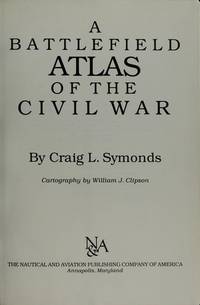
Symonds Craig L. Cartography by William J. Clipson
A Battlefield Atlas of the Civil War
Annapolis MD: Nautical and Aviation Publ. 1983. First Edition. Hardcover. Very Good/Very Good. Size=7"x10". B/W Photos 42 Maps. full book description Nautical and Aviation Publ. Annapolis MD 1983. 1st Edition VG/VG Hard Cover w/Dust Jacket. Size=7"x10" 106pp. B/W Photos 42 Maps. 1" DJ top front edge tears2 owner bookplate ink owner name/date on front endpapers o.w. clean tight and bright. Rest of bo ok in Fine condition. ISBN 0933852401 U.S. Civil War; American Civil War; Battlefield Atlas; Battlefield Maps; Cartography; Civil War Maps; Civil War History; Military History SELLING WORLDWIDE SINCE 1987. WE ALWAYS PACK WITH GREAT CARE! Nautical and Aviation Publ. hardcover
Référence libraire : CONROY266627I ISBN : 0933852401 9780933852402
|
|
|
Symonds Craig L./Clipson William J. cartography
A Battlefield Atlas of the Civil War
Annapolis: Nautical & Aviation Publishing Co. 1983. 1st printing. VG/VG dust jacket price clipped dust jacket. xvi 106 p. frontis photos maps large 8vo; Nautical & Aviation Publishing Co. hardcover
Référence libraire : 66338 ISBN : 0933852401 9780933852402

|
|
|
SYMONDS Craig L. and cartography by William J. Clipson
A Battlefield Atlas of the American Revolution
Mount Pleasant South Carolina: The Nautical & Aviation Publishing Company of America Inc 2001. Hardcover. Fine/Fine. Book club edition. Fine in fine dustwrapper. The Nautical & Aviation Publishing Company of America, Inc hardcover
Référence libraire : 391332 ISBN : 0933852533 9780933852532

|
|
|
Symonds Craig L
A Battlefield Atlas of the Civil War
Annapolis Maryland: The Nautical and Aviation Publishing Company of America 1983. 7" wide by 10" tall. Bright clean square tight copy. No underlining. No highlighting. No margin notes. Pages are fresh and crisp. Bound in the original red boards lettered in gold on the spine and front cover. Gilt lettering is still bright and shiny. Illustrated throughout with vintage portraits and photos and 43 two-color full-page maps. The text accompanying each map enables the reader to relive the action of battle and sense the drama it held for the troops that fought. Introduction. Suggestions for Further Reading. First Printing of the First Edition. Hard Cover. Fine condition./VG DJ short closed tears. Illus. by Clipson William J. cartography. xv 106pp. . The Nautical and Aviation Publishing Company of America Hardcover
Référence libraire : 003536 ISBN : 0933852401 9780933852402
|
|
|
Symonds Craig L. Cartography by William J. Clipson
A Battlefield Atlas of the Civil War
Annapolis MD: Nautical & Aviation Pub'g. 1983. First Edition. Hardcover. Fine/Very Good. Size=Large 8vo. B/W Photos & Maps. full book description Nautical & Aviation Pub'g. Annapolis MD 1983. 1st Edition Fine-/VG Hard Cover w/Dust Jacket. Size=Large 8vo 106pgsBiblio. B/W Photos & Maps. 1/2" DJ tear at bottom rear edge o.w. clean bright & tight. No ink names etc. Military History SELLING WORLDWIDE SINCE 1987. WE ALWAYS PACK WITH GREAT CARE! Nautical & Aviation Pub'g. hardcover
Référence libraire : CONROY030887I
|
|
|
Symonds Craig L.; cartography by William J. Clipson
BATTLEFIELD ATLAS Of the Civil War
Annapolis MD: Nautical and Aviation Publishing Co. G/G. 1983. . Leatherette w/DJ. Sm 4to. 106 pp. DJ rubbedfrayed toned tears cover edges rubbed . Nautical and Aviation Publishing Co. hardcover
Référence libraire : BOOKS287977 ISBN : 0933852401 9780933852402
|
|
|
Symonds Craig L.; cartography by William J. Clipson
BATTLEFIELD ATLAS Of the Civil War
Baltimore MD: Nautical and Aviation Publishing Co. VG/G. 1985. 2nd Edition. Leatherette w/DJ. Seventh printing 1990 . Sm 4to. 110 pp. DJ rubed frayed tears toning . Nautical and Aviation Publishing Co. hardcover
Référence libraire : BOOKS292543 ISBN : 0933852495 9780933852495
|
|
|
Symonds Craig L.; cartography by William J. Clipson
BATTLEFIELD ATLAS Of the Civil War
Baltimore MD: Nautical and Aviation Publishing Co. VG/G. 1985. 2nd Edition. Boards w/DJ. Seventh Printing 1990 . Sm 4to. 110 pp. Dj rubbed edges toned shelfwear . Nautical and Aviation Publishing Co. hardcover
Référence libraire : BOOKS290943 ISBN : 0933852495 9780933852495
|
|
|
Symonds Craig L.; cartography by William J. Clipson
BATTLEFIELD ATLAS Of the Civil War
Baltimore MD: Nautical and Aviation Publishing Co. G/G. 1985. 2nd Edition. Leatherette w/DJ. 2nd Printing . Sm 4to. 110 pp. Dj rubbed frayed tears cover bumped writing on ffe . Nautical and Aviation Publishing Co. hardcover
Référence libraire : BOOKS275597 ISBN : 0933852495 9780933852495
|
|
|
Symonds Craig L. with Cartography by William J. Clipson.
Gettysburg: A Battlefield Atlas.
Baltimore Maryland U.S.A.: Nautical & Aviation Publishing Company of America. 1992. Book. Good. Hardcover. 5th or later Edition. HARDCOVER; minor scattered highlighting and notes in ink; o/w in good condition with dustjacket. . Nautical & Aviation Publishing Company of America. Hardcover
Référence libraire : 020397 ISBN : 187785316X 9781877853166

|
|
|
Symonds; Craig L. Cartography by William J. Clipson
A Battlefield Atlas of the Civil War
Annapolis MD: The Nautical And Aviation Publishing Company Of America. Fine in Fine dust jacket. 1983. First Edition. Hardcover. 0933852401 . Hardcover in dust jacket. First printing of first edition. Book is As New crisp and clean with tight binding and sharp corners. Unclipped dust jacket is also As New fresh and bright. Illustrated with maps and photos. 8vo. 100 pp. In protective Mylar. . The Nautical And Aviation Publishing Company Of America hardcover
Référence libraire : 92918 ISBN : 0933852401 9780933852402
|
|
|
Sánka, H
Pomistni názvy brnenského okoli.
(Praha), Naklad. Ceskoslov. Akad. Ved, 1960. M. 1 losen Faltkte. 106 S. (Rozpravy CAV 70,16).
Référence libraire : 245712
|
|
|
T.C.I.
CARTA AUTOMOBILISTICA D'ITALIA AL 650.000 IN DUE FOGLI. 1° foglio.
(Codice IT/0155) Misuara cm. 80x115. Comprende il Nord e parte Centro. Alcuni strappi, riparabili, ma valida e completa. Copertina tela originale, titolo argento. ~~~ SPEDIZIONE IN ITALIA SEMPRE TRACCIATA

|
|
|
T.C.I.
carta dell'Africa Orientale scala 1: 3.500.000. Eritrea, Etiopia (Abissinia), Somalia Cm. 60 X 82
Carta a colori.

|
|
|
T.C.I.
L'Italia in 300 immagini.
<br/> TITOLO: L'Italia in 300 immagini. <br/> AUTORE: T.C.I.<br/> EDITORE: T.C.I.<br/> DATA ED.: 1956,<br/>
|
|
|
T.C.I. / BERTARELLI L.V.
CORSICA. Foglio 25bis della Carta d'Italia del Touring Club Italiano + OPUSCOLO-INDICE dei nomi delle località corse. Scala 1:250.000. Coastruzione e redazione: A. DARDANO, Capo tecnico E. Roessing.
CARTA a COLORI cm. 52x39,2 munita del opuscolo INDICE dei NOMIdi pp. 24 circa, a graffa. In buste di pergamena vegetale impermeabile (20x14 cm) con quadro d'unione su una facciata e pubblicità sull'altra. In calcela legenda: Strade di grande percorrenza, carrozzabili, non sempre praticabili, mulattiere e campestri, senteiri di montagna, Ferrovie, Tramvie e ferrovie secodarie, confine di provincia, di regione, pendenze per cento, passaggio a livello, viadotto, sottopassaggio. Nomi dei disegnatori, incisori, correttori.
|
|
|
Tani Pier Domenico.
TRATTATO DI PRATICA CATASTALE - Nuovo catasto edilizio urbano.
(Codice OS/0254) In 8° 293 pp. Brossura editoriale, come nuovo. ~~~ SPEDIZIONE IN ITALIA SEMPRE TRACCIATA

|
|
|
Tani Pier Domenico.
TRATTATO DI PRATICA CATASTALE - Nuovo catasto terreni-
(Codice OS/0253) In 8° 391 pp. Brossura editoriale, come nuovo. ~~~ SPEDIZIONE IN ITALIA SEMPRE TRACCIATA

|
|
|
TANNER HELEN HORNBECK editor with cartography by PINTHER MIKLOS
ATLAS OF GREAT LAKES INDIAN HISTORY
University of Oklahoma Press Norman 1987. 224 pp quarto sepia illustrations coloured maps very good copy in illustrated limp wrappers. With the bookplate of John Calaby inside front cover. University of Oklahoma Press, Norman, 1987 unknown
Référence libraire : 228372
|
|
|
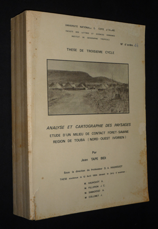
Tape Bidi Jean
Analyse et cartographie des paysages : Etude d'un milieu de contact forêt-savane, région de Touba (nord-ouest ivoirien)
Université Nationale de Côte d'Ivoire Dos carré collé 1984 In-4 (21 x 29 cm), dos carré collé, 458 pages, thèse de doctorat 3e cycle ; pliures au dos, quelques traces et rousseurs aux plats et tranches, déchirure sans manque et éraflures au premier plat, par ailleurs intérieur bien conservé, état moyen. Livraison a domicile (La Poste) ou en Mondial Relay sur simple demande.
Référence libraire : xs2308
|
|
|
TARANTINO Angela (a cura di).
La Cartografia Europea tra il XVI ed il XVIII secolo Catalogo della Mostra. Palermo, Museo Archeologico Regionale, Novembre-Dicembre 1984
con 124 illustrazioni a colori, per lo più a tutta pagina. Note e bibliografie.
|
|
|
TARDIEU (Ambroise);
ATLAS pour servir à l'intelligence de l'Histoire Générale des Voyages de LAHARPE.
Ledoux Paris 1821 1 vol. In-folio de 2 ff.n.ch. 15 feuillets double (planches), demi-chagrin de l'époque, dos à nerfs orné.
Référence libraire : 14946
|
|
|
TARDIEU, AMBROISE.
Carte de l'Ile d'Elbe.
Tratta da "Campagne de 1801", Tome 1. Incisione in rame all'acquaforte, 1820 circa, b/n, cm 27 x 41 circa (alla lastra), in rettangolo in alto a sinistra la Rade de Porto - Ferrajo. Ambroise Tradieu (1788 - 1841) cartografo del governo francese. Carta vergata priva di filigrana, margini irregolari e leggermente ingialliti, lievissimo foxing, inciso in buono stato di conservazione. .

|
|
|
Tardieu, Amédée
Senegambia e Guinea di Amedeo Tardieu. Nubia di S. Cherubini. Abissinia di Natale Desvergers
8°, 23 cm, pp. 407, (3); 140; 48; 2 carte geografiche più volte ripiegate e 39 tavole incise fuori testo, testo su due colonne, rilegatura coeva in mezza pelle, titolo in oro su tassello al dorso, piatti marmorizzati. Fa parte di: L'Universo o storia e descrizione di tutti i popoli ec, loro religioni, costumi usanze ec. Esemplare molto buono

|
|
|
Tardieu, Pierre Francois
Gouvernement d'Anjou. Grave par P. F. Tardieu. Ecrit par Dubuisson. [Kupferstich / copper engraving].
o.J.
Référence libraire : 43564BB

|
|
|
Tardieu, Pierre Francois
Gouvernement de Berry. Grave par P. F. Tardieu. Ecrit par Dubuisson. [Kupferstich / copper engraving].
o.J.
Référence libraire : 43566BB

|
|
|
Tardieu, Pierre Francois
Gouvernement de l'Orleanois. Grave par P. F. Tardieu. Ecrit par Dubuisson. [Kupferstich / copper engraving].
o.J.
Référence libraire : 43563BB

|
|
|
Tardieu, Pierre Francois
Gouvernement de La Touraine. Grave par P. F. Tardieu. Ecrit par Dubuisson. [Kupferstich / copper engraving].
o.J.
Référence libraire : 43561BB

|
|
 Recevoir par e-mail
 Télécharger en PDF
 Flux RSS


