|
|
|
EREDI HOMANN (HOMANNIANORUM HEREDUM).
Carte generale d’Empire de Russie et de Tartarie grande et petite en Europe et Asie. Tartariae Maioris sive Asiaticae tabula.
Norimberga, 1730. Incisione in rame all’acquaforte, colore d’epoca, cm 50 x 57 (alla lastra), titolo in alto, piccolo cartiglio in basso a sn. animato da personaggi e animali, reticolato e margine graduato su tutto il perimetro. Esemplare non freschissimo, aloni di umido ai margini bianchi, tenue coloritura.

|
|
|
EREDI HOMANN (IOH. BAPT. HOMANNUM).
Regnum Portugalliae.
Norimberga, 1776. Incisione in rame, colore d’epoca, cm 50 x 60 (alla lastra). Titolo entro cartiglio in alto a sn. con stemma e fregi floreali sorretti da figure scala miliare in bs. a sinistra. Molto bello il cartiglio riccamente decorato. Antiche note manoscritte lungo il margine laterale sinistro, rifilati in prossimità della battuta i margini superiore e inferiore, peraltro esemplare in bella coloritura e in buono stato di conservazione.

|
|
|
EREDI JOHANNES BAPTISTAE HOMANN (HOMANNIANIS HEREDIBUS).
Status Mutinensis in suas ditiones utopte Ducatum Mutinensem, Reginensem, Mirandulanum, Principatum Carpiensem et Corregiensem / Tavola dello Stato di Modena accuratamente diviso ne' suoi Ristretti, cioè nel Ducato di Modena, Reggio, Mirandola, nel Principato di Carpi e Correggio, come pure de Paesi vicini.
Norimberga, 1740 circa. Incisione in rame, colore d’epoca, cm 48,5 x 51,5 (alla lastra). Sono segnalate e ben evidenti tutte le località di montagna e i gruppi montuosi del lucchese, del reggiano e del modenese fino a tutta l’area geografica del bolognese. Esemplare con margini leggermente interessati da inchiostratura (comune nelle tirature di questa stampa), tenue coloritura, discreta impressione e a pieni margini. .

|
|
|
EREDI JOHANNES BAPTISTAE HOMANN (HOMANNIANIS HEREDIBUS).
Status Parmensis sive Ducatus Parmensis et Piacentinus una cum Ditione Buxetana et Valle Tarae Novissime exhibitus.
Tratta dal "Nieuwe Atlas", Norimberga, 1731. Incisione in rame, colore d’epoca, cm 49,5 x 58 (alla lastra) più margini, nella parte bassa del foglio le piante di Parma e Piacenza e un ricco cartiglio a soggetto venatorio e agreste, animato da figure e animali in primo piano. la carta fu stampata dagli eredi di Homann e reca la data del 1731 nel cartiglio. Nel 1702 Johann Baptist Homann inizia l'attività di cartografo a Norimberga. Dopo la pubblicazione del primo atlante nel 1707 divenne membro dell'Accademia delle Scienze di Berlino e nel 1715 fu nominato Geografo dell'Imperatore. Nel 1724 data della sua morte, l'attività passa al figlio e successivamente fu trasmessa ai suoi eredi, appunto con il nome di Homannianis Heredibus (Eredi Homann). Esemplare con un certo sbiadimento del colore in corrispondenza della brachetta centrale e lievi aloni al margine bianco inferiore, peraltro in buona coloritura e discreta impressione impressione. .

|
|
|
EREDI JOHANNES BAPTISTAE HOMANN (HOMANNIANOS HEREDES).
Ducatus Mantuani, ceu Sedis belli 1733 – 1735 recentissima delinatio.
Dall’ “Atlas Compendiarius”, Norimberga, Eredi di J. B. Homann, 1735. Incisione in rame, colore d’epoca, cm 51 x 58 (alla lastra). Una lieve abrasione sulla parte centrale sinistra dell'inciso, in margini e in bella coloritura, buono stato di conservazione.

|
|
|
Erik Houtman, Marie Juliette Marinus
Op geestelijke gronden : Kaarten van het bisdom Antwerpen en het Onze-Lieve-Vrouwekapittel en de kloosters van Terzieken en Falcon te Antwerpen, 1550-1791
, ALGEMEEN RIJKSARCHIEF 2009, 2009 Hardcover, 320 pagina's, Nederlands, 340 x 250 mm, Nieuw, met illustraties in kleur en z/w,. ISBN 9789057461507.
Referencia librero : 57316
|
|
|
Erik Houtman, Marie Juliette Marinus
Op geestelijke gronden : Kaarten van het bisdom Antwerpen en het Onze-Lieve-Vrouwekapittel en de kloosters van Terzieken en Falcon te Antwerpen, 1550-1791
Hardcover, 320 pagina's, Nederlands, 340 x 250 mm, Nieuw, met illustraties in kleur en z/w,. ISBN 9789057461507. Cartografische en iconografische bronnen voor de geschiedenis van het landschap in België

|
|
|
ERKÂN-I HARBIYE UMUMIYE].
[MAP of Kharpout] Harput. Dersim, Palu, Malatya, Siverek.
Very Good Turkish, Ottoman (1500-1928) Original map. Oblong elephant folio. (50 x 60 cm). In Ottoman script. Scale: 1/200.000. [MAP of Kharpout]. Harput. Dersim, Palu, Malatya, Siverek. Rare Ottoman map shows Elaziz (Elazig), Dersim, ancient Harput et environment. This is one the serie of the Bonn projection maps which are the first map series in modern techniques in Turkey and the Ottoman Empire. This is one the serie of the Bonn projection maps which are the first map series in modern techniques in Turkey and the Ottoman Empire. In order to produce these maps covering Turkish territory, Reconnaissance Branch was incorporated into The Mapping Commission. The maps were produced in the datum based on the latitude and longitude of Ayasofya Mosque in equal area Bonn Projection. The field works for the 123 sheets covering the country were conducted by 76 staff. The production was completed in 18 years starting from east west. Field works continued without stopping except in years 1914 and 1920. This map series called also reconnaissance maps contributed a lot to producing 1:25.000 scale maps.
|
|
|
ERKÂN-I HARBIYE- UMUMIYE HARITA HEYETI [PREPARED BY THE MAP COMMITTEE].
[MAP of the BOSPHORUS and ENVIRONMENT] Istanbul Bogaz ve civar haritasi.
Very Good Turkish, Ottoman (1500-1928) Original cromolithograph mounted on cloth. Folded. Some foxing and slimming on creases. Oblong double elephant folio. (97 x 107 cm). In Ottoman script. Shows the Bosphorus, Istanbul city with detailed place names. Black Sea at North, Marmara Sea at South and the Princes' Islands seen at southwest area. Mapmaker not described usual like in Turkish military maps. An extremely rare the Bosphorus map with its unusual size. Not in TBBMM library (The Grand Assembly of Turkish Republic Liibrary). Not in Military Libraries in Turkey.
|
|
|
ERKÂN-I HARBIYE- UMUMIYE HARITA HEYETI [PREPARED BY THE MAP COMMITTEE].
[MAP of the BOSPHORUS] Bogaziçi; Kavaklar: Rumeli Kavagi, Belgrad, Hisarlar.
Very Good Turkish, Ottoman (1500-1928) Original cromolithograph color map. Repaired. A good copy. Oblong atlas folio. (50 x 60 cm). In Ottoman script. [MAP of the BOSPHORUS] Bogaziçi; Kavaklar: Rumeli Kavagi, Belgrad, Hisarlar. Shows Asian and European shores, topography with detailed place names in its Bosphorus part of Anadolu and Rumeli Kavagi of Istanbul. At east, Belgrad; at northeast, Black Sea. No information on mapmaker. Hegira:: 1327 = Gregorian: 1911. Scale: 1/25.000. Rare.
|
|
|
ERKÂN-I HARBIYE-I UMUMIYE.
[MAP of the BOSPHORUS / CONSTANTINOPLE] Kavaklar: Rumeli Kavagi, Hisarlar.
Very Good Turkish, Ottoman (1500-1928) Original color map. Folded. Chipped and slightly tears on extremities. Slightly stained and yellowing on paper. Oblong atlas folio. (50 x 60 cm). In Ottoman script. [MAP of the BOSPHORUS / CONSTANTINOPLE] Kavaklar: Rumeli Kavagi, Hisarlar. Shows the Bosphorus, and its Kavaklar and Hisarlar shores. Mapmaker is not described. Scale: 1/25.000. Mubde-i tul: Hagia Sophia. This is one the serie of the Bonn projection maps which are the first map series in modern techniques in Turkey and the Ottoman Empire. This is one the serie of the Bonn projection maps which are the first map series in modern techniques in Turkey and the Ottoman Empire. In order to produce these maps covering Turkish territory, Reconnaissance Branch was incorporated into The Mapping Commission. The maps were produced in the datum based on the latitude and longitude of Ayasofya Mosque in equal area Bonn Projection. The field works for the 123 sheets covering the country were conducted by 76 staff. The production was completed in 18 years starting from east west. Field works continued without stopping except in years 1914 and 1920. This map series called also reconnaissance maps contributed a lot to producing 1:25.000 scale maps. Hegira: 1328 = Gregorian: 1911. A good copy. Very scarce.
|
|
|
ERKÂN-I HARBIYE-I UMUMIYE.
[MAP of WEST ANATOLIA - SHORES of NORTH AEGEAN] Edremid Bay, The Dardanelles, Limni, Bozcaada (Tenedos), Balikesir, Ayvalik, Kal'a-yi Sultaniye.
Very Good Turkish, Ottoman (1500-1928) Original color map on cloth. Folded. A good copy. Oblong atlas folio. (50 x 60 cm). In Ottoman script. [MAP of WEST ANATOLIA] Edremid Bay, The Dardanelles, Limni, Bozcaada (Tenedos), Balikesir, Ayvalik, Kal'a-yi Sultaniye. Shows Northeast Anatolia; southwest entrance of the Dardanelles, Çanakkale, Balikesir cities, Ayvalik, Tenedos Island, shores of North Aegean, Bay of Edremit. Mapmaker is not described. Scale: 1/200.000. Mubde-i tul: Greenwich and Dersaadet. This is one the serie of the Bonn projection maps which are the first map series in modern techniques in Turkey and the Ottoman Empire. This is one the serie of the Bonn projection maps which are the first map series in modern techniques in Turkey and the Ottoman Empire. In order to produce these maps covering Turkish territory, Reconnaissance Branch was incorporated into The Mapping Commission. The maps were produced in the datum based on the latitude and longitude of Ayasofya Mosque in equal area Bonn Projection. The field works for the 123 sheets covering the country were conducted by 76 staff. The production was completed in 18 years starting from east west. Field works continued without stopping except in years 1914 and 1920. This map series called also reconnaissance maps contributed a lot to producing 1:25.000 scale maps. Hegira: 1327 = Gregorian: 1910. Slightly stained and yellowing on paper. Loose extremities. A good copy. Very scarce. One copy in TBMM Library Map Collection: 201102274.
|
|
|
ERKÂN-I HARBIYE-I UMUMIYE.
[OTTOMAN MAP of HASANKALE - ERZERON] Erzurum, Hasankale, Oltu, Hinis, Karakilise.
Very Good Turkish, Ottoman (1500-1928) Original color map. Oblong atlas folio. (51 x 61 cm). In Ottoman script. Folded. Topography and toponyms of East Anatolia: Shows Erzurum region, Hasankale (Pasinler), Oltu, Hinis, Karakilise and surroundings. Scale: 1: 200.000. This is one the serie of the Bonn projection maps which are the first map series in modern techniques in Turkey and the Ottoman Empire. In order to produce these maps covering Turkish territory, Reconnaissance Branch was incorporated into The Mapping Commission. The maps were produced in the datum based on the latitude and longitude of Ayasofya Mosque in equal area Bonn Projection. The field works for the 123 sheets covering the country were conducted by 76 staff. The production was completed in 18 years starting from east west. Field works continued without stopping except in years 1914 and 1920. This map series called also reconnaissance maps contributed a lot to producing 1:25.000 scale maps. Rare.
|
|
|
ERKÂN-I HARBIYE-I UMUMIYE].
[MAP of ALEXANDRETTA] Iskenderun - Tayakadin.
Very Good Turkish, Ottoman (1500-1928) Original color map on cloth. Folded. Wrinkled on paper. Stains on cloth. 12 sheets on paper. Oblong atlas folio. (50 x 60 cm). In Ottoman script.[MAP of ALEXANDRETTA] Iskenderun - Tayakadin. It shows villages and settlements in Tayakadin of Iskenderiye. Scale: 1/25.000. Hegira: 1329 = Gregorian: 1913. This is one the serie of the Bonn projection maps which are the first map series in modern techniques in Turkey and the Ottoman Empire. In order to produce these maps covering Turkish territory, Reconnaissance Branch was incorporated into The Mapping Commission. The maps were produced in the datum based on the latitude and longitude of Ayasofya Mosque in equal area Bonn Projection. The field works for the 123 sheets covering the country were conducted by 76 staff. The production was completed in 18 years starting from east west. Field works continued without stopping except in years 1914 and 1920. This map series called also reconnaissance maps contributed a lot to producing 1:25.000 scale maps. Not description on map-maker. A very detailed map. Extremely rare.
|
|
|
ERKÂN-I HARBIYE-I UMUMIYE].
[MAP of EAST & SOUTHEAST ANATOLIA] Maras - Elbistan - Birecik - Kilis.
Very Good Turkish, Ottoman (1500-1928) Original color map. Folded. Oblong atlas folio. (50 x 60 cm). In Ottoman script. Shows Eastern and Southeastern parts of Anatolia; Maras, Elbistan, Birecik and Kilis areas. Hegira: 1333 = Gregorian: 1917. Not description on map-maker.
|
|
|
ERKÂN-I HARBIYE-I UMUMIYE].
[MAP of EAST ANATOLIA and EAST BLACK SEA] Oltu, Artvin, Ispir, Hasankale.
Very Good Turkish, Ottoman (1500-1928) Original color map. Folded. Oblong atlas folio. (50 x 60 cm). In Ottoman script. [MAP of EAST ANATOLIA and ARTVIN] Oltu, Artvin, Ispir, Hasankale. Shows Artvin, Ispir, Hasankale and Kars city. Scale: 1/200.000. This is one the serie of the Bonn projection maps which are the first map series in modern techniques in Turkey and the Ottoman Empire. In order to produce these maps covering Turkish territory, Reconnaissance Branch was incorporated into The Mapping Commission. The maps were produced in the datum based on the latitude and longitude of Ayasofya Mosque in equal area Bonn Projection. The field works for the 123 sheets covering the country were conducted by 76 staff. The production was completed in 18 years starting from east west. Field works continued without stopping except in years 1914 and 1920. This map series called also reconnaissance maps contributed a lot to producing 1:25.000 scale maps. Hegira: 1332 = Gregorian: 1916. Not description on map-maker.
|
|
|
ERKÂN-I HARBIYE-I UMUMIYE].
[MAP of EAST ANATOLIA] Hozat, Dersim.
Very Good Turkish, Ottoman (1500-1928) Original color map. Folded. Oblong atlas folio. (50 x 60 cm). In Ottoman script. [MAP of EAST ANATOLIA] Hozat, Dersim. Shows Eastern parts of Anatolia; Dersim-Horat and border of Erzincan city; Divrigi; Harput (Kharpout); Kilis; and Munzur Mountains, et alli. Scale: 1/200.000. Hegira: 1330 = Gregorian: 1914. Not description on map-maker.
|
|
|
ERKÂN-I HARBIYE-I UMUMIYE].
[MAP of EAST BLACK SEA] Artvin, Rize, Oltu.
Good Turkish, Ottoman (1500-1928) Original color map. Folded. Tears in margins. Slightly stained. Otherwise a good copy. Oblong atlas folio. (50 x 60 cm). In Ottoman script. [MAP of EAST BLACK SEA] Artvin, Rize, Oltu. Shows Artvin and Georgian borders, Rize (Rizeon - Rizunda - Rizini) and Oltu cities and regions. Scale: 1/200.000. Hegira: 1330 = Gregorian: 1914. This is one the serie of the Bonn projection maps which are the first map series in modern techniques in Turkey and the Ottoman Empire. In order to produce these maps covering Turkish territory, Reconnaissance Branch was incorporated into The Mapping Commission. The maps were produced in the datum based on the latitude and longitude of Ayasofya Mosque in equal area Bonn Projection. The field works for the 123 sheets covering the country were conducted by 76 staff. The production was completed in 18 years starting from east west. Field works continued without stopping except in years 1914 and 1920. This map series called also reconnaissance maps contributed a lot to producing 1:25.000 scale maps. Not description on map-maker. Extremely rare.
|
|
|
ERKÂN-I HARBIYE-I UMUMIYE].
[MAP of EAST BLACK SEA] Trabzon, Giresun, Erzincan, Ispir.
Very Good Turkish, Ottoman (1500-1928) Original color map. Folded. Oblong atlas folio. (50 x 60 cm). In Ottoman script. [MAP of EAST BLACK SEA] Trabzon, Giresun, Erzincan, Ispir. Shows Trebizond, Cerasonte, Erzingan (Eriza), Suspiritis (Sper) of Erzurum (Erzeron city); mostly Black Sea shores of Trabzon and Giresun. . Scale: 1/200.000. This is one the serie of the Bonn projection maps which are the first map series in modern techniques in Turkey and the Ottoman Empire. In order to produce these maps covering Turkish territory, Reconnaissance Branch was incorporated into The Mapping Commission. The maps were produced in the datum based on the latitude and longitude of Ayasofya Mosque in equal area Bonn Projection. The field works for the 123 sheets covering the country were conducted by 76 staff. The production was completed in 18 years starting from east west. Field works continued without stopping except in years 1914 and 1920. This map series called also reconnaissance maps contributed a lot to producing 1:25.000 scale maps. Hegira: 1336 = Gregorian: 1920. Not description on map-maker. Extremely rare.
|
|
|
ERKÂN-I HARBIYE-I UMUMIYE].
[MAP of ISTANBUL / CONSTANTINOPLE] Küçükköy, Petnahor (Old Greek-Byzantine name of Göktürk), Makriköy, Kagidhane [Kagithane].
Very Good Turkish, Ottoman (1500-1928) Original color map on cloth. Oblong atlas folio. (49 x 60 cm). Toponyms in Turkish with Arabic letters. In Ottoman script. Scale: 1/25.000. [MAP of ISTANBUL / CONSTANTINOPLE] Küçükköy, Petnahor, Makriköy, Kagidhane [Kagithane]. A rare Istanbul map including some old Byzantine toponyms.
|
|
|
ERKÂN-I HARBIYE-I UMUMIYE].
[MAP of KONIA and ALAIYYA] Konya, Beysehir, Alaiyye.
Very Good Turkish, Ottoman (1500-1928) Original color map on cloth. Folded. Oblong atlas folio. (50 x 60 cm). In Ottoman script. Shows Konya city and around, Alaiye at south. Not description on map-maker. Scale: 1: 200.000. This is one the serie of the Bonn projection maps which are the first map series in modern techniques in Turkey and the Ottoman Empire. In order to produce these maps covering Turkish territory, Reconnaissance Branch was incorporated into The Mapping Commission. The maps were produced in the datum based on the latitude and longitude of Ayasofya Mosque in equal area Bonn Projection. The field works for the 123 sheets covering the country were conducted by 76 staff. The production was completed in 18 years starting from east west. Field works continued without stopping except in years 1914 and 1920. This map series called also reconnaissance maps contributed a lot to producing 1:25.000 scale maps. Rare.
|
|
|
ERKÂN-I HARBIYE-I UMUMIYE].
[MAP of MAGNESIA - AEGEAN REGION] Manisa - Soma, Izmir, Aydin.
Very Good Turkish, Ottoman (1500-1928) Original color map on cloth. Folded. Oblong atlas folio. (50 x 60 cm). In Ottoman script. [MAP of MAGNESIA - AEGEAN REGION] Manisa - Soma, Izmir, Aydin cities (Magnesia, Smyrna and Tralleis) in Aegean region. It shows villages and settlements in Tayakadin of Iskenderiye. Scale: 1/25.000. Hegira: 1328 = Gregorian: 1912. This is one the serie of the Bonn projection maps which are the first map series in modern techniques in Turkey and the Ottoman Empire. In order to produce these maps covering Turkish territory, Reconnaissance Branch was incorporated into The Mapping Commission. The maps were produced in the datum based on the latitude and longitude of Ayasofya Mosque in equal area Bonn Projection. The field works for the 123 sheets covering the country were conducted by 76 staff. The production was completed in 18 years starting from east west. Field works continued without stopping except in years 1914 and 1920. This map series called also reconnaissance maps contributed a lot to producing 1:25.000 scale maps. Not description on map-maker. A very detailed map showing lakes, rivers and mountains. Extremely rare.
|
|
|
ERKÂN-I HARBIYE-I UMUMIYE].
[OTTOMAN MAP of BIGA PENINSULA & TENEDOS] Biga Peninsula, Çanakkale Straight, Tenedos [Bozcaada], Edremit Bay.
Very Good Turkish, Ottoman (1500-1928) Original color map on cloth. Oblong atlas folio. (44 x 58 cm). Scale: 1/200.000. Toponyms in Ottoman script /Turkish with Arabic letters). Shows southwest of the Gallipoli Peninsula [and the Hellespont], Edremid Gulf, Tenedos, and North Aegean shores of Anatolia]. Folded. This is one of the series of the Bonn projection maps which are the first map series in modern techniques in Turkey and the Ottoman Empire. In order to produce these maps covering Turkish territory, Reconnaissance Branch was incorporated into The Mapping Commission. The maps were produced in the datum based on the latitude and longitude of the Ayasofya Mosque in equal area Bonn Projection. The field works for the 123 sheets covering the country were conducted by 76 staff. The production was completed in 18 years starting from east-west. Fieldworks continued without stopping except in the years 1914 and 1920. This map series called also reconnaissance maps contributed a lot to producing 1:25.000 scale maps. Hegira: 1336 = Gregorian: 1920. Not description on map-maker. Extremely rare.
|
|
|
ERKÂN-I HARBIYE-I UMÛMIYE HARITA MÜDÜRLÜGÜ].
[MAP of ARCHIPELAGO] Sisam (Vathy), Arki (Arkioi), Lipso (Leipsoi), Nekarya, Patmos, Istanköy (Kos), Forni (Fournoi) Islands and Izmir (Smyrna) shores. Mübde-i tûl: Dersaadet.
Very Good Turkish, Ottoman (1500-1928) Original chromolithograph folded map mounted on cloth. A good copy. Oblong atlas folio. (47 x 60 cm). In Ottoman script. Scale: 1/200.000. Shows Vathy, Arkioi, Leipsoi, Nekaria, Patmos, Kos, and Fournoi Islands in Greek archipelago with Smyrna shores at east. A decorative and rare map.
|
|
|
ERKÂN-I HARBIYE.
[MAP of EAST ANATOLIA - ERZERON] [Erzurum:] Oltu, Artvin, Hasankale, Ispir.
Very Good Turkish, Ottoman (1500-1928) Original color map. Folded. Oblong atlas folio. (50 x 60 cm). In Ottoman script. Scale: 1/200.000. [MAP of EAST ANATOLIA - ERZERON] [Erzurum:] Oltu, Artvin, Hasankale, Ispir. This is one the serie of the Bonn projection maps which are the first map series in modern techniques in Turkey and the Ottoman Empire. This is one the serie of the Bonn projection maps which are the first map series in modern techniques in Turkey and the Ottoman Empire. In order to produce these maps covering Turkish territory, Reconnaissance Branch was incorporated into The Mapping Commission. The maps were produced in the datum based on the latitude and longitude of Ayasofya Mosque in equal area Bonn Projection. The field works for the 123 sheets covering the country were conducted by 76 staff. The production was completed in 18 years starting from east west. Field works continued without stopping except in years 1914 and 1920. This map series called also reconnaissance maps contributed a lot to producing 1:25.000 scale maps. Not in Ataturk Library and TBMM Library.
|
|
|
ERKÂN-I HARBIYE].
[MAP of CAUCASUS] Demirhan - Sûra (Buynaksk).
Very Good Turkish, Ottoman (1500-1928) Original color map. Folded. Atlas folio. (82 x 57 cm). In Ottoman script. Scale: 1/400000. A clean copy. Including Azerbaijan, Dagestan, Mahaçkala, Tbilisi, Yerevan, Darband, et alli. A fine map of Caucasus and shores of Caspian Sea. Extremely rare.
|
|
|
ERKÂN-I HARBIYYE-I UMUMIYYE.
[OTTOMAN MAP of EAST ANATOLIA in ENVERÎ SCRIPT - HURÛF-I MUNFASILA] Bayazid, Bargiri, Nahcivan, Karakilise.
Very Good Turkish, Ottoman (1500-1928) Original color map of Eastern Anatolia, Dogu Beyazit, Bayazid, Bargiri, Nakhchevan, Karakilise, Van, etc. 50x60 cm. In Ottoman script (Enverî). 1 p. Scale: 1:200.000. Slightly toned, several small holes on paper. Otherwise a very good copy. Enverî script is the war minister Enver Pasha's alphabet and writing amendment, which he tried to implement within the Ministry of War between 12 March 1914 and 10 August 1914. Starting from the Tanzimat (Westernization) period in the Ottoman Empire, the discussions on simplification in language, writing, alphabet and reading-writing had increased and at the end of the 19th century, military necessities also became one of the concerns. The problems such as the low rate of literacy among the recruited soldiers, the need to teach the soldiers how to read and write in a short time, and their misconceptions about the spelling of proper nouns led Enver Pasha to add the writing problem to his reform agenda, once he took office. Enver Pasha's reform is based on the principle of writing the Ottoman letters, which take different forms in the beginning, in the middle and at the end according to their unification with the other letters, separately in their original state without merging them. While this new alphabet was being created, the existing 32 letters in the Ottoman were preserved. The 8 vowels in the Turkish language, which could not be written with the old letters, was shown by placing small marks on the existing vowels and by doing so a new alphabet consisting of a total of 40 letters was created. With this alphabet, officially called 'Ordu Elifbasi', rules were adopted such as writing of the letters without merging them, writing the words as they are pronounced. At first glance, Enver Pasha's writing reform, which appeared as a definite solution to the theory of the solution of the ongoing debates on the alphabet and the spelling, formed a wide experiment field in the military. It was not possible to use Ordu Elifbasi, which essentially is a transliteration alphabet that allows transferring the sounds of these three different languages (Turkish, Arabic, Persian) to a single alphabet, in the daily life. Thanks to this new alphabet and spelling, learning to read and write were accelerated to some extent. However, it was seen that the literacy rate of the well-educated, literate people fell to the spelling and did not even progress. This alphabet and spelling reform, which Enver Pasha thought of spreading to the whole country, caused much more problems as it was experienced in the army. Although it was postponed until the end of the mobilization period following the declaration of the mobilization, Ordu Elifbasi, which remained in force for 152 days, eventually failed to be realized. (Source: Karakus: Enver Pasha's Alphabet And Spelling Attempt: Ordu Elifbasi (Army Alphabet)).In this extremely rare document, there are some articles and thoughts on a case. This is one the serie of the Bonn projection maps which are the first map series in modern techniques in Turkey and the Ottoman Empire. In order to produce these maps covering Turkish territory, Reconnaissance Branch was incorporated into The Mapping Commission. The maps were produced in the datum based on the latitude and longitude of Ayasofya Mosque in equal area Bonn Projection. The field works for the 123 sheets covering the country were conducted by 76 staff. The production was completed in 18 years starting from east west. Field works continued without stopping except in years 1914 and 1920. This map series called also reconnaissance maps contributed a lot to producing 1:25.000 scale maps. Extremely rare. KW: "Harfleri Islah Cemiyeti" Hurûf-i munfasila Reform Turkish Letter revolution First World War WW 1 Map Geography Military maps.
|
|
|
Ersal
I suoli del Casalasco. Progetto "carta pedologica"
30 cm, brossura illustrata; pp. 131, diverse tabelle e grafici nel testo, 8 tavole fuori testo, 2 grandi carte geografiche più volte ripiegate allegate in tasca

|
|
|
Ersal
I suoli del parco "Pineta di Appiano Gentile - Tradate" e aree limitrofe. Progetto "Carta pedologica"
30 cm, brossura illustrata; pp. 358, numerose tabelle nel testo, 8 tavole fuori testo, senza la carta geografica

|
|
|
Ersal
I suoli della bassa pianura bresciana fra i fiumi Mella e Chiese. Progetto "carta pedologica"
30 cm, brossura illustrata; pp. 112, diverse tabelle e grafici nel testo, 8 tavole fuori testo, 2 grandi carte geografiche più volte ripiegate allegate in tasca

|
|
|
Ersal
I suoli della pianura bresciana orientale. Progetto "carta pedologica"
30 cm, brossura illustrata; pp. 257, diverse tabelle nel testo, 8 tavole fuori testo, 2 grandi carte geografiche più volte ripiegate allegate in tasca

|
|
|
Ersal
I suoli della pianura mantovana centrale. Progetto "carta pedologica"
30 cm, brossura illustrata; pp. 127, diverse tabelle e grafici nel testo, 8 tavole fuori testo, una grande carta geografica più volte ripiegata allegata in tasca

|
|
|
Ersal
I suoli della pianura ostigliese. Progetto "Carta pedologica"
30 cm, brossura illustrata; pp. 81, alcune tabelle nel testo, 8 tavole a colori fuori testo; una grande carta geografica più volte ripiegata allegata in tasca

|
|
|
Esav
I suoli dell'area a doc dei Colli Euganei
30 cm, brossura illustrata; pp. 192, numerose tabelle e illustrazioni nel testo; una grande carta geografica più volte ripiegata allegata in tasca

|
|
|
Esav
I suoli dell'area a doc del Piave. Provincia di Venezia
30 cm, brossura illustrata; pp. 158, diverse tabelle e illustrazioni a colori nel testo; una grande carta geografica più volte ripiegata allegata in tasca

|
|
|
Esav
I suoli dell'area doc del Piave. Provincia di Treviso
30 cm, brossura illustrata; pp. 181, numerose tabelle e illustrazioni nel testo; una grande carta geografica più volte ripiegata allegata in tasca

|
|
|
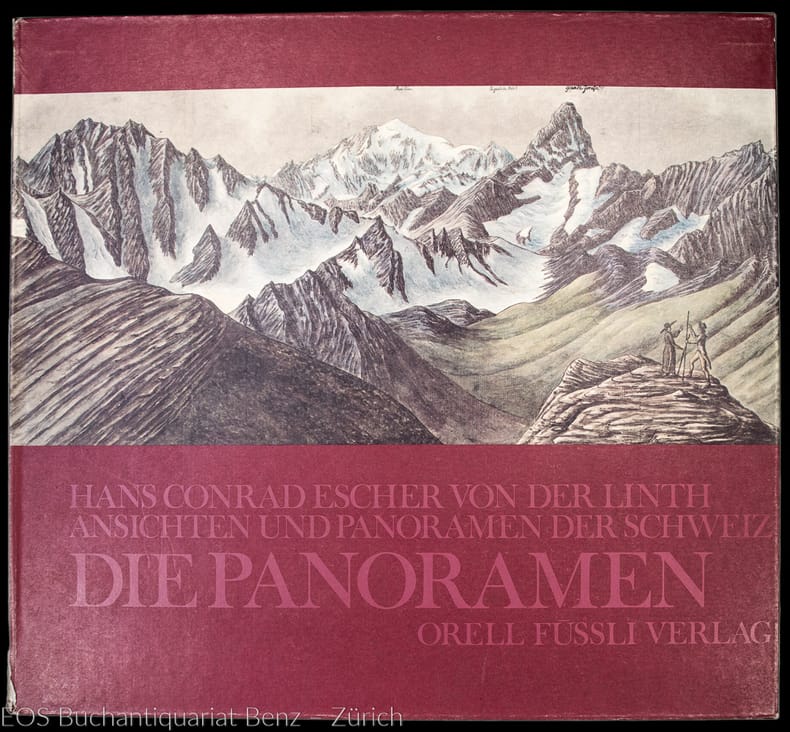
Escher von der Linth, Hans Conrad:
Ansichten und Panoramen der Schweiz - Die Panoramen.
Zürich, Orell Füssli, 1976. Folio. 131, (1) S. Mit 27 faksimilierten Panoramen. Orig.-Leinenband in farb. illustr. Pappkassette.
Referencia librero : 4461DB
|
|
|
Escher von der Linth, Hans Conrad:
Ansichten und Panoramen der Schweiz - Die Panoramen.
Zürich, Orell Füssli, 1976. Folio. 131, (1) S. Mit 27 faksimilierten Panoramen. Orig.-Leinenband in farb. illustr. Pappkassette.
Referencia librero : 28507AB
|
|
|
ESCHMANN, J. (Johannes) (1808-1852):
Ergebnisse der trigonometrischen Vermessungen in der Schweiz. Nach Befehl der Hohen Tagsatzung aus den Protokollen der eidgenössischen Triangulirung.
Zürich, Orell, Füssli, 1840, gr. in-4to, XVI + 240 S. + 1 grosse mehrfach gefalt. lithographierte Uebersichtskarte-Karte (vom Schweizer Triangulations-Netz von 1840), moderner Halbleinenband mit rotem goldgeprägten Rückenschildchen, die Deckel mit Marmorpapier bezogen, etwas fleckiger Original-Umschlag liegt lose bei. Schönes Exemplar.
Referencia librero : 41368aaf
|
|
|
Escher von der Linth, Hans Conrad
Ansichten und Panoramen der Schweiz - Die Panoramen.
Zürich, Orell Füssli, 1976. Folio. 131, (1) S. Mit 27 faksimilierten Panoramen. Orig.-Leinenband in farb. illustr. Pappkassette. + Wichtig: Für unsere Kunden in der EU erfolgt der Versand alle 14 Tage verzollt ab Deutschland / Postbank-Konto in Deutschland vorhanden +
Referencia librero : 4461DB
|
|
|
Escher von der Linth, Hans Conrad
Ansichten und Panoramen der Schweiz - Die Panoramen.
Zürich, Orell Füssli, 1976. Folio. 131, (1) S. Mit 27 faksimilierten Panoramen. Orig.-Leinenband in farb. illustr. Pappkassette. + Wichtig: Für unsere Kunden in der EU erfolgt der Versand alle 14 Tage verzollt ab Deutschland / Postbank-Konto in Deutschland vorhanden +, A|B|C [3 Warenabbildungen]
Referencia librero : 28507AB

|
|
|
ESPENHORST, JURGEN.
ANDREE STIELER MEYER & CO.
, Swerthe, Pangaea Verlag, 1994., Gebunden, original kartoniert illustriert koloriert, 15x21,5cm, 432pp, illustriert s/w.
Referencia librero : 11479
|
|
|
ESPENHORST, Jurgen und KUMPEL, Erhard;
Diercke, Ein Atlas F r Generationen. Hintergr nde, Geschichte Und Bibliographische Daten Bis 1955.
, Schwerte, Pangaea Verlag, 1999, Gebunden, Frontispiz, 210 x 215mm., 119S., illustriert. ISBN 3 930401 50 9. ISBN 3930401509.
Referencia librero : 19480
|
|
|
Esperandieu Emile
Guide pratique pour la lecture et l'emploi de la carte d'état major
1942 Charles LAVAUZELLe,1942,in12 broché,dos factice,53p.,5 cartes hors texte dont une dépliante,60 illustrations in texte,
Referencia librero : 4681
|
|
|
ESPENHORST, Jurgen und KUMPEL, Erhard
Diercke, Ein Atlas Für Generationen. Hintergründe, Geschichte Und Bibliographische Daten Bis 1955.
Gebunden, Frontispiz, 210 x 215mm., 119S., illustriert. ISBN 3 930401 50 9. ISBN 3930401509. Ein Eckstein des Unterrichts entsteht. Bibliographie des DIERCKE. Bibliographie der reduzierten Ausgaben. Anhang. Namenverzeichnis. Guter Zustand.

|
|
|
ESPENHORST, JURGEN.
ANDREE STIELER MEYER & CO.
Gebunden, original kartoniert illustriert koloriert, 15x21,5cm, 432pp, illustriert s/w. Bibliographie der Handatlanten. Handatlanten des deutschen Sprachraums ( 1800 - 1945). Nebst Vorlaufen und Abkommlingen im In- und Ausland. Bibliographisches Handbuch. Mit einem Vorwort von Lothar Zogner.
|
|
|
Esposito, Vincent J (chief editor)
The West Point Atlas of American Wars. Volume I: 1689-1900 Volume II: 1900-1953"
New York: Frederick A. Praeger 1959. Two volumes complete with original slipcase published in 1959 at $47.50. Both volumes are first printings of the first edition with "First published. in 1959" so stated on the copyright pages and no indication of any other printings. Volume I: 1689-1900 Volume II: 1900-1953." Both books are in Fine condition and appear seldom if ever read. They are square and tight with sharp corners. NO owner's name or bookplate. NOT a library discard. NO dust jackets as issued. The original slipcase is in only Good condition entirely intact with minor soil and several edge cracks that have been securely and neatly glue reinforced. PHOTOS UPON REQUEST. With an introductory letter by Dwight D. Eisenhower. Pages are crisp clean and unmarked. There are approximately 600 total pages nearly half consisting of mostly full page maps printed in multiple colors. The maps cover the battles of American Colonial wars Revolutionary war War of 1812 Mexican war American civil war Spanish American war WW1 WW2 and Korean war. The two volumes are uniformly bound in the original gilt-stamped black cloth with oatmeal cloth spines with gilt-stamping over black spine panels. Oversize Oblong Hardcover. Altogether the measurements are 14.5" wide by 11" tall by 3" thick This large very heavy set will require SUBSTANTIAL extra postage for International shipments but only the standard one book charge for priority or media mail. We ship 2 volumes for cost of 1 via priority or media mail. First printings of the first edition. Oversize Hardcover. Fine condition/Good original slipcase. Illus. by NOT a library discard. 2 vols: irregular pagination but about 600 pages. Great Packaging Fast Shipping. Frederick A. Praeger Hardcover
Referencia librero : 031767
|
|
|
ESPOSIZIONE DI MILANO (CARTOGRAFIA)
Esposizione di Milano 1906. Ministero della Guerra. Cenni sugli istrumenti antichi e moderni e sui lavori geodetici e cartografici esposti dall’Istituto Geografico Militare.
Firenze, Tipografia M. Ricci, 1906. Cenni sugli istrumenti antichi e moderni e sui lavori geodetici e cartografici esposti dall‚Istituto Geografico Militare. In 8vo; copertina originale con titoli al piatto; pp. 34. Ax
|
|
|
Experimental Cartography Unit
Land use mapping by local authorities in Britain: A report
Architectural Press. Used - Good. Ships from UK in 48 hours or less usually same day. Your purchase helps support Sri Lankan Children's Charity 'The Rainbow Centre'. Ex-library so some stamps and wear but in good overall condition. 100% money back guarantee. We are a world class secondhand bookstore based in Hertfordshire United Kingdom and specialize in high quality textbooks across an enormous variety of subjects. We aim to provide a vast range of textbooks rare and collectible books at a great price. Our donations to The Rainbow Centre have helped provide an education and a safe haven to hundreds of children who live in appalling conditions. We provide a 100% money back guarantee and are dedicated to providing our customers with the highest standards of service in the bookselling industry. Architectural Press unknown
Referencia librero : Z1-W-029-02214 ISBN : 0851393330 9780851393339
|
|
|
EZIO MATTIOCCO
VEDUTE PROSPETTICHE DELLA CITTA' DI SULMONA DAL XVI SECOLO ALL'UNITA' D'ITALIA.
IN 8°, pp.59, COPERTINA EDITORIALE PATINATA CON TITOLO E SIGILLO DI SULMONA.<BR>STUDIO ARRICCHITO DA 23 ILLUSTRAZIONI in b/n. f.t.CON RIPRODUZIONE DI PIANTE E VEDUTE DELLA CITTA' DI SULMONA DAL XVI SECOLO ALL'UNITA' D'ITALIA.<BR>QUADERNI DEL MUSEO CIVICO DI SULMONA, COLLANA DI STUDI DI ARCHEOLOGIA, STORIA E ARTE DIRETTA DA EZIO MATTIOCCO. n° 7. OTTIMA CONSERVAZIONE. ID 2003

|
|
|

 Recibir por correo electrónico
 Descargar en documento PDF
 Flujo RSS
 Link permanente


