|
TCI
Carta dell'Africa Orientale scala 1:3.500.000 a colori cm. 69,5 X 84 a colori.
Supplemento alle vie d'Italia. in custodia edit.

|
|
|
Teledido, A V, and P KTeslia, M G Shabanova, cartography; A I Povolots'kyi, editor K T
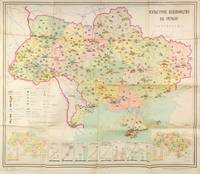
DATA VISUALIZATION AS PROPAGANDA - CULTURAL DEVELOPMENT OF SOVIET UKRAINE Kulturne budivnytstvo na Ukraini kartoskhema Cultural development in Ukraine a diagrammatic map
Kyiv: Vydavnytstvo politychnoi literatury Ukrainy 1965. Single leaf measuring 95 × 80 cm color offset lithograph. Creases from folding; light fading due to stock; else about very good. A colorful infographics map showcasing cultural development of Soviet Ukraine in 1965 likely published ahead of the celebrations planned for the 50th anniversary of the October Revolution in 1967. The map promotes the Ukrainian SSR as having exceptional educational and cultural resources showing the size and locations of universities trade schools theatres museums as well as TV and radio towers print runs of magazines newspapers and educational literature. Two inserts at the lower corners show locations of libraries and archives left corner and culture clubs and cinemas right corner. Eight additional graphs at the bottom show consistently growing numbers of students enrolled in technical schools universities and other secondary education institutions as well as the number of scientific workers. The graphs also show a growing number of theatres and museums print runs of magazines newspapers and books as well as retail sales of books in millions of rubles. <br /> <br /> The map was published by the Political Literature publishing house of Ukraine rather than by the Academy of Sciences and the scale is not mentioned on the map but is likely 1:1750000 to 1:1500000 typical for Soviet maps of this period suggesting that this publication was made primarily for propaganda purposes. Likely for this reason no mention of this map is made in the Ukrainian cartographic references such as Rostyslav Sossa's "Political and Administrative maps of Ukraine 1918-2008 Politiyko-administratyvni i administratyvni karty Ukrainy 1918-2008 which does mention several other maps by Teledido as map designer and Povolots'kyi as editor. In addition to this map the authors collaborated on other statistical/cartographic projects which mapped and diagrammed the five-year plans of the 1960s-1970s. <br /> <br /> Rare despite the 33000 copies printed. As of December 2025 KVK OCLC show two copies worldwide both in North America. unknown
Referencia librero : 55306
|
|
|
TEN HOORN NICOLAUS
PADOVA
TEN HOORN NICOLAUS PADOVA. , 1703, Ottimo (Fine) ottime condiz.. incisione in rame <br> in dodicesimo cm. 16 x 12 <br> <br> <br>

|
|
|
Termier,Henri et Geneviève.
L'évolution de la lithosphère. Vol. I: Pétrogénèse. Vol. II ( premier fascicule ) : Orogénèse. Vol. II ( second fascicule ) : Orogénèse. Vol. III: Glyptogénèse.
3 voll.in 4 tomi, completo <br/> TITOLO: L'évolution de la lithosphère. Vol.I: Pétrogénèse. Vol.II (premier fascicule): Orogénèse. Vol.II (second fascicule): Orogénèse. Vol.III: Glyptogénèse. <br/> AUTORE: Termier,Henri et Geneviève.<br/> EDITORE: Masson et Cie, Editeurs<br/> DATA ED.: 1956-1961,<br/> COLLANA: ant.e ai dorsi. Legg. sbiadite ma solide ed eccellenti interni.<br/>
|
|
|
Terrell, Christopher
THE EVOLUTION OF THE SEA CHART
Very light shelfwear and creasing else fine. ; Lecture given in May 1997 by Commander Christopher Terrell, Head of the Department of Navigation at the National Maritime Museum at Greenwich until 1987, on the evolution of the sea chart from its origins to nowadays. In a long journey that began from the early thirteenth-century sea charts on vellum to reach the nineteenth-century sophisticated British hydrographical surveys, chart-making underwent a variety of phases ranging from the Mediterranean portolans to the great contribution of the French eighteenth-century school of organised hydrography. ; Cyprus Cartography Lectures No. 4. the Helen Wallis Memorial Lecture; 4to 11" - 13" tall; 46 pages
|
|
|
TERRENI ANTONIO DISEGNO e INCISE
VEDUTA DELLA FOLLONICA
ACQUATINTA, cm.26 X 37 ( impr.) / 23 X 34 ( ved.) + AMPI MARGINI. PUBBLICATA IN: FONTANI FRANCESCO, VIAGGIO PITTORICO DELLA TOSCANA. OTTIMA CONSERVAZIONE. ID, 6700

|
|
|
TERRENI ANTONIO DISEGNO e INCISE
VEDUTA DI FUCECCHIO
ACQUATINTA cm.26 X 36 ( impr.) / 23 X 34 ( ved.) + AMPI MARGINI. PUBBLICATA IN: FONTANI FRANCESCO, VIAGGIO PITTORICO DELLA TOSCANA. OTTIMA CONSERVAZIONE. ID, 6699

|
|
|
TESI MARIO ( A CURA DI )
MONUMENTI DI CARTOGRAFIA A FIRENZE ( SECC. X - XVII )
IN 8°, pp.VI, 111. COPERTINA EDITORIALE PATINATA ILLUSTRATA A COLORI CON TITOLO. CATALOGO DELLA IX CONFERENZA INTERNAZIONALE DI STORIA DELLA CARTOGRAFIA<BR>( PISA - FIRENZE - ROMA , MAGGIO - GIUGNO 1981 ).IN CUI SONO ELENCATE 278 SCHEDE .<BR>TAVV. XL f.t. in b/ n/ col. CHE RIPRODUCONO CABREI, MAPPAMONDI, CARTE, ECC.<BR>OTTIMA CONSERVAZIONE DI QUESTO RARO CATALOGO. ID, 6640

|
|
|
Tesi Mario (a cura)
Monumenti di cartografia a Firenze (Sec. X-XVII)
24 cm, brossura illustrata; pp. v, 111; 40 tavole in nero e a colori fuori testo, timbretto al frontespizio

|
|
|
Testa Corrado
Levante e Barberia [LIBIA - MALTA - TURCHIA]
|
|
|
THACHER, John Boyd:
The continent of America. Its discovery and its baptism. An essay on the nomenclature of the old continents. A critical and bibliographical inquiry into the naming of America and into the growth of the cosmography of the new world; together with an attempt to establish the landfall of Columbus on Watlin Island, and the subsequent discoveries and explorations on the main land by Americus Vespucius. (Reprint).
Amsterdam, Meridian, 1971, in-4°, XX + 270 p., richly illustrated in the text and full page, and with 14 fac-simile maps, original cloth binding.
Referencia librero : 13019aaf
|
|
|
The Automobile Association of South Africa
Road Atlas and Touring Guide of Southern Africa. Fourth Edition
The Automobile Association of South Africa - Keartland Press, Johannesburg, 1972. 232 S. ; 25,5 x 19 cm ; Pp. ;
Referencia librero : 127575

|
|
|
The Gentleman's and London Magazine
THE GENTLEMAN'S AND LONDON MAGAZINE August 1758
Dublin: John Exshaw Dame Street 1758. No Binding. Fine. 8vo. 427-480pp. A disbound copy of the Dublin version of the Gentleman's Magazine for the month of August 1758. Fine fresh paper with no foxing wear or marks. The title-page lists 24 articles on the title-page and includes a fine copy of the rare 'A PLAN of the Harbour and TOWN of LOUISBOURG in the Island of CAPE BRETON Drawn on the Spot. Folding page 28 x 20 cms with a plate impression 24 x 18 cms.4 page description of the plan and town. Other articles include an estimate of the Naval Debt; Part of the trial of William Barnard; Journal of the Seige of Louisbourg; General Abercromby's Account of the Exped. to Crown Point. Single page map of 'The Country between CROWN POINT and ALBANY being the Great Pass from the English to the French Settlements in North America'.11.5 x 19.1 cms. Please email for photos. <br/> <br/> John Exshaw, Dame Street unknown
Referencia librero : T370
|
|
|
The Gentleman's and London Magazine
THE GENTLEMAN'S AND LONDON MAGAZINE June 1758
Dublin: John Exshaw Dame Street 1758. 1st Edition . No Binding. Fine. 8vo. 313-368pp. A disbound copy of the Dublin version of the Gentleman's Magazine for the month of June 1758. Fine fresh paper with no foxing wear or marks. The title-page lists 24 articles on the title-page and includes a fine copy of the rare folding map 'A NEW MAP OF THE ENGLISH CHANNEL' engraved by Ridge 25 x 17 cms. Map engraved by Ridge. Title contents calls for a Sheet map of Germany and not the English Channel. Please email for photos. <br/> <br/> John Exshaw, Dame Street unknown
Referencia librero : T372
|
|
|
The Gentleman's and London Magazine
THE GENTLEMAN'S AND LONDON MAGAZINE January 1758
Dublin: John Exshaw Dame Street 1758. 1st Edition . No Binding. Fine. 8vo. 3-64pp. A disbound copy of the Dublin version of the Gentleman's Magazine for the month of January 1758. Fine fresh paper with no foxing wear or marks. The title-page lists 21 articles on the title-page and includes a fine copy of the rare folding map 'Island Rathlin showing the Ballycastle Colleries 21x18 cms. Also A PLAN OF THE CITY OF BRESLAU Capital of Silesia 18x12 CMS.Please email for photos. <br/> <br/> John Exshaw, Dame Street unknown
Referencia librero : T373
|
|
|
The Gentleman's and London Magazine
THE GENTLEMAN'S AND LONDON MAGAZINE July 1758
Dublin: John Exshaw Dame Street 1758. 1st Edition . No Binding. Fine. 8vo. 369-425pp. A disbound copy of the Dublin version of the Gentleman's Magazine for the month of July 1758. Fine fresh paper with no foxing wear or marks. The title-page lists 19 articles on the title-page and includes a fine copy of the rare folding sheet map 'A New and Accurate Map of Germany Drawn from the latest surveys Discribing the Port Roads & Distances from Town to Town according to the original Map of the Prussion Routs Published at berlin By Richd Bennet Engineer'. Engraved by S. Wheatley.33x26 cms. Trifle margin crop lower corner. Title-page call for a map of the Channel Islands but Germany map present. Please email for photos. <br/> <br/> John Exshaw, Dame Street unknown
Referencia librero : T374
|
|
|
The Gentleman's and London Magazine
THE GENTLEMAN'S AND LONDON MAGAZINE Sept 1758
Dublin: John Exshaw Dame Street 1758. 1st Edition . No Binding. Fine. 8vo. 481-536pp. A disbound copy of the Dublin version of the Gentleman's Magazine for the month of Sept 1758. Fine fresh paper with no foxing wear or marks. The title-page lists 25 articles on the title-page and includes a fine copy of the rare 'Plan of the Country from the LANDING PLACE with the Encampments and Marches of the Troops under Major General ABERCROMBIE to the Attack of TICONDEROGA . 19 x11 cms. Together with an account from the action. Also a fine plan of St Malo with map of part of French Coast inset 19 x 11cms together with an account of shipping lost in recent action. Also a PLAN of Cherburg with Channel map inset 19 x 11cms with an account. All 3 plans engraved by Ridge. Please email for photos. <br/> <br/> John Exshaw, Dame Street unknown
Referencia librero : T371
|
|
|
The Gentleman's and London Magazine
THE GENTLEMAN'S AND LONDON MAGAZINE November 1758
Dublin: John Exshaw Dame Street 1758. 1st Edition . Audio Book DVD. Fine. 8vo. 595-648pp. A disbound copy of the Dublin version of the Gentleman's Magazine for the month of November 1758. Fine fresh paper with no foxing wear or marks. The title-page lists 25 articles on the title-page and includes a fine copy of the rare map 'A Plan of Milford Haven' by Ridge; 19 x 12 cms. Articles include the capture of Fort Frontemac. Major Grant debacle at Fort Quesne. Please email for photos. <br/> <br/> John Exshaw, Dame Street unknown
Referencia librero : W196
|
|
|
The Gentleman's and London Magazine
THE GENTLEMAN'S AND LONDON MAGAZINE April 1758
Dublin: John Exshaw Dame Street 1758. 1st Edition . No Binding. Fine. 8vo. 131-192pp. A disbound copy of the Dublin version of the Gentleman's Magazine for the month of April 1758. Fine fresh paper with no foxing wear or marks. The title-page lists 24 articles on the title-page. Articles include History of the last campaign in North America 214-221; The Idler A New Paper; Account of the pilgrimages to Mecca; Temoray foot bridge over the Thames is consumed by fire; etc Please email for photos. <br/> <br/> John Exshaw, Dame Street unknown
Referencia librero : W204
|
|
|
The Gentleman's and London Magazine
THE GENTLEMAN'S AND LONDON MAGAZINE May 1758
Dublin: John Exshaw Dame Street 1758. 1st Edition . No Binding. Fine. 8vo. 259-312pp. A disbound copy of the Dublin version of the Gentleman's Magazine for the month of May 1758. Fine fresh paper with no foxing wear or marks. The title-page lists 22 articles on the title-page. Articles include The Effects of Camphire on a 'lunatic'.; York rioters ordered for execution; Shipping lists; The conduct of Admiral Knowles. Please email for photos. <br/> <br/> John Exshaw, Dame Street unknown
Referencia librero : W201
|
|
|
The HAKLUYT Society (founded 1846)
PROSPECTUS with LIST of PUBLICATIONS and MAPS.
In-8° (cm. 21,4), pp. LIII, (2). Bross. edit. Lista delle pubblicazioni e delle CARTE GEOGRAFICHE re piante dal 1847 al 1955. In fine indice alfab. degli Autori, indice delle Carte, e regolamenti dell Società.
|
|
|
THIERS (Adolphe). DUVOTENAY (Th.)
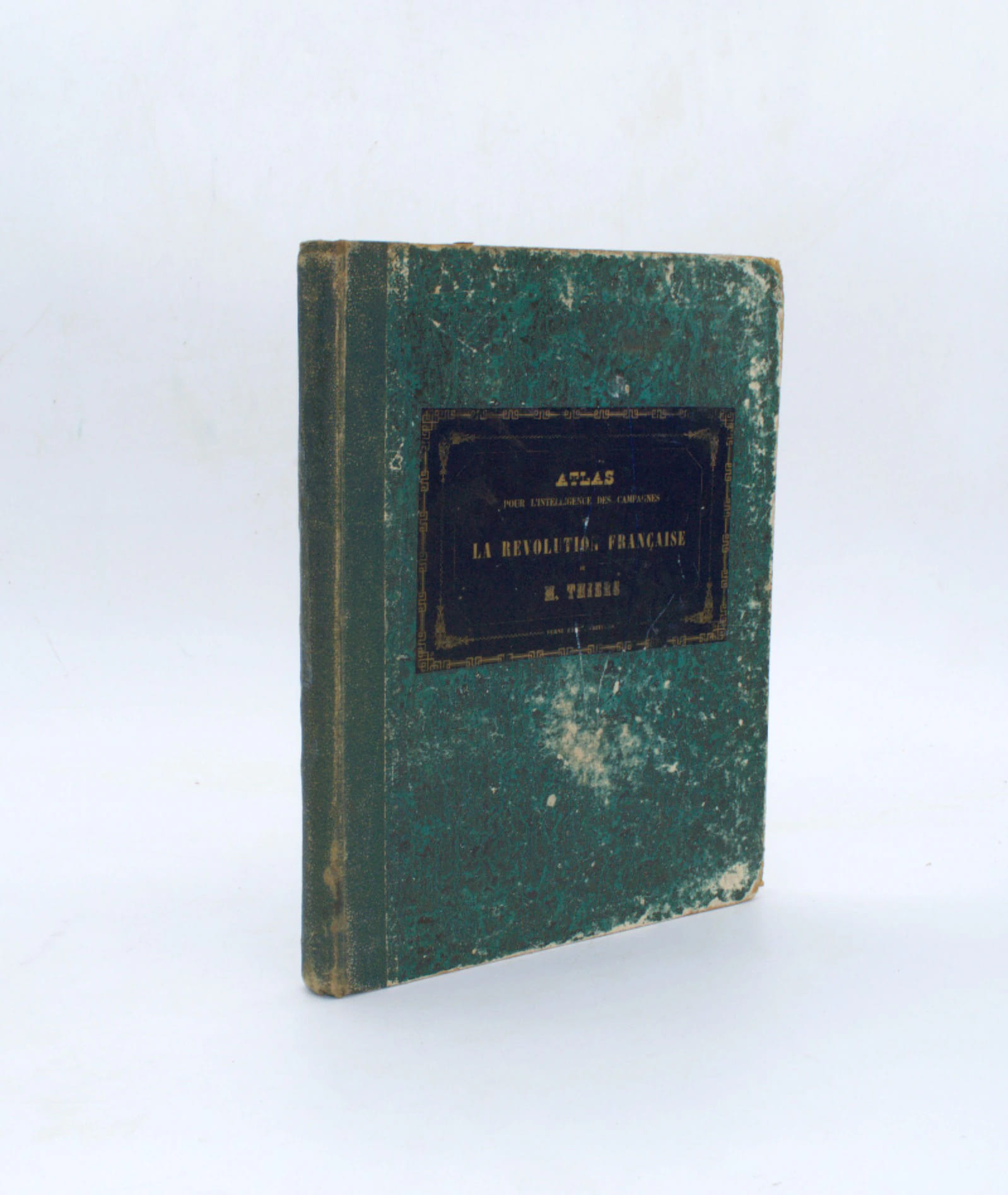
Atlas pour servir à l'intelligence des campagnes de la Révolution française de M. Thiers
Paris, Furne, Jouvet & Cie, 1860, petit in-folio, 2 ff. et 32 cartes et plans à double page. Demi percale époque, étiquette de titre au plat, frottement, coins et champs usés, 1 carte détachée. Complet de ses 32 cartes et plans gravés par Ch. Dyonnet d'après Th. Duvotenay montées sur onglets
Referencia librero : PHO-2587
|
|
|
THIERS, Adolphe (1797-1877):
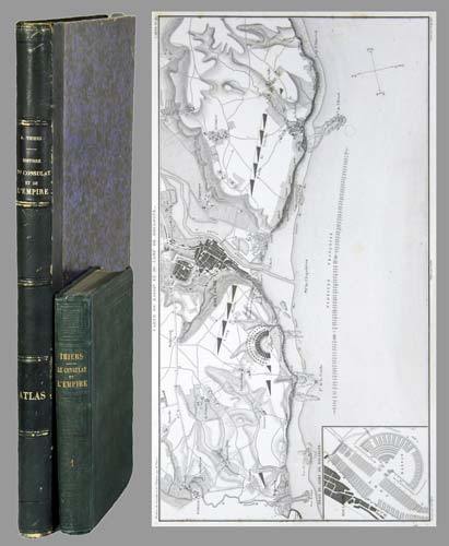
Histoire du Consulat et de l'Empire faisant suite à l'histoire de la Révolution française. 20 tomes + Atlas de l'histoire du Consulat et de l'Empire, dressé et dessiné sous la direction de M. Thiers par MM. Dufour et Duvotenay, gravé sur acier par Dyonnet. Ensemble 21 volumes.
Paris, Paulin-Lheureux, 1845-62, atlas (1866), in-8vo, atlas in-folio, chaque volume env. 500 p., l'atlas comprend 66 cartes dont 7 sur double-page montées sur onglets (deux coloriées), non paginé, toutes les cartes en excellent état + 2 cartes ajoutées: une carte du Nord de l'Italie pour l'étude de la campagne de Napoléon III en1859 par le colonel Suisse F. Lecomte et une carte en fac-similé de la ville de Paris en 1576, reliures en pleine percaline verte, dos et plats estampés de filets à froid, quelques frottements et usures. Atlas in-folio relié en demi-chagrin, dos à nerfs orné de filets dorés, Généralement bel ensemble.
Referencia librero : 71051aaf
|
|
|
Thilo, G
Anschluß d. mecklenburgischen Landesvermessung an d. deutsche Einheitssystem.
Berlin, 1926. M. einigen Tab. 50 S. OBr. Umschl. kaum angestaubt. (Mitteil. d. Reichsamts für Landesaufnahme So.-H. 3).
Referencia librero : 187311
|
|
|
Thilo, G
Unmittelbare Übertragung Schreiberscher in Gauß-Krügersche Koordinaten.
Berlin, 1928. M. einigen Tab. 55 S. OBr. Umschl. kaum angestaubt. (Mitteil. d. Reichsamts für Landesaufnahme So.-H. 5).
Referencia librero : 187313
|
|
|
THOMAS (Charles E.)
Catalogue of the Very Choice and Important Collection of Works on Cartography, Shipbuilding and Navigation, Voyages and Travels, Early Maps and Atlases, Etc.
2 Parts, 16 plates, orig. printed wrappers, 937 lots.
|
|
|
THOMAS (Richard)
Hints for the Improvement of the Navigation of The Severn; Comprising Information which may be applicable to other Navigations.
First edition, 8vo (210 x 140 mm), 35, [1]pp., recent quarter calf, marbled boards, morocco title label to spine. Richard Thomas (1779-1858), civil engineer and surveyor, often referred to as Richard Thomas of Falmouth. This was his first appearance in print, on the verso of the terminal leaf is an advert for "A Chart of the Severn, On a large Scale, from an Actual Survey, Size 6 feet by 2 feet, by Richard Thomas". The former owner of this scarce pamphlet has noted "I have this Chart of the Severn - now with my other charts. 1890. N. W." Skempton, 1629; Not in the British Library.
|
|
|
Thomas Horst.
wereld in kaart, Gerard Mercator en de eerste wereldatlas (1512-1594)
Hardback, 325x245mm, 400p, 200 colour illustrations, Dutch (NL) edition . ISBN 978906153124113. De Atlas van Mercator, de beroemdste atlas ter wereld, werd in 1595 in meerdere fascikels gedrukt en was al voor zijn tijdgenoten een sensatie. Gerard Mercator bedacht niet alleen het woord atlas voor een systematische verzameling van kaarten, maar hij ontwierp ook de zogenaamde Mercatorprojectie die vandaag nog altijd wordt gebruikt. Van de Atlas van Mercator zijn nog slechts weinig volledige exemplaren bewaard en daarvan zijn er maar enkele ingekleurd. In dit boek wordt een inleiding gegeven op leven en werk van de grote kosmograaf en worden alle kaarten uit de 'Editio principissima' die in de Staatsbibliothek zu Berlin wordt bewaard, in waarheidsgetrouwe kleuren gereproduceerd. Het werk is een hommage aan de uitvinder van het moderne wereldbeeld wiens vijfhonderste geboortedag in 2012 wordt gevierd.

|
|
|
Thomas Horst.
wereld in kaart, Gerard Mercator en de eerste wereldatlas (1512-1594)
, Mercator/ Mercatorfonds , 2011 Hardback, 325x245mm, 400p, 200 colour illustrations, Dutch (NL) edition . ISBN 9789061531241.
Referencia librero : 30884
|
|
|
THOMAS MOULE
Engraved Map of Kent. ENGRAVED MAP FINELY COLOURED BY HAND
Steel-engraved map on paper; measuring 8.0 x 10.5 ins (approx. 20.00 x 26.5 cms), FINELY COLOURED BY HAND; attractively mounted in bevelled-edge steel-grey card with bevelled edges, a very good, bright, clean copy. The map is enclosed by an elaborate pictorial border incorporating four coats-of-arms and various other symbolic figures, and includes three charming vignettes of Greenwich Hospital, Rochester and Dover.

|
|
|
THOMPSON (John) Engineer.
Plans & Sections of the Fleetwood-on-Wyre & Clitheroe Railway 1845.
Oblong folio (380 x 510 mm), title page followed by 13 plans, scale, 1 inch to 900 feet, 1 inch to 100 feet; enlargements: 1 inch to 6 chains, unfortunately all leaves and wrappers badly water damaged.
|
|
|
Thomson, John,
Map of ATTICA Greece - TURKISH DOMINIONS in EUROPE- 2 maps on one sheet
Edinburgh: John Thomson 1815. 1st Edition . No Binding. Fine. Original hand-colour fine scarce unfolded copy 490 X 700 From John Thomsons New General Atlas 1817 beautifully hand-coloured on thick paper <br/> <br/> John Thomson unknown
Referencia librero : Map697
|
|
|
Thomson, John,
Map of AUSTRIAN DOMINIANS
Edinburgh: John Thomson 1814. 1st Edition . No Binding. Fine. Original hand-colour fine scarce unfolded copy 510 x 610 From John Thomsons New General Atlas 1817 beautifully hand-coloured on thick paper <br/> <br/> John Thomson unknown
Referencia librero : Map710
|
|
|
Thomson, John,
Map of BRITISH INDIA - Southern Part
Edinburgh: John Thomson 1816. No Binding. Fine. Original hand-colour fine scarce unfolded copy 510 X 610 From John Thomsons New General Atlas 1817 beautifully hand-coloured on thick paper. <br/> <br/> John Thomson unknown
Referencia librero : Map696
|
|
|
Thomson, John,
Map of DENMARK
Edinburgh: John Thomson 1814. 1st Edition . No Binding. Fine. Original hand-colour fine scarce unfolded copy some chipping to top edge 510 x 610 From John Thomsons New General Atlas 1817 beautifully hand-coloured on thick paper <br/> <br/> John Thomson unknown
Referencia librero : Map702
|
|
|
Thomson, John,
Map of ENGLAND
Edinburgh: John Thomson 1814. 1st Edition . No Binding. Fine. Original hand-colour fine scarce unfolded copy 610 x 510 From John Thomsons New General Atlas 1817 beautifully hand-coloured on thick paper <br/> <br/> John Thomson unknown
Referencia librero : Map699
|
|
|
Thomson, John,
Map of EUROPE
Edinburgh: John Thomson 1817. No Binding. Fine. Original hand-colour fine scarce unfolded copy 470 X 540 From John Thomsons New General Atlas 1817 beautifully hand-coloured on thick paper <br/> <br/> John Thomson unknown
Referencia librero : Map686
|
|
|
Thomson, John,
Map of FRANCE in Provinces
Edinburgh: John Thomson 1814. No Binding. Fine. Original hand-colour fine scarce unfolded copy small damp stain to top margin and professional small repair to edge 510 X 580 From John Thomsons New General Atlas 1817 beautifully hand-coloured on thick paper. <br/> <br/> John Thomson unknown
Referencia librero : Map683
|
|
|
Thomson, John
Map of FRANCE in Departments
Edinburgh: John Thomson 1817. 1st Edition . No Binding. Fine. Original hand-colour fine scarce unfolded copy 510 X 620 From John Thomsons New General Atlas 1817 beautifully hand-coloured on thick paper <br/> <br/> John Thomson unknown
Referencia librero : Map693
|
|
|
Thomson, John,
Map of GERMANY- South of the Mayne
Edinburgh: John Thomson 1816. Hardcover. Fine. Original hand-colour fine scarce unfolded copy small damp stain to top edge 510 X 610 From John Thomsons New General Atlas 1817 beautifully hand-coloured on thick paper <br/> <br/> John Thomson hardcover
Referencia librero : Map690
|
|
|
Thomson, John,
Map of NORTH AMERICA
Edinburgh: John Thomson 1817. 1st Edition . No Binding. Fine. Original hand-colour fine scarce unfolded copy small damp stain to bottom edge 510 X 610 From John Thomsons New General Atlas 1817 beautifully hand-coloured on thick paper <br/> <br/> John Thomson unknown
Referencia librero : Map688
|
|
|
Thomson, John,
Map of PERSIA
Edinburgh: John Thomson 1814. 1st Edition . No Binding. Fine. Original hand-colour fine scarce unfolded copy one edge sl. stain 470 x 520 From John Thomsons New General Atlas 1817 beautifully hand-coloured on thick paper <br/> <br/> John Thomson unknown
Referencia librero : Map705
|
|
|
Thomson, John,
Map of PRUSSIAN DOMINIANS
Edinburgh: John Thomson 1816. No Binding. Fine. Original hand-colour fine scarce unfolded copy 490 X 620 From John Thomsons New General Atlas 1817 beautifully hand-coloured on thick paper. <br/> <br/> John Thomson unknown
Referencia librero : Map694
|
|
|
Thomson, John,
Map of SCANDINAVIA
Edinburgh: John Thomson 1817. 1st Edition . No Binding. Fine. Original hand-colour fine scarce unfolded copy 620 X 490 From John Thomsons New General Atlas 1817 beautifully hand-coloured on thick paper <br/> <br/> John Thomson unknown
Referencia librero : Map687
|
|
|
Thomson, John
Map of SPANISH NORTH AMERICA - Southern Part. Inc. Jamaica
Edinburgh: John Thomson 1816. 1st Edition . No Binding. Fine. Original hand-colour fine scarce unfolded copy small damp stain to top margin 510 X 610 From John Thomsons New General Atlas 1817 beautifully hand-coloured on thick paper <br/> <br/> John Thomson unknown
Referencia librero : Map682
|
|
|
Thomson, John,
Map of SPAIN & PORTUGAL
Edinburgh: John Thomson 1817. 1st Edition . No Binding. Fine. Original hand-colour fine scarce unfolded copy 530 x 670mm From John Thomson's New General Atlas 1817 beautifully hand-coloured on thick paper wide margins <br/> <br/> John Thomson unknown
Referencia librero : Map684
|
|
|
Thomson, John,
Map of THE BRITISH CHANNEL
Edinburgh: John Thomson 1814. No Binding. Fine. Original hand-colour fine scarce unfolded copy 520 X 650 From John Thomsons New General Atlas 1817 beautifully hand-coloured on thick paper <br/> <br/> John Thomson unknown
Referencia librero : Map689
|
|
|
Thomson, John,
Map of TURKEY in ASIA
Edin`: John Thomson 1817. 1st Edition . No Binding. Fine. Original hand-colour fine scarce unfolded copy one edge sl. Stain 410 x 520 From John Thomsons New General Atlas 1817 beautifully hand-coloured on thick paper <br/> <br/> John Thomson unknown
Referencia librero : Map706
|
|
|
Thomson, John,
VENETIAN STATES Map
Edinburgh: John Thomson 1816. 1st Edition . No Binding. Fine. Original hand-colour fine scarce unfolded copy minor damp stain 510 X 610 From John Thomsons New General Atlas 1817 beautifully hand-coloured on thick paper <br/> <br/> John Thomson unknown
Referencia librero : Map685
|
|
|
THONE Karl -
Karte und kompass.
Bern, Hallwag, (anni 50), 16mo legatura mezza tela editoriale con copertina illustrata, pp. 80 con 50 illustrazioni n.t.

|
|

 Recibir por correo electrónico
 Descargar en documento PDF
 Flujo RSS
 Link permanente


