|
|
|
Universo (L'). Rivista mensile. Anni V-XVII. (V: NN. 1-7, 9-12; VI, VII, VIII: NN. 1-12; IX: NN. 7-12; X: NN. 1-6, 8, 10, 11; XI: NN. 1-12; XII: NN. 1-12; XIII: NN. 1-12; XIV: NN. 7-12; XV: NN. 1-12; XVI: NN. 1-12; XVII: NN. 1-12. (Molti articoli di argomento locale su: Osservatorio di Arcetri; Istituto di Ottica di Firenze; le 3 piante iconografiche più antiche di Firenze; origini di Firenze, ecc. Segnaliamo anche: note geologiche ai terremoti bolognesi; il parco Naz. d'Abruzzo; le Paludi Pontine; Rodi, città dei Cavalieri; scavi in Tripolitania; ripopolamento della Palestina con gli Ebrei; grafia europea nella traduzione dei nomi cinesi; recenti studi sull'Atlantide; antiche carte nautiche olandesi; primo volo al Polo Nord del Comandante R.E. Byrd; tunnel della Manica...).
Firenze, Istituto Geografico Militare, 1924-1936, fasc. 140 complessivi (9 annate complete + altri 32), raccolti in voll. 24, copp. fittizie (ma conservate le br. edit. dei fasc.), pp. 571, da 617 a 947 - 1064 - 1072 - 1407 - da 617 a 1321 - 729, da 765 a 888, da 995 a 1067 - 1347 - 742 - da 507 a 978 - 1089 - 1106 - 960. Numerose ill. in b.n. e cartine. Ampia bibliografia (incluse le riviste) e notiziario. Alcune adesioni. Contributi di: R. Almagià, R. Biasutti, C. Basevi, C. Casamorata, A. Loperfido, G. Pullè G. Abetti, E. Masini, G. Boffito, L. Arditi, A. Neppi Modona, L. Giannitrapani, L. Cipriani, ecc. Interessante rivista che tratta di geografia, esplorazioni, etnologia, cartografia, topografia, geologia, astronomia, ecc; numerosi articoli monografici su Oriente (Giappone, Manciuria, Cina, India), America Latina (Brasile, Perù, Bolivia, Cile, Argentina, ecc.), U.R.S.S. e sulle colonie italiane (Libia, Eritrea, Somalia); resoconti di Convegni e congressi: I Convegno Naz. Etrusco a Firenze (1926), II/III Assemblea dell'Unione Astronomica Internaz. (1925, 1928), Congresso Internaz. di Geografia a Cambrige (1928), XIX Riunione della Società Italiana per il progresso delle Scienze (1930), Congresso di studi coloniali di Firenze (1931), ecc.

|
|
|
Valli di Biella e di Gressoney Alta Valsesia.
Volume di cm. 47 contenente una piccola carta generale d'insieme e 36 carte a doppia pagina, ciascuna di cm. 45 x 55 ed applicate su tela. Legatura coeva in mezza pelle con titoli in oro al piatto. Qualche scoloritura al piatto anteriore, peraltro buona conservazione. Interessante insieme, verosimilmente non editoriale e composto da un collezionista del tempo. L'unione di tutte le tavole compone un'ideale, grandissima carta topografica del territorio citato nel titolo.

|
|
|
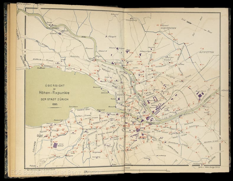
Verzeichniss der Höhen-Fixpunkte im Gebiete der Stadt Zürich. Herausgegeben vom Vermessungsamt der Stadt Zürich
Zürich, Museumsgesellschaft Zürich, 1895. 8°. 166 S., mit vielen ganzseitigen Abbildungen. Halbleinenband mit handschriftlichem Bibliotheks-Rückenschild.
Referenz des Buchhändlers : 4834DB
|
|
|
Verhandlungen d. Conferenz d. permanenten Commission d. internationalen Erdmessung. Red. v. A. Hirsch. Verhandl. 1888 (Salzburg), 1890 (Freiburg i.Br.), 1891 (Florenz), 1893 (Genf).
Berlin, Reimer, 1889-94. 4°. M. gef. Ktn. u. Taf. OU. beschmutzt.
Referenz des Buchhändlers : 220319
|
|
|
Verhandlungen d. östereichischen Gradmessungs-Kommission. Protokolle über Sitzungen, welche von 17.12.1886-19.10.1911 abgehalten wurden.
Wien, Selbstvlg. d. Öster. Gradmessungs-Komm. 1889-1912. In 2 Bibl.-Einbdn. Rücken stockfl. St. u. Sign. a. Tit.
Referenz des Buchhändlers : 220209
|
|
|
VERZEICHNIS DER VOR 1830 ERSCHIENENEN KARTEN UND PLÄNE. (in der) Stadtbibliothek Braunschweig.
Braunschweig, 1984. 4to. 166 (eig. 167) S. Kart. (gebräunt, mehr. Bibl.-Stempel).
Referenz des Buchhändlers : 1320982
|
|
|
Verzeichniss der Höhen-Fixpunkte im Gebiete der Stadt Zürich. Herausgegeben vom Vermessungsamt der Stadt Zürich
Zürich, Museumsgesellschaft Zürich, 1895. 8°. 166 S., mit vielen ganzseitigen Abbildungen. Halbleinenband mit handschriftlichem Bibliotheks-Rückenschild. + Wichtig: Für unsere Kunden in der EU erfolgt der Versand alle 14 Tage verzollt ab Deutschland / Postbank-Konto in Deutschland vorhanden +, 4834DB|4834DB_2 [2 Warenabbildungen]
Referenz des Buchhändlers : 4834DB

|
|
|
Veröffentlichungen d. Instituts für Erdmessung. H. 6, 8-10, 14.
Bamberg, Meisenbach & Co. 1951-52. M. Taf. u. Abb. Leicht bestoßen.
Referenz des Buchhändlers : 220183
|
|
|
Viaggio nelle isole Baleari e Pitiuse
16°, cm 15x9, due volumi in un tomo di pp. 179, (1); 180; legatura in mezza pelle coeva con fregi e titolo in oro al dorso, qualche lievissimo segno del tempo all'esterno, minime fioriture alle pagine per la qualità della carta, peraltro ottimo esemplare. Prima edizione napoletana adorna di 6 rami, tra cui una carta geografica e 3 incisioni in coloritura coeva. L'autore fu un prete cattolico che visse molti anni a Corfù e pubblicò le relazioni dei viaggi che effettuò in numerose isole del Mediterraneo.

|
|
|
Viaggio nelle isole italiane con Guy de Maupassant, A. Valéry, A. Dumas, E. Renan
4°, pp. 57, 32 tavole a colori, rilegatura editoriale, titolo in oro al piatto e dorso, sovracoperta editoriale illustrata a colori, custodia editoriale, Esemplare come nuovo

|
|
|
VIE DEL MONDO . [tutti i numeri pubblicati: 1987 - 1992].
(Codice VA/1106) Nuova testata, edita in collaborazione con National Geographic Society, che continuò la tradizione dell'antica "LE VIE DEL MONDO". Raccolta completa di tutto il pubblicato, dal n° 1 anno I (luglio 1987) all'ultimo numero con il "commiato" del direttore (Anno VI - settembre 1992). In totale 63 riviste, tutte complete di copertine e in ottima conservazione. ~~~ SPEDIZIONE IN ITALIA SEMPRE TRACCIATA

|
|
|
Weltatlas. Die Staaten d. Erde u. ihre Wirtschaft.
Leipzig, Enzyklopädie, 1957. 4°. M. 1 beilieg. Legende u. 105 farb. Ktn. 58 S. Reg. OLwd.
Referenz des Buchhändlers : 123947
|
|
|
Westindien. Central-America und das nördliche und nordwestliche Süd America. Nueva Granada und Venezuela. Bearb. von Heinrich Kiepert. Redact. von A. Gräf. Maßstab 1:6 000 000.
Weimar, Geograph. Inst. o. J. (ca 1860). Grenzkol. Stahlst., mit Erläut. u. Glossar, 51 x 62 cm. Breitrand. Mittelfaltung. Mit hinterlegten Randläs. Im w. Rand leichte Benutzunsspuren. Im Kartenbild einige Fingerfl. Rücks. leicht verstaubt mit wenigen kl. Braunspuren. Insges. sehr guter Zustand. Die Karte umfasst das Gebiet vom Meerbusen von Mexico, der Karibik bis zum Beginn von Ecuador.
Referenz des Buchhändlers : KART0040

|
|
|
World directory of map collections. Comp. by the Section of Geography a. Map Libraries. Ed. by J.A. Wolter a.o. 2nd ed.
München, Saur, 1986. XLIII, 405 S. OPp. (IFLA Publ. 31).
Referenz des Buchhändlers : 608948
|
|
|
Zeitschrift des Deutschen und Österreichischen Alpenvereins. Beilage zu Bd. 21, Jg. 1890.
O.O. (Wien/Innsbruck/München), Vlg. des ZdD&OEAV, 1890, in-8vo, 1 gefalt. Karte + 6 Panoramen + 1 Kartenskizze + 1 Situationsplan + 17 Repro.-Abb. (alles aufgezogen auf Leinen) Hldr. - Schuber.
Referenz des Buchhändlers : 46520aaf
|
|
|
Zeitschrift d. Vereins d. Höheren Bayerischen Vermessungsbeamten. Bd. 2, 4, 7, 10, 12-15, 18-23, 26.
Würzburg u. München, 1898-1927. M. Ktn. u. Abb. In 14 Hlwdbdn. Teilw. St. u. Sign. a. Tit. Bd. 18 Einbd. Wasserschaden. Fehlt: Bd. 22 TI.
Referenz des Buchhändlers : 217243
|
|
|
Zona Alta Roia - Gessi carta alla scala 1: 50.000 con indicazione delle strade ordinarie, a fondo ufficiale con manutenzione regolare, strade a fondo naturale e non sempre praticabili; ponti; acquedotti; canali; liniti di stato, di confine; case in muratura, baracche, opifici, centrali elettriche, chiese, stazioni radiotelegrafiche, boschi, vigneti, ecc.
carta telata a colori di dimensioni cm. 166 X 145. Ottima la conservazione.
|
|
|
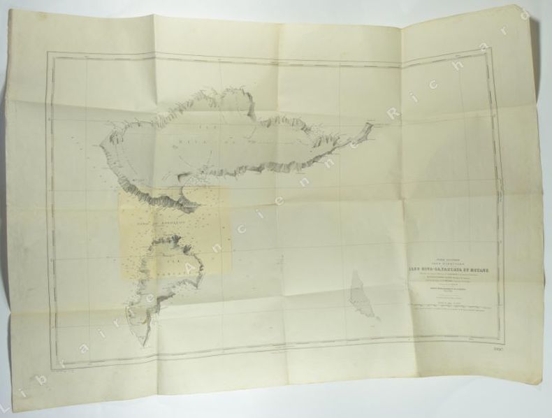
Îles Hiva-Oa, Tahuata et Motane. Plan levé en Janvier 1882 par M. M. Laurent Lieutnant de Vaisseau. Le Golleur, Barthe, Lauwick. Enseignes de Vaisseau. Sous la diretion de Mr. Ménard, Capitaine de Frégate. Commandant le Hugon. Service Hydrographique de la Marine, Paris, 1884.
s. l.(Paris), 1943 - 1950. 1 carte géographique 1050 x 740 mm, imprimé en noir et blanc, 1 correction (également imprimé) au format 179 x 220 mm collée, 1 tache de rousseurs sur la partie imprimée, plusieurs claires piqûres de rousseurs par ailleurs, traces de pli. Bon exemplaire.
Referenz des Buchhändlers : 5468
|
|
|
Österreich. (Bearbeitet von Karl Klammer). Masstab: 1: 600.000.
Wien, Druck und Verlag der Kartogr. Anstalt G. Freytag & Berndt, s.d. (primi del sec. XX). Grande carta a col. (cm. 73x100) piegata entro br. edit. (cm. 15x25), con riquadro in alto a destra: Hauptverkehrswege nach Österreich. Mancanze alla br., minimi strappetti, restaurati al verso, lungo le piegature.

|
|
|
“Carta del Presidio di Firenze”.
Firenze, I.G.M., 1893. Scala di 1: 25.000. Cm. 53 x 90. In sezioni riportate su tela. Ripiegata a soffietto.
|
|
|
“Carta di Firenze e Dintorni”.
Firenze, I.G.M., 1909. Scala di 1: 25.000. Cm. 62 x 103. In sezioni riportate su tela. Ripiegata a soffietto.
|
|
|
“Carta di Firenze e Dintorni”.
Firenze, I.G.M., 1920. Scala di 1: 25.000. Cm. 100 x 75. In sezioni riportate su tela. Ripiegata a soffietto. Alcune sezioni semistaccate.
|
|
|
( COLLECTIF )
CATALOGUE DES CARTES ET OUVRAGES QUI COMPOSENT L'HYDROGRAPHIE FRANÇAISE
Paris Imprimerie Nationale 1951 in 8 (23,5x15,5) 1 volume broché, XV et 332 pages, et un feuillet volant d'errata, Service hydrographique de la marine, N°7. Bel exemplaire ( Photographies sur demande / We can send pictures of this book on simple request )
Referenz des Buchhändlers : 48574
|
|
|
( GENERAL MAP OF THE UNITED STATES )
Philips series of travelling maps. UNITED STATES
London - Liverpool George Philip & Son. No date (circa 1890) 1 carte entoilée et pliée d'époque fin XIXème, présentée sous chemise de percaline rouge de l'éditeur (17x11,5 cm), plat supérieur titré en lettres dorées. Carte lithographique en couleurs des Etats-Unis d'Amérique (Color lithographic map of the UNITED STATES), par J. Bartholomew F. R. G. S. chacun des états dans une couleur différente avec contours (56x65,5 cm). Bel exemplaire ( Photographies sur demande / We can send pictures of this book on simple request )
Referenz des Buchhändlers : 26787
|
|
|
( VOSGIEN ). PARISOT Valentin.
Dictionnaire géographique universel de Vosgien, totalement refondu... par V. Parisot...
Paris , Baudouin frères, 1828 ; in-8°, pleine basane fauve flammée de l' époque, dos lisse orné de palettes dorées alternant avec des fleurons dorés, titre doré sur étiquette de maroquin citron, tranches jaunes; X, (2), 739pp., ( 1)p.( texte sur 2 colonnes) ; 6 cartes dépliantes hors texte des continents et 1 mappemonde.
Referenz des Buchhändlers : c7084
|
|
|
(AA.VV.)
Viaggio nella Geografia. (Testi di: J.-P. Ayé - U. Bonapace - I. Caraci - Berardo Cori - G. Corna Pellegrini - G. ferro - M. Fondi - L. Gambi - G. Gobbi - F. Maraini - F. Quilici - E. Turri - A. Zorzi).
Milano, T.C.I., 1985, in-4, cartone editoriale, pp. 192. Con numerose illustrazioni a colori. (“Un'esplorazione” che spazia dall'alta Valsesia al Grand Canyon; dagli Xavante del Mato Grosso alla “città ideale” di San Gimignano; dalla carta topografica alla Compagnia delle Indie...).
|
|
|
(Americana).
Catalogue of Americana, Voyages and Travel, Atlases and Maps, Autograph Letters and Historical Documents.
London, Sotheby, 1965 & 1968, 2 cataloghi, in-8, br., pp. 54, 123. Con 4 tavv. in b.n. e prezzi di stima.
|
|
|
(ATLAS) MERIAN.
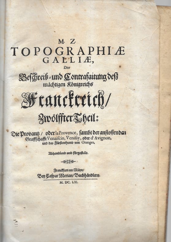
Topographie de la Gaule. Provence.
1 plaquette petit in-folio comprenant 9 cartes, plans et vues. Broché Bon Frankfurt Merian 1661 1 plaquette petit in-folio
Referenz des Buchhändlers : 7870
|
|
|
(Autore non indicato)
Alpi Ligure : 5 idee di circuiti escursionistici a piedi - La via crinale MTB dalle alpi al Mare - Presentazioni delle Alpi Ligure - Carta Alpi Ligure: Itinerari escursionistici transfrontalieri
Opuscoli. Le Alpi Ligure: un depliant, una carta più volte ripiegata, un libretto di presentazioni, un opuscolo, tutti in triplice lingua, francese, italiana ed inglese. Con ill. e imm. fot. a col. e in b.n. n.t.

|
|
|
(Autore non indicato)
Medioevo - Carta stradale delle Abbazie d'Italia
Carta stradale più volte ripiegata con ill. a col. n.t.

|
|
|
(Autore non indicato)
Sicilia Automobilistica Turistica con le distanze chilometriche
Opuscolo pieghevole con mappa della Siclia e delle relative strade, distanze kilometriche dai capoluoghi e breve descrizione dei principali comuni siciliani. Pubblicato a cura della ditta "Cutrano", vendita elettrodomestici in Palermo (32h).
|
|
|
(BASO Giuliana) -
Catalogo dei documenti fotografici. Cartografia storica (1).
Venezia, Cento Servizi Interpartimentale di Cartografia e Fotogrammetria “Nani Valle” - 1993, 4to brossura, pp. 201 con numerosissime illustrazioni nel testo.

|
|
|
(BLAEU Johannis)
Istria olim Iapidia.
Bella carta geografica incisa in rame, formato lastra 380x500 mm. + margini, contorni acquarellati . Cartiglio in alto a destra e scala di miglia nove italiane in basso a sinistra, entrambi in bella coloritura coeva. Testo latino al verso. Tratta dall'edizione latina dell'Atlas Novus pubblicato ad Amsterdam nel 1640 ca. La carta è in cornice di legno scuro di epoca metà '900, con doppio vetro in modo da poter leggere anche il testo. Rinforzo alla piegatura centrale sul verso, ma buon esemplare.
|
|
|
(Carta della frontiera orientale).
Disponibili 5 fogli su 6 (manca il foglio II, sud). Istituto geografico militare, 1914.
Riproduzione sistema Gliamas. Ripiegata a soffietto, in sezioni riportate su tela. In evidenza: i laghi lombardi, il Golfo di Trieste, con Trieste, Capodistria, Pirano, Umago e parte dell'Istria. Con doppia legenda.
|
|
|
(CARTOGRAFIA - GEOGRAFIA)
Scoperte Artiche Atlante. Conte Francesco Miniscalchi Erizzo. Cartellina con legacci e scritta in oro al centro “Scoperte Artiche Atlante”. All’interno due grandi carte geografiche: Carta delle Terre Polari Artiche dalla Baia di Baffin all’Isola di Baring - Carta delle Terre Polari Artiche.
Cartellina di cm. 26,5 con legacci e scritta in oro al centro “Scoperte Artiche Atlante”. All’interno due grandi carte geografiche: Carta delle Terre Polari Artiche dalla Baia di Baffin all’Isola di Baring corretta sopra documenti ufficiali al 1853 dal Conte Francesco Miniscalchi Erizzo (cm. 60x90), leggermente colorata; Carta delle Terre Polari Artiche tratta da quella dell’Ammiraglio Inglese e corretta al 1853 dal Conte Francesco Miniscalchi Erizzo (cm. 60x90), leggermente colorata. Il Conte F. Miniscalchi compiuti i primi studi nel collegio di Parma e in quello di Desenzano del Garda, li completò nel liceo di Verona. La passione per i viaggi gli fu trasmessa dai genitori, con i quali percorse gran parte d’Italia già nel 1830. Qualche anno più tardi (1834), autonomamente, visitò la Svizzera, la Germania, la Danimarca, e poi (1837) la Francia e l’Inghilterra, traendo stimoli per una visione più aperta e moderna della propria classe sociale: fu infatti esponente di spicco di quella aristocrazia non parassitaria, ma direttamente impegnata nell’amministrazione e nell’ammodernamento delle proprie tenute agricole, secondo la migliore tradizione illuministica. Appassionato di studi geografici e di cartografia, il M. dette un impulso notevole alle conoscenze geografiche in Italia con un volume incentrato su Le scoperte artiche (Venezia 1855). Lo studio è ancora oggi utile sia per l’ingente materiale documentario raccolto sia «per alcune osservazioni etnologiche sui lapponi e i loro contatti con il mondo ugro-finnico, e più in generale, uralo-altaico». A parte i pregi sul piano dell’informazione e dell’erudizione, non mancano al M. anche schiette doti narrative, per l’emozione che riesce a far vibrare nel racconto delle spedizioni più sfortunate, e per la fiducia, sincera se pur non scevra d’ingenuità, dimostrata verso i progressi della scienza. Axs

|
|
|
(CARTOGRAFIA - TOPOGRAFIA - MANUALI GIUSTI) VALLECCHI, Ottavio C.
Esemplari di Disegno Cartografico graduati e coordinati all’insegnamento della Geografia nelle scuole secondarie.
Livorno, Tipografia Raffaello Giusti, 1905. Terza edizione. Volume appartenente alla Collana: Manuali Giusti. In 16mo (cm. 15,5); legatura originale in tutta tela editoriale di colore rosso con titoli in nero al piatto e al dorso; pp. XII + 64 tavole illustrate a pagina doppia con esempi di disegno cartografico di coste e spiaggie, mare, fiumi, laghi, isole, montagne, ecc. Ottima copia. Ax
|
|
|
(CARTOGRAPHY - 16TH CENTURY GLOBES, FACSIMILES). WOODWARD, DAVID
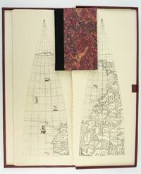
THE HOLZHEIMER VENETIAN GLOBE GORES OF THE SIXTEENTH CENTURY
Madison Wisconsin: The Juniper Press 1987. No. 116 OF 150 COPIES. 632 x 250 mm. 25 x 9 3/4". 2p.l. 19 1 pp. <br/> Black quarter buckram over maroon marbled paper boards spine lettered in gilt. In a custom maroon buckram clamshell box. WITH 24 FACSIMILE GLOBE GORES. Signed by Woodward on the limitation page. Just a hint of use to the box booklet corners just a touch rubbed otherwise as new.<br/> <br/> This sizable attractive publication reproduces one of the largest complete sets of 16th century globe gores. Dating from around 1574 the original gores which when assembled would make a globe measuring just under 70 centimeters in diameter have been attributed to brothers Livio and Giulio Sanuto Venetian cartographers and engravers. Little is known about the gores' origin; the accompanying essay suggests they may have never made it to the final stages of publication and production possibly stopped by an outbreak of plague. This facsimile was created from the only extant set in the collection of Arthur Holzheimer 1932-2025 and was produced by his research foundation along with the Newberry Library. The gores are accompanied by a booklet by noted cartography scholar David Woodward 1942-2004 which provides background and the evidence supporting the attribution of the gores to the Sanuto brothers. The Juniper Press unknown
Referenz des Buchhändlers : ST20505-11
|
|
|
(DALMAZIA).
Lotto di 18 cartoline con vedute delle antiche città dalmate nella cartografia dei sec. XVI e XVII: Ragusa, Fiume, Dolcigno, Curzola, Sebenico, Spalato, Cattaro, Pola, ecc., oggi città iugoslave. Tutte in b.n., nel formato cm. 11 x 16.
Zagrabia, anni '60 del Novecento.
|
|
|
(DUVOSQUEL) DIERKENS, A. - LOIR, Chr. - MORSA, D. - VANTHEMSCHE, G.
Villes et villages. Organisation et représentation de l'espace.- Mélanges offerts a Jean-Marie Duvosquel a l'occasion de son soixante-cinquieme anniversaire. (2 volumes en coffret).
2 volumes grand in-8° (24x16 cm), 1018 pages, abdt ill.en n&b et couleurs, brochés sous étui carton illustré. COMME NEUF ! [FL-3]
|
|
|
(GOSS John) -
Blaeu’s the Grand Atlas of the 17th Century World.
London, Studio Editions, 1990, 4to tutta tela editoriale con sovraccopertina illustrata a colori, pp. 224 completamente illustrato a colori. In stato di nuovo.
|
|
|
(Graf, J. H.).
La topographie de la Suisse 1832 - 1864. Histoire de la carte Dufour. Publiée par le Bureau Topographique Fédéral.
Berne, Imprimerie Staempfli & Cie. 1898, 250x165mm, frontispice, VIII - 270pages, reliure percaline verte de l’éditeur. Auteur, titre dorés et ornementations à froid au dos et sur le plat supérieur. Très bel exemplaire.
Referenz des Buchhändlers : 97512

|
|
|
(LEAF BOOK - CARTOGRAPHY, NORTHEASTERN ITALY). THROWER, NORMAN J W
A LEAF FROM THE MERCATOR-HONDIUS WORLD ATLAS EDITION OF 1619 WITH AN ESSAY BY NORMAN J. THROWER
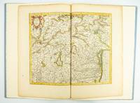
Fullerton California: Stone & Lorson 1985. ONE OF 89 COPIES in quarter vellum of a total edition of 115. 490 x 325 mm. 19 1/4 x 13". viii 23 1 pp. 1 leaf. <br/> Publisher's quarter vellum over gray paper boards covers with device in gilt smooth spine lettered in gilt. In just slightly chafed black buckram slipcase. WITH A MAP FROM THE ORIGINAL 1619 ATLAS bound in with period hand coloring. Map 293 "Tarvisina Marchia Et Tirolis Comitatus". De Hamel & Silver "Disbound and Dispersed" 186. One corner a bit bumped otherwise the main volume flawless; the map edges a bit browned and just slightly frayed a few light spots but still excellent with good color and strong general appeal.<br/> <br/> This attractive oversized production includes an original map of an important region of northeastern Italy taken from the 1619 edition of the Mercator-Hondius atlas. A pioneer in commercial cartography and a founder of the Netherlandish school of cartography and geography Mercator 1512-94 produced maps used around the world that were informed by his brilliant "Mercator Projection" which allowed the round Earth to be accurately depicted on a flat map. Near the end of his life he began work on an ambitious cosmography that would contain an account of the creation of the world a description of the universe descriptions of the countries and oceans of the world genealogies and political histories of the several countries and a chronology of the cosmos. Only the account of creation the chronology and maps of the known regions of the world came to fruition. Mercator having died before the work came to press it was completed by his heirs and published in 1595 with 107 maps. Leading Amsterdam map publisher Jodocus Hondius 1563-1612 acquired the plates in 1604 and issued the first Mercator-Hondius "Atlas" in 1606 with 37 maps he had engraved added to the original 107. Teacher and Hondius' brother-in-law Pieter van den Berg wrote the introduction and the descriptive text that appears on the versos of the maps. A 1611 edition increased the number of maps to 150 and another six were added in 1619. The hand-colored map included in our copy depicts the South Tyrol and Veneto regions including Lake Garda Verona Padua and Venice. It is accompanied with an essay by Norman J. W. Thrower 1919-2020 UCLA geography professor and cartographer describing the historical background of the atlas. Joel Silver in "Disbound and Dispersed" tells us that "the physical production of this leaf book is superb from the design by Vance Gerry to the presswork of Patrick Reagh.". Stone & Lorson unknown
Referenz des Buchhändlers : ST20505-12
|
|
|
(LIVIERATOS Evangelos - BERIATOS Lias) -
L'eptaneso nelle carte da Tolomeo ai satelliti.
Venezia, Il Poligrafo, 2004, in-4to brossura con copertina illustrata, pp. 200 con numerosissime illustrazioni in nero e a colori nel testo (Quaderni IUAV)

|
|
|
(Lübecker Nord-Ostsee-Canal-Commission) ..
Denkschrift über den St. Margarethen - Travemünder Nord-Ostsee-Canal.
Progetto per un canale di collegamento tra il Mar Baltico e il Mare del Nord; il canale doveva andare da Travemünde (nel distretto di Lubecca sul Mar Baltico) a Sankt Margarethen (nel distretto di Steinburg), alla foce dell'Elba nel Mare del Nord. Tre carte in busta editoriale: due carte (ripiegate a metà) di cm 40 x 46, ed una (ripiegata in cinque parti) di cm 40 x 100 con il tracciato e il profilo del canale; tutte acquarellate. Buono stato di conservazione.
|
|
|
(MERCATORE)
Gerardo Mercatore. Sulle tracce di geografi e viaggiatori nelle Marche.
Urbania, Edizioni Biblioteca e Civico Museo di Urbania - Il Lavoro Editoriale, 1996. Catalogo pubblicato in occasione della Mostra tenutasi al Palazzo Ducale di Urbania dal 21 luglio al 30 settembre 1996. A cura di Giorgio Mangani e Feliciano Paoli. Introduzione di Marcel Watelet. Con saggi di Attilio Brilli, Bonita Cleri, Daniele Diotallevi, Cosimo Palagiano, Peris Persi. Volume N. 4 appatenente alla Collana: Le collezioni di Casteldurante dai Della Rovere agli Ubaldini - Grafica e Cultura Roveresca. In 4to (cm. 28); brossura originale illustrata con titoli al piatto e al dorso; pp. 191, (1). Con numerose illustrazioni a colori e in bianco e nero nel testo. Al piatto anteriore: Globo terrestre e celeste di Gerardo Mercatore. Ottima copia. PAx
|
|
|
(MILANESI Marica) -
L'Europa delle carte. Dal XV al XIX secolo, autoritratti di un Continente.
Milano, Mazzotta, 1990, 8vo (cm. 27 x 23) brossura con copertina illustrata a colori, pp. 178 completamente illustrato (riproduzioni in nero e a colori di antiche carte geografiche) . Stato di nuovo.

|
|
|
(MODENA - CARTOGRAFIA - TOPOGRAFIA)
Carta Topografica della Provincia di Modena compilata e disegnata dal prof. Antilli Alessandro Insegnate alla Scuola Militare di Modena. Con una tabella della Popolazione e della superficie dei comuni della Provincia e della loro altezza sul livello del mare con l’indicazione degli Uffici di Posta e Telegrafo e Pretura. Con una tavola delle distanze in chilometri per tutti i Comuni della Provincia.
Augusto dal Re incise e Litografia di G. Pizzolotti Modena. Seconda edizione 1895. Bella e dettagliata carta di cm. 50x 63. Intelata all’origine e piegata in 4. Axs

|
|
|
(MONDOLFO Anita) -
L'Africa dalle origini alla metà del secolo XIX. Mostra bibliografica.
Firenze, Biblioteca Nazionale Centrale, 1948, 8vo (cm. 21,5 x 15,5) brossura originale, pp. 80 con una tavola in antiporta e due tavole ripiegate fuori testo e dedica autografa originale firmata dell'Autore.

|
|
|
(Museo Civico di Foggia) -
Mostra grafica di Foggia antica.
Foggia, Ciampoli, 1968, 8vo brossura con copertina illustrata, pp. (10) completamente illustrato.

|
|
|
(PACIFIC NORTHWEST: CARTOGRAPHY)
Map of the Surveyed Portions of Oregon Territory 1852.
Oregon City: Surveyor General's Office 1852. First edition. 15 3/4 x 26 inches. Printed in various shades of green blue red and black. Some light toning long fold-lines else a very good map of a vastly underpopulated Territory.The map above shows the surveyed portion of the Oregon Territory as of October 21 1852. It was prepared by John B. Preston first surveyor general of Oregon."With the establishment of the Oregon Territory on August 14 1848 all grants of claims of land in the territory were nullified. It was not until the passage of the Donation Land Act on September 27 1850 that new provisions were made for acquiring unclaimed land to be based upon government surveys. John B. Preston was appointed first surveyor general of Oregon where he arrived on April 20 1851. On June 7 1851 Preston drove the “starting stake†for the base surveys of the territory at what is today known as the Willamette Stone. The east-west Willamette Base Line and the north-south Willamette Meridian still define surveying and legal land descriptions in Oregon and Washington state.Preston and his crew were able to carry out their surveying and mapping to the extent depicted on this map in just over one year. Each square of the grid termed a section is one mile on each side and includes 640 acres of land—the maximum acreage allowed for a married couple making a claim under the Donation Land Act; a single man could claim up to 320 acres. Thirty-six sections make up a township.The surveyors took careful note of waterways hills prairies and roads. Some recognizable places are already viable communities such as Salem and Lafayette; other communities of the period—Champoeg Fairfield Cincinnati for example—have vanished as meaningful places. All three of those were river landings that were affected by floods channel changes and the eventual disappearance of river transportation. Notably absent from the map is Mission Bottom or Mission Landing the by-then-abandoned site of the Methodist mission of the 1830s and St. Paul on French Prairie. The roads that are mapped include ancient routes such as the California-Oregon Trail which had sections that paralleled both sides of the valley as well as newer roads established in recent years. The roads converging on Salem from the outlying farming districts for instance reflect its recent importance as a mill town powered by the waters of Mill Creek Surveyor General's Office unknown
Referenz des Buchhändlers : 75869
|
|
|

 Per e-mail erhalten
 Als pdf-Dokument herunterladen
 RSS feed
 Permanenter link


