|
Moinot I.
LEVES DE PLANS A LA STADIA. Notes pratiques pour études de tracés.
(Codice OS/0208) In 4° (28 cm) IV-83 pp. Edition originale, 9 planches dépliantes et nombreuses figures dans le texte. Anciennes notes marginales (en italien), peu de soulignures. Marges non rognées. Manque d'un coin blanc (ne touchant pas le texte). Toile moderne, plat original gardé. Très bon état. ~~~ SPEDIZIONE IN ITALIA SEMPRE TRACCIATA

|
|
|
Molinari Maurizio
Atlante del mondo che cambia. Le mappe che spiegano le sfide del nostro tempo
br. Il mutamento è una costante fondamentale del nostro mondo, tanto sul piano geopolitico quanto negli aspetti economici e sociali, ma all'inizio del terzo millennio la velocità e la frequenza di queste trasformazioni ha raggiunto un'intensità inedita. Da questa consapevolezza, e dalla necessità di comprendere quanto accade, nasce l'idea di questo libro: unire lo strumento tradizionale della mappa alla ricerca sui dati per descrivere il mondo che cambia. Individuando otto trend - dai conflitti combattuti a quelli latenti, dall'emergenza climatica alle discriminazioni razziali, dalle diseguaglianze sociali al sovranismo, passando per il fenomeno migratorio, la parità di genere e l'emergenza sanitaria legata all'esplodere delle epidemie - Molinari racconta il mutamento e le sue conseguenze profonde, con l'acutezza dell'osservatore esperto e la lucidità del grande giornalista, mettendo a punto uno strumento prezioso per chiunque voglia esplorare il futuro.

|
|
|
Moll, Herman
CANAAN PALESTINE OR THE HOLY LAND: DIVIDED INTO THE TWELVE TRIBES OF ISRAEL
Map. 1st Edition. Framed and matted. 9 X 7.5 inches. In English. An original copper-engraved map of Palestine by the legendary cartographer Herman Moll circa 1709, and later hand-colored. Herman Moll (1654 1732) , was a London cartographer, engraver, and publisher
. Moll's exact place of origin is unknown, although his birth year is generally accepted to be the year 1654. He moved to England in 1678 and opened a book and map store in London
Moll's maps were in his lifetime and after very influential, and are still among the most sought after aesthetic engravings in the history of cartography. (Wikipedia, 2017) OCLC lists 1 copy worldwide (Bayerische Staatsbibliothek) . Also digitized at NLI, see: Laor 499. Very good condition. (ART-26-5)

|
|
|
MOLLAT Michel ADAM Paul ( Colloque présenté Par )
Les Aspects Internationaux De La Découverte Océanique Aux XVe et XVI è Siècles
Paris S.E.V.P.E.N 1966 In-8 386 pp, illustrations comprises dans la pagination
Referenz des Buchhändlers : 24735
|
|
|
Mollo Tranquillo
Athenae cum portibus Piraeeo et Phalereo et regione adjacente
Incisione su rame, foglio 472 x 380 mm (420 x 310 mm alla battuta) a pieni margini su carta vergata. Carta della città di atene con il porto, dentro doppio riquadro inciso. In basso a sinistra, fuori riquadro dentro battura " S.B.V. Adm 20 Kr. W.W.". A destra: "C.P.S.C.R.A.M.". Qualche segno di ossidazione. Mollo Maria Laurentio Tranquillo (1767-1837) nato nella Svizzera italiana fu grafico, incisore, commerciante di musica e grande editore d'arte a Vienna .

|
|
|
Monaco, Franco
Roma curiosa. Guida turistica
16x21 cm, oblungo, pp. 140, numerose fotografie nel testo anche ironiche. brossura editoriale illustrata, titolo al piatto, minime abrasioni alla prima copertina per il resto esemplare molto buono

|
|
|
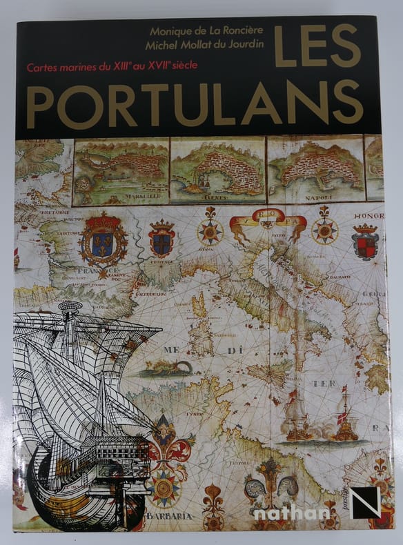
Monique de La Roncière
Les Portulans. Cartes marines du XIIIe au XVIIe siècle
Paris, Nathan, 1984, in-4, relié, jaquette éditeur, 295 pages. Etat de neuf. Sous emboîtage muet.
Referenz des Buchhändlers : 81442
|
|
|
MONMONIER, Mark.
How to lie with Maps.
in-8, 176 pages. Book in very fine condition. [P-14]
|
|
|
MONMONIER, Mark.
Spying with Maps. Surveillance Technologies and the Future of Privacy.
Hardcover in-8, 239 pages. With unclipped DW. Book in very fine condition. [SO-4]
|
|
|
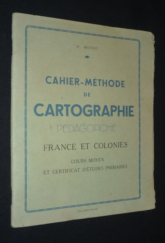
Monot H.
Cahier-méthode de cartographie. Pédagofiche. France et colonies. Cours moyen et Certificat d'études primaires
Monot H. Dos agrafé In-8 (17,8 x 21,8 cm), dos agrafé, 40 pages, sans date ; rabat du premier plat frotté et fendu aux extrémités, par ailleurs assez bon état général. Livraison a domicile (La Poste) ou en Mondial Relay sur simple demande.
Referenz des Buchhändlers : vg236
|
|
|
MONTANARI Armando a cura.
Pianta dei beni culturali artistici e ambientali del Lazio (esclusa Roma).
In-4° gr. pp. 125 con 7 grandi carte a col. più volte ripiegate f.t. Bross. edit.
|
|
|
MONTEFORTI B., RAGGI G.
Per la GEOLOGIA dell'ENTROTERRA di LA SPEZIA tra SARZANA e ZIGNAGO. Con grande CARTA GEOLOGICA a COLORI. Estr. orig. da Boll. Soc. Geol. It., 94, 1975
In-8° (cm. 26,5x18), pp. 17 (da p. 927 a p. 943) + 1 grande CARTA GEOLOGICA a COLORI di cm. 79x71,5, ripiegata in fascetta a parte. Bross. edit. Perfetta la carta, lievi mende alla copertina dell'estratto in bross. edit. INVIO degli Autori al piatto ant.
|
|
|
Moorehead Alan
La grande avventura di Cooper's Creek
illustrazioni

|
|
|
Moorehead Alan
The Blue Nile
illustrazioni in bianco e nero

|
|
|
Moorehead Alan
The White Nile
illustrazioni in bianco e nero

|
|
|
Mora Zerbini Gemmalisa
La controversia Cook-Peary per il raggiungimento del Polo Nord
illustrazioni in bianco e nero

|
|
|
MORANDINI G. -
Una carta batimetrica del Lago di Saima.
(Roma, 1941) 8vo stralcio con copertina posticcia muta, pp. 541/546 con una illustrazione. - !! ATTENZIONE !!: Con il termine estratto (o stralcio) intendiamo riferirci ad un fascicolo contenente un articolo di rivista, sia che esso sia stato stampato a parte utilizzando la stessa composizione sia che provenga direttamente da una rivista. Le pagine sono indicate come "da/a", ad esempio: 229/231 significa che il testo è composto da tre pagine. Quando la rivista di provenienza non viene indicata é perchè ci è sconosciuta. - !! ATTENTION !!: : NOT A BOOK : “estratto” or “stralcio” means simply a few pages, original nonetheless, printed in a magazine. Pages are indicated as in "from” “to", for example: 229/231 means the text comprises three pages (229, 230 and 231). If the magazine that contained the pages is not mentioned, it is because it is unknown to us.

|
|
|
MORDEN
Map of NORTHUMBERLAND
1695. No Binding. Very Good. UNCOLOURED 16.5X14.25 <br/> <br/> 1695. unknown
Referenz des Buchhändlers : Map435
|
|
|
MORDEN
Map of NOTTINGHAMSHIRE
Robert Morden 1695. No Binding. Very Good. HAND COLOURED V.G. 13.75 X 16.5 <br/> <br/> Robert Morden unknown
Referenz des Buchhändlers : Map480
|
|
|
MORDEN,
Map of HUNTINGDON
1695. No Binding. Fine. COLOURED F 16x11 <br/> <br/> 1695. unknown
Referenz des Buchhändlers : Map279
|
|
|
MORDEN,
Map of HUNTINGDON
1695. No Binding. Fine. UNCOLOURED F 16x11 <br/> <br/> 1695. unknown
Referenz des Buchhändlers : Map278
|
|
|
MORDEN,
Map of LINCOLNSHIRE
1720. No Binding. Very Good. UNCOLOURED V.G. 14.25 X 16.5 <br/> <br/> 1720. unknown
Referenz des Buchhändlers : Map356
|
|
|
MORDEN,
Map of NOTTINGHAMSHIRE
1695. No Binding. Very Good. HAND COLOURED 16.5 X 13.75 <br/> <br/> 1695. unknown
Referenz des Buchhändlers : Map477
|
|
|
MORDEN,
Map of WESTMORLAND
1695. No Binding. Very Good. UNCOLOURED V.G. 14.25 X16.75 <br/> <br/> 1695. unknown
Referenz des Buchhändlers : Map633
|
|
|
MORDEN, Robert
CAMBRIDGESHIRE
London: Abel Swal and Amsham & John Churchill 1695. No Binding. Fine. Folio. ND 1695- 43x36 cms 16.5 x 14 inches. Uncoloured copy with a margin and no clipping. Nice dark impression printed on thick paper. PLEASE EMAIL FOR PHOTO <br/> <br/> Abel Swal and Amsham & John Churchill unknown
Referenz des Buchhändlers : Map723
|
|
|
MORDEN, Robert
PLAYING CARD Map of Lincolnshire VIII
London: H. Turpin 1773. 3rd Edition . No Binding. Fine. Single map of Lincolnshire. A fine uncoloured copy of the last issue of Robert Moderns playing card maps. Approx 55x90mms. Title to the head wth Roman numeral VIII and the uncoloured map to the main section enclosed with double ruled lines above and below with county dimensions and distances at the foot. Harry Turpin published a 52 sheet set of these maps between 1764 and 1787 but no exact date is known for publication. RARE. Please email for photos. <br/> <br/> H. Turpin unknown
Referenz des Buchhändlers : Map922
|
|
|
Moreland Carl - Bannister David
Antique Maps. Christie Collectors Guides.
Ril. in tela con sovr., cm 23,5x19,5, pp 314, ill. in b/n.. - ISBN: 0780714880341

|
|
|
MORELAND CARL - BANNISTER DAVID
Christie's Collectors Guides. Antique maps.
in 8°, cart. edit. con sovracc. edit. ill., pp. (10),326, con num. ill. n.t., testo in lingua inglese, ottimo es.. (L026/d) (la spedizione standard è SEMPRE tracciata con raccomandata-piego di libri, eventuale fattura da richiedere all'ordine)
|
|
|
Moret,Léon.
Précis de Géologie.
<br/> NOTE: ammaccatura all'angolo inf. del piatto ant., altrimenti buon esemplare.<br/> TITOLO: Précis de Géologie. <br/> AUTORE: Moret,Léon.<br/> EDITORE: Masson & Cie<br/> DATA ED.: 1947,<br/> COLLANA: buon esemplare.)<br/>
|
|
|
MOREUX Théophile ( Argent-sur-Sauldre 1867 - Bourges 1954).
Atlas céleste par l'Abbé Moreux. Compléments par Didier Godillon. Aspects du Ciel visible dans nos régions pour chaque mois de l'année.
1967 Paris, Editions Doin-Deren et Cie, 1967; in-4 oblong en feuilles de 26 p. dont 12 cartes en bleu marine et blanc , couverture blanche à large encadrement bleuet illustré au centre di 1er plat, texte en sépia. Document cartographique dû à l'abbé Moreux, paru pour la 1ère fois en 1947. Il est ici et complété dans cette 2e édition par Didier Godillon. Théophile Moreux, ordonné Prêtre en 1891, astronome et météorologiste, fut nommé Directeur de l'Observatoire de Bourges (Cher), membre de la Société astronomique de France (à partir de 1893).
Referenz des Buchhändlers : 12157

|
|
|
MORGHEN Filippo
Pianta del Cratere.
(cm. 21x36) il campo inc. + ampi margini, con la descrizione dei luoghi elencati sotto la pianta. Trattasi della pianta litorale dei confini del Cratere dei Campi Flegrei, appartenente ad una famosa raccolta di ben 43 tavole. Edizione speciale su carta azzurrina.

|
|
|
Mori A.
Nuova valutazione della superficie del Regno.
(Firenze, Tip. M. Ricci, 1896), in-8, copertina fittizia, pp. 7. Estratto.
|
|
|
Mori Alberto
Le carte Geografiche e loro lettura e interpretazione
In 8° br. pp. 255, con 15 tav. b/n f/t, ben tenuto
|
|
|
MORI Assunto -
Cartografia primitiva.
Milano, 1910, stralcio con copertina posticcia muta, pp. 306/311 con ill. - !! ATTENZIONE !!: Con il termine estratto (o stralcio) intendiamo riferirci ad un fascicolo contenente un articolo di rivista, sia che esso sia stato stampato a parte utilizzando la stessa composizione sia che provenga direttamente da una rivista. Le pagine sono indicate come "da/a", ad esempio: 229/231 significa che il testo è composto da tre pagine. Quando la rivista di provenienza non viene indicata é perchè ci è sconosciuta. - !! ATTENTION !!: : NOT A BOOK : “estratto” or “stralcio” means simply a few pages, original nonetheless, printed in a magazine. Pages are indicated as in "from” “to", for example: 229/231 means the text comprises three pages (229, 230 and 231). If the magazine that contained the pages is not mentioned, it is because it is unknown to us.

|
|
|
MORI Attilio
Come progredi' la conoscenza geografica della Toscana nel secolo XIX. Contributo alla storia della geografia italiana
In 8, pp. 56. Br. rifatta. Estratto dagli 'Atti del Congresso Geografico italiano' (Firenze, 12-17 aprile 1898). Testo sugli studi geografici e cartografici in Toscana dalla fine del XVIII secolo. Fra gli argomenti: Lavori geodetici e cartografici dei Francesi in Toscana; determinazioni astronomiche e geodetiche del Barone de Zach; triangolazione dell'Inghirami; nuovo catasto e carta geometrica della Toscana, etc... Mori fu docente di Geografia all'Universita' di Firenze fra 1932 e 1935.
|
|
|
MORI Matsuda
AJIA REKISHI CHIZU ( ATLAS HISTORIQUE DE L’ASIE). En langue japonaise
Heibonsha, Tokyo, 1966
Referenz des Buchhändlers : 22552
|
|
|
Moriconi Ubaldo A.
Da Genova ai deserti dei Mayas. Ricordi di un viaggio commerciale [MESSICO]
345 illustrazioni

|
|
|
MORITZ, Eduard:
Die Entwickelung des Kartenbildes der Nord- und Ostseeländer bis auf Mercator. Mit besonderer Berücksichtigung Deutschlands. (Nachdruck).
Amsterdam, Meridian, 1967, gr. in-8°, V + 84 S., Original-Leinenband.
Referenz des Buchhändlers : 9457aaf
|
|
|
Moroni Carla (a cura di)
Gli atlanti antichi della Biblioteca Paroniana di Rieti
illustrazioni
|
|
|
MOROZZI FERDINANDO
CARTA GEOGRAFICA DEL GRANDUCATO DI TOSCANA
COFANETTO IN FOLIO ( cm.46 X 34 ),IN TUTTA TELA RIGIDA AMARANTO CON TITOLO ENTRO ETICHETTA AL PRIMO PIATTO CONTENENTE 24 CARTE IN FACSIMILE ( cm.85 X 61 ) + v.r.a col. DI VARIE PARTI DELLA TOSCANA + 2 CARTE D'INSIEME ( 1 in b/n, e 1 a col. di cm.63 X 59 ), COMPILATE DAL MOROZZI TRA IL 1752 E IL 1784. COMPLETA L'OPERA, UN FASCICOLO DI pp.26<BR>CON UN SAGGIO DI GIUSEPPE PANSINI E INDICE DEI NOMI A CURA DI MATTEO BARBARULO.<BR>FERDINANDO MOROZZI ( 1723 - 1785 ), ARCHITETTO, INGEGNERE E CARTOGRAFO TOSCANO.<BR>SI ERA FORMATO TRA SIENA E FIRENZE NELLE SCIENZE MATEMATICHE E NEL DISEGNO, AVEVA ESERCITATO LE MANSIONI DI MATEMATICO A BORDO DELLE GALERE DELL'ORDINE DI SANTO STEFANO E NEL 1749 ERA STATO IMBORSATO FRA GLI AIUTO INGEGNERI. A LUI FU ORDINATO DAL RICHECOURT DI FORMARE LA CARTA GENERALE DELLO STATO DEL GRANDUCATO DI TOSCANA . NEL 1770 PUBBLICO' UN TRATTATO SULLE CASE COLONICHE. COLLABORO' CON GIOVANNI TARGIONI TOZZETTI NELLA STESURA DELL'OPERA " VIAGGI FATTI IN DIVERSE PARTI DELLA TOSCANA ", REALIZZANDO LE CARTE DEL TERRITORIO DI PISA E DI LIVORNO. PRESTIGIOSA OPERA COMPLETA DELLE 24 CARTE + LE 2 D'INSIEME CHE<BR>SPESSO MANCANO. PERFETTA CONSERVAZIONE. MANTENUTO IL CONTENITORE DI CARTONE CON I TITOLI AL DORSO. ID, 4310
|
|
|
Morozzi, Ferdinando Introduzione di G. Pansini e indici a cura di M. Barbarulo.
Carta geografica del Granducato di Toscana.
facsimile in 24 carte, ciascuna di cm. 61 x 85, ripiegate, raccolte in una scatola in tela di cm. 36,5 x 46,5. Testo di ii-26 pp. 3600 gr. ii-26 p.
|
|
|
Morozzi,Ferdinando.
Carta geografica del Granducato di Toscana.
<br/> STATO: USATO, COME NUOVO.<br/> TITOLO: Carta geografica del Granducato di Toscana. <br/> AUTORE: Morozzi,Ferdinando.<br/> CURATORE: Introduzione di G. Pansini e indici a cura di M. Barbarulo.<br/> EDITORE: Coedizione Olschki Ed. - Electa Ed.<br/> DATA ED.: 1993,<br/> EAN: 9788822241634
|
|
|
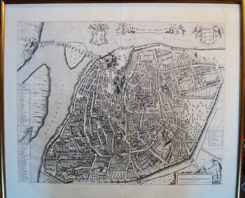
Mortier Pierre
AVENIO vulgo AVIGNON
Célèbre plan de la ville d’Avignon. De grandes dimensions, de nombreux détails apparaissent. Certainement un des plus beaux plans. Cadre doré. Petite fente dans le pli originel de la planche. Bon état Encadré très bon Avignon 1671 42,0 x 52,5 cm. 54 x 62 cm avec le cadre.
Referenz des Buchhändlers : 5482
|
|
|
Mortier Pierre
Traw. Ville de la Republique de Venise dans la Dalmatie.
Incisione all'acquaforte di mm 512 x 414 su carta di filo olandese. Bel foglio a pieni margini, privo di qualunque difetto. Il foglio è tratto dall'Atlante stampato da Pierre Mortier dal titolo "Nouveau Theatre de l'Italie".

|
|
|
MORTIER PIERRE (Leida, 1661 - Amsterdam, 1711)
VICENCE
MORTIER PIERRE (Leida, 1661 - Amsterdam, 1711) VICENCE. , inizio XVIII sec., Buono (Good) Buon es. e marginoso. acquaforte <br> inciso cm. 52 x 42 <br> <br> <br>
|
|
|
Mortillet, Gabriel de
Guide en Savoie par Gabriel de Mortillet
32°, 14 cm, pp. XII, 338, 2 incisioni e due carte geografiche fuori testo più volte ripiegate, brossura originale, titolo incorniciato al piatto e dorso, Interessante guida della Savoia con cenni ad alcuni cammini di montagna. Esemplare discreto

|
|
|
Mosconi, Carlo - Fagiolari, Elvio (a cura di)
Pavimentazione di Strade e Piazze nel Centro Storico di Perugia e nei Centri Storici Minori
Mm 205x280 Brossura originale, 52 pagine con numerose figure in nero e a colori nel testo. Ottima copia, spedizione in 24 ore dalla conferma dell'ordine.
|
|
|
MOSSELMANS Jean, CHOUQUER Gérard, DE GRAEVE Jan, WAHA Michel de, et autres
Des agrimensores romains aux arpenteurs du XVIe siècle.
Bruxelles, UGEB, 2001. 21 x 29, 210 pp., broché, très bon état.
Referenz des Buchhändlers : 90575
|
|
|
MOULE THOMAS.
Moule's County Maps. The West of England including the West Midlands. Introduced by Ashley Baynton-Williams.
In 4°, tutta tela editoriale con sovracoperta illustrata, pp. 48, riccamente illustrato, ottima copia. (IK02/02) . (spedizione standard SEMPRE tracciata con raccomandata, eventuale FATTURA da richiedere all'ordine)
|
|
|
MOULE, Thomas
CAMBRIDGE City Plan
London: George Virtue 1848. re-issue . No Binding. Vg. 21 x 27 cms. Original un-coloured state first issue in 1832. Finely engraved views of Cambridge. A nice original dark impression steel engraving. Arms of the colleges and vignette of Trinity College <br/> <br/> George Virtue unknown
Referenz des Buchhändlers : Map 822
|
|

 Per e-mail erhalten
 Als pdf-Dokument herunterladen
 RSS feed
 Permanenter link


