|
|
|
PÉRONCEL-HUGOZ, Jean-Pierre
Villes du Sud. Paris. Balland. Paris. 1990.
1 volume in-8° broché, couverture illustrée, 404 p. + illustrations. Très bon état. Nom de propriétaire manuscrit en page de faux-titre.
Referenz des Buchhändlers : 25625

|
|
|
QUAINI Massimo a cura.
Carte e cartografi in Liguria con numerosi contributi. Catalogo della mostra.
In-8° gr. carrè pp. 295 con 60 tav. a col. f.t. di carte e vedute oltre a centinaia di ill. in nero n.t. anche a piena pagina. Bross. edit. a colori Stato di nuovo.
|
|
|
QUAINI, Massimo (a cura di).
CARTE E CARTOGRAFI IN LIGURIA.
Genova, Sagep, 1986. In 8° carré, PP 294n. Brossura originale. Nel testo vi sono contributi di: Josepha Costa Restagno, Gianni De Moro, Leone Carlo Forti, Giuliana Franchini, Antonio Frova, Daniela Gandolfi, William Henry Klecker, Daniele Levi, Maria Rita Mari, Franco Noberasco, Anna Panerai, Giovanni Puerari, Massimo Quaini, Luigi Sartori, Marco Sassetti, Magda Tassinari, Enrico Viola, Flavia Varaldo. Di seguito sono riportate le sedi della mostra: “Albenga, Palazzo Peloso Cepolla, 6 novembre-20 dicembre”- “La Spezia, Sala Dante e Centro Bibliografico Sant’Agostino, 7 novembre-20 dicembre”- “Imperia, Pinacoteca Civica, 5 novembre-30 novembre”- “Savona, Palazzo della Provincia, 14 ottobe-14 novembre”. 208 figure in nero e a colori intercalate nel testo.

|
|
|
QUARTIERI Alessandro -
Cervia città fabbrica. La storia e la cartografia da Cervia Vecchia alla fondazione di Cervia Nuova.
Rimini, Maggioli, 1987, 8vo (cm. 24 x 22) brossura con copertina illustrata, pp. 94 con 31 carte e mappe e 6 illustrazioni fotografiche nel testo (Città/Cultura, Immagini, 12) .

|
|
|
Queirazza, Gasca,Giuliano. Marcato,Carla. Pellegrini,Giovan Battista. Sicardi Petracco,Giulia. Rossebastiano,Alda.
Dizionario dei Nomi dei luoghi. A - Z.
2 volumi A-Z. <br/> STATO: USATO, COME NUOVO.<br/> TITOLO: Dizionario dei Nomi dei luoghi. A-Z. <br/> AUTORE: Queirazza, Gasca,Giuliano. Marcato,Carla. Pellegrini,Giovan Battista. Sicardi Petracco,Giulia. Rossebastiano,Alda.<br/> EDITORE: Istituto Geografico De Agostini<br/> DATA ED.: 2006,<br/> COLLANA: GEDEA.<br/>
|
|
|
Queirazza, Gasca,Giuliano. Marcato,Carla. Pellegrini,Giovan Battista. Sicardi Petracco,Giulia. Rossebastiano,Alda.
Dizionario dei Nomi dei luoghi. A - Z. Dizionario etimologico dei dialetti. A - Z.
Opera completa in 4 volumi A-Z. <br/> STATO: NUOVO.<br/> TITOLO: Dizionario dei Nomi dei luoghi. A-Z. Dizionario etimologico dei dialetti. A-Z. <br/> AUTORE: Queirazza, Gasca,Giuliano. Marcato,Carla. Pellegrini,Giovan Battista. Sicardi Petracco,Giulia. Rossebastiano,Alda.<br/> EDITORE: Istituto Geografico De Agostini<br/> DATA ED.: 2006,<br/> COLLANA: GEDEA. <br/>
|
|
|
Quilici Folco
India. Un pianeta
illustrazioni

|
|
|
Quilici Folco
Le Americhe
illustrazioni

|
|
|
Quilici Folco
Oceano
illustrazioni

|
|
|
R. Bultot, G. Hasenohr
Pierre Crapillet, recteur de l'hopital du Saint Esprit de Dijon, Le 'Cur Deus homo' d'Anselme de Canterbury et le 'De arrha animae' d'Hugues de Saint-Victor traduits pour Philippe le Bon.
, Brepols - Harvey Miller, 1984 Hardcover. 462 p., 9 ill:, 160 x 240 mm, Languages: French, Including an index. Fine copy. ISBN 02110060200.
Referenz des Buchhändlers : 45387
|
|
|
R. ESERCITO ITALIANO COMANDO SUPREMO UFFICIO OPERAZIONI
NOTIZIE SULL'ANATOLIA
In 8vo (cm 15,5x22) brossura pag 42 con 3 carte topografiche a colori ripiegate. Completo del fascicolo: Aggiunte e Varianti di pag. 15. Ottimo stato.

|
|
|
R. V. Tooley
Tooley's dictionnary of mapmakers
New York, Alan R. Liss, Inc, 1979. Format 18x25 cm, broche, 684 pages. Ouvrage en langue anglaise. Tranches sales, mais surtout un gros pli oblique en 4e de couverture. Etat acceptable.
Referenz des Buchhändlers : 26181

|
|
|
R.V. TOOLEY, CHARLES BRICKER, GERALD ROE CRONE
LANDMARKS OF MAPMAKING, CHOSEN AND DISPLAYED BY R.V. TOOLEY, WITH TEXT BYCHARLES BRICKER.
IN 4° gr.( cm.36,5 X 26,5 ), pp.276, COPERTINA EDITORIALE CARTONATA RIGIDA CON TITOLO AL DORSO + SOVRACOPERTINA ILLUSTRATA A COLORI CON TITOLO. VOLUME RICCAMENTE ILLUSTRATO in b/n/col. DI CUI MOLTE TAVV. RIPIEGATE f.t. TESTO IN LINGUA INGLESE. OTTIMA CONSERVAZIONE. ID 4826

|
|
|
R[ONALD] V[ERE] TOOLEY, (1898-1986).
Tooley's dictionary of mapmakers: Supplement.
Very Good Turkish Original bdg. Dust wrapper. 4to. (28 x 20 cm). In English. [x], 116 p., b/w ills. and maps. Tooley's dictionary of mapmakers: Supplement. "The credentials of the author are well known to professionals in the history of cartography and to map collectors all over the world. Mr. Tooley's long professional life has been devoted to the study of maps and atlases. His book 'Maps and map-makers (originally published in 1949) sold widely in Britain, Europe, and the United States and has gone into many editionss. For many years he was editor of 'Map collector's circle' and is now co-editor of 'Map collector'. He was written, edited, and contributed widely.".
|
|
|
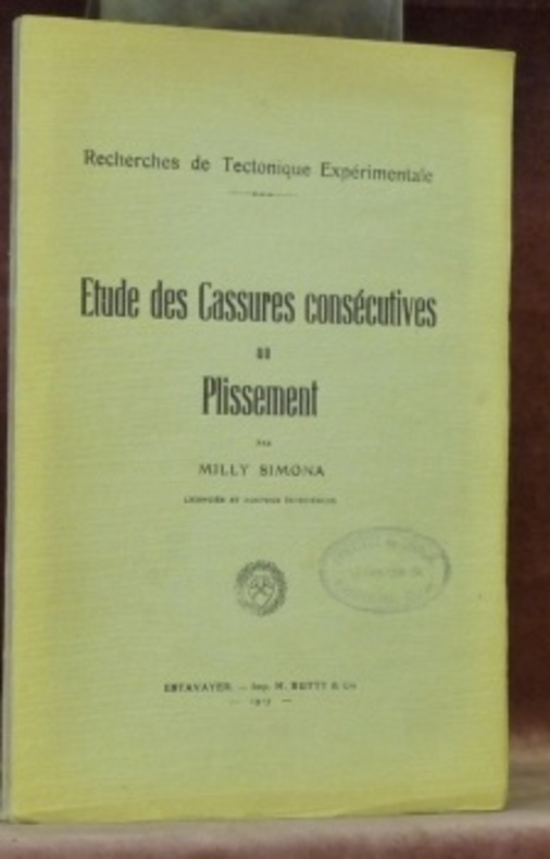
RABADAN, P. Reginald-Jean.
Les théories tétraédristes de la forme de la terre. Thèse.
Roma, Tip. Madre di Dio 1936, 225x155mm, 158pages, broché.
Referenz des Buchhändlers : 56666
|
|
|
RACI.
Carta automobilistica d'Italia al 500.000. Foglio 4. Calabria e Sardegna.
1939 circa. In 8vo lungo, carta ripiegata, copertina anteriore in azzurro e ill. pubblicitarie in colore alla copertina posteriore. Con la sigla RACI si indicava il Reale Automobile Club d'Italia, attivo dal 1927 al 1946 e in seguito rinominato ACI. Buono stato di conservazione.

|
|
|
RACI.
Carta automobilistica d'Italia al 500.000. Foglio 5. Sicilia.
1939 circa. In 8vo lungo, carta ripiegata, copertina anteriore in azzurro e ill. pubblicitarie in colore alla copertina posteriore. Con la sigla RACI si indicava il Reale Automobile Club d'Italia, attivo dal 1927 al 1946 e in seguito rinominato ACI. Buono stato di conservazione.

|
|
|
Racine Jean-Bernard. Reymond,Henry.
L' analisi quantitativa in geografia.
<br/> STATO: COME NUOVO.<br/> TITOLO: L' analisi quantitativa in geografia. <br/> AUTORE: Racine Jean-Bernard. Reymond,Henry.<br/> EDITORE: Marsilio Editori<br/> DATA ED.: 1983,<br/> COLLANA: Coll.Ricerche.<br/> EAN: 9788831746410 COPIA CON PAGINE INGIALLIALLITE- COP. UN PO' GRAFFIATA
|
|
|
RADUNATA N.E.
CARTA D'ITALIA E DEI TERRITORI LIMITROFI AL 100.000 - QUARTA SERIE. Quadro d’unione - Carta topografica della Monarchia Austro-Ungarica alla scala di 1:75.000.
Offriamo un lotto di 24 cartine topografiche a colori, cm. 41 x 42 ciascuna, (con al verso spiegazione delle abbreviazioni e traduzione delle denominazioni straniere più usate: tedesco e slavo meridionale) così composto: 1) Foglio II - Coira 2) Foglio III - Schuls 3) Foglio IV - Nauders 4) Foglio V - Merano 5) Foglio VI - Brixen 6) Foglio VII - Welsberg 7) Foglio VIII - Lienz 8) Foglio IX - Greifenburg 9) Foglio X - Spittal 10) Foglio XI - S. Veit 11) Foglio XII - Wolfsberg 12) Foglio XV - Bolzano 13) Foglio XVI - Villach 14) Foglio XVII - Klagenfurt 15) Foglio XVIII - Wolkermarkt 16) Foglio XXII - Trento 17) Foglio XXIII - Kranj 18) Foglio XXIV - Lubiana 19) Foglio XXV - Gorizia 20) Foglio XXVI - Adelsberg 21) Foglio XXVII - Ribnica (Reifnitz) 22) Foglio XXIX - Trieste 23) Foglio XXX - Volosca 24) Foglio XXXI - Gottschee. Tutta la raccolta è ben conservata.

|
|
|
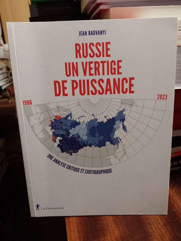
RADVANYI Jean
Russie, - Un vertige de puissance. Une analyse critique et cartographique
Paris, La Découverte, février 2023, 19 x 25, 192 pages cousues sous couverture souple illustrée. Nombreuses cartes couleurs.
Referenz des Buchhändlers : RUSSIE127845691123
|
|
|
RAILWAY MAP.
Cruchley's Railway and Station Map of Yorkshire, Showing all the Railways & Names of Stations, also the Turnpike Roads, Gentlemen's Seats, &c. &c. Improved from the Ordnance Surveys.
Coloured map on linen, (590 x 505 mm), divided into 28 sections and laid on linen, scale approximately 8 miles to the inch, a couple of minor marks but overall in good condition, orig. blue pebbled-patterned cloth, lettered in gilt on upper cover (Crutchley's Tourist Map of Yorkshire with the Railways), advert leaf pasted onto inside front cover. The Harold Whitaker Collection, 321.
|
|
|
RAMIZPASAZÂDE MEHMED IZZET, (?-1853).
[BIOGRAPHY OF THE ADMIRALS] Harîta-i kapudânân-i deryâ. [i.e. The chart of the admirals].
Very Good Turkish, Ottoman (1500-1928) Contemporary quarter leather bdg. Rebacked boards. Foolscap 8vo. (18 x 12 cm). In Ottoman script (Old Turkish with Arabic letters). 220 p. Very rare early book of the concise biographies of 137 people who served as admirals in the Ottoman Empire between 1352 and 1853, written by Mehmed Izzet Pasha (d. 1853), son of Turkish admiral Abdullah Râmiz Pasha (d. 1813). Ceridehâne Printing House was founded for publishing Ceride-i Havâdîs [i.e. The Journal of News], which was the first semi-official newspaper in the Ottoman Empire. This journal was published from 1840 to 1877 and was founded by William Nosworthy Churchill (1796-1846), a British-born journalist who moved to Turkey aged 19. He was the cause of a diplomatic incident that resulted in the temporary severance of diplomatic relations between Britain and the Ottoman Empire. Babinger p. 323/2.; Özege 6951.; Library of Congress. Karl Süssheim Collection, no. 1336., OCLC: 11810438, 880485954.
|
|
|
Rand McNally & Company
Rand McNally Commercial Atlas Sixtieth Edition 1929
Chicago: Rand McNally & Company 1929. Good condition. Tears and creases to the title page. Vertical and corner creases up to page 6. SEE PHOTOS. Includes double page full color maps and other maps printed in yellow red and black. SEE PHOTOS. The double page maps open to an impressive 27.75" across. Contents: Part I: The World pp.4 - 23; Part II: The United States pp. 24 - 481; Part III: Foreign Countries pp. 482 - 537; Supplementary Maps: Canada Mexico China and Japan Polar Regions pp. 538 - 550. Bound in the original gilt-stamped green cloth. Oversize Hardcover. 15.50" wide by 20.75" tall by 2.25" thick at the spine. This massive extremely heavy book will require SUBSTANTIAL extra postage at our cost based on your locatuion. Sixtieth Edition 60th edition. Oversize Hardcover. Good condition. Illus. by NOT a library discard. 550 pages. Great Packaging Fast Shipping. Rand McNally & Company Hardcover
Referenz des Buchhändlers : 028276
|
|
|
Rand McNally and Company
Rand McNally & Co's Indexed County and Township Pocket Map and Shippers' Guide of New Jersey - Showing in Detail the Entire Railroad System The Express Company Doing Business over Each Road and Accurately Locating All Cities Towns Post Offices Railr
Chicago and New York: Rand McNally & Company 1892. Very Good condition but for short tears at 3 or 4 of the map folds which have been neatly reinforced with archival tape on the blank side. SEE PHOTOS. A very attractive well preserved copy. 60 pages of text including brief information on 78 railroads a detailed 39-page index and ads for Rand McNally publications. Attached at the rear is a full color map that unfolds to 13'' wide by 21" tall. Bound in the publisher's tan-color stiff printed wraps. Cover title: Rand McNally & Co's Indexed County and Township Pocket Map and Shippers' Guide of New Jersey
Showing in Detail the Entire Railroad System The Express Company Doing Business over Each Road and Accurately Locating All Cities Towns Post Offices Railroad Stations Villages Counties Islands Lakes Rivers etc
Locating
the Nearest Mailing Point of All Local Places; Designating
Telegraph Stations
Population is Given According to the Latest Official Census" i.e. 1890. 1st ed No additional printings listed. Stiff card covers. Very Good condition. 60 pages a full color fold-out map. Rand McNally & Company Paperback
Referenz des Buchhändlers : 016610

|
|
|
Rand McNally
Rand McNally World Atlas Premier Edition
New York Chicago San Francisco: Rand McNally & Company 1929. 1929 edition No date on title page; 1929 on copyright page; no other printings listed. Very Good condition. 11.25" wide by 14.25" tall. Inner hinges are perfectly sound. Pages are clean and unmarked. Illustrated green endpapers feature scenes labeled Occident/Orient. First blank page has one vertical crease. Contains more than 125 pages of full-color maps. This 1929 edition is apparently quite scarce. Bound in the original dark green cloth lettered in gold on the front cover. Keywords: Atlases Map Reference Geography Maps. 1st ed No additional printings listed. Oversize Hardcover heavy. Very Good condition/No jacket probably as issued. 279pp. Rand McNally & Company Hardcover
Referenz des Buchhändlers : 013898
|
|
|
Rand McNally and Company
Atlas of the world
Folio in blue pictorial DJ; approx 475 p. numerous full page color maps ; index. Maps, atlases. **Extra shiping charges at cost apply to international orders**
|
|
|
Randegger, (Johannes)
Topographische Karte des Bezirks Winterthur nach den neuesten Materialien und mit besonderer Berücksichtigung sämtlicher Eisenbahnen revidirt 1891. 1: 50 000.
Winterthur, Zürich, Topogr. Anstalt von Wurster, Randegger & Cie., Commissions Verlag J. Wurster & Cie, 1891. 55 x 63 cm. Gef. chromolith. Karte zwischen Pappdeckeln + Wichtig: Für unsere Kunden in der EU erfolgt der Versand alle 14 Tage verzollt ab Deutschland / Postbank-Konto in Deutschland vorhanden + (berieben und bestossen).
Referenz des Buchhändlers : 29428AB
|
|
|
Randegger, (Johannes):
Topographische Karte des Bezirks Winterthur nach den neuesten Materialien und mit besonderer Berücksichtigung sämtlicher Eisenbahnen revidirt 1891. 1: 50 000.
Winterthur, Zürich, Topogr. Anstalt von Wurster, Randegger & Cie., Commissions Verlag J. Wurster & Cie, 1891. 55 x 63 cm. Gef. chromolith. Karte zwischen Pappdeckeln (berieben und bestossen).
Referenz des Buchhändlers : 29428AB
|
|
|
Ranieri,Luigi.
Le moderne vedute sui bradisismi e lo stato attuale del bradisisma flegreo. Estratto dagli Annali della Fa
4 fasc. <br/> TITOLO: Le moderne vedute sui bradisismi e lo stato attuale del bradisisma flegreo. Estratto dagli Annali della Facoltà di Economia e Commercio della R. Università di Bari. Nuova serie, vol. VI, anno 1945. Dello stesso A. e sullo stesso tema presentiamo inoltre: "Inversione del bradisisma di Pozzuoli?", estratto dal Bollettino della Società Geografica Italiana, serie VIII, vol.V, n.1 (Gennai
|
|
|
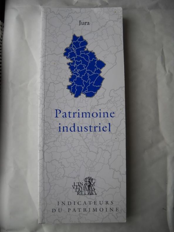
RAPHAEL FAVERAUX LAURENT POUPARD Photographies de Jerome Mongreville - Laurent Poupard - Yves Sancey Cartographie de Christophe Batardy
PATRIMOINE INDUSTRIEL DU JURADirection régionale des affaires culturelles de Franche-comté Service régional de l'inventaire général
Broché - 10,5 x 27 - 360 pp - année 1999 - édité par l'association pour la promotion et le développement de l'inventaire comtois - nb illustrations -
Referenz des Buchhändlers : 15362
|
|
|
RAPKIN John
[Map of] Arabia. [Facsimile re-issue]. NEAR FINE COPY
Steel-engraved map on ivory stock measuring 12.25 x 15.5 ins (approx. 31.25 x 39.0 cms) with engraved surface 8.75 x 11.75 ins (approx. 22.0 x 30.0 cms), coloured in outline; four coloured vignettes of Arab Women, Arab Men with horse, Camel and Palm, and Mount Sinai (illustrations by H. Warren; engraving by J. Rogers); decorative scroll frame incorporating title cartouche, a fine copy. Mounted ready for framing in double card mount (ivory over blue) with gilt frame border. Rapkin's map for Tallis was first issued c. 1856 and contains significantly more detail that that produced for the 'Illustrated Atlas' of 1851. Areas covered include Babylon, Basra, Cairo, Jerusalem, Oman, Persian Gulf, Red Sea and Suez. This high-quality facsimile accurately reflects thetones of the contemporary hand colouring and makes a most attractive map at a fraction of the cost of the original.
|
|
|
Rapkin, J
BRITISH INDIA
London: The London Printing And Publishing Co Ltd 1851. Original printed issues 1st Editions . No Binding. Fine. quarto. An original map of BRITISH INDIA originally pub. by John Tallis in this issue by The London Printing Company. Original out-line hand colour showing the borders and boundaries and with fine vignette scenes of cities and an Indian Procession. Enclosed within a highly decorative border with nice wide margins. A fine copy printed on thick paper folded to the centre with no wear. PLEASE EMAIL FOR PHOTOS <br/> <br/> The London Printing And Publishing Co Ltd unknown
Referenz des Buchhändlers : Map920
|
|
|
Rapkin, J
NORTHERN INDIA Including the Presidency Bengal
London: The London Printing And Publishing Co Ltd 1851. Original printed issues 1st Editions . No Binding. Fine. quarto. An original map of Northern India pub. originally by John Tallis in this edition by The London Printing Company. Original out-line hand colour showing the borders and boundaries and with fine vignette scenes of cities and a tiger Hunt. Enclosed within a highly decorative border with nice wide margins and printed on thick paper. A fine copy. PLEASE EMAIL FOR PHOTOS. Folded to the centre with no wear. <br/> <br/> The London Printing And Publishing Co Ltd unknown
Referenz des Buchhändlers : Map919
|
|
|
Ratzel,Federico.
La Terra e la Vita. Geografia comparativa. Vol. II.
Disponibile solo volume II. <br/> STATO: DA COLLEZIONE, MOLTO BUONO.<br/> TITOLO: La Terra e la Vita. Geografia comparativa. Vol.II. <br/> AUTORE: Ratzel,Federico.<br/> CURATORE: Prima traduzione italiana di Aristide Cignolini, Mario Lessona.<br/> EDITORE: UTET<br/> DATA ED.: 1907,<br/>
|
|
|
RAVANEL Nathalie -
La conservazione e il restauro delle carte.
Firenze, 1999, 8vo stralcio con copertina posticcia muta, pp. 683/694 con illustrazioni ed una tavola fotografica a colori. - !! ATTENZIONE !!: Con il termine estratto (o stralcio) intendiamo riferirci ad un fascicolo contenente un articolo, completo in se, sia che esso sia stato stampato a parte utilizzando la stessa composizione sia che provenga direttamente da una rivista. Le pagine sono indicate come "da/a", ad esempio: 229/231 significa che il testo è composto da tre pagine. Quando la rivista di provenienza non viene indicata é perché ci è sconosciuta. - !! ATTENTION !!: : NOT A BOOK : “extract” or “excerpt” means simply a few pages, original nonetheless, printed in a magazine. Pages are indicated as in "from” “to", for example: 229/231 means the text comprises three pages (229, 230 and 231). If the magazine that contained the pages is not mentioned, it is because it is unknown to us.

|
|
|
RAVESTEIN, LUDWIG.
Karte der Lombardishen, und Sud Tiroler.
Ravestein, L., Frankfurt a Main, 1889. Incisione su acciaio stampata a colori, cm 50,5 x 74,5 (il foglio). Carta ripiegata e applicata su tela, 21 riquadri, senza brossura. La carta è relativa alla Lombardia e al Sud Tirolo, il confine a Nord comprende le aree tra la Valtellina e la Valsugana. Buono lo stato di conservazione.
|
|
|
Ravizza Giuliano
Pavia nelle vecchie carte.
4° oblungo, mm 430x330,pp. 36 volume rilegato in seta rossa con fregio in oro al piatto, custodia cartonata con fregi in oro con piccola macchia al margine sinistro, eccellente stato di conservazione, illustrato con riproduzione di tavole, a cura della Pìelliceria Annabella, citazioni tratte dall'opera di Stefano Breventano Historia della Antichità Nobiltà et delle cose notabili della città di Pavia, 1570, la riproduzione delle stampe e stata concessa da Civici Musei Pavia e De Bernardi Grafica Pavia. Stampato in 500 copie numerate, la presente copia n. 455.

|
|
|
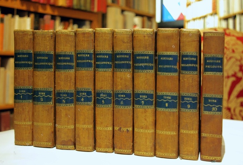
Raynal (Guillaume-Thomas, 1713-1796) :
Histoire Philosophique et Politique des Etablissements et du Commerce des Européens dans les deux Indes.
Genève, sans nom (probablement Pellet), 1781 ; 10 tomes in-12 et Atlas in-4 (1780) ; demi-basane fauve, dos à faux-nerfs dorés, pièces de titre et de tomaison bleu-canard, tranches jaunes ; ON AJOUTE : Atlas : demi-veau glacé vert-Empire, dos décoré de fleurons dorés, titre doré (reliure début du XIXe siècle) ; XII, 452 ; VIII, 516 ; VIII, 471 ; VIII, 391 ; VIII, 352 ; VIII, 404 ; XII, 471 ; 426 ; VIII, 362 ; IV, 447 ; portrait de Raynal par F.G. Lardy en frontispice du tome Ier et 9 frontispices gravés, un à chaque tome, eux aussi par Lardy ; Atlas : (4), 22 pp., (1) f. blanc, 50 cartes dépliantes (49 + 17 bis).
Referenz des Buchhändlers : 11470
|
|
|
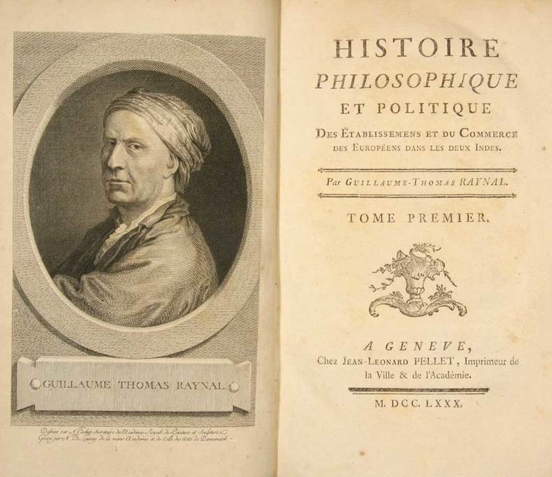
RAYNAL, Guillaume-Thomas (François) (1711-1796):
Histoire philosophique et politique des établissemens et du commerce des Européens dans les deux Indes. En 10 volumes.
Genève, Jean-Léonard Pellet, 1780, in-8°, 10 frontispices gravés dont le portrait de l'auteur, 23 tables repl., reliures en veau marbré, dos richement orné or, encadrement d'un triple filet doré sur les plats, tranches marbrées, bel ensemble.
Referenz des Buchhändlers : 128506aaf
|
|
|
RAYNAL, Guillaume-Thomas (François) (1713-1796):
Histoire philosophique et politique des établissemens et du commerce des Européens dans les deux Indes. En 5 volumes y compris l'atlas de cartes géographiques et tableaux.
Genève, Jean-Léonard Pellet, 1780 (i.e. April 1781), in-4°, 4 (de 5) front. dont le portrait de l'auteur, avec atlas de 2 ff. + 28 p. + 23 tables dont 12 repl., 50 doubles cartes (num. 1 à 49 plus 17bis), qqs traces d'eau et de lég. taches princip. marginales plus fortes vers la fin du tome 4, belles reliures en veau marbré à nerfs, dos richement ornés en or, pièces de titre et tomaison bordeaux et vertes aux dos, encadrement d'un triple filet doré sur les plats, qqs frottements , tranches marbrées, restaurations professionelles aux reliures.
Referenz des Buchhändlers : 46680aaf
|
|
|
Reale Automobile Club d'Italia
ITALIA CENTRALE scala 1: 500.000. Foglio II° della CARTA AUTOMOBILISTICA d'ITALIA
Grande carta geografica a fisarmonica entro 2 belle copertine ill. da disegno razionalista a colori. Comprende parte del Piemonte, Liguria, parte dell'Emilia Romagna, gran parte della Toscana, Umbria, Marche.
|
|
|
Reclus Elisée.
PLANCHES de: LA TERRE - DESCRIPTION DES PHÉNOMÈNES DE LA VIE DU GLOBE.
(Codice SC/0962) Recueil de 25+29 cartes en noir et couleurs, dont 27 double page et 15 en couleurs. Page de titre absente. Attachè un index à la plume. Reliure de l'époque en percaline rouge, titre doré. Très bon état. ~~~ SPEDIZIONE IN ITALIA SEMPRE TRACCIATA

|
|
|
Reclus Élisée
Collection des Guides-Joanne. Londres illustré. 60 gravures, 1 carte et 10 plans
16°, mm 180x110, pp. VIII, 216, 80 di pubblicità su carta azzurra al fondo; legatura in tela nera con titoli in oro al piatto e al dorso, piccola slabbratura alla cuffia superiore altrimenti esemplare in ottimo stato, completo della grande carta ripiegata e conservata in fodera al contro-piatto posteriore. Moltissime silografie nel testo e una carta a doppia pagina dell'itinerario da Parigi a Londra. Graziosa e utile guida.

|
|
|
RECLUS, Onésime
En France. Paris. Hachette et Cie.
1 volume grand in-8° relié pleine percaline rouge estampée d'un décor doré. Tranches dorées. 603 p., 21 cartes, 250 gravures. Quelques rousseurs éparses. Une fissure au mors supérieur, petites boursouflures en pied.
Referenz des Buchhändlers : 22965

|
|
|
RECLUS, Élisée
Les phénomènes terrestres. Les continents. Cinquième édition. Paris. Hachette et Cie. 1884.
1 volume in-12° relié demi-chagrin noir, dos à nerfs, titre et filets dorés, plats de de toile chagrinée, fer spécial doré du lycée d'angoulême. 228 p. + figures. Rousseurs sinon très bel état.
Referenz des Buchhändlers : 19980

|
|
|
Reclus,Onésime.
La Terre à vol d'oiseau.
<br/> TITOLO: La Terre à vol d'oiseau. <br/> AUTORE: Reclus,Onésime.<br/> EDITORE: Librairie Hachette<br/> DATA ED.: 1893,<br/> COLLANA: in oro. Lacuna al margine sup.del frontesp.con interessamento del titolo e strappo di ca.10 cm. a una delle prime cc. Fioriture non gravi agli interni.<br/>
|
|
|
REGIO UFFICIO GEOLOGICO
Brevi cenni relativi alla carta geologica della campagna romana con le regioni limitrofe
In 8, pp. 23. Br. ed. Cenni relativi alla stesura della carta geografica della campagna romana e delle regioni limitrofe in scala 1/100.000 e classificazione delle formazioni geologiche.
|
|
|
Regione Emilia Romagna, Assessorato Agricoltura e Alimentazione
Elementi di base per la predisposizione della carta ittica regionale
2 vol, 42 cm, brossura illustrata, cofanetto editoriale illustrato; p. 156; 70, numerose carte geografiche, foto e illustrazioni a colori e in nero

|
|
|
Regione Emilia-Romagna
La cartografia geologica della Regione Emilia-Romagna. The geological cartography of the Emilia-Romagna Region
24 cm, cartella editoriale che contiene due volumi e due carte geografiche più volte ripiegate. i volumi sono di p. 29 e 117 (La geologia del foglio 265, S. Piero in Bagno, Appennino settentrionale). Le carte geografiche: Carta geologica dell'Appennino Emiliano-Romagnolo, foglio 265, S. Piero in Bagno e Carta geologica dell'appennino Emiliano Romagnolo

|
|
|
Regione Sicilia
La cartografia europea tra il XVI e il XVIII secolo
In 8° quadrato, pp. 153. Brossura editoriale.
|
|
|

 Per e-mail erhalten
 Als pdf-Dokument herunterladen
 RSS feed
 Permanenter link


