|
|
|
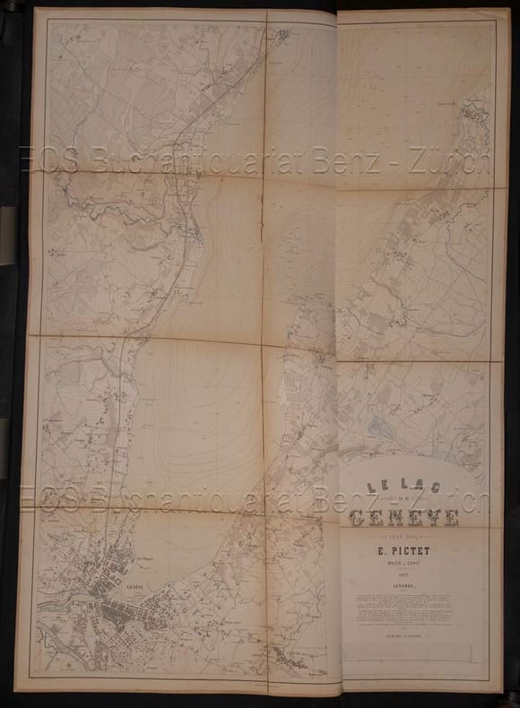
Pictet, E
Le lac de Genève.
Genf, H. Georg, 1877. 117 x 81 cm. Karte auf Leinen aufgezogen. Orig.-Leinenmappe. + Wichtig: Für unsere Kunden in der EU erfolgt der Versand alle 14 Tage verzollt ab Deutschland / Postbank-Konto in Deutschland vorhanden +, A|B [2 Warenabbildungen]
Referenz des Buchhändlers : 5449CB

|
|
|
Pictet, E.:
Le lac de Genève.
Genf, H. Georg, 1877. 117 x 81 cm. Karte auf Leinen aufgezogen. Orig.-Leinenmappe.
Referenz des Buchhändlers : 5449CB
|
|
|
PIERLUIGI PORTINARO
ANTICHE CARTE GEOGRAFICHE DEL PIEMONTE
IN 8° CARRE' ( cm.23 X 23 ), pp.118. COPERTINA EDITORIALE CARTONATA RIGIDA PATINATA ILLUSTRATA A COLORI CON TITOLO SU FONDO NERO. VI TAVV.( ROSA DEI VENTI TOLOMEO ,<BR>TAV. PEUTINGERIANA,PLANISFERIO SALLUSTIO,ITALIA TRECHSEL.ITALIA HONDIUS, MAPPAMONDO CASSINI ). SEGUONO 69 TAVV. DEL PIEMONTE in b/n/col. CON RELATIVE SCHEDE. OTTIMA CONSERVAZIONE.ID 5209
|
|
|
PIERLUIGI PORTINARO and FRANCO KNIRSCH
THE CARTOGRAPHY OF NORTH AMERICA 1500 - 1800
IN 4° ( cm.33 X 25 ), pp.320, COPERTINA EDITORIALE IN PIENA TELA RIGIDA CON TITOLO AL DORSO + SOVRACOPERTINA ILLUSTRATA A COLORI CON TITOLO. NUMEROSE ILLUSTRAZIONI in b/n/col. NEL TESTO, CLXXI ILLUSTRAZIONI a col. RIPRODUCENTI CARTE DEL NORD AMERICA E MAPPAMONDI CON RELATIVE SCHEDE DAL 1500 AL 1800. NELLA PARTE FINALE, BIOGRAFIE DEI PRINCIPALI CARTOGRAFI, DA BATTISTA AGNESE a ANTONIO ZATTA. TESTO IN LINGUA INGLESE SU DUE COLONNE. PERFETTA CONSERVAZIONE.

|
|
|
Pierluigi Salvadeo (a cura di)
Paesaggi di architettura. Infrastrutture, territorio, progetto
Un volume di 95 pagine, brossura editoriale illustrata. Dimensioni: 28x28 cm. Ottime condizioni. Illustrazioni in b/n e a colori nel testo.
|
|
|
Piero Bencini
Appunti di cartografia
Coperta lievemente imbrunita ai margini e al dorso, tagli e pagine in buono stato, testo completamente fruibile, volume appartenente alla collana "Collezione testi didattici" curata dall'Istituto Geografico Militare, presenti formule e figure in nero nel testo, ristampa, numero pagine 85 USATO

|
|
|
PIERRE GEORGE
I METODI DELLA GEOGRAFIA. CHE COS'È LA GEOGRAFIA?
DISPONIBILITÀ GARANTITA AL 99%; SPEDIZIONE ENTRO 12 ORE DALL'ORDINE. RIMANENZA DI MAGAZZINO PARI AL NUOVO. Informazioni bibliografiche Titolo: I metodi della geografia Titolo originale: Les Méthodes de la Géographie; Que sais-je? Collana: Volume 116 di I Gabbiani Autore: Pierre George Traduzione di: Gaetano La Pira Editore: Milano: Il saggiatore, 1974 Lunghezza: 151 pagine; 19 cm Soggetti: Geografia umana, Metodi, Filosofia della natura, Terra, Scienze, Geografia fisica, Economica, Industriale, Urbana, Documenti, Fonti, Applicata, popolazione, Classici, Geography, Social sciences, Emmanuel de Martonne, Geomorfologia, Regioni naturali, Carte, Cartografia, Mappe, Climatologia

|
|
|
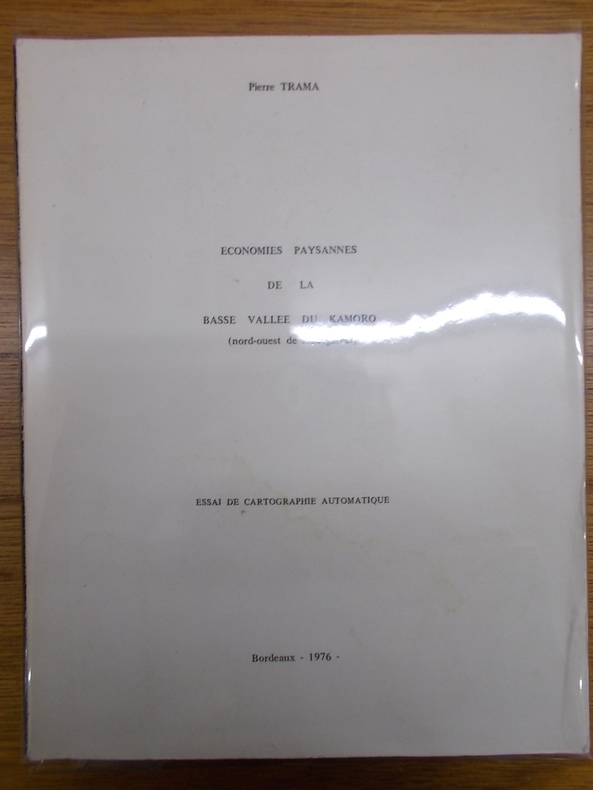
Pierre Trama
Economies paysannes de La basse vallée du Kamoro (nord-ouest de Madagascar) / Essai de cartographie automatique / Bordeaux - 1976
1976, Université de Bordeaux 3 - Talence, Bordeaux. Fort volume in-4, broché, 285pp. Thèse de doctorat présentée à l'Université Bordeaux 3 - Talence. Nombreuses photographies contrecollées. Quelques annotations au crayon. Riche iconographie. Trace de mouillure sur la couverture sans incidence. Bon exemplaire Photo sur demande.
Referenz des Buchhändlers : DIV253VIT
|
|
|
Pierre van der [sst.] Pol, Jeroen Grosfeld
Breda in kaart
, Breda's Museum 2002, 2002 Hardcover, 112 pagina's, Nederlands, 325 x 245 mm, in goede staat. ISBN 9789080610828.
Referenz des Buchhändlers : 55025
|
|
|
Pierre-Yves Kairis (ed)
Nouveaux regards sur les saisies patrimoniales en Europe l' poque de la R volution fran aise
, Brepols, 2021 Paperback, 362 pages, Size:210 x 297 mm, Illustrations:100 col., Language(s):French, English. ISBN 9782503588100.
Referenz des Buchhändlers : 65448
|
|
|
Pietri, J.M.et Fenouil M.
Carte Routière et Vicinale du Département de l'Hérault
4 étuis cartonnés, sans nom, 1862-1864 de cartes entoilées et rempliées, La carte est dressée sous l'administration du préfet J.M. Pietri, sous la direction de l'agent-voyer Fenouil. Arrondissement de Montpellier: 8 cartes (1862); Arrrondissement de Lodève: 6 cartes (1862); Arrondissement de Saint-Pons: 6 cartes 1862); Arrondissement de Béziers: 9 cartes (1864). La taille des cartes est de 46,5 cm x 59 cm.
Referenz des Buchhändlers : 2049

|
|
|
Pietro Allodi
Carta Postale, itinerante e amministrativa del Regno Lombardo-Veneto
60 X 85,5 cm. Litografia colorata a mano, con schede sulla navigabilità dei fiumi e dei laghi presenti nel Regno e sull’altezza dei principali monti.
|
|
|
PIGEON (Patrick) ROBIN (Marc)
Cartes commentées et croquis, méthodes et exemples, Paris, éditions Nathan, 1993.
1 vol. in-8° br. couv. pelliculée illustrée, 199 p. + cartes et croquis hors et dans le texte, neuf.
Referenz des Buchhändlers : 2125

|
|
|
PILONI LUIGI
LE CARTE GEOGRAFICHE DELLA SARDEGNA
in4° ( 42x30,5) - legatura editoriale telata con scritta al piatto e al dorso - pp. XVIII + CLXVI tavole + 24 - alcune tavole sono ripiegate - sguardie illustrate - presentazione di Osvaldo Baldacci - condizioni eccellenti

|
|
|
Pina Testoni (a cura di)
Aspetti naturalistici delle zone umide salmastre dell'Emilia-Romagna
illustrazioni

|
|
|
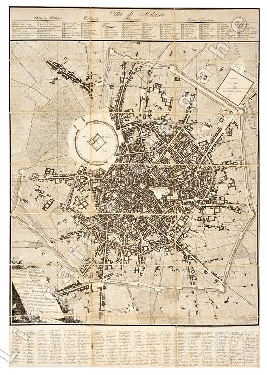
Pinchetti (Giacomo) :
Città di Milano. 1801. Giuseppe Caniani incise.
Plan de Milan (807 x 569 mm), gravé à l’eau-forte, entoilé et dépliant (21 morceaux) qui comprend le projet “Foro-Bonaparte” décrété par une loi du 30 nivôse an IX (20 janvier 1801) et projeté par l’architecte Antolini.
Referenz des Buchhändlers : 20474
|
|
|
Pinelli Carlo Alberto - Quilici Folco
L'alba dell'uomo [Edizione riservata agli abbonati di "Giorni"]
illustrazioni

|
|
|
PINETTI - ARTARIA.
Carta Topografica del Regno d'Italia. Diviso ne Suoi Dipartimenti. Con il Parmigiano, Genovesato e Toscana sino a Firenze. Con parte dei paesi confinanti del Piemonte, Svizzera, Grigioni, Tirolo, Carintia e Istria […]. Trieste, Treviso, Venezia.
Dalla “Topographische Carte des Konigreichs Italien. Mit angranzenden Landern”. Wien, Artaria und Comp., 1830 circa. Disegnata dal Pinetti e edita dall'Artaria, incisione su acciaio applicata su tela, b/n, cm 41,7 x 48,2 (il foglio). Si tratta del solo riquadro con il frontespizio comprendente le città di Mesola, Venezia, Treviso, Portogruaro, Trieste, Rovigno. Buona conservazione. .

|
|
|
PINETTI - ARTARIA.
Lago Maggiore, di Lugano, di Como, d'Iseo. Bormio, Bellinzona, Como, Morbegno, Sondrio.
Dalla “Topographische Carte des Konigreichs Italien. Mit angranzenden Landern”. Wien, Artaria und Comp. 1830 circa. Incisione su acciaio applicata su tela, b/n, cm 41,8 x 61,5 (il foglio). Disegnata dal Pinetti e edita dall'Artaria, dettagliata carta di gran parte della Lombardia, con i laghi e la Valtellina. Buona conservazione.

|
|
|
PINETTI - ARTARIA.
Villach, Udine, Gorz / Gorizia, Palmanuova, Belluno, San Daniele, Cividale.
Dalla “Topographische Carte des Konigreichs Italien. Mit angranzenden Landern”. Wien, Artaria und Comp. 1830 circa. Incisione su acciaio applicata su tela, b/n, cm 41,7 x 48,2 (il foglio). Disegnata dal Pinetti e edita dall'Artaria, dettagliata carta del Friuli con confine Veneto e con segnalata la città di Belluno. Buona conservazione.

|
|
|
Pinyinban,Hanyu.
Zhonghua Renmin Gongheguo Fen Sheng Dituji.
<br/> TITOLO: Zhonghua Renmin Gongheguo Fen Sheng Dituji. <br/> AUTORE: Pinyinban,Hanyu.<br/> EDITORE: Ditu Chubanshe Zhongguo<br/> DATA ED.: 1977,<br/> COLLANA: Edizione bilingue: indice dei nomi in ideogrammi e con trascrizione, toponomastica delle cartine solo in trascrizione.<br/>
|
|
|
PIRI REIS, (1465-1553).
Piri Reis's Kitab-i Bahriyye. Facsimile, Topkapi Palace Museum Library, Treasury Collection, number 642.= Kitab-i Bahriyye. Topkapi Sarayi Müzesi Kütüphanes Hazine Koleksiyonu. Prep. by Fikret Saricaoglu.
New English Original very decorative full leather bdg. with mystical sun gilded. Folio. (33 x 24 cm). In English, Turkish and Ottoman Turkish. 1 atlas (40 pages; 426 leaves, that is, 852 pages) color illustrations, color maps. Piri Reis's Kitab-i Bahriyye. Facsimile, Topkapi Palace Museum Library, Treasury Collection, number 642.= Kitab-i Bahriyye. Topkapi Sarayi Müzesi Kütüphanes Hazine Koleksiyonu. Printed to 2000 copies.
|
|
|
PIRI REIS.
The book of bahriye. Edited by Bülent Özükan.
New English Original cloth bdg. Oblong large 8vo. (22 x 22 cm). In English. 276 p. Ills. "Kitâb-i Bahriye, (The Book of the Navy or The Book of Navigation) is the most valuable result of Pîrî Reis' relentless and determined studies as well as of his knowledge, observations, and experience. This book consists of facsimile reproductions of the original Bahriye maps together with its text transcribed and rendered into modern language without corrupting the original city and the castle names."
|
|
|
Pirovano Carlo (a cura)
LOMBARDIA il territorio, l'ambiente, il paesaggio - l'et? delle riforme
Direttore editoriale, Carlo Pirovano - Art director, Pierluigi Cerri - Direttore tecnico, Giovanni Gardel - Premessa - Milano e la Lombardia alle soglie della modernit?, Roberto Mainardi - La cartografia lombarda: criteri di rappresentazione. uso e destinazione, Aurora Scotti - Le ville storiche nell'ambiente lombardo, Pier Fausto Bagatti Valsecchi - Artisti e viaggiatori fra citt? e campagne lombarde all'epoca del Grand Tour, Maria Cristina Gozzoli - Note - Bibliografia - Indice dei nomi e dei luoghi 1 28x24,5 cm., legatura in piena tela, sopraccoperta illustrata con immagine a colori: A. Aragonio, Carta della Pieve di Missaglia, 1611, ripetuta sui due piatti del cofanetto, cofanetto rigido, pp. 305 (3), 329 illustrazioni in nero e a colori, prima edizione, in italiano, normali segni del tempo sul cofanetto, ottime condizioni. Allegata scheda editoriale
|
|
|
Pirovano Francesco
Milano nuovamente descritta dal pittore Francesco Pirovano co' suoi stabilimenti di scienze, di pubblica beneficenza, ed amministrazione, chiese, palagi, teatri, ec., loro pitture e sculture
16°, pp. (2), VIII, 519, (1), cartonato editoriale con silografia del Duomo al piatto, copia fresca e in barbe con nota del proprietario al contropiatto posteriore: "Donatomi il giorno 6 gennaio 1822 da' Fratelli Silvestri". Ecco perché l'esemplare conserva la rara pianta di Milano legata al fondo, anche questa candida e ben conservata, da restaurare i due strappetti alla carta e relative tracce di nastro trasparente.

|
|
|
PISANI Vittorio -
La carica dei pinguini. Una spedizione cartografica che opera nei pressi del Polo Sud era giunta in vista di una città di pinguini abitata da circa 250 mila animali e il fotografo, sceso sul ghiaccio, lo stava ritraendo quando veniva aggredito e selvaggiamente beccato da stormi inferociti di questi palmipedi di solito così mansueti.
Roma, 1956 marzo 4, copertina illustrata a colori in fascicolo originale completo di pp. 32 de "La Tribuna illustrata" .

|
|
|
PITTONI detto "Battista Vicentino" Giovanni Battista (Vicenza 1520 - 1583)
Il Porto di Malta
Acquaforte e bulino, 1565, firmata e datata in lastra in basso a destra. Esemplare nel secondo stato di due, con il ritratto di Giovanni da Valletta aggiunto in basso a destra; tuttavia il primo stato della lastra può essere considerato come una prova di stampa. Magnifica prova, impressa su carta vergata coeva con filigrana non leggibile, con margini, in ottimo stato di conservazione. Nicolò Nelli è autore di diverse mappe e piante di Malta e la Valletta. Secondo Albert Ganado, il maggiore studioso della cartografia di Malta, questa mappa non è originale di Nelli ma realizzata usando e alterando la lastra dell’opera di Giovanni Battista Pittoni del luglio del 1565. Sempre secondo Ganado questa mappa sarebbe stata realizzata nell’ottobre dello stesso anno. Nelli modifica la lastra incisa dal Pittoni per raffigurare la battaglia del 11 settembre 1565 dove le truppe cristiane guidate da Ascanio della Corgna e Don Alvaro de Sande sconfissero i Turchi che fuggirono dall’isola. Il ritratto raffigura padre Jean de La Vallette-Parisot , il quarantanovesimo Gran Maestro del Sovrano Ordine di San Giovanni di Gerusalemme, da cui il nome della capitale di Malta, nominato nel 1557 per difendere l'isola dagli ottomani. Questa è l’unica mappa degli assedi che include il ritratto di Giovanni da Valletta, ed è assolutamente rarissima.Le vicende dell’isola di Malta, della costruzione della città fortificata, la guerra contro i Turchi e il celebre assedio dell’isola costituiscono motivo di grande interesse nella civiltà rinascimentale europea, tanto da produrre una relativa cospicua letteratura e soprattutto una notevole produzione iconografica del susseguirsi degli eventi. Il Grande Assedio di Malta del 1565 rappresenta una pietra miliare nella storia delle isole maltesi, e anche un punto di svolta nella guerra tra i cristiani contro le forze dell'Impero Ottomano, conclusa con la celebre battaglia di Lepanto nel 1571. Nonostante queste due sconfitte catastrofiche, i Turchi continuarono a fare incursioni lungo le coste del Mediterraneo occidentale per il resto del secolo, dopo aver recuperato Cipro dai Veneziani e Tunisi dagli Spagnoli, ma il declino del loro impero era ormai annunciato. L'Assedio di Malta, che durò da maggio a settembre 1565, fu seguito con trepidazione non solo a Napoli, Roma e Venezia, ma anche a Vienna, Londra e Madrid, a Parigi, Anversa e Bruxelles. La notizia della lentezza degli assedianti e della disperata difesa dell'isola raggiunse la Sicilia attraverso le lettere scritte dal Gran Maestro Jean de La Valette- Parisot, bozzetti di battaglie spediti dai Cavalieri dell'Ordine di San Giovanni e Relationi, scritte da soldati o marinai. Scene e mappe dell’assedio furono realizzate in Francia, Germania, Spagna e Italia per raccontare in immagini le diverse fasi della strenua resistenza di Malta contro le forze armate della Mezzaluna. In Italia i principali centri di produzione furono Roma e Venezia. Dato la finalità essenzialmente informativa di questi lavori, gli acquirenti non sempre si curavano della loro conservazione, ragione per cui sono oggi di incredibile rarità. Albert Ganado, il maggiore esperto di cartografia maltese, elenca oltre 60 lavori cartografici sull’isola, nelle loro varie diverse ristampe, concentrati nel brevissimo spazio di soli 10 anni. Etching and engraving, 1565, signed and dated in the plate lower right. Example in the second state of two, with a portrait of John Valletta added at the bottom right, but the first state of the plate can be considered as a test print. Magnificent proof, printed on contemporary laid paper with watermark unreadable, with margins, in excellent condition. Nicolo Nelli is the author of several maps and plans of Malta and Valletta. According to Albert Ganado, the greatest scholar of cartography of Malta, this map is not original but Nelli achieved by using and altering the sheet of Giovanni Battista Pittoni in July of 1565. Also according to Ganado this map was completed in October of the same year. Nelli change the plate engraved by Pittoni to portray the battle of September 11, 1565 where the Christian troops led by Ascanio della Corgna and Don Alvaro de Sande defeated the Turks who fled from the island. The portrait depicts Jean de la Vallette-Parisot, the forty-ninth Grand Master of the Sovereign Order of Saint John of Jerusalem, hence the name of the capital of Malta, who was appointed in 1557 to defend the island against the Ottomans. This is the only map of sieges which includes the portrait of John, Valletta, and is absolutely rare.The history of the island of Malta, the construction of the walled city, the war against the Turks and the famous siege of the island, is a matter of great interest in European Renaissance culture, so as to produce a relatively large literature and above all a remarkable iconographic production of sequence of events. The year 1565 is a landmark in the history of the Maltese Islands. It was also a turning-point in the struggle of Christendom against the forces of the Ottoman Empire, on which the battle of Lepanto (1571) put the final seal. Despite these two disasters, the Turks continued to ravage the coasts of the western Mediterranean during the rest of the century, after having recovered Cyprus from the Venetians and Tunis from the Spaniards; but the decline of their empire was in sight. The siege of Malta, which lasted from May till September 1565, was watched with trepidation not only in Naples, Rome and Venice, but even in Vienna, London and Madrid, in Paris, Antwerp and Brussels. News of the slow progress of the besiegers and of the desperate defence of the island reached Sicily through letters written by Grand Master La Valette, battle-sketches despatched by the Knights of the Order of St. John and “Relationi” written by soldiers or seamen. Thence it spread fanlike to all the centers of Christendom stretching from the Iberian peninsula in the west to Hungary in the east. Picture-maps of the siege were produced in France, Germany, Spain and Italy to illustrate for the layman the stand being put up by Catholic Malta against the armed might of the Crescent, the main centers of production being Rome and Venice, which even turned out several editions of various broadsheets to bring up to date the latest developments in the bitter and uneven struggle. Albert Ganado, the major expert of Maltese cartography, clists over 60 maps on the island, in their various states, concentrated in a very short space of just 10 years. Ganado, A study in depth of 143 Maps representing the Great Siege of Malta of 1565, pp. 30/36, 9.

|
|
|
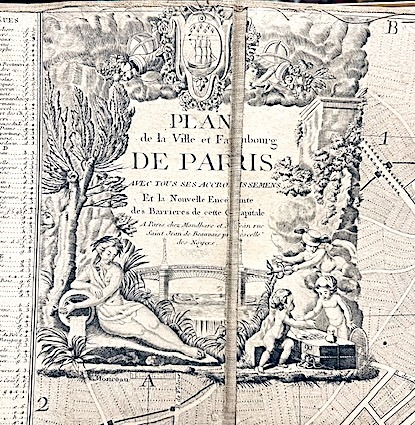
PLAN DE PARIS;
Plan de la ville et faubourg de Paris, avec tous ses accroissemens et la nouvelle enceinte des barrières de cette capitale.
Mondhare et Jean Paris 1790 1 vol. Feuille de 98 x 63 cm, entoilée et repliée, étiquette.
Referenz des Buchhändlers : 15849
|
|
|
PLAN-NIVELE' DU COL DU MONT-CENIS ..
Extrait des Minute de la Brigade Tipographique du Genie Militaire.
Carta litografica di cm. 59x77, Scala 1/40000, con numerazione altimetrica. Tracce d'uso e segni di piegatura.

|
|
|
Planisfero, mappamondo
Planisphere physique ou l'on voit du Pole Septentrional avec les grandes chaines de montagnes.
Paris, Dezauche succ. De l'Isle et Buache, 1783. (mm. 350 x 450). Bel planisfero in coloritura coeva, con testo ai lati, proveniente da Atlas géographique des quatre parties du monde par Guillaume De L'Isle et P. Buache. Incisione di Desbruslins.
|
|
|
Pnina Arad
Christian Maps of the Holy Land. Images and Meanings
, Brepols, 2020 Paperback, xxv + 176 pages, Size:216 x 280 mm, Illustrations:62 b/w, 11 col., Language: English. ISBN 9782503585260.
Referenz des Buchhändlers : 65684
|
|
|
POCKET-ATLAS - FRANCE.
Atlas portatif qui contient le roiaume de France avec le pais conquis ses frontieres, meres, & rivieres. Le tout en une carte generale avec 21 petites cartes... / Sak atlas van het geheel koninkryk Vrankryk, en desselfs geconquesteerde en aangrensende landschappen, zeen en rivieren...
Tall 8vo (18 x 8cm), [14]pp., with parallel title pages in both French and Dutch, woodcut vignettes, 23 hand-coloured engraved folding maps, cont. half red morocco, title label chipped. A rare pocket-atlas of France in both French and Dutch. Illustrated with 23 hand-coloured engraved folding maps: 1 general map, 21 detailed maps and 1 plate with an index of scale. Koeman 5, p. 263.
|
|
|
PODESTA' Bartolommeo
Le mappe delle loggie vaticane
In 8, pp. 15. Br. ed. Estratto dalla 'Rivista Internazionale' del 15 aprile 1877 (Anno VIII, vol. II, fasc. I). Saggio sulle mappe geografiche, raffiguranti le regioni italiane e i possedimenti della Chiesa all'epoca di Papa Gregorio XIII, affrescate sulle pareti della Galleria delle Carte Geografiche nei Musei Vaticani. Furono dipinte fra il 1580 e il 1585 sulla base di cartoni di Ignazio Danti, famoso geografo del tempo.
|
|
|
Poggi, Gaetano
Carte di Genova antica
4°, 35 cm, 4 tavole sciolte e una grande carta geografica più volte ripiegata con titolo: Genova preromana - romana e medioevale. Leggero alone alle copertine, per il resto esemplare molto buono

|
|
|
POLI Emilia -
Saggio cartografico sull'alto Etna.
Roma, 1965, 8vo stralcio con copertina posticcia muta, pp. 291/299 con una tabella ripiegata e due carte a colori di grande formato, più volte ripiegate, allegate in fine. - !! ATTENZIONE !!: Con il termine estratto (o stralcio) intendiamo riferirci ad un fascicolo contenente un articolo, completo in se, sia che esso sia stato stampato a parte utilizzando la stessa composizione sia che provenga direttamente da una rivista. Le pagine sono indicate come "da/a", ad esempio: 229/231 significa che il testo è composto da tre pagine. Quando la rivista di provenienza non viene indicata é perché ci è sconosciuta. - !! ATTENTION !!: : NOT A BOOK : “extract” or “excerpt” means simply a few pages, original nonetheless, printed in a magazine. Pages are indicated as in "from” “to", for example: 229/231 means the text comprises three pages (229, 230 and 231). If the magazine that contained the pages is not mentioned, it is because it is unknown to us.

|
|
|
POLITECNICO DI TORINO - DIPARTIMENTO CASA-CITTÀ
BENI CULTURALI E AMBIENTALI NEL COMUNE DI TORINO.
In-4 (cm. 30), 2 volumi, brossura illustrata, cofanetto, pp. 839, illustrate da numerose fotografie e cartine topografiche in bianco e nero; pp. 86 con 84 tavole f.t., a doppia pagina. In buono stato di conservazione (good copy).
|
|
|
Polk, Dora Beale
The Island of California A History of the Myth
Spokane Washington: The Arthur H. Clark Company 1991. Brand New HARDCOVER in a Brand New dust jacket. Perfect condition. NO chips. NO tears. NO creases. NO rubbing. NO fading. Bright shiny clean square and tight. Sharp corners. NOT a library discard. NO owner's name or bookplate. NO remainder mark. Fresh and crisp - obviously never read. 1991. First Edition. A fascinating look at a geographic misconception that persisted for two centuries. Extensively illustrated with 57 historic maps. Has a 23 page bibliography of sources for additional reading. List of chapter notes. Index. Bound in the original gilt-stamped maroon cloth. From the dust jacket: "The Island of California -- this misconception flourished on and off for almost two centuries following the Spanish discovery early in the 16th century. This book traces the origin of this strange notion -- how it evolved how it kept recurring and how it was finally put to rest." Volume XIII in the Spain in the West series. First Edition. Hardcover. New/New. 8vo. 398pp. Great Packaging Fast Shipping. The Arthur H. Clark Company Hardcover
Referenz des Buchhändlers : 018856 ISBN : 087062198X 9780870621987
|
|
|
POLLACCHI, Paul
Atlas Colonial Français
1931 - reliure - Edité par L'Illustration - 1931 - Grand in-folio (40,5 x 34 cm), reliure demi-basane à coins, premier plat orné d'un décor géométrique polychrome et d'un titre doré, dos titré en lettres dorées - 318 pages - 56 cartes (la numérotation de la table va jusqu'à 40, certaines cartes étant numérotées bis ou ter) - Très riche iconographie - Titre complet : Atlas colonial Français. Colonies, Protectorats et pays sous mandat - Cartes et texte du Commandant P. Pollacchi - Préface du Maréchal Lyautey
Referenz des Buchhändlers : 949

|
|
|
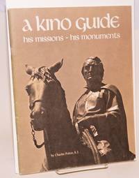
Polzer Charles cartography by Donald Bufkin
A Kino Guide: a life of Eusebio Francisco Kino Arizona's first pioneer and a guide to his missions and monuments cartography by Donald Bufkin
Tucson: Southwestern Mission Research Center 1976. 50p. 8.5x11 inches illustrations photos maps reading guide very good later revised printing booklet in stapled pictorial wraps. Southwestern Mission Research Center unknown books
Referenz des Buchhändlers : 60413
|
|
|
POMBA Cesare
NUOVO RILIEVO d'ITALIA a SUPERFICIE CURVA, alla SCALA UNICA di 1:1.000.000 ideato e costrutto dal Cav. Cesare POMBA, disegnato ed eseguito da G. Enrico FRITZSCHE Direttore dell'Istituto Cartografico Italiano in Roma. Schiarimenti e considerazioni dell'Autore.
Al front. DEDICA AUTOGRAFA "omaggio dell'autore". Introd. dedicatoria al pittore Vittorio AVONDO nel cui Castello (di Issogne!) l'Autore aveva preparato questo scritto. Bross. edit. Censito in 5 bibl. ALLEGATO: l'introvabile opuscolo pubblicitario di 8 pagine "Esposizione delle Provincie dell'Emilia - Mostra Nazionale del CLUB ALPINO ITALIANO. L'ITALIA nel suo aspetto fisico. RILIEVO a SUPERFICIE CURVA nella scala di 1 milionesimo, colle altezze proporzionali. Cenni dell'Autore, prezzo del Rilievo (L. 225, imballaggio L. 25, supporto sul quale il Rilievo può girare dalla posizione verticale all'orizzontale L. 60). Ottimo es.
|
|
|
PONT-A-MOUSSON (PLAN DES USINES)
Sociétés des Fonderies de Pont à Mousson. Usine de Pont à Mousson.
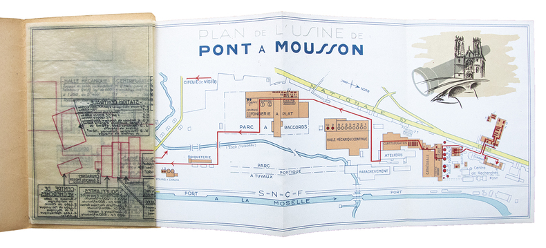
Plan des unités de production de l'usine de Pont à Mousson dépliant (465 x 180 mm) en couleurs (échelle 1/5000e) sur l'ensemble du site, accompagné d'un calque d'architecte détaillant en transparence les machines, installations et équipements pour chaque bâtiment. Ensemble relié sous couverture illustrée. Pont à Mousson, sans date (vers 1930).
Referenz des Buchhändlers : 27063
|
|
|
PONT-A-MOUSSON (PLAN DES USINES)
Sociétés des Fonderies de Pont à Mousson. Usine de Pont à Mousson.
Plan des unités de production de l'usine de Pont à Mousson dépliant (465 x 180 mm) en couleurs (échelle 1/5000e) sur l'ensemble du site, accompagné d'un calque d'architecte détaillant en transparence les machines, installations et équipements pour chaque bâtiment. Ensemble relié sous couverture illustrée. Aucun exemplaire de ce document n'est répertorié. Il manque à la réunion des bibliothèques mondiales en ligne (WorldCat). Bon exemplaire.
|
|
|
Pontificiae Academiae Scientiarum.
SEMAINE D'ETUDE SUR LE PROBLEME DES MICROSEISMES.
(Codice OS/0001) In 8º (24,5 cm) XLVI-417 pp. Recueil de 19 travaux scientifiques en français, anglais, allemand, espagnol, italien, illustrés de nombreuses figures et 8 planches sous serpente ou rempliées. Très peu de jaunissures. Broché, bon état. ~~~ SPEDIZIONE IN ITALIA SEMPRE TRACCIATA

|
|
|
PORCACCHI, Thomaso.
L'Isole più famose del Mondo descritte da Thomaso Porcacchi da Castiglione Aretino e intagliate da Girolamo Porro Padovano,
in-4 gr. (mm.350x215), pp. (28), 201, (ultimo bianco mancante), ottima leg. posteriore in pieno cuoio, di imitazione 500sca, filetti a secco e oro sui piatti, autore e titolo impressi in oro al centro degli stessi, dorso a nervi con filett. oro, tagli dor. Titolo inciso in rame entro bordura con varie figure allegoriche, iniziali silogr. istoriate, fregi tipografici. Nel testo vi sono 47 mappe delle isole incise su mezza pagina n.t., compreso il mappamondo (copia del Camocio del 1567) e la ''carta da navigare'' con le rotte ed i venti. Seconda edizione, con dedica a Giorgio Trivulzio, di questo celebre isolario, arricchita di 16 nuove carte geografiche rispetto alla prima edizione del 1572. Splendida rara opera, nella quale 8 tavole riguardano le Americhe ed il terzo libro è dedicato alla storia ed alle illustrazioni delle nuove scoperte. Le belle incisoni, in stile Lafreriano, sono opera dell'artista veneziano G. Porro. L'Isolario, si sviluppò in Italia durante il XV e XVI secolo, come guida illustrata ad uso dei naviganti. Tommaso Porcacchi (Castiglione Aretino 1530-1582) fu dotto letterato e ricercatore. Esemplare assai fresco.. Olschki, Choix, I 990. Adams P. 1905. Phillips 167. Sabin 64149. Alden L.575/24. Borba de Moraes 685. Blackmer 1330. Leclerc 1192.

|
|
|
PORENA F. -
La collezione di carte nautiche di T. Fisher.
Roma, 1887, 8vo stralcio con copertina posticcia muta, pp. 381/388 - !! ATTENZIONE !!: Con il termine estratto (o stralcio) intendiamo riferirci ad un fascicolo contenente un articolo, completo in se, sia che esso sia stato stampato a parte utilizzando la stessa composizione sia che provenga direttamente da una rivista. Le pagine sono indicate come "da/a", ad esempio: 229/231 significa che il testo è composto da tre pagine. Quando la rivista di provenienza non viene indicata é perché ci è sconosciuta. - !! ATTENTION !!: : NOT A BOOK : “extract” or “excerpt” means simply a few pages, original nonetheless, printed in a magazine. Pages are indicated as in "from” “to", for example: 229/231 means the text comprises three pages (229, 230 and 231). If the magazine that contained the pages is not mentioned, it is because it is unknown to us.

|
|
|
PORENA Filippo -
La geografia in Roma e il Mappamondo Vaticano.
Roma, 1888, tre stralci in 8vo con copertina posticcia muta, pp. 221/238 + pp. 311/339 + pp. 427/453 con quattro schizzi cartografici.

|
|
|
PORENA Filippo -
Un cartografo italiano del principio del secolo XVIII.
Roma, 1895, estratto cop. muta, pp. 45/73 + 235/236. - !! ATTENZIONE !!: Con il termine estratto (o stralcio) intendiamo riferirci ad un fascicolo contenente un articolo, completo in se, sia che esso sia stato stampato a parte utilizzando la stessa composizione sia che provenga direttamente da una rivista. Le pagine sono indicate come "da/a", ad esempio: 229/231 significa che il testo è composto da tre pagine. Quando la rivista di provenienza non viene indicata é perché ci è sconosciuta. - !! ATTENTION !!: : NOT A BOOK : “extract” or “excerpt” means simply a few pages, original nonetheless, printed in a magazine. Pages are indicated as in "from” “to", for example: 229/231 means the text comprises three pages (229, 230 and 231). If the magazine that contained the pages is not mentioned, it is because it is unknown to us.

|
|
|
Porro Carlo.
TERMINOLOGIA GEOGRAFICA. RACCOLTA DI VOCABOLI DI GEOGRAFIA E SCIENZE AFFINI per uso degli studi di geografia generale e militare.
(Codice OS/0274) In 8° VIII+74 pp. di testo su 2 colonne + appendice di 91 pp.: Segni convenzionali delle principali carte militari dell'Italia, Francia, Svizzera, Austria-Ungheria e Germania. Dedica autografa dell'Autore. Mezza tela editoriale, con ingialliture. Ottimo stato. ~~~ SPEDIZIONE IN ITALIA SEMPRE TRACCIATA

|
|
|
Porro Joseph.
GUIDE PRATIQUE DE TACHEOMETRIE.
(Codice SM/1860) In 8° 178 pp. Edizion originale, très rare. Volume illustré de 26 figures et nombreuses tables dont 6 rempliées hors texte. Sporadiques anciennes soulignures, jaunissures. Ancienne table de l'alphabet grec contrecollée au contreplat. Broché, dos correct. ~~~ SPEDIZIONE IN ITALIA SEMPRE TRACCIATA

|
|
|
PORTI DELLA NUOVA YORK E PERTHAMBOY ..
Tratta dal 'Gazzettiere Americano'.
Pianta di cm 20,5 x 17 alla battuta, più i margini, incisa in rame da Giuseppe Maria Terreni. La carta mostra i territori da Manhattan a Middletown, da Perth Amboy a Long Island, con i porti e gli altri insediamenti esistenti. Ottimo esemplare, assai fresco.

|
|
|

 Per e-mail erhalten
 Als pdf-Dokument herunterladen
 RSS feed
 Permanenter link


