|
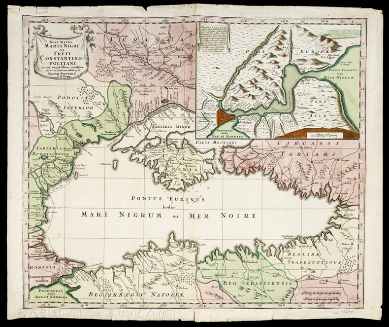
Seutter, Matthias (1678–1757):
Nova Mappa Maris Nigri et Freti Constantinopolitani.
Augsburg, 1741. Altkolorierter Kupferstich. Blattgrösse: 49.4 x 57.8 cm
Referenz des Buchhändlers : 986DG
|
|
|
Seutter, Matthäus
Mappa Geographica in qua Ducatus Lotharingiae et Barr ut et Episcopatuum Metens. Tullens. Verdunens. [Um 1730]. [altkolorierter Kupferstich, gerahmt / handcolored copper engraving, framed].
o.J. Matthäus Seutter (Matthias Seutter), geboren 1678 in Augsburg; gestorben 1757 ebenda. [3 Warenabbildungen]
Referenz des Buchhändlers : 59009BB

|
|
|
Seutter, Matthäus
Peloponnesus Hodie Morea. [Um 1730]. [altkolorierter Kupferstich, gerahmt / handcolored copper engraving, framed].
o.J. Matthäus Seutter (Matthias Seutter), geboren 1678 in Augsburg; gestorben 1757 ebenda. [3 Warenabbildungen]
Referenz des Buchhändlers : 59008BB

|
|
|
Seutter, Matthäus
XVII. Provinciae Belgii sive Germaniae Inferioris priscis temporib...[Um 1730]. [altkolorierter Kupferstich, gerahmt / handcolored copper engraving, framed].
o.J. Matthäus Seutter (Matthias Seutter), geboren 1678 in Augsburg; gestorben 1757 ebenda. [3 Warenabbildungen]
Referenz des Buchhändlers : 59007BB

|
|
|
SHERRER C.
Niederlande - Belgien und Luxembourg. Carte N° 40, extraite de Stielers Hand-Atlas.
- Carte 40 x 50 cm, pliée en 2.
Referenz des Buchhändlers : 70145
|
|
|
SHERRER C. - HABENICHT H.
Ostalpen. (Alpenländer : Westlisches Blatt.) Carte N° 15, extraite de Stielers Hand-Atlas.
- Carte 40 x 50 cm, pliée en 2.
Referenz des Buchhändlers : 70139
|
|
|
SHERRER C. - HABENICHT H.
Schweiz. (Alpenländer : Westlisches Blatt) Carte N° 14, extraite de Stielers Hand-Atlas.
- Carte 40 x 50 cm, pliée en 2.
Referenz des Buchhändlers : 70138
|
|
|
SHERRER C. - KOFFMAHN O.
Thüringishe Staaten. Carte N° 13, extraite de Stielers Hand-Atlas.
- Carte 40 x 50 cm, pliée en 2.
Referenz des Buchhändlers : 70137
|
|
|
SHIRLEY RODNEY W
THE MAPPING OF THE WORLD EARLY PRINTED WORLD MAPS 1472 - 1700.
IN 4° gr.( cm.26 X 35 ), pp.669. LEGATURA EDITORIALE TELATA RIGIDA + SOVRACOPERTINA ILLUSTRATA A COLORI CON TITOLO. SGUARDIE FIGURATE. 440 ILLUSTRAZIONI in b/n/col. DI PLANISFERI DELLE VARIE EPOCHE. OPERA FONDAMENTALE PER LA CATALOGAZIONE DEI PLANISFERI E DEI LORO AUTORI, DAL 1472 AL 1700. NUOVA EDIZIONE AGGIORNATA.<BR>OTTIMA CONSERVAZIONE. RARO. ID, 6767

|
|
|
Shirley Rodney W.
The Mapping of the World. Early Printed World Maps 1472 - 1700. Volune nine.
Ril. in tela con sovr.ill. a col., cm 34,5x24,5, pp 669, moltissime ill. a col. e b/n.. Come nuovo. - ISBN: o946323038

|
|
|
SHIRLEY Rodney W. -
Early Printed Maps of the British Isles 1477-1650.
England, Antique Atlas Publications, 1991, 4to (cm. 30,5 x 21,5) legatura tutta tela con titoli dorati al piatto anteriore e al dorso e sovraccopertina illustrata a colori, pp. XX-233 con 160 carte nel testo.

|
|
|
Shirley, Rodney W
Early Printed Maps of the British Isles : A Bibliography 1477-1650 Revised Edition
London: Holland Press 1980. Brand New in perfect condition. NO rubbing. NO fading. Bright clean square and tight. Sharp corners. NO owner's name or bookplate. NO remainder mark. Fresh and crisp -- obviously never read. Revised Edition. 1980. 88 plates. In 1973 a preliminary version of this work appeared in 5 issues of the periodical MAP COLLECTORS' CIRCLE. For this 1980 revision an index has been added as well as 97 new or corrected entries. Described and commented on are over 700 maps of the period. A final chronological listing identifies the cartographer date of publication and gives an estimate of rarity for each map's principal edition or first state. Volume #5 in The Holland Press Cartographica series. Bound in the original gilt-stamped dark green boards. 7.5" wide by 10" tall. 1980 Revised Edition. Hardcover. New/No jacket. xxv 188pp. Great Packaging Fast Shipping. Holland Press Hardcover
Referenz des Buchhändlers : 017928 ISBN : 0900470976 9780900470974
|
|
|
Shirley, Rodney W
Early Printed Maps of the British Isles : A Bibliography 1477-1650 Revised Edition
London: Holland Press 1980. Near Fine condition. Bright clean square and tight. Sharp corners. NO owner's name or bookplate. NO remainder mark. Fresh and crisp -- probably never read. Revised Edition. 1980. 88 plates. In 1973 a preliminary version of this work appeared in 5 issues of the periodical MAP COLLECTORS' CIRCLE. For this 1980 revision an index has been added as well as 97 new or corrected entries. Described and commented on are over 700 maps of the period. A final chronological listing identifies the cartographer date of publication and gives an estimate of rarity for each map's principal edition or first state. Volume #5 in The Holland Press Cartographica series. Bound in the original gilt-stamped dark green boards. 7.5" wide by 10" tall. 1980 Revised Edition. Hardcover. Near Fine condition/No jacket. xxv 188pp. Great Packaging Fast Shipping. Holland Press Hardcover
Referenz des Buchhändlers : 018076 ISBN : 0900470976 9780900470974
|
|
|
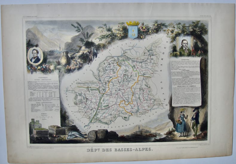
Shmith et Burly
Département des Basses-Alpes
Planche de l'Atlas National Illustré. Dressé par Levasseur. Pas de couverture Très bon Paris Pelissier Vers 1850 35 x 50 cm
Referenz des Buchhändlers : 11398
|
|
|
SIDER (Sandra) ANDREASIAN (Anita) & CODDING (Mitchell)
Maps, Charts, Globes: Five Centuries of Exploration. A New Edition of E. L. Stevenson's Portolan Charts and Catalogue of the 1992 Exhibition.
First Edition, 4to, 73 plates (some coloured), orig. cloth, d.w. Catalogue of the Society's manuscript portolan charts covering material from the fifteenth through the seventeenth century.
|
|
|
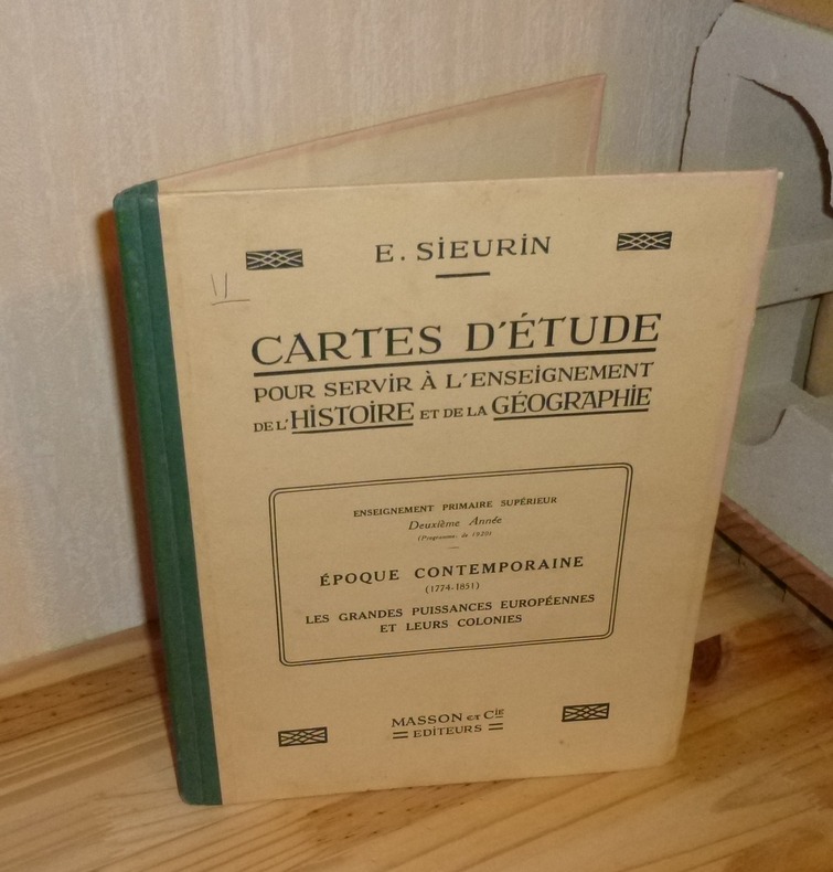
SIEURIN, E.
Cartes D'Étude pour servir à l'enseignement de l'histoire et de la géographie. Enseignement primaire supérieur deuxième année (programmes de 1920). Époque Contemporaine (1774-1851). Les grandes puissances européennes et leurs colonies. Paris, Masson et Cie. 1923.
1 volume in-4° relié toile verte, 36 cartes. Très bon état infime état d'usage.
Referenz des Buchhändlers : 14396
|
|
|
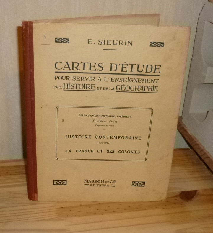
SIEURIN, E.
Cartes D'Étude pour servir à l'enseignement de l'histoire et de la géographie. Enseignement primaire supérieur troisième année (programmes de 1920). Histoire Contemporaine (1852-1920). La France et ses colonies. Paris, Masson et Cie. 1923.
1 vol. in-4° rel. toile verte, 32 cartes. Couverture un peu salie avec léger état d'usage sinon bel état.
Referenz des Buchhändlers : 14397
|
|
|
SILVANO GHIRONI - ANTONIO MANNO
PALMANOVA
IN 8° CARRE' ( cm.22 X 24,5 ), pp.273, COPERTINA EDITORIALE PATINATA ILLUSTRATA A COLORI CON TITOLO. 95 ILLUSTRAZIONI DI PIANTE E PARTICOLARI DELLA' CITTA' DI PALMANOVA CON RELATIVE SCHEDE. SEGUE BIBLIOGRAFIA. IL VOLUME HA IL PREGIO DI RACCOGLIERE I CONTRIBUTI DI DUE SPECIALISTI, UNO IN CARTOGRAFIA URBANA E L'ALTRO IN ARCHITETTURA MILITARE VENEZIANA SULLA STORIA DELLA CITTA' - FORTEZZA DI PALMANOVA. PERFETTA CONSERVAZIONE. ID 5023

|
|
|
SILVESTRE Marguerite, FINCOEUR Michel-Benoit
"Inventaire raisonné des collections cartographiques Vandermaelen, conservées à la Bibliothèque Royale de Belgique (4 volumes); tome 1 : Cartes de Belgique; tome 2 : Carte topographique de la Belgique au 1 : 20 000; tome 3 : Villes et communes de Belgique (hors Bruxelles); tome 4 : Bruxelles."
Bruxelles, Bibliothèque Royale Albert 1er, 1994-2000. 21 x 28, 4 volumes, xxviii-563 + 335 + xxx-466 + xxx-546 pages, très nombreux figures, plans et cartes en N/B et en couleurs, reliure d'édition pleine toile bleue, très bon état (1 cachet d'ex-propriétaire au bas de la page de garde dans chaque volume).
Referenz des Buchhändlers : 91651
|
|
|
SILVESTRE, M. - FINCOEUR, M.B. - CHANTERENNE, C. - OP DE BEECK, B. - ELKHADEM, H.
INVENTAIRE RAISONNE DES COLLECTIONS CARTOGRAPHIQUES VANDERMAELEN. Conservees a la Bibliotheque Royale de Belgique.- Vols I+II+III+IV+V (complet !).
5 volumes Hardcover in-4° (22x28 cm), + de 2500 pages, BW & colour illustrations. Bibliography & indexes. Text in French. Très bel ensemble, état proche du NEUF ! DEDICACE des auteurs et collaborateurs. [P-48] Vol.I: Cartes de Belgique. Vol.II: Carte topographique de la Belgique au 1:20000. Vol. III: Villes et communes de Belgique (hors Bruxelles). Vol IV: Bruxelles. Vol. V: L'Atlas universel (1825-1827)
|
|
|
Silvestri, F- Stecchi De Bellis, Maria A.- Silvestri Baffi, Rosetta- Manzionna, Rosa M.G.
LA PUGLIA NELLE ANTICHE STAMPE
In 4', br. ed. con sovrac., pp. nn., CXXX tavv. in n. molte ripiegate; opera pubblicata in occasione del XVI Congresso Nazionale dei Distretti Lions 108 Italia, copia fuori commercio numerata 401/2400, premessa di Giuseppe Pittorino, presentazione di Adriano Prandi.Segni d'uso e di sporco alla sovrac. e dorso brunito, cop. e interni in ottimo stato.

|
|
|
Silvestri, Roberto
Bastia Umbra Storia Di Terremoti estratto dalla tesi di laurea di Roberto Silvestri "Tutela del patrimonio architettonico e monumentale e rischio sismico. Il caso di Bastia" Pagine selezionate, raccolte ed integrate, da Edda Vetturini
Mm 170x240 Volume nella sua brossura originale, 144 pagine con numerose illustrazioni in nero e a colori nel testo e fuori testo, Copia in ottime condizioni. Spedizione in 24 ore dalla conferma dell'ordine.
|
|
|
SIMAAN Arkan et FONTAINE Joëlle
L'image du monde, des Babyloniens à Newton.
Paris, ADAPT Editions, 1999. 16 x 24, 235 pp., quelques illustrations en N/B, broché, très bon état (cachet d'ex-propriétaire).
Referenz des Buchhändlers : 91895
|
|
|
SIMAR Th.
LA GEOGRAPHIE DE L’AFRIQUE CENTRALE. Dans l’antiquité et au Moyen Age.
In-8 gr., brossura, pp. 131,(3), con carte e figure nel testo e 9 tavole in b.n. fuori testo. “Phéniciens et Grecs - Les Romains - Les Arabes - Théories, cartes du XIII au XV siècle”. Timbro di appartenenza al piatto anteriore, ma testo ben conservato.
|
|
|
Simeon Giuseppe.
CARTOGRAFIA AERONAUTICA - COSMOGRAFIA ED ASTRONAVIGAZIONE - IMPPIEGO DELLA MACCHINA.
(Codice AV/6381) Edizione ciclostilata. Tre parti rilegate in un solo volume in 4° (33 cm) 141+52+11 pp. e 10 tavole fuori testo, 1 ripiegata. Grosso volume, legatura dell'epoca in tela muta. Lievi segni del tempo, minima rosicatura marginale alle ultime pagine, ma ottimo stato. Molto raro. ~~~ SPEDIZIONE IN ITALIA SEMPRE TRACCIATA

|
|
|
Simon Garfield
OP DE KAART hoe de wereld in kaart werd gebracht.
Ingenaaid boek, 494 pp met illustraties, nieuw staat !!. ISBN 9789460581120. Simon Garfields belangstelling voor kaarten wordt gewekt wanneer hij als kind dagelijks de metrokaart in de Londense subway bestudeert. Zijn fascinatie is sindsdien alleen maar toegenomen. In Op de kaart onderzoekt hij hoe kaarten, vanaf de eerste schetsen van de oude Grieken tot aan Google Maps, onze geschiedenis hebben gemaakt en beinvloed. Garfield verhaalt over de onmogelijke opdracht om Afrika in kaart te brengen, over het maken van de perfecte globe, over Ptolemeus en Johannes Blaeu, over de ontdekkers van de Zuidpool en de Star Maps in Hollywood. En waarom heet Amerika eigenlijk niet Columbus? Op de kaart is een onweerstaanbare zoektocht, rijk geillustreerd en vol vermakelijke anekdotes, naar waar we waren, waar we zijn en waar we naartoe gaan. Een verrukkelijk boek over letterliefde, schreef De Morgen over het veelgeprezen Precies mijn type, waarin Simon Garfield de geschiedenis van de typografie belicht. Op dezelfde enthousiasmerende, onnavolgbare wijze schrijft hij in Op de kaart over landkaarten en atlassen. Simon Garfield (1960) is journalist en schrijft voor The Independent en The Observer. Hij heeft vele non-fictieboeken op zijn naam staan. Recent verscheen van hem het reeds herdrukte Precies mijn type, een boek over letters.

|
|
|
Simon Garfield
OP DE KAART hoe de wereld in kaart werd gebracht.
, Luster uitgeverij, 2014 Ingenaaid boek, 494 pp met illustraties, nieuw staat !!. ISBN 9789460581120.
Referenz des Buchhändlers : 46500
|
|
|
Sir John F.W. HERSCHELL
Manuel élémentaire pour la construction et le dessin des cartes géographiques
Paris, Roret, 1837. In-18° broché de 346 + 90 pages. 3 planches dépliantes en fin de volume. Le haut du dos est absent sinon trés bel état pour ces livres si fragiles.
Referenz des Buchhändlers : 3628
|
|
|
SIRON (Commandant) et GAILLARD (Capitaine)
"Les cartes topographiques belges; lecture et emploi pratique en campagne, croquis, reconnaissances, levée à vue, etc."
Paris, Librairie Chapelot, 1922. 14 x 23, 148 pp., 118 figures, broché, bon état (papier légèrement jauni).
Referenz des Buchhändlers : 64728
|
|
|
SKELTON (R.A.)
County Atlases of the British Isles 1579-1850: A Bibliography. 1579-1703.
4to, viii,262pp., frontis., 40 plates, facsimiles, orig. cloth, d.w.
|
|
|
SKELTON (R.A.) Compiler.
County Atlases of the British Isles 1579-1850: A Bibliography. 1579-1703.
4to, viii,262pp., frontis., 40 plates, facsimiles, orig. cloth.
|
|
|
SKELTON R.A.
Decorative Printed Maps of the 15th to 18th Centuries. A revised Edition of 'Old Decorative Maps and Charts' by A.L. Humphreys. With eighty-four Reproductions and a new Text. BRIGHT, CLEAN COPY
Roy. 4to., First Edition, with 12 coloured plates and 72 monochrome plates; burgundy cloth, upper board blocked in gilt, gilt back, a very good, bright, clean copy. The first form of this work, by Humphreys, appeared in 1926 designed as a picture book to illustrate the wealth of a notable collection. Skelton's classic reworking serves both as a specimen book and a guide to the study of maps printed from wood blocks or copper-plates from the birth of mapmaking to the eve of scientific cartography. The majority of plates in the original work have been retained and twenty-two new illustrations added, together with a bibliography.

|
|
|
Skelton Raleigh Ashlin
A Venetian terrestrial globe, represented by the largest surviving printed gores of the 16th century. Twenty-four engraved globe gores designed for a terrestrial globe.
In 4° piccolo; 11, (5) pp. e una grande tavola più volte ripiegata. Brossura editoriale. Perfetto stato di conservazione. Prima ed unica edizione di questo repertorio bibliografico-cartografico dedicato agli spicchi componenti un globo terrestre realizzato a Venezia intorno al 1570.

|
|
|
Skelton, R A; & R V Tooley
Map Collectors' Circle Series Fourth Volume Vol. IV No. 37 : The Marine Surveys of James Cook in North America 1758-1768 Particularly the Survey of Newfoundland A Bibliography of Printed Charts and Sailing-Directions
London: Map Collectors' Circle 1967. Complete with errata slip laid in. Near Fine condition. Clean and unmarked. NOT a library discard. NO owner's name or bookplate. Describes in detail 23 main entries plus variants. Includes collations. Lists all charts and maps. Cross referenced to Phillips. Illustrated with 22 plates 1 fold-out. Bound in the original tan wraps printed in black. 7.25" wide by 9.75" tall. First Edition. Softcover. Near Fine condition. 50pp. Great Packaging Fast Shipping. Map Collectors' Circle Paperback
Referenz des Buchhändlers : 018898
|
|
|
SKELTON, R. A.
Explorers' Maps; Chapters in the Cartographic Record of Geological Discovery
4to [28.5 x 22 cm]; xii, 337 pp, color frontis, more than 200 illustrations of maps, charts and drawings from early sources, bibliog, index. original cloth, title lettering on spine, dj (spine faded from sun but lettering clear, slight wear at spine ends), signature on endpaper but very good copy. A picture of this book is available upon request by email. An excellent and most useful book, by the former chief of the Map Room at the British Museum whose book are highly respected. This book traces the development of cartography from medieval times to the present and discusses the European exploration and discovery of the rest of the world. Parts of the book were published in Geographic Magazine in a different form. This edition is in larger format than previous edition, making it easier to read.
|
|
|
Skelton, R. A. , Thomas E. Marston & George D. Painter
VINLAND MAP AND THE TARTAR RELATION
Book has slight soiling to textblock. Dustjacket is price-clipped. DJ has small tears to corner and chipping to spine ends. Light soiling to DJ. ; Evidence concerning the Viking discovery of North America in the tenth and eleventh centuries is so incomplete, investigation of this area of history will be substantially aided by the discovery of new documents. Such is the claim made for the previously unknown manuscripts here published for the first time. They are two documents copied about 1440 from much earlier originals, now lost. The first is an account of Friar John of Plano Carpini's mission to the Mongols in 1245-47. The second is a world map, including the western ocean, with delineations of Iceland, Greenland, and a land mass named Vinland which represents the North American mainland as known to the medieval Norsemen. This map is the earliest known and indisputable cartographic representation of any part of the Americas. As the editors show, the Tartar Relation provides information on Mongol history and legend not to be found in any known source, and a portion of the Map represents the only surviving medieval example based on Norse cartography - a conclusion with far-reaching implications for the history of cartography and of the Viking navigations. OVERSIZED. ; 291 pages
|
|
|
Skelton, R. A. ; Humphreys, Arthur Lee
Decorative printed maps of the 15th to 18th centuries; a rev. ed. of Old decorative maps and charts by A.L. Humphreys. With eighty-four reproductions and a new text by R.A. Skelton.
Large quarto / small folio in maroon cloth boards an pink illus DJ; viii, 80 p. 84 plates (part col.) 29 cm; bibl. Early maps -- Facsimiles. Early maps.
|
|
|
Skelton, R. A., Marston, Thomas E., & Painter, George, D.
The Vinland Map and the Tartar Relation. With a Foreword by Alexander O. Vietor
Folio 291p., illus. Hardcover Very good condition good
|
|
|
Skelton, R.A. and Melvin H. Jackson
The European Image and Mapping of America, A.D. 1000-1600 [with] Salt, Sugar, and Slaves: The Dutch in the Caribbean (The James Ford Bell Lectures, numbers 1 and 2)
The first two lectures in this important series. 8vo. Original wraps. FINE AND BRIGHT.
|
|
|
Skrivanic,Gavro A.
Monumenta cartographica Jugoslaviae II
NOTE : Volume TWO ONLY 101p. maps index Book
|
|
|
SLOT B. J.
Les origines du Koweit.
Koweït: Centre de recherches et d'études koweitiennes, 2005 in-4, 193 pages, 82 planches en couleurs. Bibliographie. Reliure d'éd., jaquette, très bon état. Histoire de la cartographie du Koweith.
Referenz des Buchhändlers : 13979415
|
|
|
SMITH & Son.
Extendes tape indicator map of London and visitors guide.
Cartella in tela di cm. 17 X 11 contenente una grande pianta a colori (telata) di Londra più volte ripiegata di cm. 90 X 30 con divisioni in quartieri, misure delle distanze, linee tranviarie, ecc. oltre ad un indice dei nomi di 70 pagine. Ben conservata la cartella in tela rossa con titolo in oro e impressioni a secco al piatto.
|
|
|
Smith, C
MAP OF YORKSHIRE East Riding Hull and Humberside
London: C. Smith 1823. Corrected 3rd Edition . No Binding. Fine. Folding map. Original hand-coloured map dated 1823 58x50 cms. Double-page folding plate printed on fine paper and original hand-colour. With a numbered list of the Wapontakes including 8 examples found on this plate. A lovely example of the 3rd 1823 issue of the Jan 6th 1804 map by C. Smith of 172 The Strand London. Smith's County Altas being a complete set of County Maps divided into Hundreds. Wide margins no wear and very clean example with no marks or wear to the centre-fold. <br/> <br/> C. Smith unknown
Referenz des Buchhändlers : Map921
|
|
|
Smith, Clofford T
Geografia storica d'Europa. Dalla preistoria al XIX secolo
8°, 21 cm, pp. XI, 742, alcune figure nel testo, 42 tavole fuori testo, brossura editoriale illustrata, titolo al piatto e dorso, Collana: Biblioteca universale Laterza, esemplare ottimo

|
|
|
Smith, George Adam
The Historical Geography of the Holy Land: Especially in Relation to the History of Israel and of the Early Church - With Six Maps - Twenty-Third Edition
Includes six folded maps. 15x23 cm. 713 pages. Hardcover. Spine slightly faded. Chafe on inner cover. Ex-libris sticker on first white page. Pen writing on title page. Several pages slightly stained in edges. Else in good condition. PLEASE NOTE: This item is overweight. We may ask for extra shipping costs.
|
|
|
Smith, J L
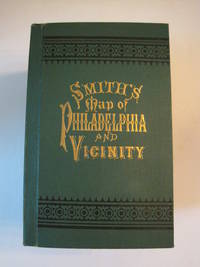
New Map of Philadelphia and Vicinity Published by J. L. Smith 27 South Sixth St. Philadelphia 1894 : Cover title: Smith's Map of Philadelphia and Vicinity
Philadelphia: J. L. Smith 1894. Fine condition. SEE PHOTOS. A very attractive well preserved copy of this detailed two-part map of Philadelphia and vicinity published in 1894 copyright 1893. Tough-to-find in collectible condition as nice as this. A bright clean copy. NO chips. NO tears. NO creases. NO owner's name or bookplate. Clean and unmarked. Drawn on a scale of 1 inch to the mile. The map consists of two parts. The eastern half unfolds to 23" wide by 27" tall. The western part is 21.5" wide by 27" tall. Both are skillfully and attractively hand colored. The maps are backed in linen as issued. They are housed in the publisher's original green cloth portfolio which is printed in black and embossed in gold on the front cover and in blind on the rear. Gilt lettering is still as bright and shiny as new. 1st ed No additional printings listed. Hardcover. Fine condition. J. L. Smith Hardcover
Referenz des Buchhändlers : 016609
|
|
|
Smith, William/ Overton, Henry
A NEW MAP OF THE COUNTY OF NORFOLK 1713
London: Henry Overton 1713. Original printed issues 1st Editions . No Binding. Fine. Folio. 1603-1713 The rare re-issue with amendments by Henry Overton of Smiths original plate of 1603. Based on the map by Saxton in 1573. Un-coloured example in fine condition of the copperplate engraving. Paper size 55 x 46 cms. Plate size 48 x 33 cms. No splits or holes. Plain verso and part of the original hinge still present. Table with a list of the hundreds. One of the original 'anonymous' maps that were identified as being by Smith in recent times.PLEASE EAMIL FOR PHOTOS. <br/> <br/> Henry Overton unknown
Referenz des Buchhändlers : Map868
|
|
|
Snead, R.E
Atlas of world physical features.
New York u.a. Wiley & Sons, (1972). 4°. M. zahlr. Ktn. 158 S. OLwd. Kleberest v. Rsign. St. a. Tit.
Referenz des Buchhändlers : 134413
|
|
|
Snyder George S.
OUDE HEMELKAARTEN. Hoogtepunten uit tien eeuwen cartografie.
Ril. in tela con sovr.a col., cm 39x31, pp 144, molte splendide tavv. e ill. a col.. - ISBN: 9023005635

|
|
|
SOCIETE D'HISTOIRE MODERNE ET CONTEMPORAINE
Revue d'histoire moderne et contemporaine - tome 54 -n°4, octobre-décembre 2007.
Au sommaire, "Ecole et société en France": article de Jean-Michel CHAPOULIE sur l'école sous la IVè République; "Politiques et pratiques coloniales (XVIIIe-XXe siècles)": articles de Laurent DUBOIS et de Bernard CAMIER sur le théâttre des Lumières à Saint-Domingue, de Hélène BLAIS sur la cartographie en Algérie dans les années 1830-1840, de Romain BERTRAND sur la politique coloniale des Pays-Bas en 1880-1930, d'Eric JENNINGS sur l'émigration depuis Saint-Pierre et Miquelon en 1903-1939; comptes rendus d'ouvrages. Français
|
|

 Per e-mail erhalten
 Als pdf-Dokument herunterladen
 RSS feed
 Permanenter link


