|
SOCIETE D'HISTOIRE MODERNE ET CONTEMPORAINE
Revue d'histoire moderne et contemporaine - tome 54 -n°4, octobre-décembre 2007.
Paris, Belin, 2007 1 volume 16 x 24cm Broché 191p. Très bon état.
Referenz des Buchhändlers : 13762
|
|
|
Soffer, Arnon ; Kipnis, Baruch [Eds.]
Atlas of Haifa and Mount Carmel.
370x310 mm. 122 pages. Hardcover with dust-jacket. Jacket edges torn and worn. Spine edges slightly rubbed. Pages slightly yellowing. Else in good condition.
|
|
|
Soldi Fiorino
Undicesima ora. La missione di Bartolomeo da Cremona al gran khan di Karakorum nel 1254 [MONGOLIA]

|
|
|
Soley, Ramon
ATLES DE BARCELONA. ICONOGRAFIA DE LA CIUTAT DE BARCELONA. VISTES I PLANOLS IMPRESOS DE 1572 A 1900 (Barcelona atlas / catalogue raisonnÈ of maps, 2 volumes, complete)
Two volumes, complete. The monumental catalogue raisonnÈ of maps and views of Barcelona printed from 1572 to 1900. LXXII, 1093 pp. with 740 large high-quality color plates. Text in Spanish, Catalan, and English. Edition limited to 1000 sets. Large oblong folio (31 x 44 cm). Publisher's cloth, with a design by Antoni T‡pies. FINE AND BRIGHT, WITH NO DEFECTS. As new.
|
|
|
Soprintendenza generale agli interventi post – sismici in Campania e Basilicata ( a cura della )
Atlante di Napoli. La forma del centro storico in scala 1 : 2000 nell'ortofotopiano e nella carta numerica.
In – 4to ( misure 30x30 ), copertina rigida con sovraccoperta illustrata, cofanetto in tela rigido con illustrazioni applicate ai piatti, pp. 83 + 196 tavole a colori fuori testo. Prima edizione. Con 98 tavole fotografiche della città ripresa dall'alto e 98 tavole con le relative trasposizioni cartografiche fuori testo, numerose riproduzioni di antiche stampe, dipinti e piantine varie nel testo. Scritti di Stefano De Caro, Mario De Cunzo, Nicola Spinosa, Anna Maria Campofredano, Licinio Ferretti e altri. Esemplare come nuovo, niente strappi, macchie, mancanze, sottolineature o altro difetto degno di nota.
|
|
|
Sotheby's.
THE WARDINGTON LIBRARY: IMPORTANT ATLASES & GEOGRAPHIES. Part One: A-K. Part Two: L-Z. London 10-18 October 2005
(Codice BB/0761) Due volumi in 4º (28 cm) 348+372 pp. Catalogo d'asta, 562 splendidi pezzi descritti e illustrati con molte foto a colori. Prezzi di stima in sterline ed euro. Rilegati in tela rossa editoriale e titolo oro. Freschissimi. ~~~ SPEDIZIONE IN ITALIA SEMPRE TRACCIATA

|
|
|
Spada Alessandra
Che cos'è una carta geografica
br. Le carte geografiche, uno strumento antico diventato oggi prodotto di sofisticate tecnologie, raccontano del nostro modo di vedere La terra su cui abitiamo. Ma quanto sono cambiate? Possiamo ancora chiamarle "carte"? A che cosa servono? Ogni mappa si manifesta come la rappresentazione di una parte di territorio, ma può svelare a chi la osserva qualche cosa di più: il rapporto di potere tra chi la commissiona, chi la disegna, chi dovrà usarla. Obiettivo di questo volume è costruire un ponte tra riflessione scientifica e uso pratico, ma anche offrire, a chi ancora lavora al disegno di nuove immagini geografiche, suggestioni di mappe antiche e contemporanee.

|
|
|
SPADA Valerio (Colle di Val d'Elsa 1613-1688)
Pianta della Candia dell'anno 1668
Veduta obliqua della città veneziana e della fortezza di Candia, che mostra lo stato dei lavori di assedio, con alcune linee di trincea e linci nel 1668 durante la fase finale della guerra e il penultimo anno del lungo assedio ottomano, iniziato nel 1648 e proseguito fino alla capitolazione della città il 27 settembre 1669. Orientata da sud verso l'alto (i punti cardinali non sono corretti; essi mostrano il nord che punta a sinistra, mentre l'est, che dovrebbe quindi puntare verso l'alto, è contrassegnato con la "P" per Ponente, in modo che ovest e est siano invertiti). L'opera appartiene al cospicuo numero di cosidette "carte d'occasione" - stampe che servivano per documentare e diffondere notizie, specialmente di avvenimenti bellici - che illustrano la quinta guerra ottomano-veneziana o guerra cretese (1645-69).La tavola è incisa da Valerio Spada ma il probabile ideatore è tale Vincenzo Vangelisti, il cui nome appare in alto, nella dedica ad Antonio Maria Vincenti, ambasciatore della Repubblica di Venezia a Firenze.Non abbiamo trovato nessuna notizia su Vangelisti, ne su questa rarissima opera di Valerio Spada, che non appare nemmeno sulla monografia di Massar.Acquaforte, con ampi margini, tracce di piega centrale visibili al verso, per il resto in ottimo stato di conservazione. A high oblique view of the Venetian town and fortress of Candia, showing state of the siege works, with some of the trenches and saps in 1668 during the final phase of the war and the penultimate year of the long Ottoman siege, begun in 1648 and continuing until the city capitulated on 27 September 1669. Oriented with south to top (cardinal points are incorrect; they show north pointing to the left while the east, which should therefore be pointing to the top, is labelled 'P' for Ponente, so that west and east are reversed). The work belongs to the large number of so-called "separately published prints" - prints that were used to document and disseminate news, especially of war events - that illustrate the fifth Ottoman-Venetian or Cretan war (1645-69).The plate is engraved by Valerio Spada but the likely creator is Vincenzo Vangelisti, whose name appears at the top, in the dedication to Antonio Maria Vincenti, ambassador of the Republic of Venice in Florence.We have found no news about Vangelisti, nor about this very rare work by Valerio Spada, which does not even appear in Massar's literature.Etching, with wide margins, traces of central fold visible on the verso, otherwise in excellent condition. cfr. Phyllis Deaborn Massar, The Prints of Valerio Spada, in “Print Quarterly” Vol. III, Num. 3 (1986) pp. 217-238 e Vol. IV, Num. 1 (1987), pp. 19-39.

|
|
|
SPADA Valerio (Colle di Val d'Elsa 1613-1688)
Veduta della città di Firenze dal muricciolo del prato de’ padri di San Francesco al monte
Acquaforte, metà del XVII secolo, firmata in lastra in alto nel cartiglio. Magnifica prova, impressa su carta vergata coeva (due fogli reali uniti), lievi pieghe di carta, rifilata al rame o con sottile margine, restauro perfettamente eseguito nella parte inferiore, per il resto in ottimo stato di conservazione. Valerio Spada fu allievo, a Firenze, di Lorenzo Lippi; divenne un fine incisore e calligrafo, tanto da meritarsi la stima di Cosimo III de Medici. Questa ambiziosa rappresentazione di Firenze descrive l’intera città, dal Belvedere alla Zecca, includendo le colline e la città di Fiesole. Inoltre, il panorama è notevole per i suoi dettagli bucolici raffigurati nel primo piano, che comprendono figure, vigneti e oliveti. L’opera è dedicata a S.A.R, il Principe Leopoldo; la dedica è contenuta nel grande cartiglio in alto, che include il titolo, costituito dallo stemma dei Medici, sostenuto da due angeli. Ottimo esemplare. Etching, half of the XVII century, signed on upper plate, in the cartouche. Magnificent work, printed on contemporary laid paper (two royal sheets joined together), light paper fold, trimmed to platemark or with thin margins, a perfectly executed repair on lower part, otherwise in excellent condition. Valerio Spada was pupil of Lorenzo Lippi, in Florence, thus becoming a fine engraver and calligrapher, a thing which gained him the appreciation of Cosimo III de Medici. This ambitious representation of Florence describes the whole city, from the Belvedere to the Zecca, including the hills and the city of Fiesole. The panorama is noteworthy due to its bucolic details in the foreground, including figures, vineyards and olive grove. The work is dedicated to H.R.H Prince Leopoldo; the dedication is enclosed in the cartouche on upper part, together with the title, formed with the dei Medici coat of arms held by two angels. Excellent example. Mori-Boffitto 62; Phyllis Deaborn Massar, The Prints of Valerio Spada, in “Print Quarterly” Vol. III, Num. 3 (1986) pp. 217-238 e Vol. IV, Num. 1 (1987), pp. 19-39.

|
|
|
SPAGNA E PORTOGALLO ..
Carta incisa in rame e acquarellata a mano.
Carta di cm 36 x 48 alla battuta, più i margini, su tav. piegata a metà. Ampio testo storico-descrittivo incorniciato a destra e a sinistra. Tratta da 'Atlante storico, geografico, genealogico, cronologico e letterario di M. A. Le Sage in ogni sua parte corretto, ampliato e proseguito sino all'anno corrente. Prima Veneta Edizione'.
|
|
|
Spagnol Mario - Dossena Giampaolo (a cura di)
Avventure e viaggi di mare. Giornali di bordo, relazioni, memorie
illustrazioni

|
|
|
Spallanzani Lazzaro
Viaggi nell'Appennino modenese e reggiano
10 tavole fuori testo

|
|
|
SPAVEN David
Mapping the Railways. FINE COPY IN UNCLIPPED DUSTWRAPPER
Roy., 8vo., First Edition, with coloured photographs and maps throughout, and coloured endpaper maps; laminated pictorial boards, a fine copy in unclipped dustwrapper.
|
|
|
Speed, John
GLOUCESTERSHIRE Original Map
London: John Sudbury and George Humble 1646. No Binding. Vg. Folio. 1611-1646. An original map of the county of Gloucestershire. Nice old hand-colouring a dark impression. One or two tiny holes near the centre-fold repaired. 39.5 x 52cms. 15.5 x 20.5 inches. The margins are all about 1cm outside the plate. ENGLISH TEXT to the reverse. The imprint is John Sudbury and George Humble. Floral initial letter to reverse in the style of John Legett. PLEASE EMAIL FOR PHOTOS <br/> <br/> John Sudbury and George Humble unknown
Referenz des Buchhändlers : Map735
|
|
|
Speed, John
SUFFOLK Original Map
London: Thomas Bassett and Richard Chiswell 1616. No Binding. Fine. Folio. 1611-1676 An original map of the county of Suffolk. Nice old hand-colouring a dark impression. 41.5 x 54cms. 16.25 x 21.5 inches. Wide margins outside the plate. ENGLISH TEXT to reverse. The imprint is by Thomas Bassett and Richard Chiswell in St Pauls Yard. London Floral initial letter to reverse in the style of Hall and Beale. PLEASE EMAIL FOR PHOTOS. Basset and Chiswell joined forces and purchase the original Speede plates and re-issued the maps in a fine edition in 1676. Only this issue was produced and is dated 1676 <br/> <br/> Thomas Bassett and Richard Chiswell unknown
Referenz des Buchhändlers : Map 752
|
|
|
Speed, John
THE KINGDOME OF SCOTLAND
London: John Sudbury and George Humble 1610. 1st Edition . No Binding. Vg. Folio. 44x52 cms. 38.5x51 cms The rare first edition of Speed's Kingdome of Scotland map with original outline colouring and printed on thick paper. Portraits of the Scottish Royal family border the side margins and the imprint reads' Performed by John Speed and are to be sold in 'Popeshead alley by John Sudbury and George Humble Cum Privilego 1610'. In the upper right corner is the inset ' The Yles of Orkney'. The map reverse has the text description in English. The map is complete to the margins but has been rather crudely repaired to the rear in past times and is generally a trifle grubby. Edges and centre fold repaired from the back.The top and bottom margins are wide but the side margin are close to the plate mark.The impression however being the first edition is very good with dark and clean lines throughout. The faded colouring is original with very understated with subtle lines and wash to the portraits and sea creatures. The Inital letter to the text is the first issue and by William Hall 1611-12. PLEASE EMAIL FOR PHOTOGRAPHS. <br/> <br/> John Sudbury and George Humble unknown
Referenz des Buchhändlers : Map903
|
|
|
Spekke Arnold e altri
Lettonia
tavole in bianco e nero fuori testo

|
|
|
SPERANDIO Antonio (a cura di)
CARTOGRAFIA STORICA E INCISIONI DEL TERRITORIO DEL LAZIO. Dalla Collezione di Fabrizio Maria Apollonj Ghetti.
In-4 (cm. 31.80), tela editoriale, sovracoperta editoriale illustrata, pp. 366, (2), con illustrazioni in bianco e nero nel testo. In ottimo stato (nice copy).
|
|
|
SPHYROERAS, Vasilis - AVRAMEA, Anna - ASDRAHAS, Spyros.
Maps and Mapmakers of the Aegean.
Hardcover in-4, 263 pp. 166 colour and b/w historic maps of Greece, , the Greek Islands and Archipelago, and the Aegean Sea.- Fine copy with no inscriptions, in a Good dustwrapper Qq accrocs à la jaquette sinon très bel exemplaire. [QU-2] Text in English.
|
|
|
Sphyroeras,Vasilis. Avramea,Anna. Asdrahas,Spyros.
Maps mapmakers
<br/> TITOLO: Maps mapmakers <br/> AUTORE: Sphyroeras,Vasilis. Avramea,Anna. Asdrahas,Spyros.<br/> CURATORE: Trad.dal greco di G.cox e J.Solman.<br/> EDITORE: Olkos<br/> DATA ED.: 1985,<br/> testo in inglese.
|
|
|
Spier, Leslie
American Anthropologist. New Series. Volume 39. Organ of the American Anthropological Association, the Anthropological Society of Washington, the American Ethnological Society of New York and the Philadelphia Anthropological Society.
New York, Kraus Reprint Co., 1969. 738 S. Gr.-8°, Halbleinen
Referenz des Buchhändlers : 98859

|
|
|
SPRECHER von BERNEGG / KLÜWER, Philipp:
Neue Karte des alpinen und verbündeten Rätien und seiner Untertanen / Georges Grosjean: Die Rätia-Karte von Fortunat Sprecher von Bernegg und Philipp Klüwer aus dem Jahre 1618.
Dietikon-Zürich, Verlag Bibliophile Drucke Josef Stocker, 1976, 52x65 cm. 4 S. Text, 1 faksim. Karte. Eines von 490 numm. Exemplaren (GA 530 Ex.). Ex. Nummer 90. Pappband-Mappe mit Leinen Rückenstreifen. (OHLn.-Mappe - Titelschild auf Umschlag vorne).
Referenz des Buchhändlers : 118961aaf
|
|
|
Spruner
DR. KARL VON SPRUNER'S HISTORICO-GEOGRAPHICAL HAND ATLAS
London: Trubner & Co. 1869. 2nd Edition . Hardback. Fine. Oblong 4to. 26 Coloured plate maps engraved on copper each with a description. Original brown blind-stamped decorative borders gilt titles. head and tail of the spine rubbed otherwises a fine copy. Karl Spruner von Merz 1803-92 <br/> <br/> Trubner & Co. hardcover
Referenz des Buchhändlers : Le273
|
|
|
Spruner, K.v
Historisch-geographischer Hand-Atlas. Tl. 1: Atlas Antiquus.
Gotha, Perthes, 1850. Fol. M. 27 doppelblattgr. gest. grenzkolor. Ktn. 4 Bl. Hldr. m. mont. Deckeltitel. Einbd. stark berieben u. bestoßen. Rücken beschäd. bzw. laienhaft repariert. Innendeckel m. Bibl.-Aufkl. Besitzverm. a. Vorsatz. M. mehr. St. Gebräunt u. teils stockfl.
Referenz des Buchhändlers : 191959

|
|
|
Stab. geograf. OSCAR DRESSLER
L'ITALIA SETTENTRIONALE E CENTRALE al tempo degli SVEVI 1138 . 1254
Incisione litografica in nero, dim. dell'intero foglio con margini L. 60 x 42,5 cm. (L. 46,7 x 33,2 cm. la sola parte incisa). In buone condizioni. Carta appartenente all'ATLANTE STORICO DELL'ITALIA (Tav. V) edito da Francesco Vallardi a Milano nel 1868.
|
|
|
Stanford's
Stanford's MAP OF THE COUNTRIES ROUND THE NORTH POLE
London: Edward Stanford 55 Charing Cross 1875. 1st issue . paper wrappers. Fine. Folding map. 78.5 x 66.5 cms. The rare first issue of Stanford's April 19th 1875 map of the North Pole. Laid on cloth in 12 dissected sections. Coloured printing. Pasted to the lower left corner is a contemporary inset map of the Kennedy Channel entering ther 'frozen Polar Ocean' text to the reverse of the inset map.The voyages and journeys of the Artic explorers throughout the centeries are neatly printed in red throughout the map with dates including up to Austrian Exped. Payer 1874. Neatly enclosed in cloth covers when folded with a hand-written original label 'North Pole'. A lovely copy of a very scarce item. PLEASE EMAIL FOR PHOTOS. <br/> <br/> Edward Stanford, 55 Charing Cross unknown
Referenz des Buchhändlers : Map877
|
|
|
STANGANINI Laura -
Le isole britanniche nella cartografia dall'antichità ad oggi. Un percorso di ricerca.
Firenze, 1999, 8vo stralcio con copertina posticcia muta, pp. 242/271 con numerose carte in nero e a colori, anche a pagina doppia. - !! ATTENZIONE !!: Con il termine estratto (o stralcio) intendiamo riferirci ad un fascicolo contenente un articolo, completo in se, sia che esso sia stato stampato a parte utilizzando la stessa composizione sia che provenga direttamente da una rivista. Le pagine sono indicate come "da/a", ad esempio: 229/231 significa che il testo è composto da tre pagine. Quando la rivista di provenienza non viene indicata é perché ci è sconosciuta. - !! ATTENTION !!: : NOT A BOOK : “extract” or “excerpt” means simply a few pages, original nonetheless, printed in a magazine. Pages are indicated as in "from” “to", for example: 229/231 means the text comprises three pages (229, 230 and 231). If the magazine that contained the pages is not mentioned, it is because it is unknown to us.

|
|
|
STARCK-MAN (P.).
Tabula Itineris, & Stationum Israelitarum in Deserto ab eurom egressu ex Aegypto ad transitum Ioardamis.
Sin lugar ni año (Siglo XVIII), mapa grabado en madera, de 32'5 x 44,5 cm.
|
|
|
Stark, E
Die Genauigkeitsstruktur im photogrammetrischen Einzelmodell. Diss.
München, 1973. 4°. 152 S. OBr. Klammern angerostet. Umschl. etwas angeschmutzt u. m. St. sowie Sign. (BAW. Veröff. d. Dt. Geodät. Komm. C 193).
Referenz des Buchhändlers : 162379
|
|
|
STATI-UNITI DELL'AMERICA SETTENTRIONALE dalle più recenti mappe.
Carta incisa in rame e acquarellata a mano.
Carta di cm 36 x 48,5 alla battuta, più i margini, su tav. piegata a metà. Tratta da 'Atlante storico, geografico, genealogico, cronologico e letterario di M. A. Le Sage in ogni sua parte corretto, ampliato e proseguito sino all'anno corrente. Prima Veneta Edizione'.
|
|
|
Stavenhagen, W
Skizze d. Entwicklung u. d. Standes d. Kartenwesens d. außerdeutschen Europas.
Gotha, Perthes, 1904. 4°. XXVIII, 376 S. Ohne Umschl. M. Kleberest v. ehemaliger Bind. Schnitt u. letzte S. etwas stockfl. St. a. Tit. (Petermanns geogr. Mitteil. Erg.-H. 148).
Referenz des Buchhändlers : 213882
|
|
|
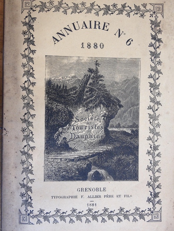
STD. Société des Touristes du Dauphiné.
SOCIETE DES TOURISTES DU DAUPHINE. Annuaire N° 6. 1880 . 6 ème année.
1881 1881 Edité à Grenoble chez Allier. 1881. Un volume in 8. broché; non coupé. 216 pages. Une très belle carte hors texte en couleurs plusieurs fois repliée, représentant la carte historique des Vallées Vaudoises par A. de Rochas d'Aiglun. éditée par le Spectateur Militaire. intérieur très frais. dos bruni comme souvent.
Referenz des Buchhändlers : 2392
|
|
|
Sterling.Tom.
L'Amazzonia.
<br/> STATO: USATO, COME NUOVO.<br/> TITOLO: L'Amazzonia. <br/> AUTORE: Sterling.Tom.<br/> EDITORE: Mondadori<br/> DATA ED.: 1986,<br/> COLLANA: Collana Grandi Distese Selvagge.<br/>
|
|
|
Stern, Friedel
Israel: In Pictorial Maps [AS IS]
AS IS. 34x28.5 cm. Irregularly numbered pages. Hardcover. Cover and spine are dirty and slightly scuffed. Front and back white pages are slightly damaged. Front cover page is slightly stained. Else in good condition. PLEASE NOTE: This item is overweight. We may ask for extra shipping costs.
|
|
|
Stevenson, Edward Luther
Terrestrial and Celestial Globes Their History and Construction 2 volumes in 1 complete; new in publisher's shrinkwrap
Mansfield Centre Connecticut: Martino Fine Books 1997. 2 volumes complete bound as 1. BRAND NEW HARDCOVER in perfect condition. STILL SEALED in the publisher's clear plastic SHRINKWRAP. NO rubbing. NO fading. Bright clean square and tight. Sharp corners. NO owner's name or bookplate. NOT a remainder. Fresh and crisp -- obviously never read. No date but 1997 First Martino printing limited to 150 copies published @ $95. Facsimile reprint of the 1921 two-volume Hispanic Society of America/Yale University Press edition. 2 vols. in 1: xxvi 218pp. xi 291pp. 143 plates mostly photos of important globes. The standard reference on the subject. According to Ristow this is "a comprehensive work including an extensive bibliography an index of globemakers with locations of globes and a general index." -- #317 GUIDE TO THE HISTORY OF CARTOGRAPHY. Keyguide 316: "A comprehensive work that includes a bibliographical listing. Valuable for astronomers as well as carto-historians and geographers." Handsomely bound in the original blue cloth stamped in bright gold over a red spine panel. First Martino printing Limited to 150. Hardcover. New/in publisher's shrinkwrap. 2 vols. in 1: xxvi 218pp. xi 291pp. 143 plates. Great Packaging Fast Shipping. Martino Fine Books Hardcover
Referenz des Buchhändlers : 018336 ISBN : 1578980844 9781578980840
|
|
|
Stewart,Robert.
Il Labrador.
<br/> STATO: USATO, COME NUOVO.<br/> TITOLO: Il Labrador. <br/> AUTORE: Stewart,Robert.<br/> CURATORE: Fotografie di Pierre Boulat.<br/> EDITORE: Mondadori<br/> DATA ED.: 1986,<br/> COLLANA: Collana Grandi Distese Selvagge.<br/>
|
|
|
STEYERT, A.
Changements de noms de rues de la ville de Lyon, proposés par la commission municipale. Texte officiel publié avec des notes critiques et huit plans en couleurs.
1884 A Lyon, Chez l'auteur - M DCCC LXXXIV (1884) - In-8 broché, couverture rempliée - 156 pages
Referenz des Buchhändlers : 126969

|
|
|
Stieler Adolph e Berghaus Ermann
Stieler Adolph e Berghaus Ermann. Atlante scolastico per la geografia politica e fisica
22838 Stieler Adolph e Berghaus Ermann Stieler Adolph e Berghaus Ermann. Atlante scolastico per la geografia politica e fisica. N. D., Gotha: Giusto Perthes 1861 - I italiano, in ottavo pp. non numerate Atlante scolastico di fine ottocento. Copertina cartonata molto usurata. Pagine leggermente ingiallite e usurata ad angoli e bordi. Leggeri segni a matita sulla prima pagina.

|
|
|
STIELER, Adolf
Schul-Atlas über alle Theile der Erde nach dem neuesten zustande, und ûber das Weltgebäude. Nach Stieler’s Hand-Atlas verkleinert. Dreissigste verbesserte und vermehrte Auflage [Trentième édition améliorée et augmentée]
Gotha, Justus Perthes 1850 In-4à l’italienne 23,5 x 31 cm. Reliure demi-basane havane, dos lisse muet, 24 planches, table. Reliure défraîchie avec manque angulaire, coupes usées, intérieur correct. En l’état.
Referenz des Buchhändlers : 140962

|
|
|
STIELER, Adolf.
Stielers Hand- Atlas. Über alle Theile der Erde und über das Weltgebäude.- Ed. 1877.
Hardcover in-folio (25,5 x 39 cm) , 90 cartes gravées sur cuivre (frontières en couleurs) double pages, reliure demi-basane d'époque, dos à nerfs en partie manquant. Plats et coins frottés, manques importants au dos, intérieur en très bon état. [P-53]
|
|
|
Stiles, President [Ezra Stiles]
A history of three of the judges of King Charles I. Major-General Whalley Major-General Goffe and Colonel Dixwell: Who at the Restoration 1660 fled to America; and were secreted and concealed in Massachusetts and Connecticut for near thirty years.
Hartford Connecticut: Elisha Babcock 1794. Good - Very Good condition. SEE PHOTOS. Hinges are sound with only a single half inch hairline crack. NOT a library discard. NO owner's name or bookplate. Foxing mostly light to moderate to several pages. Slight age toning. Bound in full leather sprinkled calf with 5 raised spine bands. Brown leather spine label mostly chipped away. Gilt spine decorations and gilt double ruled borders on the front and rear covers. Handsome gilt inside dentelles i.e. borders decorated with gilt lacy pattern at inner edges. SEE PHOTOS. Frontispiece portrait of the author engraved by Amos Doolittle. This copy includes plates 1 2 4 5 6 8 also engraved Amos Doolittle. Of these 6 plates 5 are folding some copies have only 3 plates that are folding. Plate 1 is a map of New Haven and Its Environs Wheat 281. Plate 4 shows 3 maps one of which shows Hadley Mass Wheat 276 278 280. Plate 5 is a map of the City of New Haven Wheat 275. Plate 8 is another map of Hadley Massachusetts Wheat 279. Lacks pages 145-156 plates 3 and 9 which apparently were not bound in. Plate 7 does not exist in any copy per Howes and Sabin: "there is no plate 7 in any of the copies seen and it is probable none was made." This is a history of three members of the tribunal which had Charles I beheaded in 1649. The author Ezra Stiles was president of Yale College from 1778 until his death in 1795. No errata slip is present in this copy so presumably it is Howes' second issue. Includes the "Advertisement" at the end on an unnumbered page that offers subscribers the option to cancel if dissatisfied with the change in the dimensions of this book from what was described in the prospectus not present. Full title: "A history of three of the judges of King Charles I. Major-General Whalley Major-General Goffe and Colonel Dixwell: Who at the Restoration 1660 fled to America; and were secreted and concealed in Massachusetts and Connecticut for near thirty years. With an account of Mr. Theophilus Whale of Narragansett supposed to have been also one of the judges." Howes S-999. Evans 27743. Sabin 91742. Trumbull Connecticut 1425. ESTC W20469. Church 1264. Wheat and Brun 275-283. First Edition Second Issue. Hardcover. Good - Very Good condition. Illus. by NOT a library discard. 12mo. 358pp. "Advertisement". Great Packaging Fast Shipping. Elisha Babcock Hardcover
Referenz des Buchhändlers : 025454
|
|
|
Stockholms Auktionverk -
Rare maps, atlases & plate books from Ericsberg's Castle.
Stockholm, 2008, 4to legatura editoriale, pp. 158 con circa 400 schede prezzate

|
|
|
STONE, J.C
(Ed.) Norwich's Maps of Africa. An illustrated and annotated carto-bibliography. Oscar I. Norwich. Bibliographical descriptions by Pam Kolbe. Second edition. Revised and edited by J. C. Stone.
(Norwich), Terra Nova Press, (1997). 4to. 37, (1) S., 408 S. m. zahlr., teils farbigen Abb., 1 Bl. OLwd m. OUmschlag (Umschlag minimal gebrauchsspurig).
Referenz des Buchhändlers : 1247024
|
|
|
Stoppani Antonio
Il bel paese. Conversazioni sulle bellezze naturali, la geologia e la geografia fisica dell'Italia

|
|
|
Stoppani,Antonio.
Il Bel Paese.
<br/> STATO: USATO, ACCETTABILE.<br/> NOTE: Il volume è da rilegare, al copertina è staccata.<br/> TITOLO: Il Bel Paese. <br/> AUTORE: Stoppani,Antonio.<br/> CURATORE: Conversazione sulle bellezze naturali, la geologia e la geografia fisica d'italia.<br/> EDITORE: Cogliati<br/> DATA ED.: 1908,<br/>
|
|
|
Storms, Martijn
Maps that made History. 1000 Years of World History in 100 old Maps
Lannoo Publishers, Tiel - Leiden University Libraries, Leiden, 2022. 431 S. ; 34,5 x 28,5 cm ; Pp. ;
Referenz des Buchhändlers : 124530

|
|
|
Stouraiti Anastasia
La Grecia nelle raccolte della Fondazione Querini Stampalia
n. 10 bross. edit. con bandelle, dorso muto, lieve macchia in cop.

|
|
|
Strabo / Jones, Horace Leonard [Trans.]
The Geography of Strabo: Based in Part upon the Unfinished Version of John Robert Sitlington Sterrett - In Eight Volumes [VOLUME VII IS MISSING] [SERIES]: The Loeb Classical Library
VOLUME VII IS MISSING. VOL. II, III, IV, V, VIII Contains folded maps. [VOL. I]: Books I-II / [VOL. II]: Books III-V / [VOL. III]: Books VI-VII / [VOL. IV]: Books VIII-IX / [VOL. V]: Books X-XII / [VOL. VI]: Books XIII-XIV / [VOL. VIII]: Book XVII & General Index. [ALL VOLUMES]: 11.5x16.5 cm. xliii+531+v+479+397+465+541+397+510 pages. Gilt hardcover. Top and bottom of spine are chafed. Pencil writing on several pages. [VOL. II]: Top of spine is worn. [IN CONCLUSION]: Else in good condition. PLEASE NOTE: This item is overweight. We may ask for extra shipping costs.
|
|
|
Strabon.
GEOGRAPHIE. TOME II (Livres III et IV). Texte établi et traduit par François Lasserre.
(Codice LL/2124) In 8° Texte en regard grec/français. Exemplaire en partie non coupé. Broché, très bon état. ~~~ SPEDIZIONE IN ITALIA SEMPRE TRACCIATA

|
|
|
Strada Gino
Buskashì. Viaggio dentro la guerra

|
|

 Per e-mail erhalten
 Als pdf-Dokument herunterladen
 RSS feed
 Permanenter link


