|
|
|
Rehav, Rubin ; Kadmon, Naftali ; Snyder, James S. / Tishby, Ariel [Ed.]
Das heilige Land auf Landkarten
Contains b&w and color plates. 280x240 mm. 168 pages. Hardcover. In as new condition.
|
|
|
REIGNIER François
Les systèmes de projections et leurs applications à la géographie, à la cartographie, à la navigation, à la topométrie.
P, Publications techniques de l ' I G N, 1967, 2 vols in4°broché pour le tome 1 et en feuilles dans classeur anneaux éditeur pour le t 2 , 312pp , 44 graphiques T 1: texte, T2 : graphiques
Referenz des Buchhändlers : ML3431
|
|
|
REIGNIER, François
Les systèmes de projection et leurs applications à la géographie, à la cartographie, à la navigation, à la topomètrie... [2 volumes]
Paris, Institut géographique national, coll. « Publications techniques de l'I.G.N. » 1957 2 volumes. Cartonnés, couvertures beiges, auteur & titre en noir sur les dos et les premiers plats de couverture, 312 pp., 90 figures - 40 planches, sommaire, table des matières, bibliographie, index alphabétique des matières. Exemplaires en très bon état.
Referenz des Buchhändlers : 135896

|
|
|
Reilly, Franz Johann Joseph von
Des Erzstifts und Kurfürstenthums Kölln Südliche Aemter Nr. 222. [um 1790]. [Altkolorierter Kupferstich, gerahmt / handcolored copper engraving, framed].
o.J. [3 Warenabbildungen] (Franz Johann Joseph von Reilly, geboren am 18. August 1766 in Wien, gestorben am 6. Juli 1820 ebenda. Österreichischer
Referenz des Buchhändlers : 61170BB

|
|
|
Reilly, Franz Johann Joseph von
Die Grafschaft Mansfeld Kur Sächsisch und Kur Brandenburgschen Antheils Nro. 374. [Altkolorierter Kupferstich, gerahmt / handcolored copper engraving, framed].
o.J. [3 Warenabbildungen] Franz Johann Joseph von Reilly, geboren am 18. August 1766 in Wien, gestorben am 6. Juli 1820 ebenda. Österreichischer V
Referenz des Buchhändlers : 13827DB

|
|
|
Reilly, Franz Johann Joseph von (1766?1820)
Schauplatz der fünf Theile der Welt ? mit beständiger Rücksicht auf die besten Originalwerke. - Deutschland und die Schweiz.
Wien, Reilly, 1789?1806. Kupferstich Nr. 413. ? Der Bund des Hauses Gottes. Worms (Veltlin). Blattgrösse: 31,5 x 48 cm. Plattengrösse: 23,5 x 32 cm. + Wichtig: Für unsere Kunden in der EU erfolgt der Versand alle 14 Tage verzollt ab Deutschland / Postbank-Konto in Deutschland vorhanden +, A
Referenz des Buchhändlers : 1031CG

|
|
|
Reilly, Franz Johann Joseph von (1766?1820)
Schauplatz der fünf Theile der Welt ? mit beständiger Rücksicht auf die besten Originalwerke. - Deutschland und die Schweiz.
Wien, Reilly, 1789?1806. Kupferstich Nr. 403. ? Der Kanton Unterwalden. Blattgrösse: 30,5 x 47,7 cm. Plattengrösse: 22 x 28,5 cm. + Wichtig: Für unsere Kunden in der EU erfolgt der Versand alle 14 Tage verzollt ab Deutschland / Postbank-Konto in Deutschland vorhanden +, A
Referenz des Buchhändlers : 1029CG

|
|
|
Reilly, Franz Johann Joseph von (1766?1820)
Schauplatz der fünf Theile der Welt ? mit beständiger Rücksicht auf die besten Originalwerke. - Deutschland und die Schweiz.
Wien, Reilly, 1789?1806. Kupferstich Nr. 415. ? Die Unterthanen der Graubündner oder das Thal Veltlin mit den Grafschaften Worms und Cleven. Blattgrösse: 29,5 x 41,5 cm. Plattengrösse: 23,5 x 32,5 cm. + Wichtig: Für unsere Kunden in der EU erfolgt der Versand alle 14 Tage verzollt ab Deutschland / Postbank-Konto in Deutschland vorhanden +, A
Referenz des Buchhändlers : 1028CG

|
|
|
Reilly, Franz Johann Joseph von (1766?1820)
Schauplatz der fünf Theile der Welt ? mit beständiger Rücksicht auf die besten Originalwerke. - Deutschland und die Schweiz.
Wien, Reilly, 1789?1806. Kupferstich Nr. 391 ? Der Kanton Zürich nördlicher Theil. Blattgrösse: 31 x 48,5 cm. Plattengrösse: 22,3 x 33,5 cm. + Wichtig: Für unsere Kunden in der EU erfolgt der Versand alle 14 Tage verzollt ab Deutschland / Postbank-Konto in Deutschland vorhanden +, A
Referenz des Buchhändlers : 1033CG

|
|
|
Reilly, Franz Johann Joseph von (1766?1820)
Schauplatz der fünf Theile der Welt ? mit beständiger Rücksicht auf die besten Originalwerke. - Deutschland und die Schweiz.
Wien, Reilly, 1789?1806. Kupferstich Nr. 392. ? Des Kantons Zür(i)ch südlicher Theil. Blattgrösse: 31 x 48 cm. Plattengrösse: 24,5 x 31,5 cm. + Wichtig: Für unsere Kunden in der EU erfolgt der Versand alle 14 Tage verzollt ab Deutschland / Postbank-Konto in Deutschland vorhanden +, A
Referenz des Buchhändlers : 1027CG

|
|
|
Reilly, Franz Johann Joseph von (1766?1820)
Schauplatz der fünf Theile der Welt ? mit beständiger Rücksicht auf die besten Originalwerke. - Deutschland und die Schweiz.
Wien, Reilly, 1789?1806. Kupferstich Nr. 414. ? Der Bund der zehn Gerichte (Teil Kanton Graubünden). Blattgrösse: 32 x 48 cm. Plattengrösse: 21,5 x 26,5 cm. + Wichtig: Für unsere Kunden in der EU erfolgt der Versand alle 14 Tage verzollt ab Deutschland / Postbank-Konto in Deutschland vorhanden +, A
Referenz des Buchhändlers : 1034CG

|
|
|
Reilly, Franz Johann Joseph von (1766?1820)
Schauplatz der fünf Theile der Welt ? mit beständiger Rücksicht auf die besten Originalwerke. - Deutschland und die Schweiz.
Wien, Reilly, 1789?1806. Kupferstich Nr. 411. ? Graubünden. Blattgrösse: 31,8 x 48 cm. Plattengrösse: 25 x 29,5 cm. + Wichtig: Für unsere Kunden in der EU erfolgt der Versand alle 14 Tage verzollt ab Deutschland / Postbank-Konto in Deutschland vorhanden +, A
Referenz des Buchhändlers : 1032CG

|
|
|
Reilly, Franz Johann Joseph von (1766?1820)
Schauplatz der fünf Theile der Welt ? mit beständiger Rücksicht auf die besten Originalwerke. - Deutschland und die Schweiz.
Wien, Reilly, 1789?1806. Kupferstich Nr. 390 ? Der Kanton Zürich. Blattgrösse: 30,4 x 45 cm. Plattengrösse: 23,5 x 28,8 cm. + Wichtig: Für unsere Kunden in der EU erfolgt der Versand alle 14 Tage verzollt ab Deutschland / Postbank-Konto in Deutschland vorhanden +, A
Referenz des Buchhändlers : 1026CG

|
|
|
Reilly, Franz Johann Joseph von (1766?1820)
Schauplatz der fünf Theile der Welt ? mit beständiger Rücksicht auf die besten Originalwerke. - Deutschland und die Schweiz.
Wien, Reilly, 1789?1806. Kupferstich Nr. 412. ? Der obere braue Bund mit der Freyherrschaft Haldenstein (Teil Kanton Graubünden). Blattgrösse: 31,5 x 48 cm. Plattengrösse: 24,5 x 30,8 cm. + Wichtig: Für unsere Kunden in der EU erfolgt der Versand alle 14 Tage verzollt ab Deutschland / Postbank-Konto in Deutschland vorhanden +, A
Referenz des Buchhändlers : 1030CG

|
|
|
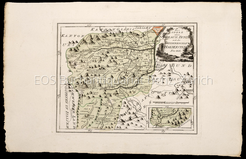
Reilly, Franz Johann Joseph von (1766–1820):
Schauplatz der fünf Theile der Welt – mit beständiger Rücksicht auf die besten Originalwerke. - Deutschland und die Schweiz.
Wien, Reilly, 1789–1806. Kupferstich Nr. 412. – Der obere braue Bund mit der Freyherrschaft Haldenstein (Teil Kanton Graubünden). Blattgrösse: 31,5 x 48 cm. Plattengrösse: 24,5 x 30,8 cm.
Referenz des Buchhändlers : 1030CG
|
|
|
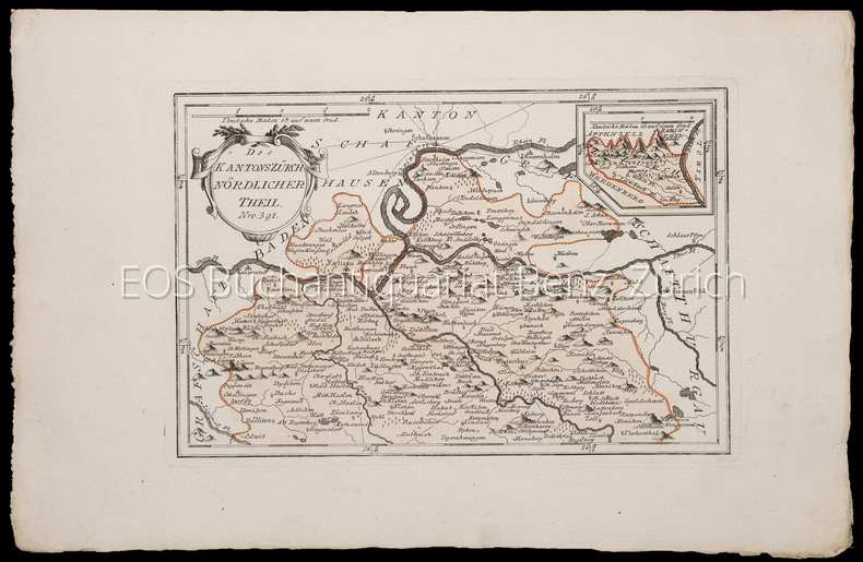
Reilly, Franz Johann Joseph von (1766–1820):
Schauplatz der fünf Theile der Welt – mit beständiger Rücksicht auf die besten Originalwerke. - Deutschland und die Schweiz.
Wien, Reilly, 1789–1806. Kupferstich Nr. 391 – Der Kanton Zürich nördlicher Theil. Blattgrösse: 31 x 48,5 cm. Plattengrösse: 22,3 x 33,5 cm.
Referenz des Buchhändlers : 1033CG
|
|
|
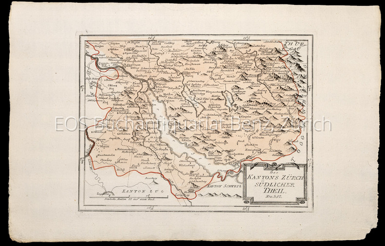
Reilly, Franz Johann Joseph von (1766–1820):
Schauplatz der fünf Theile der Welt – mit beständiger Rücksicht auf die besten Originalwerke. - Deutschland und die Schweiz.
Wien, Reilly, 1789–1806. Kupferstich Nr. 392. – Des Kantons Zür(i)ch südlicher Theil. Blattgrösse: 31 x 48 cm. Plattengrösse: 24,5 x 31,5 cm.
Referenz des Buchhändlers : 1027CG
|
|
|
Reilly, Franz Johann Joseph von (1766–1820):
Schauplatz der fünf Theile der Welt – mit beständiger Rücksicht auf die besten Originalwerke. - Deutschland und die Schweiz.
Wien, Reilly, 1789–1806. Kupferstich Nr. 413. – Der Bund des Hauses Gottes. Worms (Veltlin). Blattgrösse: 31,5 x 48 cm. Plattengrösse: 23,5 x 32 cm.
Referenz des Buchhändlers : 1031CG

|
|
|
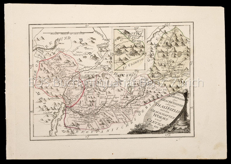
Reilly, Franz Johann Joseph von (1766–1820):
Schauplatz der fünf Theile der Welt – mit beständiger Rücksicht auf die besten Originalwerke. - Deutschland und die Schweiz.
Wien, Reilly, 1789–1806. Kupferstich Nr. 415. – Die Unterthanen der Graubündner oder das Thal Veltlin mit den Grafschaften Worms und Cleven. Blattgrösse: 29,5 x 41,5 cm. Plattengrösse: 23,5 x 32,5 cm.
Referenz des Buchhändlers : 1028CG
|
|
|
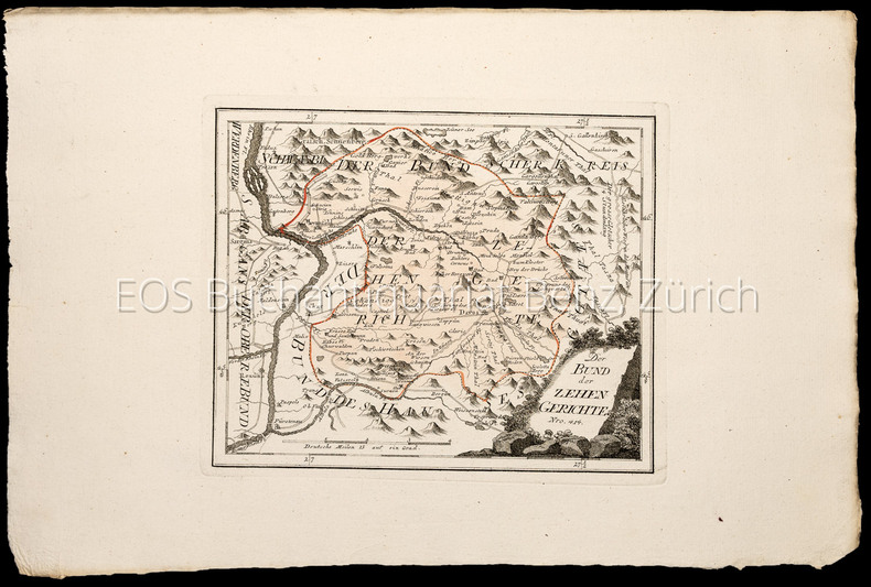
Reilly, Franz Johann Joseph von (1766–1820):
Schauplatz der fünf Theile der Welt – mit beständiger Rücksicht auf die besten Originalwerke. - Deutschland und die Schweiz.
Wien, Reilly, 1789–1806. Kupferstich Nr. 414. – Der Bund der zehn Gerichte (Teil Kanton Graubünden). Blattgrösse: 32 x 48 cm. Plattengrösse: 21,5 x 26,5 cm.
Referenz des Buchhändlers : 1034CG
|
|
|
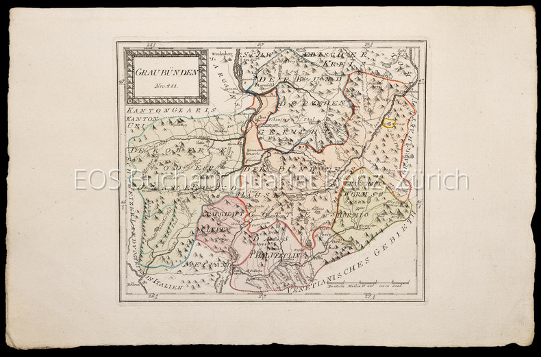
Reilly, Franz Johann Joseph von (1766–1820):
Schauplatz der fünf Theile der Welt – mit beständiger Rücksicht auf die besten Originalwerke. - Deutschland und die Schweiz.
Wien, Reilly, 1789–1806. Kupferstich Nr. 411. – Graubünden. Blattgrösse: 31,8 x 48 cm. Plattengrösse: 25 x 29,5 cm.
Referenz des Buchhändlers : 1032CG
|
|
|
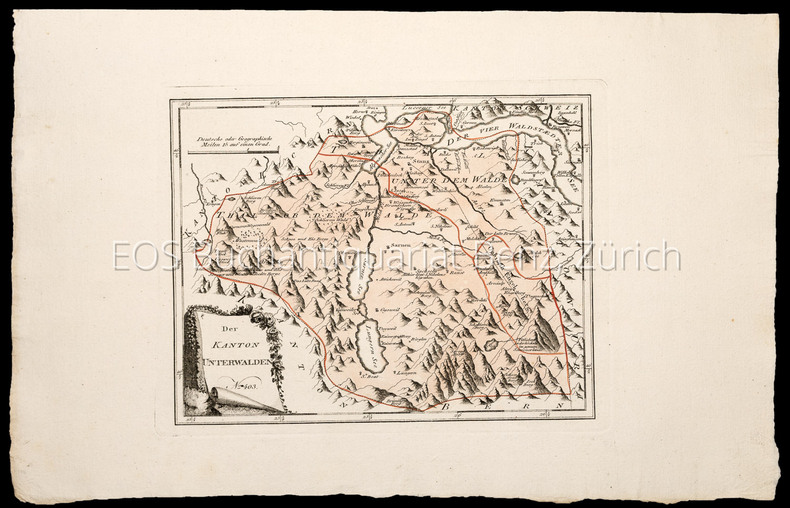
Reilly, Franz Johann Joseph von (1766–1820):
Schauplatz der fünf Theile der Welt – mit beständiger Rücksicht auf die besten Originalwerke. - Deutschland und die Schweiz.
Wien, Reilly, 1789–1806. Kupferstich Nr. 403. – Der Kanton Unterwalden. Blattgrösse: 30,5 x 47,7 cm. Plattengrösse: 22 x 28,5 cm.
Referenz des Buchhändlers : 1029CG
|
|
|
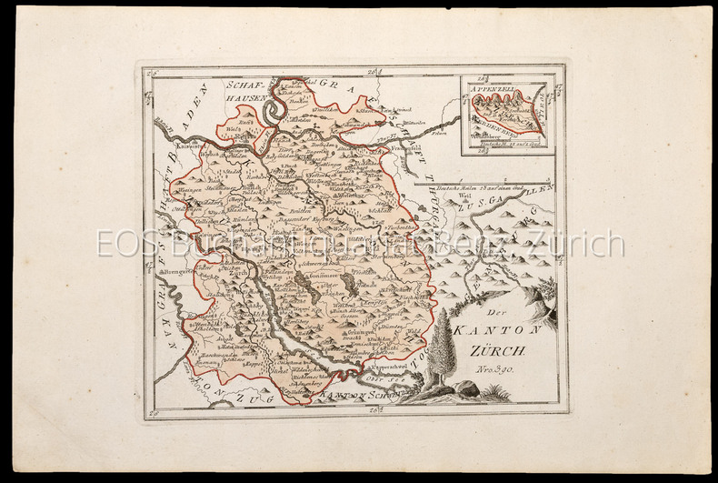
Reilly, Franz Johann Joseph von (1766–1820):
Schauplatz der fünf Theile der Welt – mit beständiger Rücksicht auf die besten Originalwerke. - Deutschland und die Schweiz.
Wien, Reilly, 1789–1806. Kupferstich Nr. 390 – Der Kanton Zürich. Blattgrösse: 30,4 x 45 cm. Plattengrösse: 23,5 x 28,8 cm.
Referenz des Buchhändlers : 1026CG
|
|
|
Reinhard, W
Zur Entwickelung d. Kartenbildes d. Britischen Inseln bis auf Merkators Karte vom Jahre 1564. Diss.
Leipzig, 1909. M. 1 gef. Taf. XII, 155 S. Interimsbr. OU. eingeb. M. mehr. St. M. Widm. d. Verf.
Referenz des Buchhändlers : 417364
|
|
|
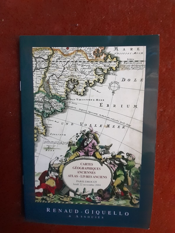
RENAUD-GIQUELLO & Associés
Cartes géographiques anciennes. Atlas - Livres rares - Drouot Richelieu, lundi 22 novembre 2004
Renaud - Giquello, 2004, in-8 br., 61 p., ill. coul., bon état.
Referenz des Buchhändlers : QWA-13490
|
|
|
René et Roger MOLINIER
LA CARTOGRAPHIE ECOLOGIQUE AU SERVICE de l'AMENAGEMENT du TERRITOIRE
Une plaquette de 8 pages, format 155 x 235 mm, illustré de 2 cartes dépliables, broché, publié en 1971, Comité de Sauvegarde et de Rénovation des Forêts et des Espaces Naturels, bon état, peu courant
Referenz des Buchhändlers : LFA-126730220
|
|
|
Repetti Emanuele.
Dizionario geografico, fisico, storico della Toscana, contenente la descrizione di tutti i luoghi del Granducato, Ducato di Lucca, Garfagnana e Lunigiana. Completo dell'Introduzione, del Supplemento e dell' Appendice.
Firenze, Tofani, 1833-1846, voll. 6 tutti a fascicoli, in-8, brossura con copertine originali. Esemplare a pieni margini, con barbe. Con 15 tavole di alberi genealogici, 3 carte topografiche una veduta del ponte sull'Arno (manca il ritratto dell'Autore). Diffuse gore da umidità. Prima edizione.

|
|
|
REPETTO (disegno), BONETTI M., Cap. di Vascello (dirett.)
Isola di CORSICA dalle carte italiane e straniere. 1940 [aggiornata in ristampa giugno 1972] scala 1:220.000. Oltre la Corsica, le Bocche di Bonifacio e l'estremo nord della Sardegna con l'Arcipelago della Maddalena., la Capraia, Pianosa, le Formiche di Montecristo, l'estremità occidentale dell'Elba.
Carta nautica di cm 107,9x73, con 5 cerchi millimetrati di declinazione e linee di cavi e vari indicatori e avvertenze impressi in viola. Comprende le Bocche di Bonifacio e l'estremo nord della Sardegna, la Capraia, Pianosa, le Formiche di Montecristo, l'estremità occid. dell'Elba. In carta forte, ripiegata, qualche traccia di gualcitura.
|
|
|
Reps, John W
Washington on View: The Nation's Capital Since 1790 New in publisher's shrinkwrap
Chapel Hill: University of North Carolina Press 1991. BRAND NEW in a BRAND NEW dust jacket. Perfect condition. Still sealed in the publisher's clear plastic shrink wrap. NO chips. NO tears. NO creases. NO rubbing. NO fading. Sharp corners. Bright and shiny. Fresh crisp clean and unmarked. 1991. First Printing of the First Edition with complete number row 54321 on the copyright page. Illustrated with more than 100 maps bird's-eye views engravings etchings collotypes aquatints mezzotints steel engravings wood engravings and lithographs. Most are in full color. Includes notes on the artists printers publishers and history of the city. Views are accompanied by 97 excerpts from contemporary published works of visitors and residents e. g. Charles Dickens Frederick Marryat Harriet Martineau Benjamin Perley Poore Anthony Trollope Francis Trollope Mark Twain Walt Whitman. Bound in the original light gray cloth stamped in bright gold over a black panel on the spine. Complete with pristine dust jacket. Oversize Hardcover. Oblong. 15" wide by 11.5" tall. This VERY large VERY heavy book will require SUBSTANTIAL extra postage for Priority and International shipments but only the standard charge for media mail. . First Printing of the First Edition. Oversize Hardcover. New/New in publisher's shrinkwrap. xiv 297pp. Great Packaging Fast Shipping. University of North Carolina Press Hardcover
Referenz des Buchhändlers : 022980 ISBN : 0807819484 9780807819487
|
|
|
REVELLI Paolo
Intorno alla CARTA della SICILIA (1719-21) di Samuele di SCHMETTAU. Estratto originale dalla Rivista Geogr. It., I-II, 1909.
In-8° (cm. 24,2),, pp. 11, (1). Bross. edit. Timbro Gabotto in cop.
|
|
|
Revelli Paolo (a cura di)
Cristoforo Colombo e la scuola cartografica genovese.
(Cartografia - Genova - Liguria - Opera cartografica genovese) Tre volumi in 4°, brossure originali con titoli in rosso e nero su fondo avorio, chiusi in una cartella editoriale rigida con laccetti di chiusura in tessuto. Volume I : Giovanni Magrini, Mario Picotti, Paolo Revelli, Raffaele Issel, Orlando Grosso "La partecipazione italiana alla Mostra oceanografica internazionale di Siviglia - 1929", pp. CCXV,(4), con 21 tavole fuori testo. Volume II : Paolo Revelli "Cristoforo Colombo e la scuola cartografica genovese", pp. 563,(8), con 81 tavole fuori testo. Volume III : Emilio Marengo "Carte topografiche e corografiche manoscritte della Liguria e delle immediate adiacenze conservate nel Reale Archivio di Stato di Genova", con prefazione e note di Paolo Revelli, pp. CCCXL,(2), con 20 tavole fuori testo. Pubblicazione edita sotto gli auspici del Consiglio Nazionale delle Ricerche, con il contributo dei Ministeri dell'Interno e dell'Educazione Nazionale, della Reale Accademia d'Italia e di altri Enti Nazionali, del Comune di Genova e di altri Enti Genovesi. Lievi tracce di ossidazione lungo i tagli dei volumi, peraltro opera ben conservata.

|
|
|
REVELLI Paolo -
Una relazione sull' “Abissinia” del 1578.
Roma, Società Geografica Italiana, 1910, 8vo stralcio con copertina posticcia muta, pp. 607/624 con tre riproduzioni di carte e antichi codici. - !! ATTENZIONE !!: Con il termine estratto (o stralcio) intendiamo riferirci ad un fascicolo contenente un articolo, completo in se, sia che esso sia stato stampato a parte utilizzando la stessa composizione sia che provenga direttamente da una rivista. Le pagine sono indicate come "da/a", ad esempio: 229/231 significa che il testo è composto da tre pagine. Quando la rivista di provenienza non viene indicata é perché ci è sconosciuta. - !! ATTENTION !!: : NOT A BOOK : “extract” or “excerpt” means simply a few pages, original nonetheless, printed in a magazine. Pages are indicated as in "from” “to", for example: 229/231 means the text comprises three pages (229, 230 and 231). If the magazine that contained the pages is not mentioned, it is because it is unknown to us.

|
|
|
REVELLI Paolo -
Una “rosa dei venti” del secolo IX.
Roma, Società Geografica Italiana, 1910, 8vo stralcio con copertina posticcia muta, pp. 269/279 con una tavola fotoincisa. - !! ATTENZIONE !!: Con il termine estratto (o stralcio) intendiamo riferirci ad un fascicolo contenente un articolo, completo in se, sia che esso sia stato stampato a parte utilizzando la stessa composizione sia che provenga direttamente da una rivista. Le pagine sono indicate come "da/a", ad esempio: 229/231 significa che il testo è composto da tre pagine. Quando la rivista di provenienza non viene indicata é perché ci è sconosciuta. - !! ATTENTION !!: : NOT A BOOK : “extract” or “excerpt” means simply a few pages, original nonetheless, printed in a magazine. Pages are indicated as in "from” “to", for example: 229/231 means the text comprises three pages (229, 230 and 231). If the magazine that contained the pages is not mentioned, it is because it is unknown to us.

|
|
|
Revue de la Bibliothèque nationale de France
Revue de la Bibliothèque nationale de France - N° 4 de 1994Images médiévales Le paramètre du temps comme stratégie disiplinaire dans le monarchisme occidental ancien - Introduction à l'étude des tentations de Saint AntoineLes estampes d'Israël Silvestre et le décor sculpté du jardin de Vaux-le-Vicomte au XVIIème siècle - Images et imaginaire du génie scientifique à travers les portraits d'Isaac newton en France et en Angleterre au XVIIIème siècle - De Séville à Mexico, une famille d'imprimeurs : les Cromberger ( 1504 - 1560 ) - A travers les canards : le petit peuple de Paris devant le crime, 1830 - 1900 - Le cheval dans les périodidues de la Bibliothèque nationale de France - l'Atlas miller : un problème résolu. L'art dans la cartographie portugaise - Un ami de Maurice Ravel, Lucien Garban
In-4 - N° 4 de 1994
Referenz des Buchhändlers : 18148
|
|
|
Revue Passage d'encres
La loi. L'écriture. Spécial : une interview inédite de Borges
Association Passage d'encres, 2001, in-4 br. (27,5 x 25,5), 150 p., N° 14-15 de la revue "Passage d'encres" (juin 2001), illustrations, très bon état.
Referenz des Buchhändlers : QWA-9463
|
|
|
REY, W.:
Les Grisons et la Haute Engadine. (Exursions suisses. (par le Valais: de Genève à la Haute Engadine).
Genève, les principaux librairies et Imprimerie Ch. Gruaz, 1850, in-8°, 129 p. (+ 1 p. bl.) + 1 ff. (Table), non rogné nom ms. sur la couverture, brochure originale bleue, titre et vignette sur la couverture, couv. détachée et avec qqs manques aux bords.
Referenz des Buchhändlers : 24695aaf
|
|
|
REY, W.:
Les Grisons et la Haute Engadine. (Exursions suisses. (Par le Valais: de Genève à la Haute Engadine).
Genève, les principaux librairies et Imprimerie Ch. Gruaz, 1850, in-8°, 129 p. (+ 1 p. bl.) + 1 f. (Table), non rogné Exlibris Peter E. Obergfell, (à la fin), brochure originale bleue, titre et vignette sur la couverture. Dos renforcé.
Referenz des Buchhändlers : 138863aaf

|
|
|
REZA SHIRAZIAN.
Atlas of old Tehran.= Atlas-e Tehran-e qadîm. Introduction by Cyrus Alai.
New Persian Original bdg. HC. Folio. (34 x 24 cm). In Persian with abstracts in English. 392 p., color and b/w ills. Tehran became a major city of Iran after 1554 A.D. during the Safavid period when Shah Tahmasb I, son of Shah Ismail, ordered the implementation of two large-scale public works. The first project was the construction of ramparts and moats surrounding the entire city, which defined the city's perimeters and increased its defense. The rampart consisted of 114 towers, representing the 114 chapters within the Holy Quran and enclosed an area of 4.35 km2. The second project was the establishment of the bazaar, the heart of the industrial and commercial activities of the city, surrounded by numerous holy shrines. However, it was 240 years later in the Spring of 1796 A.D. that Tehran became the national capital of Iran, during Agha Mohammad Khan Qajar's reign. 2016 A.D. actually marks the 220th year since Tehran became the political centre of Iran. The first known map of Tehran (page 18), a Russian spy map, dates back to 1826 A.D. The next Russian map of Tehran (page 24) from 1852 A.D. was translated into Persian and presented as a gift to Naser al-Din Shah Qajar (page 29). After the establishment of the military polytechnic school in 1851 A.D. and the arrival of Europe an military instructors, the importance of accurate topographical maps was recognized by the nation's leaders. The Austrian artillery trainer for cannons, August Karl Krziz, coordinated in 1858 A.D. the preparation of the maps of Tehran (page 39) and its surrounding area (page 35). This was the beginning of scientific cartography in Iran. By 1863 A.D., maps of Tehran Province for the purpose of tax collection (page 58) were being produced by engineer Abdul Rasool Khan. Tehran dramatically expanded after a huge flood in 1867 A.D. destroyed a large portion of the Safavid period ramparts and moats, after which Alexander Bohler, a French military instructor, designed a new and enlarged rampart and moat enclosure. Within four years between 1867 A.D. and 1871 A.D., Tehran grew from 4 .35 km2 to 19.75 km2 with these new constructions. By 1891 A.D., a highly detailed and technical map of Tehran (page 64) had been produced by Abdul Ghafar Najmolmoq. During the reigning years of Mozafar al-Din Shah, Mohammad Ali Shah, and Ahmad Shah, maps for Tehran postal services (page 126) and Tehran provincial delineation (page 127) were produced. During these years, the Russian, British and French prepared several geopolitical maps of the region including Tehran. For example, the map on page 323 reproduces a map prepared in 1892 A.D. by the British Survey of India at the scale of 1:506,880. In 1914 A.D., German publisher Wagner & Debes prepared a touristic map of Tehran (page 134). In 1922 A.D. the Ministry of Culture's Investigation Section prepared a map of schools in Tehran (page 138). During the Pahlavi I period (1925~1941 A.D.), modernization of Tehran became a national priority. By 1930 A.D. a map for street enlargement in Tehran (page 158) had been published. In 1932 A.D., the demolition of the Naser al-Din Shah Qajar period ramparts began simultaneous to further expansion of urbanized Tehran. The 1936 A.D. military map of Tehran (page 169) is testimony to the changes in the urban morphology of this period. The creation of a dedicated military cartographic service in 1935 A.D. marked an important milestone in the history of cartography in Iran. The 1937 A.D. urban development plan of Tehran (page 170) clearly shows the new streets, squares and urban development envisioned. The first known aerial photograph of Tehran dating from 1940 A.D. (page 177) displays the realization of this urban development plan. After the invasions by the Russians, British and Americans in 1941 A.D., cartographic activities in Iran suddenly increased. Sergeant Mohammad Reza Ghaffari privately published maps of Tehran [.] The above mentioned maps are a few representative samples of the over 270 maps
|
|
|
RIBOUD, Jacques
Développement urbain. Recherche d'un principe. Éditions Mazarine. Paris. 1965.
1 volume in-8° broché, 205 p. - Figures, tableaux. Très bon état.
Referenz des Buchhändlers : 22723
|
|
|
RICCHIERI Giuseppe (Fiume Veneto 1861- Milano 1926)
Per la CORREZIONE dei NOMI nelle CARTE TOPOGRAFICHE. Estratto originale dalla Rivista Geografica Italiana, a. 12, fasc. II-III - 1905.
In-8° (cm. 24,2), pp. 6. Brossura editoriale. macchiolina e timbro Gabotto in cop.
|
|
|
RICCHIERI Giuseppe -
Riesame della terminologia italiana della morfologia suboceanica.
Firenze, 1924, 8vo stralcio con copertina posticcia muta, pp. 118/141. - !! ATTENZIONE !!: Con il termine estratto (o stralcio) intendiamo riferirci ad un fascicolo contenente un articolo, completo in se, sia che esso sia stato stampato a parte utilizzando la stessa composizione sia che provenga direttamente da una rivista. Le pagine sono indicate come "da/a", ad esempio: 229/231 significa che il testo è composto da tre pagine. Quando la rivista di provenienza non viene indicata é perché ci è sconosciuta. - !! ATTENTION !!: : NOT A BOOK : “extract” or “excerpt” means simply a few pages, original nonetheless, printed in a magazine. Pages are indicated as in "from” “to", for example: 229/231 means the text comprises three pages (229, 230 and 231). If the magazine that contained the pages is not mentioned, it is because it is unknown to us.

|
|
|
Richard J. A. Talbert (Eds. )
BARRINGTON ATLAS OF THE GREEK AND ROMAN WORLD [2 VOLUME SET] Map-By-Map Directory. Vol. 1 & 2
Very faint foxing to textblock else fine. ; 2 Volume Set; Vol. 1/2/2022; 13.1 X 10.1 X 4.5 inches; 1448 pages
|
|
|
Richard Jean-Marie Vincent Audin
Guide du voyageur en Italie
16°, mm 160x100, pp. 840, 4 di pubblicità ; tela editoriale nera con impressioni decorative a secco e titolo in oro al centro del piatto anteriore, contiene le piante ripiegate di Torino, Milano, Venezia, Roma e Napoli, il piano di Pompei e la carta delle strade della Sicilia. Decima edizione aumentata di una delle più classiche guide per i viaggiatori in Italia. ID 6475

|
|
|
Richard Oram (ed)
With Our Backs to the Ocean': Land, Lordship, Climate Change, and Environment in the North-West European Past. Essays in Memory of Alasdair Ross
, Brepols, 2023 Hardback, xii + 326 pages, Size:156 x 234 mm, Illustrations:1 b/w, 5 col., 7 tables b/w., 2 maps b/w, 1 maps color, Language: English. ISBN 9782503596990.
Referenz des Buchhändlers : 64334
|
|
|
Richard-Molard (J.) et Collectif
Cartes ethno-démographiques de l'Afrique Occidentale, Feuilles 1.
1952 1952 IFAN, Dakar, 1952. 2 cartes dépliantes en deux feuilles chacune. 1 chemise in-4. Bel exemplaire. Bibliothèque de Z. Ligers.
Referenz des Buchhändlers : 938
|
|
|
Riga Giulio.
ELABORAZIONE TRIDIMANSIONALE DEL TERRITORIO.
(Codice GL/0667) In 8° (25 cm) 107 pp. Cartone editoriale, come nuovo. Allegato floppy disk ancora sigillato nella busta originale. ~~~ SPEDIZIONE IN ITALIA SEMPRE TRACCIATA

|
|
|
Riggio Giuseppe - Vitali Giuseppe
Conoscere l'Etna. Guida ai percorsi del Parco regionale
illustrazioni, 1 carta ripiegata in fondo al volume

|
|
|
Righini di S. Giorgio Alessandro*
Trattato di Topografia Terza edizione riveduta ed ampliata
*barone, Colonnello nel Corpo reale dello Stato Maggiore - Proemio - Corso elementare di Studi militari compilato per ordine del Ministero della Guerra 1+ A. 23,5x15 cm., legatura in mezza pelle, fregi e titolo (Trigonometria e Topografia) in oro al dorso, pp. 448, 231 figure nel testo, tabelle, schemi, Tavola "Itinerario da Pinerolo a Cesanne" pi? volte ripiegata e le figure 1, 2, 10 e dalla 18 alla 29 su tavole fuori testo, in italiano, una tavola staccata, ma buon esemplare. AGGIUNTO (prima): stesso Autore e stesso editore (edito nel 1856) CORSO ELEMENTARE DI TRIGONOMETRIA, manca frontespizio, pp. 137, 26 figure nel testo e numerose formule, esempi, 1 tavola "Quadro delle formule..." pi? volte ripiegata, in italiano. Piccole lacerazioni e normali segni d'uso all'esterno, annotazioni manoscritte e firme , etichetta e timbro di Biblioteca privata regolarmente pervenuto. ..." affinch? le sopra accennate lezioni pratiche di topografia possano riuscire proficue, si richiedono almeno 100 giorni di esercitazioni sul terreno, lavorando in media 12 ore al giorno" -
|
|
|
Righini, Davide (a Cura di)
Antiche Mappe Bolognesi. Le Piante Dei Beni Rurali dell'Opera Pia Dei Poveri Vergognosi
Mm 210x280 Brossura editoriale di 167 pagine, numerose illustrazioni a colori, sovraccoperta originale. Libro in condizioni di nuovo. SPEDIZIONE IN 24 ORE DALLA CONFERMA DELL'ORDINE.
|
|
|
Riitano Mariagiovanna.
UNA GEOGRAFIA PER L'EUROPA. Assetto del territorio e dinamiche evolutive.
(Codice EA/0047) In 8° (24 cm) XVIII-350 pp. Illustrato con molte figure, cartine e diagrmmi. Brossura editoriale,lievemente ingiallita, ma volume in ottimo stato. ~~~ SPEDIZIONE IN ITALIA SEMPRE TRACCIATA

|
|
|

 Per e-mail erhalten
 Als pdf-Dokument herunterladen
 RSS feed
 Permanenter link


