|
Neugebauer, G
Entwurf einer Geomorpholischen Übersichtskarte d. westlichen Mitteleuropa 1:1 Million.
Frankfurt, 1970. 4°. M. 11 Ktn. 117 S. OBr. Umschl. teils gebräunt u. m. Sign. St. verso Tit. (BAW. Veröff. d. Geodätischen Komm. C 148).
書籍販売業者の参照番号
: 162395
|
|
|
New Jersey Geological Survey; George H Cook (State Geologist)
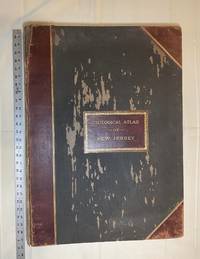
Atlas of New Jersey : Geological Survey of New Jersey
New York: Julius Bien & Co 1889. Condition of the binding is only Fair with pest damage. Leather over the spine has perished. Front and rear outer hinges cracks have been neatly reinforced with high quality clear flexible glue. Inner hinges are OK having been reinforced by the publisher/bookbinder with sturdy maroon cloth. SEE PHOTOS. Condition of all maps is NEAR FINE - FINE. NO foxing or toning. Pages are clean and unmarked. SEE PHOTOS. Includes a title page map of New Jersey Key to the System of Mapping and 19 linen-backed double page maps. Collated and complete per table of contents -- SEE PHOTOS. The maps are lithographically printed in blue red yellow and black. The double page maps open to an impressive 26.50" across by 36.50" tall. No year of publication is stated but Phillips 2149 in A LIST OF GEOGRAPHIC ATLASES Vol. 1 says 1889. The maps themselves are variously dated up to 1888. Titles of Sheets: No. 0. New Jersey State Map Geographic; No. 1. Kittatinny Valley and Mountain No. 2. Southwestern Highlands; No. 3. Central Highlands; No. 4. Northeastern Highlands; No. 5.Vicinity of Flemington; No. 6. Valley of the Passaic; No. 7. The Counties of Bergen Hudson Essex No. 8. Vicinity of Trenton; No. 9. Monmouth Shore; No. 10. Vicinity of Salem No. 11. Vicinity of Camden; No. 12. Vicinity of Mount Holly; No. 13. Vicinity of Barnegat Bay; No. 14. Vicinity of Bridgeton; No. 15. Southern Interior; No. 16. Egg Harbor and Vicinity; No. 17. Peninsula of Cape May; Unnumbered map. "New Jersey from Original Surveys based on the Triangulation of the U.S. Coast and Geodetic Survey Relief Map." Scale of first and last doublepage maps: 5 miles to an Inch. Scale of maps No. 1 to No. 17: 1 mile to an Inch. Bound in black pebble-grain cloth with gilt-stamped brown leather title label leather spine and corners leather backstrip has perished. SEE PHOTOS. The textblock could be easily rebacked or recased with no re-sewing required since all pages/maps are still securely bound together. Oversize Hardcover. 19.50" wide by 27" tall. This massive extremely heavy book will require SUBSTANTIAL extra postage at our cost based on your location. LeGear ATLASES OF THE UNITED STATES L5609. See also Schwartz and Ehrenerg's THE MAPPING OF AMERICA pp. 310-311. Phillips 2149. This massive extremely heavy book will require SUBSTANTIAL extra postage at our cost based on your location. Second Edition. Oversize Hardcover. Fair - FINE condition. Illus. by NOT a library discard. Atlas folio. Great Packaging Fast Shipping. Julius Bien & Co Hardcover
書籍販売業者の参照番号
: 028277
|
|
|
New York State Education Department; Henry Leighton; D H Newland; George H Hudson; Rudolf Ruedemann; M R Harrington [from the li
New York State Museum 62d Annual Report 1908 Volume I 28th Report of the State Geologist
Albany: University of the State of New York 1909. Original green cloth gilt is in Very Good condition. The book's inner hinges are badly cracked and nearly separated. However since the text block is secure entirely intact it could be easily re-cased without any re-sewing required. Thick 8vo. 234pp. 51pp. 66pp. 41pp. approx. 100 plates inserted. Complete with all of the maps as called for by the table of contents. A tough-to-find book especially complete with all the BEAUTIFUL MULTI-COLOR FOLDING MAPS IN PERFECT CONDITION. Any of them would look magnificent framed. This amazing miscellany contains the Fifth Report to the Director 1908 and Museum Bulletins 126-128 and 133 and Report of the State Paleontologist for 1908. A particularly useful contribution is: One Hundred Years of New York State Geologic Maps 1809-1909 by Henry Leighton. It includes a CARTO-BIBLIOGRAPHY that describes 329 New York Geologic Maps and has its own index. Some other contributions: A Peculiar Landslip in the Hudson River Clays by D. H. Newland; Some Items Concerning a New and an Old Coast Line of Lake Champlain by George H. Hudson; Types of Inliers Observed in New York by Rudolf Ruedemann; The Last of the Iroquois Potters by M. R. Harrington; etc. There are several other articles on the same subjects as and supporting the maps described below. Bound into Museum Bulletin 127 are NINE MULTI-COLOR FOLDING MAPS #34-42: showing 9 stages of Glacial Lake Succession in New York State 1908. In a pocket at the end are SEVEN BEAUTIFUL MULTI-COLOR FOLDING MAPS most by H. L. Fairchild as follows: Museum Bulletin 126: Geologic Map of the Remsen Quadrangles unfolds to 17" wide by 21" tall; Museum Bulletin 127: Plate 2: Channels and Deltas of Ice-Border Drainage between Leroy and Fishers 1906. 39" wide by 17.5" tall; Museum Bulletin 127: Plate 3: Channels and Deltas of Ice-Border Drainage between Irondequoit and Cayuga Valleys 1906. 39" wide by 20" tall; Museum Bulletin 127: Plate 4: Channels and Deltas of Ice-Border Drainage between Jordan and Chittenango Valleys 1906. 36" wide by 20" tall; Museum Bulletin 127: Plate 5: Channels and Deltas of Ice-Border Drainage between Chittenango and Oneida 1906. 17" wide by 12" tall; Museum Bulletin 128: Geologic Map of the Geneva-Ovid Quadrangles 17" wide by 38" tall; Museum Bulletin 128: East-West Section on Ovid and Genoa Quadrangles. Showing the Low Synclines of the Lake Basins. 17" wide by 8" tall. This copy has the small ink stamp of C. Wesley Yeakel in 4 places. First Edition. Hardcover. VG inner hinges cracked/No jacket. Illus. by Fairchild H. L. maps. Thick 8vo. University of the State of New York Hardcover
書籍販売業者の参照番号
: 014713
|
|
|
Ng, Peter Y. L. (Signed)
New Peace County: A Chinese Gazetteer of the Hong Kong Region
152 pages. Index. Bibliography. Reference notes. Map stored in pocket inside back cover. Signed and inscribed by author upon half-title page. "For the student of Chinese history, for those interested in pre-British Hong Kong and for the layman alike this is a fascinating and enjoyable book which while satisfying in itself will also serve as a guide to further research." - from dust jacket. Book clean and bright with very light wear. Light wear to dust jacket. A quality copy. Book

|
|
|
Nibby Antonio.
ANALISI STORICO TOPOGRAFICO ANTIQUARIA DELLA CARTA DE' DINTORNI DI ROMA. Volume 1 - Volume 2. Edizione seconda.
(Codice TU/1055) Due volumi in 8° (23 cm) XLVIII-555, 679 pp. Manca il 3° volume. Legature originali mezza pergamena, tasselli e titolo oro. Una tavola ripiegata, piegatura parzialmente lesa. Tracce di antichi timbri, iniziali ai frontespizi, leggeri aloni nelle sole prime e ultime pagine.Testo in ottimo stato. ~~~ SPEDIZIONE IN ITALIA SEMPRE TRACCIATA

|
|
|
Nice,Bruno.
Geografia economica dell'Europa.
<br/> TITOLO: Geografia economica dell'Europa. <br/> AUTORE: Nice,Bruno.<br/> EDITORE: ERI-Edizioni Rai Radiotelevisione Italiana<br/> DATA ED.: 1961,<br/> COLLANA: Coll.Classe Unica,124.<br/>
|
|
|
NICHOLSON Tim
The Birth of the Modern Ordnance Survey Small-Scale Map. The Revised New Series Colour Printed One-Inch Map of England and Wales 1897-1914. FINE COPY
8vo., First Edition, with coloured plates and monochrome illustrations in the text; printed wrappers, a near fine copy.

|
|
|
NICOLAS DE FER
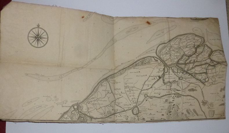
Carte des environs de Bruges, D'ostende de l'Écluse. Extraite des frontières de France et des Pays-Bas. 1709.
Carte entoilée le titre de la partie supérieure à apparement été découpé. 31 x 62 cm. Deux traces de rouille incrustées sinon bon état.
書籍販売業者の参照番号
: 18666
|
|
|
NICOLAS DE TRALAGE, J. (TILLEMON)
Description du Royaume de France Contenant ses principales Divisions G?ogaraphiques dress?es pour la grande Carte, intitul?e Le Royaume de France avec ses Acquisitions, &c
D?di?e ? Louis Le Grand, Avec une table alphab?tique de tous les noms qui sont sur cette carte pour les y trouver aisement 1 vol. 16.2x9.5 cm., [9] cc., 379, [4] pp., frontespizio inciso con scena allegorica, legatura coeva in piena pelle con, in francese Questa ? la parte descrittiva che accompagnava la carta del Royaume de France di NOLIN, Jean-Baptiste, (1648-1708), pubblicata nello stesso anno, come si deduce dall'opera stessa. La carta era dedicata al Re Luigi il grande, di cui lo stesso Nolin era cartografo ufficiale. Ottimo esemplare
|
|
|
NIOX (Gustave-Léon Lieutenant-Colonel)
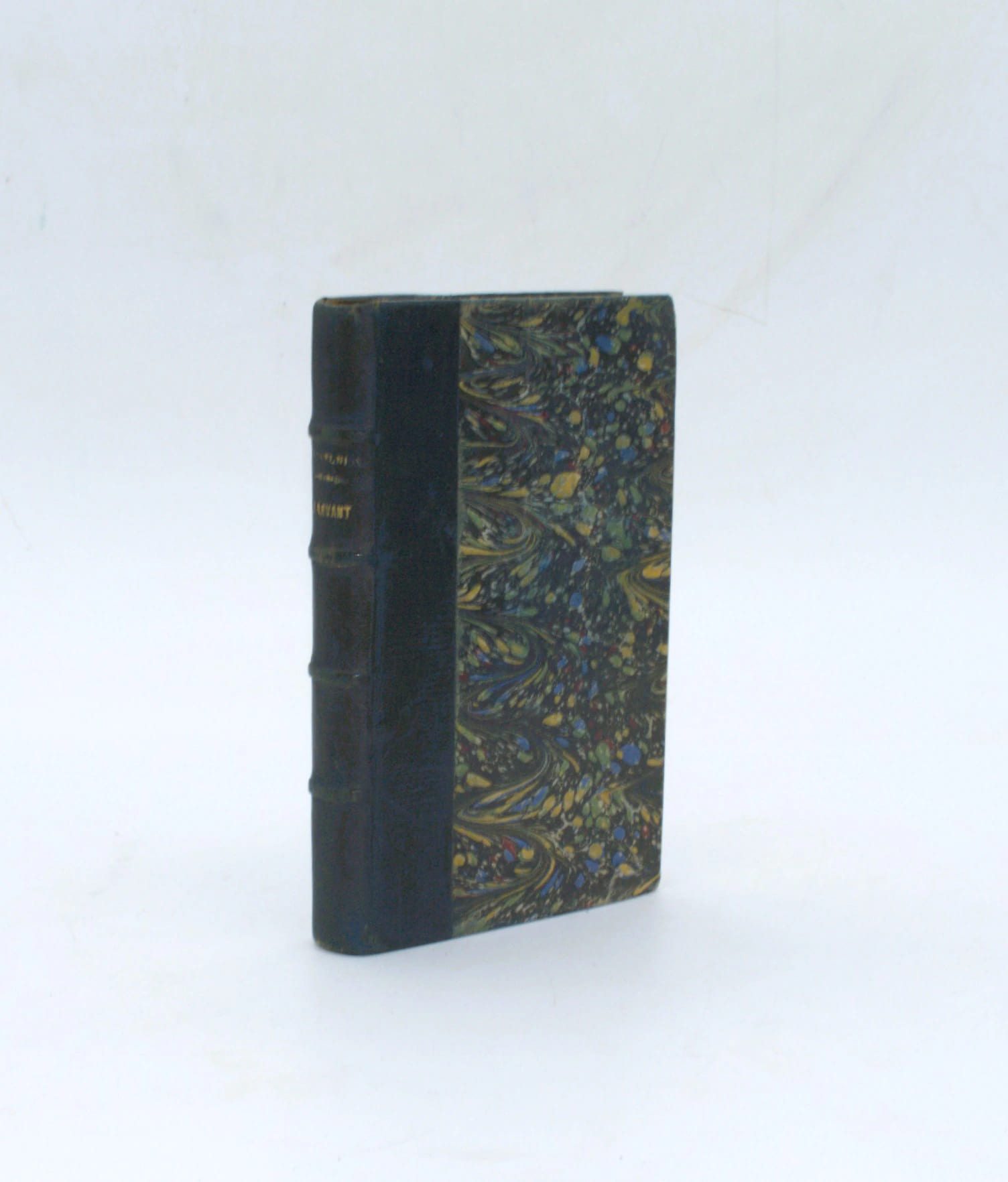
Le Levant et le bassin de la Méditerranée, seconde édition
Paris, librairie militaire L. Baudoin, 1887, in-12 (18x11cm), 239pp., 1 carte dépliante in fine, demi cuir époque, dos à nerfs avec auteur et titre. Défaut au titre, rousseurs éparses, carte brunie avec trace d’adhésif.
書籍販売業者の参照番号
: PHO-2564
|
|
|
NISTRI Paolo Emilio -
Gli organi cartografici e l'imprenditoria privata nel settore del rilevamento topocartografico.
Firenze, 1998, 8vo stralcio con copertina posticcia muta, pp. 694/699. - !! ATTENZIONE !!: Con il termine estratto (o stralcio) intendiamo riferirci ad un fascicolo contenente un articolo, completo in se, sia che esso sia stato stampato a parte utilizzando la stessa composizione sia che provenga direttamente da una rivista. Le pagine sono indicate come "da/a", ad esempio: 229/231 significa che il testo è composto da tre pagine. Quando la rivista di provenienza non viene indicata é perché ci è sconosciuta. - !! ATTENTION !!: : NOT A BOOK : “extract” or “excerpt” means simply a few pages, original nonetheless, printed in a magazine. Pages are indicated as in "from” “to", for example: 229/231 means the text comprises three pages (229, 230 and 231). If the magazine that contained the pages is not mentioned, it is because it is unknown to us.

|
|
|
NIYAZI ÖZTÜRK (Tanzim eden), (Galata Veli Alemdar Han No: 16).
[EARLY REPUBLICAN MANUSCRIPT MAP of ANTHRACITE MINE in ZONGULDAK] Zonguldak ili Devrek ilçesine bagli Deli Ahmet Oglu Mah. Sabunlar Köyü Camisi, Çumu Camisi ile sinirlanmis olan saha içinde tas kömürü arama krokisi.
Very Good Turkish Original manuscript map on cloth. Chipped margins, stains on cloth. Folded. Oblong folio. (32x35 cm) In modern Turkish. Sealed. It shows the exploration of an area of ??1487 hectares and some stone and brick mosques, fountains, buildings and geographic status of the region in the upper corner. Scale: 1:25.000. Extremely rare.
|
|
|
NN
Gazetteers of France, Belgium and Luxembourg and Holland to G.S.G.S. 1:250.000 map series. Compiled by C.I.U., published by Directorate of Military Survey War Office, February 1944
[London], 1944 CXI + XV + XIII pp. + 1p. errata & 1 folding map, 33x21cm., publisher's hardcover binding, text and interior are clean and bright, good condition, [This publication was a military reference book providing geographical names (places, features) for Allied forces, correlating directly to the G.S.G.S.(Geographical Section, General Staff) 1:250,000 map series, crucial for invasion planning during World War II, detailing towns, roads, rivers, and topography for operations like D-Day and beyond in Western Europe], rare, G120629
書籍販売業者の参照番号
: G120629
|
|
|
NN
Plan Maritime & Commercial de la ville et du port d'Anvers offert par la Canadian Pacific Railway Company. Service direct d'Anvers vers le Canada et l'Extrême-Orient, départs tous les mercredis
grand plan dépliant (125x84cm.) d'Anvers et son port, sous farde d'éditeur (22x16cm.), bon état, B93518
|
|
|
NN
Plan Maritime & Commercial de la ville et du port d'Anvers offert par la Canadian Pacific Railway Company. Service direct d'Anvers vers le Canada et l'Extrême-Orient, départs tous les mercredis
Bruxelles, I. Khiat s.d. grand plan dépliant (125x84cm.) d'Anvers et son port, sous farde d'éditeur (22x16cm.), bon état, B93518
書籍販売業者の参照番号
: B93518
|
|
|
NOBENZAHL Kenneth
"Exploration des routes de la soie et au-delà; 2000 ans de cartographie."
Paris, Editions Phaidon, 2005. 30 x 26, 176 pp., très nombreuses cartes en couleurs, reliure d'édition pleine toile + jaquette, très bon état (sauf 1 cachet d'ex-propriétaire).
書籍販売業者の参照番号
: 90578 ISBN : 714894427
|
|
|
Nobile Umberto
L'Italia al Polo Nord
172 illustrazioni e grafici 2 carte fuori testo

|
|
|
Noble Wilford,John.
Cartografi. Precursori e innovatori da Tolomeo al satellite.
In un'opera di mole imponente ma di scorrevole lettura, Wilford ripercorre la storia della cartografia, dalle prime carte dell'antichità greco-romana alla lettura satellitare del territorio, passando per la lenta ma progressiva conquista di nuovi mondi e di nuove rotte. Seguiamo così le navi che fanno vela verso le coste del Nuovo Mondo sulla scorta delle prime carte nautiche della costa americana <br/> STATO: NUOVO.<br/> TITOLO: Cartografi. Precursori e innovatori da Tolomeo al satellite. <br/> AUTORE: Noble Wilford,John.<br/> CURATORE: Traduzione di Gianna Lonza.<br/> EDITORE: Ediz.Sylvestre Bonnard<br/> DATA ED.: 2005,<br/> COLLANA: Coll.Il Sapere del Libro.<br/> EAN: 9788889609040

|
|
|
Nodier Charles
La Seine et ses bords, par M. Ch. Nodier; illustrés de cinquante-quatre Gravures sur bois et de quatre cartes de la Seine. Publiés par M. Alex Mure de Pelanne
8°, mm 235x150, pp.192, brossura originale conservata all'interno di legatura in cartonato colorato con titolo su tassello al dorso, esemplare in barbe con sporadiche fioriture ai margini delle carte, completo delle 4 carte della Senna ripiegate e delle 42 tavole incise su acciaio fuori testo e 8 vignette nel testo. Edizione originale. ID 6447

|
|
|
NOLIN, I.B.:
Afrique selon les Relations les plus nouvelles. Dressée sur les memoires du S.r de Tillemont divisée en tous ses Royaumes et grands Etats avec un discour sur la nouvelle découverte de la situation des sources du Nil. (Carte geografique).
Paris, I.B. Nolin, 1743, 59 cm / 44.5 cm pts déchirures amarginales, coin sup.droite avec pt. manque, bruni et traces d’ usage, 1 feuille.
書籍販売業者の参照番号
: 101211aaf

|
|
|
Non identificato
SOLLIÈS PONT - CUERS / TOULON - HYÈ RES / S.t TROPEY - COLLOBIÈRES / CAP. BLANC - Î LES d'HYÈRES.
Grandissima carta topografica di cm. 131,7 x 83,5 perfettamente TELATA e in ottime condizioni, divisa in 32 rettangoli di cm. 20,8x16,3 editorialmente applicata alla tela grigia, e ripiegata a formare un oggetto di cm. 21x 16,5 x 2 di spessore. Impressa in bianco e nero, con bella evidenza dei rilievi, corsi d'acqua e laghi in azzurro, con indicazioni dei gradi ai bordi reticolo in nero e più piccolo in rosso. Parrebbe in scala 1:50.000 (cioè un cm. sulla carta equivale a 500 metri nella realtà).
|
|
|
NORDEN (Frédéric-Louis).
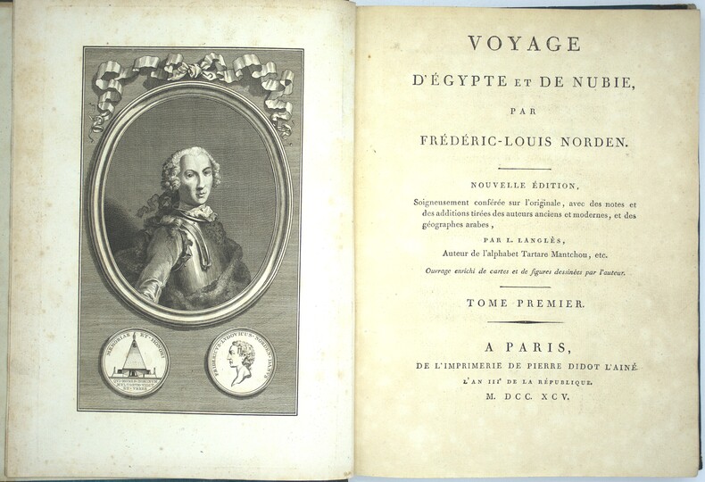
Voyage d'Égypte et de Nubie. Nouvelle édition, soigneusement conférée sur l'originale, avec des notes et des additions tirées des auteurs anciens et modernes, et des géographes arabes par L. Langlès, auteur de l'alphabet Tartare Mantchou.
Paris, de l'imprimerie de Pierre Didot l'aîné, 1795-98. 3 vol. in-4°, demi chagrin et coins, dos lisse avec titre et tomaison, tranches jaspées bleues. Frottements, épidermures aux dos, coins usés, quelques rousseurs en début et fin, papier légèrement bruni. Tome I ; portrait-LV-176 pp.- 59 planches et cartes (n°1 à 59), Tome II ; frontispice- 256 pp. ; 56 planches et cartes (n°60 à 113 avec 96bis & ter), Tome III ; frontispice-149 pp.-3ff. - 392 pp., 36 (53) planches et cartes (n°131 à 160) et 9 non numérotées. Un total de 149 (166) planches et cartes, certaines dépliantes et 9 planches d'éléments décoratifs non numérotées, manque les planches n° 114 à 130 qui n’ont pas été reliés ici.
書籍販売業者の参照番号
: PHO-2281
|
|
|
NORDEN (Frédéric-Louis).
Voyage d'Égypte et de Nubie. Nouvelle édition, soigneusement conférée sur l'originale, avec des notes et des additions tirées des auteurs anciens et modernes, et des géographes arabes par L. Langlès, auteur de l'alphabet Tartare Mantchou.
Paris, de l'imprimerie de Pierre Didot l'aîné, l'an IIIe de la République, 1795 - l'an VIe de la République, 1798. 1795 3 vol. in-4° (300 x 225 mm) de : I. 1 frontispice ; 1 portrait ; LV (dont faux titre, titre, préface) ; 176 pp. (dont table) ; 59 planches et cartes (n°1 à 59) ; II. 256 pp. (dont faux titre, titre) ; 54 planches et cartes (n°60 à 113) ; 149 pp. ; [3] ff. ; pp. 392 pp (reprise à 153) ; 53 planches et cartes (n°114 à 159, 140 et 141 ainsi que 142 et 143 réunies en deux planches + 9 non numérotées) ; petit dessin collé en regard de la planche n°8 avec notes manuscrites. Un total de 166 planches et cartes dont 2 composées de 2 numéros, certaines dépliantes et 9 planches d'éléments décoratifs non numérotées. (Petites manques aux premiers feuillets du second volume). Pleine basane marbrée, dos à nerfs orné, pièce de titre de maroquin et tomaison, filets dorés sur les plats, dos à nerfs très ornés, tranches rouges, gardes de couleurs. (reliure frottée).
書籍販売業者の参照番号
: 6386
|
|
|
Nordenskiöld, A.E
Om bröderna zenos resor och de äldsta kartor öfver Norden.
Stockhom, Norstedt & Söner, 1883. M. 2 gefalt. Ktn. u. 2 Taf. im Anhang u. einigen im Text. 52 S. OBr. Ohne Umschl. Rücken m. Kleberest v. ehemaliger Bind. (Bihang till K. Svenska Vet. Akad. Handl. 8/2).
書籍販売業者の参照番号
: 150065
|
|
|
Note illustrative su la carta geologica degli Altipiani Hararini e della Dancalia Meridionale.
GORTANI Michele - BIANCHI Angelo -
Bologna, 1941, 4to stralcio, pp. 89/104. Intonso. - !! ATTENZIONE !!: Con il termine estratto (o stralcio) intendiamo riferirci ad un fascicolo contenente un articolo, completo in se, sia che esso sia stato stampato a parte utilizzando la stessa composizione sia che provenga direttamente da una rivista. Le pagine sono indicate come "da/a", ad esempio: 229/231 significa che il testo è composto da tre pagine. Quando la rivista di provenienza non viene indicata é perché ci è sconosciuta. - !! ATTENTION !!: : NOT A BOOK : “extract” or “excerpt” means simply a few pages, original nonetheless, printed in a magazine. Pages are indicated as in "from” “to", for example: 229/231 means the text comprises three pages (229, 230 and 231). If the magazine that contained the pages is not mentioned, it is because it is unknown to us.

|
|
|
NUOVA E CORRETTA CARTA DELL'ISOLA DI TERRA NUOVA ..
Tratta dal 'Gazzettiere Americano'.
Carta di cm 23 x 17,5 alla battuta, più i margini, incisa in rame da Veremondo Rossi. Ottimo esemplare, assai fresco.

|
|
|
OCEANIA (L') ..
Carta geografica dell'Autralia, Nuova Zelanda e arcipelago.
Carta geografica di cm. 34x26, all'immagine, più i margini. Raffig. dall'estremo sud della Cina a tutto l'arcipelago Polinesiano. Incisione in rame da G. C. castellini.

|
|
|
Oehme, R
Die Geschichte d. Kartographie d. deutschen Südwestens.
Konstanz u. Stuttgart, Thorbecke, (1961). 4°. M. 16 Farbtaf. u. 42 s/w Ktn. 167 S. OLwd. M. Rsign. Einbd. leicht angestaubt. St. verso Tit. u. verso Taf. u. Ktn. Letzte Kte. m. geringem Randanriss. Hint. Vors. m. Sign.
書籍販売業者の参照番号
: 170066
|
|
|
Oest, K. u. P. Knobloch
Untersuchungen zu Arbeiten aus d. themat. Kartographie m. Hilfe d. EDV.
Hannover, Schroedel, 1974. 3 Bl., 258 S. (Veröff. d. Akad. f. Raumforsch. u. Landesplanung 72).
書籍販売業者の参照番号
: 621972
|
|
|
Oettinger, Johannes (1577-1633). - Oehme, Ruthardt
Johannes Oettinger 1577 - 1633 : Geograph, Kartograph und Geodät.
Stuttgart, W. Kohlhammer Verlag, 1982. gr8° (23x17), XIII, 120 S., farb Frontispiz, 3 Titelblatt-Faksmilies im Text, 1 mehrfach gefaltete farb Kartenbeilage in Deckeltasche (Liebenzeller Forst), OKart (Brosch), ohne Gebrauchsspuren, offensichtlich ungelesen, [= Veröffentlichungen der Kommission für Geschichtliche Landeskunde in Baden-Württemberg: Reihe B (Forschungen); 103],
書籍販売業者の参照番号
: 31646AB ISBN : 317007699

|
|
|
Ogilby, John
BRITANNIA Volume the First:
London: Alexander Duckham 1939. facsimile reprint . Hardback. Vg./No Jacket. Oblong 4to. 108 pp including 100 pp of facsimile road maps plus a general map of England and Wales Facsimile edition of the 1675 edition. Red cloth labels. Internally clean and tight. Trifle foxing to the fore-edge. A nice copy. or an Illustration of the Kingdom of England and Dominion of Wales. a. Description of the Principal Roads <br/> <br/> Alexander Duckham hardcover
書籍販売業者の参照番号
: P278
|
|
|
OKAY SÜTÇÜOGLU.
Piri Reis'in gemileri: Rönesans sanatina meydan okuma.
New Turkish Original bdg. HC. 4to. (27 x 24 cm). In Turkish. 146 p., ills. Piri Reis'in gemileri: Rönesans sanatina meydan okuma. Analysis of the ships in Piri Reis' Kitab-i Bahriye (Book of Navigation).
|
|
|
Olami, Ya'aqov; Gal, Zvi
Map of Shefar'am (24) [Shefa-'Amr; Shfar'am]. [SERIES]: Archaeological Survey of Israel.
Contains maps. 240x170 mm. 68+52 pages. Softcover. In good condition.
|
|
|
OLIVER R.
A Guide to the Ordnance Survey One-Inch Fifth Edition. Guide to the Ordnance Survey One-Inch Fifth Edition.
8vo., First Edition, with illustrations in the text; laminated card covers, a near fine copy. Includes much new material, particularly relating to the Fifth (Relief) Edition.
|
|
|
OLIVER R.
A Guide to the Ordnance Survey One-Inch New Popular Edition. Guide to the Ordnance Survey One-Inch New Popular Edition.
8vo., First Edition, with illustrations in the text; printed wrappers, wire-stitched as issued, a near fine copy.
|
|
|
OLIVER Richard
A Guide to the Ordnance Survey One-Inch Popular Edition of Scotland. NEAR FINE COPY IN WRAPPERS
8vo., First Edition, with illustrations in the text; printed wrappers, wire-stitched as issued, a near fine copy.

|
|
|
OLIVER Richard
A Guide to the Ordnance Survey One-Inch Seventh Series. [Second Edition]. FINE COPY IN ORIGINAL WRAPPERS
8vo., Second Edition; wrappers, wire-stitched as issued, a near fine copy. The Seventh Series (1952-1961) was the final stage in the development of the OS one-inch map before its replacement in 1974-6 by 1:50,000. Revised and expanded version of the orignal edition of 1991
|
|
|
OLIVER Richard
Ordnance Survey Maps. A Concise Guide for Historians. Third Edition, Revised and Expanded. FINE COPY
8vo., Third Edition, with maps in the text; pictorial boards, a fine copy. The standard reference. This is a revised and expanded version of the first edition of 1993, with 64 more pages, several new sections and renewed illustrations. It contains the only up-to-date bibliography of writings on the Ordnance Survey.
|
|
|
Olivieri, Massimo
Come Leggere Il Territorio
Mm 115x175 Collana Italia Nostra/Educazione. Brossura editoriale di pp. 123, illustrazioni in bianco e nero nel testo. Opera in ottime condizioni. SPEDIZIONE IN 24 ORE DALLA CONFERMA DELL'ORDINE.
|
|
|
Olivieri,Dante.
Toponomastica veneta.
<br/> TITOLO: Toponomastica veneta. <br/> AUTORE: Olivieri,Dante.<br/> EDITORE: Sansoni per Ist.per la Collab.Culturale<br/> DATA ED.: 1962,<br/> COLLANA: Coll. Fondazione Giorgio Cini - Civiltà Veneziana - Dizionari dialettali e studi linguistici, 2.<br/> EAN: 9788822222626 II Ristampa 2003.

|
|
|
OLSEN, Örjan Dr.
La conquête de la terre. Histoire des découvertes et des explorations des origines à nos jours. VI - Bibliothèque Historique. Payot. Paris. 1937.
1 volume in-8° broché, 330 p. et 36 gravures. Très bon état.
書籍販売業者の参照番号
: 17193

|
|
|
Onbekend
Kaart Trams - Autobussen Expo 58
Brussel, Maatschappij voor het intercommunaal vervoer te brussel, 1958 Enkelbladig, geplooid, dubbelzijdig bedrukt. 17.5 x 12 cm, NL/FR. *goede staat.
書籍販売業者の参照番号
: 70214
|
|
|
Onomastica - Revue Internationale de Toponymie et d'AnthroponymieDirecteur : Albert Dauzat
OnomasticaNuméro Spécial consacré au Deuxième Congrès International de Toponymie et d'Anthroponymie (Tenue à Paris du 15 au 19 Juillet 1947)I. Actes du congrèsII. Texte des communications relatives à l'Anthroponymie romane et bretonne, à la Toponymie gallo-romaine et à la cartographie toponymiqueAnthroponymie romane et bretonne : Sur le patronyme Grobon (J. Descroix) - Les noms propres de l'antiquité gréco-latine en ancien français (J. Engels) - Le date più antiche della penetrazione in Italia dei nomi degli eroi del ciclo brettone (G. Serra) - Les rapports entre l'héraldique et l'anthroponymie d'après l'Armorial de la Généralité de Soissons (1696-1700) (R. Derche) - Les surnoms militaires en France au XVIIIe siècle (Résumé) (R. Dauvergne) - Le mouvement de la population et l'anthroponymie dans une paroisse du Finistère (G. Gourvil) - Les listes électorales et les prénoms d'une commune du Borinage...Toponymie gallo-romaine : Les toponymes pré-latins des terrains aqueux en France...
1ère année - N° 3-4 - Septembre-Décembre 1947 - A Lyon, rue Victor-Lagrange. A Paris, 10, rue de l'Eperon (VIe) / Editions IAC - broché
書籍販売業者の参照番号
: 48920
|
|
|
OOMKENS, J. ZOON - ROELANDSZN, J. WAN WIJK – JAEGER, J.
Afrika.
Groningen, 1850 circa. Incisione su acciaio, confini in colore d'epoca, cm 57,5 x 67,5 (il foglio). Buona conservazione.

|
|
|
Oosterbosch Michel; Persoons Ernest; Staes Jan; e.a.
Kaartboek van de Leuvense Augustijnen-Eremieten 1777
Paperback, 80 pagina's, Nederlands, 335 x 240 mm, boek in nieuwstaat, met illustraties in kleur en z/w, . Cartografische en iconografische bronnen voor de geschiedenis van het landschap in België.

|
|
|
Oosterbosch Michel; Persoons Ernest; Staes Jan; e.a.
Kaartboek van de Leuvense Augustijnen-Eremieten 1777
, Algemeen Rijksarchief 2002, 2002 Paperback, 80 pagina's, Nederlands, 335 x 240 mm, boek in nieuwstaat, met illustraties in kleur en z/w, .
書籍販売業者の参照番号
: 57313
|
|
|
Oppen William A.
The Riel Rebelllions: A Cartographic History / Le récit cartographique des affaires Riel
University of Toronto Press Cartonné 1979 In-4 (31,2 x 23,5 cm), format à l'italienne, cartonné toilé, 109 pages, texte en anglais et en français, illustrations en noir et blanc ; plats un peu incurvés, bords du corps d'ouvrage un peu gondolés, par ailleurs assez bon état général. Livraison a domicile (La Poste) ou en Mondial Relay sur simple demande.
書籍販売業者の参照番号
: ws1069
|
|
|
Orazio Toraldo di Francia -
La cartografia militare italiana.
Roma, 1939, 8vo stralcio con copertina posticcia muta, pp. 615/621 con cinque carte in nero e cinque a colori. - !! ATTENZIONE !!: Con il termine estratto (o stralcio) intendiamo riferirci ad un fascicolo contenente un articolo, completo in se, sia che esso sia stato stampato a parte utilizzando la stessa composizione sia che provenga direttamente da una rivista. Le pagine sono indicate come "da/a", ad esempio: 229/231 significa che il testo è composto da tre pagine. Quando la rivista di provenienza non viene indicata é perché ci è sconosciuta. - !! ATTENTION !!: : NOT A BOOK : “extract” or “excerpt” means simply a few pages, original nonetheless, printed in a magazine. Pages are indicated as in "from” “to", for example: 229/231 means the text comprises three pages (229, 230 and 231). If the magazine that contained the pages is not mentioned, it is because it is unknown to us.

|
|
|
ORDANCE SURVEY
Ordnance Survey One-Inch Map. Fifth Edition. Reigate & Tunbridge Wells. Sheet 125.
Large folding map on cloth measuring 22.5 x 33.5 ins (approx. 57.0 x 85.0 cms) folding in 24 panels to 7.5 x 4.25 ins (approc. 19.0 x 11.0 cms), some light age-soiling; original pictorial wrapper, folded as issued, covers mildly browned and scuffed else a good, sound copy. With Ellis Martin's well-known 'hiker' illustration on cover, and the trade ticket of Roffey & Clarke of Croydon on rear wrapper. First revision of the original issue of 1936. OS print code 6038. Hellyer 23.2.a

|
|
|
ORDANCE SURVEY
Ordnance Survey Road Map of N.London, St. Albans and Hertford. Sheet 29. Layers. Scale: ½ inch to 1 Mile.. [With Ellis Martin's 'car & signpost' cover]. BRIGHT, CLEAN COPY
Folding coloured map on cloth measuring 28 x 30 ins (approx. 71.0 x 76.0 cms) folding in 32 panels to 7.0 x 3.75 ins (approx. 18.0 x 9.5 cms), some very light age-soiling; original pictorial card wrappers, wrappers lightly age-soiled, else a very good, bright, clean copy. The half-inch road maps were reduced from the one-inch map of 1903-08. This 1925 issue includes the 1924 revisions, with Ellis Martin's well-known 'car & signpost' cover in the green and brown variant. SCARCE. Browne, 12.2.a.

|
|

 検索結果のメールを受信する
 PDFファイルの検索結果をダウンロード
 RSSフィード
 パーマネントリンク


