|
|
|
SAN FILIPPO (Pietro Amat di)
Bibliografia dei Viaggiatori Italiani colla Bibliografia delle loro opere. [With:] UZIELLI (G.) & SAN FILIPPON (Pietro Amat di) Mappamondi, Carte Nautiche, Portolani ed altri Monumenti Cartografice Specialmente Italiani dei Scoli XIII-XVII.
3 Vols., in one, 742;85;325; 3 maps, orig. cloth. Contains 717 chronologically arranged entries for Italian explorers from 1120 to 1881. The second work comprises 524 entries for maps of Italian exploration for the period indicated.
|
|
|
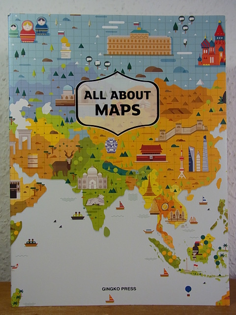
Sandu Publishing Co. and Wang Shaoqiang (Chief Editor)
All about Maps
Gingko Press, Berkeley, 2016. 240 S. ; 28,5 x 21 cm ; kart. ;
Referentie van de boekhandelaar : 124408
|
|
|
SANKEY H.R.
The Maps of the Ordnance Survey: a Mid-Victorian View.
8vo., First Edition, with illustrations in the text; printed wrappers, a near fine copy.
|
|
|
Sanmarchi Toni
Itinerari Alpini 8 - ALTA VIA DEI SILENZI Dalle sorgenti del Piave a Vittorio Veneto
ITINERARI ALPINI Guideper alpinisti ed escursionisti 8 - Premessa - Caratteristiche dell'Alta Via e avvertenze generali - Cartografia e bibliografia - L'accesso...- Alta Via... - Il Gruppo del Duranno 1 15,5x10,5 cm., brossura editoriale plastificata, in sguardie Itinerario completo, pp. 195 (5), numerose illustrazioni in bianconero, schizzi, grafici, tutto nel testo, prima edizione, in italiano, buone condizioni. RARO Ex libris
|
|
|
SANSON (Nicolas).
Espagne
(Paris, 1752), mapa grabado en madera de 14'5 x 16'5 cm.
|
|
|
SANSON (Nicolas).
l'Asie.
(Paris, 1752), mapa grabado en madera de 15 x 16'5 cm.
|
|
|
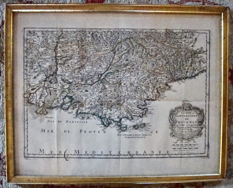
Sanson d'Abbeville
Comté et Gouvernement de Provence. Aveq les pays circonvoisins Comtat Venaiscin, Principauté d'Orange, Comtat de Nice, etc.
À Paris chez l'autheur. Encadré Très bon Paris 1669 1669 44 x 55 cm avec son cadre ancien.
Referentie van de boekhandelaar : 7613
|
|
|
Sanson d'Abbeville Nicolas
L'Europe / L'Asie, en plusieurs cartes nouvelles et exactes... / L'Afrique, en plusieurs cartes nouvelles et exactes... / L'Amérique, en plusieurs cartes nouvelles et exactes...
Chez L'auteur Relié 1662 "MAGNIFIQUE ENSEMBLE DES QUATRE CONTINENTS CARTOGRAPHIÉS PAR LE PREMIER CARTOGRAPHE FRANÇAIS, DANS UN ÉTAT DE FRAICHEUR INCOMPARABLE. Quatre volumes petit in-4 (18,5 x 25 cm), reliés en plein veau brun de l'époque. Les reliures sont toutes identiques, dos à 5 nerfs, titrés, roulettes dorées sur les coupes. Nicolas Sanson d'Abbeville est considéré comme le fondateur de la cartographie en France. En 1627, rencontrant Richelieu (il venait d'Abbeville et s'était installé à Paris), il fut présenté par lui à Louis XIII, qui le nomma Géographe Ordinaire du Roi. Il cartographia quatre continents (ici présents : l'Europe, l'Asie, l'Afrique et l'Amérique), et fut même le premier à cartographier certaines parties du globe (ainsi, par exemple, la région des grands lacs canadiens, avec sa carte ""Le Canada ou Nouvelle France"" (carte datant de 1656)). Il fut le premier Français à concevoir le plan d'un atlas mondial. Les cartes et le texte de chaque volume sont entièrement montés sur onglets. Chaque carte reçoit un commentaire explicatif, avec informations sur l'économie, les habitants et les moeurs du pays décrit, tiré des auteurs anciens (Pline, Strabbon...), de récits de voyageurs ou de rapports des missions des jésuites. De plus, chacune des cartes présente les tracés de contours des pays ou régions aquarellés. Les volumes s'organisent comme suit : L'Europe (sans date) : Titre et dédicace gravés sur double page, 12 cartes doubles et 30 feuillets imprimés au recto. L'Asie (1662) : 108 pages (avec erreurs connues de chiffrage et inversion de feuillets) et 17 cartes doubles. L'Afrique (1662) : 96 pages et 17 planches doubles, proposant 18 cartes (car l'une des planches porte deux cartes) (ce volume est le seul à présenter une petite mouillure sur les quelques premières pages). L'Amérique (1662) : non paginé (80 pages) et 15 cartes doubles. Nos exemplaires sont en TRÈS BEL ÉTAT. Les pages sont très fraiches, sans aucune réelle trace, tache, piqûre ni mouillure. Les cartes, particulièrement, sont dans un vraiment très bel état de fraîcheur, avec des couleurs extrêmement éclatantes. Les reliures présentent des traces peu visibles de réparations anciennes. Les volumes ont étés reliés avec contre-gardes, mais sans pages de garde. Ce rare ensemble est véritablement en TRÈS BEL ÉTAT. Livraison a domicile (La Poste) ou en Mondial Relay sur simple demande."
Referentie van de boekhandelaar : bf4740
|
|
|
SANSON, NICOLAS (D'ABEVILLE) - ALEXIS HUBERT JAILLOT.
Partie du Duché de Milan, la Principauté de Piémont, le Montferrat et la Republique de Genes.
Dalla “Cartes générales de toute les parties du Monde”, Parigi, 1654. Paris, H. Iaillot primi anni del XVIII secolo. Incisione in rame, confini in col. d’epoca, cm 55 x 73,5 (alla lastra). Sopra l’originale didascalia, è stata riportata, fuori del margine superiore della parte incisa e a ricoprire la battuta della lastra, entro la quale si trova l’originale didascalia, una ulteriore scritta esplicativa. Una lieve gora d’umido all'angolo superiore bianco, peraltro esemplare fresco, in bella coloritura, con una bella impressione e grandi margini, in ottimo stato di conservazione.

|
|
|
SANSON, NICOLAS (D'ABEVILLE).
Les estats de Savoye, Piemont et le Comté de Nice.
Amsterdam, Pierre Scenk, 1654 circa. Tratta da “Cartes générales de toute les parties du Monde” (Parigi, 1654), incisione in rame, colore d’epoca, cm 49 x 58 (alla lastra). Leggermente rifilato al margine superiore, esemplare fresco, in bella impressione e in bella coloritura. .

|
|
|
SANSON, NICOLAS - PEYROUNIN, ABRAHAM.
Carte generalle du Royaume de Danemarc.
Paris, Pierre Mariette, Rue S. Jacques a l'Esperance, 1646. Incisione in rame all'acquaforte, confini in colore d'epoca, in basso a destra, in lastra, "A. Peyrounin fecit 1646". La carta è anteriore a quella di Pierre Du Val che reca il titolo "Carte du Royaume de Danemarq, et de la partie Meridionale de la Gotie", del 1686. Abraham Peyrounin (1620 – 1666 circa), incisore francese attivo a Parigi durante la metà del XVII secolo. Della sua vita poco sappiamo e il suo nome resta legato a quello dei più noti Nicolas Sanson e Pierre Mariette, con i quali collaborò per la realizzazione di carte e mappe. Esemplare stampato su carta fine, smarginato, una mancanza all'angolo superiore destro, sgualciture della carta, inciso buono e leggibile. .

|
|
|
SANSON, ROBERT.
Les Indes orientales où sont distingués les Empires et Royaumes qu'elles continnent tirées du Neptune Oriental. Par le S. Robert Géographe ordinaire du Roy.
Avec Privilege, (Paris), 1751. Incisione in rame all'acquaforte, confini in colore d'epoca, cm 50 x 58,5 (alla lastra) più margini. Cartiglio in cornice floreale in alto a sn, scala delle miglia in basso in riquadro. Sono segnalati le Golfe de Bengale, l'Ocean Indien e le Isles Maldives con tutte le numerose isole. Piega editoriale e un minimo accenno di foxing, leggermente rifilato il margine superiore, tenue e assai piacevole coloritura, buona conservazione.

|
|
|
Santarem Visconde de
Estudos de cartographia antiga
Broché 1919 Deux volumes in-8 broché, CCLVIII, 260 pp. XVII cartes hors-texte, blasons hors-texte, deuxième volume : 318 pp., XLI planches hors-texte, exemplaire de la bibliothèque de t'Sersteven qui note en début d'ouvrage 'c'est un pieux recueil des notes qui avaient été prise par Santarem pour son histoire de la cosmogrpahie, précieux en ce qu'il nous donne une sorte de tableau chronologique des plus anciennes cartes, avec commentaires interessant, Pp 51 et 11, envoi de l'auteur à un certain H. Vallée, ouvrage en grande partie en portugais ; dos fragiles, bon état. Livraison a domicile (La Poste) ou en Mondial Relay sur simple demande.
Referentie van de boekhandelaar : bb3198
|
|
|
SANTARÉM (Manuel Francisco de, vicomte de)
Recherches sur la priorité de la découverte des pays situés sur la côte occidentale d’Afrique, au-delà du Cap Bojador, et sur les progrès de la science géographique, après les navigations des Portugais, au XVe siècle, accompagnées d’un atlas composé de mappemondes et de cartes pour la plupart inédites, dressées depuis le XIe jusqu’au XVIIe siècle.
Paris, Librairie orientale de Ve Dondey-Dupré, 1842, in-8 (21,5x13,5cm), demi veau époque, dos à nerfs avec auteur et titre, reliure signée Lebrun (élève de Simier) en pied. Frottements, coins usés, coiffe sup. abimée, quelques rousseurs et cahiers brunis.
Referentie van de boekhandelaar : PHO-2492

|
|
|
Santini Francesco; Bellin Jacques-Nicolas
Partie Meridionale de Portugal…
Incisione su rame all'acquaforte e bulino in due fogli incollati di mm 563 x 489. Bella vergata veneziana. Filigrana FV sormontate da tre stelle. Foglio a larghi margini in bellissima carta veneziana. Titolo entro ricco cartiglio in alto a destra. Toponimi e descrizioni geografiche nella mappa. Proveniente da: "Atlas universel dressé sur les meilleures cartes modernes", Venezia 1784. Gli Atlanti stampati da Francesco Santini, che, come indicato spesso nelle carte, teneva bottega a Santa Giustina, nel Sestiere di Castello, riutilizzano le lastre incise da Lattrè e disegnate da Janvier per l' "Atlas Moderne" stampato a Parigi nel 1771. L'Atlante di Janvier ebbe un immediato apprezzamento, sia per la precisione geografica, che per i ricchi cartigli molto decorativi. Robert (Jean) Janvier: working in Paris in the second half of the eighteenth century, Jean Janvier (1746 – 1776) produced a series of maps in the later half of the century. While there is some confusion about his Christian name, his maps usually were inscribed “Le Sieur Janvier”. He is best known for his collaboration with engraver Jean Lattre for an Atlas Moderne first released in 1762 and in several later editions some by C. F. Delamarche and by Chez Remondini. He also produced several maps used in general atlases by William Fadan and P. Santini.

|
|
|
Santini Francesco; Bellin Jacques-Nicolas
Partie Septentrionale de Portugal…
Incisione su rame all'acquaforte e bulino in due fogli incollati di mm 563 x 489. Bella vergata veneziana. Filigrana tre lune. Foglio a larghi margini in bellissima carta veneziana tre lune. Titolo entro ricco cartiglio in alto a destra. Toponimi e descrizioni geografiche nella mappa. Proveniente da: "Atlas universel dressé sur les meilleures cartes modernes", Venezia 1784. Gli Atlanti stampati da Francesco Santini, che, come indicato spesso nelle carte, teneva bottega a Santa Giustina, nel Sestiere di Castello, riutilizzano le lastre incise da Lattrè e disegnate da Janvier per l' "Atlas Moderne" stampato a Parigi nel 1771. L'Atlante di Janvier ebbe un immediato apprezzamento, sia per la precisione geografica, che per i ricchi cartigli molto decorativi. Robert (Jean) Janvier: working in Paris in the second half of the eighteenth century, Jean Janvier (1746 – 1776) produced a series of maps in the later half of the century. While there is some confusion about his Christian name, his maps usually were inscribed “Le Sieur Janvier”. He is best known for his collaboration with engraver Jean Lattre for an Atlas Moderne first released in 1762 and in several later editions some by C. F. Delamarche and by Chez Remondini. He also produced several maps used in general atlases by William Fadan and P. Santini.

|
|
|
Santini Francesco; D'Anville, Jean Baptiste
Gallia Antiqua ex Aevi Romani Monumentis Eruta et Ser.mi Carnutum Ducis Munifcientia Publicis iuris facta.
Incisione su rame all'acquaforte e bulino in due fogli incollati di mm 572 x 482. Bella vergata veneziana. Filigrana AS. Foglio a larghi margini in candida e spessa carta di filo veneziana. Titolo entro ricco cartiglio in alto a destra. Elenco delle province antiche. Toponimi e descrizioni geografiche nella mappa. Proveniente da: "Atlas universel dressé sur les meilleures cartes modernes", Venezia 1776 (ma 1760). Gli Atlanti stampati da Francesco Santini, che, come indicato spesso nelle carte, teneva bottega a Santa Giustina, nel Sestiere di Castello, riutilizzano le lastre incise da Lattrè e disegnate da Janvier per l' "Atlas Moderne" stampato a Parigi nel 1771. L'Atlante di Janvier ebbe un immediato apprezzamento, sia per la precisione geografica, che per i ricchi cartigli molto decorativi. Robert (Jean) Janvier: working in Paris in the second half of the eighteenth century, Jean Janvier (1746 – 1776) produced a series of maps in the later half of the century. While there is some confusion about his Christian name, his maps usually were inscribed “Le Sieur Janvier”. He is best known for his collaboration with engraver Jean Lattre for an Atlas Moderne first released in 1762 and in several later editions some by C. F. Delamarche and by Chez Remondini. He also produced several maps used in general atlases by William Fadan and P. Santini.

|
|
|
Santini Francesco; De Vaugondy, Robert
Britannicae Insulae in quibus Albion seu Britannia Major, et Ivernia seu Britannia Minor…"
Incisione su rame all'acquaforte e bulino in due fogli incollati di mm 556 x 485. Bella vergata veneziana. Filigrana AV e stelle. Foglio a larghi margini. Una gora pesante sul margine bianco sinistro e tre più lievi entro la battuta. Titolo entro ricco cartiglio in alto a sinistra. Toponimi e descrizioni geografiche nella mappa. Proveniente da: "Atlas universel dressé sur les meilleures cartes modernes", Venezia 1784 (ma 1780). Gli Atlanti stampati da Francesco Santini, che, come indicato spesso nelle carte, teneva bottega a Santa Giustina, nel Sestiere di Castello, riutilizzano le lastre incise da Lattrè e disegnate da Janvier per l' "Atlas Moderne" stampato a Parigi nel 1771. L'Atlante di Janvier ebbe un immediato apprezzamento, sia per la precisione geografica, che per i ricchi cartigli molto decorativi. Robert (Jean) Janvier: working in Paris in the second half of the eighteenth century, Jean Janvier (1746 – 1776) produced a series of maps in the later half of the century. While there is some confusion about his Christian name, his maps usually were inscribed “Le Sieur Janvier”. He is best known for his collaboration with engraver Jean Lattre for an Atlas Moderne first released in 1762 and in several later editions some by C. F. Delamarche and by Chez Remondini. He also produced several maps used in general atlases by William Fadan and P. Santini.

|
|
|
Santini Francesco; De Vaugondy, Robert
Royaume de Danemarck qui comprend le Nort-Jutland …le Sud-Jutland… et le Isles de Fionie, Sélande, Laland, & c.
Incisione su rame all'acquaforte e bulino in due fogli incollati di mm 575 x 486. Bella vergata veneziana. Filigrana trelune. Foglio a larghi margini. Una gora leggera nella parte centrale. Titolo entro ricco cartiglio in alto a destra. Toponimi e descrizioni geografiche nella mappa. Proveniente da: "Atlas universel dressé sur les meilleures cartes modernes", Venezia 1776. Gli Atlanti stampati da Francesco Santini, che, come indicato spesso nelle carte, teneva bottega a Santa Giustina, nel Sestiere di Castello, riutilizzano le lastre incise da Lattrè e disegnate da Janvier per l' "Atlas Moderne" stampato a Parigi nel 1771. L'Atlante di Janvier ebbe un immediato apprezzamento, sia per la precisione geografica, che per i ricchi cartigli molto decorativi. Robert (Jean) Janvier: working in Paris in the second half of the eighteenth century, Jean Janvier (1746 – 1776) produced a series of maps in the later half of the century. While there is some confusion about his Christian name, his maps usually were inscribed “Le Sieur Janvier”. He is best known for his collaboration with engraver Jean Lattre for an Atlas Moderne first released in 1762 and in several later editions some by C. F. Delamarche and by Chez Remondini. He also produced several maps used in general atlases by William Fadan and P. Santini.
|
|
|
Santini Francesco; Remondini Giuseppe
Carte du Grand-Duchè de Toscane par le Sr. Robert Geographe ordin. Du Roy
Incisione su rame all'acquaforte e bulino, foglio di 630 x 540 mm alla battuta mm 576 x 490. Bella vergata veneziana. Ottimo foglio a larghi margini. Titolo entro ricco cartiglio in basso a sinistra. Toponimi e descrizioni geografiche nella mappa. Proveniente da: "Atlas universel dressé sur les meilleures cartes modernes", Venezia 1776. Gli Atlanti stampati da Francesco Santini, che, come indicato spesso nelle carte, teneva bottega a Santa Giustina, nel Sestiere di Castello, riutilizzano le lastre incise dai migliori geografi francesi dell'epoca.

|
|
|
Santini Francesco; Remondini Giuseppe
Frontespizio allegorico dell'Atlas Universel dresseè sur les meilleures cartes modernes
Incisione all'acquaforte di mm 366 x 498 su bella carta di filo veneziana. Si tratta del magnifico frontespizio per l'Atlante di Santini pubblicato da Remondini nel 1784. In realtà non è chiaro l'autore di questa bellissima tavola, per cui si sono fatti i nomi dei più grandi incisori veneziani dell'epoca. Foglio privo di difetti.

|
|
|
Santini Francesco; Remondini Giuseppe
Partie Meridionale de la Russie Europeenne ou sont distinguees exactament toutes le Provinces d'apres le detail de l'Atlas Russien.
Incisione su rame all'acquaforte e bulino in due fogli uniti di mm 652 x 490.Bella vergata veneziana. Filigrana "R". Ottimo foglio a larghi margini. Titolo entro ricco cartiglio in alto a destra. Toponimi e descrizioni geografiche nella mappa. Proveniente da: "Atlas universel dressé sur les meilleures cartes modernes", Venezia 1776. Gli Atlanti stampati da Francesco Santini, che, come indicato spesso nelle carte, teneva bottega a Santa Giustina, nel Sestiere di Castello, riutilizzano le lastre incise dai migliori geografi francesi dell'epoca.

|
|
|
SANTINI PAOLO
ASIA MINOR IN SUAS PARTES SEU PROVINCIAS DIVISA
SANTINI PAOLO ASIA MINOR IN SUAS PARTES SEU PROVINCIAS DIVISA. Venezia, Remondini Seconda metà XVIII sec., Dall' "Atlas Universel" stampato a Venezia nel 1776 e nel 1784. Il soggetto riprende la precendete carta di R. De Vaugondy. Buono (Good) Buon es.. acquaforte acquerellata a mano <br> cm. 62,3 x 50 (inciso) <br> <br> <br>

|
|
|
SANTINI PAOLO
CARTE DE L'EGYPTE ANCIENNE ET MODERNE
SANTINI PAOLO CARTE DE L'EGYPTE ANCIENNE ET MODERNE. Venezia, Remondini 1779, Dall' "Atlas Universel" stampato a Venezia nel 1776 e nel 1784. Il soggetto riprende la precendete carta di R. De Vaugondy. Buono (Good) Buon es.. acquaforte acquerellata a mano <br> cm. 48,3 x 65 (inciso) <br> <br> <br>

|
|
|
SANTINI PAOLO
CARTE DE L'EMPIRE DE PERSE DRESSEE SUR LES CARTES DU S. D'ANVILLE
SANTINI PAOLO CARTE DE L'EMPIRE DE PERSE DRESSEE SUR LES CARTES DU S. D'ANVILLE. Venezia, Remondini 1779, Dall' "Atlas Universel" stampato a Venezia nel 1776 e nel 1784. Buono (Good) Buon es.. acquaforte acquerellata a mano <br> cm. 62,8 x 49,9 (inciso) <br> <br> <br>

|
|
|
SANTINI PAOLO
CARTE DE LA BARBARIE, CONTENANT LES ROYAUMES DE MAROC, DE FEZ, D'ALGER, DE TUNIS ET DE TRIPOLI AVEC LES DESERTS LIMITROPHES DE L'INTERIEUR DE L'AFRIQUE
SANTINI PAOLO CARTE DE LA BARBARIE, CONTENANT LES ROYAUMES DE MAROC, DE FEZ, D'ALGER, DE TUNIS ET DE TRIPOLI AVEC LES DESERTS LIMITROPHES DE L'INTERIEUR DE L'AFRIQUE. Venezia, Remondini 1775, Dall' "Atlas Universel" stampato a Venezia nel 1776 e nel 1784. Il soggetto riprende la precendete carta di R. De Vaugondy e J. B. D'anville Buono (Good) Buon es.. acquaforte acquerellata a mano <br> cm. 56,6 x 47,5 (inciso) <br> <br> <br>

|
|
|
SANTINI PAOLO
CARTE DE LA GEORGIE ET DES PAYS SITUES ENTRE LA MER NOIRE ET LA MER CASPIENNE
SANTINI PAOLO CARTE DE LA GEORGIE ET DES PAYS SITUES ENTRE LA MER NOIRE ET LA MER CASPIENNE. Venezia, Remondini 1775, Dall' "Atlas Universel" stampato a Venezia nel 1776 e nel 1784. Buono (Good) Buon es.. acquaforte acquerellata a mano <br> cm. 68 x 50 (inciso) <br> <br> <br>

|
|
|
SANTINI PAOLO
CARTE DE LA GUINEE CONTENANT LES ISLES DU CAP VERD, LE SENEGAL, LA COTE DE GUINEE PROPREMENT DITE, LES ROYAUMES DE LOANGO, CONGO, ANGOLA ET BENGUELA
SANTINI PAOLO CARTE DE LA GUINEE CONTENANT LES ISLES DU CAP VERD, LE SENEGAL, LA COTE DE GUINEE PROPREMENT DITE, LES ROYAUMES DE LOANGO, CONGO, ANGOLA ET BENGUELA. Venezia, Remondini 1779, Dall' "Atlas Universel" stampato a Venezia nel 1776 e nel 1784. Buono (Good) Buon es.. acquaforte acquerellata a mano <br> cm. 62,5 x 47,3 (inciso) <br> <br> <br>

|
|
|
SANTINI PAOLO
CARTE DE LA POLOGNE AUTRICHIENNE CONTENANT LA RUSSIE ROUGE ET LA PARTIE MERIDIONALE DU PALATINAT DE CRACOVIE
SANTINI PAOLO CARTE DE LA POLOGNE AUTRICHIENNE CONTENANT LA RUSSIE ROUGE ET LA PARTIE MERIDIONALE DU PALATINAT DE CRACOVIE. Venezia, Remondini 1776, Dall' "Atlas Universel" stampato a Venezia nel 1776 e nel 1784Il soggetto riprende la precendete carta di Heritiers Homan. Buono (Good) Buon es.. acquaforte acquerellata a mano <br> cm. 61 x 47 (inciso) <br> <br> <br>

|
|
|
SANTINI PAOLO
CARTE DE LA PRUSSE OCCIDENTALE OU SONT TRACEES LES PROVINCES CEDEES PAR LA POLOGNE AU ROI DE PRUSSE
SANTINI PAOLO CARTE DE LA PRUSSE OCCIDENTALE OU SONT TRACEES LES PROVINCES CEDEES PAR LA POLOGNE AU ROI DE PRUSSE. Venezia, Remondini 1775, Dall' "Atlas Universel" stampato a Venezia nel 1776 e nel 1784. Buono (Good) Buon es.. acquaforte acquerellata a mano <br> cm. 66,6 x 47 (inciso) <br> <br> <br>

|
|
|
SANTINI PAOLO
CARTE DES ENVIRONS DE LA MER NOIRE OU SE TROUVENT L'UKRAYNE, LA PETITE TARTARIE, ET LES CONFINS DE LA RUSSIE EUROPEENE, ET DE LA TURQUIE
SANTINI PAOLO CARTE DES ENVIRONS DE LA MER NOIRE OU SE TROUVENT L'UKRAYNE, LA PETITE TARTARIE, ET LES CONFINS DE LA RUSSIE EUROPEENE, ET DE LA TURQUIE. Venezia, Remondini Seconda metà XVIII sec., Dall' "Atlas Universel" stampato a Venezia nel 1776 e nel 1784.Il soggetto riprende la precendete carta di R. De Vaugondy. Buono (Good) Buon es.. acquaforte acquerellata a mano <br> cm. 66 x 51,2 (inciso) <br> <br> <br>

|
|
|
SANTINI PAOLO
CARTE DES ETATS DE PARME, ET DE MODENE AVEC LA PARTIE ORIENTALE DE LA RIVIERE DE GENES
SANTINI PAOLO CARTE DES ETATS DE PARME, ET DE MODENE AVEC LA PARTIE ORIENTALE DE LA RIVIERE DE GENES. Venezia, Remondini 1779, Dall' "Atlas Universel" stampato a Venezia nel 1776 e nel 1784. Buono (Good) Buon es.. acquaforte acquerellata a mano <br> cm. 64,2 x 49 (inciso) <br> <br> <br>

|
|
|
SANTINI PAOLO
CARTE DES GOUVERNEMENTS DE FLANDRE FRANCOISE, D'ARTOIS, DE PICARDIE ET DU BOULENOIS
SANTINI PAOLO CARTE DES GOUVERNEMENTS DE FLANDRE FRANCOISE, D'ARTOIS, DE PICARDIE ET DU BOULENOIS. Venezia, Remondini 1771, Dall' "Atlas Universel" stampato a Venezia nel 1776 e nel 1784.Il soggetto riprende la precendete carta di Bonne. Buono (Good) Buon es.. acquaforte acquerellata a mano <br> cm. 59,6 x 45,6 (inciso) <br> <br> <br>

|
|
|
SANTINI PAOLO
CARTE DU CHILI MERIDIONAL, DU RIO DE LA PLATA, DES PATAGONS, ET DU DETROIT DE MAGELLAN
SANTINI PAOLO CARTE DU CHILI MERIDIONAL, DU RIO DE LA PLATA, DES PATAGONS, ET DU DETROIT DE MAGELLAN. Venezia, Remondini 1779, Dall' "Atlas Universel" stampato a Venezia nel 1776 e nel 1784. Il soggetto riprende la precendete carta di D'Anville. Buono (Good) Buon es.. acquaforte acquerellata a mano <br> cm. 56,3 x 47 (inciso) <br> <br> <br>

|
|
|
SANTINI PAOLO
CARTE DU GOUVERNEMENT DE BRETAGNE
SANTINI PAOLO CARTE DU GOUVERNEMENT DE BRETAGNE. , 1777, Molto buono (Very Good) buon es.. acquaforte <br> cm. 58 x 44 <br> <br> <br>

|
|
|
SANTINI PAOLO
CARTE DU PADOUAN, DU DOGADO, ET DE LA PLUS GRANDE PARTIE DU VICENTIN
SANTINI PAOLO CARTE DU PADOUAN, DU DOGADO, ET DE LA PLUS GRANDE PARTIE DU VICENTIN. Venezia, Remondini 1776, Dall' "Atlas Universel" stampato a Venezia nel 1776 e nel 1784. Il soggetto riprende la precendete carta di Bartolomeo Clarici. Buono (Good) Buon es.. acquaforte acquerellata a mano <br> cm. 67,8 x 50 (inciso) <br> <br> <br>

|
|
|
SANTINI PAOLO
CARTE DU PEROU ET BRESIL SEP. DE TIERRA-FIRME, DE GUAYANA, ET DE LA RIVIERE DES AMAZONES
SANTINI PAOLO CARTE DU PEROU ET BRESIL SEP. DE TIERRA-FIRME, DE GUAYANA, ET DE LA RIVIERE DES AMAZONES. Venezia, Remondini 1779, Dall' "Atlas Universel" stampato a Venezia nel 1776 e nel 1784. Il soggetto riprende la precendete carta di D'Anville. Buono (Good) Buon es.. acquaforte acquerellata a mano <br> cm. 68,5 x 48,6 (inciso) <br> <br> <br>

|
|
|
SANTINI PAOLO
CARTE DU ROYAUME D'ESCLAVONIE ET DU DUCHE' DE SYRMIE, DONT L'UN ET L'AUTRE EST ARROSE' PAR LE DANUBE, L'ILLOVE, LA SAVE ET LA DRAVE
SANTINI PAOLO CARTE DU ROYAUME D'ESCLAVONIE ET DU DUCHE' DE SYRMIE, DONT L'UN ET L'AUTRE EST ARROSE' PAR LE DANUBE, L'ILLOVE, LA SAVE ET LA DRAVE. Venezia, Remondini 1783, Dall' "Atlas Universel" stampato a Venezia nel 1776 e nel 1784. Buono (Good) Buon es.. acquaforte acquerellata a mano <br> cm. 59 x 50 (inciso) <br> <br> <br>

|
|
|
SANTINI PAOLO
CARTE DU TERRITOIRE DE BRESCE SUIVANT LE PLAN DRESSE' SUR LE LIEUX
SANTINI PAOLO CARTE DU TERRITOIRE DE BRESCE SUIVANT LE PLAN DRESSE' SUR LE LIEUX. Venezia, Remondini 1777, Dall' "Atlas Universel" stampato a Venezia nel 1776 e nel 1784. Buono (Good) Buon es.. acquaforte acquerellata a mano <br> cm. 67,4 x 46,5 (inciso) <br> <br> <br>

|
|
|
SANTINI PAOLO
CARTE QUI REPRESENTE LA PARTIE MERIDIONALE DU BRESIL ET DU PEROU, LE CHILI SEPTENTRIONAL, ET LE PARAGUAY
SANTINI PAOLO CARTE QUI REPRESENTE LA PARTIE MERIDIONALE DU BRESIL ET DU PEROU, LE CHILI SEPTENTRIONAL, ET LE PARAGUAY. Venezia, Remondini 1779, Dall' "Atlas Universel" stampato a Venezia nel 1776 e nel 1784. Il soggetto riprende la precendete carta di D'Anville. Buono (Good) Buon es.. acquaforte acquerellata a mano <br> cm. 69 x 50 (inciso) <br> <br> <br>

|
|
|
SANTINI PAOLO
CERCLE DE SOUABE, DANS LEQUEL SONT DISTINGUES LES PRINCIPAUX ETATS ET LES ENCLAVES
SANTINI PAOLO CERCLE DE SOUABE, DANS LEQUEL SONT DISTINGUES LES PRINCIPAUX ETATS ET LES ENCLAVES. Venezia, Remondini 1778, Dall' "Atlas Universel" stampato a Venezia nel 1776 e nel 1784. Buono (Good) Buon es.. acquaforte acquerellata a mano <br> cm. 54,3 x 50,3 (inciso) <br> <br> <br>

|
|
|
SANTINI PAOLO
DUCHE DE SAVOYE QUI COMPREND LE CHABLAIS, LE FOSSIGNY, LE GENEVOIS, LE SAVOYE PROPRE, LA TARENTAISE ET LA MAURIENNE
SANTINI PAOLO DUCHE DE SAVOYE QUI COMPREND LE CHABLAIS, LE FOSSIGNY, LE GENEVOIS, LE SAVOYE PROPRE, LA TARENTAISE ET LA MAURIENNE. Venezia, Remondini 1778, Dall' "Atlas Universel" stampato a Venezia nel 1776 e nel 1784. Il soggetto riprende la precendete carta di R. De Vaugondy Buono (Good) Buon es.. acquaforte acquerellata a mano <br> cm. 54,2 x 50,6 (inciso) <br> <br> <br>

|
|
|
SANTINI PAOLO
ETATS DU GRAND-SEIGNEUR EN ASIE, EMPIRE DE PERSE, PAYS DES USBECS, ARABIE ET EGYPTE
SANTINI PAOLO ETATS DU GRAND-SEIGNEUR EN ASIE, EMPIRE DE PERSE, PAYS DES USBECS, ARABIE ET EGYPTE. Venezia, Remondini 1778, Dall' "Atlas Universel" stampato a Venezia nel 1776 e nel 1784. Il soggetto riprende la precendete carta di R. De Vaugondy Buono (Good) Buon es.. acquaforte acquerellata a mano <br> cm. 57,3 x 51 (inciso) <br> <br> <br>

|
|
|
SANTINI PAOLO
GRAECIAE ANTIQUAE SPECIMEN GEOGRAPHICUM IN QUO MACEDONIA, THESSALIA, EPIRUS, ACHAIA ET PELOPONESUS, IN MINORES PARTES SEU POPULOS DISTINGUUNTUR
SANTINI PAOLO GRAECIAE ANTIQUAE SPECIMEN GEOGRAPHICUM IN QUO MACEDONIA, THESSALIA, EPIRUS, ACHAIA ET PELOPONESUS, IN MINORES PARTES SEU POPULOS DISTINGUUNTUR. Venezia, Remondini 1778, Dall' "Atlas Universel" stampato a Venezia nel 1776 e nel 1784.Il soggetto riprende la precendete carta di D'Anville. Buono (Good) Buon es.. acquaforte acquerellata a mano <br> cm. 51.3 x 59 (inciso) <br> <br> <br>

|
|
|
SANTINI PAOLO
ITALIA ANTIQUA CUM INSULIS SICILIA, SARDINIA, ET CORSICA
SANTINI PAOLO ITALIA ANTIQUA CUM INSULIS SICILIA, SARDINIA, ET CORSICA. Venezia, Remondini 1778, Dall' "Atlas Universel" stampato a Venezia nel 1776 e nel 1784. Il soggetto riprende la precendete carta di R. De Vaugondy Buono (Good) Ottimo es.. acquaforte acquerellata a mano <br> cm. 57,6 x 50 (inciso) <br> <br> <br>

|
|
|
SANTINI PAOLO
L'AFRIQUE DIVISEE EN SES PRINCIPAUX ETATS ASSUJETTIE AUX OBSERVATIONS ASTRONOMIQUE PAR LE S. JANVIER GEOGRAPHE
SANTINI PAOLO L'AFRIQUE DIVISEE EN SES PRINCIPAUX ETATS ASSUJETTIE AUX OBSERVATIONS ASTRONOMIQUE PAR LE S. JANVIER GEOGRAPHE. Venezia, Remondini seconda metà XVIII sec., Dall' "Atlas Universel" stampato a Venezia nel 1776 e nel 1784. Buono (Good) Buon es.. acquaforte acquerellata a mano <br> cm. 66,5 x 49,5 (inciso) <br> <br> <br>

|
|
|
SANTINI PAOLO
L'ASIE DIVISEE EN LES PRINCIPAUX ETATS ASSUJETTIE AUX OBSERVATIONS ASTRONOMIQ PAR LE S. JANVIER GEOGRAPHE
SANTINI PAOLO L'ASIE DIVISEE EN LES PRINCIPAUX ETATS ASSUJETTIE AUX OBSERVATIONS ASTRONOMIQ PAR LE S. JANVIER GEOGRAPHE. Venezia, Remondini seconda metà XVIII sec., Dall' "Atlas Universel" stampato a Venezia nel 1776 e nel 1784. Buono (Good) Buon es.. acquaforte acquerellata a mano <br> in ventiquattresimo cm. 66,5 x 49,6 (inciso) <br> <br> <br>

|
|
|
SANTINI PAOLO
L'EUROPE DIVISEE EN SES PRINCIPAUX ETATS SUIVANT LES NOUVELLES OBSERVATIONS ASTRONOMIQUES
SANTINI PAOLO L'EUROPE DIVISEE EN SES PRINCIPAUX ETATS SUIVANT LES NOUVELLES OBSERVATIONS ASTRONOMIQUES. Venezia, Remondini seconda metà XVIII sec., Dall' "Atlas Universel" stampato a Venezia nel 1776 e nel 1784. Buono (Good) Buon es.. acquaforte acquerellata a mano <br> cm. 65,5 x 48,5 (inciso) <br> <br> <br>

|
|
|
SANTINI PAOLO
LA JUDEE OU TERRE SAINTE DIVISEE EN SES DOUZE TRIBUS
SANTINI PAOLO LA JUDEE OU TERRE SAINTE DIVISEE EN SES DOUZE TRIBUS. Venezia, Remondini 1779, Dall' "Atlas Universel" stampato a Venezia nel 1776 e nel 1784. Buono (Good) Buon es.. acquaforte acquerellata a mano <br> cm. 63 x 50 (inciso) <br> <br> <br>

|
|
|
SANTINI PAOLO
LA PRUSSIE DIVISEE EN PRUSSE ROYALE ET PRUSSE DUCALE
SANTINI PAOLO LA PRUSSIE DIVISEE EN PRUSSE ROYALE ET PRUSSE DUCALE. Venezia, Remondini 1778, Lotto di 8 mappe dall' "Atlas Universel" stampato a Venezia nel 1776 e nel 1784Il soggetto riprende la precendete carta di Janvier. Buono (Good) Buon es.. acquaforte acquerellata a mano <br> cm. 63 x 50,5 (inciso) <br> <br> <br>

|
|
|

 De zoekresultaten per email ontvangen
 Zoekresultaten downloaden als PDF
 RSS feed
 Permanente link


