|
VAN DER HEIJDEN, Henk A.M.
Nieut Kaert boeck vande XVII Nederlandsche Provincien, HERUITGAVE VAN DE ATLAS VAN DE NEDERLANDEN UITGEGEVEN DOOR F. DE WIT IN 1670-1672 MET EEN INLEIDING VAN H.A.M. VAN DER HEIJDEN. ReeDITION DE L??™ATLAS DES PAYS-BAS PUBLIe PAR F. DE WIT EN 1670-1672, ACCOMPAGNeE D??™UNE INTRODUCTION DE H.A.M.
Bound, with dusjacket, in kunstlederen band, 40 p. - 51 x 31,50 cm, tweetalige inleiding (Nederlands-Frans) 20 p. facsimile tekst, 25 kaartbladen van 51 x 63 cm. ISBN 9789061868743. Zo ook in de Atlas van de XVII Provincien, die in de tweede helft van de 17de eeuw in verschillende edities werd uitgegeven door de Amsterdamse drukker/uitgever en graveur Frederik de Wit (?°1629/30 - 1698). Deze publicatie, die in facsimile wordt uitgegeven, bevat een overzichtskaart van de XVII Provincien en een aantal gewestkaarten van de Nederlanden. In totaal gaat het om 25 kaartbladen (51 x 63 cm). Opmerkelijk is de aanwezigheid van een kaart van Westfalen en de kaart van de reisweg van de Nederlanden via Duitsland naar Italie en via Zwitserland naar Genua, Luon en Rome. Naast de kaarten wordt ook de originele beschrijving van 20 bladzijden in de facsimile opgenomen. De facsimile van de atlas (editie 1670/72) wordt voorafgegaan door een uitvoerige inleiding van de hand van Dr. H.A.M. van der Heijden, waarin leven en werk van de kunstenaar worden geschetst. Voorts wordt ingegaan op de geschiedenis van deze atlas en op de afzonderlijke kaartbladen. Deze inleiding is opgesteld in het Nederlands Text in Dutch et French.

|
|
|
VAN DER HEIJDEN, Henk A.M. / Pertus Verbiest
Description de touts les Pays Bas, autrement appellez, la Germanie Inferieure, ou Basse Allemagne PAR PIERRE VERBIST, AVEC TOUTES LES CARTES GEOGRAPHIQUES DESDITS PAYS, EN ANVERS.
, CANALETTO / Leuven, U pers.1999., Bound, ,166 p. - 12 x 17 cm - illustrated. as new ! facsimile. ISBN 9061869846.
Riferimento per il libraio : 15178
|
|
|
VAN DER HEIJDEN, Henk A.M. / Pertus Verbiest
Description de touts les Pays Bas, autrement appellez, la Germanie Inferieure, ou Basse Allemagne PAR PIERRE VERBIST, AVEC TOUTES LES CARTES GEOGRAPHIQUES DESDITS PAYS, EN ANVERS.
Bound, ,166 p. - 12 x 17 cm - illustrated. as new ! facsimile. ISBN 9061869846. Na de val van Antwerpen in 1585 trokken duizenden Vlamingen, vooral intellectuelen en handelslui, naar het Noorden. Ook een aantal belangrijke cartografen en uitgevers verlieten de metropool en vestigden zich in Amsterdam of andere steden in de noordelijke provincies. Ook de familie Verbiest, waarover weinig is geweten, vluchtte naar het Noorden, maar keerde terug tijdens het Twaalfjarig Bestand, toen een relatieve rust en vrede terugkeerde in de Nederlanden.De familie Verbiest heeft een groot aantal kaarten gemaakt van de Nederlanden, of van afzonderlijke provincies. Veelal gaat het om grote kaarten, die echter nooit in een eigenlijke atlas zijn samengebracht. De enige atlas die van hem bekend is, is dit kleine, uiterst zeldzame en in de tijd fraai ingekleurde atlasje. Het bevat kaarten van de hele Nederlanden, en van de afzonderlijke provincies. Elke kaart wordt voorafgegaan door een beschrijvende tekst, die werd ontleend aan onder andere Guicciardini.

|
|
|
VAN DER KEERE
Map of ANGLESEY AND CARNARVON
London: George Humble 1627. 1st Edition . No Binding. Fine. An original uncoloured issue of Van Der Keere's map of Anglesey and Carnarvon. Lovely dark impression of this 'miniature Speede map'. 5 x 3.5 inches <br/> <br/> George Humble unknown
Riferimento per il libraio : Map864
|
|
|
VAN DER KEERE,
Map of BERKSHIRE Barkshire
London: George Humble 1627. 1st Edition . No Binding. Fine. An original uncoloured issue of Van Der Keere's map of Berkshire. Lovely dark impression of this 'miniature Speede map'. 5 x 3.5 inches <br/> <br/> George Humble unknown
Riferimento per il libraio : Map054
|
|
|
VAN DER KEERE,
Map of CAMBRIDGESHIRE
London: George Humble 1627. 1st Edition . No Binding. Fine/No Jacket. An original uncoloured issue of Van Der Keere's map of Cambridgeshire. Lovely dark impression of this 'miniature Speede map'. 5 x 3.5 inches <br/> <br/> George Humble unknown
Riferimento per il libraio : Map082
|
|
|
VAN DER KEERE
Map of DENBEIGH AND FLINT
London: George Humble 1627. 1st Edition . No Binding. Fine. An original uncoloured issue of Van Der Keere's map of Denbeigh and Flintshire. Lovely dark impression of this 'miniature Speede map'. 5 x 3.5 inches <br/> <br/> George Humble unknown
Riferimento per il libraio : Map132
|
|
|
VAN DER KEERE
Map of DORCETSHIRE
London: George Humble 1627. 1st Edition . No Binding. Fine. An original uncoloured issue of Van Der Keere's map of Dorset. Lovely dark impression of this 'miniature Speede map'. 5 x 3.5 inches <br/> <br/> George Humble unknown
Riferimento per il libraio : Map859
|
|
|
VAN DER KEERE,
Map of GLAMORGANSHIRE
London: George Humble 1627. 1st Edition . No Binding. Fine. An original uncoloured issue of Van Der Keere's map of Glamorganshire. Lovely dark impression of this 'miniature Speede map'. 5 x 3.5 inches Nice wide margins <br/> <br/> George Humble unknown
Riferimento per il libraio : Map218
|
|
|
VAN DER KEERE
Map of Huntingtonshire
London: George Humble 1627. 1st Edition . No Binding. Fine. An original uncoloured issue of Van Der Keere's map of Huntingtonshire. Lovely dark impression of this 'miniature Speede map'. 5 x 3.5 inches. Nice wide margins <br/> <br/> George Humble unknown
Riferimento per il libraio : Map860
|
|
|
VAN DER KEERE
Map of LANCASTER
London: George Humble 1627. 1st Edition . No Binding. Fine. An original uncoloured issue of Van Der Keere's map of Linster. Lovely dark impression of this 'miniature Speede map'. 5 x 3.5 inches. Nice wide margins <br/> <br/> George Humble unknown
Riferimento per il libraio : Map331
|
|
|
VAN DER KEERE
Map of LINSTER
London: George Humble 1627. 1st Edition . No Binding. Fine. An original uncoloured issue of Van Der Keere's map of Linster. Lovely dark impression of this 'miniature Speede map'. 5 x 3.5 inches <br/> <br/> George Humble unknown
Riferimento per il libraio : Map362
|
|
|
VAN DER KEERE,
Map of MONTGOMERY AND MERIONETHSHIRE
London: George Humble 1627. 1st Edition . No Binding. Fine. An original uncoloured issue of Van Der Keere's map of Montgomery and Merionethshire. Lovely dark impression of this 'miniature Speede map'. 5 x 3.5 inches <br/> <br/> George Humble unknown
Riferimento per il libraio : Map395
|
|
|
VAN DER KEERE
Map of Mounster Munster
London: George Humble 1627. 1st Edition . No Binding. Fine. An original uncoloured issue of Van Der Keere's map of Huntingtonshire. Lovely dark impression of this 'miniature Speede map'. 5 x 3.5 inches. Nice wide margins <br/> <br/> George Humble unknown
Riferimento per il libraio : Map861
|
|
|
VAN DER KEERE
Map of NORTHAMPTONSHIRE
London: George Humble 1627. 1st Edition . No Binding. Fine. An original uncoloured issue of Van Der Keere's map of Northamptonshire. Lovely dark impression of this 'miniature Speede map'. 5 x 3.5 inches <br/> <br/> George Humble unknown
Riferimento per il libraio : Map419
|
|
|
VAN DER KEERE
Map of SOMERSETSHIRE
London: George Humble 1627. 1st Edition . No Binding. Fine. An original uncoloured issue of Van Der Keere's map of Somerset. Lovely dark impression of this 'miniature Speede map'. 5 x 3.5 inches <br/> <br/> George Humble unknown
Riferimento per il libraio : Map863
|
|
|
VAN DER KEERE,
Map of WARWICKSHIRE
George Humble. 1st Edition . No Binding. Fine. An original uncoloured issue of Van Der Keere's map of Warwickshire. Lovely dark impression of this 'miniature Speede map'. 5 x 3.5 inches <br/> <br/> George Humble unknown
Riferimento per il libraio : Map617
|
|
|
VAN DER KEERE
Map of WESTMORLAND AND CUMBERLAND
London: George Humble 1627. 1st Edition . No Binding. Fine. An original uncoloured issue of Van Der Keere's map of Westmoreland and Cumberland Lovely dark impression of this 'miniature Speede map'. 5 x 3.5 inches. Nice wide margins <br/> <br/> George Humble unknown
Riferimento per il libraio : Map635
|
|
|
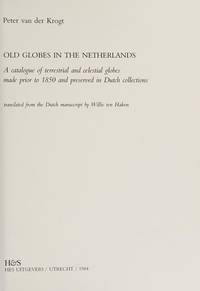
Van Der Krogt, Peter
Old Globes in the Netherlands : A Catalogue of Terrestrial and Celestial Globes Made Prior to 1850 and Preserved in Dutch Collections 1984 First Edition; new in publisher's shrinkwrap
Utrecht: H&S / Hes Uitgevers 1984. This is the original 1984 FIRST EDITION in PERFECT condition. Brand New in a Brand New dust jacket. STILL SEALED in the publisher's clear plastic SHRINKWRAP thanks to a lucky warehouse find. NO chips. NO tears. NO creases. NO rubbing. NO fading. Bright clean square and tight. Sharp corners. NO owner's name or bookplate. NO remainder mark. Fresh and crisp -- obviously never read. A history of early globe production and their makers. Extensive descriptions of 340 globes made in London Paris Brussels Nuremberg Venice Amsterdam etc. Illustrated with 83 photos 9 in color. Translated into English from the Dutch manuscript by Willie ten Haken. Bound in the original gilt-stamped green cloth. Complete with a pristine dust jacket. 7" wide by 9.75" tall 18cm x 24.5 cm. . First Edition. Hardcover. New/in publisher's shrinkwrap. 290pp. Great Packing Fast Shipping. H&S / Hes Uitgevers Hardcover
Riferimento per il libraio : 018064 ISBN : 9061942349 9789061942344
|
|
|
VAN DER KROGT, P.C.J.
ADVERTENTIES VOOR KAARTEN, ATLASSEN, GLOBES E.D.
Gebonden, 473pp. ISBN 978906194055590. Advertenties voor kaarten, atlassen, globes e.d. in Amsterdamse kranten, 1621-1811. Nieuw.

|
|
|
VAN DER KROGT, P.C.J.
GLOBI NEERLANDICI
Bound, 647pp. ISBN 9789061941385. The production of globes in the Low Countries. Globi Neerlandici is the first comprehensive study of globe production in the Netherlands. This work covers the early globemakers in the first half of the sixteenth century to the mass production in the nineteenth and twentieth centuries. Each globe is extensively described with over 572 illustrations. New.
|
|
|
van der poel halsted b. (a cura)
CORPUS TOPOGRAPHICUM POMPEIANUM. Vol. II Toponymy.
Un vol. in 4° picc., legatura edit. T.Tela nera, titolo oro al dorso, sovr. ill. b/n, pp. XXXVIII, 336(2) con 1 tav. ripieg. f.t. Testo in inglese. Edizione di 1000 esempl. num. (ns. 750). Come nuovo.
|
|
|
van der poel halsted b. (a cura)
CORPUS TOPOGRAPHICUM POMPEIANUM. Vol. IV Biliography.
Un vol. in 4° picc., legatura edit. T.Tela nera, titolo oro al dorso, sovr. ill. b/n, pp. XXIV, 339(7).Testo in inglese. Edizione di 2000 esempl. num. Ottimo.
|
|
|
van der poel halsted b. (a cura)
CORPUS TOPOGRAPHICUM POMPEIANUM. Vol. V Cartography.
Un vol. in 4° picc., legatura edit. T.Tela nera, titolo oro al dorso, sovr. ill. b/n, pp. LIX, 519(3) con tavv. f.t. Testo in inglese. Edizione di 1000 esempl. num. (ns. 750). Come nuovo.
|
|
|
Van der Vekene, Emile
Les cartes géographiques du Duché de Luxembourg. Editées aux XVIe, XVIIe et XVIIIe siècles. Catalogue descriptif et illustré.
Luxemburg, Editions de l'imprimerie Saint-Paul, Société anonyme, 1975. 4°. 301 S. Mit zahlr. Illustr. nach antiken Vorlagen. Illustr. Orig.-Leinenbd. + Wichtig: Für unsere Kunden in der EU erfolgt der Versand alle 14 Tage verzollt ab Deutschland / Postbank-Konto in Deutschland vorhanden + (bestossen u. fleckig).
Riferimento per il libraio : 28887AB
|
|
|
Van der Vekene, Emile:
Les cartes géographiques du Duché de Luxembourg. Editées aux XVIe, XVIIe et XVIIIe siècles. Catalogue descriptif et illustré.
Luxemburg, Editions de l'imprimerie Saint-Paul, Société anonyme, 1975. 4°. 301 S. Mit zahlr. Illustr. nach antiken Vorlagen. Illustr. Orig.-Leinenbd. (bestossen u. fleckig).
Riferimento per il libraio : 28887AB
|
|
|
VAN ERMEN Eduard
Het kaartboek van Averbode 1650-1680
Brussel, Gemeentekrediet 1997 191pp., rijkelijk geïllustreerd, linnen band met geïllustreerde stofwikkel, 34cm., in de reeks "Cartografische en iconografische bronnen voor de geschiedenis van het landschap in België", mooie staat, B59614
Riferimento per il libraio : B59614
|
|
|
Van Ermen Eduard - Van Mingroot Erik - Minnen Bart - Van deru Eycken Michel
Limburg in Kaart en Prent. Historisch Cartografisch overzicht van Belgisch en Nederlands Limburg.
Ril. in tela con sovr., cm 39x 30,5, pp 159, tavv. e ill. a col. e b/n.. - ISBN: 9020912178

|
|
|
VAN ERMEN, Eduard, VAN MINGROOT, Erik e.a.
LIMBURG IN KAART EN PRENT. HISTORISCH CARTOGRAFISCH OVERZICHT VAN BELGISCH EN NEDERLANDS LIMBURG
gebonden in donkerbruin linnen met goudopdruk op rug en front, geillustreerde omslagwikkel en binnen platten, 300 x 390mm., 160pp., prachtig en overvloedig geillustreerd in kleur. ISBN 9020912178. Uitgegeven in samenwerking met Mappamundi, Knokke / Mappamundi Ltd. London, Perth. Beeldende inkijk in de kleurrijke tradities en de, veelal monumentale, verworverheden die de Limburgen tot ' dierbare oorden ' maken. Bestrijkt de huidige provincies Belgisch en Nederlands Limburg. in redelijke staat, gebruikt..

|
|
|
VAN HAM W.A. & DANCKAERT L.
De wandkaart van het hertogdom Brabant uitgegeven door Nicolaas Visscher en Zacharias Roman (1656)
Alphen aan den Rijn/ Leuven, Canaletto-Repro Holland/ Universitaire Pers 1997 24 + [20] pp., formaat: 51x41cm.!, groene uitgeversband met goudopdruk, zeer goede staat, ISBN 90-6469-714-0 & 90-6186-800-9, gewicht: 2kg., B98825
Riferimento per il libraio : B98825
|
|
|
VAN HAM W.A. & DANCKAERT L.
De wandkaart van het hertogdom Brabant uitgegeven door Nicolaas Visscher en Zacharias Roman (1656)
24 + [20] pp., formaat: 51x41cm.!, groene uitgeversband met goudopdruk, zeer goede staat, ISBN 90-6469-714-0 & 90-6186-800-9, gewicht: 2kg., B98825
|
|
|
VAN KEULEN, E.O.
GEKROONDE LOOTSMAN
Gebonden, 104pp. ISBN 9789061943976. Dit boek geeft een thematisch overzicht van de geschiedenis van de firma Van Keulen. Deze was onder de naam `De Gekroonde Lootsman` gedurende ruim tweehonderd jaar gevestigd in een pand op de hoek van de Nieuwe Brugsteeg in Amsterdam, recht tegenover waar nu het Victoria Hotel gevestigd is. Van hier uit verkochten de opeenvolgende generaties van dit geslacht kaarten, zeevaartkundige instrumenten en boeken, kortom alles wat `voor de zeevaerdt van nut is`. In de negentiende eeuw veranderde het karakter van het bedrijf. De nadruk werd verlegd van productie naar verkoop. Daarnaast werd het assortiment uitgebreid met buitenlandse uitgaven. Door de overgang van zeil- naar stoomvaart daalde het aantal schepen en zeevarenden en daarmee ook het aantal afnemers van kaarten, instrumenten en boeken waardoor de firma in 1885 werd beeindigd. Na een algemene inleiding wordt in het eerste hoofdstuk de ontwikkeling van zeekaarten en zeeatlassen van de firma Van Keulen behandeld. In het tweede hoofdstuk komen de boeken aan bod en in hoofdstuk drie de instrumenten. Het laatste hoofdstuk behandelt de firma Van Keulen in de negentiende eeuw. Nieuw.
|
|
|
VAN KEULEN, E.O. e.a.
IN DE GEKROONDE LOOTSMAN ". HET KAARTEN-, BOEKUITGEVERS EN INSTRUMENTENMAKERSHUIS VAN KEULEN TE AMSTERDAM 1680 - 1885
Gebonden, grijs linnen onder geillustreerde stofomslag, 205 x 245mm., 104pp., prachtige illustratie in kleur en z/w. Na een algemene inleiding wordt in het eerste hoofdstuk de ontwikkeling van zeekaarten en zeeatlassen van de firma Van Keulen behandeld. In het tweede hoofdstuk komen de boeken aan bod en in hoofdstuk drie de instrumenten. Het laatste hoofdstuk behandelt de firma Van Keulen in de negentiende eeuw. Boek is in goede staat.

|
|
|
VAN KEULEN, J.
In de Gekroonde Lootsman. Het kaarten-, boekuitgevers en instrumentenmakershuis Van Keulen te Amsterdam 1680-1885.
in-4to, 104 pp. Met illustraties in kleur en z/w. Keurig exemplaar - Tres bel exemplaire - VG+++ [P-3]
|
|
|
VAN KEULEN, JOHANNES (JOHANNIS VAN KEULEN).
Italien, Tuschen, Piombino, en C. dell’Arme met de Noord – Kust yan’t Eyland Sicilia.
Amsterdam, 1680 circa. Incisione in rame, b/n, cm 51 x 57,5 (alla lastra). Carta nautica pubblicata per la prima volta nello Zee Atlas del 1680, e successivamente inserita nelle varie edizioni dell’atlante nautico, pubblicate sino al 1720 circa. Bell’esemplare.
|
|
|
Van Loon,Hendrik Willem.
La Geografia.
<br/> TITOLO: La Geografia. <br/> AUTORE: Van Loon,Hendrik Willem.<br/> EDITORE: Valentino Bompiani Ed.<br/> DATA ED.: 1939,1933,<br/>
|
|
|
Van Loon,Hendrik Willem.
La Geografia.
<br/> STATO: USATO, BUONO.<br/> TITOLO: La Geografia. <br/> AUTORE: Van Loon,Hendrik Willem.<br/> CURATORE: Versione dall'americano di Carlo Coardi.<br/> EDITORE: Valentino Bompiani Ed.<br/> DATA ED.: 1937,1945,<br/>
|
|
|
Van Loon,Hendrik Willem.
La Geografia.
<br/> STATO: USATO, MOLTO BUONO.<br/> TITOLO: La Geografia. <br/> AUTORE: Van Loon,Hendrik Willem.<br/> CURATORE: Versione di Rinaldo Caddeo, quinta edizione riveduta. Traduzione di Carlo Coardi.<br/> EDITORE: Valentino Bompiani Ed.<br/> DATA ED.: 1939,<br/>
|
|
|
VAN ORTROY F.
Chrétien Sgrooten, cartographe (XVIe siècle)
161pp., 23cm., brochure originale, non coupé, extrait des Annales de l'Académie royale d'archéologie de Belgique" (1923), très bon état, rare, N94483
|
|
|
VAN ORTROY Fern.
L'oeuvre cartographique de Gérard et de Corneille De Jode
Gand, Van Goethem 1914 xxxv + 131pp. + frontispce et qqs. planches hors-texte, dans la série "Université de Gand. Recueil de travaux publiés par la Faculté de philosophie et lettres" fasc.44, 25cm., brochure originale (petit manque en bas du dos), bon état, A102738
Riferimento per il libraio : A102738
|
|
|
VAN ORTROY Fern.
L'oeuvre cartographique de Gérard et de Corneille De Jode
xxxv + 131pp. + frontispce et qqs. planches hors-texte, dans la série "Université de Gand. Recueil de travaux publiés par la Faculté de philosophie et lettres" fasc.44, 25cm., brochure originale (petit manque en bas du dos), bon état, A102738
|
|
|
VAN ORTROY Fernand
Exposition de la Cartographie Blge aux XVIe, XVIIe et XVIIIe Sicèles organisée au Musée Plantin Moretus à l'occasion du Cinquantenaire de la Société Royale de Géographie d'Anvers, 1876-1926
Anvers, Museum Plantin Moretus (Impr. J.-E. Buschmann) 1926 59pp. + 3pp. addenda & 28 planches en n/bl (dont quelques-unes dépliantes), 27cm., brochure oriignal, bilingue: français-néerlandais ("Tentoonstelling van de Belgische Kaartmakerskunde in de XVIe, XVIIe en XVIIIe Eeeuwen.."), peu de rousseurs, bon état, B120832
Riferimento per il libraio : B120832
|
|
|
VAN RAEMDONCK J.
Orbis imago. Mappemonde de Gérard Mercator (1538)
Sint-Nikolaas, J. Edom 1886 93pp., 28cm., dans "Annalen van den oudheidskundigen kring van het Land van Waas 10e deel 4e afl. juni 1886 / Annales du cercle archéologique du pays de Waas 10e tome 4e livr. juin 1886", br.orig., non-coupé, dos restauré
Riferimento per il libraio : B67378
|
|
|
VAN RAEMDONCK J.
Orbis imago. Mappemonde de Gérard Mercator (1538)
93pp., 28cm., dans "Annalen van den oudheidskundigen kring van het Land van Waas 10e deel 4e afl. juni 1886 / Annales du cercle archéologique du pays de Waas 10e tome 4e livr. juin 1886", br.orig., non-coupé, dos restauré
|
|
|
VAN WAMBEKE A.
Carte des sols et de la vegetation du Congo et du Ruanda-Urundi. 17: Region de Yanonge-Yatolema, A: Sols
Bruxelles, Institut National pour l'étude agronomique du Congo 1960 28pp. + 1 carte dépliante, sous étui d'éditeur, 29cm., bon état, C47884
Riferimento per il libraio : C47884
|
|
|
VAN WAMBEKE A.
Carte des sols et de la vegetation du Congo et du Ruanda-Urundi. 12: Region de Bengamisa (A et C) Notice explicative de la carte des sols
Bruxelles, Institut National pour l'étude agronomique du Congo belge 1958 47pp. + 1 grande carte dépliante, sous étui d'éditeur, 29cm., bon état, C117987
Riferimento per il libraio : C117987
|
|
|
VAN WAMBEKE A. & LIBEN L.
Carte des sols et de la vegetation du Congo et du Ruanda-Urundi. 6: Yangambi, planchette 4: Yambaw, A et B: Notice explicative de la carte des sols et de la végétation
Bruxelles, Institut National pour l'étude agronomique du Congo belge 1957 47pp. + 2 grandes cartes dépliantes, sous étui d'éditeur, 29cm., bon état, C117984
Riferimento per il libraio : C117984
|
|
|
VAN WAMBEKE A. & VAN OOSTEN M.F.
Carte des sols et de la vegetation du Congo et du Ruanda-Urundi. 8: Vallée de la Lufira (Haut-Katanga), A et C: Notice explicative de la carte des sols
Bruxelles, Institut National pour l'étude agronomique du Congo belge 1956 71pp. + 2 grandes cartes dépliantes, sous étui d'éditeur, 29cm., bon état, C117985
Riferimento per il libraio : C117985
|
|
|
VANCOUVER (George)
Voyage de découvertes à l’Océan Pacifique du Nord, et autour du monde […] et exécuté en 1790 (à) 1795.
Paris, Imprimerie de la République, an VIII (1800). 3 vol. in-4 (28,5 × 21 cm), XII-491pp., 2ff.-516pp., 3ff.-562pp., demi-veau fauve à petits coins de vélin, dos lisses teintés vert et ornés de bateaux (reliure de l’époque). Charnières fendillées, accrocs à deux coiffes. Infimes rousseurs, petites déchirures sans gravité. Tome I, quelques cahiers brunis, 1 feuillet fragile.
Riferimento per il libraio : PHO-2418

|
|
|
VANDER HAEGHEN Victor
Contribution à l'histoire du grand plan de Gand dressé en 1551 par Jean Otho
Gand, Vuylsteke 1903 13pp.+ un grand plan dépliant en couleurs, 23cm., br.orig., extrait des "Annales de la Société d'Histoire et d'Archéologie de Gand" (1903), bon état, B87306
Riferimento per il libraio : B87306
|
|

 Ricevere i risultati per e-mail
 Scaricare i risultati in PDF
 RSS feed
 Link
Link


