|
Wallis Hellen M. - Robinson Arthur H
Cartographical Innovations. An International Handbook of Mapping Terms to 1900.
Ril. in tela con sovr., cm 24.5x18, pp 353, alcune tavv. in b/n.. - ISBN: 0906430046

|
|
|
Walser, Gabriel
Atlas der alten Eidgenossenschaft in 20 Karten aus dem Jahre 1769.
Gattikon, Verlag Dorfpresse, 1968. Folio. 2 Bl. Mit 20 kol. faks. Karten. Lose in Pappmappe. + Wichtig: Für unsere Kunden in der EU erfolgt der Versand alle 14 Tage verzollt ab Deutschland / Postbank-Konto in Deutschland vorhanden +, A|B [2 Warenabbildungen]
书商的参考编号 : 31223AB

|
|
|
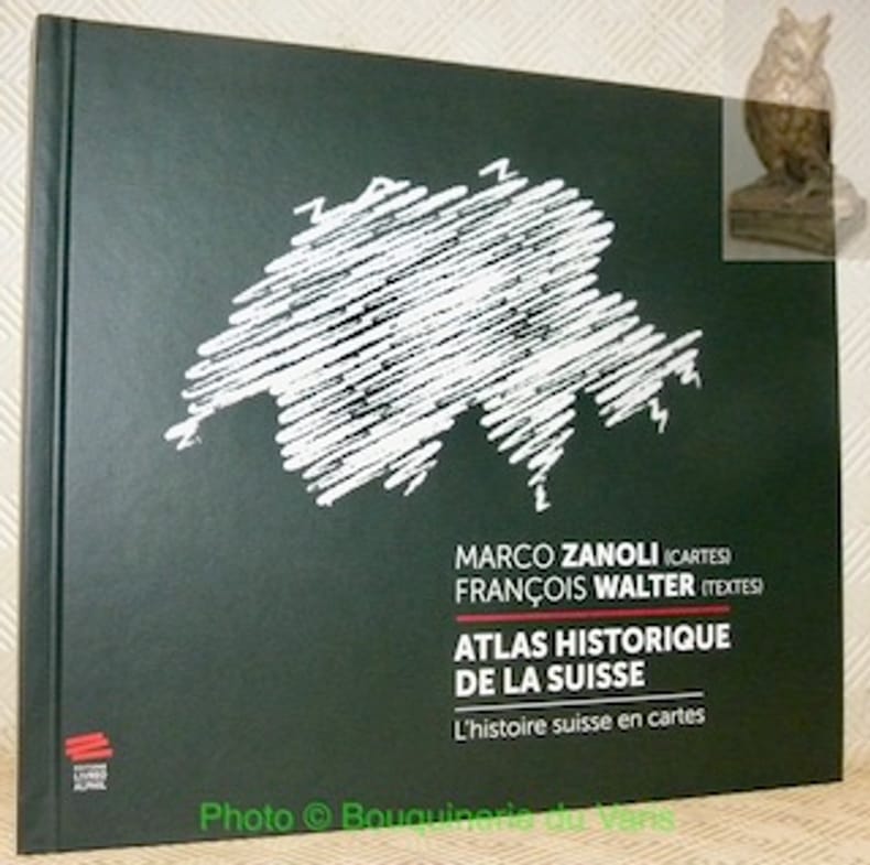
WALTER, François (textes). - ZANOLI, Marco (cartes).
Atlas historique de la Suisse. L'histoire suisse en cartes. 2e Edition.
Neuchâtel, Editions Livreo-Alphil 2021, 245x285mm, 195pages, reliure d'éditeur. Format oblong. Très bel exemplaire.
书商的参考编号 : 106916
|
|
|
WARDINGTON LIBRARY.
The Wardington Library: Important Atlases & Geographies. Part One: A-K [-Part Two: L-Z].
2 Vols., 4to, 347;368pp., numerous plates and illustrations throughout (many coloured), orig. decorated cloth. "The collection of printed atlases and associated books assembled by the late Lord Wardington. is, in my view, the finest collection in private hands. In Sotheby's two-part sale over 650 individual items have been catalogued spanning the years from 1472 to the late twentieth century. There are some interesting incunabula containing maps, an example of the first atlas to be printed - the 1477 Bologna atlas by Claudius Ptolemaeus - with some maps as proof sheets, and a further two dozen Ptolemaic atlases up to the early eighteenth century. There follows a very wide range of atlases - Dutch, French, German, English, and others, including a strong array of holdings from the twentieth century; indeed with fresh acquisitions up to a year or so ago. It is unlikely that an offering such as this to the open market will be repeated!"?Introduction.
|
|
|
Waser, Mauro
Geografia illustrata della Svizzera per la scuola e per la casa. Prima edizione italiana sulla sesta tedesca
16°, 19 cm, pp. 286, (8), tavola a colori con gli stemmi dei cantoni all'antiporta, numerose incisioni e alcune fotografie nel testo, a cura di Eligio Pometta. Rilegatura editoriale in mezza tela, titolo incorniciato al piatto. rare sottolineature a matita, qualche brunitura, timbro di libreria al frontespizio, esemplare nell'assieme molto buono
|
|
|
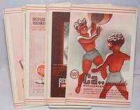
Wassermann Farmaco Terapeuticas. Cartografia: Bescos Dolcet
Sociedad Espanola de Especialidades Wassermann Farmaco Terapeuticas / Atlas Turistico de Espana
no city Spain: Wassermann 1940. Nineteen quarto leaves of alkaline paperstock each folded vertically in half to make nineteen separate advertising brochures of 8.5x5.5 inches all four faces of each brochure printed in colors with a come-on cover; pages within pp.2 & 3 print a detailed doublespread color map back cover mostly text with spot-color touches. Partial set 19 of an original total of 42. Each map features a different region or province in Spain including the Islands and North Africa while exterior covers boast a different medicine medications for the blood or bone for young and old: Take Aspasmol a sedative for spaamodic attacks &c &c. Please note that nos.13 and 37 use the same cover image but deal different meds and differing parts of Spain. All in nice condition clean and sound. Wassermann unknown books
书商的参考编号 : 250450
|
|
|
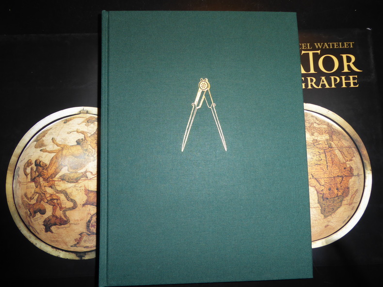
WATELET (Marcel) et autres :
Gérard Mercator cosmographe. Le temps et l’espace.
[Anvers], Fonds Mercator et la Banque BNP Paribas Belgique, 1994. Grand in-4, 445[dont faux-titre et titre]-(1) pp. – (1) f.[Colophon/registre- ancien- de caractères], bradel toile verte, titre doré au dos, compas doré sur le plat supérieur, jaquette rempliée et étui illustrés en couleurs (reliure de l’Éditeur ; infimes défauts sur l’étui, sinon exemplaire quasi-parfait).
书商的参考编号 : 80197
|
|
|
WATELET Marcel
"Cartographie et politique dans la Belgique du XIXe siècle; matériaux pour l'histoire nationale et locale. Aux origines du Ministère des Travaux Publics."
Bruxelles, Crédit Communal de Belgique, 1987. 25 x 34, 273 pp., très nombreuses cartes en couleurs, quelques illustrations en couleurs et en N/B, reliure d'édition pleine toile, très bon état (1 cachet d'ex-propriétaire).
书商的参考编号 : 91030
|
|
|
WATELET Marcel, et autres
"Gérard Mercator, cosmographe; le temps et l'espace. "
Belgique, Fonds Mercator Paribas, 1994 25 x 33, 445 pp., très nombreuses illustrations en couleurs pour la plupart, reliure d'édition pleine toile + jaquette rempliée, sous étui carton noir illustré, très bon état.
书商的参考编号 : 79561
|
|
|
Watelet Marcel. {direction}.
GERARD MERCATOR COSMOGRAPHE, le temps et l'espace.
, Antwerpen, Mercatorfonds, 1994., grand In-4 toile, sous etui, illustrates et sous jaquette, 445pp. BON ETAT ! ISBN 9061533147.
书商的参考编号 : 2576
|
|
|
WATELET, M.
MERCATOR, GERARDUS MERCATOR RUPELMUNDANUS.
Antwerpen, Mercatorfonds, 1994 linnen band met goudstempeling, geplastificeerde stofomslag, 340 x 260 mm., 448 pp., 450 illustraties waarvan 350 in kleur. Cassette. ISBN 9061533139.
书商的参考编号 : 533
|
|
|
WATELET, Marcel.
CARTOGRAFIE EN POLITIEK IN HET BELGIE VAN DE 19de EEUW.
Gebonden, beige linnen hardcover met bruine opdruk, originele uitgeversomslag met flappen in kleur, 34.2x24.8 cm., 271 pp. + 5, geillustreerd in kleur en in z/w. ISBN 9050660304. De beginjaren van het ministerie van Openbare Werken. Bronnen voor de nationale en lokale geschiedschrijving.

|
|
|
WATELET, MARCEL.
GERARDI MERCATORIS ATLAS EUROPAE.
Suite, niet gebonden, met foudraal, vergulde bandstempel op de voorplaat, rug versierd met vergulde titel, zonder omslagwikkel, 27,5x40cm, 92pp + 17 uitvouwbare kaarten in kleur. ISBN 9789061533177. Een facsimili-uitgave van kaarten van Gerard Mercator uit de Atlas van Europa, ca. 1570 - 1572.

|
|
|
WATELET, MARCEL.
GERARDI MERCATORIS ATLAS EUROPAE.
, Antwerpen, Bibliotheek van de Vrienden van het Mercatorfonds, 1994., Suite, niet gebonden, met foudraal, vergulde bandstempel op de voorplaat, rug versierd met vergulde titel, zonder omslagwikkel, 27,5x40cm, 92pp + 17 uitvouwbare kaarten in kleur. ISBN 9789061533177.
书商的参考编号 : 12046
|
|
|
WATTELET (Marcel)
Gérard Mercator cosmographe. Le temps et l’espace
Anvers, Fond Mercator, Paribas 1994 Grand in-4 25 x 34 cm. Reliure de l’éditeur pleine toile verte sous jaquette rempliée illustrée en couleurs et étui, 445 pp. Très nombreuses illustrations en noir et en couleurs dans le texte et à pleine page. Exemplaire en excellent état. Très bel ouvrage publié à l’occasion du 400e anniversaire de la mort de Gérard Mercator 1512-1594 humaniste, mathématicien, géographe des Pays-Bas espagnols, inventeur de la projection qui porte son nom.
书商的参考编号 : 57473
|
|
|
Wauwermans, Lieutenant-General
Histoire de L'Ecole Cartographique Belge et Anversoise du XVIe siecle. Amsterdam, Meridian Publishing Co, 1964. 2 vols.
2 vols. 402,470 pp. 15 plts. Soft cover.*Reprint of the 1895 edition, fine condition.

|
|
|
Wauwermans, Lieutenant-General
Histoire de L'Ecole Cartographique Belge et Anversoise du XVIe siecle. Amsterdam, Meridian Publishing Co, 1964. 2 vols.
Amst., 1964, ,
书商的参考编号 : 26107
|
|
|
Weber, Julius
Geologische Karte von Winterthur und Umgebung.
Winterthur, 1924. Farbige Karte auf Leinen aufgezogen. 59 x 87 cm. + Wichtig: Für unsere Kunden in der EU erfolgt der Versand alle 14 Tage verzollt ab Deutschland / Postbank-Konto in Deutschland vorhanden +, A|B [2 Warenabbildungen]
书商的参考编号 : 1802AG

|
|
|
Weber,Hans
Sud Italia. Basilicata, Calabria, Campania, Puglia.
<br/> TITOLO: Sud Italia. Basilicata, Calabria, Campania, Puglia. <br/> AUTORE: Weber,Hans<br/> CURATORE: Testo di Heinz - Joachim Fischer. Traduz.di Ingeborg Babitsch.<br/> EDITORE: Cantini Ed.<br/> DATA ED.: 1989,<br/> EAN: 9788877370914
|
|
|
Wegener Alfred
LA FORMAZIONE DEI CONTINENTI E DEGLI OCEANI.
(Codice OS/0037) In 8° 320 pp., 63 figurei. Prima edizione. Data e firma. Brossura editoriale, ottimo stato. ~~~ SPEDIZIONE IN ITALIA SEMPRE TRACCIATA

|
|
|
Weigel Christoph
Vindelicia Rheti et Noricum
30,5 x 38,5 cm. Incisione in rame a pieni margini, con acquarellatura d'epoca. Piccolo cartiglio sulla sinistra, rappresentante un ritrovamento archeologico di una lapide con inciso il titolo della carta ed la firma dell'autore sorro. A fianco quattro monete romane. Qualche fioritura, piccole abrasioni alla piega naturale della carta.

|
|
|
WEIGEL Johann Christoph (1661 - 1726)
AUSTRIA inferior Secundum IIII. Quadrantes & regiones contiguas excudente Christophoro Weigelio
CARTA GEOGRAFICA di cm. 34,8x28,2 al filo della lastra, incisa in rame su forte carta pregiata di cm. 45,3x36,7 e colorata a amano all'epoca, proveniente da Atlante (probabilm. "Atlas Portatilis, Oder Compendieuse Vorstellung Der gantzen Welt: in einer kleinen Cosmographie, 1723) in cui era rilegata mediante brachetta alla piega. Uno dei primi atlanti scolastici, utile anche ai viaggiatori. WEIGEL, incisore su rame, mercante d'arte ed editore (cfr de.wikipedia).Perfettamente conservata.
|
|
|
WEIGEL Johann Christoph (1661 - 1726)
BELGIUM Regium accuratissime descriptum cum permutationibus cursus publici curante Christophoro Weigelio Noribergae
CARTA GEOGRAFICA di cm. 39x34,4 al filo della lastra, incisa in rame su forte carta pregiata di cm. 44x36,7 e COLORATA a mano all'epoca, proveniente da Atlante (probabilm. "Atlas Portatilis, Oder Compendieuse Vorstellung Der gantzen Welt: in einer kleinen Cosmographie, 1723) in cui era rilegata mediante brachetta alla piega. Uno dei primi atlanti scolastici, utile anche ai viaggiatori. WEIGEL, incisore su rame, mercante d'arte ed editore (cfr de.wikipedia). Salvo una fessura di 5 cm.al bordo inferiore della piega, è perfettamente conservata.
|
|
|
WEIGEL Johann Christoph (1661 - 1726)
HOLSATIAE, DITHMARSIAE, STORMARIAE et VAGRIAE Ducatus. Autore Christ: Weigel Norimbergae. [Schleswig-Holstein, Dithmarschen, Stormarn, foce dell'Elba...].
CARTA GEOGRAFICA di cm. 39,4X33,2 al filo della lastra, incisa in rame su forte carta pregiata di cm. 45x37 e COLORATA a mano all'epoca, proveniente da Atlante (probabilm. "Atlas Portatilis, Oder Compendieuse Vorstellung Der gantzen Welt: in einer kleinen Cosmographie, 1723) in cui era rilegata mediante brachetta alla piega. Uno dei primi atlanti scolastici, utile anche ai viaggiatori. Kiel Lubeck Hamburg, Bad Segeberg, la regione Eckernförde-Travemünde-Lüneburg-Elbemündung. WEIGEL, incisore su rame, mercante d'arte ed editore (cfr de.wikipedia). Salvo una fessura di 5 cm.al bordo inferiore della piega, è perfettamente conservata.

|
|
|
Weiland, C. F
Koenigl. Preuss. Prov. Schlesien. Entworfen und gezeichnet von C. F. Weiland.
Weimar, Geograph. Inst. 1846. Grenzkolor. Stahlst., 41 x 56 cm, mit Maßstäben u. statist. Übersicht sowie einer Nebenkarte. Breitrandig. Mittelfaltung. W. Rand mit Knick- u. Knitterspuren. Randläs. tlw. hinterlegt. Mittelfalz mit kl. hinterlegten Rissen. Zwei kl. Ecken fehlen. Papierbed. schwach gebr. Schönes Kartenbild. Nebekarte: Die nächste Umgebung von Breslau. Die Statistik zeigt die Einteilung der Provinz in Regierungs-Bezirke.
书商的参考编号 : KART0046

|
|
|
WEISS (Helmut) DUNCKER (Dieter R.)
duche de Brabant en cartes et gravures anciennes.
Couverture reliee sous jaquette, 160 pages, 39 x31 cm, ** tres bon etat ( neuf !!! ). ISBN 9782801104767. reproductions de cartes et gravures en couleurs et en noir et blanc, legendes en francais, anglais et allemand, captions in French, English and German, Beschriftung im Franzosisch, Englisch und Deutsch

|
|
|
WEISS (Helmut) DUNCKER (Dieter R.)
duche de Brabant en cartes et gravures anciennes.
Hardcover, 160 pages, Texte en Francais, 385 x 305 mm, Tres belle exemplaire !!. ISBN 9782801104767. reproductions de cartes et gravures en couleurs et en noir et blanc, legendes en francais, anglais et allemand, captions in French, English and German, Beschriftung im Franzosisch, Englisch und Deutsch

|
|
|
WEISS (Helmut) DUNCKER (Dieter R.)
duche de Brabant en cartes et gravures anciennes.
, Duculot / Mappamundi,1983 Gembloux / Knokke, Belgique, 1983., Couverture reliee sous jaquette, 160 pages, 39 x31 cm, ** tres bon etat ( neuf !!! ). ISBN 9782801104767.
书商的参考编号 : 52071
|
|
|
WEISS (Helmut) DUNCKER (Dieter R.)
duche de Brabant en cartes et gravures anciennes.
Gembloux / Knokke, Duculot / Mappamundi, 1983 Hardcover, 160 pages, Texte en Francais, 385 x 305 x 25 mm, Tres belle exemplaire !!. ISBN 9782801104767.
书商的参考编号 : 55288
|
|
|
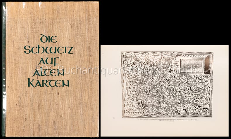
Weisz, Leo
Die Schweiz auf alten Karten. Mit Geleitwort und einem kartographisch-technischen Anhang von Prof. Ed. Imhof.
Zürich, NZZ, 1969. 4°. 247 S. Mit zahlr. (dv. viele gef.) Karten u. Textillustr. nach alten Vorlagen. Orig.-Halblederband. + Wichtig: Für unsere Kunden in der EU erfolgt der Versand alle 14 Tage verzollt ab Deutschland / Postbank-Konto in Deutschland vorhanden +, A 2. Auflage.
书商的参考编号 : 4008CB

|
|
|
WEISZ, Leo:
Die Schweiz auf alten Karten. Mit Geleitwort und einem kartographisch - technischen Anhang von Ed. Imhof.
Zürich, Verlag der Neue Zürcher Zeitung, 1945, in-4to, 227 S. + 4 n.numm. S., mit Textabb. u. 244 z.T. gefalt. Kartenabb., Widmung vom Vorbesitzer auf Vorsatz, Original H.-Leinenband, (erste Ausgabe).
书商的参考编号 : 128731aaf
|
|
|
WEISZ, Leo:
Die Schweiz auf alten Karten. Mit Geleitwort und einem kartographisch - technischen Anhang von Ed. Imhof.
Zürich, Verlag der Neue Zürcher Zeitung, 1945, in-4to, 227 S. + 4 n.numm. S., mit Textabb. u. 244 z.T. gefalt. Kartenabb., Original H.-Leinenband, Orig. ill. Umschlag. (Erste Ausgabe).
书商的参考编号 : 130316aaf
|
|
|
Weisz, Leo:
Die Schweiz auf alten Karten. Mit Geleitwort und einem kartographisch-technischen Anhang von Prof. Ed. Imhof.
2. Auflage. Zürich, NZZ, 1969. 4°. 247 S. Mit zahlr. (dv. viele gef.) Karten u. Textillustr. nach alten Vorlagen. Orig.-Halblederband.
书商的参考编号 : 4008CB
|
|
|
WH Smith & Sons W H
PLAN OF LONDON With INDEX
Edinburgh: John Bartholomew & Co. 1880. 1st Edition . Hardback. Fine. Folio. ND 1880 The Royal Horticultural Society Gardens in Kensington are still mapped but closed in 1882 being the Royal Albert Hall and Royal College of Music so this scarce map is published prior to that date. 23.5 x 33 x 23.5 inches 80x60 cms Folded and enclosed with a green cloth booklet 31pp with index of the streets etc. A nice copy with a few pin-holes where the folds intersect. A single un-dissected sheet pasted on linen with 36 panels when folded. From Hampstead to south of Battersea and Shepherd's Bush to Greenwich with printed and hand-colouring. The map has grid-lines each covering half mile suares with grid letters and numbers in the margins. Tower Bridge is not present. <br/> <br/> John Bartholomew & Co. hardcover
书商的参考编号 : GT058
|
|
|
WHEAT J. C. - BRUN C.F.
Maps and Charts published in America before 1800. A bibliography. Second revised edition.
In 8°, t.t. edit. con sovracc. ill., pp. XXIV,215,(3), con numerose riprod. di carte in tavv. f.t.,copia molto buona. (L026/d) (la spedizione standard è SEMPRE tracciata con raccomandata-piego di libri, eventuale fattura da richiedere all'ordine)
|
|
|
Wheat, Carl I; Institute Of Historical Cartography, San Francisco
Mapping The Transmississippi West 1540-1861: Volumes One - Five Parts 1 & 2 Complete 350-Copy Limited Edition
Parsippany NJ.: Maurizio Martino. VG In Green Cloth With Gilt Lettering. 5 Books In 6 Volumes Complete. Oversize. All Pages Clean Bindings Tight. Pub. 1995 Reprint Of 1957 I.H.C. Edition. Pages: 1378. Undated. Reprint. Hardcover. Maurizio Martino hardcover
书商的参考编号 : MASTER361054I
|
|
|
Wheat, Carl I
Mapping the Transmississippi West 1995 6 separate vols complete; with large FOLD-OUT maps; new in publisher's shrinkwrap & PUBLISHER'S CARDBOARD SHIPPING BOX
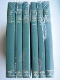
Storrs-Mansfield CT / Parsippany New Jersey: Martino Fine Books / About Books 1995. 6 separate volumes complete 5 volumes bound in 6 books WITH LARGE FOLD-OUT MAPS -- just like the first edition. SEE PHOTOS. Each of the 6 books in this 1995 large format edition measures 9.25" wide by 12.25" tall. This is NOT the later smaller format 3-volume reprint in which the maps are reduced in size. Unlike later reduced-size editions the maps in this 1995 six-volume edition measure as large as 21" by 33" when unfolded. SEE PHOTOS. As original co-publisher we are pleased to offer the few remaining sets of the 1995 large-format 6-volume edition recently rediscovered in our warehouse. They are BRAND NEW in perfect condition. STILL SEALED in the publisher's clear plastic SHRINKWRAP and the PUBLISHER'S CARDBOARD SHIPPING BOX. NO rubbing. NO fading. Bright clean square and tight. NO owner's name or bookplate. NOT a remainder. Fresh and crisp -- obviously never read. No date but 1995 First Martino/About Books printing "strictly limited to 350". Reprint of the original 1957-1963 six separate volumes: xiv 264; xiii 281; xiii 349; xiii 260; xix 222; iv 223-487pp. MAPPING THE TRANSMISSISSIPPI WEST is a monumental and exceptionally thorough work that is unlikely to be surpassed. The set is illustrated with a total of 376 maps including several that fold out. In this standard carto-bibliography are full descriptions of some 1300 maps from the year 1540 to about 1880. Wheat discusses each map showing the origins of its date and weighing its significance and accuracy. He also identifies the atlases and books in which the maps can be found. Norman Thrower: "Scholars and others who are interested in the American west have found Wheat's work indispensable." Ristow 382: "A comprehensive cartobibliography with many fine reproductions." The 6 volumes are uniformly bound in the original gilt-stamped green cloth. SEE PHOTOS. Oversize Hardcover. All 6 volumes measure 9.25" wide by 12.25" tall. This heavy set will require extra postage for Priority and International shipments. But for media mail you pay only our standard charge for 1 volume and we ship the other 5 volumes at no extra cost. First Martino/About Books printing. Oversize Hardcover. New/in publisher's shrinkwrap. Illus. by We ship all 6 volumes for cost of 1. 6 volumes: 9.25" wide by 12.25" tall. Great Packaging Fast Shipping. Martino Fine Books / About Books Hardcover
书商的参考编号 : 018762
|
|
|
Wheat, Carl I
Mapping the Transmississippi West Volume Five Part 1 From the Civil War to the Geological Survey Part One of Vol. V; Vol. 5; 1995 new
Storrs-Mansfield CT / Parsippany New Jersey: Martino Fine Books / About Books 1995. Vol. 5 Part I only of 6 separate books. As original co-publisher we are pleased to offer the few remaining individual volumes from our 1995 large-format 6-volume edition that were recently rediscovered in our warehouse. Oversize Hardcover. 9.25" wide by 12.25" tall. This volume is NOT from the later smaller format 3-volume reprint in which the maps are reduced in size. Offered here is Vol. 5 Part I only Vol. 5 was issued in 2 separate books. It is BRAND NEW in perfect condition. NO rubbing. NO fading. Bright clean square and tight. NO owner's name or bookplate. NOT a remainder. Fresh and crisp -- obviously never read. No date but 1995 First Martino/About Books printing "strictly limited to 350". Vol. 5 Part I only. Reprint of the 1963 Institute of Historical Cartography original. MAPPING THE TRANSMISSISSIPPI WEST is a monumental and exceptionally thorough work that is unlikely to be surpassed. In this standard carto-bibliography are full descriptions for hundreds of important maps 1861-1867. Many are illustrated on full page plates 9.25" wide by 12.25" tall. Wheat discusses each map showing the origins of its date and weighing its significance and accuracy. He also identifies the atlases and books in which the maps can be found. Norman Thrower: "Scholars and others who are interested in the American west have found Wheat's work indispensable." Ristow 382: "A comprehensive cartobibliography with many fine reproductions." Bound in the original gilt-stamped green cloth. This large heavy book will require extra postage for Priority and International shipments but only the standard charge for media mail. First Martino/About Books printing. Oversize Hardcover. New/No jacket as issued. xix 222pp. Great Packaging Fast Shipping. Martino Fine Books / About Books Hardcover
书商的参考编号 : 018771
|
|
|
Wheat, Carl I
Mapping the Transmississippi West Volume Five Part Two From the Civil War to the Geological Survey Part 2 of Vol. V; Vol. 5; 1995 new
Storrs-Mansfield CT / Parsippany New Jersey: Martino Fine Books / About Books 1995. Vol. 5 Part 2 only of 6 separate books. As original co-publisher we are pleased to offer the few remaining individual volumes from our 1995 large-format 6-volume edition that were recently rediscovered in our warehouse. Oversize Hardcover. 9.25" wide by 12.25" tall. This volume is NOT from the later smaller format 3-volume reprint in which the maps are reduced in size. Offered here is Vol. 5 Part 2 only Vol. 5 was issued in 2 separate books. It is BRAND NEW in perfect condition. NO rubbing. NO fading. Bright clean square and tight. NO owner's name or bookplate. NOT a remainder. Fresh and crisp -- obviously never read. No date but 1995 First Martino/About Books printing "strictly limited to 350". Vol. 5 Part 2 only. Reprint of the 1963 Institute of Historical Cartography original. MAPPING THE TRANSMISSISSIPPI WEST is a monumental and exceptionally thorough work that is unlikely to be surpassed. In this standard carto-bibliography are full descriptions for hundreds of important maps from 1868 to the 1870s. Many are illustrated on full page plates 9.25" wide by 12.25" tall. Wheat discusses each map showing the origins of its date and weighing its significance and accuracy. He also identifies the atlases and books in which the maps can be found. As this is the final volume it contains a comprehensive index for all 6 books in the set. Norman Thrower: "Scholars and others who are interested in the American west have found Wheat's work indispensable." Ristow 382: "A comprehensive cartobibliography with many fine reproductions." Bound in the original gilt-stamped green cloth. This large heavy book will require extra postage for Priority and International shipments but only the standard charge for media mail. . First Martino/About Books printing. Oversize Hardcover. New/No jacket as issued. iv pp. 223-487. Great Packaging Fast Shipping. Martino Fine Books / About Books Hardcover
书商的参考编号 : 018772
|
|
|
Wheat, Carl I; & Gary Kurutz; Warren Heckrotte
The Maps of the California Gold Region 1848-1857 A Biblio-Cartography of an Important Decade : Enlarged
Storrs-Mansfield Connecticut: Maurizio Martino Publisher 1995. 1995 Enlarged edition. BRAND NEW in perfect condition. NO rubbing. NO fading. Bright clean square and tight. Sharp corners. NO owner's name or bookplate. NOT a remainder. Fresh and crisp -- obviously never read. No date but 1995 First Martino printing "strictly limited to 350". This 1995 edition has all the content of the 1942 original plus is updated and enlarged. There is a new introduction by Gary Kurutz that places Wheat's work in historical context and offers information on the book's production and initial reception. Also new are descriptions by Warren Heckrotte of 27 Gold Rush maps or variants that Wheat missed. Another plus is the frontispiece Map of the Southern Mines 1852 which did not appear in the 1942 trade edition but only in 22 deluxe presentation copies. Including the frontispiece there are a total of 27 full-page and double-page map facsimiles. This is an attractively produced book handsomely bound in the original tan cloth stamped in bright red and black over a cream color spine label. Oversize Hardcover. 9.25" wide by 12.25" tall. This large heavy book will require SUBSTANTIAL extra postage for international shipments but only the standard charge for priority or media mail. Updated and Expanded Edition. Oversize Hardcover. New/No jacket as issued. xlii 153pp. plates 262 total pages. Great Packaging Fast Shipping. Maurizio Martino Publisher Hardcover
书商的参考编号 : 018317
|
|
|
Wheat, James Clement; & Christian F Brun (signed)
Maps and Charts Published in America before 1800 A Bibliography
New Haven Connecticut & London: Yale University Press 1969. SIGNED by co-author Christian Brun on the title page his signature only NOT personalized to anyone. Very Good condition. Mild crease to one corner of a few early leaves. NOT a library discard. NO owner's name or bookplate. NO underlining. NO highlighting. NO margin notes. 1969. First Edition. Expertly described here are all separately published maps and charts in America until 1800 as well as those in books pamphlets almanacs magazines atlases and gazetteers. Illustrated with 18 map reproductions frontispiece in color; 1 folding. Bibliography. Index. Bound in the original gilt-stamped blue cloth. 7.75" wide by 10.25" tall. Signed by Christian F. Brun. First Edition. Hardcover. Very Good condition/No jacket. xxii 215pp. 18 plates . Great Packaging Fast Shipping. Yale University Press Hardcover
书商的参考编号 : 018432
|
|
|
WHITAKER (Harold)
The Harold Whitaker Collection of County Atlases, Road-Books & Maps Presented to the University of Leeds.
First Edition, 4to, frontis., facsimiles, orig. cloth.
|
|
|
WHITAKER Harold
The Harold Whitaker Collection of County Atlases, Road-Books & Maps presented to the University of Leeds. A Catalogue.
4to., SOLE EDITION, with a frontispiece and 9 plates of facsimiles; cloth, covers a little sunned and age-marked, backstrip faded else a very good, clean copy of a scarce work. This outstanding catalogue (compiled by Whitaker of his own collection) was published by the Brotherton Library as 'Library Publications' No. 2. It was never reprinted and is now increasingly hard to find. Sold from an institution with its small, neat stamp on front free endpaper, half-title and title only

|
|
|
Whitfield (Peter)
Mapping the World. A History of exploration.
Folio Society, Londres, 2000. Un volume in-4 reliure de l'éditeur sous étui cartonné illustré, 263 pages, texte en anglais, riche iconographie en couleurs. Parfait état.
书商的参考编号 : 4856
|
|
|
WHITFIELD Peter
The Charting of the Oceans. Ten Centuries of Maritime Maps. FINE COPY IN UNCLIPPED DUSTWRAPPER
Roy 4to., First Edition, with numerous fine coloured reproductions and pictorial endpapers; blue cloth, gilt back, a fine copy in unclipped dustwrapper.

|
|
|
WHITFIELD PETER -
The Charting of the oceans. Ten centuries of maritime maps.
London, The British Library, 1996, 4to quadrato (cm. 27 x 29) tutta tela editoriale con sovraccopertina illustrata a colori, pp. 136 con numerosissime illustrazioni in nero e a colori nel testo. Stato di nuovo.

|
|
|
WHITFIELD PETER -
The Charting of the oceans. Ten centuries of maritime maps.
London, The British Library, 1996, 4to quadrato (cm. 27 x 29) tutta tela editoriale con sovraccopertina illustrata a colori, pp. 136 con numerosissime illustrazioni in nero e a colori nel testo. Stato di nuovo.

|
|
|
WHITFIELD Peter -
The Charting of the oceans. Ten centuries of maritime maps.
London, The British Library, 1996, 4to quadrato (cm. 27 x 29) tutta tela editoriale con sovraccopertina illustrata a colori, pp. 136 con numerosissime illustrazioni in nero e a colori nel testo. Stato di nuovo.

|
|
|
WICHURA, A.:
Das militärische Planzeichnen und die Militär-Kartographie. Ein Handbuch für Officiere. (ERSTAUSGABE).
Berlin, Ernst Siegfried Mittler, 1872, in-8vo, 2 Bl. + 86 S. + 2 lith. Figurentafeln, Bibl.-Stempel und hs. Bibl.-Nr. auf Titelbl., Leinenband, vergold. Titel und Bibl.-Nr. auf dem Rücken.
书商的参考编号 : 59489aaf
|
|
|
Wiebeking Carl Friedrich von; Eckard, Johann Christian
Hydrographisch und militairische Karte von dem Nieder Rhein von Lintz bis unter Arnheim in X Blatt ; Sr: Hocfurstl :Durchlaucht dem Landgrafen von Hessen Darmstadt
Serie di 9 (su 10) incisioni all'acquaforte di mm 670 x 340 alla battuta su carta di gran corpo. Tutti i foglio a grandi margini in perfetto stato di conserazione. Carta in scala 1:30 000. Magnifica e molto rara opera cartografica sul Corso del Reno, purtroppo mancante dell'ottavo (8) foglio.
|
|

 ?????????
 ?????PDF???
 RSS feed
 ??
??


