|
|
|
INSTITUT GEOGRAPHIQUE NATIONAL
Carte administrative de la France.
CHEZ L'AUTEUR. Avril 1946. In-Plano. En feuillets. Bon état, Livré sans Couverture, Dos satisfaisant, Intérieur frais. Carte dépliante en couleurs, hors-texte, de 91 / 74 cm. Une déchirure de 4 / 5 cm, au niveau d'une pliure.. . . . Classification Dewey : 912-Atlas, cartes et plans
Referência livreiro : RO80040679
|
|
|
INSTITUT GEOGRAPHIQUE NATIONAL
Carte de l'Archipel de la Société
Non Renseigné. s.d. In-Plano. Broché. Bon état, Couv. convenable, Dos satisfaisant, Intérieur frais. Carte couleurs N°513, echelle 1:100.000.. . . . Classification Dewey : 912-Atlas, cartes et plans
Referência livreiro : RO20019165
|
|
|
INSTITUT GEOGRAPHIQUE NATIONAL
CARTE DE RANDONNEES : BIGORRE, PARC NATIONAL DES PYRENEES / PYRENEES, MONTAGNES SUD. ECHELLE 1 : 50 000. DIMENSION : 88 x 121 cm environ.
RANDONNEES PYRENEENNES. NON DATE. In-Plano. Broché. Etat d'usage, Coins frottés, Dos satisfaisant, Intérieur acceptable. Carte en couleurs (recto uniquement) dépliante de DIMENSION : 88 x 121 cm environ.. . . . Classification Dewey : 912-Atlas, cartes et plans
Referência livreiro : ROD0108013
|
|
|
INSTITUT GEOGRAPHIQUE NATIONAL
CARTE DE FRANCE 1/50000 - TYPE 1922 / GAVARNIE (ARGELES-GAZOST) - FLLE XVI-48. Carte en couleurs (recto uniquement) de DIMENSION : 72 x 56 cm environ.
INSTITUT GEOGRAPHIQUE NATIONAL. 1962. In-Plano. Broché. Bon état, Couv. convenable, Dos satisfaisant, Intérieur frais. Carte en couleurs (recto uniquement) de DIMENSION : 72 x 56 cm environ.. . . . Classification Dewey : 912-Atlas, cartes et plans
Referência livreiro : ROD0108059
|
|
|
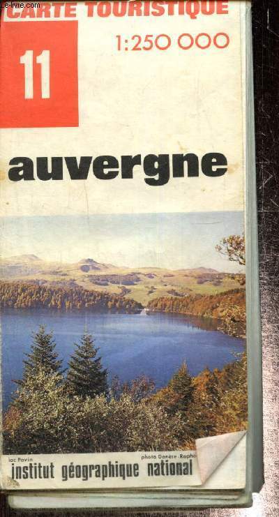
Institut Géographique National
Carte touristique n°11 : Auvergne
Institut Géographique National. 1972. In-Plano. En feuillets. Etat d'usage, Couv. convenable, Dos satisfaisant, Déchirures. 1 carte dépliante en couleurs. Echelle 1/250000. Environ 92x121 cm.. . . . Classification Dewey : 912-Atlas, cartes et plans
Referência livreiro : RO80244206
|
|
|
Institut géographique national
Les spéciales de l'Ign - Outre-mer - Guyane Carte touristique au 1 :500 000
Institut géographique national. 1995. In-Plano. Broché. Bon état, Couv. convenable, Dos satisfaisant, Intérieur frais. Carte touristique au 1 :500 000 en couleurs.. . . . Classification Dewey : 912-Atlas, cartes et plans
Referência livreiro : RO80216015
|
|
|
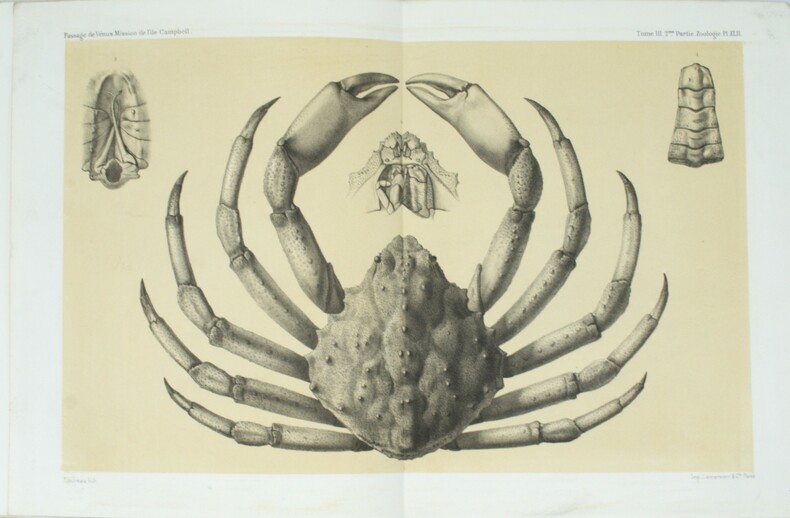
INSTITUT DE FRANCE, Académie des sciences
Recueil de Mémoires, Rapports et Documents relatifs a l'Observation du Passage de Venus Sur Le Soleil
Paris, Gauthier-Villars, 1885, 2 volumes grands in-4, couverture éditeur, Introduction et Zoologie 576pp., Botanique 23pp., Géologie 180pp., Planches 32pp.-2ff. et son Atlas de 2ff. et 68 planches en lithographie, d'études géologiques et zoologiques (55 planches de zoologie sur fond crème et 13 planches de géologie dont 10 d'observations microscopiques de roches, en couleurs), dos cassé à l’atlas.
Referência livreiro : PHO-1499
|
|
|
INSTITUT DE FRANCE, Académie des Sciences.
Recueil de mémoires, rapports et documents relatifs à l'observation du passage de Vénus sur le Soleil.
Firmin-Didot puis Gauthier-Villard, Paris, 1878-85, 5 volumes grands et forts in-4 (sur 8), tome 2, 1ere et 2eme partie relié cartonnage éditeur, tome 3, 1ere, 2eme partie et atlas, brochage éditeur, non coupé.
Referência livreiro : PHO-1677

|
|
|
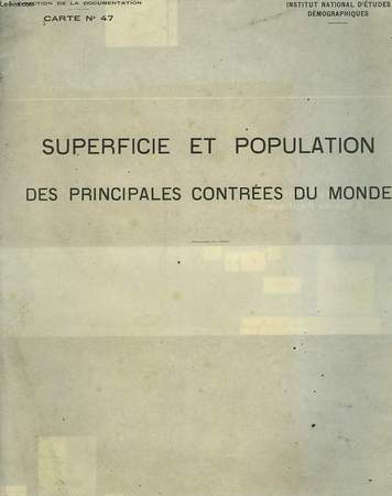
INSTITUT NATIONAL D'ETUDES DEMOGRAPHIQUES
SUPERFICIE ET POPULATION DES PRINCIPALES CONTREES DU MONDE
NON PRECISE. non daté. In-8. En feuillets. Bon état, Couv. convenable, Dos satisfaisant, Intérieur frais. 1 carte bi-couleur de 59 x 92 cm.. . . . Classification Dewey : 912-Atlas, cartes et plans
Referência livreiro : RO30025925
|
|
|
INSTITUTO GEOGRAFICO DE AGOSTINI.
TOSCANA - CARTE REGIONALI DE AGOSTINI - CON INDICE DEI NOMI - 1:250 000 CARTA - STRADALE CON SIMBOLOGIA TURISTICA.
INSTITUTO GEOGRAFICO DE AGOSTINI. 1999. In-8. Broché. Bon état, Couv. convenable, Dos satisfaisant, Intérieur frais. fascicule de 31 pages + 1 carte grande carte géographique en couleur.. . . . Classification Dewey : 912-Atlas, cartes et plans
Referência livreiro : R320004921
|
|
|
INSIGHT ATLAS
INSIGHT ATLAS FAMILY WORLD ATLAS SPECIAL EDITION
INSIGHT ATLAS 01/01/2009. Hardcover. Used; Good. WE SHIP WITHIN 24 HRS FROM LONDON UK 98% OF OUR ORDERS ARE RECEIVED WITHIN 7-10 DAYS. We believe you will be completely satisfied with our quick and reliable service. All orders are dispatched as swiftly as possible! Buy with confidence! INSIGHT ATLAS hardcover
Referência livreiro : mon0001490855 ISBN : 9812820094 9789812820099
|
|
|
Institut National de la Recherche agronomique.
Carte pédologique de la France à l'échelle du millionième dressée par Jacques Dupuis.
français Ensemble de 2 cartes, chacune mesurant 60x116 cm.
|
|
|
Instituto Geografico Agustin Codazzi ; Archivo Historico Nacional
Atlas de cartografia historica de Colombia [ Edition originale ]
500 ejemplares numerados y con encuadernacion especial (ejemplar n° AB22), 1 vol. in-folio reliure éditeur sous jaquette illustrée, Instituto Geografico Agustin Codazzi, Instituto Colombiano de Cultura, Archivo Historico Nacional, 1985, 85 laminas Scarce and interesting copy (tear on dustjacket, otherwise a good copy). This atlas offer a large collection (85 plates) of quality reproductions of historic map of Colombia. Espagnol

|
|
|
Intemann, Gabriele / Snoussi-Zehnter, Annette / Venhoff, Michael / Wiktorin, Dorothea
Diercke-Länderlexikon. Sonderausgabe für den Archiv Verlag, Braunschweig.
(Braunschweig), Westermann, (1999). 936 S. Mit 1500 Abb. u. 300 Ktn. 31 cm. Goldgeprägtes, schwarzes HALBLEDER auf 5 Scheinbünden mit 2 Lesebändchen. Im blauen, leinenbezog. Schuber.
Referência livreiro : 91933

|
|
|
InternationalAssociation Of Agricultural Economists Committee For The World Atlas Of Agricultural
World Atlas Of Agriculture Volume 2 Asia and Oceania
Novora: Instituto Geofrafico De Agostini 1973. Tear on top spine missing. 671 pages. Hard Cover. Good. 10 X 14. Instituto Geofrafico De Agostini Hardcover
Referência livreiro : 037111
|
|
|
International Association Of Agricultural Economists Committee For The World Atlas Of Agricultural
World Atlas Of Agriculture Volume 1 Europe U. S. S. R. Asia Minor
Novora: Instituto Geofrafico De Agostini 1969. 527 pages. Hard Cover. Very Good. 10 X 14. Instituto Geofrafico De Agostini Hardcover
Referência livreiro : 037110
|
|
|
IOANNIS IANSSONIUS EXC
"Carte originale ""DESCRIPTION DU GUIENNE"""
"IOANNIS IANSSONIUS EXC. 17ème-18ème s.. In-Plano. Broché. Bon état, Couv. convenable, Dos satisfaisant, Intérieur frais. Carte originale, sur papier à la forme, 56/42 cm, délimitation des provinces en couleurs, deux échelles ""Milliaria Germanica"" et Milliaria Gallica"".XVIII ème siècle environ.. . . . Classification Dewey : 912-Atlas, cartes et plans"
Referência livreiro : RO20020300
|
|
|
IRISH HISTORY: ATLAS. Haughton J. P.
ATLAS OF IRELAND. Prepared under the direction of the Irish National Committee for Geography.
IRISH HISTORY: ATLAS. Haughton J. P. ATLAS OF IRELAND. Prepared under the direction of the Irish National Committee for Geography. Chairman: Josph P. Haughton/ . Dublin:: Royal Irish Academy 1979. First edition. . Binding is slightly bumped at tips of corners else a near fine copy with all plates fresh and clean issued without dust jacket. . Folio dark green cloth stamped in gilt on spine and front cover pp. 7 104 illustrated with maps and charts of Ireland most in color. Contains a one-page foreword by G. F. Mitchell and a two-page introduction by Joseph F. Haughton a two-page detailed list of contents followed by 97 full-page maps and charts of Ireland with following topics: Geology and geophysics; Geomorphology and hydrology; Soils; Climate; Flora and fauna; Settlement; Population; Primary production; Manufacturing; Tertiary activities; Society and culture; The Irish landscape; and Ordnance Survey concluding with a detailed index of the contents. Royal Irish Academy, hardcover
Referência livreiro : 79915
|
|
|
Irlinger, Bernhard
Radtouren in Irland : 60 Radtouren durch alle Landesteile der Republik Irland mit Schwerpunkt im Westen
München : Bruckmann, 1993. 192 S. Mit 97 Farbfotos, 54 Kt.-Skizzen u. 1 Übersichtskt. Gr. 8°. Ill. orig. engl. Broschur.
Referência livreiro : 32035
|
|
|
IRO Autoführer
Italien - Französische Riviera - Westösterreich. Hier: Band Norditalien. Mit 21 6farbigen Kartenseiten im Massstab 1:250 000 / zwei 6farbigen Kartenseiten im Massstab 1:400000 / einer zehnfarbigen strassenkarte im Masstab 1:1 000 000. In Hinterdeckeltasche eine 10farbige, gefaltete IRO-Strassen- und Reisekarte im Massstab 1:1 000 000 (124 : 86,5 cm), bearbeitet von Ernst Kremling. Mit reich illustrierter Werbung im Textteil.
München, IRO., (um 1955). Gr.8°. [14,5 : 24,5 cm]. XVI/48/192 Seiten für Karten und Textteil. Roter Originalleinenband mit goldgeprägtem Deckeltitel und Lesebändchen. (1 Eck und oberes Rückenende gering bestossen). - Ansonsten ein sehr gut erhaltenes, sauberes Exemplar in fester Bindung, ohne Eintragungen und seltener Vollständigkeit.
Referência livreiro : 48746AB

|
|
|
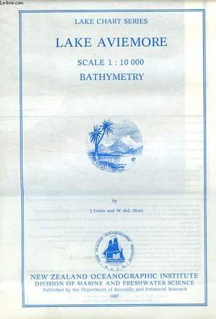
IRWIN J., MAIN W. DE L.
LAKE AVIEMORE BATHYMETRY, LAKE CHART SERIES, SCALE 1:10 000
New Zealand Oceanographic Institute - DSIR. 1987. In-8. En feuillets. Très bon état, Couv. fraîche, Dos impeccable, Intérieur frais. 1 carte dépliable très grand format en couleur.. . . . Classification Dewey : 912-Atlas, cartes et plans
Referência livreiro : RO40107297
|
|
|
IRWIN J., MAIN W. DE L.
LAKE WAITAKI BATHYMETRY, LAKE CHART SERIES, SCALE 1:6 000
New Zealand Oceanographic Institute - DSIR. 1987. In-8. En feuillets. Etat du neuf, Couv. fraîche, Dos impeccable, Intérieur frais. 1 carte dépliable très grand format en couleur dans sa pochette plastique d'origine.. . . . Classification Dewey : 912-Atlas, cartes et plans
Referência livreiro : RO40107298

|
|
|
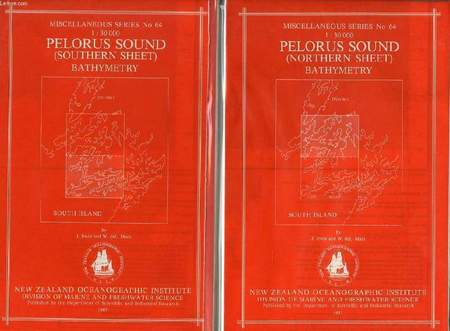
IRWIN J., MAIN W. DE L.
PELORUS SOUND, NORTHERN & SOUTHERN SHEETS, BATHYMETRY, MISCELLANEOUS SERIES N° 64, 1:30 000
New Zealand Oceanographic Institute - DSIR. 1987. In-8. En feuillets. Etat du neuf, Couv. fraîche, Dos impeccable, Intérieur frais. 2 cartes dépliables très grand format en couleur dans leur pochette plastique d'origine.. . . . Classification Dewey : 912-Atlas, cartes et plans
Referência livreiro : RO40107292
|
|
|
IRWIN J., MAIN W. DE L.
LAKE AVIEMORE BATHYMETRY, LAKE CHART SERIES, SCALE 1:10 000
New Zealand Oceanographic Institute - DSIR. 1987. In-8 Carré. En feuillets. Très bon état. Couv. fraîche. Dos impeccable. Intérieur frais. 1 carte dépliable très grand format en couleur. N.Z. Ocean. Inst., Division of Marine and Freshwater Science.

|
|
|
IRWIN J., MAIN W. DE L.
LAKE WAITAKI BATHYMETRY, LAKE CHART SERIES, SCALE 1:6 000
New Zealand Oceanographic Institute - DSIR. 1987. In-8 Carré. En feuillets. Etat du neuf. Couv. fraîche. Dos impeccable. Intérieur frais. 1 carte dépliable très grand format en couleur dans sa pochette plastique d'origine. N.Z. Ocean. Inst., Division of Marine and Freshwater Science.

|
|
|
IRWIN J., MAIN W. DE L.
PELORUS SOUND, NORTHERN & SOUTHERN SHEETS, BATHYMETRY, MISCELLANEOUS SERIES N° 64, 1:30 000
New Zealand Oceanographic Institute - DSIR. 1987. In-8 Carré. En feuillets. Etat du neuf. Couv. fraîche. Dos impeccable. Intérieur frais. 2 cartes dépliables très grand format en couleur dans leur pochette plastique d'origine. N.Z. Ocean. Inst., Division of Marine and Freshwater Science.

|
|
|
ISELIN, Marc:
Chirurgie der Hand. Atlas der Operationstechnik. Mit 693 Abbildungen.
Stuttgart, Georg Thieme Verlag, 1959, Q-4to, XII + 324 S., illustr. mit 693 Abbildungen, Original-Leinenband mit vergoldeter Schrift.
Referência livreiro : 79122aaf
|
|
|
ISFAHAN MAP.
[CITY MAP OF ISFAHAN]. Map of Isfahan with a large index.
Very Good English Original color city map of Isfahan. 70x50 cm. In English. Folded. No scale. This detailed Isfahan city map includes a very detailed alphabetical index as well. There are some b/w photos indicated several important places and buildings on the map. Remarks says, "Please note that most Government Departments, Point 4, Fao, Banks etc. are situated around the Shah Sqaure. Ask for Ostandari i.e. the Governor's Office at F6 or find the Information Dept. at D6. All streets, avenues, kuchehs are listed under the name of khiaban eg. Khiaban Abbasssad is under K. not A. Historic places are listed both under their own names e.g. Ali-Qapu, Chehel-Sotoon etc.; and under Mosques, Minarets, etc.".
|
|
|
ISHAK HAKKI SUBASI, (1890-1932?].
[MAP of EAST ANATOLIA] Urfa: Siverek, Harput, Diyarbakir, Adiyaman.
Very Good Turkish, Ottoman (1500-1928) Original color map. Folded. Oblong atlas folio. (50 x 60 cm). In Ottoman script. Shows Eastern parts of Anatolia; Siverek, Urfa city and border of Diyarbakir and Adiyaman cities; Siverek; Harput (Kharpout); et alli. Scale: 1/200.000. Hegira: 1333 = Gregorian: 1917. Not description on map-maker. This is one the serie of the Bonn projection maps which are the first map series in modern techniques in Turkey and the Ottoman Empire. This is one the serie of the Bonn projection maps which are the first map series in modern techniques in Turkey and the Ottoman Empire. In order to produce these maps covering Turkish territory, Reconnaissance Branch was incorporated into The Mapping Commission. The maps were produced in the datum based on the latitude and longitude of Ayasofya Mosque in equal area Bonn Projection. The field works for the 123 sheets covering the country were conducted by 76 staff. The production was completed in 18 years starting from east west. Field works continued without stopping except in years 1914 and 1920. This map series called also reconnaissance maps contributed a lot to producing 1:25.000 scale maps. Subasi is cartographer of this map according to Türkezer - Cobanoglu: History of Mapping in Turkey-1:200.000 Scale Maps.
|
|
|
ISIDORE
Carte de France. Côte-d'Or. N°20
IMP. MIGEON. XIXe siècle. In-4. En feuillets. Bon état, Livré sans Couverture, Dos satisfaisant, Intérieur frais. Une planche de 35 x 26.5 cm, illustrée d'une carte gravée en couleurs.. . . . Classification Dewey : 912-Atlas, cartes et plans
Referência livreiro : RO80087894
|
|
|
ISMAIL KUMAN, NEBAHAT SÜTUNÇ, (Bursa School Teachers of Geeography).
Türkiye cografyasi sorulu uygulama atlasi.
Very Good Turkish Paperback. 4to. (29 x 21 cm). In Turkish. [16] p., 18 numerous b/w maps of Turkey. Türkiye cografyasi sorulu uygulama atlasi.
|
|
|
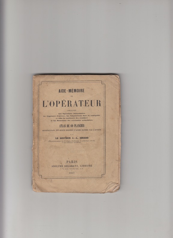
ISNARD J.A.-
AIDE MEMOIRE DE L'OPERATEUR -ATLAS DE 60 Planches -lithographies en noir -
A.DELAHAYS 1857 - IN12 br.-couv.imp.-
Referência livreiro : 831
|
|
|
ITALY ATLAS.
Viaggi d'Italia i piu frequentati e particolarmente da chi viaggi per le Poste
ca 1790. Small 4to. 5 x 4 inches. Manuscript title-page index leaves and pages of notes of useful information to travellers concerning costs/tolls. 15 exceptionally fine manuscript folding route maps in ink and watercolor each with separate title-leaf one or two maps with discreet repairs to folds on verso. Modern red morocco signed S.E 1968. Provenance: with the small ink library stamp of The Admiralty Library on the title-page and verso of last map; from the library of Christopher Henry Beaumont Pease Lord Wardington 1924-2005 his sale Sotheby's May 9th 2006 lot 113 A beautiful atlas of road maps showing the main post roads of Italy. These detailed and colourful maps are described in the notes at the beginning as depicting the most commonly traveled routes in particular those that go through areas that act as postal stages. In addition to the roads the maps show distance in miles and postal stages castles towns rivers regional borders and coastlines. The individual routes are: from Florence to Rome Rome to Naples Rome to Ancona Florence to Bologna Bologna to Ancona Bologna to Padua Venice to Rimini Milan to Venice Mantua to Bologna Mantua to Trento Milan to Bologne Turin to Milan Milan to Genoa Genoa to Pisa and Livorno to Florence. From the distinguished library of Lord Wardington whose collection of Atlases was unique: "a panoply of the history of cartography and of great mapmakers" Andrew Phillips "An Appreciation" Sotheby's sale catalogue. [ca 1790]. unknown
Referência livreiro : 72lib1089
|
|
|
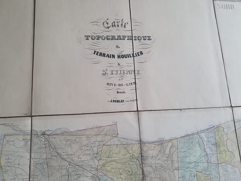
J Nublat
Carte Topographique du terrain houillier de Saint Etienne et de Rive de Gier - Dressée par J. Nublat Géomètre Topographe
Nublat 0 Grande Carte ( 150 X 104 cm ) toilée en 18 panneaux - Sans date ( vers 1840/1850) - Trés bon état
Referência livreiro : Tir306
|
|
|
J Nublat
Carte Topographique du terrain houillier de Saint Etienne et de Rive de Gier - Dressée par J. Nublat Géomètre Topographe
Nublat 0 Grande Carte ( 150 X 104 cm ) toilée en 18 panneaux - Sans date ( vers 1840/1850) - Trés bon état
Referência livreiro : Tir306
|
|
|
J Belot . F Lepennetier
Anatomie radiographique du squelette normal . Atlas
Amédée Legrand Paris 1927
Referência livreiro : 9725
|
|
|
J. Henry, maître de pension
CARTE DU DÉPARTEMENT : ALGER, tirée de : ATLAS DE LA FRANCE, Nouvelle Géographie et statistique de la France, Alger et la Belgique, suivie d'un traité sur le monde entier : Ornée de 95 cartes et approuvée de l'Université , par J. Henry, maître de pension; 1842 [Tours] : Alexandre CORBIN lithographe Editeur,
TOURS Alexandre CORBIN 1842 carte ancienne gravée en noir , cartouche illustré en noir. Lithographie recto-verso d'Alexandre Corbin, Format total : 40 centimètres de haut par 26,5 centimètres de large, 1842 Tours : Alexandre CORBIN lithographe Editeur,
Referência livreiro : 27565
|
|
|
J. Henry, maître de pension
CARTE DU DÉPARTEMENT : N° 08 - ARIÈGE, tirée de : ATLAS DE LA FRANCE, Nouvelle Géographie et statistique de la France, Alger et la Belgique, suivie d'un traité sur le monde entier : Ornée de 95 cartes et approuvée de l'Université , par J. Henry, maître de pension; 1842 [Tours] : Alexandre CORBIN lithographe Editeur,
Tours Alexandre CORBIN 1842 carte ancienne gravée en noir , cartouche illustré en noir. Lithographie recto-verso d'Alexandre Corbin, Format total : 40 centimètres de haut par 26,5 centimètres de large, 1842 Tours : Alexandre CORBIN lithographe Editeur,
Referência livreiro : 27566
|
|
|
J. Henry, maître de pension
CARTE DU DÉPARTEMENT : N° 18 - CORRÈZE, tirée de : ATLAS DE LA FRANCE, Nouvelle Géographie et statistique de la France, Alger et la Belgique, suivie d'un traité sur le monde entier : Ornée de 95 cartes et approuvée de l'Université , par J. Henry, maître de pension; 1842 [Tours] : Alexandre CORBIN lithographe Editeur,
TOURS Alexandre CORBIN 1842 carte ancienne gravée en noir , cartouche illustré en noir. Lithographie recto-verso d'Alexandre Corbin, Format total : 40 centimètres de haut par 26,5 centimètres de large, 1842 Tours : Alexandre CORBIN lithographe Editeur,
Referência livreiro : 27567
|
|
|
J. Henry, maître de pension
CARTE DU DÉPARTEMENT : N° 26 - EURE, tirée de : ATLAS DE LA FRANCE, Nouvelle Géographie et statistique de la France, Alger et la Belgique, suivie d'un traité sur le monde entier : Ornée de 95 cartes et approuvée de l'Université , par J. Henry, maître de pension; 1842 [Tours] : Alexandre CORBIN lithographe Editeur,
TOURS Alexandre CORBIN 1842 carte ancienne gravée en noir , cartouche illustré en noir. Lithographie recto-verso d'Alexandre Corbin, Format total : 40 centimètres de haut par 26,5 centimètres de large, 1842 Tours : Alexandre CORBIN lithographe Editeur,
Referência livreiro : 27568
|
|
|
J. Henry, maître de pension
CARTE DU DÉPARTEMENT : N° 49 - MANCHE, tirée de : ATLAS DE LA FRANCE, Nouvelle Géographie et statistique de la France, Alger et la Belgique, suivie d'un traité sur le monde entier : Ornée de 95 cartes et approuvée de l'Université , par J. Henry, maître de pension; 1842 [Tours] : Alexandre CORBIN lithographe Editeur,
TOURS Alexandre CORBIN 1842 carte ancienne gravée en noir , cartouche illustré en noir. Lithographie recto-verso d'Alexandre Corbin, Format total : 40 centimètres de haut par 26,5 centimètres de large, 1842 Tours : Alexandre CORBIN lithographe Editeur,
Referência livreiro : 27569
|
|
|
J. Henry, maître de pension
CARTE DU DÉPARTEMENT : N° 54 - MEUSE, tirée de : ATLAS DE LA FRANCE, Nouvelle Géographie et statistique de la France, Alger et la Belgique, suivie d'un traité sur le monde entier : Ornée de 95 cartes et approuvée de l'Université , par J. Henry, maître de pension; 1842 [Tours] : Alexandre CORBIN lithographe Editeur,
TOURS Alexandre CORBIN 1842 carte ancienne gravée en noir , cartouche illustré en noir. Lithographie recto-verso d'Alexandre Corbin, Format total : 40 centimètres de haut par 26,5 centimètres de large, 1842 Tours : Alexandre CORBIN lithographe Editeur,
Referência livreiro : 27570
|
|
|
J. Henry, maître de pension
CARTE DU DÉPARTEMENT : N° 63 - BASSES-PYRÉNÉES, tirée de : ATLAS DE LA FRANCE, Nouvelle Géographie et statistique de la France, Alger et la Belgique, suivie d'un traité sur le monde entier : Ornée de 95 cartes et approuvée de l'Université , par J. Henry, maître de pension; 1842 [Tours] : Alexandre CORBIN lithographe Editeur,
TOURS Alexandre CORBIN 1842 carte ancienne gravée en noir , cartouche illustré en noir. Lithographie recto-verso d'Alexandre Corbin, Format total : 40 centimètres de haut par 26,5 centimètres de large, 1842 Tours : Alexandre CORBIN lithographe Editeur,
Referência livreiro : 27571
|
|
|
J. Henry, maître de pension
CARTE DU DÉPARTEMENT : N° 67 - HAUT-RHIN, tirée de : ATLAS DE LA FRANCE, Nouvelle Géographie et statistique de la France, Alger et la Belgique, suivie d'un traité sur le monde entier : Ornée de 95 cartes et approuvée de l'Université , par J. Henry, maître de pension; 1842 [Tours] : Alexandre CORBIN lithographe Editeur,
TOURS Alexandre CORBIN 1842 carte ancienne gravée en noir , cartouche illustré en noir. Lithographie recto-verso d'Alexandre Corbin, Format total : 40 centimètres de haut par 26,5 centimètres de large, 1842 Tours : Alexandre CORBIN lithographe Editeur,
Referência livreiro : 27572
|
|
|
J. Henry, maître de pension
CARTE DU DÉPARTEMENT : N° 69 - HAUTE-SAONE, tirée de : ATLAS DE LA FRANCE, Nouvelle Géographie et statistique de la France, Alger et la Belgique, suivie d'un traité sur le monde entier : Ornée de 95 cartes et approuvée de l'Université , par J. Henry, maître de pension; 1842 [Tours] : Alexandre CORBIN lithographe Editeur,
TOURS Alexandre CORBIN 1842 carte ancienne gravée en noir , cartouche illustré en noir. Lithographie recto-verso d'Alexandre Corbin, Format total : 40 centimètres de haut par 26,5 centimètres de large, 1842 Tours : Alexandre CORBIN lithographe Editeur,
Referência livreiro : 27573
|
|
|
J. Henry, maître de pension
CARTE DU DÉPARTEMENT : N° 71 - SARTHE, tirée de : ATLAS DE LA FRANCE, Nouvelle Géographie et statistique de la France, Alger et la Belgique, suivie d'un traité sur le monde entier : Ornée de 95 cartes et approuvée de l'Université , par J. Henry, maître de pension; 1842 [Tours] : Alexandre CORBIN lithographe Editeur,
TOURS Alexandre CORBIN 1842 carte ancienne gravée en noir , cartouche illustré en noir. Lithographie recto-verso d'Alexandre Corbin, Format total : 40 centimètres de haut par 26,5 centimètres de large, 1842 Tours : Alexandre CORBIN lithographe Editeur,
Referência livreiro : 27574
|
|
|
J. Henry, maître de pension
CARTE DU DÉPARTEMENT : N° 73 - SEINE-ET-MARNE, tirée de : ATLAS DE LA FRANCE, Nouvelle Géographie et statistique de la France, Alger et la Belgique, suivie d'un traité sur le monde entier : Ornée de 95 cartes et approuvée de l'Université , par J. Henry, maître de pension; 1842 [Tours] : Alexandre CORBIN lithographe Editeur,
TOURS Alexandre CORBIN 1842 carte ancienne gravée en noir , cartouche illustré en noir. Lithographie recto-verso d'Alexandre Corbin, Format total : 40 centimètres de haut par 26,5 centimètres de large, 1842 Tours : Alexandre CORBIN lithographe Editeur,
Referência livreiro : 27575
|
|
|
J. Henry, maître de pension
CARTE DU DÉPARTEMENT : N° 76 - DEUX-SÈVRES, tirée de : ATLAS DE LA FRANCE, Nouvelle Géographie et statistique de la France, Alger et la Belgique, suivie d'un traité sur le monde entier : Ornée de 95 cartes et approuvée de l'Université , par J. Henry, maître de pension; 1842 [Tours] : Alexandre CORBIN lithographe Editeur,
TOURS Alexandre CORBIN 1842 carte ancienne gravée en noir , cartouche illustré en noir. Lithographie recto-verso d'Alexandre Corbin, Format total : 40 centimètres de haut par 26,5 centimètres de large, 1842 Tours : Alexandre CORBIN lithographe Editeur,
Referência livreiro : 27576
|
|
|
J. Henry, maître de pension
CARTE DU DÉPARTEMENT : N° 77 - SOMME, tirée de : ATLAS DE LA FRANCE, Nouvelle Géographie et statistique de la France, Alger et la Belgique, suivie d'un traité sur le monde entier : Ornée de 95 cartes et approuvée de l'Université , par J. Henry, maître de pension; 1842 [Tours] : Alexandre CORBIN lithographe Editeur,
TOURS Alexandre CORBIN 1842 carte ancienne gravée en noir , cartouche illustré en noir. Lithographie recto-verso d'Alexandre Corbin, Format total : 40 centimètres de haut par 26,5 centimètres de large, 1842 Tours : Alexandre CORBIN lithographe Editeur,
Referência livreiro : 27577
|
|
|
J. Henry, maître de pension
CARTE DU DÉPARTEMENT : N° 80 - VAR, tirée de : ATLAS DE LA FRANCE, Nouvelle Géographie et statistique de la France, Alger et la Belgique, suivie d'un traité sur le monde entier : Ornée de 95 cartes et approuvée de l'Université , par J. Henry, maître de pension; 1842 [Tours] : Alexandre CORBIN lithographe Editeur,
TOURS Alexandre CORBIN 1842 carte ancienne gravée en noir , cartouche illustré en noir. Lithographie recto-verso d'Alexandre Corbin, Format total : 40 centimètres de haut par 26,5 centimètres de large, 1842 Tours : Alexandre CORBIN lithographe Editeur,
Referência livreiro : 27578
|
|
|
 Receber por correio electrónico
 Descarregar em documento PDF
 Fluxo RSS


