|
Radtke, Jörg (Herausgeber)
Meyers großer Weltatlas. Atlas zum 21. Jahrhundert.
Mannheim / Leipzig / Wien, Meyers Lexikonverlag, 2001. 7., völlig neu bearbeitete Auflage. Durchgehend bebildert. ca. 600 S. 37 x 28,5 cm, Ln. im Pappschuber. Leichte Gebrauchsspuren, sonst gut erhalten.
Referência livreiro : 53073

|
|
|
Radtke, Jörg, Eberhard Anger Eva-Maria Brugger u. a
Brockhaus Biosphäre - Die Lebensräume der Erde - Weltatlas.
Leipzig/Mannheim, F. A. Brockhaus, 2001. 64, 64, 328, 144 S. (36x28 cm) Großformat, dunkelgrüne Cabraleder-Ausgabe im Schuber
Referência livreiro : 28885
|
|
|
Radó Alex
Atlas für Politik Wirtschaft Arbeiterbewegung I. der Imperialismus - Vorwort von Th. Rothstein
[Wien / Berlin] / Gotha / Leipig ([Verlag für Literatur und Politik] VEB Hermann Haack) [1930] / 1980 (= Reprint der Ersten Ausgabe). Quer- 4°, Originalleinen (Hardcover), 170 S, zahlreiche Karten 1
Referência livreiro : Khe00411
|
|
|
Raffy (Casimir)
Cours de géographie physique et historique, à l'usage de toutes les classes.
français In-12 de (4)-320 pp.; demi-toile (cartonné ancien, lég. postérieur). Troisième édition, augmentée de tableaux synoptiques et de cartes sur acier.
|
|
|
Raignier A.
Fourmis
Payot Petits atlas Payot Lausanne Cartonné In-12, (15x10.5 cm), cartonné, couverture illustrée, 80 pages, sans date, illustrations en noir et blanc ; plats jaunis, coiffes frottées, assez bon état. Livraison a domicile (La Poste) ou en Mondial Relay sur simple demande.
Referência livreiro : ny95

|
|
|
Rail Atlas
Atlas of Train Operating Companies
Ian Allan Publishing 2006. Book. Near Fine. Hardcover. 2nd Edition. hardback large 8vo pictorial glazed boards no wrapper called for a very good tightly bound copy maps & Index 64pp. Ian Allan Publishing Hardcover
Referência livreiro : 207712 ISBN : 071103138X 9780711031388

|
|
|
Railroad Atlas Model
Beginner's Guide to HO Model Railroading Level 1
USA: Atlas Model Railroad 1992. Atlas Model Railroad 1992 Very Good/ Light wear to bright glossy cover tight bright 1-color illustrated pages. Pen drawing on back page. Paperback. Very Good. Atlas Model Railroad Paperback
Referência livreiro : 296562
|
|
|
Railroad; Atlas E & T. Fairbanks & Co
Fairbanks' Pocket Atlas of the United States and Miniature Railway Guide with Illustrations .
New York: Schonberg & Co 1859. Scarce pocket atlas and railway guide to the United States in the period preceding the transcontinental railroad with 30 individual color state railway maps from Maine down to Texas and across to California showing existing rail lines and accompanied with charts listing completed railway line distances. Cuba is also represented in a map with two short lengths of railway shown. The Atlas with many illustrated advertisements for E & T. Fairbanks & Co.'s industrial scales. Founded in 1823 Fairbanks became an extremely successful manufacturer of the platform scale which allowed the weighing of large objects much more accurately giving more accurate calculations of value for example the value of a wagon load of farm produce. The Atlas includes an Appendix with list of Railways "now or soon to be opened for traffic" which records the State Island Railway from Stapleton S.I. to opposite South Amboy 14 miles "will be opened about January 1860". 16mo v 61pp including Appendix. 5 3/4 x 4". A ruffled printed tan front wrapper; stitch bound. We have not located this specific copy on WorldCat. OCLC: 1150075 records 5 copies but at 59pp; this copy is 61pp although apparently lacking the rear wrapper. Harvard holds a copy with 59pp no Appendix but with 2pp of ads at the rear. Our copy with a single page advertisement at the front for Lansing Bonnell Dealer in Stoves Tin Plate & c. Milwaukee Wisconsin. Good condition; internally maps bright and fresh. <br/><br/> Schonberg & Co unknown
Referência livreiro : 23507

|
|
|
Raine Craig. James Atlas introduction
"The Way It Was" in Talk December 1999/January 2000
New York 1999. Fine in original wappers. . First Edition. Soft Cover. Fine. Paperback
Referência livreiro : b43432
|
|
|
Rakers Arnold
Mundartatlas der alten Grafschaft Bentheim hrsg., bearb. Und auf der Basis des Rakerschen Forschungsansatzes kommentiert von Hendrik Entjes und Hermann Niebaum (=Emsland /Bentheim - Beiträge zur Geschichte hrsg. V. d. Emsländischen Landschaft ... Bd. 9)
Sögel ( Emsländische Landschaft e.V. für die Landkreise Emsland und Grafschaft Bentheim) 1993 (= Erste Ausgabe). 8°, Originalkarton mit illustriertem Originalumschlag (Hardcover), 324 S., Karten, ISBN 3925034226 1
Referência livreiro : V41537

|
|
|
RAMEE D
CARTE DE LA CRIMEE
GARNIER. sans date. In-12. Broché. Etat d'usage, Couv. défraîchie, Dos frotté, Quelques rousseurs. carte de 64X54 cm.Manque le premier plat.. . . . Classification Dewey : 912-Atlas, cartes et plans
Referência livreiro : RO80001211
|
|
|
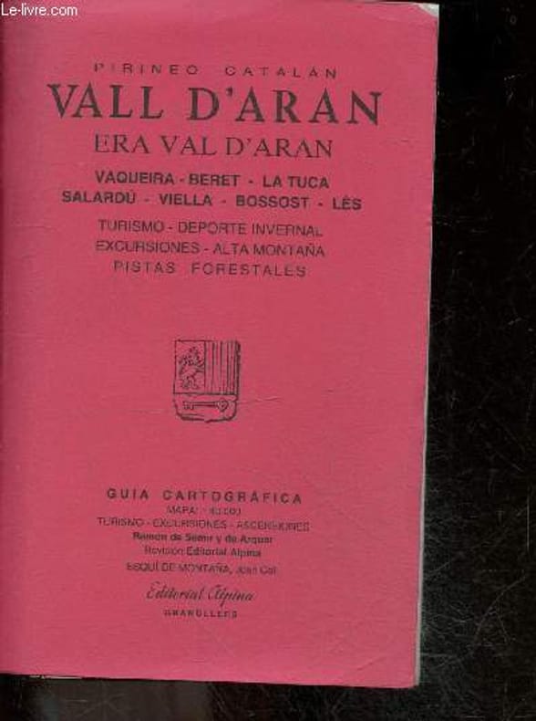
RAMON DE SEMIR Y DE ARQUER- COLL JOAN
Pirineo catalan - Vall d'aran - era val d'aran- vaqueira, beret, la tuca, salardu, viella, bossost, les- turismo, deporte invernal, excursiones, alta montana, pistas forestales- guia cartografica- turismo, excursiones, ascensiones
EDITORIAL ALPINA. NON DATE. In-8. Broché. Etat d'usage, Couv. convenable, Agrafes rouillées, Quelques rousseurs. 36 Pages + une carte couleur dépliante d'environ 95 x 65cm (recto uniquement). . . . Classification Dewey : 912-Atlas, cartes et plans
Referência livreiro : RO20258913
|
|
|
RAMIZPASAZÂDE MEHMED IZZET, (?-1853).
[BIOGRAPHY OF THE ADMIRALS] Harîta-i kapudânân-i deryâ. [i.e. The chart of the admirals].
Very Good Turkish, Ottoman (1500-1928) Contemporary quarter leather bdg. Rebacked boards. Foolscap 8vo. (18 x 12 cm). In Ottoman script (Old Turkish with Arabic letters). 220 p. Very rare early book of the concise biographies of 137 people who served as admirals in the Ottoman Empire between 1352 and 1853, written by Mehmed Izzet Pasha (d. 1853), son of Turkish admiral Abdullah Râmiz Pasha (d. 1813). Ceridehâne Printing House was founded for publishing Ceride-i Havâdîs [i.e. The Journal of News], which was the first semi-official newspaper in the Ottoman Empire. This journal was published from 1840 to 1877 and was founded by William Nosworthy Churchill (1796-1846), a British-born journalist who moved to Turkey aged 19. He was the cause of a diplomatic incident that resulted in the temporary severance of diplomatic relations between Britain and the Ottoman Empire. Babinger p. 323/2.; Özege 6951.; Library of Congress. Karl Süssheim Collection, no. 1336., OCLC: 11810438, 880485954.
|
|
|
RAND Ayn
Atlas Shrugged. Introduced by Michael Dirda. Illustrated by Anna and Elena Balbusso. FINE COPY IN PUBLISHER'S SLIP-CASE
3 vols., 8vo., First Edition thus, with 3 coloured frontispieces and 12 coloured illustrations; pictorial boards, backstrips lettered in black, a fine copy in publisher's blocked and lettered board slip-case.
|
|
|
Rand McNally Staff; Reference Atlas Staff
Atlas Classic World Atlas
Rand McNally 2004. Hardcover. Very Good. Disclaimer:A copy that has been read but remains in excellent condition. Pages are intact and are not marred by notes or highlighting but may contain a neat previous owner name. The spine remains undamaged. At ThriftBooks our motto is: Read More Spend Less.Dust jacket quality is not guaranteed. Rand McNally hardcover
Referência livreiro : G0528965794I4N00 ISBN : 0528965794 9780528965791

|
|
|
Rand McNally New Indexed Atlas of the World
Map of Alabama
14" x 20". Map is colored in pink green and yellow and shows railroad lines. This is a double page map which is taped together with archival tape. Map is 1887-1888. All in very good condition. unknown
Referência livreiro : 001984

|
|
|
Rand McNally New Indexed Atlas of the World
Map of Alaska
14" x 10.50". White outlined in pink. Has an inset of Aleutian Islands in pink and black and white. Map is in good condition with a date of 1887-1888. unknown
Referência livreiro : 001981
|
|
|
Rand McNally New Indexed Atlas of the World
Map of Alaska
No Jacket. 1887-88. Colored in pink white and black lettering measuring 14" x 10.50" with black borders. Copyright Rand McNally 1888-89. All very good condition. Map is placed on acid-free white bac kboard and shrink wrapped. Cartography history geography Alaska United States. unknown
Referência livreiro : 000188
|
|
|
Rand McNally New Indexed Atlas of the World
Map of Arizona
17" x 19.75". Map is colored in pink green and yellow. This is a double page map taped together with archival tape. Railroad lines lead and silver mine locations indian reservations etc. Map is 1887-1888 All very good condition. unknown
Referência livreiro : 001985
|
|
|
Rand McNally New Indexed Atlas of the World
Map of Arkansas
19.50" x 14". New Railroad and Township map. Colored in pink gray coral and yellow. This is a double page map taped down the center with archival tape. Map is 1887-1888. All in very good condition. unknown
Referência livreiro : 001986
|
|
|
Rand McNally New Indexed Atlas of the World
Map of Asia
Map is colored with blue waters yellow and coral. An inset of Palestine or the Holy Land on the bottom right of the map. This is a double page map measuring 20.50" x 14" taped down the center on t he back with archival tape. Then the map is placed on acid-free whiteboard and shrink wrapped. All very good condition. Map is 1887-1888. unknown
Referência livreiro : 002103
|
|
|
Rand McNally New Indexed Atlas of the World
Map of Australia Etc
Map is colored in yellow green pink and black and white. Inset in right corner of North Island South or Middle Island and New Zealand. Small inset of Tasmania on the bottom left. An inset of Sydn ey and Port Jackson is in the top right corner. Map measures 20.50" x 14". This is a double page map taped down the center on the back with archival tape then placed on acid-free whiteboard and shr ink-wrapped. All very good condition. Map is 1887-1888. unknown
Referência livreiro : 002084
|
|
|
Rand McNally New Indexed Atlas of the World
Map of Austro-Hungarian Monarchy
This map is colored in pink green and yellow. An Inset of Vienna and its environs and an inset of Dalmatia. This is a double page map measuring 19.75" x 14" taped down the center on the back with archival tape. Then the map is placed on acid-free whiteboard and shrink wrapped. All very good condition. This map is 1887-1888. unknown
Referência livreiro : 002104
|
|
|
Rand McNally New Indexed Atlas of the World
Map of Belgium and the Netherlands
This map is colored in yellow and pink with blue waters. There is an inset of the Plan of Brussels. This is a double page map measuring 14" x 20" taped down the center on the back with archival tap e. Then the map is placed on acid-free whiteboard and shrink wrapped. All very good condition. This map is 1887-1888. unknown
Referência livreiro : 002105
|
|
|
Rand McNally New Indexed Atlas of the World
Map of California
14" x 19.70". This map is colored in pink green and yellow. Has an inset of San Francisco Vicinity and also showing railroad lines and stations. This is a double page map taped in the center with archival tape and in good condition. Map is 1887-1888. unknown
Referência livreiro : 002015
|
|
|
Rand McNally New Indexed Atlas of the World
Map of Central America
Colors on map are pink green yellow and black and white. Map measures 14" x 10.50". Map is 1887. Very good condition. unknown
Referência livreiro : 001965
|
|
|
Rand McNally New Indexed Atlas of the World
Map of Colorado
20" x 14". Colored in pink yellow green and coral. Shows battlefield of Sept. 29 1879 Major Thornsburgh's command attached by Ute Indian Reservation mine locations railroad lines stations and p ost offices. This is a double page map taped down the center with archival tape. Map is 1887-1888. All in very good condition. unknown
Referência livreiro : 001987
|
|
|
Rand McNally New Indexed Atlas of the World
Map of Connecticut
Colors on map are blue and yellow road are in red. Also shows Long Island Sound and Block Island Sound. Map measures 14" x 10.50". Map is 1887. Very good condition. unknown
Referência livreiro : 001963
|
|
|
Rand McNally New Indexed Atlas of the World
Map of Cuba
Map is colored in pink yellow green and black and white. Map measures 20" x 14". This is a double page map taped down the center on the back with archival tape then it is placed on acid-free whi teboard and shrinkwrapped. All good condition. Map is 1887-1888. unknown
Referência livreiro : 002089
|
|
|
Rand McNally New Indexed Atlas of the World
Map of Dakota
14" x 19.50". This map is colored in pink green yellow and coral. Displayed are railroad lines Cheyenne Indian Reservation Standing Rock Indian Resercation Proposed Diminished Reservation Agreeme nt Dec. 14 1886 Garafield City Military Reservation Indian Agency's Upper Brule on Rosebud Reservation Lower Brule Cheyenne Indian Reservation Yankton Indian Reservation Pine Ridge on Ogala Reser vation and Agency. This is a double page map taped in the center with archival tape and in very good condition. Map is 1887-1888. unknown
Referência livreiro : 002005
|
|
|
Rand McNally New Indexed Atlas of the World
Map of Denmark
With North Portion of the German Empire Comprising Schleswig Holstein and Lauenburg. Small inset of Bornholm to Denmark. Also an inset of Iceland and Faroe Island to Denmark. Colors on map are blue yellow pink light orange black and white. Map measures 10.50" x 14".Map is 1887. Very good condition. unknown
Referência livreiro : 001969
|
|
|
Rand McNally New Indexed Atlas of the World
Map of Egypt Arabia Petraca and Lower Nubia
Map colors are yellow blue light pink and black and white black decorated borders. Map measures 10.50" x 14". Map is 1887. Very good condition. unknown
Referência livreiro : 001959
|
|
|
Rand McNally New Indexed Atlas of the World
Map of Egypt
This map is colored in pink and green. An inset of Said or Upper Egypt is at the bottom left and and inset of the Environs of Cairo as far as the Barrage on the North and Dahshur on the South is at t he bottom right side of the map. This is a double page map measuring 14" x 20.25" taped on the back down the center with archival tape. Then the map is placed on acid-free whiteboard and shrink wrap ped. All very good condition. This map is 1887-1888. unknown
Referência livreiro : 002102
|
|
|
Rand McNally New Indexed Atlas of the World
Map of England and Wales
14" x 20.25". Has inset of Sicily Island and Lands End. Map is colored in pink green and yellow. This is a double-paged map taped together with archival tape Map is 1887-1888. Alll very good condition. unknown
Referência livreiro : 001983
|
|
|
Rand McNally New Indexed Atlas of the World
Map of European Russia
14" x 20". Map is colored in pink green yellow and orange. This is a double page map taped in the center with archival tape and in good condition with a slight tear at the fold of the map. Map is 1887-1888. unknown
Referência livreiro : 002006
|
|
|
Rand McNally New Indexed Atlas of the World
Map of Europe
This map of Europe is colored in pink green yellow and black and white. This is a double page map measuring 14" x 20.50" taped down the center on the back with archival tape. Then the map is pla ced on acid-free whiteboard and shrinkwrapped. All very good condition. This map is 1887-1888. unknown
Referência livreiro : 002106
|
|
|
Rand McNally New Indexed Atlas of the World
Map of Florida
Map is colored in green yellow and pink. Has an inset of the Northwestern Portion of Florida. Measures 14" x 19.50". This is a double page map taped down the center on the back with archival tape t hen placed on acid-free whiteboard and shrink wrapped. All very good condition. Map is 1887-1888. unknown
Referência livreiro : 002091
|
|
|
Rand McNally New Indexed Atlas of the World
Map of France
This map of France is colored in pink green yellow and coral. There is an inset of the Plan of the City of Paris and another small inset of Corse Corsica. This is a double page map measuring 20" x 14" taped down the center on the back with archival tape. Then the map is placed on acid-free white board and shrink wrapped. All very good condition. This map is 1887-1888. unknown
Referência livreiro : 002107
|
|
|
Rand McNally New Indexed Atlas of the World
Map of Georgia
14" x 19.75". Map is colored in pink yellow green and coral. Shows railroad lines stations and post offices. This is a double page map taped in the center with archival tape. Map is 1887-1888. All in very good condition. unknown
Referência livreiro : 001988
|
|
|
Rand McNally New Indexed Atlas of the World
Map of Greece
This map is colored in green pink and yellow. This is a double page map measuring 20.50" x 14" taped down the center on the back with archival tape. Then the map is placed on acid-free whiteboard and shrink wrapped. All very good condition. This map is 1887-1888. unknown
Referência livreiro : 002110
|
|
|
Rand McNally New Indexed Atlas of the World
Map of Idaho
14" x 20". Map is colored in pink coral green and yellow. Shows indian reservations railroad lines stage stations ferrys creeks rivers etc. This is a double page map taped together in the cen ter with archival tape. Map is 1887-18887. All in very good condition. unknown
Referência livreiro : 001989 ISBN : 1887188878 9781887188876
|
|
|
Rand McNally New Indexed Atlas of the World
Map of Illinois
Map is colored in green yellow pink and coral. This is a double page map taped down the center on the back with archival tape then placed on acid-free whiteboard and shrink wrapped. Map measures 2 0" x 14" and is in very good condition. Map is 1887-1888. unknown
Referência livreiro : 002092
|
|
|
Rand McNally New Indexed Atlas of the World
Map of Illinois
14" x 20.25". Map is colored in green yellow and pink. Has an inset of Chicago & Vicinty. Also a list of railroad lines stations and depots. Another inset of Davenport Iowa in yellow Rock Island a nd Moline and Rock Island Arsenal and Bridge over Mississippi River in pink. Also shows Winnebag Swamp. This is a double page map taped in the center with archival tape. Map is In very good condition. Map is 1887-1888. unknown
Referência livreiro : 002004
|
|
|
Rand McNally New Indexed Atlas of the World
Map of Ireland
This map is colored in pink yellow and green. This is a double page map measuring 14" x 20.50" taped down the center in the back with archival tape. Then the map is placed on acid-free whiteboard and shrink wrapped. All very good condition. This map is 1887-1888. unknown
Referência livreiro : 002111
|
|
|
Rand McNally New Indexed Atlas of the World
Map of Italy
This map is colored in yellow with black and white. This is a double page map measuring 14" x 20" taped down the center on the back with archival tape. Then the map is placed on acid-free whiteboar d and shrink wrapped. All very good condition. This map is 1887-1888. unknown
Referência livreiro : 002112
|
|
|
Rand McNally New Indexed Atlas of the World
Map of Kansas
Map is colored in pink green yellow and coral. This is a double page map measuring 20.50" x 14" taped down the center in the back with archival tape. Then it is placed on acid-free whiteboard an d shrink wrapped. All very good condition. Map is 1887-1888. unknown
Referência livreiro : 002095
|
|
|
Rand McNally New Indexed Atlas of the World
Map of Louisiana
20" x 14". Map is colored in green yellow coral and pink. Shows railroad lines Texas & Pacific and Illinois railroad. This is a double page map taped in the center with archival tape. Map is 1887-1888. All in very good condition. unknown
Referência livreiro : 001991
|
|
|
Rand McNally New Indexed Atlas of the World
Map of Maine
Map is colored in pink coral green and yellow. This is a double page map measuring 14" x 20" taped down the center on the back with archival tape. Then iit is placed on acid-free whiteboard and shrink wrapped. All very good condition. Map is 1887-1888. unknown
Referência livreiro : 002094
|
|
|
Rand McNally New Indexed Atlas of the World
Map of Manitoba
Map is colored in pink yellow green and black and white. Also shows the Turtle Mountain Indian Reservation. Map measures 20" x 14". This is a double page map taped in the center on the back with archival tape then placed on acid-free whiteboard and shrink-wrapped. There is a small piece missing at the top of the map in the center. Only the word "longitude" is missing. Overall the map is very good. Map is 1887-1888. unknown
Referência livreiro : 002086
|
|
|
Rand McNally New Indexed Atlas of the World
Map of Maryland
20" x 14". This map has an inset of Garrett and District of Columbia. Colored in green yellow coral and pink. Shows Drawbridges Dixon's Tavern Brick Meetinghouse railroad lines and stations. Thi s is a double page map taped with archival tape down the center and in good condition. Map is 1887-1888. paperback
Referência livreiro : 001992
|
|
 Receber por correio electrónico
 Descarregar em documento PDF
 Fluxo RSS


