|
MICHELIN
CARTE MICHELIN N°89
MICHELIN ET CIE. Non daté. In-8. Broché. Bon état, Couv. convenable, Dos satisfaisant, Intérieur frais. Carte michelin Paris sud.. . . . Classification Dewey : 912-Atlas, cartes et plans
书商的参考编号 : RO70118005
|
|
|
MICHELIN
CARTE MICHELIN N°58
MICHELIN ET CIE. Non daté. In-8. Broché. Etat d'usage, Couv. convenable, Dos satisfaisant, Intérieur frais. Carte michelin Brest/Quimper.. . . . Classification Dewey : 912-Atlas, cartes et plans
书商的参考编号 : RO70117912
|
|
|
MICHELIN
CARTE MICHELIN N°66
MICHELIN ET CIE. Non daté. In-8. Broché. Etat d'usage, Couv. convenable, Dos satisfaisant, Intérieur frais. Carte michelin Dijon/Mulhouse.. . . . Classification Dewey : 912-Atlas, cartes et plans
书商的参考编号 : RO70117936
|
|
|
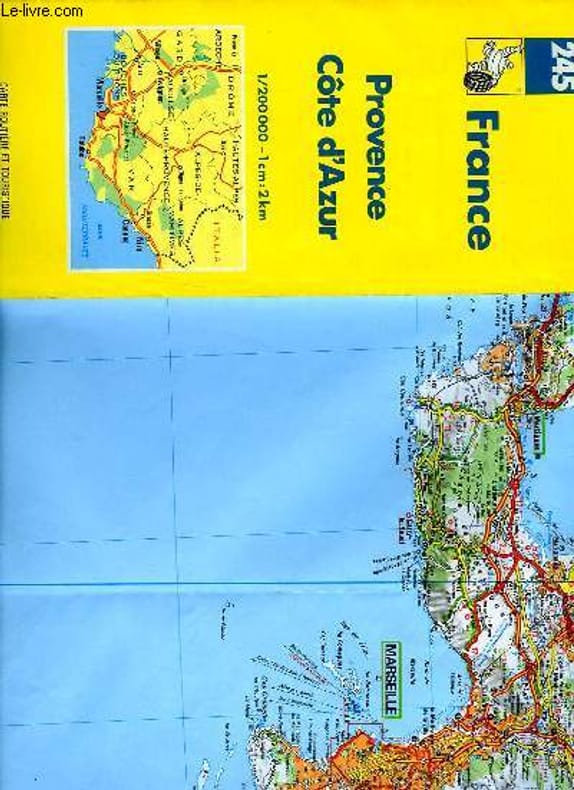
MICHELIN
CARTE MICHELIN N°245
MICHELIN ET CIE. Non daté. In-8. Broché. Bon état, Couv. convenable, Dos satisfaisant, Intérieur frais. Carte michelin Provence/Côte d'Azur.. . . . Classification Dewey : 912-Atlas, cartes et plans
书商的参考编号 : RO70118460
|
|
|
MICHELIN
CARTE MICHELIN N°88
MICHELIN ET CIE. Non daté. In-8. Broché. Bon état, Couv. convenable, Dos satisfaisant, Intérieur frais. Carte michelin Paris nord.. . . . Classification Dewey : 912-Atlas, cartes et plans
书商的参考编号 : RO70118002
|
|
|
MICHELIN
CARTE MICHELIN N°67
MICHELIN ET CIE. Non daté. In-8. Broché. Etat d'usage, Couv. convenable, Dos satisfaisant, Intérieur frais. Carte michelin Nantes/Poitiers.. . . . Classification Dewey : 912-Atlas, cartes et plans
书商的参考编号 : RO70117939
|
|
|
MICHELIN
CARTE MICHELIN N°65
MICHELIN ET CIE. Non daté. In-8. Broché. Etat d'usage, Couv. convenable, Dos satisfaisant, Intérieur frais. Carte michelin Auxerre/Dijon.. . . . Classification Dewey : 912-Atlas, cartes et plans
书商的参考编号 : RO70117933
|
|
|
MICHELIN
CARTE MICHELIN N°60
MICHELIN ET CIE. Non daté. In-8. Broché. Etat d'usage, Couv. convenable, Dos satisfaisant, Intérieur frais. Carte michelin Le Mans/Paris.. . . . Classification Dewey : 912-Atlas, cartes et plans
书商的参考编号 : RO70117918
|
|
|
MICHELIN
CARTE MICHELIN N°64
MICHELIN ET CIE. Non daté. In-8. Broché. Etat d'usage, Couv. convenable, Dos satisfaisant, Intérieur frais. Carte michelin Angers/Orléans.. . . . Classification Dewey : 912-Atlas, cartes et plans
书商的参考编号 : RO70117930
|
|
|
MICHELIN
CARTE MICHELIN N°62
MICHELIN ET CIE. Non daté. In-8. Broché. Etat d'usage, Couv. convenable, Dos satisfaisant, Intérieur frais. Carte michelin Chaumont/Strasbourg.. . . . Classification Dewey : 912-Atlas, cartes et plans
书商的参考编号 : RO70117924
|
|
|
MICHELIN
CARTE MICHELIN N°63
MICHELIN ET CIE. Non daté. In-8. Broché. Etat d'usage, Couv. convenable, Dos satisfaisant, Intérieur frais. Carte michelin Vannes/Angers.. . . . Classification Dewey : 912-Atlas, cartes et plans
书商的参考编号 : RO70117927
|
|
|
MICHELIN
CARTE MICHELIN N°86
MICHELIN ET CIE. Non daté. In-8. Broché. Bon état, Couv. convenable, Dos satisfaisant, Intérieur frais. Carte michelin Luchon/Perpignan.. . . . Classification Dewey : 912-Atlas, cartes et plans
书商的参考编号 : RO70117996
|
|
|
MICHELIN
CARTE MICHELIN N°79
MICHELIN ET CIE. Non daté. In-8. Broché. Bon état, Couv. convenable, Dos satisfaisant, Intérieur frais. Carte michelin Bordeaux/Montauban.. . . . Classification Dewey : 912-Atlas, cartes et plans
书商的参考编号 : RO70117975
|
|
|
MICHELIN
CARTE MICHELIN N°71
MICHELIN ET CIE. Non daté. In-8. Broché. Etat d'usage, Couv. convenable, Dos satisfaisant, Intérieur frais. Carte michelin La Rochelle/Bordeaux.. . . . Classification Dewey : 912-Atlas, cartes et plans
书商的参考编号 : RO70117951
|
|
|
MICHELIN
CARTE MICHELIN N°73
MICHELIN ET CIE. Non daté. In-8. Broché. Bon état, Couv. convenable, Dos satisfaisant, Intérieur frais. Carte michelin Clermont-Fd/Lyon.. . . . Classification Dewey : 912-Atlas, cartes et plans
书商的参考编号 : RO70117957
|
|
|
MICHELIN
CARTE MICHELIN N°74
MICHELIN ET CIE. Non daté. In-8. Broché. Etat d'usage, Couv. convenable, Dos satisfaisant, Intérieur frais. Carte michelin Lyon/Genève.. . . . Classification Dewey : 912-Atlas, cartes et plans
书商的参考编号 : RO70117960
|
|
|
MICHELIN
CARTE MICHELIN N°80
MICHELIN ET CIE. Non daté. In-8. Broché. Etat d'usage, Couv. convenable, Dos satisfaisant, Intérieur frais. Carte michelin Rodez/Nimes.. . . . Classification Dewey : 912-Atlas, cartes et plans
书商的参考编号 : RO70117978
|
|
|
MICHELIN
CARTE MICHELIN N°90
MICHELIN ET CIE. Non daté. In-8. Broché. Bon état, Couv. convenable, Dos satisfaisant, Intérieur frais. Carte michelin Corse.. . . . Classification Dewey : 912-Atlas, cartes et plans
书商的参考编号 : RO70118008
|
|
|
MICHELIN
CARTE MICHELIN N°85
MICHELIN ET CIE. Non daté. In-8. Broché. Bon état, Couv. convenable, Dos satisfaisant, Intérieur frais. Carte michelin Biarritz/Luchon.. . . . Classification Dewey : 912-Atlas, cartes et plans
书商的参考编号 : RO70117993
|
|
|
MICHELIN
CARTE MICHELIN N°84
MICHELIN ET CIE. Non daté. In-8. Broché. Bon état, Couv. convenable, Dos satisfaisant, Intérieur frais. Carte michelin Marseille/Menton.. . . . Classification Dewey : 912-Atlas, cartes et plans
书商的参考编号 : RO70117990
|
|
|
MICHELIN
CARTE MICHELIN N°81
MICHELIN ET CIE. Non daté. In-8. Broché. Etat d'usage, Couv. convenable, Dos satisfaisant, Intérieur frais. Carte michelin Avignon/Digne.. . . . Classification Dewey : 912-Atlas, cartes et plans
书商的参考编号 : RO70117981
|
|
|
MICHELIN
CARTE MICHELIN N°83
MICHELIN ET CIE. Non daté. In-8. Broché. Etat d'usage, Couv. convenable, Dos satisfaisant, Intérieur frais. Carte michelin Carcassonne/Nimes.. . . . Classification Dewey : 912-Atlas, cartes et plans
书商的参考编号 : RO70117987
|
|
|
MICHELIN
CARTE VERTE MICHELIN N°95
MICHELIN ET CIE. Non daté. In-8. Broché. Etat passable, Couv. convenable, Dos satisfaisant, Intérieur frais. Carte verte Michelin Environs de Paris.. . . . Classification Dewey : 912-Atlas, cartes et plans
书商的参考编号 : RO70118020
|
|
|
MICHELIN
CARTE VERTE MICHELIN N°100
MICHELIN ET CIE. Non daté. In-8. Broché. Bon état, Couv. convenable, Dos satisfaisant, Intérieur frais. Carte verte michelin Sorties de Paris.. . . . Classification Dewey : 912-Atlas, cartes et plans
书商的参考编号 : RO70118035
|
|
|
MICHELIN
CARTE MICHELIN N°92
MICHELIN ET CIE. Non daté. In-8. Broché. Bon état, Couv. convenable, Dos satisfaisant, Intérieur frais. Carte michelin Pontarlier/Grenoble.. . . . Classification Dewey : 912-Atlas, cartes et plans
书商的参考编号 : RO70118014
|
|
|
MICHELIN
CARTE MICHELIN N°91
MICHELIN ET CIE. Non daté. In-8. Broché. Bon état, Couv. convenable, Dos satisfaisant, Intérieur frais. Carte michelin Clermont-Fd/Lyon/Chambéry.. . . . Classification Dewey : 912-Atlas, cartes et plans
书商的参考编号 : RO70118012
|
|
|
MICHELIN
CARTE MICHELIN N°98 ET N°99
MICHELIN ET CIE. Non daté. In-8. Broché. Bon état, Couv. convenable, Dos satisfaisant, Intérieur frais. Carte michelin Grandes Routes.La France en un seul Feuillet.. . . . Classification Dewey : 912-Atlas, cartes et plans
书商的参考编号 : RO70118027
|
|
|
MICHELIN
CARTE VERTE MICHELIN N°96
MICHELIN ET CIE. Non daté. In-8. Broché. Bon état, Couv. convenable, Dos satisfaisant, Intérieur frais. Carte verte Michelin environs de Paris.. . . . Classification Dewey : 912-Atlas, cartes et plans
书商的参考编号 : RO70118022
|
|
|
MICHELIN
CARTE MICHELIN N°93
MICHELIN ET CIE. Non daté. In-8. Broché. Bon état, Couv. convenable, Dos satisfaisant, Intérieur frais. Carte michelin Lyon/Avignon.. . . . Classification Dewey : 912-Atlas, cartes et plans
书商的参考编号 : RO70118017
|
|
|
MICHELIN
CARTE MICHELIN N°99
MICHELIN ET CIE. Non daté. In-8. Broché. Bon état, Couv. convenable, Dos satisfaisant, Intérieur frais. Carte michelin Grandes routes de France.. . . . Classification Dewey : 912-Atlas, cartes et plans
书商的参考编号 : RO70118029
|
|
|
MICHELIN
CARTE MICHELIN N°97
MICHELIN ET CIE. Non daté. In-8. Broché. Bon état, Couv. convenable, Dos satisfaisant, Intérieur frais. Carte michelin 150 km autour de Paris.. . . . Classification Dewey : 912-Atlas, cartes et plans
书商的参考编号 : RO70118023
|
|
|
MICHELIN
CARTE MICHELIN N°98
MICHELIN ET CIE. Non daté. In-8. Broché. Bon état, Couv. convenable, Dos satisfaisant, Intérieur frais. Carte michelin Grandes Routes.La France en deux Cartes.. . . . Classification Dewey : 912-Atlas, cartes et plans
书商的参考编号 : RO70118025
|
|
|
MICHELIN
CARTE MICHELIN N°115
MICHELIN ET CIE. Non daté. In-8. Broché. Bon état, Couv. convenable, Dos satisfaisant, Intérieur frais. Carte michelin Côte d'Azur.. . . . Classification Dewey : 912-Atlas, cartes et plans
书商的参考编号 : RO70118073
|
|
|
MICHELIN
CARTE MICHELIN N°106
MICHELIN ET CIE. Non daté. In-8. Broché. Bon état, Couv. convenable, Dos satisfaisant, Intérieur frais. Carte michelin Environs de Paris.. . . . Classification Dewey : 912-Atlas, cartes et plans
书商的参考编号 : RO70118046
|
|
|
MICHELIN
CARTE VERTE MICHELIN N°101
MICHELIN ET CIE. Non daté. In-8. Broché. Bon état, Couv. convenable, Dos satisfaisant, Intérieur frais. Carte verte michelin Banlieue de Paris.. . . . Classification Dewey : 912-Atlas, cartes et plans
书商的参考编号 : RO70118036
|
|
|
MICHELIN
CARTE TOURISTIQUE MICHELIN N°140
MICHELIN ET CIE. Non daté. In-8. Broché. Bon état, Couv. convenable, Dos satisfaisant, Intérieur frais. Carte michelin de la Provence.. . . . Classification Dewey : 912-Atlas, cartes et plans
书商的参考编号 : RO70118148
|
|
|
MICHELIN
CARTE MICHELIN N°122
MICHELIN ET CIE. Non daté. In-8. Broché. Bon état, Couv. convenable, Dos satisfaisant, Intérieur frais. Carte michelin Costa Brava.Plans de Barcelone,Figueres. . . . Classification Dewey : 912-Atlas, cartes et plans
书商的参考编号 : RO70118094
|
|
|
MICHELIN
CARTE VERTE MICHELIN N°196
MICHELIN ET CIE. Non daté. In-8. Broché. Bon état, Couv. convenable, Dos satisfaisant, Intérieur frais. Carte verte michelin Environs de Paris .. . . . Classification Dewey : 912-Atlas, cartes et plans
书商的参考编号 : RO70118316
|
|
|
MICHELIN
CARTE MICHELIN N°87
MICHELIN ET CIE. Non daté. In-8. Broché. Bon état, Couv. convenable, Dos satisfaisant, Intérieur frais. Carte michelin Wissembourg/Belford.. . . . Classification Dewey : 912-Atlas, cartes et plans
书商的参考编号 : RO70117999
|
|
|
MICHELIN
CARTE ROUGE MICHELIN N°155
MICHELIN ET CIE. Non daté. In-8. Broché. Bon état, Couv. convenable, Dos satisfaisant, Intérieur frais. Carte rouge michelin Afrique Centrale et sud.. . . . Classification Dewey : 912-Atlas, cartes et plans
书商的参考编号 : RO70118193
|
|
|
MICHELIN
CARTE MICHELIN N°244
MICHELIN ET CIE. Non daté. In-8. Broché. Bon état, Couv. convenable, Dos satisfaisant, Intérieur frais. Carte michelin Rhône-Alpes.. . . . Classification Dewey : 912-Atlas, cartes et plans
书商的参考编号 : RO70118457
|
|
|
MICHELIN
CARTE MICHELIN N°169
MICHELIN ET CIE. Non daté. In-8. Broché. Bon état, Couv. convenable, Dos satisfaisant, Intérieur frais. Carte michelin Maroc.. . . . Classification Dewey : 912-Atlas, cartes et plans
书商的参考编号 : RO70118235
|
|
|
MICHELIN
CARTE ROUGE MICHELIN N°154
MICHELIN ET CIE. Non daté. In-8. Broché. Bon état, Couv. convenable, Dos satisfaisant, Intérieur frais. Carte rouge michelin Afrique Nord-Est.. . . . Classification Dewey : 912-Atlas, cartes et plans
书商的参考编号 : RO70118191
|
|
|
MICHELIN
CARTE MICHELIN N°162
MICHELIN ET CIE. Non daté. In-8. Broché. Bon état, Couv. convenable, Dos satisfaisant, Intérieur frais. Carte michelin Allemagne et Autriche ouest.. . . . Classification Dewey : 912-Atlas, cartes et plans
书商的参考编号 : RO70118214
|
|
|
MICHELIN
CARTE MICHELIN N°77
MICHELIN ET CIE. Non daté. In-8. Broché. Etat d'usage, Couv. convenable, Dos satisfaisant, Intérieur frais. Carte michelin Valence/Grenoble.. . . . Classification Dewey : 912-Atlas, cartes et plans
书商的参考编号 : RO70117969
|
|
|
MICHELIN
CARTE MICHELIN N°171
MICHELIN ET CIE. Non daté. In-8. Broché. Bon état, Couv. convenable, Dos satisfaisant, Intérieur frais. Carte michelin Maroc en deux cartes.. . . . Classification Dewey : 912-Atlas, cartes et plans
书商的参考编号 : RO70118241
|
|
|
MICHELIN
CARTE MICHELIN N°82
MICHELIN ET CIE. Non daté. In-8. Broché. Bon état, Couv. convenable, Dos satisfaisant, Intérieur frais. Carte michelin Pau/Toulouse.. . . . Classification Dewey : 912-Atlas, cartes et plans
书商的参考编号 : RO70117984
|
|
|
MICHELIN
CARTE MICHELIN N°78
MICHELIN ET CIE. Non daté. In-8. Broché. Etat d'usage, Couv. convenable, Dos satisfaisant, Intérieur frais. Carte michelin Bordeaux/Biarritz.. . . . Classification Dewey : 912-Atlas, cartes et plans
书商的参考编号 : RO70117972
|
|
|
MICHELIN
CARTE MICHELIN N°175
MICHELIN ET CIE. Non daté. In-8. Broché. Bon état, Couv. convenable, Dos satisfaisant, Intérieur frais. Carte michelin Côte d'Ivoire.. . . . Classification Dewey : 912-Atlas, cartes et plans
书商的参考编号 : RO70118253
|
|
|
MICHELIN
CARTE MICHELIN N°204
MICHELIN ET CIE. Non daté. In-8. Broché. Bon état, Couv. convenable, Dos satisfaisant, Intérieur frais. Carte michelin Allemagne.. . . . Classification Dewey : 912-Atlas, cartes et plans
书商的参考编号 : RO70118338
|
|
 ?????????
 ?????PDF???
 RSS feed


