|
Oestrem, G.. Haakensen, N.. Melander, O
Atlas over breer i Noird-Skandinavia: Glaciers Atlas in Northern Scandinavia. Norges Vassdrags- og Elektrisitetsvesen.
(Oslo)., Hydrologisk Avdeling - (Meddelelse nr. 22) - og Stockholms Universitet (Meddelande nr. 46 fran Naturgeografiska Institutionen)., 1973. 315 Seiten mit zahlreichen Tabellen, Karten und Fotografien. 2 gefaltete Übersichtskarten (Brekart over Nordskandiinavia, Nordre Blad, Sondre Blad) in hinterer Buchtasche. Zustand: Aus einer Institutsbibliothek ausgeschieden, unterer Rücken mit kleinem Gewebeaufkleber, Titelblatt mit Bibliotheksstempel und Inventarnummer. Rückenkanten eingerissen (einfach geklebt), Einbandkanten leicht berieben und mit kleinen Einrissen. Quer-4°. S OKarton (mit Leinenstreifen).
Référence libraire : 063203
|
|
|
Oestrem, G.. Ziegler, T
Atlas over breer i Sør-Norge: Atlas of glaciers in south Norway. Norges Vassdrags- og Elektrisitetsvesen.
(Oslo)., Hydrologisk Avdeling - (Meddelelse nr. 20)., 1969. 207 Seiten mit zahlreichen Tabellen, Karten und Fotografien. Eine gefaltete Übersichtskarte (Norges Vassdrags- og Elektrisitetsvesen. Brekart over Sor-Norge) in hinterer Buchtasche. Zustand: Aus einer Institutsbibliothek ausgeschieden, unterer Rücken mit kleinem Gewebeaufkleber, Titelblatt mit Bibliotheksstempel und Inventarnummer. Einbandkanten leicht beriben, letzte Seite mit Randeinrissen. Quer-4°. S OKarton (mit Leinenstreifen).
Référence libraire : 063202
|
|
|
OFFICIERS DU CORPS D'ETAT MAJOR
AIGURANDE 144 - CARTE TOPOGRAPHIQUE DE L'ETAT-MAJOR - CARTE GEOLOGIQUE DETAILLEE
CH. BERANGER EDITEUR. 1850. In-Plano. En feuillets. Bon état, Couv. convenable, Dos satisfaisant, Intérieur frais. 1 carte dépliante en couleurs entoilée grise/bleue. Echelle : 1/80.000. Dimensions : 65 x 62,5 cm.. . . . Classification Dewey : 912-Atlas, cartes et plans
Référence libraire : RO30041832
|
|
|
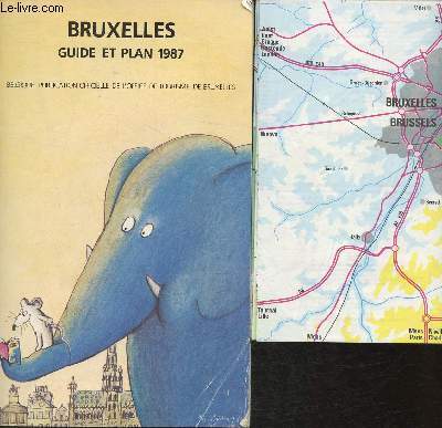
Office de tourisme de Bruxelles
Bruxelles guide et plan 1987
Office de tourisme de Bruxelles. 1987. In-8. Broché. Bon état, Couv. convenable, Dos satisfaisant, Intérieur frais. 96 pages de guide + 1 plan en couleurs in Plano.. . . . Classification Dewey : 912-Atlas, cartes et plans
Référence libraire : RO30320728
|
|
|
OFFICIERS DU CORPS D'ETAT-MAJOR
Carte du Sud-Ouest de Périgueux
INSTITUT GEOGRAPHIQUE NATIONAL. 1955. In-Plano. En feuillets. Bon état, Livré sans Couverture, Dos satisfaisant, Intérieur frais. Carte dépliante en noir et blanc, de 53 x 74 cm. Echelle 1 / 50000. Un itinéraire tracé au feutre rose.. . . A l'italienne. Classification Dewey : 912-Atlas, cartes et plans
Référence libraire : RO80154199
|
|
|
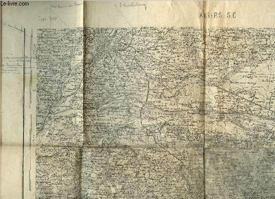
Officiers du Corps d'Etat-Major
Carte d'Etat-Major d'Angers S.O. - Type 1889 - 106
Dépôt de la Guerre. 1894. In-Plano. En feuillets. Etat d'usage, Couv. défraîchie, Dos satisfaisant, Papier jauni. Une carte en noir et blanc dépliante. 34 x 52 cm environ. Echelle : 1/80000. Annotations au crayon.. . . . Classification Dewey : 912-Atlas, cartes et plans
Référence libraire : RO80250503
|
|
|
OFFICIERS DU CORPS D'ETAT MAJOR
CASTRES. CARTE
Imprimerie Lemercier et cie. 1867. In-Plano. En feuillets. Etat d'usage, Couv. défraîchie, Dos satisfaisant, Rousseurs. Carte collée sur toile et pliée, Echelles Métriques, Echelles en Lieues, Echelles en Toises.. . . . Classification Dewey : 912-Atlas, cartes et plans
Référence libraire : RO30009826
|
|
|
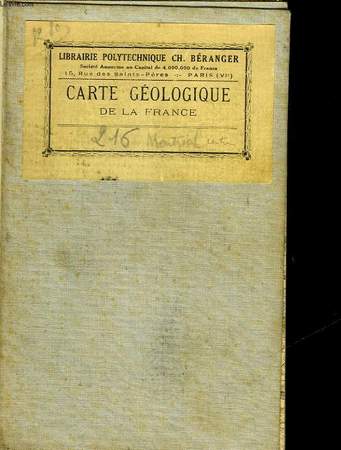
OFFICIERS DU CORPS D'ETAT MAJOR
CASTELNAU 228 - CARTE TOPOGRAPHIQUE DE L'ETAT-MAJOR - CARTE GEOLOGIQUE DETAILLEE
CH. BERANGER EDITEUR. 1865. In-Plano. En feuillets. Bon état, Couv. convenable, Dos satisfaisant, Intérieur frais. 1 carte dépliante entoilée en couleurs. Echelle : 1/80000. Dimensions : 117 x 63 cm.. . . . Classification Dewey : 912-Atlas, cartes et plans
Référence libraire : RO30041835
|
|
|
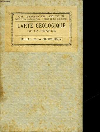
OFFICIERS DU CORPS D'ETAT MAJOR
CHATEAUROUX 133 - CARTE TOPOGRAPHIQUE DE L'ETAT-MAJOR - CARTE GEOLOGIQUE DETAILLEE
CH. BERANGER EDITEUR. 1847. In-Plano. En feuillets. Bon état, Couv. convenable, Dos satisfaisant, Intérieur frais. 1 carte dépliante entoilée en couleurs. Echelle : 1/80000. Dimensions : 166 x 63 cm.. . . . Classification Dewey : 912-Atlas, cartes et plans
Référence libraire : RO30041833
|
|
|
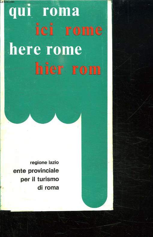
OFFICE PROVINCIAL DU TOURISME DE ROME.
ICI ROME. PETIT GUIDE DE LA VILLE AVEC PLANS ET RENSEIGNEMENTS SUR LA PROVINCE.
CHEZ L AUTEUR.. 1980. In-8. Broché. Bon état, Couv. convenable, Dos satisfaisant, Intérieur frais. 78 pages. Quelques plans en couleurs dans le texte.. . . . Classification Dewey : 912-Atlas, cartes et plans
Référence libraire : R150157679
|
|
|
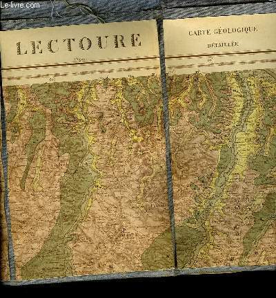
OFFICIERS DU CORPS D'ETAT MAJOR
LECTOURE 217 - CARTE TOPOGRAPHIQUE DE L'ETAT MAJOR - CARTE GEOLOGIE DETAILLEE
NON PRECISE. 1861. In-Plano. En feuillets. Bon état, Couv. convenable, Dos satisfaisant, Intérieur frais. 1 carte dépliante en couleurs entoilée grise. Echelle 1/80000. Dimensions : 112.5 x 61 cm.. . . . Classification Dewey : 912-Atlas, cartes et plans
Référence libraire : RO30041831
|
|
|
OFFICIERS DU CORPS D'ETAT MAJOR
MONTREAL 216 - CARTE TOPOGRAPHIQUE DE L'ETAT MAJOR - CARTE GEOLOGIQUE DETAILLEE
CH. BERANGER EDITEUR. 1858. In-Plano. En feuillets. Bon état, Couv. convenable, Dos satisfaisant, Intérieur frais. 1 carte dépliante entoilée en couleurs. Echelle : 1/80000. Dimensions : 117 x 63 cm.. . . . Classification Dewey : 912-Atlas, cartes et plans
Référence libraire : RO30041834
|
|
|
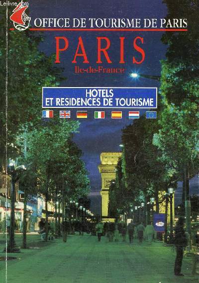
Office de tourisme de Paris
Paris, Ile-de-France : Hôtals et résidences de tourisme
Mairie de Paris. 1995. In-8. Broché. Bon état, Couv. convenable, Dos satisfaisant, Intérieur frais. 184 pages. Quelques photos en couleurs dans le texte et cartes en couleurs hors texte.. . . . Classification Dewey : 912-Atlas, cartes et plans
Référence libraire : RO80240996
|
|
|
OFFICE DE TOURISME.
PLAN DE TOULOUSE.
Crédit Mutuel.. Non daté.. In-8. Broché. Bon état, Couv. convenable, Dos satisfaisant, Intérieur frais. Plan en couleurs de la ville de Toulouse.. . . . Classification Dewey : 912-Atlas, cartes et plans
Référence libraire : RO20076153

|
|
|
office de tourisme de bordeaux
PLAN DE BORDEAUX EDITION 1987 -
OFFICE DE TOURISME DE BORDEAUX. 1987. In-Folio. Broché. Bon état, Couv. convenable, Dos satisfaisant, Intérieur frais. en feuillet d'environ 8 pages -. . . . Classification Dewey : 912-Atlas, cartes et plans
Référence libraire : RO80196483
|
|
|
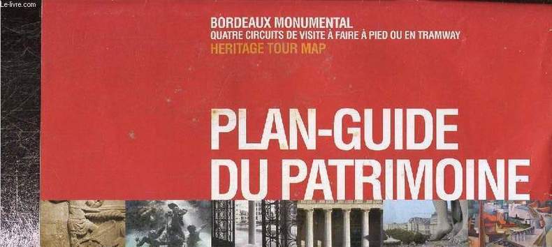
Office du tourisme de Bordeaux
Plan guide du patrimoine, Bordeaux Monumental quatre circuits de visite à faire à pied ou en tramway
Office de tourisme de Bordeaux. Non daté. In-12. Broché. Bon état, Couv. convenable, Dos satisfaisant, Intérieur frais. Environ 20 pages augmentées de nombreuses illustrations en couleurs dans et hors texte. Carte déplinate en couleurs en fin d'ouvrage.. . . . Classification Dewey : 912-Atlas, cartes et plans
Référence libraire : RO80219166
|
|
|
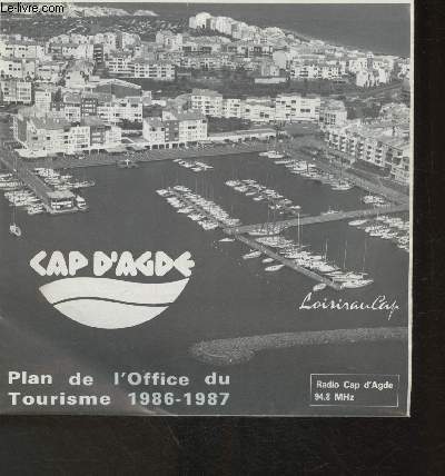
Office du Tourisme du Cap D'Agde
Plan de l'Office du tourime 1986-1987- Cap D'Agde
Office du Tourisme du Cap D'Agde. 1986-1987. In-Plano. Broché. Bon état, Couv. convenable, Dos satisfaisant, Intérieur frais. 1 pages: Un plan en couleurs.. . . . Classification Dewey : 912-Atlas, cartes et plans
Référence libraire : RO30319866
|
|
|
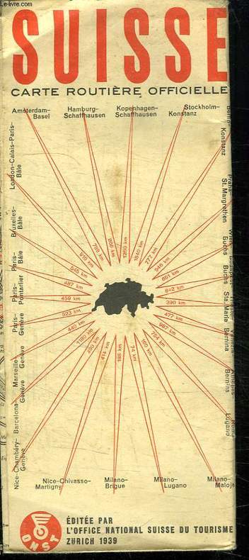
OFFICE NATIONAL SUISSE DU TOURISME.
SUISSE CARTE ROUTIERE OFFICIELLE. 1/ 450 000.
CHEZ L AUTEUR.. 1939.. In-8. Broché. Etat d'usage, Couv. légèrement passée, Dos satisfaisant, Intérieur acceptable. Carte dépliante en couleurs.. . . . Classification Dewey : 912-Atlas, cartes et plans
Référence libraire : R150149601
|
|
|
OFFICE NATIONAL SUISSE DU TOURISME.
SUISSE CARTE ROUTIERE OFFICIELLE. 1/ 450 000.
CHEZ L AUTEUR.. 1939.. In-8 Carré. Broché. Etat d'usage. Couv. légèrement passée. Dos satisfaisant. Intérieur acceptable. Carte dépliante en couleurs.

|
|
|
OFFICE NATIONAL SUISSE DU TOURISME.
SUISSE CARTE ROUTIERE OFFICIELLE. 1/ 450 000.
CHEZ L AUTEUR.. 1938.. In-8 Carré. Broché. Etat d'usage. Couv. légèrement passée. Dos satisfaisant. Intérieur acceptable. Carte dépliante en couleurs.

|
|
|
OFFICE PROVINCIAL DU TOURISME DE ROME.
ICI ROME. PETIT GUIDE DE LA VILLE AVEC PLANS ET RENSEIGNEMENTS SUR LA PROVINCE.
CHEZ L AUTEUR.. 1980. In-8 Carré. Broché. Bon état. Couv. convenable. Dos satisfaisant. Intérieur frais. 78 pages. Quelques plans en couleurs dans le texte.

|
|
|
OGER (F.)
Atlas de géographie générale, à l'usage des lycées, collèges et institutions préparatoires aux écoles du gouvernement, et de tous les établissements d'instruction publique.
Paris, Gauthier-Villars, 1875 In-folio, rel. de l'époque demi-toile noire, 2 ff.n.ch., 31 cartes lithographiées et aquarellées en 26 pl. à double page montées sur onglets.
Référence libraire : 525389
|
|
|
Oger (Félix)
Géographie générale, et géographie de la France physique, militaire, historique, politique, administrative et statistique.
français In-8 de VIII-249-5 pp.; demi-basane cerise, dos lisse orné (reliure de l'époque). Huitième édition. Petit accroc au dos. Sans atlas.
|
|
|
Ogrissek, Rudi
Haack Hausatlas
Gotha, Leipzig: VEB Hermann Haack, Geographisch-Kartographische Anstalt, 1974. 3., überarbeitete und erweiterte Auflage 296 Seiten , 35 cm Gewebeeinband in Einsteckhülle
Référence libraire : 19220

|
|
|
Ogueur (J.)
Carte touristique du Nord-Finistère.
français Sans date (circa 1930). Carte dépliante : 53x74 cm. Sous chemise de l'éditeur. Avec publicités locales au dos de la carte. Petit manque à l'angle supérieur du second plat.
|
|
|
Ohainski, Uwe. Reitemeier, Arnd
Das Fürstentum Braunschweig - Wolfenbüttel im Jahr 1574. Der Atlas des Gottlieb Mascop.
Bielefeld., Verlag für Regionalgeschichte., 2012. Herausgegeben von Uwe Ohainski und Arnd Reitemeier. 230 Seiten mit vielen Abbildungen (in Farbe und Schwarzweiß) im Text, 28 Tafelseiten im Anhang mit je einer Kommentar seiten, 7 weitere Kartenseiten im Anhang. Guter Zustand. Erschien vermutlich zur Ausstellung im Städtischen Museum Braunschweig: "Vermessen gannz furstenthumb Braunschweig. Der älteste Ämteratlas aus Niedersachsen". Quer - 2°. OPappband.
Référence libraire : 062249
|
|
|
OHIO / ATLAS / BIRD'S EYE VIEWS AND MAPS
Atlas of Athens Co. Ohio. From actual Surveys by and under the directions of D. J. Lake C.E. to which is added A Township Map of the State of Ohio. Cover title: Atlas of Athens Co. Ohio.
Philadelphia.: Titus Simmons & Titus. 1875. Large folding handcoloured map 23 3/4 x 23 1/2 inches folding handcolored street map Nelsonville full page hand coloured maps full page black and white lithographic illustrations 88pp 16 1/2 x 14 1/2 inches gilt lettered decorative embossed cloth covered boards hardbound. Wear to cover extremities exposing edges of boards head of spine split a few small abraded areas on back cover; interior has scattered foxing and soiled areas in margins occasional pencil mark creases and foxing to front endpaper overall toning / soiling to map of Carthage. Large folding map has 1 inch separation along one fold the extra large Nelsonville map which folds out has a short split at the centre of the lower fold being rather tricky to fold out from the atlas. Overall the atlas is in bright condition with tight binding. A fine example of an American county atlas testimony to a county with proud and industrious landowners and businesses. Among the interesting views are small interior vignettes of the interiors of Scott's Drug Store and Carnes & Shephard's Store in Nelsonville Ohio. This antique atlas includes an attractive large folding map: Railroad & Township Map of the State of Ohio with a decorative border and vignette illustration of the State Capitol at Columbus in the lower right corner plus a folding street map of Nelsonville. There are full page maps of Townships and Towns some with more than one map to a page. The bird's eye views of the local landscapes city views and portraits of important figures are particularly richly lithographed. . Titus, Simmons & Titus. hardcover
Référence libraire : 41248
|
|
|
ohne Agaben
CH Touring: Die Schweiz und Grenzgebiete - Automobilführer 1974/ 1975
Bern, Hallwag AG, 1974. 264, 271 Seiten , 24 cm, Hardcover/Pappeinband
Référence libraire : 50471

|
|
|
ohne Agaben
CH Touring: Die Schweiz und Grenzgebiete - Automobilführer 1966/ 1967
Bern, Hallwag AG, 1966. 246, 256 Seiten , 24 cm, Hardcover/Pappeinband
Référence libraire : 50321

|
|
|
ohne Angabe
Atlas der Weltwunder Faszinierende Bauwerke und Monumente - Vom Kolosseum zum Tadsch Mahd
Gütersloh: Bertelsmann Club GmbH, 1992. 240 Seiten , 30 cm, Pappeinband mit Schutzumschlag
Référence libraire : 7791

|
|
|
ohne Angabe
Kleiner Schulatlas. Vorläufige Ausgabe 1946. farbige Karten
Berlin - Leipzig, Volk und Wissen, 1946. 32 S., mit farbigen Karten, 4° OKarton, Klammerheftung
Référence libraire : 164842

|
|
|
ohne Angabe , ohne Autor
Adelboden - Le
ohne Angabe. ca 1900 Postkartenheft mit 10 schwarzweiss Ansichten von Adelboden /
Référence libraire : 40411

|
|
|
ohne Angabe , ohne Autor
Album von Weimar. - Leporello
Jena, Verlag der Frommann'schen Hofbuchhandlung (Armin Bräunlich), o. J. (vor 1900) 1900. 20 Ansichten, s/w Photographien der Stadt in Leporello-Form, 10,5x13,5cm (Querformat)
Référence libraire : 40749

|
|
|
ohne Angabe , ohne Autor
Dresden - Leporello mit 20 Ansichten
Dresden, Römmler & Jonas 1894. 20 Fotografien (Lichtdrucke), 14,6 x 9,6 cm, roter Kaliko - Einband, Einband wasserfleckig, Leporello mit 20 Abb. montiert auf Karton, sonst Exemplar in gutem Erhaltungszustand
Référence libraire : 58636

|
|
|
ohne Angabe , ohne Autor
Frederiksborg Slot - 10 udvalgte Billeder
C. Rathsach, Hillerbrod Eneret ca. 1900. querformat: 22 x 12,5 cm Leporello mit 10 schwarzweiss Fotos, Exemplar in gutem Erhaltungszustand
Référence libraire : 40409

|
|
|
ohne Angabe , ohne Autor
Hildesheim : 20 der schönsten Ansichten in Postkartenform, in feinstem Kupfertiefdruck-Verfahren
Cassel : Kunstverlagsanstalt Bruno Hansmann. 20 monochrome Ansichtskarten, 14 x 9 cm Leporello im Kartonumschlag, Exemplar in gutem Erhaltungszustand
Référence libraire : 40419

|
|
|
ohne Angabe , ohne Autor
Leipzig 1813 - 1913 - Album - Leporello
Darmstadt, Zedler & Vogel ohne Jahr (1913). 1913. 20 Ansichten in schwarzweiss Leporello, Einband fleckig, sonst Exemplar in gutem Erhaltungszustand
Référence libraire : 40748

|
|
|
ohne Angabe , ohne Autor
Luftkurort Freudenstadt im Schwarzwald 730 m ü. M. mit Umgebung - Postkarten-Leporello
Tübingen, Sting. 10 Ansichtskarten im Kupfertiefdruck Leporello mit Postkarten, Exemplar in gutem Erhaltungszustand
Référence libraire : 40758

|
|
|
ohne Angaben
JRO Welt Atlas
München, JRO Kartografische Verlagsgesellschaft, 1987. 246 Seiten , 19 cm, Hardcover/Pappeinband
Référence libraire : 47846

|
|
|
OIZON René et alii
Atlas mondial.
Paris, Larousse, 1996. 24 x 32, 48 pp., très nombreuses cartes en couleurs, reliure d'édition pleine toile + jaquette, bon état.
Référence libraire : 39400 ISBN : 2035212081
|
|
|
Oldenhof, H
Lytse Schotanus Atlas
Fryske Akademy, Leeuwarden, 1967. 4°, quer, 143 S., zahlr. s/w Karten, , Because of nonsensical laws, orders outside of Germany will only be carried out if the delivery is made to an address in Germany! Lieferungen NUR an Adressen in Deutschland! Bezahlung per PayPal möglich, we accept PayPal, , Einb. min. beschabt u. min. bestoßen u. ger. angeschmutzt, Schnitte angeschmutzt, altersbed. Bräunungen, ger. Gebr.sp., Leinen
Référence libraire : 38086
|
|
|
OLIVIER CAMBESSEDES
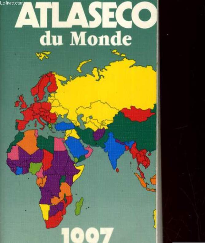
ATLASECO DU MONDE. EDITION 1997
EOC. 1996. In-12. Broché. Bon état, Couv. convenable, Dos satisfaisant, Intérieur frais. 711 pages. Nombreuses cartes en noir et blanc, dans le texte. Tampons sur la page de tire et la tranche.. . . . Classification Dewey : 912-Atlas, cartes et plans
Référence libraire : RO20144952 ISBN : 290976608
|
|
|
OLIVIER CAMBESSEDES
ATLASECO DE POCHE. EDITION 1988. ATLAS ECONOMIQUE MONDIAL
EDITIONS S.G.B.. 1988. In-12. Cartonné. Bon état, Couv. convenable, Dos satisfaisant, Intérieur frais. 655 pages.. . . . Classification Dewey : 912-Atlas, cartes et plans
Référence libraire : RO20139172
|
|
|
OLIVIER CAMBESSEDES
ATLASECO DE POCHE. EDITION 1993. ATLAS ECONOMIQUE MONDIAL.
LES EDITIONS DU SERAIL. 1993. In-12. Cartonné. Etat d'usage, Couv. légèrement passée, Dos fané, Intérieur frais. 927 pages. Premier plat illustré en couleurs. Cartes en noir et gris dans le texte.. . . . Classification Dewey : 912-Atlas, cartes et plans
Référence libraire : R260134567
|
|
|
OLIPHANT MARGARET
ATLAS DU MONDE ANTIQUE.
FRANCE LOISIRS / SOLAR. 1994. In-4. Relié. Bon état, Couv. convenable, Dos satisfaisant, Intérieur frais. 220 pages. Nombreuses illustrations en couleur et en noir et blanc dans le format hors texte.. . . . Classification Dewey : 912-Atlas, cartes et plans
Référence libraire : R240047347
|
|
|
OLIVIER CAMBESSEDES
ATLASECO DU MONDE 1997
LES EDITIONS EOC. 1996. In-12. Broché. Bon état, Couv. convenable, Dos satisfaisant, Intérieur frais. 712 pages. Premier plat illustré en couleurs. Nombreuses cartes et tableaux.. . . . Classification Dewey : 912-Atlas, cartes et plans
Référence libraire : R260170672 ISBN : 290976608
|
|
|
OLIPHANT MARGARET
L'ATALS DU MONDE ANTIQUE
FRANCE LOISIRS. 1994. In-4. Cartonné. Bon état, Couv. convenable, Dos satisfaisant, Intérieur frais. 220 pages - nombreuses photos, illustrations et cartes en noir et blanc et en couleurs dans et hors texte.. . . . Classification Dewey : 912-Atlas, cartes et plans
Référence libraire : RO20176255
|
|
|
OLIPHANT MARGARET
L'ATLAS DU MONDE ANTIQUE.
FRANCE LOISIRS. 1993. In-4. Relié. Bon état, Couv. convenable, Dos satisfaisant, Intérieur frais. 220 pages - nombreuses illustrations, cartes en couleurs et en noir et blanc dans et hors texte - petite annotation sur la page de titre.. . . . Classification Dewey : 912-Atlas, cartes et plans
Référence libraire : R240138180
|
|
|
OLIPHANT, Margaret.
L'Atlas du Monde Antique.
Paris, France Loisirs, 1993. in-4 (25x31), 220 pp., illustrations N/B et en couleurs, index, cartonnage editeur illustre
Référence libraire : 19823
|
|
|
OLIPHANT, Margaret.
L'Atlas du Monde Antique.
in-4 (25x31), 220 pp., illustrations N/B et en couleurs, index, cartonnage editeur illustre Bel exemplaire [PIL-HA4]
|
|
 Recevoir par e-mail
 Télécharger en PDF
 Flux RSS


