|
o. Angabe
Harms Weltatlas Ausgabe Mecklenburg-Vorpommern
Hannover: Schroedel Schulbuchverlag GmbH, 1996. 138 Seiten , , 32 cm, Pappeinband
書籍販売業者の参照番号
: 16

|
|
|
o. Autor
Atlas National Geographic. Europa I.
[Barcelona], RBA Coleccionables, 2004. 37 cm, 95 Seiten, mit zahlreichen Karten und Farbfotos, schwarzer farbig illustrierter Hochglanzpappband. Edición española Kapitale und Kanten leicht bestoßen, gut bis sehr gut erhalten. National Geographic.
書籍販売業者の参照番号
: 32032AB
|
|
|
o. Autor
Beckmanns Neues Welt-Lexikon mit Welt-Atlas. A-Z.
München, G. Freytag Verlag, 1957. 8°, 2555, X, 42, 85 Seiten, mit zahlreichen Illustrationen, Abbildungen und einigen Karten zum Ausklappen, blaues Leinen, gelber Kopfschnitt, goldgeprägter Rückentitel und Deckelvignette. Siebente Nachkriegsauflage Schutzumschlag fehlt, oberes Kapital berieben, Rücken hinten angeplatzt, Namenseintrag auf fliegendem Blatt, sonst recht gut erhalten.
書籍販売業者の参照番号
: 11488AB
|
|
|
o. Autor
Road Atlas & Travel Guide. United States / Canada / Mexico. Outdoors with Liberty Mutual.
[Skokie/Illinois], Rand McNally & Company, 1969. 28 cm, 96 Seiten, mit zahlreichen Karten, broschiert. Einband mit Gebrauchsspurenm gut erhalten.
書籍販売業者の参照番号
: 32878AB
|
|
|
o. Autor
Road Atlas of Great Britain.
London, George Philip & Son, 1972. 29 cm, 88, 72 (Index) Seiten, rotes Kunstleder. leichte Gebrauchs- und Lagerspuren, Kopfschnitt etwas stockfleckig, gut erhalten.
書籍販売業者の参照番号
: 3527AB
|
|
|
oA
Volks-Atlas Volksatlas - mit 24 Haupt- und 9 Nebenkarten, 8 Seiten Text und 16 Seiten Ortsnamenverzeichnis
Berlin, Drei Türme Verlag, ca1930. PP, gutes Exemplar
書籍販売業者の参照番号
: 10328
|
|
|
oA, <ohne Autorenangabe>
Der grosse Reader`s Digest Weltatlas
Stuttgart ; Zürich ; Wien : Verlag Das Beste G.m.b.H. 1966. 4. revidierte Auflage 1 Atlas (217 Seiten) : Illustrationen ; 40 cm Halbleder
書籍販売業者の参照番号
: 76093

|
|
|
OAKLAND: PLAT MAP ATLAS
Thomas Bros. Block Book of Oakland CA: Allendale District 10.
Oakland & Los Angeles: Thomas Bros. 1924. First and only edition. Oblong folio 15 1/2 x 8 1/2 inches. Key map of Allendale in color index leaf and maps in blue numbered 901-966. The plate maps are all in blue and printed on rectos only. Publisher's two-post binding of quarter red over black cloth gilt cover lettering floral pastedowns. Spine rubbed and edges strengthened but overall a very attractive and complete copy of this scarce real estate atlas.For many of us the firm Thomas Bros. connotes street guides used by drivers to find addresses but in the early 20th century they also made plate books for realtors. Indeed this copy seems to have been owned by a realtor as there are numerous corrections and in-fillings in pencil giving the correct homeowner's name etc. Allendale is a former settlement in Alameda County California now annexed to Oakland.1 It was located 1.5 miles 2.4 km northeast of Fruitvale. A post office opened in 1903 and by 1908 was a branch of the Oakland post office. Allendale was named for Charles E. Allen a real estate broker. The commercial district of Allendale is located along 38th Avenue up and down from where it crosses Allendale Avenue. Allendale Elementary School is located there. Allendale is on what might be called the cinema archipelago of East Oakland. Each commercial district with an exception or two had a theatre beginning with the 1920s or so. This applied to not only Allendale District but nearby Laurel which had two Fairfax Dimond and Fruitvale which had a second one nearby at Foothill and 35th Avenue and another at the foot of Park Boulevard on the east side of the lake. The Allendale theatre like most of the others has been converted to another use. The one that has continued in use as a theatre is the Grand Lake at the edge of East Oakland at the north end of Lake Merritt. Thomas Bros. hardcover
書籍販売業者の参照番号
: 74441
|
|
|
Obscura, Atlas
The Explorer's Library
Workman Publishing (11/2022)
書籍販売業者の参照番号
: SVALIVCN-9781523520954
|
|
|
Obscura Atlas
Atlas Obscura Wall Calendar 2018
Workman Publishing Company. CALENDAR. 1523501553 . New. Workman Publishing Company unknown
書籍販売業者の参照番号
: D8-402DIA ISBN : 1523501553 9781523501557

|
|
|
OBSHCHESLAVYANSKII LINGVISTICHESKII ATLAS
Seriya leksiko-slovoobrazovatel'naya.
Hardback. 1988. Vypusk 1. Zhivotnyi Mir. 188pp including 48 maps 4to Moscow 1988. VG . hardcover
書籍販売業者の参照番号
: HALL333031
|
|
|
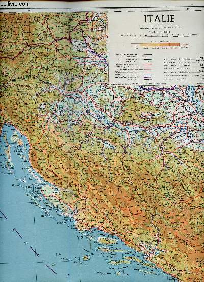
ODEL
Carte de l'Italie
ODEL. Non daté. In-4. Broché. Bon état, Couv. convenable, Dos satisfaisant, Papier jauni. Une carte en couleur et en noir et blanc, d'environ 70cm x 60cm. Une face en couleur représentant l'Italie en entier. L'autre face est composée de plusiseurs cartes en noir et blanc sur divers sujets.. . . . Classification Dewey : 912-Atlas, cartes et plans
書籍販売業者の参照番号
: RO30345948
|
|
|
ODEL
Carte de la Péninsule Ibérique
ODEL. Non daté. In-4. Broché. Bon état, Couv. convenable, Dos satisfaisant, Papier jauni. Une carte en couleur et en noir et blanc, d'environ 80cm x 50cm. Une face en couleur représentant la Péninsule Ibérique en entier. L'autre face est composée de plusiseurs cartes en noir et blanc sur divers sujets.. . . . Classification Dewey : 912-Atlas, cartes et plans
書籍販売業者の参照番号
: RO30345947
|
|
|
ODEL
Carte de l'URSS et des Démocraties Populaires
ODEL. Non daté. In-4. Broché. Bon état, Couv. convenable, Dos satisfaisant, Intérieur frais. Une carte en couleur d'environ 1m sur 1m. Une face représentant l'URSS, l'autre représentant la Pologne, la Tchécoslovaquie, la Hongrie, la Bulgarie et la Roumanie. Carte contenue dans une enveloppe en état d'usage.. . . . Classification Dewey : 912-Atlas, cartes et plans
書籍販売業者の参照番号
: RO30345946

|
|
|
Oehme, Ruthardt
Geschichte der Kartographie des deutschen Südwestens
Konstanz und Stuttgart, Jan Thorbecke Verlag, 1961. Mit 16 Farbtafeln und 42 s/w-Karten von Martin Waldseemüller, Sebastian Münster, Johann Georg Tibianus, Wilhelm Schickhardt, Johann Andreas Rauch, Johann Ulrich Stirlin, Daniel Meyer, Josef Anton Feuchtmayer, August Gottlieb Preuschen u.a. Herausgegeben von der Kommission für geschichtliche Landeskunde in Baden-Württemberg. EA., OLwd. m. OU., 168 S., 4to - Reihe: Arbeiten zum historischen Atlas von Südwestdeutschland Band III.
書籍販売業者の参照番号
: 20694

|
|
|
OEKONOMIDES AL. N.
L ACROPOLE D ATHENE
N. GOUVOUSSIS EDITEUR. 1975. In-8. Broché. Bon état, Couv. convenable, Dos satisfaisant, Intérieur frais. 31 pages augmentées de nombreuses photos en couleur + une carte.. . . . Classification Dewey : 912-Atlas, cartes et plans
書籍販売業者の参照番号
: RO80163948
|
|
|
Oelsner, O.
Atlas of the Most Important Ore Mineral Parageneses Under the Microscope
311 pages. First published in German in 1961. "A pictorial record of ore minerals as seen in reflected light. Contains some five-hundred black and white photos of which twenty-three are repeated in colour. The minerals are classified according to their paragenesis and each section of the book commences with notes on the genesis of the ores and on the particular association of ore minerals occurring in the paragenesis. This is accompanied by a tabular statement of the chemical composition, crystal system, three strongest X-ray powder reflections, relative hardness, colour, reflectivity, anistropy, and notes on the twinning and other characteristics of the individual minerals." - from dust jacket. Above-average wear. Usual library markings. Binding intact. Worthy reference copy. Book

|
|
|
Oestergaard
Die Deutsche Heimat im Bild. = Ostergaards Handatlas "Karte und Bild" - Neue Ausgabe in Einzelbänden.
Berlin, Verlag Oestergaard, 1937. 2. Aufl. mit 257 Kupfertiefdruckphotos (in Grünton). (blaue) ill. OLwd., 231 S., 4° (=30 cm)
書籍販売業者の参照番号
: 2203

|
|
|
Oestrem, G.. Haakensen, N.. Melander, O
Atlas over breer i Noird-Skandinavia: Glaciers Atlas in Northern Scandinavia. Norges Vassdrags- og Elektrisitetsvesen.
(Oslo)., Hydrologisk Avdeling - (Meddelelse nr. 22) - og Stockholms Universitet (Meddelande nr. 46 fran Naturgeografiska Institutionen)., 1973. 315 Seiten mit zahlreichen Tabellen, Karten und Fotografien. 2 gefaltete Übersichtskarten (Brekart over Nordskandiinavia, Nordre Blad, Sondre Blad) in hinterer Buchtasche. Zustand: Aus einer Institutsbibliothek ausgeschieden, unterer Rücken mit kleinem Gewebeaufkleber, Titelblatt mit Bibliotheksstempel und Inventarnummer. Rückenkanten eingerissen (einfach geklebt), Einbandkanten leicht berieben und mit kleinen Einrissen. Quer-4°. S OKarton (mit Leinenstreifen).
書籍販売業者の参照番号
: 063203
|
|
|
Oestrem, G.. Ziegler, T
Atlas over breer i Sør-Norge: Atlas of glaciers in south Norway. Norges Vassdrags- og Elektrisitetsvesen.
(Oslo)., Hydrologisk Avdeling - (Meddelelse nr. 20)., 1969. 207 Seiten mit zahlreichen Tabellen, Karten und Fotografien. Eine gefaltete Übersichtskarte (Norges Vassdrags- og Elektrisitetsvesen. Brekart over Sor-Norge) in hinterer Buchtasche. Zustand: Aus einer Institutsbibliothek ausgeschieden, unterer Rücken mit kleinem Gewebeaufkleber, Titelblatt mit Bibliotheksstempel und Inventarnummer. Einbandkanten leicht beriben, letzte Seite mit Randeinrissen. Quer-4°. S OKarton (mit Leinenstreifen).
書籍販売業者の参照番号
: 063202
|
|
|
OFFICIERS DU CORPS D'ETAT MAJOR
AIGURANDE 144 - CARTE TOPOGRAPHIQUE DE L'ETAT-MAJOR - CARTE GEOLOGIQUE DETAILLEE
CH. BERANGER EDITEUR. 1850. In-Plano. En feuillets. Bon état, Couv. convenable, Dos satisfaisant, Intérieur frais. 1 carte dépliante en couleurs entoilée grise/bleue. Echelle : 1/80.000. Dimensions : 65 x 62,5 cm.. . . . Classification Dewey : 912-Atlas, cartes et plans
書籍販売業者の参照番号
: RO30041832
|
|
|
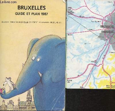
Office de tourisme de Bruxelles
Bruxelles guide et plan 1987
Office de tourisme de Bruxelles. 1987. In-8. Broché. Bon état, Couv. convenable, Dos satisfaisant, Intérieur frais. 96 pages de guide + 1 plan en couleurs in Plano.. . . . Classification Dewey : 912-Atlas, cartes et plans
書籍販売業者の参照番号
: RO30320728
|
|
|
OFFICIERS DU CORPS D'ETAT-MAJOR
Carte du Sud-Ouest de Périgueux
INSTITUT GEOGRAPHIQUE NATIONAL. 1955. In-Plano. En feuillets. Bon état, Livré sans Couverture, Dos satisfaisant, Intérieur frais. Carte dépliante en noir et blanc, de 53 x 74 cm. Echelle 1 / 50000. Un itinéraire tracé au feutre rose.. . . A l'italienne. Classification Dewey : 912-Atlas, cartes et plans
書籍販売業者の参照番号
: RO80154199
|
|
|
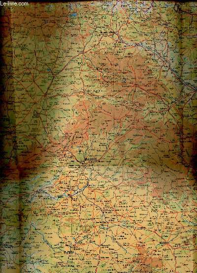
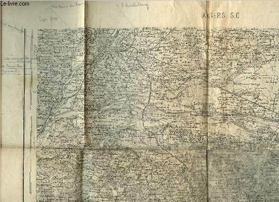
Officiers du Corps d'Etat-Major
Carte d'Etat-Major d'Angers S.O. - Type 1889 - 106
Dépôt de la Guerre. 1894. In-Plano. En feuillets. Etat d'usage, Couv. défraîchie, Dos satisfaisant, Papier jauni. Une carte en noir et blanc dépliante. 34 x 52 cm environ. Echelle : 1/80000. Annotations au crayon.. . . . Classification Dewey : 912-Atlas, cartes et plans
書籍販売業者の参照番号
: RO80250503
|
|
|
OFFICIERS DU CORPS D'ETAT MAJOR
CASTRES. CARTE
Imprimerie Lemercier et cie. 1867. In-Plano. En feuillets. Etat d'usage, Couv. défraîchie, Dos satisfaisant, Rousseurs. Carte collée sur toile et pliée, Echelles Métriques, Echelles en Lieues, Echelles en Toises.. . . . Classification Dewey : 912-Atlas, cartes et plans
書籍販売業者の参照番号
: RO30009826
|
|
|
OFFICIERS DU CORPS D'ETAT MAJOR
CASTELNAU 228 - CARTE TOPOGRAPHIQUE DE L'ETAT-MAJOR - CARTE GEOLOGIQUE DETAILLEE
CH. BERANGER EDITEUR. 1865. In-Plano. En feuillets. Bon état, Couv. convenable, Dos satisfaisant, Intérieur frais. 1 carte dépliante entoilée en couleurs. Echelle : 1/80000. Dimensions : 117 x 63 cm.. . . . Classification Dewey : 912-Atlas, cartes et plans
書籍販売業者の参照番号
: RO30041835
|
|
|
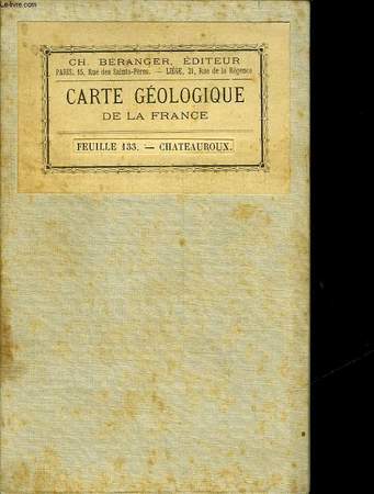
OFFICIERS DU CORPS D'ETAT MAJOR
CHATEAUROUX 133 - CARTE TOPOGRAPHIQUE DE L'ETAT-MAJOR - CARTE GEOLOGIQUE DETAILLEE
CH. BERANGER EDITEUR. 1847. In-Plano. En feuillets. Bon état, Couv. convenable, Dos satisfaisant, Intérieur frais. 1 carte dépliante entoilée en couleurs. Echelle : 1/80000. Dimensions : 166 x 63 cm.. . . . Classification Dewey : 912-Atlas, cartes et plans
書籍販売業者の参照番号
: RO30041833
|
|
|
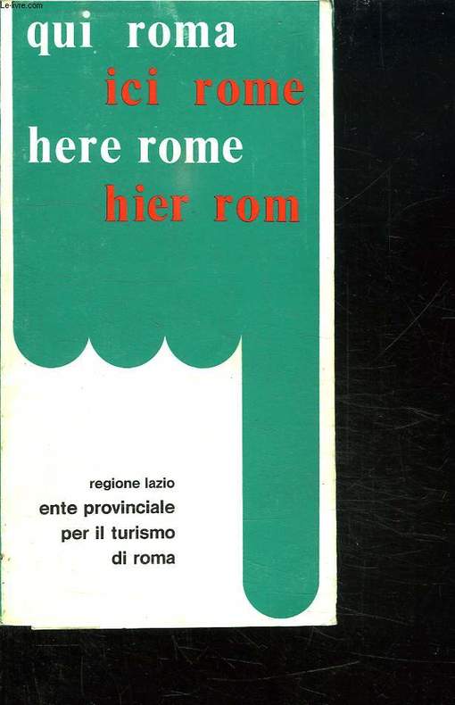
OFFICE PROVINCIAL DU TOURISME DE ROME.
ICI ROME. PETIT GUIDE DE LA VILLE AVEC PLANS ET RENSEIGNEMENTS SUR LA PROVINCE.
CHEZ L AUTEUR.. 1980. In-8. Broché. Bon état, Couv. convenable, Dos satisfaisant, Intérieur frais. 78 pages. Quelques plans en couleurs dans le texte.. . . . Classification Dewey : 912-Atlas, cartes et plans
書籍販売業者の参照番号
: R150157679
|
|
|
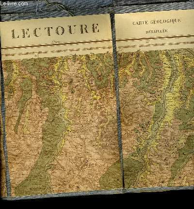
OFFICIERS DU CORPS D'ETAT MAJOR
LECTOURE 217 - CARTE TOPOGRAPHIQUE DE L'ETAT MAJOR - CARTE GEOLOGIE DETAILLEE
NON PRECISE. 1861. In-Plano. En feuillets. Bon état, Couv. convenable, Dos satisfaisant, Intérieur frais. 1 carte dépliante en couleurs entoilée grise. Echelle 1/80000. Dimensions : 112.5 x 61 cm.. . . . Classification Dewey : 912-Atlas, cartes et plans
書籍販売業者の参照番号
: RO30041831
|
|
|
OFFICIERS DU CORPS D'ETAT MAJOR
MONTREAL 216 - CARTE TOPOGRAPHIQUE DE L'ETAT MAJOR - CARTE GEOLOGIQUE DETAILLEE
CH. BERANGER EDITEUR. 1858. In-Plano. En feuillets. Bon état, Couv. convenable, Dos satisfaisant, Intérieur frais. 1 carte dépliante entoilée en couleurs. Echelle : 1/80000. Dimensions : 117 x 63 cm.. . . . Classification Dewey : 912-Atlas, cartes et plans
書籍販売業者の参照番号
: RO30041834
|
|
|
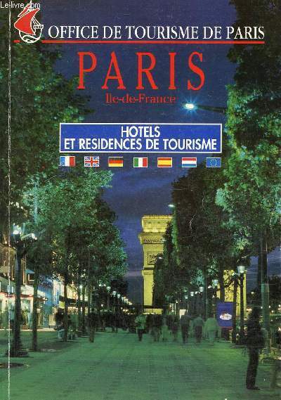
Office de tourisme de Paris
Paris, Ile-de-France : Hôtals et résidences de tourisme
Mairie de Paris. 1995. In-8. Broché. Bon état, Couv. convenable, Dos satisfaisant, Intérieur frais. 184 pages. Quelques photos en couleurs dans le texte et cartes en couleurs hors texte.. . . . Classification Dewey : 912-Atlas, cartes et plans
書籍販売業者の参照番号
: RO80240996
|
|
|
OFFICE DE TOURISME.
PLAN DE TOULOUSE.
Crédit Mutuel.. Non daté.. In-8. Broché. Bon état, Couv. convenable, Dos satisfaisant, Intérieur frais. Plan en couleurs de la ville de Toulouse.. . . . Classification Dewey : 912-Atlas, cartes et plans
書籍販売業者の参照番号
: RO20076153

|
|
|
office de tourisme de bordeaux
PLAN DE BORDEAUX EDITION 1987 -
OFFICE DE TOURISME DE BORDEAUX. 1987. In-Folio. Broché. Bon état, Couv. convenable, Dos satisfaisant, Intérieur frais. en feuillet d'environ 8 pages -. . . . Classification Dewey : 912-Atlas, cartes et plans
書籍販売業者の参照番号
: RO80196483
|
|
|
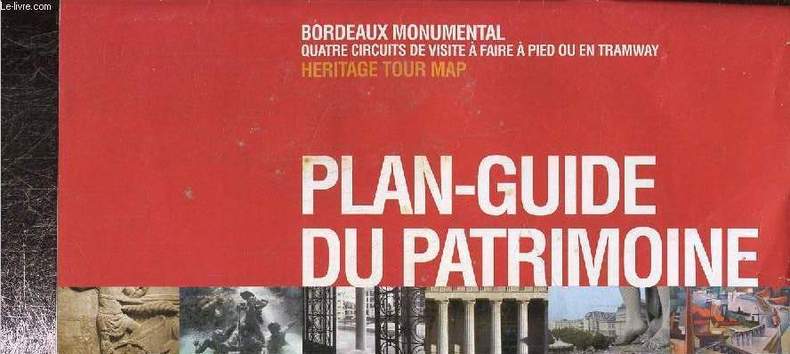
Office du tourisme de Bordeaux
Plan guide du patrimoine, Bordeaux Monumental quatre circuits de visite à faire à pied ou en tramway
Office de tourisme de Bordeaux. Non daté. In-12. Broché. Bon état, Couv. convenable, Dos satisfaisant, Intérieur frais. Environ 20 pages augmentées de nombreuses illustrations en couleurs dans et hors texte. Carte déplinate en couleurs en fin d'ouvrage.. . . . Classification Dewey : 912-Atlas, cartes et plans
書籍販売業者の参照番号
: RO80219166
|
|
|
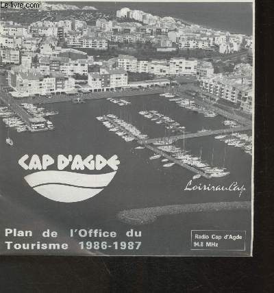
Office du Tourisme du Cap D'Agde
Plan de l'Office du tourime 1986-1987- Cap D'Agde
Office du Tourisme du Cap D'Agde. 1986-1987. In-Plano. Broché. Bon état, Couv. convenable, Dos satisfaisant, Intérieur frais. 1 pages: Un plan en couleurs.. . . . Classification Dewey : 912-Atlas, cartes et plans
書籍販売業者の参照番号
: RO30319866
|
|
|
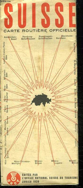
OFFICE NATIONAL SUISSE DU TOURISME.
SUISSE CARTE ROUTIERE OFFICIELLE. 1/ 450 000.
CHEZ L AUTEUR.. 1939.. In-8. Broché. Etat d'usage, Couv. légèrement passée, Dos satisfaisant, Intérieur acceptable. Carte dépliante en couleurs.. . . . Classification Dewey : 912-Atlas, cartes et plans
書籍販売業者の参照番号
: R150149601
|
|
|
OFFICE NATIONAL SUISSE DU TOURISME.
SUISSE CARTE ROUTIERE OFFICIELLE. 1/ 450 000.
CHEZ L AUTEUR.. 1939.. In-8 Carré. Broché. Etat d'usage. Couv. légèrement passée. Dos satisfaisant. Intérieur acceptable. Carte dépliante en couleurs.

|
|
|
OFFICE NATIONAL SUISSE DU TOURISME.
SUISSE CARTE ROUTIERE OFFICIELLE. 1/ 450 000.
CHEZ L AUTEUR.. 1938.. In-8 Carré. Broché. Etat d'usage. Couv. légèrement passée. Dos satisfaisant. Intérieur acceptable. Carte dépliante en couleurs.

|
|
|
OFFICE PROVINCIAL DU TOURISME DE ROME.
ICI ROME. PETIT GUIDE DE LA VILLE AVEC PLANS ET RENSEIGNEMENTS SUR LA PROVINCE.
CHEZ L AUTEUR.. 1980. In-8 Carré. Broché. Bon état. Couv. convenable. Dos satisfaisant. Intérieur frais. 78 pages. Quelques plans en couleurs dans le texte.

|
|
|
OGER (F.)
Atlas de géographie générale, à l'usage des lycées, collèges et institutions préparatoires aux écoles du gouvernement, et de tous les établissements d'instruction publique.
Paris, Gauthier-Villars, 1875 In-folio, rel. de l'époque demi-toile noire, 2 ff.n.ch., 31 cartes lithographiées et aquarellées en 26 pl. à double page montées sur onglets.
書籍販売業者の参照番号
: 525389
|
|
|
Oger (Félix)
Géographie générale, et géographie de la France physique, militaire, historique, politique, administrative et statistique.
français In-8 de VIII-249-5 pp.; demi-basane cerise, dos lisse orné (reliure de l'époque). Huitième édition. Petit accroc au dos. Sans atlas.
|
|
|
Ogrissek, Rudi
Haack Hausatlas
Gotha, Leipzig: VEB Hermann Haack, Geographisch-Kartographische Anstalt, 1974. 3., überarbeitete und erweiterte Auflage 296 Seiten , 35 cm Gewebeeinband in Einsteckhülle
書籍販売業者の参照番号
: 19220

|
|
|
Ogueur (J.)
Carte touristique du Nord-Finistère.
français Sans date (circa 1930). Carte dépliante : 53x74 cm. Sous chemise de l'éditeur. Avec publicités locales au dos de la carte. Petit manque à l'angle supérieur du second plat.
|
|
|
Ohainski, Uwe. Reitemeier, Arnd
Das Fürstentum Braunschweig - Wolfenbüttel im Jahr 1574. Der Atlas des Gottlieb Mascop.
Bielefeld., Verlag für Regionalgeschichte., 2012. Herausgegeben von Uwe Ohainski und Arnd Reitemeier. 230 Seiten mit vielen Abbildungen (in Farbe und Schwarzweiß) im Text, 28 Tafelseiten im Anhang mit je einer Kommentar seiten, 7 weitere Kartenseiten im Anhang. Guter Zustand. Erschien vermutlich zur Ausstellung im Städtischen Museum Braunschweig: "Vermessen gannz furstenthumb Braunschweig. Der älteste Ämteratlas aus Niedersachsen". Quer - 2°. OPappband.
書籍販売業者の参照番号
: 062249
|
|
|
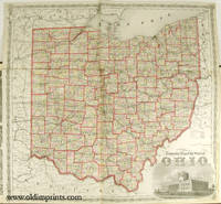
OHIO / ATLAS / BIRD'S EYE VIEWS AND MAPS
Atlas of Athens Co. Ohio. From actual Surveys by and under the directions of D. J. Lake C.E. to which is added A Township Map of the State of Ohio. Cover title: Atlas of Athens Co. Ohio.
Philadelphia.: Titus Simmons & Titus. 1875. Large folding handcoloured map 23 3/4 x 23 1/2 inches folding handcolored street map Nelsonville full page hand coloured maps full page black and white lithographic illustrations 88pp 16 1/2 x 14 1/2 inches gilt lettered decorative embossed cloth covered boards hardbound. Wear to cover extremities exposing edges of boards head of spine split a few small abraded areas on back cover; interior has scattered foxing and soiled areas in margins occasional pencil mark creases and foxing to front endpaper overall toning / soiling to map of Carthage. Large folding map has 1 inch separation along one fold the extra large Nelsonville map which folds out has a short split at the centre of the lower fold being rather tricky to fold out from the atlas. Overall the atlas is in bright condition with tight binding. A fine example of an American county atlas testimony to a county with proud and industrious landowners and businesses. Among the interesting views are small interior vignettes of the interiors of Scott's Drug Store and Carnes & Shephard's Store in Nelsonville Ohio. This antique atlas includes an attractive large folding map: Railroad & Township Map of the State of Ohio with a decorative border and vignette illustration of the State Capitol at Columbus in the lower right corner plus a folding street map of Nelsonville. There are full page maps of Townships and Towns some with more than one map to a page. The bird's eye views of the local landscapes city views and portraits of important figures are particularly richly lithographed. . Titus, Simmons & Titus. hardcover
書籍販売業者の参照番号
: 41248
|
|
|
ohne Agaben
CH Touring: Die Schweiz und Grenzgebiete - Automobilführer 1974/ 1975
Bern, Hallwag AG, 1974. 264, 271 Seiten , 24 cm, Hardcover/Pappeinband
書籍販売業者の参照番号
: 50471

|
|
|
ohne Agaben
CH Touring: Die Schweiz und Grenzgebiete - Automobilführer 1966/ 1967
Bern, Hallwag AG, 1966. 246, 256 Seiten , 24 cm, Hardcover/Pappeinband
書籍販売業者の参照番号
: 50321

|
|
|
ohne Angabe
Atlas der Weltwunder Faszinierende Bauwerke und Monumente - Vom Kolosseum zum Tadsch Mahd
Gütersloh: Bertelsmann Club GmbH, 1992. 240 Seiten , 30 cm, Pappeinband mit Schutzumschlag
書籍販売業者の参照番号
: 7791

|
|
|
ohne Angabe
Kleiner Schulatlas. Vorläufige Ausgabe 1946. farbige Karten
Berlin - Leipzig, Volk und Wissen, 1946. 32 S., mit farbigen Karten, 4° OKarton, Klammerheftung
書籍販売業者の参照番号
: 164842

|
|
|
ohne Angabe , ohne Autor
Adelboden - Le
ohne Angabe. ca 1900 Postkartenheft mit 10 schwarzweiss Ansichten von Adelboden /
書籍販売業者の参照番号
: 40411

|
|
 検索結果のメールを受信する
 PDFファイルの検索結果をダウンロード
 RSSフィード


