|
Sarah Atlas
All the Beautiful Lies: Passion Always Comes with a Price
2015-03-13. Good. Ships with Tracking Number! INTERNATIONAL WORLDWIDE Shipping available. May not contain Access Codes or Supplements. May be re-issue. May be ex-library. Shipping & Handling by region. Buy with confidence excellent customer service! unknown
Référence libraire : 0692392912 ISBN : 0692392912 9780692392911

|
|
|
Sarah Atlas
All the Beautiful Lies: Passion Always Comes with a Price
2015-03-13. New. Ships with Tracking Number! INTERNATIONAL WORLDWIDE Shipping available. May be re-issue. Buy with confidence excellent customer service! unknown
Référence libraire : 0692392912n ISBN : 0692392912 9780692392911

|
|
|
Sartorius, Joachim (Hrsg.)
Atlas der neuen Poesie. [Herausgegeben von Joachim Sartorius].
Reinbek bei Hamburg: Rowohlt 1995. 379, (3) Seiten. Gr. 8° (22,5-25 cm) Orig.-Leinenband mit kreativ gestaltetem Orig.-Schutzumschlag. [Hardcover / fest gebunden].
Référence libraire : 2137282

|
|
|
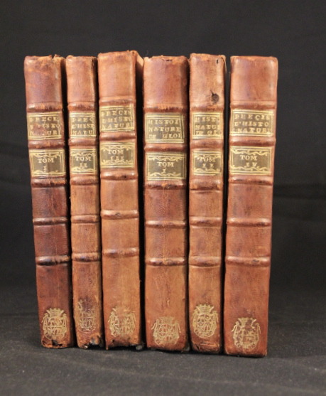
SAURI Abbé:
Histoire naturelle du globe, ou Géographie physique. [Suivi de] Précis d’histoire naturelle, extrait des meilleurs auteurs françois & étrangers.
A Paris, Chez l’auteur, 1778. 6 vol. in-12 de [4]-406-[2] + 245 + XV-[2], 276 + 188 + VIII, 340 + VIII, 408 pages. Demi-basane havane, dos à nerfs ornés aux armes (non-identifiées), pièces de titre et tomaison vertes. Coiffes, coins et bords frottés, accrocs aux coiffes des 5 vol, quelques galeries de vers sur le dos et les plats. Exemplaire non rogné.
Référence libraire : 2798
|
|
|
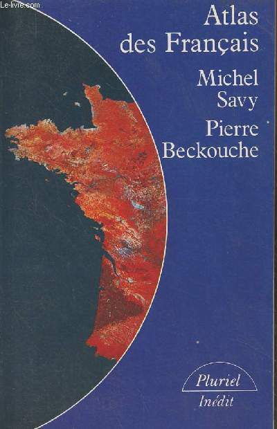
Savy Michel/Beckouche Pierre
"Atlas des français - Collection ""Pluriel"" n°8462"
Hachette. 1985. In-12. Broché. Bon état, Couv. convenable, Dos satisfaisant, Intérieur frais. 331 pages - nombreuses cartes en noir et blanc hors texte. 2e plat légèrement plié.. . . . Classification Dewey : 912-Atlas, cartes et plans
Référence libraire : R300277915 ISBN : 2010115120
|
|
|
Sayer Robert & BennettT John Holster Atlas
The American Military Pocket Atlas; being an an Approved Collection of Correct Maps Both General and Particular of the British Colonies; Especially Those which Now Are or Probably May Be the Theatre of War: Taken Principally from the Actual Surveys
London: Printed for R. Sayer and J. Bennet 1776. The elusive so called "Holster Atlas".This is a first edition published in 1776 by Sayers and Bennett containing all the 6 maps as called for all in first state. vi-viiipp. dedication letter and Advertisement list of maps; with six folding engraved maps with original outline colour all mounted on stubs some light dust marking to map 4 'Middle British Colonies''; a few very small minor splitsrepaired to folds but nothing significant. Bound in original marbled boards with calf spine with green leather title label the heraldic bookplate of Heinrich Johann Freiherr von Gudenus dated 1891 on front pastedown. A little rubbed spine slightly worn at foot a very good handsome copy Sabin 1147 & 1343 Known as the 'Holster Atlas' this work was designed for and issued to British cavalry officers for use in the field during the American War of Independence. It was "calculated in its Bulk and Price to suit the Pockets of Officers of all Ranks" from the Advertisement leaf. The six maps here represent a distillation of what the British high command saw as the most pertinent topographical information for soldiers and being issued at the war's outset provides keen insight into how the British envisioned the war unfolding. First Edition. Hardback. Very Good. 8vo - over 7�" - 9�" Tall. Printed for R. Sayer and J. Bennet Hardcover
Référence libraire : 056373
|
|
|
SCANDINAVIA ATLAS. BERGSTROM Ola & MOBERG Oskar.
Bergvalls Skolatlas. . . .Kartorna utforda och tryckta av A.B. Kartografiska Institutet Stockholm. . . .
Stockholm: A.B. Magn Bervalls Forlag 1944. Tall 8vo. 32 colour maps. Printed boards slght shlfwr frmr ownrshp signature on frnt cvr VG. First edition thus of this atlas focusing on Sweden Norway and Scandinavia. A.B. Magn Bervalls Forlag, hardcover
Référence libraire : 34334
|
|
|
SCARRE, Chris / GAILLARD, Jacques:
Atlas de la Rome antique.
Editions Autrement, Collection Atlas, 1996, in-8vo, 144 p., richement ill. couleurs, brochure originale.
Référence libraire : 124620aaf
|
|
|
Scarre, Christopher (Herausgeber)
Weltatlas der Archäologie. hrsg. von Chris Scarre. [Kt. und Graphiken: Swanston Graphics ... Glossar: Liv Gibbs and Andy Brown. Übers. aus dem Engl.: Susanne Lücke]
München : Südwest 1990. Dt. Ausg. 320 S. : 900 Ill. und graph. Darst., 275 Kt. ; 37x27 cm Pappe
Référence libraire : 74669

|
|
|
Scarre, Christopher (Hrsg.)
Weltatlas der Archäologie.
München : Südwest; The Times, 1990. Deutsche Ausgabe; 320 S. mit 275 Karten, 900 Farbbildern, Plänen und Diagrammen; 37 cm; gebunden, illustrierter Orig.-Pappband,
Référence libraire : 105624

|
|
|
SCHAEFFER, Oskar:
Atlas und Grundriss der Lehre vom Geburtsakt und der operativen Geburtshilfe.
München, J. F. Lehmann, 1900, pt. in-8vo, 107 S. + 122 Figuren auf 9 gefaltete Tafeln, Original-Leinenband.
Référence libraire : 67074aaf
|
|
|
SCHAEFFNER Claude
Cette terre où nous vivons. Le grand atlas universel Hachette.
Paris, Le Livre de Paris-Hachette, 1977. 28 x 37, 304 pp., très nombreuses cartes et illustrations en couleurs, reliure d'édition carton imprimé + jaquette, bon état.
Référence libraire : 88187 ISBN : 224500650
|
|
|
SCHAFERS BERNHARD
ATLAS DE L ALLEMAGNE - ANNEES 1989-1999 : SOCIETE, ECONOMIE, ETAT
AUTREMENT. 1998. In-4. Broché. Bon état, Couv. convenable, Dos satisfaisant, Intérieur frais. 126 pages augmentees de nombreuses illustrations en couleurs dans le texte - texte en 2 colonnes. . . . Classification Dewey : 912-Atlas, cartes et plans
Référence libraire : RO30146399
|
|
|
Schalansky, Judith
Atlas der abgelegenen Inseln. Fünfzig Inseln, auf denen ich nie war und niemals sein werde. Buchgestaltung Judith Schalansky. 7. Aufl.
Hamburg : Mare, 2010. 143 S. Mit zahlr. auch farb. Abb. Originalhalbleinen.
Référence libraire : 1232882

|
|
|
Schalansky, Judith
Atlas der abgelegenen Inseln. Fünfzig Inseln, auf denen ich nie war und niemals sein werde.
Hamburg, Mereverlag, 2009. 3.Aufl. zahlr. Karten, 1 Vorsatzkarte, 143 S. 4°, ill. OHLn.
Référence libraire : 33673

|
|
|
Schams
Handbuch der gesamten Weberei. Mit 681 Figuren auf 62 lithogr. Tafeln.
Weimar, 1890. 4°. Unpaginiert. Marmorierter Halblederband der Zeit mit Lederecken, Rückenvergoldung, floralen Blindprägungen und marmoriertem Ganzschnitt. Schmuckpapiervorsatz und -hintersatz. (Leden an Kanten etwas berieben. Kleines Schildchen auf Schmutztitel. Exlibris). - Ansonsten ein sehr gut erhaltenes, sauberes Exemplar ohne Eintragungen. 2. Auflage.
Référence libraire : 32568AB
|
|
|
Scharfe, Wolfgang (Hrsg.)
Administrativ-statistischer Atlas vom Preußischen Staate 1828. Neudruck mit einem Erläuterungsband (fehlt).
Berlin, Kiepert, 1990. Imperial-Folio (59 x 40 cm). 2 Bl., 22 doppelblattgr. kolorierte Karten. OLwd. m. Deckelschild. sowie Orig.-Schutzumschlag.
Référence libraire : 23973

|
|
|
Schaup, Wilhelm
Salzburg auf alten Landkarten 1551 - 1866/67. Redaktion: Gerda Dohle, Oskar Dohle, Peter F. Kramml. (= Schriftenreihe des Archivs der Stadt Salzburg, Nr. 13).
Salzburg, [Stadtgemeinde Salzburg], 2000. 395 S. Mit zahlr. (tls. farb.) Kartenabb. Quer-4°. Orig.-Pappband mit farb. Deckelillustration.
Référence libraire : 25353

|
|
|
Scheer (Hrsg.), Albert
Stufenatlas für höhere Lehranstalten in drei Stufen. Achte Auflage
Bielefeld, Verlag von Velhagen & Klasing, 1936. 114 S. 4° Quart, Halbleinen
Référence libraire : 84729

|
|
|
Schenk, Pieter d. Älteren
Diversa Orbis terrae visu incedente? 1706
Saarbrücken, Fines Mundi Verlag, 2013. 4°, Unveränderter Faksimilereprint, 2013; Original erschienen 1706 in Amsterdam; Bezahlung per PayPal möglich, we accept PayPal, Halbleinen
Référence libraire : 34783
|
|
|
Scheuch, Manfred
Atlas zur Zeitgeschichte: Europa im 20. Jahrhundert. Von Manfred Scheuch. (Der Standard-Bibliothek). 2., aktualisierte und erweiterte Auflage.
Wien: Christian Brandstätter 1992. 189 Seiten. 4° (25-35 cm). Orig.-Pappband mit Orig.-Schutzumschlag. [Hardcover / fest gebunden].
Référence libraire : 107357

|
|
|
Scheuch, Manfred
Historischer Atlas Deutschland. Vom Frankenreich bis zur Wiedervereinigung in Karten, Bildern, Texten..
Augsburg: Weltbild-Vlg. um 2013. 255 S., zahlr. Abb. u. Ktn. 4° Kart. *neuwertig*
Référence libraire : 150081
|
|
|
Scheuch, Manfred
Historischer Atlas Deutschland. Vom Frankenreich zur Wiedervereinigung in Karten, Bildern und Texten. Sonderausgabe / Lizenz der Ausgabe Wien, Christian Brandstätter, 1997.
(Braunschweig), Archiv Verlag, 1997). 255 S. Mit zahlr farb. Abb. und 119 Ktn. (= Bibliothek Der Standard) 29,5 cm. Schwarzes HLdr mit goldgeprägt. Rücken und Lederecken. Im stabilen OLn-Schuber.
Référence libraire : 91926

|
|
|
SCHEURMANN, J.J. ( Samuel Johann Jakob Scheuerman) / IMHOF, Edouard:
Die Karten der Schweizerischen Kantone aus dem Helvetischen Almanach 1805-1822. Erschienen bei Füssli & Comp. Neudruck der von J(ohann) J(akob) Scheurmann gestochenen und von Scheurmann Vater und Sohn revidierten Original-Kupferplatten. Begleittext von Eduard Imhof. (NACHDRUCK der General-Carte der Schweiz).
Zürich, Orell, Füssli , 1981, in-Folio, 12 S., mit 19 gestochenen mit Seidenpapier abgedeckten Karten in Passepartout, Or. Leinen Kassette mit Titelschild ‘General-Carte der Schweiz’.
Référence libraire : 104727aaf
|
|
|
Schimkus, Andreas und Johannes u.a. Ebert
Der große historische Weltatlas. Epochen - Ereignisse - Entwicklungen. Ein ADAC-Atlas.
München, ADAC-Verlag, 2004.
Référence libraire : 217636

|
|
|
Schirmer, Fritz
Kriegsgeschichtlicher Atlas zum Studium der Feldzüge der neuesten Zeit : Zum Gebrauche an den k. u. k. Militär-Erziehungs- und Bildungsanstalten.
Wien, Seidel, 1912. 27 (doppelbl. gr.) Tafeln, H 26 x 19 cm, OLeinen. - Einband minimale Gebrauchsspuren, sonst sehr guter Zustand. fest gebunden/ hardcover
Référence libraire : ATL2882

|
|
|
SCHLAGINTWEIT, Adolph & Hermann:
Atlas zu den neuen Untersuchungen ueber die physicalische Geographie und die Geologie der Alpen. Mit XXII Tafeln.( Photographierter Atlasband (im Jahr 2000) nach dem Exemplar der Schweizer. Zentralbibl (1854) Kopie auf ‘Kodak Professional paper’),
Leipzig, T.O. Weigel, 2000, imp.-Fol. (55 x 39 cm) und in-4to, 2 Bl. (Titelblatt - Verzeichnis der Tafeln und Karten) + 22 meist farbige lithograph. Tafeln davon 3 doppelblattgr. + 8 Umrisstafeln (zu Tafel 7-9, 11-14, und 20), dem Original im Zentral-Bibliothek entsprechend mit wenigen Feuchtflecken, Halbleinenmappe mit Ecken.
Référence libraire : 115638aaf
|
|
|
SCHLAGINTWEIT, Adolph & Hermann:
Neue Untersuchungen ueber die physicalische Geographie und die Geologie der Alpen. Textband und Atlas. Zus. 2 Bde.
Leipzig, T.O. Weigel, 1854, imp.-Fol. (55 x 39 cm) und in-4to, XVI + 639 S. + 1 Falttab. / 2 Bl. (Titel, und Verzeichnis der Tafeln) + 22 meist farbige lithograph. Tafeln davon 3 doppelblattgr. + 8 Umrisstafeln (zu Tafel 7-9, 11-14, und 20) + 8 Bl., teils stockfleckig, Textband in Original-Broschur & Tafelband. Tafeln lose eingelegt in Original-Umschlag (dieser etwas gebraucht und mit kl. Randeinrissen).
Référence libraire : 127041aaf
|
|
|
Schlau, Wilfried [Hrsg.]
Strassenatlas von Estland 1938 (Erweiterter Nachdruck der von V. Nemirovits-Dantsenko redigierten Eesti Maanteede Kaart 1:300.000)
Marburg/Lahn : J.-G.-Herder-Institut 1989. ca. 80 S. (26x28 cm) Broschierte Ausgabe
Référence libraire : 50681
|
|
|
Schlechter, R.; Translated By: Rogers, R.S.; Katz, H.J.; Simmons, J.T.
The Orchidaceae of German New Guinea (incorporating the Figure Atlas to the Above)
Translated from the German, first published in 1914. 1180 pages. Index. Two fold-out maps at back. Illustrated with black and white diagrams. "This monumental work will increase in stature as time goes on and habitats fall to bulldozers and man's incursions that lead to irreversible destruction and change... A Priceless gift from earlier days never to return. The more the book ages, the more important and valuable it will become." - from Foreword. Clean, bright and unmarked with negligible wear. Appears unused. A superb copy. Book

|
|
|
Schlemmer-Atlas
Ein Wegweiser zu rund 2000 Restaurants in Deutschland 1985. Aral. Durchgehend farbig illustriert.
Stuttgart/München, Lizenzausgabe DBB, 1985. Gr.8°. 612 Seiten. Farbig illustrierter Originalpappband mit Karten auf Vor- und Hintersatz. - Wohlerhalten. 11. Auflage.
Référence libraire : 16645AB
|
|
|
Schleuen, D. J
Sachsen. Accurate Situations-Carte von einem Theile des Churfürstenthums Sachsen, und hauptsaechlich von den Gegenden 4 bis 5 Meilen aus dem Centro um die Haupt-und Residenbz-Stadt Dresden.
o.J. EA. 11 von 12 Kupferkarten a. Leinen je 53,5 cm X 59,5 cm. Rückseite stärker fl., Karten l. gebr., ansonsten guter Zustand.
Référence libraire : 45101AB
|
|
|
Schlieben, Wilhelm Ernst August v. (Bearb.)
Atlas von Europa nebst den Kolonien. Lfg. 2: Königreich Frankreich, II. Heft und das Türkische (Osmanische) Reich in Europa.
[Leipzig, Göschen 1825]. Quer 4°. VIII, 12 S. Mit 19 handkol. Kupferstich-Karten. Halblederband der Zeit
Référence libraire : 195542-1
|
|
|
SCHLUMPF, J. (Bearb):
Schweizerischer Volksschul-Atlas. (Volksschulatlas für den Gebrauch in den Klassen des 6ten, 7ten, u. 8ten Schuljahres) unter Mitwirkung von W. Götzinger. bearbeitet von J. Schlumpf.
Winterthur, Hrsg. v.d. Topgr. Anstalt, 1903, gr. in-4to, 1 Bl. (Orig.-Umschl.) + 40 S. mit Karten, Pappband Lei9nen-Rückenstreifen (Orig.-Umschlag. miteingebunden). Sauberes Exemplar.
Référence libraire : 102104aaf
|
|
|
SCHMETS PAUL, HAYT FRANZ
ATLAS D'HISTOIRE UNIVERSELLE (COLLECTION ROLAND)
Ad. Wesmael-Charlier. 1962. In-4. Broché. Etat d'usage, Couv. convenable, Dos frotté, Intérieur acceptable. 100 pages. Illustré de nombreuses cartes en couleur.. . . . Classification Dewey : 912-Atlas, cartes et plans
Référence libraire : RO40247080
|
|
|
SCHMETS PAUL, HAYT FRANZ
ATLAS D'HISTOIRE UNIVERSELLE (COLLECTION ROLAND)
Ad. Wesmael-Charlier. 1962. In-4 Carré. Broché. Etat d'usage. Couv. convenable. Dos frotté. Intérieur acceptable. 100 pages. Illustré de nombreuses cartes en couleur. Collection Roland. Edition révisée par Franz Hayt.

|
|
|
SCHMETS, Paul - HAYT, Franz.
ATLAS d'Histoire Universelle et d'Histoire de Belgique.
in-4°, 151 pp., nombreuses cartes en couleurs pleine page, broché, couverture illustrée. Très bel exemplaire. [P-36] Edition révisée suivant nouveau programme par Franz Hayt.
|
|
|
Schmidseder, Josef
Ästhetische Zahnmedizin.
Stuttgart, Georg Thieme Verlag, 1998. XII + 298 S. 4° Quart, Leinen
Référence libraire : 80672

|
|
|
Schmidt, Josef M
Taschenatlas Homöopathie in Wort und Bild : Grundlagen, Methodik und Geschichte. [Grafiken von Roland Nagl].
Heidelberg : Haug, 2001. 266 S. : zahlr. Ill., graph. Darst., Kt. ; 19 cm, kart.
Référence libraire : 1149656

|
|
|
Schmidt, Karl & Richard [Hrsg.]
Rudolf Schmidts Volksschul-Atlas in 141 Haupt- und Nebenkarten.
Bielefeld, Leipzig, Verlag von Velhagen & Klasing, 1930. 4°, 46, 32 Seiten, mit vielen farbigen Karten und einem Bilderanhang (in sw), Halbleinen. 180. Auflage Rücken angeplatzt (hinten, nur der Leinenüberzug), eine Lage lose (Seiten 5 bis 12), durchgängig mit Wasserrand unten, insgesamt durchaus in guter Erhaltung.
Référence libraire : 31580AB
|
|
|
Schmidt, Roderich (Hrsg.) und Helge bei der Wieden (Erl.)
Historischer Atlas von Mecklenburg. [Begründet von Franz Engel, herausgegeben von Roderich Schmidt]. Karte 8: Manufakturen und Fabriken im Jahre 1793. Mit Erläuterungen von Helge bei der Wieden.
Köln und Wien: Böhlau 1988. 17, (3) Seiten. Mit einer großen mehrfach gefalteten und mehrfarbigen Karte im Maßstab 1:350.000. 4° (26 x 18,5 cm). Klammergehefteter Orig.-Umschlag. [Softcover / Paperback].
Référence libraire : 2099740

|
|
|
Schmidt, Roderich (Hrsg.) und Helge bei der Wieden (Erl.)
Historischer Atlas von Mecklenburg. [Begründet von Franz Engel, herausgegeben von Roderich Schmidt]. Karte 7: Das öffentliche Telegraphennetz 1849-1880. Mit Erläuterungen von Helge bei der Wieden.
Köln und Wien: Böhlau 1987. 21, (3) Seiten. Mit einer großen mehrfach gefalteten und mehrfarbigen Karte im Maßstab 1:350.000. 4° (26 x 18,5 cm). Klammergehefteter Orig.-Umschlag. [Softcover / Paperback].
Référence libraire : 2099738

|
|
|
Schmidt, Roderich (Hrsg.) und Helge bei der Wieden (Erl.)
Historischer Atlas von Mecklenburg. [Begründet von Franz Engel, herausgegeben von Roderich Schmidt]. Karte 6: Die Entwicklung des Eisenbahnnetzes bis zum Jahre 1952. Mit Erläuterungen von Helge bei der Wieden.
Köln und Graz: Böhlau 1974. 23 Seiten. Mit einer großen mehrfach gefalteten und mehrfarbigen Karte im Maßstab 1:350.000. 4° (26 x 18,5 cm). Klammergehefteter Orig.-Umschlag. [Softcover / Paperback].
Référence libraire : 2099734

|
|
|
Schmit J.-P.
Atlas complet du manuel de l'architecte des monuments religieux ou traité d'application pratique de l'archéologie chrétienne
Relié In-8 (25 x 15 cm), format à l'italienne, reliure demi-peau, dos lisse, sans date, complet des 20 planches ; épidermures et trou sur le cuir, coupes frottées, mouillure sur l'ensemble des planches, en l'état. Livraison a domicile (La Poste) ou en Mondial Relay sur simple demande.
Référence libraire : xf161
|
|
|
Schmit, Guy. Wiese, Bernd
Luxemburg in Karte und Luftbild. Le Luxembourg en Cartes et Photos Aeriennes.
Luxembourg., Edition Guy Schmit + Bernd Wiese. Mit 14 farbigen Luftbildern, 1 farbigen Satellitenbild, 12 Schwarz-Weiß-Luftbildern, 24 farbigen Karten, 59 figuren, 11 Tabellen und einer farbigen Übersichtskarte 1 : 250 000 im Anhang / avec 14 photos aériennes en couleurs, 1 photo-satallite en couleurs,... . . IX, 168(1) Seiten, beiliegend eine Überischtskarte: Grand-Duché de Luxembourg, mit markierten Kartenausschnitten, und eine Transparentpapier-Folie, sowie Errata-Zettel. Zustand: Aus einer Institutsbibliothek ausgeschieden, Titelblatt mit zwei Inventarnummern. 4°. OLeinen.
Référence libraire : 047511
|
|
|
Schneider, Christoph
Unsere Welt. Der Atlas für die ganze Familie
Ostfildern, RV Verlag, 1998. 256 Seiten , 33 cm , Hardcover/Pappeinband
Référence libraire : 48336
|
|
|
Schnell, Johannes Dieter
Cytology and Microbiology of the Vagina: A Brief Atlas for Doctors and Medical Students
89 pages. Index. Profusely illustrated with colour and black and white photography. "The finding that cancer therapy depends in large part on early detection of gynaecological carcinoma laid the basis for screening examinations in gynaecological practice... Experience has shown that subjective well-being does not preclude the presence of gynaecological disease. .. In this context the cytology and microbiology of the vagina assume special significance." - from Foreword. Clean and unmarked with moderate wear. A quality copy. Book

|
|
|
SCHNITZLER (J.H), BAQUOL (J.)
Atlas historique et pittoresque ou Histoire universelle disposée en tableaux synoptiques embrassant à la fois les faits politiques, religieux, littéraires et artistiques et illustrées de cartes et de planches.
1895 percaline rouge éditeur titre sur les plats. 4 vol. in-folio, 20, 32pp. (index), P. Lyon Simon 1895
Référence libraire : 13510
|
|
|
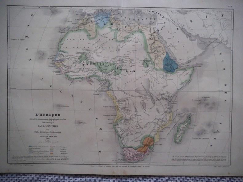
SCHNITZLER J.H
Carte de l’Afrique
suivant les connaissances géographiques actuelles. Carte en couleurs, dressée par SCHNITZLER J.H pour l’atlas historique et pittoresque, E. SIMON éditeur 1860. 330x480 mm et 380x580mm avec les marges
Référence libraire : 10988
|
|
|
SCHNITZLER J.H
Carte de l’Amérique actuelle
carte en couleurs, dressée par SCHNITZLER J.H pour l’atlas historique et pittoresque, E. SIMON éditeur 1860. 330x480 mm et 380x580mm avec les marge
Référence libraire : 10986

|
|
 Recevoir par e-mail
 Télécharger en PDF
 Flux RSS


