|
Tardieu, A.-F
Statistique générale et particulière de la France et de ses colonies avec une nouvelle description ... Collection de tableaux et cartes. Tafelband mit 13 (12 gefalt.) Tabellen u. 8 grenzkolorierten gefalteten Kupferkarten nach J.B. Poirson von Tardieu u.a. gestochen.
Paris, Buisson, 1804. 4°. 4 Seiten, 13 gefalt. Tabellen, 8 gefalt. Karten, S. 5-52. Interims-Pappband d. Zt. (mit wohl später mit marmor. Papier überzogen) (kleine Einrisse und Fehlst., etwas gelockert).
Référence libraire : 18539

|
|
|
Tardieu, Ambroise
Atlas Universel de géographie ancienne et moderne. Revue et corrigé par A. Vuillemin. Mit 24 (von 31) dppblgr. gestochenen flächenkolorierten Karten und 1 dppblgr. gest. Plan von Paris.
Paris, Furne, 1863. Folio. Hlableder d. Zt. mit Deckelschild (stärker berieben).
Référence libraire : 15337
|
|
|
TARDIEU, Ambroise ; VUILLEMIN, A.
Atlas Universel de Géographie ancienne et moderne
Dressé par Ambroise Tardieu, revu et corrigé par A. Vuillemin, pour l'intelligence de la Géographie Universeklle de Malte-Brun Lavallée, 1 vol. in-folio reliure éditeur demi-percaline verte, Furne, Jouvet et Cie, Editeurs, Jouvet et Cie, Successeurs, Paris, 1880, avec 31 cartes : 1 : Empire Romain ; 2 : Empire d'Alexandre ; 3 : Géographie de la Bible ; 4 : Les Gaules ; 5 : Italie ancienne ; 6 : Grèce ancienne ; 7 : Espagne ancienne ; 8 : Mappemonde ; 9 : Europe ; 10 : France au Moyen-Age ; 11 : France par province ; 12 : France par départements ; 13 : Iles Britanniques ; 14 : Allemagne ou Europe Centrale ; 15 : Russie d'Europe ; 16 : Belgique et Hollande ; 17 : Suède et Danemark ; 18 : Espagne et Portugal ; 19 : Italie ; 20 : Turquie d'Europe et Grèce ; 21 : Asie ; 22 : Presqu'Ile de l'Inde ; 23 : Afrique ; 24 : Amérique Septentrionale ; 25 : Etats-Unis et Mexique ; 26 : Amérique Méridionale ; 27 : Océanie ; 28 : Algérie ; 29 : Environs de Paris ; 30 : Plan de Paris avec ses Fortifications ; 31 : Chemins de fer de l'Europe Bon état (coupes un peu frottées, qq. croquis anciens d'étudiants au crayon léger au verso des premières cartes) pour ce bel atlas en couleurs (hormis pour les cartes 28 et 31), au 31 cartes doubles, montées sur onglet. Français

|
|
|
TARIDE.
PLANISPHERE LES CINQ PARTIES DU MONDE COMPRENANT POSSESSIONS D OUTRE MER, CHEMINS DE FER, LIGNES DE NAVIGATION.
CHEZ L AUTEUR.. 1962. In-Plano Carré. Broché. Bon état. Couv. convenable. Dos satisfaisant. Pliures. Carte en couleurs de 99cm / 130 cm.

|
|
|
Tarraire (Jean)
La géographie en images. Cours élémentaire.
français In-4 de 48 pp.; album cartonné illustré de l'éditeur. Riche illustration en noir et couleur. Petits manques en pied et sommet de dos.
|
|
|
Tassin, Christophe Nicolas
Leytoure - Plan Du Château De Lectoure - Gravure
36,2 x 31,6 Gravure sur cuivre, 29 x 19, [début XVIIème], composé de deux feuilles accollées, représentant vu d'oiseau le plan du château de Lectoure (Gers), extraite (ou tirée à partir des mêmes plaques) vraisemblablement de l'Atlas de Tassin de 1634, composé des "Plans et profils de toutes les principales villes et lieux considérables de France". Papier vergé avec un très beau filigrane. Bon état. Estampes - Gravures - Dessins
Référence libraire : 4176
|
|
|
Taschen Atlas
Taschen-Atlas Der Erde 30 Karten Mit Statistischen Angaben
Leipzig: Kartographische Brockhaus. Good with no dust jacket. 1940. Paperback. Owner inscriptions & ink stamps/tear at back top outer corner/text in German . Kartographische Brockhaus paperback
Référence libraire : 167624
|
|
|
TATRZANSKI PARK NARODOWY
Atlas Tatrzanskiego Parku Narodowego [ Tatrzanski Park Narodowy ]
1 vol. in-folio green editor's binding, Zakopane Krakow, Polskie Towarzystwo Przyjació Nauk o Ziemi Wymiary, 1985, 4 ff., 32 and 14 folding maps
Référence libraire : 64438

|
|
|
Tauril-Pneumatik GmbH, (Hrsg.)
Tauril-Atlas Bd. 1. Automobil-Tourenkarte der österreichisch-ungarischen Monarchie. Masstab 1: 600 000.
Wien, Budapest, Tauril-Pneumatik, 1914. 2 Seiten Vorwort, 6 Seiten Legende in Deutsch, Ungarisch, Französisch, Englisch, Serbisch und Italienisch, 50 Doppel-Kartenseiten, 3 Seiten: "Die deutschen Namen der ungarländischen Ortsnamen". 5 Blätter herausgeschnitten Register, oder bindetechnische Stützen?, H 24 x 15,5 cm, 2 Lesebdch., OLeinen. - Vord. Falz etwas beschädigt, Rücken leicht wellig mit kl. Flecken. Buchblock fest. Insgesamt zwar Gebrauchsspuren, aber guter Zustand. fest gebunden/ hardcover
Référence libraire : ATL2579

|
|
|
Tavenier, R./ Ameryckx, J./ Snacken, F./ Faeasyn, D.
Cote, dunes, Polders. Atlas de Belgique, planche 17.
, Brussel, Koninklijke Belgische Academie, 1970., softcover, Broche, couverture d' editeur, 29,5x21cm, 32pp.
Référence libraire : 14251
|
|
|
Tavenier, R./ Ameryckx, J./ Snacken, F./ Faeasyn, D.
Kust, duinen, polders, atlas van Belgie, blad 17.
, Brussel, Koninklijke Belgische Academie, 1970., softcover, 29,5x21cm, 32pp. Nederlands,
Référence libraire : 50698
|
|
|
Taylor & Wilson Ltd. Atlas Works Accrington.
Illustrated Catalogue Of Washing Wringing And Mangling Machines Blueing troughs Step Ladders Champion Gas Irons Portable Boilers Tin Cutters Garden Rollers Garden Seats Etc. Etc.
Accrington.: Taylor & Wilson Ltd. Atlas Works Accrington. 1897. 1st Edition . Soft cover. Very Good/No Jacket. 4to - over 9� - 12" tall. Profusely illustrated throughout. . First edition thus September 1895. Includes the 12 page wholesale price list for January 25th 1897 which is loosely inserted. Slight water stain to bottom edge of a first few pages page four has some very slight adhesion with very small loss of text below illustration. Some very light marking throughout. Publishers gilt lettered burgundy imitation crocodile skin wrappers with cloth spine lightly rubbed and darkened else very good copy. The illustrations in this catalogue are of superb quality full page illustrations of mangles and washing machines etc. etc. Rare. <br/> <br/> Taylor & Wilson Ltd., Atlas Works, Accrington. paperback
Référence libraire : 003171
|
|
|
TC HARITA UMUMIYESI.
[PLAN OF KARS FORTRESS] Kars Kal'asi plâni (Based on 1898 discoveries and 1908 practice).
Very Good Turkish, Ottoman (1500-1928) Original map of Kars Fortress. Oblong: 45x57 cm. In Ottoman script. Scale: 1/21000. [PLAN OF KARS FORTRESS] Kars Kal'asi plâni (Based on 1898 discoveries and 1908 practice). A very detailed plan in Ottoman script of Kars Fortress and is environment. Some red markings. Extremely rare.
|
|
|
TE Wale & Sons Atlas Works Oozell St Birmingham:
Improvements in Machines for Cleaning Knives Forks Spoons & other such Articles
HMSO 1893 Ann original patent pub at 8d pp 2 folding plate 2 indelible stamps Roy 8vo unbound vg HMSO 1893 unknown
Référence libraire : 4050
|
|
|
Ted Atlas
Candlestick Park
2010-12-06. New. Ships with Tracking Number! INTERNATIONAL WORLDWIDE Shipping available. May be re-issue. Buy with confidence excellent customer service! unknown
Référence libraire : 1531654045n ISBN : 1531654045 9781531654047

|
|
|
Ted Atlas
Candlestick Park Images of Sports
2010-06-05. New. Ships with Tracking Number! INTERNATIONAL WORLDWIDE Shipping available. May be re-issue. Buy with confidence excellent customer service! unknown
Référence libraire : 0738581593n ISBN : 0738581593 9780738581590

|
|
|
Ted Atlas Mark Purdy Foreword
Candlestick Park Images of Sports
Arcadia Publishing 2010-12-06. Paperback. Used:Good. Arcadia Publishing paperback
Référence libraire : DADAX0738581593 ISBN : 0738581593 9780738581590

|
|
|
Ted Atlas; foreword by Mark Purdy
Candlestick Park Images of Sports
Arcadia Publishing 2010-12-01. Paperback. Good. Arcadia Publishing paperback
Référence libraire : SONG0738581593 ISBN : 0738581593 9780738581590
|
|
|
Teddy Atlas
Atlas
2006-08-07. Good. Ships with Tracking Number! INTERNATIONAL WORLDWIDE Shipping available. May not contain Access Codes or Supplements. May be re-issue. May be ex-library. Shipping & Handling by region. Buy with confidence excellent customer service! unknown
Référence libraire : 0060542403q ISBN : 0060542403 9780060542405

|
|
|
Teddy Atlas
Atlas: From the Streets to the Ring: A Son's Struggle to Become a Man
Paperback / softback. New. Teddy captured the Adirondack Golden Gloves title at 139 pounds in 1976. Forced out of competition because of injury he turned his talents to training fighters including Mike Tyson and Barry McGuigan. He has also employed his talents in appearing in films and choreographing fight scenes for a television series. This memoir presents his story. paperback
Référence libraire : A9780060542412 ISBN : 0060542411 9780060542412

|
|
|
Teddy Atlas
Atlas: From the Streets to the Ring: A Son's Struggle to Become a Man
2007-01-08. Good. Ships with Tracking Number! INTERNATIONAL WORLDWIDE Shipping available. May not contain Access Codes or Supplements. May be re-issue. May be ex-library. Shipping & Handling by region. Buy with confidence excellent customer service! unknown
Référence libraire : 0060542411q ISBN : 0060542411 9780060542412

|
|
|
Teddy Atlas
Atlas: From the Streets to the Ring: A Son's Struggle to Become a Man
2007-01-08. New. Ships with Tracking Number! INTERNATIONAL WORLDWIDE Shipping available. May be re-issue. Buy with confidence excellent customer service! unknown
Référence libraire : 0060542411n ISBN : 0060542411 9780060542412

|
|
|
Teddy Atlas Peter Alson
Atlas: From the Streets to the Ring: A Son's Struggle to Become a Man
Ecco 2006-05-02. Hardcover. Used:Good. Ecco hardcover
Référence libraire : DADAX0060542403 ISBN : 0060542403 9780060542405

|
|
|
Teddy Atlas Peter Alson
Atlas: From the Streets to the Ring: A Son's Struggle to Become a Man
Harper Paperbacks 2007-05-08. Reprint. Paperback. Used:Good. Harper Paperbacks paperback
Référence libraire : DADAX0060542411 ISBN : 0060542411 9780060542412

|
|
|
Teddy Atlas Peter Alson
Atlas: From the Streets to the Ring: A Son's Struggle to Become a Man
Ecco. Used - Very Good. Great condition for a used book! Minimal wear. Ecco unknown
Référence libraire : GRP2462523 ISBN : 0060542403 9780060542405
|
|
|
Teddy Atlas; Peter Alson
Atlas: From the Streets to the Ring: A Son's Struggle to Become a Man
Harper Paperbacks 2007-05-01. Paperback. Good. Excellent customer service. Prompt Customer Service. Harper Paperbacks paperback
Référence libraire : SONG0060542411 ISBN : 0060542411 9780060542412
|
|
|
Teddy Atlas; Peter Alson
Atlas: From the Streets to the Ring: A Son's Struggle to Become a Man
Ecco 2006-05-01. Hardcover. Used:Good. Ecco hardcover
Référence libraire : SONG0060542403 ISBN : 0060542403 9780060542405
|
|
|
TELLIER LOUIS
ATLAS HISTORIQUE DU NOUVEAU TESTAMENT
EDITIONS SPES. 1961. In-12. Broché. Bon état, Couv. légèrement pliée, Dos satisfaisant, Papier jauni. 61 pages. Carte dépliante inclue.. . . . Classification Dewey : 912-Atlas, cartes et plans
Référence libraire : RO40075734
|
|
|
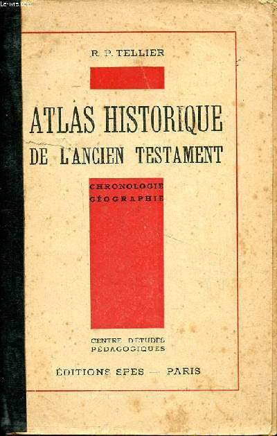
Tellier R.P.
Atlas historique de l'ancien testament Chronologie Géographie
SPES. 1937. In-8. Broché. Bon état, Couv. convenable, Dos abîmé, Intérieur frais. 163 pages augmenntées de nombreuses cartes géographiques en noir et blanc hors texte.. . . . Classification Dewey : 912-Atlas, cartes et plans
Référence libraire : R260272789
|
|
|
TELLIER R. P.
Atlas historique de l'Ancien Testament. Chronologie - Géographie.
Couverture souple. Broché. 162 pages.
Référence libraire : 26136
|
|
|
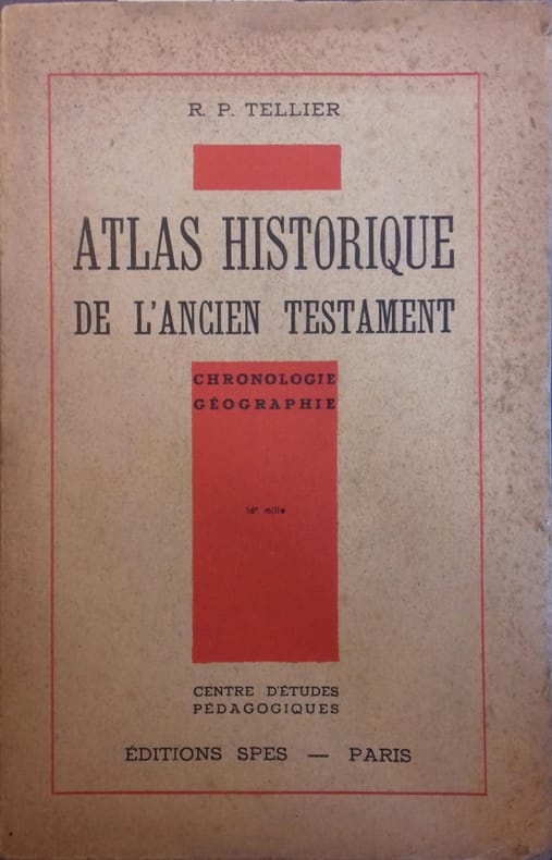
TELLIER R P
Atlas historique de l'Ancien Testament. Chronologie - Géographie.
P , spes , 1953 , in8br , 162 pp , 67 cartes. Langue: Français
Référence libraire : M11894
|
|
|
TELLIER LOUIS
ATLAS HISTORIQUE DE L'ANCIEN TESTAMENT
EDITIONS SPES. 1948. In-12 Carré. Broché. Etat d'usage. Couv. légèrement passée. Dos abîmé. Intérieur bon état. 162 pages. Carte dépliante en fin de livre. Chronologie, géographie.
|
|
|
TELLIER LOUIS
ATLAS HISTORIQUE DU NOUVEAU TESTAMENT
EDITIONS SPES. 1961. In-12 Carré. Broché. Bon état. Couv. légèrement pliée. Dos satisfaisant. Papier jauni. 61 pages. Carte dépliante inclue. Chronologie, géographie.
|
|
|
TELLIER LOUIS
ATLAS HISTORIQUE DU NOUVEAU TESTAMENT
EDITIONS SPES. 1958. In-12 Carré. Broché. Bon état. Couv. convenable. Dos satisfaisant. Intérieur frais. 61 pages avec cartes hors et dans le texte. Chronologie, géographie.
|
|
|
Temming, Rolf L
Aus dem Stammbuch des Weines. Europäische Weinlandschaften, dargestellt in ihren Weinetiketten. (77 farbige Weinetiketten im Text).
Dortmund, Harenberg., 1984. Kl.8°. [17,5 x 12 cm]. 132 Seiten, 2 Blätter Verlagsverzeichnis. Originalkarton mit montiertem farbigen Deckelschild. [Rücken mit Innenwölbung).- Ansonsten ein sehr sauberes Exemplar ohne Einträge. = 2., erweiterte und durchgesehene Auflage. Die bibliophilen Taschenbücher 342. / Sonderdruck für das Hanseatische Wein- und Sekt-Kontor in Hamburg.
Référence libraire : 54619AB

|
|
|
Tenge, Oskar [Carl Christian]
Der Jeversche Deichband. Geschichte und Beschreibung der Deiche, Uferwerke und Siele im Dritten Oldenburgischen Deichbande und im Königlich Preußischen westlichen Jadegebiet. Und: 18 Karten zum Jeverschen Deichband.
Oldenburg: Stalling, 1884. XVI, 272 S.; 1 S. "Verzeichniß der Karten" und 18 Bll. lithographierte Karten; 8°; gebunden, Halbleinenband der Zeit; 4° (ca. 33 x 21,5 cm); Broschur der Zeit;
Référence libraire : 114976

|
|
|
TERRAS / LAURENT / BONNEROT.
ATLAS DE LA FRANCE ET DU MONDE / GUIDE D'UTILISATION / DOCUMENTS ET PAYSAGES / ANALYSE DE CHACUN DES DOCUMENTS - ETUDE THEMATIQUE - LES PLAINES - LES MONTAGNES - LES VALLEES - LES PLATEAUX - LE RIVERAINS DE LA MER - LES COMMUNICATIONS - LES MILIEUX DE VIE
HACHETTE. 1978. In-4. Broché. Etat d'usage, Couv. convenable, Dos satisfaisant, Intérieur acceptable. 135 pages illustrées de nombre'ux schémas bicolores - Couverture illustrée d'une photo monochrome.. . . . Classification Dewey : 912-Atlas, cartes et plans
Référence libraire : R320010864 ISBN : 201005220
|
|
|
Tertrais Bruno Nicolas Alexandre
ATLAS MONDIAL DU NUCLEAIRE: CIVIL ET MILITAIRE
AUTREMENT 2013 82 pages 24 2x1x16 6cm. 2013. Broché. 82 pages.
Référence libraire : 500111067

|
|
|
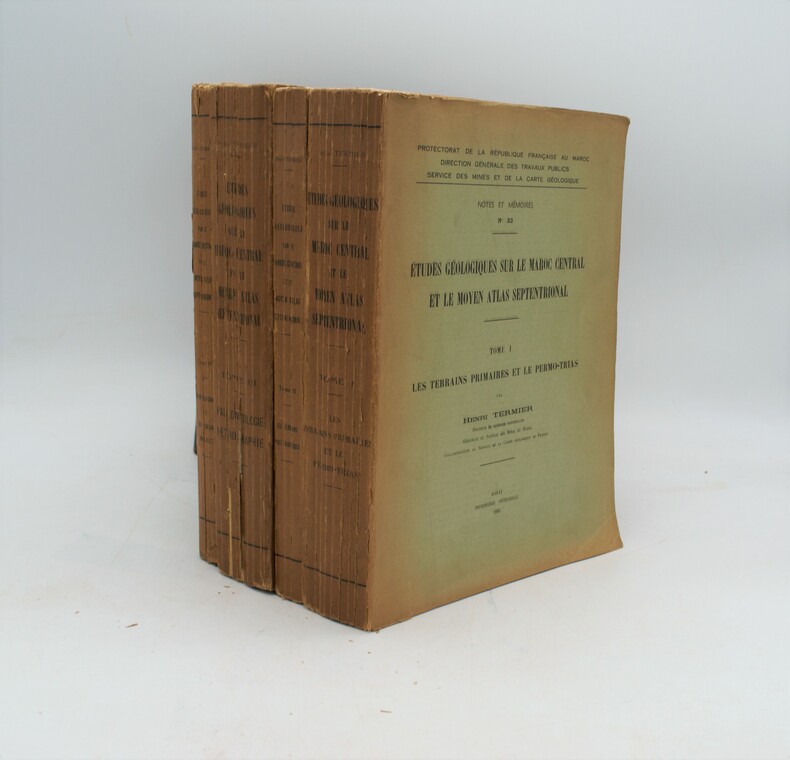
TERMIER Henri
Etudes géologiques sur le Maroc Central et le Moyen Atlas Septentrional - 4 volumes (complet)
Rabat, Imprimerie officielle, Protectorat de la République Française au Maroc / Direction générale des travaux publics, Service des mines et de la carte géologique, Notes et mémoires n°33, 1936 - 4 volumes in-4 brochés, 1566 pages de texte, 63 figures in texte et 25 tableaux synoptiques sur les 2 premiers tomes, 4 tableaux synoptiques et 28 planches hors texte dans le tome III - Tome I : Les terrains primaires et le permo-trias - Tome II : Les terrains post-triasiques - Tome III : Paléontologie, pétrographie - Tome IV : Atlas des figures et des tableaux hors texte (contient 19 tableaux synoptiques, 17 schémas dépliants, 17 planches de dessins et de coupes, 3 planches de photographies - Bon état général, dos roussis, bords de couv. élimés, intérieurs impeccables - Avec dédicace autographe de l'auteur sur page de garde du tome I
Référence libraire : 31470
|
|
|
TERMIER Henri
Études géologiques sur le Maroc Central et le Moyen Atlas Septentrional
Rabat, Imprimerie officielle, Protectorat de la République Française au Maroc , 1936 ,4 volumes in-4,brochage éditeur ,T1-743pp.,T2-744pp.,T3-1083-1566 pp. 30 Planches H.T. (17 bis et 23 bis) et 4 tableaux dépliants, T4-Atlas des figures et des tableaux hors texte (contient 19 tableaux synoptiques, 17 schémas dépliants, 17 planches de dessins et de coupes, 3 planches de photographies)
Référence libraire : PHO-1188
|
|
|
Texts by HALIL INALCIK.
Çanakkale gravürleri (16.- 17.- 18.- 19. yüzyil).
New English Original bdg. HC. Oblong: (25 x 34 cm). In Turkish. [144] p., color and b/w ills. Çanakkale gravürleri (16.- 17.- 18.- 19. yüzyil). Engravings on Çanakkale and the Hellespont in 16.-17.-18. and 19th centuries.
|
|
|
Th.Rimli Eugene & Visintin Louis
Nouvel atlas mondial géographique et économique de tous les pays - 500 cartes géographiques, politiques, économiques, climatiques, géologiques et confessionnelles ou plans de villes.
Stauffacher S.A.. 1956. In-4. Relié. Bon état, Couv. convenable, Dos satisfaisant, Intérieur frais. 500 cartes en couleurs + 191 pages d'index.. . . . Classification Dewey : 912-Atlas, cartes et plans
Référence libraire : RO80277339
|
|
|
THAPA N.P.
Carte du Nepal
SUNITA AND AJIT THAPA. Non daté. In-8. En feuillets. Bon état, Livré sans Couverture, Dos satisfaisant, Intérieur frais. Carte dépliante de 25 / 74 cm, illustrée en couleurs. Légendes en anglais.. . . A l'italienne. Classification Dewey : 912-Atlas, cartes et plans
Référence libraire : RO80133464
|
|
|
THARAUD Jérome & Jean
MARRAKECH ou les SEIGNEURS de l'Atlas.
PARIS, Plon - 1930 - In-8 ° broché - 284 pages - Ouvrage dédié au Général LYAUTEY 6 Ex. propre;
Référence libraire : 1200
|
|
|
Thalmann, Georges und Archibald Thorburn
Thorburns Bilder der Vogelwelt. Verbreitungs-Atlas der wichtigsten Vogelarten in sechs Sprachen
Lausanne: Delachaux & Niestlé S.A., 1994. 176 S. ; 31,5 x 25 cm ; Pp. ;
Référence libraire : 132053

|
|
|
THARAUD Jérome & Jean
MARRAKECH ou les SEIGNEURS de l'Atlas.
PARIS, Plon - 1930 - In-8 ° broché - 284 pages - Ouvrage dédié au Général LYAUTEY 6 Ex. propre
|
|
|
THE BRITISH TRAVEL AND HOLIDAYS ASSOCIATION
"Carte ""Britain, A map of tourits / Map of Britain and Northern Ireland"""
BARTHOLOMEW JOHN & SONS. Non daté. In-12. En feuillets. Bon état, Couv. convenable, Dos satisfaisant, Intérieur frais. Carte dépliante de 73 x 88 cm. Quelques dessins et plans bicolores au dos de la carte. Légendes en anglais.. . . . Classification Dewey : 912-Atlas, cartes et plans
Référence libraire : RO80150777
|
|
|
The british travel and holidays association
Britain, a map for tourists
John Bartolomew & son Ltd. Non daté. In-Plano. Broché. Bon état, Couv. convenable, Dos satisfaisant, Intérieur frais. Carte en couleurs dépliante de 85x55 cm.. . . . Classification Dewey : 912-Atlas, cartes et plans
Référence libraire : RO80219164

|
|
|
THE NATIONAL GEOGRAPHIC SOCIETY.
CARTE. THE UNITED STATES OF AMERICA.
CHEZ L AUTEUR.. 1946. In-Plano. Broché. Bon état, Couv. convenable, Dos satisfaisant, Pliures. Carte en, couleurs de 104 cm / 68 cm.. . . . Classification Dewey : 912-Atlas, cartes et plans
Référence libraire : R150147441

|
|
 Recevoir par e-mail
 Télécharger en PDF
 Flux RSS


