|
|
|
Buller PhD senior partner ATLAS Leadership Training, Jeffrey L h D
Evaluating Boards and Administrators: Promoting Greater Accountability in Higher Education
Rowman & Littlefield Publishers 2020-11-01. hardcover. New. 6.37x0.79x8.97. Buy with confidence. Excellent Customer Service & Return policy. Rowman & Littlefield Publishers hardcover
Riferimento per il libraio : DADAX1475854765 ISBN : 1475854765 9781475854763

|
|
|
Buller PhD senior partner ATLAS Leadership Train h D
Managing Time and Stress: A Guide for Academic Leaders to Accomplish What Matters
paperback. Good. Access codes and supplements are not guaranteed with used items. May be an ex-library book. paperback
Riferimento per il libraio : 1475845995.G ISBN : 1475845995 9781475845990

|
|
|
Buneteau
Exposition universelle 1900 - Plan général.
"A. Taride. 1900. In-8. Broché. Etat d'usage, Tâchée, Dos frotté, Déchirures. plan dépliant en couleur d'environ 53x70cm, 4 pages ""Guide du visiteur"" désolidarisées - papier jauni, quelques décirures aux zones de pliures de la carte, pliure sur les plats, coins frottés.. . . . Classification Dewey : 912-Atlas, cartes et plans"
Riferimento per il libraio : R200131980

|
|
|
Bundesanstalt für Arbeitsschutz (Hg)
Gasatlas.
Bremerhaven, Wirtschaftsverlag NW Verlag für neue Wissenschaft, 1989. 8°, 295 S., Schriftenreihe der Bundesanstalt für Arbeitsschutz, - Gefährliche Arbeitsstoffe - GA 32. Bezahlung per PayPal möglich, we accept PayPal, mit wenigen Papierresten eines entfernten Ex Libris a. d. Vorsatz, altersbedingte Bräunungen, sonst ger. Gebr.sp., kartoniert
Riferimento per il libraio : 21442
|
|
|
Bunsen, Christian Carl Josias
Bibelatlas. Zehn Karten zu Bunsens Bibelwerk. Entworfen und gezeichnet von Henry Lange.
Leipzig, Brockhaus, 1860. 10 Karten. Gr. 8°. gebundene Ausgabe, Halbleinen, Karten mit starken Gebrauchsspuren. Einband m. Ausrissen am Rand, fleckig etc. - die Karten jedoch in Ordnung
Riferimento per il libraio : 25147

|
|
|
BUREAU E.
Atlas de Géographie Militaire, adopté par M. le Ministre de la Guerre pour l'Ecole Spéciale Militaire de Saint-Cyr.
FURNE, JOUVET & Cie.. 1874. In-Folio. Cartonné. A relier, Couv. défraîchie, Dos abîmé, Intérieur acceptable. 33 planches et doubles-planches (collationnées) de cartes en couleurs et en noir et blanc (43 x 26 cm). Les cartes sont fraiches et propres. Ouvrage déboité, dos absent, plats détachés aux coupes frottées.. . . . Classification Dewey : 912-Atlas, cartes et plans
Riferimento per il libraio : RO80159930
|
|
|
Bureau E.
Atlas de Géographie militaire, adopté par M. le Ministre de la Guerre pour l'école impériale militaire de Saint-Cyr, accompagné d'un exposé complet de l'organisation politique et administrative de la France & de tableaux de statistique militaire
Furne, Jouvet et Cie. 1871. In-Folio. Relié. Etat d'usage, Coins frottés, Coiffe en pied abîmée, Intérieur acceptable. 36 planches et double-planches de cartes (collationnées) en noir et blanc et en couleurs hors texte. + 20 pages environ de statistique. Quelques traces de mouillures sans conséquences sur les planches ou le texte. Coins et tranches des plats frottés. Coiffes abîmées, mors légèrement fendus. Une carte légèrement salie.. . . . Classification Dewey : 912-Atlas, cartes et plans
Riferimento per il libraio : R300271175
|
|
|
Burckhardt, W
Atlas und Praktikum der Dermatologie und Venerologie Mit 14 Abbildungen im Text und 52 einfarbigen und 99 mehrfarbigen Abbildungen auf 112 Tafeln
München, Berlin, Urban & Schwarzenberg, 1963. Sechste, verbesserte Auflage 196 Seiten , 24 cm, Hardcover/Pappeinband
Riferimento per il libraio : 27234

|
|
|
Burdajewicz, Stanislaw/Tadeusz Glaser
Atlas der Krankheiten und Schädlinge an Zierpflanzen.
Berlin, Dt. Landwirtschaftsverl, 1980. 21,5 cm. 222 (1) S. mit zahlr. Illustrationen von Maria Daniecka auf 91 Farbtafeln. Illustrierter Pappband (Hardcover), Fadenheftung. 1. Aufl. Tadelloses gepflegtes Exemplar.
Riferimento per il libraio : 17539AB

|
|
|
Burlage, Robert S [Editor]; Atlas, Ronald [Editor]; Stahl, David [Editor]; Geesey, Gill [Editor]; Sayler, Gary [Editor];
Techniques in Microbial Ecology
Oxford University Press 1998-03-26. Plastic Comb. New. New. In shrink wrap. Looks like an interesting title! Oxford University Press unknown
Riferimento per il libraio : Q-0195092236 ISBN : 0195092236 9780195092233

|
|
|
BURSALI KAYMAKAM MEHMED NIHAD BEY, (1886-1928).
[GREECE, THE ARCHIPELAGO, MEDITERRANEAN SHORES OF NORTH AFRICA, AND WEST ANATOLIA] [Plan of Greece showing the Second Battle of Çatalca].
Very Good Turkish, Ottoman (1500-1928) Original b/w map. 70x57 cm. In Ottoman script. Folded. No scale info. A huge plan showing The Second Battle of Çatalca fought between 03 February 1913 and 03 April 1913 was a major "continuous skirmish" of the First Balkan War. The battle consisted of a series of thrusts and counter-thrusts by both the Ottomans and the Bulgarians. On 20 February the Ottomans, in coordination with a separate attack from Gallipoli, charged the Bulgarian positions. Although the Bulgarians repulsed the initial attack, they were weakened enough that they withdrew over fifteen kilometers to the south and twenty kilometers to the west to secondary defensive positions; but eventually the lines returned to essentially the originals. The separate siege of Edirne resulted in its loss to the Bulgarians on 26 March, sapping Ottoman morale; and with heavy Bulgarian losses to both fighting and cholera, the battle dwindled down and ceased by 3 April 1913. On 16 April a second ceasefire (armistice) was agreed to, ending the last fighting in the war. Lieutenant Colonel Mehmet Nihat Bey of Bursa who was born in 1886 accomplished to write 39 books about military history which are including his war experience and his translation works. Nihat Bey who is the first and the most important military historian in the Republic of Turkey was an intellectual person rather than a soldier. He meticulously evaluated many mistakes and points should learn about war by an objective eye in his works. Although it passed a century from the time these books had been written this great person couldn't have been totally discovered by researchers yet. The first military historian in the Republic of Turkey Mehmet Nihat Bey, participated in Tripoli, Balkan, Gallipoli, and the Turkish War of Independence. He taught in a military academy for many years and he impressed many staff officers in terms of idea. During the first years of the republic era in Turkey he lectured about military history and until the last year before he died he had given so useful pieces of information in the warfare of Çanakkale for visitors. Nihat Bey evaluated the conditions about the period of his life and the wars he participated by an objective view and he left great materials for the next generations succeeding him. He enlightened Turkish recent history by writing the events which he had witnessed. Studies of Nihat Bey have an important impact on the researchers who want to have knowledge about Balkan and Gallipoli wars which fulfilled their 100th anniversary.
|
|
|
BURSALI KAYMAKAM MEHMED NIHAD BEY, (1886-1928).
[MAP of LOCATION of ARMIES from BALKAN WARS to WAR of INDEPENDENCE] [Unnamed map: Showing occupied places by Greek, Bulgarian and Entente Armies and Turkish-Ottoman Army in Balkans].
Very Good Turkish, Ottoman (1500-1928) Original folded b/w military map. Atlas folio. (70 x 57 cm). In Ottoman script. Shows a very vast area on north: from Adriatic Sea to Black Sea and Sevastopol; on south: from Benghazi (Tripoli) to Cyprus, Mediterranean Sea and Port Said; and it shows armies on Shkodra, Metroviche, Ipek, Ilebsan, Yanya (Ioannina), Manastir (Bitola), Selânik (Thessaloniki - Salonica), Dirama, Siroz, Istranca, Usküp (Skopje), Gümülcine (Komotini), Kircaali, Edirne (Adrianople), Dimetoka, Uzun Köprü, Kirk Klise, Çorlu, Tekfur Dagi, Istanbul (Constantinople), Gelibolu (Gallipoli) and Izmir (Smyrna). Lieutenant Colonel Mehmet Nihat Bey of Bursa who was born in 1886 accomplished to write 39 books about military history which are including his war experience and his translation works. Nihat Bey who is the first and the most important military historian in the Republic of Turkey, was an intellectual person rather than a soldier. He meticulously evaluated many mistakes and points should be learn about war by an objective eye in his works. Although it past a century from the time this books had been written this great person couldn't have been totally discovered by researchers yet. The first military historian in Republic of Turkey Mehmet Nihat Bey, participated in Tripoli, Balkan, Gallipoli and Turkish War of Independence. He taught in military academy for many years and he impressed many staff officers in terms of idea. During the first years of republic era in Turkey he lectured about military history and until the last year before he died he had given so useful informations in warfare of Çanakkale for visitors. Nihat Bey evaluated the conditions about the period of his life and the wars he participated by an objective view and he left great materials for next generations succeeding him. He enlightened Turkish recent history by writing the events which he had witnessed. Studies of Nihat Bey has an important impact for the researchers who want to have knowledge about Balkan and Gallipoli wars which fulfilled their 100th anniversary.
|
|
|
Burton-Roberts, N [Editor]; Atlas, Jay David [Contributor]; Bach, Kent [Contributor]; Cappelen, Herman [Contributor]; Noveck, Ir
Pragmatics Palgrave Advances in Language and Linguistics
Palgrave Macmillan 2007-05-16. Hardcover. New. In shrink wrap. Looks like an interesting title! Palgrave Macmillan hardcover
Riferimento per il libraio : Q-1403986983 ISBN : 1403986983 9781403986986

|
|
|
Butler, Samuel
An Atlas of Ancient Geography. Mit 1 doppelblgr. Frontispizkarte "Specimen of Dr. Butler's ooutline maps" und 20 (19 grenzkolorierten), gestochenen, doppelblattgroßen Karten.
London, Longman, Hurst u.a., 1822. (Spät.) hangebundener Halblederband mit montiertem altem Deckeltitel.
Riferimento per il libraio : 16764
|
|
|
Buy de Mornas, Charles.
Atlas méthodique et élémentaire de géographie et d'histoire. Dédié à monsieur le président Hénault.
Paris chez l'auteur et Desnos 1762-1783, 3 volumes petit in-folio(33,5 X 28 cm). Frontispice en noir, 70 doubles pages gravées dont 55 cartes et gravures (49 rehaussées en coloris d'époque)-double page de table des matières. + Frontispice en noir, doubles pages numérotées de 71 à 130 dont 34 cartes rehaussées en coloris d'époque-double page de table des matières.+ Frontispice en noir-doubles pages numérotées de 131 à 206 dont 41 cartes rehaussé&es en coloris d'époque-double page de table des matières. Demi basane époque, dos très frottés avec des manques importants, mors fendus, plats usagés, coupes et coins très usés. Bon état intérieur malgré quelques pliures, quelques feuillets cornés, et les frontispices qui se détachent. (LXIX)-(6,4 kg.).
Riferimento per il libraio : DZN-1416

|
|
|
by Galit Atlas (Author)
The Enigma of Desire: Sex Longing and Belonging in Psychoanalysis Relational Perspectives Book Series
new. unknown
Riferimento per il libraio : 23976830-n ISBN : 1138789593 9781138789593

|
|
|
by Galit Atlas (Author)
The Enigma of Desire: Sex Longing and Belonging in Psychoanalysis Relational Perspectives Book Series
like new. unknown
Riferimento per il libraio : 23976830 ISBN : 1138789593 9781138789593
|
|
|
By The Atlas Collaboration (Author),
ATLAS: A 25-Year Insider Story of the LHC Experiment Advanced Directions in High Energy Physics Advanced Series on Directions in High Energy Physics 30
World Scientific Publishing 2019. 1st. Hardcover. New/New. World Scientific Publishing hardcover
Riferimento per il libraio : AME_9789813271791 ISBN : 9813271795 9789813271791

|
|
|
BYASSON
Carte routière - Vélo-Touriste. Pyrénées Centrales.
CASTERA M.V.. Non daté. In-18. Broché. Etat d'usage, Couv. défraîchie, Dos satisfaisant, Intérieur frais. Carte dépliante tricolore, de 34/42 cm.. . . . Classification Dewey : 912-Atlas, cartes et plans
Riferimento per il libraio : RO80003254
|
|
|
Byland-Fritschy, C.F
Republica de Cuba - Atlas Universal Americano - especialmente para el uso en los Colegios, las Escuelas y demás centros docentes de la República con arreglo a las últimas investigaciones geográfico-cientí ficas y de acuerdo con las indicaciones y los datos suministrados...
Zürich, Orell Füssli, 1926. 4°. (2), 32 S. farb. Karten. Orig.-Leinenband. + Wichtig: Für unsere Kunden in der EU erfolgt der Versand alle 14 Tage verzollt ab Deutschland / Postbank-Konto in Deutschland vorhanden +, 2761D
Riferimento per il libraio : 2761DB

|
|
|
Böckenholt, Hans-Joachim, Hansjörg Küster und Udo Moll
Großer Wander-Atlas - Die schönsten Ausflugsgebiete entdecken, erleben, erwandern
Stuttgart, Europäische Bildungsgemeinss-GmbH, ohne Angabe. Lizenzausgabe 407 Seiten , 26 cm, Hardcover/Pappeinband
Riferimento per il libraio : 40688

|
|
|
Böhm, Wilhelmine und Ernst Deuerlein
Die Welt im Spiegel der Geschichte. Geschichtsatlas. Kleine Ausgabe.
München, Buch-und Kunstdruckerei Hanns Lindner, 1970. 17. Auflage. 43 Seiten. Mit vielen farbigen und schw.-weißen Abbildungen. 4°, Softcover/Paperback.
Riferimento per il libraio : 31301

|
|
|
Böhm, Wilhelmine und Ernst Deuterlein. (Bearb.)
Die Welt im Spiegel der Geschichte. Geschichtsatlas. Kleine Ausgabe. Mit vielen mehrfarbigen Karten, marginalen Bildern mit Text und Zahlen.
München, Bayerischer Schulbuch-Verlag., 1951. Gr.-4°. [34 x 24 cm]. 33 Seiten. Illustrierter Originalkarton mit leinenkaschiertem Rücken. (Deckel minimal und unauffällig fleckig). - Im übrigen ein sehr gut erhaltenes, sauberes Exemplar ohne Eintragungen. 7. Auflage.
Riferimento per il libraio : 37344AB

|
|
|
Böhm, Wilhelmine und Ernst Deuterlein. (Bearb.)
Die Welt im Spiegel der Geschichte. Geschichtsatlas. Kleine Ausgabe. Mit vielen mehrfarbigen Karten, marginalen Bildern mit Text und Zahlen.
München, Bayerischer Schulbuch-Verlag., 1951. Gr. 4°. [24 : 34 cm]. 33 Seiten. Illustrierter Originalkarton mit leinenkaschiertem Rücken. (Kurze Knickspur im unteren Deckeleck. Gestempelt). - Im übrigen ein sehr gut erhaltenes, sauberes Exemplar ohne Eintragungen. 8. Auflage.
Riferimento per il libraio : 64218AB

|
|
|
BÜLENT ÖZÜKAN.
Tarihte Türkiye haritalari: 2000 yillik harita koleksiyonu.
New Turkish Original bdg. HC. In publisher special box. Atlas folio. In Turkish. 336 p., fully color ills. Tarihte Türkiye haritalari: 2000 yillik harita koleksiyonu. This work begins from the first ages, continues with maps from Islamic geographers, maps with religious motifs, maps from the age of explorations and from the Ottoman Empire, goes until the Arabic letter maps from the early years of the Turkish Republic and ends with the map of Hatay joining the Turkish Republic in 1939. It is an indispensible work that traces the evolution of cartography in these lands. The collection, enriched with maps compiled from the major museums and libraries of England, France, the Netherlands, Russia and the USA, is the largest exhibition of maps of the Turkish lands. THis book is a product of nearly 20 years of work with 265 select maps in large 50 x 70 cm pages. A very heavy volume.
|
|
|
C. SCARRE
ATLAS DE L'ARCHEOLOGIE -
FRANCE LOISIRS. Dépot légal 1991. In-Folio. Relié. Très bon état, Couv. fraîche, Dos impeccable, Intérieur frais. 320 pages augmentées de nombreuses illustrations en couleurs -. Avec Jaquette. . . Classification Dewey : 912-Atlas, cartes et plans
Riferimento per il libraio : RO80197397
|
|
|
CABATON (Antoine)
L'Indochine
Paris, Librairie Renouard, H. Laurens Editeur, 1931. 1 volume in-8 carré, 256 pp., reliure moderne plein cuir, couvertures illustrées conservées, mais un peu piquées, intérieur propre et frais. Ouvrage abondamment illustré de 148 gravures en noir et blanc et d'une carte dépliante, bon état général.
Riferimento per il libraio : 9208
|
|
|
CAHIT KAYRA.
Istanbul: Mekanlar ve zamanlar.
New Turkish Paperback. 4to. (29 x 24 cm). In Turkish. 207 p., color and b/w ills., 10 folding maps (complete). Istanbul: Mekanlar ve zamanlar.
|
|
|
Caillard Francine
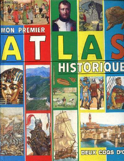
Mon premier atlas historique
Deux Coqs d'Or. 1988. In-4. Relié. Etat d'usage, Couv. convenable, Dos satisfaisant, Intérieur frais. 93 pages. Nombreuses cartes et illustrations en couleurs dans et hors texte.. . . . Classification Dewey : 912-Atlas, cartes et plans
Riferimento per il libraio : RO80259434
|
|
|
CALMETTE JOSEPH
ATLAS HISTORIQUE - II : LE MOYEN AGE.
PRESSES UNIVERSITAIRES DE FRANCE. 1941. In-8. Broché. Etat d'usage, Couv. partiel. décollorée, Mors fendus, Intérieur frais. 18 pages + XXIV planches en noir et blanc depliantes.. . . . Classification Dewey : 912-Atlas, cartes et plans
Riferimento per il libraio : R320075598
|
|
|
CALMETTE (Joseph), R. Grousset et J.-J. Gruber.
Atlas historique. II : Le Moyen Age.
PUF, 1936 gr. in-8° carré (17 x 22), 18 pp, + 24 cartes dépliantes hors texte, biblio, broché, bon état
Riferimento per il libraio : 11101
|
|
|
CALMET Augustin Dom
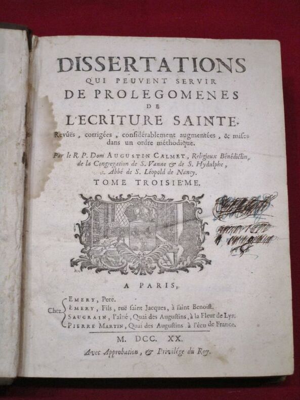
Dissertations qui peuvent servir de prolégomenes de l'Ecriture Sainte. Revûës, corrigées, considérablement augmentées, & mises dans un ordre méthodique.
A Paris, Chez Emery, père, Emery, fils, Saugrain l'aîné, Pierre Martin, 1720, 3 volumes in-4 de 190x 250 mm environ, vj, 822 pages; 428-476 pages et (2) ff. (titre, table), 898 pages, (1) f. (Catalogue). Complet des 8 planches (cartes dépliantes, plans et gravures diverses). Pleines basanes granitées, dos à 5 nerfs portant titres dorés sur pièce de cuir bordeaux, tomaisons dorées, roulette sur les coupes, tranches mouchetées de rouge, gardes blanches. Reliures solides avec des usures du temps (deux coiffes accidentées, coins émoussés, plats avec quelques épidermures), ex libris manuscrit à l'encre raturé sur les pages de titre, mouillures présentes dans les 3 tomes et plus importantes dans le troisième, quelques feuillets déchirés sans manque dont 1 restauré, bon état général, bel ensemble.
Riferimento per il libraio : 112406
|
|
|
CAMBESSEDES OLIVIER ET ALII
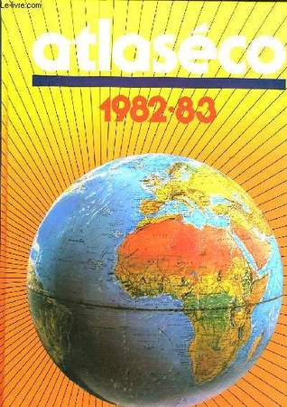
ATLASECO, 1982-83
Robert LAFFONT. 1983. In-4. Relié. Bon état, Couv. convenable, Dos satisfaisant, Intérieur frais. 322 pages. Illustré de nombreuses cartes monochromes et photos en noir et blanc.. . . . Classification Dewey : 912-Atlas, cartes et plans
Riferimento per il libraio : RO40082481
|
|
|
CAMBESSEDES OLIVIER.
ATLASECO DE POCHE - EDITION 1987
EDITIONS S.G.B. - ROBERT LAFFONT. 1987. In-12. Relié. Bon état, Couv. convenable, Dos satisfaisant, Intérieur frais. 735 Pages - Nombreuses cartes en noir et blanc dans et hors texte. . . . Classification Dewey : 912-Atlas, cartes et plans
Riferimento per il libraio : R160181731
|
|
|
Cambessédès Olivier
Atlaseco de poche editiobn 1988. Atlas économique mondial
Edition S.G.B.. 1988. In-12. Relié. Bon état, Couv. convenable, Dos satisfaisant, Intérieur frais. 656 pages.. . . . Classification Dewey : 912-Atlas, cartes et plans
Riferimento per il libraio : RO80236448
|
|
|
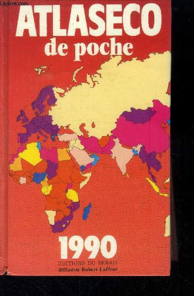
Cambessedes Olivier
Atlaseco de poche 1990
Editions du serail. Non daté. In-12. Broché. Bon état, Couv. convenable, Dos satisfaisant, Intérieur frais. 758 pages.. . . . Classification Dewey : 912-Atlas, cartes et plans
Riferimento per il libraio : RO40013628
|
|
|
Cambessédès Olivier
Atlaseco de poche édition 1985 - Atlas économique mondial.
Editions S.G.B.. 1985. In-12. Relié. Bon état, Couv. convenable, Dos satisfaisant, Intérieur frais. 600 pages - texte sur deux colonnes - nombreuses cartes et nombreux tableaux en noir et blanc dans le texte.. . . . Classification Dewey : 912-Atlas, cartes et plans
Riferimento per il libraio : R100062645 ISBN : 222104889

|
|
|
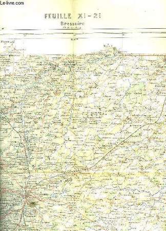
CAMESCASSE
BRESSUIRE
ERHARD - HACHETTE ET CIE. 1988. In-Folio. En feuillets. Bon état, Couv. convenable, Dos satisfaisant, Intérieur frais. 1 carte dépliante en couleurs de 56 x 44 cm. Echelle : 1 centimètre pour 1Km.. . . . Classification Dewey : 912-Atlas, cartes et plans
Riferimento per il libraio : RO30055332
|
|
|
CAMPABELLE
CARTES-GUIDES CAMPBELL N°3 - LA NORMANDIE COMPRENANT UN GUIDE PRATIQUE ET UNE CARTE EN 4 COULEURS A L'ECHELLE DE 1: 320 000e - A L'USAGE DES AUTOMOBILISTES, CYCLISTES ET TOURISTES.
BLONDEL ED.. NON DATE. In-Plano. En feuillets. Bon état, Couv. convenable, Dos satisfaisant, Intérieur frais. 56 pages - nombreux plans et illustrations en noir et blanc dans et hors texte + 1 carte depliante en couleur de dimension: 96 x 67 cm environs - ECHELLE 1: 320 000e. . . . Classification Dewey : 912-Atlas, cartes et plans
Riferimento per il libraio : RO20188212
|
|
|
CAMBESSEDES OLIVIER ET ALII
ATLASECO, 1982-83
ISBN : 2221010345. Robert LAFFONT. 1983. In-4 Carré. Relié. Bon état. Couv. convenable. Dos satisfaisant. Intérieur frais. 322 pages. Illustré de nombreuses cartes monochromes et photos en noir et blanc. Réalités démographiques, politiques et économiques de 170 pays.

|
|
|
Candido Mendes de Almeida
Atlas do Imperio do Brazil
Rio de Janeiro, Rainer, 2000. Réimpression fac-similé de l'original de 1868, réalisé sur commande de l'empereur du Brésil Dom Pedro II. En portugais. Un grand volume in-folio de 46,5 x 34,5 cm. relié à la Bradel avec un dos en percaline cerise. 37 pp. de texte explicatif et 24 planches. Les planches montrent une mappemonde, une carte complète du Brésil et une carte de chaque région de l'Empire. On remarquera avec intérêt des régions ayant disparu au gré des redécoupages administratifs, comme Pinsonia et le Grão Para, auxquels correspondent à peu près les actuels Amapá (près de la Guyane) et Pará. Cartes d'une qualité exceptionnelle. Le livre avait été conçu pour l'enseignement des futures élites de l'Empire dans les écoles impériales. Cette édition reproduit fidèlement les cartes et textes originaux, dans le moindre détail, en ajoutant à peine une mention du 2 janvier 2000 au-dessous de la page de préface de l'organisateur du volume originel. ************************** Rio de Janeiro, Rainer, 2000. Reimpressão fac-símile do original de 1868, encomendada pelo Imperador do Brasil, Dom Pedro II. Em português. Um grande volume in-fólio medindo 46,5 x 34,5 cm. Encadernado com dobradiças Bradel e lombada de percalino cerejeiro. 37 pp. de texto explicativo e 24 pranchas. As pranchas incluim um mapa-múndi, um mapa completo do Brasil e um mapa de cada região do Império. Vale destacar com interesse que regiões desapareceram devido à redistribuição administrativa, como Pinsônia e Grão Pará, que correspondem aproximadamente aos atuais Amapá (próximo à Guiana) e Pará. Mapas de qualidade excepcional. O livro foi criado para ensinar as futuras elites do Império nas escolas imperiais. Esta edição reproduz fielmente os mapas e textos originais, em todos os detalhes, com apenas uma menção ao dia 2 de janeiro de 2000, abaixo da página de prefácio do organizador do volume original.
Riferimento per il libraio : 0467

|
|
|
CANADA - DIRECTION DES LEVES ET DE LA CARTOGRAPHIE.
Atlas et toponymie du Canada.
Ottawa, Imprimeur de la Reine, 1969 1 volume 25,5 x 37,1cm Reliure éditeur illustrée couleurs; carte XVIIè reproduite sur les gardes. 104p. dont 48 de cartes couleurs. Bon état.
Riferimento per il libraio : 20059
|
|
|
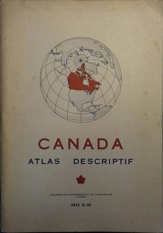
CANADA
Canada. Atlas descriptif.
Couverture souple. Broché. Environ 100 pages. 20 x 28 cm.
Riferimento per il libraio : 26168
|
|
|
CANADA - DIRECTION DES LEVES ET DE LA CARTOGRAPHIE.
Atlas et toponymie du Canada.
24 cartes couleurs doubles pages dont 1 carte générale du relief et 1 carte générale-index indiquant le découpage des cartes régionales qui suivent, d'échelle variable selon la densité des éléments (partie sud du pays, régions septentrionales, cartes des villes d'Ottawa, Montréal, Québec, Toronto et Vancouver); suivies d'un index aux très nombreuses entrées (plus de 50 pages). Français
|
|
|
CAPITAINE MADER
"CARTE DE ""SOUDAN OCCIDENTAL"" - en noir et blanc - Echelle 1/4.000000e - de dimension 40 Cm 31 Cm environ."
NON PRECISE. NON DATE. In-Plano. En feuillets. Etat d'usage, Couv. convenable, Dos satisfaisant, Intérieur acceptable. 1 CARTE EN NOIR ET BLANC DE DIMENSION 40 Cm X 31 Cm ENVIRON.. . . . Classification Dewey : 912-Atlas, cartes et plans
Riferimento per il libraio : R320059943
|
|
|
CAPITAINE MADER
CARTE DE L'AFRIQUE FRANCAISE ET LE PROJET DU TRANSSAHARIEN - en noir et blanc - Echelle 1/20000000e - de dimension 40 Cm 31 Cm environ / Conference de Garnison - l'Expansion française en Afrique.
NON PRECISE. NON DATE. In-Plano. En feuillets. Etat d'usage, Couv. convenable, Dos satisfaisant, Intérieur acceptable. 1 CARTE EN NOIR ET BLANC DE DIMENSION 40 Cm X 31 Cm ENVIRON.. . . . Classification Dewey : 912-Atlas, cartes et plans
Riferimento per il libraio : R320059942
|
|
|
Carte topographique originale manuscrite.
"""Généralités de Bordeaux , plan itinéraire de la route de Bordeaux à Toulouse commençcant au faubourg de St Julin jusqu'au pont de Malauze, limites de la généralités"""
"Non Renseigné. 1768. In-8. Relié. Bon état, Couv. convenable, Dos satisfaisant, Intérieur frais. Carte topographique,déssinée et coloriée à la main , sur papier à la forme, légende et page de titre manuscrites, en couleurs, est signalé le relief, la nature du sol, (""terrain graveleux planté en vignes qui produit ce bon vin blanc"", ""terrain sableux"", ""carrières"", ""terrain sablonneux""), l'implantation des vignes.Les habitations sont indiquées en rouge, les vignes et forêts en vert et les cours d'eau en bleu.Sont mentionnés également les aqueducs, les ponts, (avec la date de construction et les matériaux utilisés, et nom du constructeur) les routes et les chemins.Le plan se présente en bande de 8 cm en pleine page et au dessous se trouve la légende manuscrite. Distances sont en toise, de bourg à bourg ( Martillac à St Médard: 966 toises), de paroisse à paroisse.Echelle des itinéraires de 5 lignes pour 100 toises.La première page est rempliée.. . . A l'italienne. Classification Dewey : 912-Atlas, cartes et plans"
Riferimento per il libraio : RO20020340
|
|
|
Carte de France
- N° 10 - Mézières
Non Renseigné. type 1912. In-8. En feuillets. Bon état, Couv. convenable, Dos satisfaisant, Intérieur bon état. Carte en couleurs de 18 feuillets sur toile - Echelle 1 / 200 000 - Tâches et rousseurs sur l'envers toilé de la carte.. . . . Classification Dewey : 912-Atlas, cartes et plans
Riferimento per il libraio : ROD0028112
|
|
|
Carte d'Etat Major
100 - Lure
Non Renseigné. Non daté. In-8. Broché. Bon état, Couv. convenable, Dos satisfaisant, Intérieur frais. Non Renseigné. . . . Classification Dewey : 912-Atlas, cartes et plans
Riferimento per il libraio : ROD0028149
|
|
|
Carte d'Etat Major
101 - Mulhouse
Non Renseigné. Non daté. In-8. En feuillets. Bon état, Couv. convenable, Dos satisfaisant, Intérieur frais. Non Renseigné. . . . Classification Dewey : 912-Atlas, cartes et plans
Riferimento per il libraio : ROD0028150
|
|
|

 Ricevere i risultati per e-mail
 Scaricare i risultati in PDF
 RSS feed
 Link
Link


