|
CALMETTE (Joseph), R. Grousset et J.-J. Gruber.
Atlas historique. II : Le Moyen Age.
PUF, 1936 gr. in-8° carré (17 x 22), 18 pp, + 24 cartes dépliantes hors texte, biblio, broché, bon état
Referencia librero : 11101
|
|
|
CALMET Augustin Dom
Dissertations qui peuvent servir de prolégomenes de l'Ecriture Sainte. Revûës, corrigées, considérablement augmentées, & mises dans un ordre méthodique.
A Paris, Chez Emery, père, Emery, fils, Saugrain l'aîné, Pierre Martin, 1720, 3 volumes in-4 de 190x 250 mm environ, vj, 822 pages; 428-476 pages et (2) ff. (titre, table), 898 pages, (1) f. (Catalogue). Complet des 8 planches (cartes dépliantes, plans et gravures diverses). Pleines basanes granitées, dos à 5 nerfs portant titres dorés sur pièce de cuir bordeaux, tomaisons dorées, roulette sur les coupes, tranches mouchetées de rouge, gardes blanches. Reliures solides avec des usures du temps (deux coiffes accidentées, coins émoussés, plats avec quelques épidermures), ex libris manuscrit à l'encre raturé sur les pages de titre, mouillures présentes dans les 3 tomes et plus importantes dans le troisième, quelques feuillets déchirés sans manque dont 1 restauré, bon état général, bel ensemble.
Referencia librero : 112406
|
|
|
California Atlas Hayes Derek.
Historical Atlas of California with Original Maps.
Berkeley:: University of California Press 2007. . A Near Fine copy in a Near Fine dust jacket. Using nearly five hundred historical maps and many other illustrations from rough sketches drawn in the field to commercial maps to beautifully rendered works of art this lavishly illustrated volume is the first to tell the story of California's past from a unique visual perspective. Covering five hundred years of history it offers a compelling and informative look at the transformation of the state from before European contact through the Gold Rush and up to the present. The maps are accompanied by a concise engaging narrative and by extended captions that elucidate the stories and personalities behind their creation. At once a valuable reference and an exhilarating adventure through history the Historical Atlas of California featuring many rare and unusual maps will be a treasured addition to any library. Distilling an enormous amount of information into one volume it presents a fascinating chronicle of how California came to be what it is today. University of California Press, unknown
Referencia librero : 26860

|
|
|
Callahan Brigette Atlas Warham Kristin Madej
Buffalo From A to Z Come Take a Tour With Me
CrissCross AppleSauce. Used - Like New. Like New condition. A near perfect copy that may have very minor cosmetic defects. CrissCross AppleSauce unknown
Referencia librero : O13C-02285 ISBN : 1942483619 9781942483618

|
|
|
CALLEWAERT CONSTANT / ATLAS
Atlas complet de g�ographie physique et politique Total 85 planches lecons et cartes en regard. 2e �dition
Bruxelles : Callewaert Freres 1858. HARDCOVER . Bound in marbled carton spine repaired name on tit.page occas. spotted pencil annotations on some papers one map misses corner else VERY GOOD. Very rare. Bruxelles : Callewaert, Freres hardcover
Referencia librero : 2218
|
|
|
CAMBESSEDES OLIVIER ET ALII
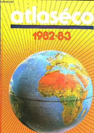
ATLASECO, 1982-83
Robert LAFFONT. 1983. In-4. Relié. Bon état, Couv. convenable, Dos satisfaisant, Intérieur frais. 322 pages. Illustré de nombreuses cartes monochromes et photos en noir et blanc.. . . . Classification Dewey : 912-Atlas, cartes et plans
Referencia librero : RO40082481
|
|
|
CAMBESSEDES OLIVIER.
ATLASECO DE POCHE - EDITION 1987
EDITIONS S.G.B. - ROBERT LAFFONT. 1987. In-12. Relié. Bon état, Couv. convenable, Dos satisfaisant, Intérieur frais. 735 Pages - Nombreuses cartes en noir et blanc dans et hors texte. . . . Classification Dewey : 912-Atlas, cartes et plans
Referencia librero : R160181731
|
|
|
Cambessédès Olivier
Atlaseco de poche editiobn 1988. Atlas économique mondial
Edition S.G.B.. 1988. In-12. Relié. Bon état, Couv. convenable, Dos satisfaisant, Intérieur frais. 656 pages.. . . . Classification Dewey : 912-Atlas, cartes et plans
Referencia librero : RO80236448
|
|
|
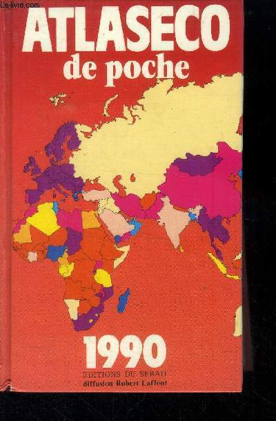
Cambessedes Olivier
Atlaseco de poche 1990
Editions du serail. Non daté. In-12. Broché. Bon état, Couv. convenable, Dos satisfaisant, Intérieur frais. 758 pages.. . . . Classification Dewey : 912-Atlas, cartes et plans
Referencia librero : RO40013628
|
|
|
Cambessédès Olivier
Atlaseco de poche édition 1985 - Atlas économique mondial.
Editions S.G.B.. 1985. In-12. Relié. Bon état, Couv. convenable, Dos satisfaisant, Intérieur frais. 600 pages - texte sur deux colonnes - nombreuses cartes et nombreux tableaux en noir et blanc dans le texte.. . . . Classification Dewey : 912-Atlas, cartes et plans
Referencia librero : R100062645 ISBN : 222104889

|
|
|
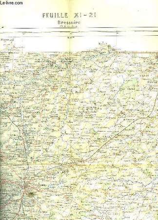
CAMESCASSE
BRESSUIRE
ERHARD - HACHETTE ET CIE. 1988. In-Folio. En feuillets. Bon état, Couv. convenable, Dos satisfaisant, Intérieur frais. 1 carte dépliante en couleurs de 56 x 44 cm. Echelle : 1 centimètre pour 1Km.. . . . Classification Dewey : 912-Atlas, cartes et plans
Referencia librero : RO30055332
|
|
|
CAMPABELLE
CARTES-GUIDES CAMPBELL N°3 - LA NORMANDIE COMPRENANT UN GUIDE PRATIQUE ET UNE CARTE EN 4 COULEURS A L'ECHELLE DE 1: 320 000e - A L'USAGE DES AUTOMOBILISTES, CYCLISTES ET TOURISTES.
BLONDEL ED.. NON DATE. In-Plano. En feuillets. Bon état, Couv. convenable, Dos satisfaisant, Intérieur frais. 56 pages - nombreux plans et illustrations en noir et blanc dans et hors texte + 1 carte depliante en couleur de dimension: 96 x 67 cm environs - ECHELLE 1: 320 000e. . . . Classification Dewey : 912-Atlas, cartes et plans
Referencia librero : RO20188212
|
|
|
CAMBESSEDES OLIVIER ET ALII
ATLASECO, 1982-83
ISBN : 2221010345. Robert LAFFONT. 1983. In-4 Carré. Relié. Bon état. Couv. convenable. Dos satisfaisant. Intérieur frais. 322 pages. Illustré de nombreuses cartes monochromes et photos en noir et blanc. Réalités démographiques, politiques et économiques de 170 pays.

|
|
|
Candido Mendes de Almeida
Atlas do Imperio do Brazil
Rio de Janeiro, Rainer, 2000. Réimpression fac-similé de l'original de 1868, réalisé sur commande de l'empereur du Brésil Dom Pedro II. En portugais. Un grand volume in-folio de 46,5 x 34,5 cm. relié à la Bradel avec un dos en percaline cerise. 37 pp. de texte explicatif et 24 planches. Les planches montrent une mappemonde, une carte complète du Brésil et une carte de chaque région de l'Empire. On remarquera avec intérêt des régions ayant disparu au gré des redécoupages administratifs, comme Pinsonia et le Grão Para, auxquels correspondent à peu près les actuels Amapá (près de la Guyane) et Pará. Cartes d'une qualité exceptionnelle. Le livre avait été conçu pour l'enseignement des futures élites de l'Empire dans les écoles impériales. Cette édition reproduit fidèlement les cartes et textes originaux, dans le moindre détail, en ajoutant à peine une mention du 2 janvier 2000 au-dessous de la page de préface de l'organisateur du volume originel. ************************** Rio de Janeiro, Rainer, 2000. Reimpressão fac-símile do original de 1868, encomendada pelo Imperador do Brasil, Dom Pedro II. Em português. Um grande volume in-fólio medindo 46,5 x 34,5 cm. Encadernado com dobradiças Bradel e lombada de percalino cerejeiro. 37 pp. de texto explicativo e 24 pranchas. As pranchas incluim um mapa-múndi, um mapa completo do Brasil e um mapa de cada região do Império. Vale destacar com interesse que regiões desapareceram devido à redistribuição administrativa, como Pinsônia e Grão Pará, que correspondem aproximadamente aos atuais Amapá (próximo à Guiana) e Pará. Mapas de qualidade excepcional. O livro foi criado para ensinar as futuras elites do Império nas escolas imperiais. Esta edição reproduz fielmente os mapas e textos originais, em todos os detalhes, com apenas uma menção ao dia 2 de janeiro de 2000, abaixo da página de prefácio do organizador do volume original.
Referencia librero : 0467

|
|
|
CANADA - DIRECTION DES LEVES ET DE LA CARTOGRAPHIE.
Atlas et toponymie du Canada.
Ottawa, Imprimeur de la Reine, 1969 1 volume 25,5 x 37,1cm Reliure éditeur illustrée couleurs; carte XVIIè reproduite sur les gardes. 104p. dont 48 de cartes couleurs. Bon état.
Referencia librero : 20059
|
|
|
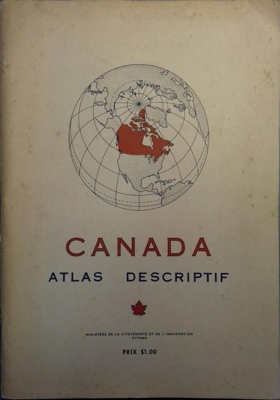
CANADA
Canada. Atlas descriptif.
Couverture souple. Broché. Environ 100 pages. 20 x 28 cm.
Referencia librero : 26168
|
|
|
CANADA ATLAS. WALLING H.enry F.rancis Ed. HUNT T.homas Sterry BELL Robert et al.
Tackabury’s atlas of the dominion of Canada with general descriptions by. . . .
Montreal Toronto & London: George N. Tackabury Printed by the Burland-Desbarats Lithographic Co. 1875. Folio. 14.25 x 17.75 in. 251 1 pp. Colour lithograph illustrated title page showing the Parliament Building in Ottawa Canada from photograph by W. Notman 53 colour lithograph maps many double-page many tables. Publisher’s plum-coloured embossed cloth gilt decorative lettering on front cover marbled endpapers nicely rebacked in simulated black calf corners renewed some wear & rubbing to corners 1 leaf w/ repairs to creases minor tidemark to upper right corner not affecting maps still G copy. First edition of this fine atlas of Victorian-era Canada including maps of climatology possessions provinces prior to Alberta Saskatchewan & Newfoundland becoming provinces plat maps of counties Railways as well as maps of the United States and Europe. Of particular interest are the city maps of Quebec Ottawa London Hamilton Kingston Toronto and Montreal. This excellent reference work also provides a comprehensive list of railways in Canada steamships in use lists post offices railway stations cities and populations as well as business cards located by city and town. George N. Tackabury, [Printed by the Burland-Desbarats Lithographic Co.], hardcover
Referencia librero : 51587
|
|
|
CANADA - DIRECTION DES LEVES ET DE LA CARTOGRAPHIE.
Atlas et toponymie du Canada.
24 cartes couleurs doubles pages dont 1 carte générale du relief et 1 carte générale-index indiquant le découpage des cartes régionales qui suivent, d'échelle variable selon la densité des éléments (partie sud du pays, régions septentrionales, cartes des villes d'Ottawa, Montréal, Québec, Toronto et Vancouver); suivies d'un index aux très nombreuses entrées (plus de 50 pages). Français
|
|
|
Canada Gazettee Canada Gazetteer Atlas Canada Gazetteer Atlas
Canada Gazetteer Atlas
University of Chicago Press . hardcover. New. pp. 176 University of Chicago Press hardcover
Referencia librero : 63823188 ISBN : 0226092593 9780226092591

|
|
|
Canada Gazetteer Atlas
Canada Gazetteer Atlas
University Of Chicago Press 1980-08-01. Hardcover. Good. University Of Chicago Press hardcover
Referencia librero : SONG0226092593 ISBN : 0226092593 9780226092591
|
|
|
CAPITAINE MADER
"CARTE DE ""SOUDAN OCCIDENTAL"" - en noir et blanc - Echelle 1/4.000000e - de dimension 40 Cm 31 Cm environ."
NON PRECISE. NON DATE. In-Plano. En feuillets. Etat d'usage, Couv. convenable, Dos satisfaisant, Intérieur acceptable. 1 CARTE EN NOIR ET BLANC DE DIMENSION 40 Cm X 31 Cm ENVIRON.. . . . Classification Dewey : 912-Atlas, cartes et plans
Referencia librero : R320059943
|
|
|
CAPITAINE MADER
CARTE DE L'AFRIQUE FRANCAISE ET LE PROJET DU TRANSSAHARIEN - en noir et blanc - Echelle 1/20000000e - de dimension 40 Cm 31 Cm environ / Conference de Garnison - l'Expansion française en Afrique.
NON PRECISE. NON DATE. In-Plano. En feuillets. Etat d'usage, Couv. convenable, Dos satisfaisant, Intérieur acceptable. 1 CARTE EN NOIR ET BLANC DE DIMENSION 40 Cm X 31 Cm ENVIRON.. . . . Classification Dewey : 912-Atlas, cartes et plans
Referencia librero : R320059942
|
|
|
Carte topographique originale manuscrite.
"""Généralités de Bordeaux , plan itinéraire de la route de Bordeaux à Toulouse commençcant au faubourg de St Julin jusqu'au pont de Malauze, limites de la généralités"""
"Non Renseigné. 1768. In-8. Relié. Bon état, Couv. convenable, Dos satisfaisant, Intérieur frais. Carte topographique,déssinée et coloriée à la main , sur papier à la forme, légende et page de titre manuscrites, en couleurs, est signalé le relief, la nature du sol, (""terrain graveleux planté en vignes qui produit ce bon vin blanc"", ""terrain sableux"", ""carrières"", ""terrain sablonneux""), l'implantation des vignes.Les habitations sont indiquées en rouge, les vignes et forêts en vert et les cours d'eau en bleu.Sont mentionnés également les aqueducs, les ponts, (avec la date de construction et les matériaux utilisés, et nom du constructeur) les routes et les chemins.Le plan se présente en bande de 8 cm en pleine page et au dessous se trouve la légende manuscrite. Distances sont en toise, de bourg à bourg ( Martillac à St Médard: 966 toises), de paroisse à paroisse.Echelle des itinéraires de 5 lignes pour 100 toises.La première page est rempliée.. . . A l'italienne. Classification Dewey : 912-Atlas, cartes et plans"
Referencia librero : RO20020340
|
|
|
Carte de France
- N° 10 - Mézières
Non Renseigné. type 1912. In-8. En feuillets. Bon état, Couv. convenable, Dos satisfaisant, Intérieur bon état. Carte en couleurs de 18 feuillets sur toile - Echelle 1 / 200 000 - Tâches et rousseurs sur l'envers toilé de la carte.. . . . Classification Dewey : 912-Atlas, cartes et plans
Referencia librero : ROD0028112
|
|
|
Carte d'Etat Major
100 - Lure
Non Renseigné. Non daté. In-8. Broché. Bon état, Couv. convenable, Dos satisfaisant, Intérieur frais. Non Renseigné. . . . Classification Dewey : 912-Atlas, cartes et plans
Referencia librero : ROD0028149
|
|
|
Carte d'Etat Major
101 - Mulhouse
Non Renseigné. Non daté. In-8. En feuillets. Bon état, Couv. convenable, Dos satisfaisant, Intérieur frais. Non Renseigné. . . . Classification Dewey : 912-Atlas, cartes et plans
Referencia librero : ROD0028150
|
|
|
Carte d'Etat Major
2 - Dunkerque
Non Renseigné. Non daté. In-8. En feuillets. Etat d'usage, Couv. convenable, Dos satisfaisant, Mouillures. Non Renseigné. . . . Classification Dewey : 912-Atlas, cartes et plans
Referencia librero : ROD0028158
|
|
|
Carte d'Etat Major
4 - St-Omer
Non Renseigné. Non daté. In-8. En feuillets. Bon état, Couv. convenable, Dos satisfaisant, Intérieur frais. Non Renseigné. . . . Classification Dewey : 912-Atlas, cartes et plans
Referencia librero : ROD0028151
|
|
|
Carte d'Etat Major
49 - Meaux
Non Renseigné. Non daté. In-8. En feuillets. Bon état, Couv. convenable, Dos satisfaisant, Intérieur frais. Non Renseigné. . . . Classification Dewey : 912-Atlas, cartes et plans
Referencia librero : ROD0028154
|
|
|
Carte d'Etat Major
50 - Chalons
Non Renseigné. Non daté. In-8. En feuillets. Bon état, Couv. convenable, Dos satisfaisant, Intérieur frais. Non Renseigné. . . . Classification Dewey : 912-Atlas, cartes et plans
Referencia librero : ROD0028155
|
|
|
Carte d'Etat Major
53 - Sarrebourg
Non Renseigné. Non daté. In-8. En feuillets. Bon état, Couv. convenable, Dos satisfaisant, Intérieur frais. Non Renseigné. . . . Classification Dewey : 912-Atlas, cartes et plans
Referencia librero : ROD0028156
|
|
|
Carte d'Etat Major
68 - Vassy
Non Renseigné. Non daté. In-8. En feuillets. Bon état, Couv. convenable, Dos satisfaisant, Intérieur frais. Non Renseigné. . . . Classification Dewey : 912-Atlas, cartes et plans
Referencia librero : ROD0028143
|
|
|
Carte d'Etat Major
7 - Arras
Non Renseigné. Non daté. In-8. En feuillets. Bon état, Couv. convenable, Dos satisfaisant, Intérieur frais. Non Renseigné. . . . Classification Dewey : 912-Atlas, cartes et plans
Referencia librero : ROD0028141
|
|
|
Carte d'Etat Major
70 - Luneville
Non Renseigné. Non daté. In-8. Broché. Bon état, Couv. convenable, Dos satisfaisant, Intérieur frais. Non Renseigné. . . . Classification Dewey : 912-Atlas, cartes et plans
Referencia librero : ROD0028145
|
|
|
Carte d'Etat Major
84 - Mirecourt
Non Renseigné. Non daté. In-8. En feuillets. Bon état, Couv. convenable, Dos satisfaisant, Intérieur frais. Non Renseigné. . . . Classification Dewey : 912-Atlas, cartes et plans
Referencia librero : ROD0028146
|
|
|
Carte d'Etat Major
86 - Colmar
Non Renseigné. Non daté. In-8. En feuillets. Bon état, Couv. convenable, Dos satisfaisant, Intérieur frais. Non Renseigné. . . . Classification Dewey : 912-Atlas, cartes et plans
Referencia librero : ROD0028148
|
|
|
CARTES TARIDE
ALLEMAGNE DU NORS GRANDS ITINERAIRES POUR AUTOMOBILES
EDITIONS TARIDE. Non daté. In-Plano. Broché. Etat d'usage, Couv. légèrement passée, Dos satisfaisant, Intérieur acceptable. Carte dépliante en couleurs en 16 volets en couleurs au 1/300.000e.. . . . Classification Dewey : 912-Atlas, cartes et plans
Referencia librero : RO70122809
|
|
|
CARPENTER Shirley & COLLECTIF
Atlas du monde en relief.
TALLANDIER Jules. 1968. In-4. Broché. Bon état, Couv. légèrement passée, Dos satisfaisant, Intérieur acceptable. 205 pages. Nombreuses cartes en couleurs, en hors-texte.. . . . Classification Dewey : 912-Atlas, cartes et plans
Referencia librero : RO80084988
|
|
|
CARWARDINE MARK
ATLAS ILLUSTRE DU MONDE ANIMAL.
FRANCE LOISIRS / HACHETTE. 1990. In-4. Relié. Bon état, Couv. convenable, Dos satisfaisant, Intérieur frais. 63 pages. Nombreuses illustrations en couleur dans le format texte.. . . . Classification Dewey : 912-Atlas, cartes et plans
Referencia librero : R240047331
|
|
|
CARREZ Ludwig S.J.
Atlas geographicus Societatis Jesu in quo delineantur quinque ejus modernae assistentiae, Provinciae tres et viginti singularumque in toto orbe missiones, necnon et veteres ejusdem Societatis provinciae quadraginta tres cum earum domicilis, quantum fieri licuit
Paris, Apud Georgium Colombier 1900 16pp. (text) + 45 maps in colour (double-page) with description, black cloth (spine in black leather) with engilded title, marbled endpapers, 39cm., small stamp, VG
Referencia librero : R59712
|
|
|
CARAYOL, Michel ; CHAUDENSON, Robert ; BARAT, Christian
Atlas Linguistique et Ethnographique de La Réunion. Volume I : Le relief, le temps, l'homme, la maison
1 vol. in-folio cartonnage éditeur, Editions du Centre National de la Recherche Scientifique, CNRS Editions, 1984, 247 pp.
Referencia librero : 67484

|
|
|
CARREZ Ludwig (S.J.)
Atlas geographicus Societatis Jesu in quo delineantur quinque ejus modernae assistentiae, provinciae tres et viginti singularumque in toto orbe missiones, necnon et veteres ejusdem Societatis provinciae quadraginta tres cum earum domiciliis, quantum fieri licuit.
Parisiis, apud Georgium Colombier, Typographum, 1900 27 x 40, cartes: 45 doubles planches couleurs, demi-reliure (dos usé, coins légèrement abîmés), bon état d'ensemble, pas de rousseurs (page de garde et de titre, 3 cachets de la bibliothèque du Collège Jésuite Saint-Stanislas à Mons)
Referencia librero : 3668
|
|
|
CARPENTER Shirley et alii
Atlas du monde en relief.
Paris, Tallandier, 1968. 21 x 30, 205 pp., quelques illustrations en N/B, très nombreuses cartes en couleurs, cartonnage d'édition imprimé, très bon état.
Referencia librero : 36936
|
|
|
CARTES TARIDE
CARTE ROUTIERE N°21 - PYRENEES (EST)
EDITIONS TARIDE. Non daté. In-Plano. Broché. Etat d'usage, Couv. légèrement passée, Dos satisfaisant, Intérieur acceptable. Carte dépliante en couleurs en 32 volets en couleurs au 1/250.000e. Note au stylo au dos de la carte.. . . . Classification Dewey : 912-Atlas, cartes et plans
Referencia librero : RO70122769
|
|
|
CARTES TARIDE
CARTE DE FRANCE ROUTIERE ET KILOMETRIQUE INDIQUANT LES GRANDS ITINERAIRES
EDITIONS TARIDE. Non daté. In-Plano. Broché. Etat d'usage, Couv. légèrement passée, Dos satisfaisant, Intérieur acceptable. Carte dépliante en couleurs en 30 volets en couleurs au 1/300.000e. Note au stylo au dos de la carte.. . . . Classification Dewey : 912-Atlas, cartes et plans
Referencia librero : RO70122775
|
|
|
CARTES TARIDE
CARTE ROUTIERE POUR CYCLISTES & AUTOMOBILES DE LA BRETAGNE ET NORMANDIE (SECTION NORD)
EDITIONS TARIDE. Non daté. In-Plano. Broché. Etat d'usage, Couv. légèrement passée, Dos satisfaisant, Intérieur acceptable. Carte dépliante en couleurs en 24 volets en couleurs au 1/250.000e. Note au stylo au dos de la carte.. . . . Classification Dewey : 912-Atlas, cartes et plans
Referencia librero : RO70122780
|
|
|
CARTES TARIDE
CARTE GUIDE CAMPBELL N°13 PYRENEES BAYONNE
EDITIONS TARIDE. Non daté. In-Plano. Broché. Etat d'usage, Couv. légèrement passée, Dos satisfaisant, Intérieur acceptable. Carte dépliante en couleurs en 24 volets en couleurs au 1/320.000e. Note au stylo au dos de la carte.. . . . Classification Dewey : 912-Atlas, cartes et plans
Referencia librero : RO70122781
|
|
|
CARTES TARIDE
CARTE ROUTIERE POUR AUTOMOBILISTES & CYCLISTES - PYRENEES SECTION OUEST
EDITIONS TARIDE. Non daté. In-Plano. Broché. Etat d'usage, Couv. légèrement passée, Dos satisfaisant, Intérieur acceptable. Carte dépliante en couleurs en 24 volets couleurs au 1/250.000e. Note au stylo au dos de la carte.. . . . Classification Dewey : 912-Atlas, cartes et plans
Referencia librero : RO70122783
|
|
|
CARTES TARIDE
CARTE ROUTIERE N°14 - LYONNAIS, SAVOIE ET DAUPHINE
EDITIONS TARIDE. Non daté. In-Plano. Broché. Etat d'usage, Couv. légèrement passée, Dos satisfaisant, Intérieur acceptable. Carte dépliante en couleurs en 30 volets en couleurs au 1/250.000e.. . . . Classification Dewey : 912-Atlas, cartes et plans
Referencia librero : RO70122787
|
|
|
CARTES TARIDE
CARTE DE LA REOLE
EDITIONS TARIDE. Non daté. In-Plano. Broché. Etat d'usage, Couv. légèrement passée, Dos satisfaisant, Intérieur acceptable. Carte dépliante en couleurs en 16 volets en noir et blanc au 1/80.000e.. . . . Classification Dewey : 912-Atlas, cartes et plans
Referencia librero : RO70122788
|
|
 Recibir por correo electrónico
 Descargar en documento PDF
 Flujo RSS


