|
[Atlas; Russo-Japanese War]
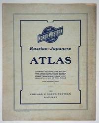
The Chicago & North-Western Russian-Japanese War Atlas: showing Russia-in-Europe and Russia-in-Asia Japan Korea Manchuria and China and the entire theater of operations in the Far Eastern Conflict
Chicago: Rand McNally and Company; Chicago and North Western Railway Company 1904. First printing. Staplebound Wraps. Very good condition. Maps of the Russo-Japanese War five maps with a key printed in the margins comprised by the North-Western Line on inside front cover b&w World map; Asia; Eastern China; Japan and Korea all in color and 'the Only Double-Track Railway Between Chicago and the Missouri River and the Route of the Overland Limited' inside the back cover b&w. <br /> <br /> OCLC: 928938679 at Newberry Library Baskes Collection. Small folio printed paper wrappers grey covers with blue titles on front/back. Maps in color and b&w. Covers dusty slt. chip on foredge original folds. Rand McNally and Company; Chicago and North Western Railway Company unknown
Referenz des Buchhändlers : 27334
|
|
|
[ATLAS]
Atlas : la France de nos campagnes du bocage normand au maquis corse.
Paris, Editions atlas, 2008 ; in-4, 239 pp., cartonnage de l'éditeur. Avec jaquette.
Referenz des Buchhändlers : 201112690
|
|
|
[ATLAS]
Atlas aérien France tome 5.
Paris, Gallimard, 1964 ; in-4, 186 pp., cartonnage d'éditeur avec jaquette. Alsace vosges, lorraine , ardennes, champagne , morvan, bourgogne , jura.
Referenz des Buchhändlers : 201106906
|
|
|
[ATLAS]
Atlas aérien tome 1.
Paris, Gallimard, 1955 ; in-4, 184 pp., cartonnage d'éditeur avec jaquette. Alpes vallée du rhone , provence, corse.
Referenz des Buchhändlers : 201106902
|
|
|
[ATLAS]
Atlas bottin en 2 volumes.
Paris, Bottin, 1951 ; in-4, 693-593 pp., cartonnage de l'éditeur. Les 2 volumes. En 2 volumes, reliure frotté.
Referenz des Buchhändlers : 202103086
|
|
|
[ATLAS]
ATLAS DE LA MONARCHIE PRUSIENNE.
A LONDRES, s.e., 1788 ; in-folio, cartonnage de l'éditeur. Qlq planches sont griboullées au dos de l'impression (sur 2 planches) contient 10 cartes de géographie ttes en bonne état par M. MENTELLE, historiographe de Mgr Cte d'ARTOIS & Cie. gravé par P.F. Tardieu - 93 planches de tactiques militaire et 74 planches de statistiques et divers - pour l'ouvrage de Mr le comte de Mirabeau, coiffes très abimé ainsi que les mors.
Referenz des Buchhändlers : 202204733
|
|
|
[ATLAS]
ATLAS DE LA MONARCHIE PRUSIENNE.
A LONDRES, s.e., 1788 ; in-folio, cartonnage de l'éditeur. Qlq planches sont griboullées au dos de l'impression (sur 2 planches) contient 10 cartes de géographie ttes en bonne état par M. MENTELLE, historiographe de Mgr Cte d'ARTOIS & Cie. gravé par P.F. Tardieu - 93 planches de tactiques militaire et 74 planches de statistiques et divers - pour l'ouvrage de Mr le comte de Mirabeau, coiffes très abimé ainsi que les mors.
Referenz des Buchhändlers : 200708944
|
|
|
[ATLAS]
Atlas du monde.
Paris, Selection du rearder's digest, 1969 ; in-8, 52 pp., cartonnage de l'éditeur .
Referenz des Buchhändlers : 200505031
|
|
|
[ATLAS]
Atlas géographique.
Paris, Editions atlas, 1986 ; in-4, cartonnage de l'éditeur .
Referenz des Buchhändlers : 200505067
|
|
|
[ATLAS]
Atlas géographique.
Paris, Fernand nathan, 1990 ; in-4, 104 pp., cartonnage de l'éditeur .
Referenz des Buchhändlers : 200505030
|
|
|
[ATLAS]
Atlas géopolitique & culturel.
Paris, Le robert - l'express, 2004 ; in-8, 168 pp., broché, couverture illustr. Les grands enjeux démographiques, économiques, politiques, sociaux et culturel du monde contemporain.
Referenz des Buchhändlers : 200811008
|
|
|
[ATLAS]
Atlas géopolitique et culturel.
, Le robert en partenariat avec l'express, 2004 ; in-8, 167 pp., br.
Referenz des Buchhändlers : 201110817
|
|
|
[ATLAS]
Atlas hachette la puissance économique.
Paris, Hachette, 1990 ; in-4, 231 pp., br. Sous la direction de pierre vallaud.
Referenz des Buchhändlers : 201318254
|
|
|
[ATLAS]
Atlas illustré de la terre.
Paris, Fernand nathan, 1979 ; in-4, 112 pp., cartonnage de l'éditeur .
Referenz des Buchhändlers : 200505026
|
|
|
[ATLAS]
ATLAS OF DORCHESTER WEST ROXBURY AND BRIGHTON CITY OF BOSTON
1899. ATLAS. ATLAS OF DORCHESTER WEST ROXBURY AND BRIGHTON CITY OF BOSTON in one volume. Boston: L. J. Richards 1899. Folio. 22" Street index plus 40 double page maps measuring 32" x 22". Bound in 1/2 leather which is largely absent. Front board is detached. Interiors are clean and free from staining with the exception of some light red or graphite pencil annotations on a few plates and soiled end-papers. Plates with pencil annotations: 28 29 30 37 39. Maps printed in as many as seven colors. A good copy. unknown
Referenz des Buchhändlers : 86734

|
|
|
[ATLAS]
ATLAS OF THE CITY OF BOSTON VOLUME 6 WEST ROXBURY
1896. ATLAS. ATLAS OF THE CITY OF BOSTON VOLUME 6 WEST ROXBURY. Philadelphia: G. W. Bromley and Co. 1896. Second edition. Folio 22.5". Contains street index outline and index map and 30 double-page maps measuring 22.5" by 32". Maps have only minor soiling to margins and occasional pencil annotations plates 1 and 27. FFEP and title page have large chips. Bound in half leather now mostly chipping or absent. In need of rebacking front board detatched. unknown
Referenz des Buchhändlers : 86739

|
|
|
[ATLAS]
ATLAS OF THE CITY OF BOSTON Vol. 7 BRIGHTON MASS
1890. ATLAS. ATLAS OF THE CITY OF BOSTON Vol. 7 BRIGHTON MASS. Philadelphia: G. W. Bromley & Co. 1890. Folio. 22" Contains 30 double page maps - outline and index map and 29 plates - measuring 32" x 22" with only slight marginal staining near spine at head. Maps are drawn at scale of either 600 100 or 150 ft/inch. Bound in 1/2 leather missing much of leather covering and has detached and chipped FFEP. Front hinge very weak. unknown
Referenz des Buchhändlers : 86735

|
|
|
[ATLAS]
ATLAS OF THE CITY OF BOSTON: SOUTH BOSTON
1899. ATLAS. ATLAS OF THE CITY OF BOSTON: SOUTH BOSTON. Philadelphia: G. W. Bromley Co. 1899. Folio 23". Street index and 33 double-page maps - outline and index map and 32 plates - measuring 32.5" x 22.5". Ffep missing. Outline and index map has tear near bottom where sheet folds. Plate 1 partly detached. Plates 29 30 31 are detached. Plates 2 and 32 have pencil annotations. Bound in 1/2 leather which is flaking. Interiors are bright some soil. Good. unknown
Referenz des Buchhändlers : 86736

|
|
|
[ATLAS]
ATLAS OF THE TOWNS OF REVERE AND WINTHROP SUFFOLK COUNTY MASS
1906. ATLAS. ATLAS OF THE TOWNS OF REVERE AND WINTHROP SUFFOLK COUNTY MASS. Boston: Whitman & Howard 1906. Folio. 22". Double page maps measure 32" by 22". All plans are drawn to a scale of 150 feet to one inch except index map. Includes street index outline and index map and 25 double-page maps. Interiors are in good condition with some light staining throughout at head and spine pencil or ink annotations to title page and plates 3 4 5 8. Exteriors are fair with heavily worn half-leather with black cloth boards and gilt-stamped edges. A good copy. unknown
Referenz des Buchhändlers : 86732

|
|
|
[ATLAS]
ATLAS OF THE CITY OF CHELSEA AND THE TOWNS OF REVERE AND WINTHROP
1896. ATLAS. ATLAS OF THE CITY OF CHELSEA AND THE TOWNS OF REVERE & WINTHROP MASS. Philadelphia: G. W. Bromley and Co. 1896. Folio 22.5". Contains street index outline and index map and 22 double-page maps measuring 22.5" by 32". Maps have only minor soiling to margins and occasional pencil annotations plates 12 17 18 21 and 22. Bound in half leather now mostly chipping or absent. In need of rebacking front board detached. As is. unknown
Referenz des Buchhändlers : 86740

|
|
|
[atlas]
Atlas pittoresque de la Suisse.
Neuchâtel & Paris, Attinger Frères, s.d. Gr. in-4°, 476p. Broché.
Referenz des Buchhändlers : 16875
|
|
|
[atlas]
Atlas pittoresque de la Suisse.
Neuchâtel & Paris, Attinger Frères, s.d. Gr. in-4°, 476p. Reliure pleine toile rouge.
Referenz des Buchhändlers : 18513
|
|
|
[ATLAS]
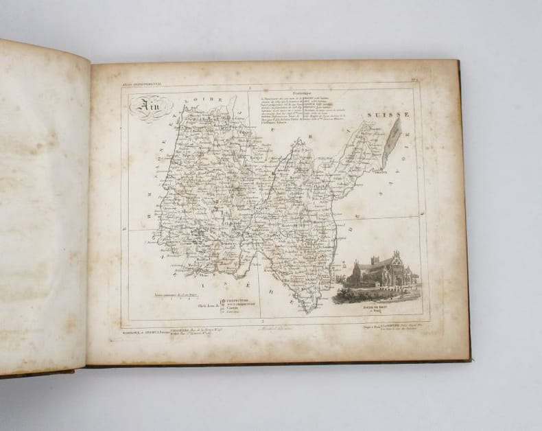
La France et ses colonies. Atlas départemental
Versailles, Andrieux et Barreswil, s.d. In-4 oblong, 1 titre, 95 cartes, demi-basane havane, dos lisse orné de filets dorés (épidermures, rousseurs).
Referenz des Buchhändlers : 19217
|
|
|
[ATLAS]
Le grand atlas du monde.
, Editions de la connaissance , 1996 ; in-4, 302 pp., cartonnage de l'éditeur.
Referenz des Buchhändlers : 201302144
|
|
|
[ATLAS]
Nieuwen Atlas der Jeugd of duydelyke grondregels om de Geograhie gemakkelyk en op korten tyd te leeren.
Antwerpen:: C. M. Spanoghe 1786. First Dutch translation. old paste-grain decorated paper boards sewn over tapes. Old ink ownership signature; a very attractive copy. 12mo. Engraved frontispiece 22 folding engraved maps with outline color and 2 folding plates. C. M. Spanoghe, hardcover
Referenz des Buchhändlers : 60376
|
|
|
[ATLAS]
Ordnance Survey Atlas of England and Wales. Quarter Inch to the Mile.
1922. Ordnance Survey Southampton. 1922. Landscape 4to. Maroon cloth gilt to upper board. 24 linen-backed colour maps each measuring 75 x 35 cm. Extremities a llittle rubbed; a little mild soiling and some surface scratch marks to boards with discolouration to cloth at bottom edge of rear board; small white paint spots to spine. All maps clean and sound. hardcover
Referenz des Buchhändlers : 83019
|
|
|
[ATLAS]
Petit atlas départemental de la France contenant 87 cartes des départements de la France, 4 cartes de l'Algérie et Tunisie, 6 cartes des colonies françaises, 1 carte d'assemblage des départements de la France.
Paris, Hachette & Cie, 1888. 1 vol. petit in-4°, demi-percaline rouge, plats illustrés en couleurs, 100 pp. ornées de grandes cartes en couleurs (dernier feuillet détaché et écorné).[D35]
Referenz des Buchhändlers : 19727
|
|
|
[ATLAS]
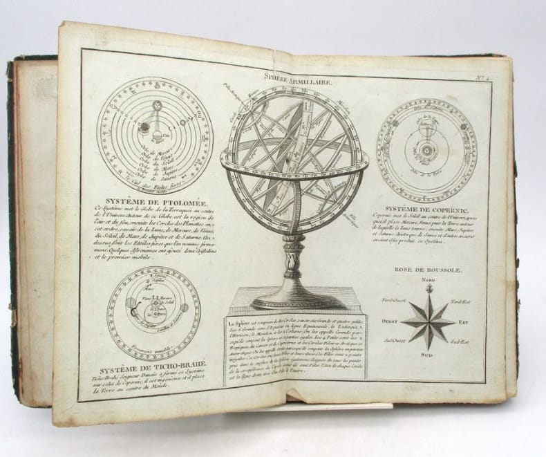
Petit Atlas moderne ou Collection de arts élémentaires dédié la Jeunesse
Paris, chez Lattré, 1788. In-8, [1]-20-[4] pp., 28 cartes ou planches doubles, cartonnage vert muet, tranches mouchetées de rouge (cartonnage défraîchi mais solide, quelques petites déchirures et taches, parfois relié dans le désordre).
Referenz des Buchhändlers : 21111
|
|
|
[ATLAS]
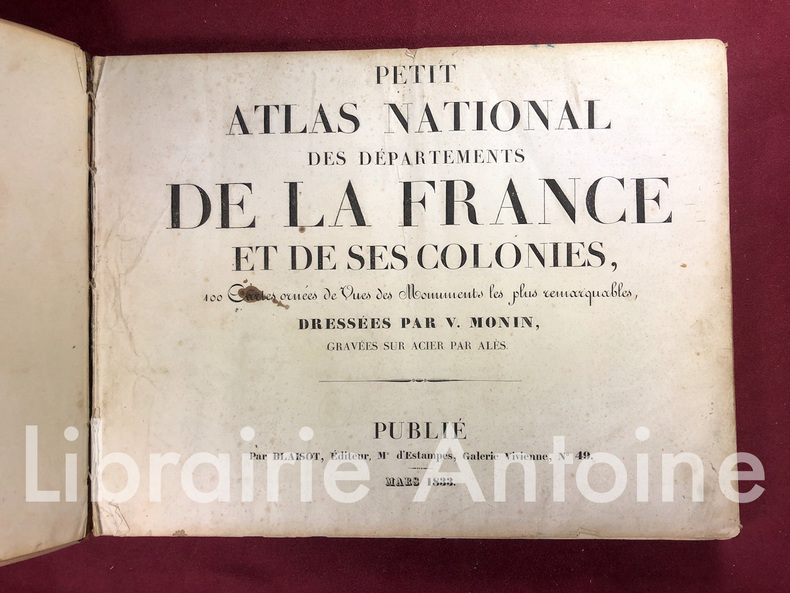
Petit atlas national des départements de la France et de ses colonies. 100 cartes ornées de vues des monuments les plus remarquables dressées par V. Monin gravées sur acier par Alès.
Paris Blaisot 1833 In-8 oblong (26 x 35 cm.), 94 cartes gravées représentant les départements de la métropole et outre-mer, avec une petite présentation et une vignette gravée représentant un lieu ou un monument. Couverture cartonnée.
Referenz des Buchhändlers : 1419
|
|
|
[ATLAS]
Recueil de cartes géographiques, plans, vues et médailles de l'ancienne Grèce, relatifs au Voyage du Jeune Anacharsis, précédé d'une analyse critique des cartes.
Paris, De Bure, 1789. 1 vol. in-4°, basane écaille, dos lisse orné de fleurons dorés, pièce de titre en maroquin brique, encadrement d'un triple filet doré sur les plats, tranches marbrées. Reliure de l'époque frottée, épidermures au dos, coiffe sup. élimée, coins émoussés. xlij pp. et 31 planches et cartes gravées en taille-douce, dont 16 repliées, par Guillaume de La Haye et Berthault, et 11 rehaussées en couleurs.
Referenz des Buchhändlers : 25368
|
|
|
[Atlas]
Robinson's Australian and New Zealand Atlas.
H.E.C. Robinson Ltd. Sydney. ND c1934. 8vo non paginated. Soft cover with simple green and pink artwork slighty soiled with a sound adhesive dark green spine and period advertising on both sides of rear cover in very good condition text in excellent condition with no tears or prior owner markings present. A series of 22 beautifully coloured and annotated maps sequentially bound together adequately describes this somewhat frail publication making it all the more rare in this very good condition H.E.C. Robinson Ltd. Sydney. ND (c1934) paperback
Referenz des Buchhändlers : 46641
|
|
|
[Atlas]
Smith's New General Atlas containing Distinct Maps of all the Principal Empires Kingdoms & States throughout the World carefully delineated from the best Authorities extant
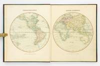
London: Printed for C. Smith Mapseller Extraordinary to his Royal Highness the Prince of Wales 1809. First Edition. Hardcover. Very Good. London Printed for C. Smith Mapseller Extraordinary to his Royal Highness the Prince of Wales 1809. Folio 404 × 330 mm engraved title leaf letterpress contents leaf and 43 hand-coloured copper-engraved maps numbered as 45 the map of Germany comprises two double-page sheets numbered 19-20 and 21-22. All leaves are printed one side only; all maps are dated 1808. Modern half calf and cloth with a gilt-lettered contrasting leather title-label on the spine; short scratch to the leather on the rear cover; title page a little tanned and discoloured around the margins by the leather corners of an earlier binding; scattered light foxing; insignificant short tears to some margins now sealed; trifling signs of age and use; overall in excellent condition. An attractive Georgian atlas 'on a Scale sufficiently large for the Purposes of general Reading and yet not too inconvenient for the Study or the Table' advertisement at the foot of the contents page. The three maps showing Australia 'Eastern Hemisphere' 'The World on Mercator's Projection' and 'Asia' all show the southern coast of the continent as uncharted. The expeditions of Flinders and Baudin had both charted this coast in 1802 but their maps were not published until 1814 and 1811 respectively. Printed for C. Smith, Mapseller Extraordinary to his Royal Highness the Prince of Wales hardcover
Referenz des Buchhändlers : 127861
|
|
|
[Atlas]
The "Geographia" Road Atlas of Great Britain.
Geographia Ltd. London. 1923. Cr 8vo 128pp. Red cloth boards in fair condition with a fraying worn spine with early hinging and the title embossed in black on the front board and spine text is in very good condition though with significant tanning of title page and endpapers and prior owner highlightings of certain destinations. In an age of GPS navigation perusing a gem like this early road atlas is a real journey back in time and a must for any tourist from this era. It even includes a perpetual lamplighting table in Great Britain relative to London. Geographia Ltd. London. 1923. hardcover
Referenz des Buchhändlers : 46644
|
|
|
[Atlas]
The Times Atlas of the World
New York: Times Books 1980. Hardcover. fine. Comprehensive edition. xl227pp. Folio. Illustrated with coloured maps and photos. Original black cloth with gilt lettering on front cover and spine in dust jacket. Fine condition. 1980 Times Books hardcover
Referenz des Buchhändlers : 122499
|
|
|
[ATLAS] - CAMBESSEDES (Olivier) -
Atlaseco de poche, atlas économiqe mondial.
Paris, Les édiitons du sérail, 1990 ; in-8, 760 pp., cartonnage de l'éditeur(cartonnage abimé sur haut du dos, déchirure). Déchirure sur haut du dos.
Referenz des Buchhändlers : 200912999
|
|
|
[ATLAS] - CHALIAND (Gérard) -
Atlas stratégique géopolitique des rapports de forces dans le monde.
Paris, Fayard, 1983 ; in-8 oblon, 224 pp., cartonnage de l'éditeur. 2e edition revue, mise à jour et argumentée.
Referenz des Buchhändlers : 200611827
|
|
|
[ATLAS] - CLOZIER (R), COLLINS (H. HIll) -
Atlas illustré EUROPE OCCIDENTALE - Europe Orientale - URSS.
Paris, Editions de deux coq d'or - les encyclopédies du livre d'or, 1975-1975 ; in-12, 180 pp., cartonnage de l'éditeur. Les 2 volumes. Très bon état tome 1 et 2 (autocollants eurojeunes sur le 1er plat).
Referenz des Buchhändlers : 201224174
|
|
|
[ATLAS] - HERRENSCHNEIDER (Sanitatsrat) -
Atlas zu des Verfaffers Lehrhuch der Hehammenkunft.
Colmar, Verlags anstast, 1912 ; in-12, 140 pp., cartonnage de l'éditeur. Bon état - ouvrage en allemand.
Referenz des Buchhändlers : 201229587
|
|
|
[ATLAS] - HOFFA (Albert) -
Atlas und grundriss der Verbandlehere.
Munchen, Lehmanns verlag, 1910 ; in-12, 141 pp., cartonnage de l'éditeur. Bon état - ouvrage en allemand.
Referenz des Buchhändlers : 201229586
|
|
|
[ATLAS] - MERIENNE (Patrick) -
Atlas de l'Europe et de l'Union Européenne.
Rennes, Ouest-France, 1997 ; in-8, 48 pp., broché, couverture illustr.
Referenz des Buchhändlers : 200505261
|
|
|
[ATLAS] - MERIENNE (Patrick) -
Atlas des drapeaux du monde.
Rennes, Ouest-France, 1997 ; in-8, 48 pp., broché, couverture illustr.
Referenz des Buchhändlers : 200505258
|
|
|
[ATLAS] - MERIENNE (Patrick) -
Atlas Mondial.
Rennes, Ouest-France, 1997 ; in-8, 48 pp., broché, couverture illustr.
Referenz des Buchhändlers : 200505260
|
|
|
[ATLAS] - MERIENNE (Patrick) -
Petit Atlas de l'Europe et de la C.E.E.
Rennes, Ouest-France, 1992 ; in-8, 48 pp., broché, couverture illustr. Nouveaux pays : Arménie, Azerbaidjan, Bélarus, Ukraine, Croatie, Slovénie.
Referenz des Buchhändlers : 200505262
|
|
|
[ATLAS] - MERIENNE (Patrick) -
Petit Atlas de la France.
Rennes, Ouest-France, 1993 ; in-8, 48 pp., broché, couverture illustr. Départements et Territoires d'Outre-Mer.
Referenz des Buchhändlers : 200505263
|
|
|
[ATLAS] - MORIEU et PERRIN.-
Atlas des départements de la FRANCE dressé d'après les documents les plus récents. Suivi d'un tableau des distances kilométriques des principales villes et du prix des places des chemins de fer.
P., Girard et Boitte, sans date (1889), petit in 4° relié demi basane brune, dos à nerfs orné à froid ; petits frottis d'usage.
Referenz des Buchhändlers : 63674
|
|
|
[ATLAS] - PREVOT (Victor), BOICHARD (Jean) -
Géopolitique transparente.
Baume-les-Dames, 1987 ; in-4, 255 pp., cartonnage de l'éditeur .
Referenz des Buchhändlers : 200505023
|
|
|
[ATLAS] - RECLUS (Onésime) -
Atlas pittoresque de la france.
Paris, Société des atlas pittoresques editions attinger , s.d. ; in-4, cartonnage de l'éditeur. Les 4 volumes. En 4 volumes très bel état.
Referenz des Buchhändlers : 201808863
|
|
|
[ATLAS] - RECLUS (Onésime) -
Atlas pittoresque de la france.
Paris, Société des atlas pittoresques editions attinger , s.d. ; in-4, cartonnage de l'éditeur. Les 4 volumes. En 4 volumes très bel état.
Referenz des Buchhändlers : 201320921
|
|
|
[ATLAS] - RECLUS (Onésme) -
Atlas pittoresque de la france.
Paris, Societe des atlas pittoresques , s.d. ; in-4, cartonnage de l'éditeur. Les 3 volumes. En 3 volumes.
Referenz des Buchhändlers : 201322916
|
|
|
[ATLAS] - SCHRADER (F), PRUDENT F (Anthoine e) -
Atlas de géographie moderne.
Paris, Librairie hachette et cie , 1894 ; in folio , cartonnage de l'éditeur. Reliure demi cuir frotté intérieur bel état.
Referenz des Buchhändlers : 202103085
|
|

 Per e-mail erhalten
 Als pdf-Dokument herunterladen
 RSS feed
 Permanenter link


