|
NON PRECISE
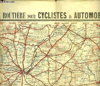
CARTE ROUTIERE POUR CYCLISTES ET AUTOMOBILES DU CENTRE DE LA FRANCE,SECTION SUD-OUEST
A. TARIDE. non daté. In-12. En feuillets. Etat d'usage, Couv. convenable, Dos satisfaisant, Intérieur bon état. 1 carte en couleurs dépliante de 93 x 78 cm. Echelle de 1 250 000°. Déchirures au niveau des pliures. Ecritures au stylo;. . . . Classification Dewey : 912-Atlas, cartes et plans
Référence libraire : RO30042032
|
|
|
NON PRECISE
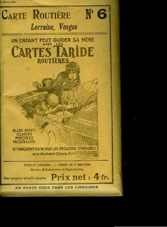
CARTE TARIDE - N°6 - LORRAINE VOSGES
IMP. GAILLON MONROCQ ET CIE. non daté. In-12. Broché. Bon état, Couv. convenable, Dos satisfaisant, Intérieur frais. 1 carte en couleurs à déplier de 92 x 74 cm. Echelle 1/250.000 soit 2.500 km au centimètre. Livré dans une pochette.. . . . Classification Dewey : 912-Atlas, cartes et plans
Référence libraire : RO30045758
|
|
|
NON PRECISE
CARTES ET CROQUIS - EN 3 PARTIES : 1 : Guerres de la Révolution et de l'empire - 2 : grandes questions européennes et guerres en Europe - 3 : guerres hors d'Europe et questions coloniales
IMP. P. MOUILLOT. NON DATE. In-4. Broché. Etat passable, Livré sans Couverture, Dos abîmé, Intérieur frais. 61 pages de textes + LX pages de cartes en couleurs - LIVRE SANS COUVERTURE - EXEMPLAIRE DE TRAVAIL - VENDU EN L'ETAT - 2 PHOTOS DISPONIBLES. . . . Classification Dewey : 912-Atlas, cartes et plans
Référence libraire : RO30139908
|
|
|
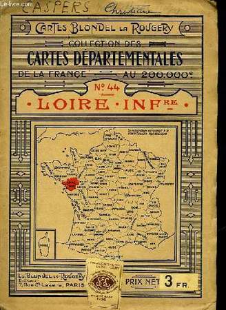
NON PRECISE
COLLECTION DES CARTES DEPARTEMENTALES DE LA FRANCE AU 200.00° - N° 44 - LOIRE INFRE
ED. BLONDEL LA ROUGERY. 1926. In-Folio. Broché. Etat d'usage, 1er plat abîmé, Dos satisfaisant, Intérieur frais. 1 carte en couleurs dépliante de 76 x 56 cm, échelle : 200.000°. Ecritures en première de couverture au stylo. Petite déchirure sur la carte au niveau d'une pliure.. . . . Classification Dewey : 912-Atlas, cartes et plans
Référence libraire : RO30042026
|
|
|
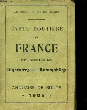
NON PRECISE
DEUX CARTES - PARIS - FRANCE
NON PRECISE. 1905. In-Folio. En feuillets. Etat d'usage, Couv. convenable, Dos satisfaisant, Déchirures. 1 carte de 57 x 48cm en couleurs de Paris (manque une partie de la carte, déchirures au nivreau des pliures) + 1 cartes en couleurs de la France de 45 x 36cm.. . . . Classification Dewey : 912-Atlas, cartes et plans
Référence libraire : RO30040753
|
|
|
NON PRECISE
DOLOMITES
Non Renseigné. sans date. In-12. Broché. Bon état, Couv. convenable, Dos satisfaisant, Intérieur frais. 57 pages illustrées de nombreuses photographies en couleur hors et dans le texte.. . . . Classification Dewey : 912-Atlas, cartes et plans
Référence libraire : RO30017457
|
|
|
NON PRECISE
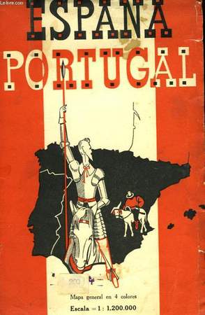
ESPAÑA - PORTUGAL
EDITOR BLONDEL LA ROUGERY. non daté. In-12. Broché. Bon état, Tâchée, Dos satisfaisant, Intérieur frais. 1 carte en couleurs (4) de l'Espagne et du Portugal, de 98 x 82 cm. Echelle: 4cm pour 70 km. Déchirée dans les plis.. . . . Classification Dewey : 912-Atlas, cartes et plans
Référence libraire : RO30024307
|
|
|
NON PRECISE
FONTAINEBLEAU AVON
NON PRECISE. non daté. In-12. Broché. Bon état, Couv. convenable, Dos satisfaisant, Intérieur frais. 1 carte en orange, blanc et noir de 53 x 44 cm. Echelle: 1/7000°.. . . . Classification Dewey : 912-Atlas, cartes et plans
Référence libraire : RO30024304

|
|
|
NON PRECISE
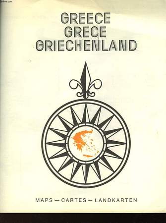
GREECE -GREVE - GRIECHENLAND
NON EDITE. non daté. In-4. Broché. Bon état, Couv. convenable, Dos satisfaisant, Intérieur frais. 15 pages.. . . . Classification Dewey : 912-Atlas, cartes et plans
Référence libraire : RO30023375
|
|
|
NON PRECISE
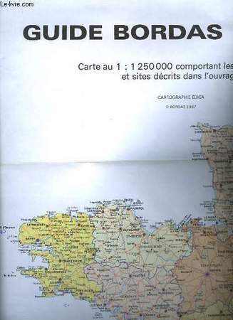
GUIDE BORDAS FRANCE
BORDAS. 1987. In-Plano. En feuillets. Bon état, Livré sans Couverture, Dos satisfaisant, Intérieur frais. Carte de France de 76.5 x 75 cm en couleurs, dépliante. Echelle : 1/1250000.. . . . Classification Dewey : 912-Atlas, cartes et plans
Référence libraire : RO30026702
|
|
|
NON PRECISE
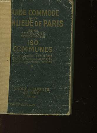
GUIDE DE LA BANLIEUE DE PARIS
ANDRE LECONTE. non daté. In-12. Cartonnage d'éditeurs. Etat d'usage, Couv. convenable, Dos abîmé, Intérieur frais. 695 pages. Environs de Paris à l'échelle du 1/100000°, indiquant les 180 communes contenues dans le Guide Leconte de la banlieue (60 x 49cm, 1 cm pour 1km). + 1 carte en couleur du Plan de Paris divisé en 20 arrondissements et 80 quartiers (75 x 58 cm, légende:2cm pour 1km) déchiré dans les plieures; 1 carte en couleur de Pneu vélo Michelin le meilleur !(87 x 38 cm). Scotch marron sur le dos.. . . . Classification Dewey : 912-Atlas, cartes et plans
Référence libraire : RO30024018
|
|
|
NON PRECISE
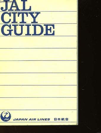
JAL CITY GUIDE
JAPAN AIR LINE. non daté. In-16. Broché. Bon état, Couv. convenable, Dos satisfaisant, Intérieur frais. 320 pages. Ecrit en japonais, anglais. Nombreux plans de grandes villes.. . . . Classification Dewey : 912-Atlas, cartes et plans
Référence libraire : RO30024146
|
|
|
NON PRECISE
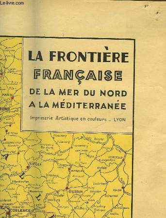
LA FRONTIERE FRANCAISE DE LA MER DU NORD A LA MEDITERRANEE
IMP. ARTISTIQUE EN COULEURS. non daté. In-12. Broché. Bon état, Couv. convenable, Dos satisfaisant, Intérieur frais. 1 carte en couelurs de l'est de la France, de 70 x 120 cm. Echelle 1 = 1.000.000°. Cette carte indique : Frontière Française, Frontières d'Etats limitrophes, Chemins de fer principaux, Canaux.. . . . Classification Dewey : 912-Atlas, cartes et plans
Référence libraire : RO30034508
|
|
|
NON PRECISE
LA TESTE DE BUCH
NON PRECISE. 1899. In-Plano. En feuillets. Etat d'usage, Couv. convenable, Dos satisfaisant, Intérieur bon état. 1 carte en noir et blanc dépliante de 84 x 60 cm. manque importants. Echelle 1/100000.. . . . Classification Dewey : 912-Atlas, cartes et plans
Référence libraire : RO30037742
|
|
|
NON PRECISE
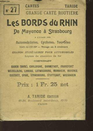
LES BORDS DU RHIN DE MAYENCE A STRASBOURG - N°27
"A. TARIDE. non daté. In-12. En feuillets. Bon état, Couv. convenable, Dos satisfaisant, Intérieur frais. 1 carte en couleurs ""Les bords du rhin"" de 50 x 64,5 cm dans une pochette. Echelle 1/350.000.. . . . Classification Dewey : 912-Atlas, cartes et plans"
Référence libraire : RO30037644
|
|
|
NON PRECISE
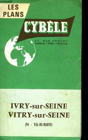
LES PLANS - CYBELE - IVRY ET VITRY
NON PRECISE. non daté. In-Folio. Broché. Bon état, Couv. convenable, Dos satisfaisant, Intérieur frais. 1 carte en couleurs de 57 x 40.5 cm.. . . . Classification Dewey : 912-Atlas, cartes et plans
Référence libraire : RO30032636
|
|
|
NON PRECISE
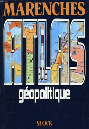
MARENCHE - ATLAS GEOPOLITIQUE
STOCK. 1990. In-8. Cartonnage d'éditeurs. Bon état, Couv. convenable, Dos satisfaisant, Intérieur frais. 217 pages. Nombreuses cartes en couleurs dans et hors texte.. . . . Classification Dewey : 912-Atlas, cartes et plans
Référence libraire : RO30026688
|
|
|
NON PRECISE
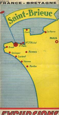
SAINT-BRIEUC EXCURSIONS
NON PRECISE. non daté. In-Folio. En feuillets. Bon état, Couv. convenable, Dos satisfaisant, Intérieur frais. 1 déplicant avec une carte en couluers à l'échelle 1/1.000.000.. . . . Classification Dewey : 912-Atlas, cartes et plans
Référence libraire : RO30040956
|
|
|
NON PRECISE
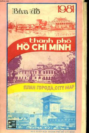
THANH PHO HO CHI MINH
NON PRECISE. 1981. In-Folio. Broché. Bon état, Couv. convenable, Dos satisfaisant, Intérieur frais. 1 carte en couleurs de 72 x 58 cm. . . . Classification Dewey : 912-Atlas, cartes et plans
Référence libraire : RO30032620
|
|
|
NON PRECISER (INCONNU)
CARTE DES ENVIRONS DE BAZAS - ECHELLE DE 0.25 par km ou 1 / 40 000e / 2 photos disponibles.
"ERHARD. NON DATE. In-Plano. Broché. Bon état, Couv. convenable, Dos satisfaisant, Intérieur frais. 1 CARTE en couleurs depliante sur toile designant les environs de ""BAZAS"", ""LANGON"", ""SAUVIAC"", "" LE BROUSTET"" - dimension: 86 x 35 cm environs - 2 photos disponibles.. . . . Classification Dewey : 912-Atlas, cartes et plans"
Référence libraire : RO20170956
|
|
|
NON PRECISER (INCONNU)
CARTE MONTREAL (FRANCE)- N°216 - ECHELLE METRIQUES 1 / 80 000
IMP. LINCONOGRAPHIQUE DU DEPOT DE LA GUERRE. AOUT 1883. In-Plano. Broché. Etat d'usage, Couv. convenable, Dos satisfaisant, Intérieur frais. CARTE en noir et blanc sur toile - dimension 90 x 63 cm environs.. . . . Classification Dewey : 912-Atlas, cartes et plans
Référence libraire : RO20171059
|
|
|
Non précisé.
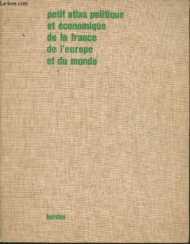
Petit atlas politique et économique de la France et du Monde
Bordas. 1967. In-4. Broché. Etat d'usage, Couv. défraîchie, Agrafes rouillées, Papier jauni. 32 pages de cartes en couleurs. Rousseurs. Coins frottés. Ex-libris à l'encre.. . . . Classification Dewey : 912-Atlas, cartes et plans
Référence libraire : RO30370216
|
|
|
Non Renseigné
LA CARTE ROUTIERE D'EUROPE
FRANCE LOISIRS. 1982. In-8. Broché. Bon état, Couv. partiel. décollorée, Dos frotté, Papier jauni. 18 pages + index, nombreuses cartes en couleurs.. . . . Classification Dewey : 912-Atlas, cartes et plans
Référence libraire : RO30128400
|
|
|
Non Renseigné
La France, par Provinces
Laboratoires Marinier. sans date. In-8. Broché. Etat d'usage, Couv. convenable, Dos satisfaisant, Intérieur frais. 32p, illustré à chaque page de gravures noir et blanc et couleurs, de cartes couleurs anciennes des régions étudiées., relié dos cuir , marron et papier marbré sur les plats.Le 1er plat ets abimé.Titre sur pièce.Un coin légèrement frotté.. . . A l'italienne. Classification Dewey : 912-Atlas, cartes et plans
Référence libraire : RO20011546
|
|
|
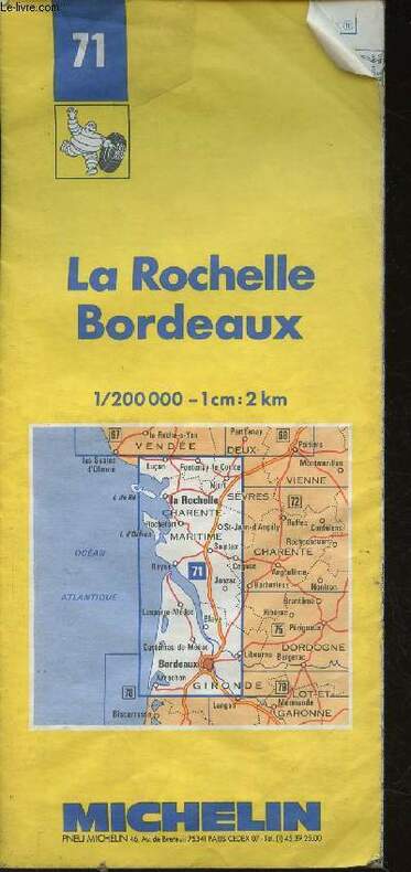
Non Renseigné
La Rochelle Bordeaux. 1/2000 000 - 1cm : 2km. Carte n°71
Michelin. Non daté. In-Folio. En feuillets. Bon état, Couv. légèrement pliée, Dos satisfaisant, Papier jauni. Une carte en couleurs d'environ 130cm x 60cm. Nombreuses pliures dans le texte.. . . . Classification Dewey : 912-Atlas, cartes et plans
Référence libraire : RO30350510 ISBN : 2067000713
|
|
|
Nona Starr CTC; Rand Mc Nally Quick Reference World Atlas Afterword; Jack Mannix CTC Preface;
Exploring the World
The TRravel institute 2011-01-01. 3rd. Paperback. Acceptable. Ships Out Tomorrow! The TRravel institute paperback
Référence libraire : 181209057 ISBN : 0931202639 9780931202636
|
|
|
none specified; classical geography for atlas by Leonhard Schmitz
Maps--Classical Geography: Classical Geography 8 map set
William Collins SOns & Company Ltd Glasgow London Edinburgh c. 1878. Broad divisional and outline color vg. The 8 small maps sold as set are: 1. Aegyptus Aegyptium Pelagus to north; Sinus Arabicus to east 2. Gallia Oceanus Britannicus to northwest Mare Internum to southeast 3. Germania Rhaetia & Noricum Mare Germanicus to northwest Sarmatia to east 4.Hispania Oceanus Atlanticus to west Oceanus Cantabricus to north Mare Internum to east 5. Italia Meridionalis--Inferum vel Tyrrhenum Mare to west Ionium Mare to east; inset with Cyrnus vel Corsica and Sardo vel Sardinia 6. Italia Septentrionalils--Tyrrhenum vel Inferum Mare to east Hadriaticum Mare to west 7.Macedonia Thracia Illyricum & c. Hadriaticum Mare to west Pontus Euxinus to east 8. Regnum Alexandri Magni indic ates the Marches of Alexander and the Course of the Fleet Each small map is 15x23cm orientation varies. William Collins, SOns, & Company Ltd, Glasgow (London, Edinburgh), c. 1878 unknown
Référence libraire : 132
|
|
|
Nordenskiöld, A(dolf) E(rik von)
Facsimile-Atlas to the early history of cartography with reproductions of the most important maps printed in the 15th and 16th centuries.
New York, Dover, (1973). X, 141 S. mit zahlr. Karten im Text und auf Tafeln. Fol. OPp. (Gebrssprn.).
Référence libraire : 22473 ISBN : 486229645
|
|
|
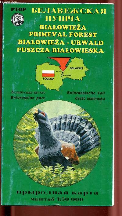
North podlassian society for bird protection
Bialowieza primeval forest / Bialoweza - urwald / Puscza Bialowieska
Non précisé. Non daté. In-Plano. Broché. Etat d'usage, Couv. convenable, Dos satisfaisant, Intérieur frais. 1 carte dépliante en couleurs, d'environ 100* 130 cm avec au verso des illustrations en couleurs et la légende de la carte et du texte en russe, anglais, allemand et polonais. Couverture défraîchie.. . . . Classification Dewey : 912-Atlas, cartes et plans
Référence libraire : R200099390
|
|
|
Not Stated
British Columbia Recreational Atlas
130 pages. Your guide to B.C.'s great outdoors. Full colour maps covering all of British Columbia in the popular topographic scale of 1 inch to 9.5 miles (1cm to 6km). Gazetteer of 10,000 places, creeks, rivers, lakes and mountains. All Wildlife management units clearly outlined and numbered. And much more. In fine condition but for light bending to tip of top corner of book. Unmarked. Attractive color-illustrated glossy covers. An exceptional reference in great condition. Book
|
|
|
NOUVEL ATLAS MIDY
Nouvel atlas Midy pour la pratique des principales injections et infiltrations locales. pour la pratique des principales injections et infiltrations locales.
Paris : Laboratoires Midy 1940. HARDCOVER . Orig. bound in ring binder. VERY GOOD. A new technique "Transvision" shows clearly the trajectory of the nerves. Very rare. Paris : Laboratoires Midy hardcover
Référence libraire : 4133
|
|
|
Nouvelle Revue Française ( Revue Mensuelle de Littérature )
Nouvelle Revue Française N° 484 ( Revue Mensuelle de Littérature ) Journal 1992 ( fin ) ( Ernst junger ) - Prière pour un aller au paradis avec Jammes ( Guy Goffette ) - Le Mont Atlas ( Didier Duprat ) - Le piano d'Epictète ( fin ) ( Jean Pierre Martin ) - Tessons ( Jean Noêl Chrisment ) - Les sderniers mois de la vie de Vermmer de Delft ( Marie-Dominique Benvenuti ) - Pollock et Guernica ( Pierre Alechinsky ) RECONNAISSANCES : Yves Bonnefoy, Le réel et la science par François Lurçat - L'Œil et l'esprit ( Edgar Wind ) par Richard Blin - James Hadley Chase et le mythe de la Femlme fatale ( fin ) par Roger Parisot - La Nouvelle : genre de l'événement ( fin ) par Camille Dumoulié
N° 484 de mai 1993 - Broché
Référence libraire : 4380
|
|
|
Nuland Sherwin & James Atlas
Leonardo Da Vinci
New York: Viking. Fine in Very Good dust jacket. 2000. Hardcover. 0670893919 . Tight unmarked book in crisp dust jacket with nick to the front "window". ; Penguin Lives; 176 pages . Viking hardcover
Référence libraire : 49658 ISBN : 0670893919 9780670893911

|
|
|
NUMISMATIQUE) - RORET Nicolas-Edme et BARTHELEMY Anatole de
NOUVEAU MANUEL COMPLET DE NUMISMATIQUE MODERNE : ATLAS
un volume in12 toile usée reliure postérieure, ATLAS seul,de 12 planches dépliantes hors-texte en noir (soit 577 gravures de monnaies ), sans date (1852) Paris Librairie Encyclopédique de RORET Editeur, nouvelle collection : "Encyclopédie Roret" ,dans l'état.
Référence libraire : 23580
|
|
|
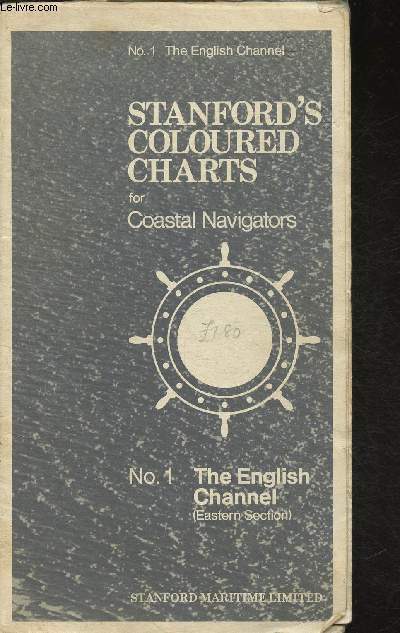
N°1 The English Channel
Stanford's couloured charts for Coastal Navigators
Stanford Maritime Limited. Non daté. In-Plano. En feuillets. Bon état, Couv. convenable, Dos satisfaisant, Intérieur frais. 1 page recto-verso. Une carte dépliante en couleurs- Texte en anglais. Quelques déchirures. Quelques notes au crayon hors texte.. . . . Classification Dewey : 912-Atlas, cartes et plans
Référence libraire : RO30320228
|
|
|
O BRIEN- PALMER
ATLAS DES RELIGIONS DANS LE MONDE- SERIE ATLAS- N°4- AVRIL 1994
ISBN : 2862604895. AUTREMENT. 1994. In-8 Carré. Broché. Bon état. Couv. convenable. Dos satisfaisant. Intérieur frais. 120 pages environ- nombreuses cartes en couleurs hors texte

|
|
|
O BRIEN- PALMER
ATLAS DES RELIGIONS DANS LE MONDE- SERIE ATLAS- N°4- AVRIL 1994
AUTREMENT. 1994. In-8. Broché. Bon état, Couv. convenable, Dos satisfaisant, Intérieur frais. 120 pages environ- nombreuses cartes en couleurs hors texte. . . . Classification Dewey : 912-Atlas, cartes et plans
Référence libraire : R150197762
|
|
|
O'Brien, Joanne/Palmer, Martin
Weltatlas der Religionen
Bonn, Dietz, 1994. Dt. Erstausg. 25 cm. 128 S. : graph. Darst., Kt. kart. Sehr guter Zust., Exlibr. a. Vors. 1
Référence libraire : 44475AB
|
|
|
O'Hear Anthony
German Philosophy since Kant (Royal Institute of Philosophy Supplements)
Cambridge University Press 2010 452 pages 16x2 4x22 8cm. 2010. Broché. 452 pages.
Référence libraire : 100125685
|
|
|
o. Angabe
Grosser Atlas Deutschland und Europa 94/ 95
Bergisch Gladbach: Lingen Verlag, 1994. 348 Seiten , 21 cm, Pappeinband
Référence libraire : 5355

|
|
|
o. Angabe
Harms Weltatlas Ausgabe Mecklenburg-Vorpommern
Hannover: Schroedel Schulbuchverlag GmbH, 1996. 138 Seiten , , 32 cm, Pappeinband
Référence libraire : 16

|
|
|
o. Autor
Atlas National Geographic. Europa I.
[Barcelona], RBA Coleccionables, 2004. 37 cm, 95 Seiten, mit zahlreichen Karten und Farbfotos, schwarzer farbig illustrierter Hochglanzpappband. Edición española Kapitale und Kanten leicht bestoßen, gut bis sehr gut erhalten. National Geographic.
Référence libraire : 32032AB
|
|
|
o. Autor
Politischer Hand-Atlas. Deutsches Reich, Europa, Erdteile.
Braunschweig, Georg Westermann, 1939. 21 x 21 cm, 48 Seiten, mit vielen farbigen Karten, broschiert. Einband stellenweise aufgehellt, sonst in guter Erhaltung.
Référence libraire : 47698AB
|
|
|
o. Autor
Road Atlas of Great Britain.
London, George Philip & Son, 1972. 29 cm, 88, 72 (Index) Seiten, rotes Kunstleder. leichte Gebrauchs- und Lagerspuren, Kopfschnitt etwas stockfleckig, gut erhalten.
Référence libraire : 3527AB
|
|
|
oA
Volks-Atlas Volksatlas - mit 24 Haupt- und 9 Nebenkarten, 8 Seiten Text und 16 Seiten Ortsnamenverzeichnis
Berlin, Drei Türme Verlag, ca1930. PP, gutes Exemplar
Référence libraire : 10328
|
|
|
oA, <ohne Autorenangabe>
Der grosse Reader`s Digest Weltatlas
Stuttgart ; Zürich ; Wien : Verlag Das Beste G.m.b.H. 1966. 4. revidierte Auflage 1 Atlas (217 Seiten) : Illustrationen ; 40 cm Halbleder 0
Référence libraire : 76093

|
|
|
OAKLAND: PLAT MAP ATLAS
Thomas Bros. Block Book of Oakland CA: Allendale District 10.
Oakland & Los Angeles: Thomas Bros. 1924. First and only edition. Oblong folio 15 1/2 x 8 1/2 inches. Key map of Allendale in color index leaf and maps in blue numbered 901-966. The plate maps are all in blue and printed on rectos only. Publisher's two-post binding of quarter red over black cloth gilt cover lettering floral pastedowns. Spine rubbed and edges strengthened but overall a very attractive and complete copy of this scarce real estate atlas.For many of us the firm Thomas Bros. connotes street guides used by drivers to find addresses but in the early 20th century they also made plate books for realtors. Indeed this copy seems to have been owned by a realtor as there are numerous corrections and in-fillings in pencil giving the correct homeowner's name etc. Allendale is a former settlement in Alameda County California now annexed to Oakland.1 It was located 1.5 miles 2.4 km northeast of Fruitvale. A post office opened in 1903 and by 1908 was a branch of the Oakland post office. Allendale was named for Charles E. Allen a real estate broker. The commercial district of Allendale is located along 38th Avenue up and down from where it crosses Allendale Avenue. Allendale Elementary School is located there. Allendale is on what might be called the cinema archipelago of East Oakland. Each commercial district with an exception or two had a theatre beginning with the 1920s or so. This applied to not only Allendale District but nearby Laurel which had two Fairfax Dimond and Fruitvale which had a second one nearby at Foothill and 35th Avenue and another at the foot of Park Boulevard on the east side of the lake. The Allendale theatre like most of the others has been converted to another use. The one that has continued in use as a theatre is the Grand Lake at the edge of East Oakland at the north end of Lake Merritt. Thomas Bros. hardcover
Référence libraire : 74441
|
|
|
Oberwandling, Alfred (Herausgeber)
Unvergessene Heimat Sudetenland : Geschichte, Kultur, Wirtschaft, Recht, Vertreibung (1945. 46) Hrsg. von der Arbeitsgemeinschaft Sudetendeutscher Lehrer und Erzieher e.V. , Pädagogischer Arbeitskreis für Mittel- und Osteuropa in Zusammenarbeit mit dem Heimatkreis Mies-Ilsen e.V. ... Alfred Oberwandling ; Hans Mirtes.
Dinkelsbühl : Heimatkreis Mies-Pilsen [u.a.], 2010. 120 Seiten. Mit zahlreichen dokumentarischen Abbildungen. 31 x 43 cm Originalpappband.
Référence libraire : 309610

|
|
|
Obscura Atlas
Atlas Obscura Wall Calendar 2018
Workman Publishing Company. CALENDAR. 1523501553 . New. Workman Publishing Company unknown
Référence libraire : D8-402DIA ISBN : 1523501553 9781523501557

|
|
|
OBSHCHESLAVYANSKII LINGVISTICHESKII ATLAS
Seriya leksiko-slovoobrazovatel'naya.
Hardback. 1988. Vypusk 1. Zhivotnyi Mir. 188pp including 48 maps 4to Moscow 1988. VG . hardcover
Référence libraire : HALL333031
|
|
 Recevoir par e-mail
 Télécharger en PDF
 Flux RSS


