|
|
|
Anon
The Dunlop Guide to Great Britain
[1933] With 162 pages of advertisements, and index, at the back. Covers worn all over, slight tears at base of spine.
|
|
|
Anon
The Dunlop Guide to Great Britain
Still has original bookmark attached. Date assumed from Lighting Up Tables which start April 1938. xiv, 31, 910, 102 pages. Signature at top of front free endpaper. Page 605-8 loose. Wear on extremities and some marks to covers.
|
|
|
ANONIMO
BERTELSMANN HAUSATLAS - 1960
In 4o, pp. 318, t.tela con sovrac. (minimi strappetti ai bordi), 42 carte f.t. Ottimo atlante tedesco diviso in 2 parti: TEXT (Astronomie, Entdeckungsgeschichte der erde, Natur der erde, Geographisches worterbuch, Die welt in zahlen, Namen und sprachen, Landerkunde) e KARTEN (1305/ ATLANTE - ATLAS - CARTOGRAFIA)
|
|
|
ANONYM.
[MAP of CONSTANTINOPEL] [German map of the Bosphorus - Constantinople - Princess Islands].
Very Good German Original color map on cloth of Constantinople, the Bosphorus, the Golden Horn, Princess' Islands, Pera, Galata, Scutari and environment. Map on cloth. 50x60 cm. Toponyms are in German entirely. Folded. Scale: 1:100000. A detailed toponyms list titled "Verzeichnis der mit Ziffern bezeichneten öffentlichen Gebaude" under the sections A: Pera und Galata, B: Stambul, C: Skutari; and "Erlauterung der Abkürzungen". Some toponyms are transcripted Turkish into western characters like Karadenis - Bahr-i Siach, Burgas Adassi, Kisil Adalar, Jeni Djami, etc. A rare Istanbul map printed in 19th century.
|
|
|
ANONYM].
[INFLUENCES BY SIR FRANCIS BAILY IN AN OTTOMAN MAP OF THE SKY] Harita-yi semâ: Kevâkib, Tasnîf-i Kürre-i Cenûbî, Tasnîf-i Kürre-i Simâlî, Mintika-yi hareye mahsûs burûc. [i.e. Map of the sky: Stars, planets, South Pole, North Pole, and Zodiacs].
Very Good Turkish, Ottoman (1500-1928) A very attractive chromo-lithograph map on paper. Oblong: 26,5x37,5 cm. In Ottoman script (Old Turkish with Arabic letters). Light foxing and fading on margins and printed area. A very detailed and fine double hemisphere map of the northern and southern skies, showing the various constellations, together with a third map showing the zodiacs on one paper. On the bottom margin, it's written 'Printed in the 549 Numbered Press', and 'Dersaadet...'. This map seems to be influenced (or, a direct translation) from the map of the sky of Sir Francis Baily, (1774-1844), who was one of the leading English Astronomers of the first part of the 19th Century. He is most famous for his observations of "Baily's beads" during a total eclipse of the Sun. Baily was also a major figure in the early history of the Royal Astronomical Society, as one of the founders and as the president four times. After a tour in the unsettled parts of North America in 1796-1797, his journal of which was edited by Augustus de Morgan in 1856, he entered the London Stock Exchange in 1799. The successive publication of Tables for the Purchasing and Renewing of Leases (1802), of The Doctrine of Interest and Annuities (1808), and The Doctrine of Life-Annuities and Assurances (1810), earned him a high reputation as a writer on life-contingencies; he amassed a fortune through diligence and integrity and retired from business in 1825, to devote himself wholly to astronomy. He had already, in 1820, taking a leading part in the foundation of the Royal Astronomical Society. In 1827, the Society awarded him its Gold Medal for preparation of the Astronomical Society's Catalogue of 2881 stars. He was instrumental in the reform of the Nautical Almanac in 1829. In 1837, he recommended to the British Association and later worked extensively on the reduction of Joseph de Lalande's and Nicolas de Lacaille's catalogues containing about 57,000 stars. He also supervised the compilation of the British Association's Catalogue of 8377 stars (published 1845) and revised the catalogues of Tobias Mayer, Ptolemy, Ulugh Beg, Tycho Brahe, Edmund Halley and Hevelius. His notice of Baily's Beads, during an annular eclipse of the sun on May 15 1836, at Inch Bonney in Roxburghshire, started the modern series of eclipse-expeditions. Very rare.
|
|
|
Anonyme
[Région de :] Troyes, Plancy, Arcis sur Aube, Brienne le chateau, etc.
français Sans date (circa fin XVIIIe siècle). Carte entoilée dépliante 59,5x93 cm, de 21 panneaux. Carte gravée et aquarellée de l'époque. Un petit gribouillage au stylo sur la toile d'un panneaux.
|
|
|
Anonyme
Atlas des enfans, ou nouvelle méthode pour apprendre la géographie, avec un nouveau traité de la sphère, et XXIV cartes enluminées.
français In-12 de Frontispice, xij-360-60 pp.; demi-basane brune, dos lisse à faux-nerfs orné (reliure de l'époque). Nouvelle édition, corrigée & fort augmentée. Quelques infimes trous de vers, petites usures et manques à la seconde carte, quelques restaurations anciennes dans les cartes, petit manque de cuir à la pièce de titre.
|
|
|
Anonyme
AUCH. Gers - FEUILLE XIII - 34.
français Carte à 100.000 de 555x450 mm; en couleurs et dépliante, dans sa couverture cartonnée. Carte de la France dressée par ordre du Ministre de l'intérieur, mise à jour en Avril 1899.
|
|
|
Anonyme
Carte entoilée de l'Allemagne.
français Slnd (circa 1900). 106x122 cm de 24 panneaux de 19x25 cm. Quelques tâches.
|
|
|
Anonyme
le front français - The franco-british front.
français Sans date. Carte dépliante (76x112) tirée en couleurs; in-12, vignettes de l'éditeur sur les plats. Carte des opérations sur le front fançais Bale - Mézières - Cologne. Echelle : 1:400.000e.
|
|
|
Anonyme
Plan de Capvern, luthilous, lagrange, Campistrous dans les hautes pyrénées.
français Sans date (circa fin XIXe siècle). 76x158 cm. Joli plan sur papier fort, dessiné et aquarellé à l'époque. Plis.
|
|
|
ANONYMOUS].
[MOUSOUL, QIRKUK, SANJAK OF DEIR AL-ZOR, BAGHDAD] Manuscript map on a tissue paper of Vilâyat of Baghdad, Zor [Deir Al-Zor], Mousul and Soleimaniyya.
Very Good Arabic Original hand-colored map on tissue paper. 23x19 cm. In Ottoman script and Arabic. No scale. Manuscript notes of toponyms. It shows Baghdad, Deir Al-Zor, Kirkuk, Mosul, Syria, borders of Ajamistan (Iran), etc. Manuscript notes show that the map was used in military purposes in the last Ottoman Imperial period.
|
|
|
Anonymus
Weltatlas.
(Schlag auf, Schau rein), 1990. Ein lustiges Riesenbuch zum Aufklappen 40x30 cm (ausgeklappt: 80x60 cm) flex. Pappe
書籍販売業者の参照番号
: 11510
|
|
|
ANSART Félix
petit atlas historique et géographique ancien et moderne troisième partie :Géographie Contemporaine
Un volume demi-toile noire,plats cartonnés,16 cartes sur onglets(20x24,5cm ouvertes)contours coloriées (Etats-Unis de l’Amérique du Nord,Nouvelle-Bretagne et Partie du Mexique,Océanie….imprimerie.Librairie ecclésiastique Editeur.Têtu & Cie 1845,très frais .
書籍販売業者の参照番号
: 579
|
|
|
ANTOINE VAN DER HEYDEN
ATLAS DE L'ANTIQUITE CLASSIQUE
SEQUOIA. 1961. In-4. Relié. Bon état, Couv. convenable, Dos satisfaisant, Intérieur frais. 218 pages. Nombreuses photos, illustrations et cartes en noir et blanc dans le texte et hors texte.. . . . Classification Dewey : 912-Atlas, cartes et plans
書籍販売業者の参照番号
: RO30100994
|
|
|
ANTOINE FREITAG
ATLAS DU MONDE CHRETIEN - L'EXPANSION DU CHRISTIANISME A TRAVERS LES SIECLES
ELSEVIER. 1959. In-4. Relié. Bon état, Couv. convenable, Dos satisfaisant, Intérieur frais. 215 pages. Nombreuses photos et cartes en noir et blanc ainsi qu'en couleurs dans le texte et hors texte.. . . . Classification Dewey : 912-Atlas, cartes et plans
書籍販売業者の参照番号
: RO30103013
|
|
|
Antoine Sfeir, Pierre Vallaud, fouche eric ...
Atlas d'initiation économique
HACHETTE JEUNESSE. 1990. In-4. Relié. Bon état, Couv. convenable, Dos satisfaisant, Intérieur frais. 92 pages illustrées en couleur. . . . Classification Dewey : 912-Atlas, cartes et plans
書籍販売業者の参照番号
: RO20265274 ISBN : 2010146018

|
|
|
Antonín Rükl
Atlas de la Lune
Relié, 224 pages, paru le 1er avril 1993 chez Gründ, livre en très bon état général.
書籍販売業者の参照番号
: AST521M

|
|
|
Anthoine E.,Prudent F.,Schrader F.
Atlas de géographie moderne
Librairie Hachette et Cie Relié 1909 In-folio (26,5 x 38,5 cm), reliure demi-peau à coins, dos lisse, non pagné, 64 cartes en couleurs + cartes en noir et blanc ; mors fendus, manques de cuir et épidermures aux mors, coiffes et coins, en l'état. Livraison a domicile (La Poste) ou en Mondial Relay sur simple demande.
書籍販売業者の参照番号
: ko1365
|
|
|
Anton Kaspar KUZEL; Johann LAUNSKY VON TIEFFENTHAL: Leopold SALZMANN; Friedrich RIVIER (Lith.):
CARTE VOM KREISE KLAGENFURTH IM HERZOGTHUME KAERNTHEN; entworfen mit Benützung der neuesten Vermessungen; Seiner Excellenz dem Hochwohlgebornen Herrn Joseph Camillo Freiherrn von Schmidburg […] in tiefster Ehrfurcht dedicirt. In mehreren Farben grenz- und teils flächenkolorierte, mit Bergstrichen und Gradnetz versehene lithografische Karte in 4 Teilen auf 16 Segmenten, mit verzierter Titelkartusche, topographischer Tabelle unter Angabe der landwirtschaftlichen Nutzflächen, Höhenprofil, Legende und Maßstabsangabe in graphischer Form (Wiener Zoll bzw. Deutsche Meile gegen Klafter, ca. 1:120.000), jeweils 4 Segmente auf graues Leinen aufgezogen.
Äußerst seltene Karte des Klagenfurter Kreises, einer Verwaltungseinheit des Herzogthums Kärnten ab 1748. – Der Klagenfurter Kreis umfasste je nach Gebietsstand im heutigen Österreich die Bezirke St.Veit an der Glan, Wolfsberg, Klagenfurt sowie Klagenfurt Land und den Bezirk Völkermarkt, im heutigen Slowenien die historische Region Slovenska Koroška. Die geographischen Namen sind teils farblich unterstrichen. – Erhaltung: Karte leicht stockfleckig, sonst sauberes, kräftig lithografiertes Exemplar. – Seltenheit: Äußerst selten, gemäß IKAR, KVK, OCLC/WorldCat und OBV sind weltweit lediglich in 4 institutionellen Beständen nachweisbar (Berlin (SBB, 2x), Wien (ÖNB) und Yale). JAP/APO nennt für die letzten über 30 Jahre keine Auktionsergebnisse.
|
|
|
ANVILLE (Jean-Baptiste Bourguignon d').
Complete Body of Ancient Geography by Mons. d'Anville. Member of the Royal Academy of Belles-Lettres, of the Academy of Science at Petersburg, and Secretary to the Great Duke of Orleans.
London, Robert Laurie and James Whittle, 1795, in-folio, (2) pp, 13 cartes montées sur onglet et réhaussées en couleurs, reliure demi-basane fauve, dos lisse avec doubles filets dorés, pièce de titre basane havane (rel. de l'époque), bon état
書籍販売業者の参照番号
: 120642
|
|
|
ARAGO M:
Annuaire pour l’an 1851, publié par le bureau des longitudes. Augmenté de notices scientifiques.
Paris, Bachelier, 1850. In-18 de 512, 28 pages. Demi-basane verte, dos lisse orné de filets dorés.
書籍販売業者の参照番号
: 2609

|
|
|
ARDAGH JOHN
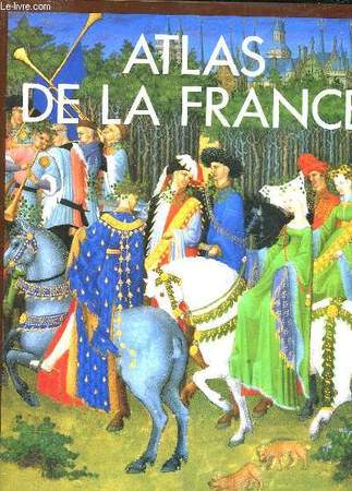
ATLAS DE LA FRANCE
EDITIONS DU FANAL. 1992. In-4. Relié. Bon état, Couv. convenable, Dos satisfaisant, Intérieur frais. 240 pages. Nombreuses illustrations en noir et blanc et en couleurs dans le texte et hors texte.. Avec Jaquette. . . Classification Dewey : 912-Atlas, cartes et plans
書籍販売業者の参照番号
: RO30057075
|
|
|
Ardagh John & Jones Colin
Atlas de la France.
Fanal. 1992. In-4. Reli. Bon tat, Couv. convenable, Dos satisfaisant, Intrieur frais. 240 pages - jaquette en bon tat - nombreuses photos et cartes en couleurs dans et hors texte.. Avec Jaquette. . . Classification Dewey : 912-Atlas, cartes et plans
書籍販売業者の参照番号
: R320144472

|
|
|
Ardagh John, Colin Jones
Atlas de la France
Editions du Fanal Cartonné avec jaquette 1992 In-4 (24,5 x 31 cm), cartonnage d'éditeur de couleur marron sous jaquette illustrée en couleurs, 240 pages, 385 illustrations dont 345 en couleurs et 50 cartes géographiques in texte ; quelques frottements à la jaquette, par ailleurs bon état. Livraison a domicile (La Poste) ou en Mondial Relay sur simple demande.
書籍販売業者の参照番号
: gf945
|
|
|
ARDOUIN-DUMAZET Victor-Eugène.
VOYAGE EN FRANCE, 9è série. DAUPHINÉ, III (3) : GRAISIVAUDAN ET OISANS (Terres-Froides - Grande-Chartreuse - Grenoble - Mateysine - Oisans - Haut et Bas Graisivaudan - Plateaux Viennois). Partie du département de l'Isère.
1911 Paris et Nancy, librairie Berger-Levrault, 1911. Troisième édition refondue, en partie originale. La plus grande partie de cet ouvrage a paru en 1896 sous le titre "Le Bas-Dauphiné", qui comprenait également le département de la Drôme désormais édité à part. La présente édition contient 5 chapitres entièrement nouveaux, et 25 cartes dont 2 dépliantes. In-12 de 389-28 pp., avec index des lieux et sommaire de tous les volumes de la collection in fine. Reliure de l'éditeur, pleine percaline grise, titre noir et or, tranche supérieure rouge, gardes illustrées. Couvertures d'origine conservées, avec une carte sur le premier plat. Des taches claires sur la tranche supérieure, coins et coiffes émoussés, petites taches peu visibles en bordure des plats. Intérieur en très bon état, exempt de rousseurs. Cartes dépliantes impeccables. Vignette d'ex-libris collée au contreplat. Bel exemplaire, malgré les défauts signalés.
書籍販売業者の参照番号
: 18700

|
|
|
Ardovini, Roberto und Tiziano Cossignani
Atlante delle Conchiglie di Profondita del Mediterraneo.
Ancona. L'Informatore Piceno, 1999. 112 Seiten. Mit zahlreichen farbigen Abbildungen. Originalpappband. 29 cm
書籍販売業者の参照番号
: 297018

|
|
|
Arendts, Carl
Naturhistorischer Schulatlas zugleich mit Berücksichtigung der Technologie. Für den methodischen Unterricht bearbeitet. 33 Tafeln enthaltend 388 Abbildungen in Holzschnitt. Nebst einem erläuterndem Texte. ERSTAUSGABE.
Leipzig, Brockhaus, 1858. 47 Seiten, 33 doppelseitige Tafeln. 24 cm. Originalpappband.
書籍販売業者の参照番号
: 225849

|
|
|
Armstrong, Joe C.W.
From Sea Unto Sea: Art & Discovery Maps of Canada
Approximately 75 pages. "Brings together for the first time thirty-eight stunning, original Canadian maps - many of them national treasures - and the fascinating stories of the explorers and cartographers who made them. From Gastaldi's woodcut map of 1556 in which monsters roam the sea, through Champlain's 1612 collage map of Canada's bounty, to Sanson's foundation map of 1656 - the first to show all five Great Lakes - this superb 'atlas' takes the modern navigator on a voyage of rediscovery to Canada's beginnings, beginnings not only in strength and adventure but also in humanity and art. Charts a compelling route to the nation's past." - from dust jacket. Book clean and unmarked with light wear to navy cloth boards. Price clipped dust jacket bears two closed tears and average wear. Overall a nice copy of this spectacular work. Book
|
|
|
ARNBERGER, Erik (Redaktion)
Grundsatzfragen der Kartographie, herausgegeben von der Österreichischen Kartographischen Gesellschaft. Beiträge von E. Arnberger, F. Aurada, H. Bobek, L. Brandstätter, J. Breu, G. Hake, A. Heupel, G. Jensch, I. Kretschmer, K.-H. Meine, E. Meynen, H. Schiede, R. Schweissthal, E. Spiess und W. Witt.
Wien, Österreichische Geographische Gesellschaft, 1970. (4) 307 Seiten; Original-Leineneinband mit Deckel- und Rückentitel; gr.-8vo.(ca. 24 x 18 cm).
書籍販売業者の参照番号
: 453057801xbvk
|
|
|
Arndt, Heinz-Peter
Handy-Autoatlas : Deutschland, Österreich, Schweiz und Europa ; [der Richtige für's Handschuhfach!].
München [u.a.] : RV-Verl., [1996]. XVI, 448, 336 S. : überw. Kt., graph. Darst. 8°. 1. Aufl., Laufzeit 1998 OKSt. (weicher Einband, abwaschbar).
書籍販売業者の参照番号
: 11657
|
|
|
Arndt, J./ Lütgens, R./ Muhle, W./ Petersen, J
Hirts Erdkunde in Stichworten.
Breslau, Ferdinand Hirt, 1941. 8°. Heft 2, 3, 4, und 5 . Mit zahlreichen Abbildungen und Bildern. OriginalBroschur, gebunden.
書籍販売業者の参照番号
: 24612
|
|
|
Arnz, J. (Josef)
Atlas der alten Welt in XVI illuminirten Charten [illuminierten Karten]. Nach den besten Hülfsmitteln [Hilfsmitteln] zum Gebrauch in Gymnasien, entworfen von J. Arnz. 6te Auflage.
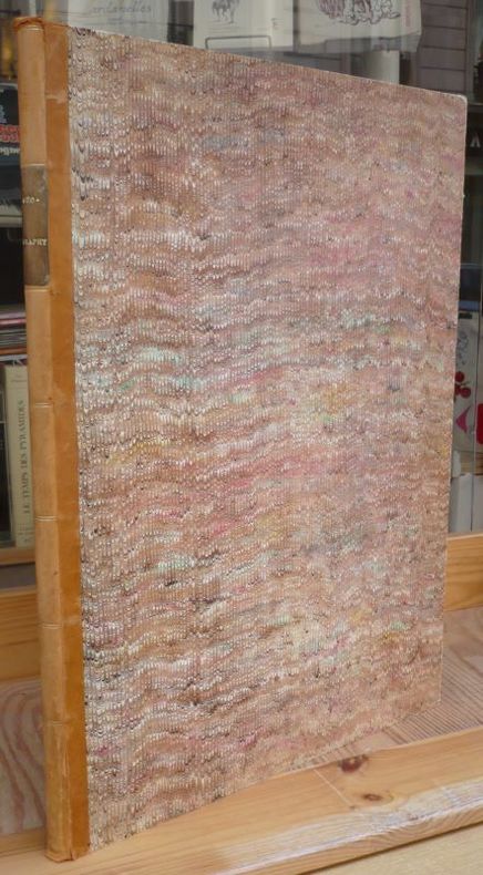
Düsseldorf, im Verlage der lithographischen Anstalt von Arnz & Co. Ohne Jahr (um 1842). 19 nicht num. Blätter. Quer-2° (35 x 27,5 cm). Halbleinenband der Zeit mit schönem grünem Marmorpapierbezug.
書籍販売業者の参照番号
: 5119876

|
|
|
Arnz, Josef
Atlas der Alten Welt Hrsg. u. verlegt von der lithographischen Anstalt von J. Arnz
Düsseldorf: Arnz, 1820. 11 Blatt Format 25 x 20 cm gebundene Ausgabe, Pappband der Zeit
書籍販売業者の参照番号
: 62677

|
|
|
Arpád, Papp-Vary
Budapest. Hier: Atlas.
Budapest, Cartographia., 1991. 4°. [15 : 26 cm = B/H]. 61 Seiten. Mit einem Index. Originalleinenband mit farbig illustriertem Schutzumschlag. - Ein sehr gut erhaltenes, sauberes Exemplar in fester Bindung und ohne Eintragungen. 1. Auflage.
書籍販売業者の参照番号
: 66086AB

|
|
|
ARRIEN FLAVE.
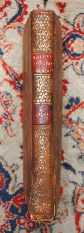
Histoire des expéditions d’Alexandre ; rédigée sur les mémoires de Ptolémée et d’Aristobule, ses lieutenans. Traduction nouvelle par P. Chaussard.
ARRIEN FLAVE. Histoire des expéditions d’Alexandre ; rédigée sur les mémoires de Ptolémée et d’Aristobule, ses lieutenans. Traduction nouvelle par P. Chaussard. Paris, Genets, an XI-1802. In-4 (200x270mm), 196pp., relié pleine basane, dos lisse orné, pièce de titre et de tomaison, reliure d’époque usagée, petit manque de cuir sur le dos, Intérieur frais. Édition ornée de 2 tableaux et de 14 planches dépliantes (plans, médailles et ordre de bataille). ATLAS SEUL.
書籍販売業者の参照番号
: P2-1A-5
|
|
|
ARRON E. S., LEWIS K. B.
MAHIA BATHYMETRY, COASTAL CHART SERIES, 1:200 000 at Lat. 41°S
New Zealand Oceanographic Institute - DSIR. 1992. In-8. Broché. Très bon état, Couv. fraîche, Dos impeccable, Intérieur frais. 1 carte dépliable très grand format en couleur dans sa pochette plastique d'origine.. . . . Classification Dewey : 912-Atlas, cartes et plans
書籍販売業者の参照番号
: RO40107772

|
|
|
Arrowsmith, A(aron):
Orbis terrarum veteribus noti descriptio. A Comparative Atlas of Ancient and Modern Geography, from original authorities, and upon a new plan, for the use of Eton School, by A. Arrwosmith, Hydrographer to His Majesty.
London, by the Author, 1828. Folio. 27 num. Doppelblätter, mit insgesamt 53 gest. mit handkolorierten Karten. Halbpergament d. 19. Jh. mit Rückenschild.
書籍販売業者の参照番号
: 5099CB
|
|
|
Arrianus, Flavius
Atlas apart zu: Histoire des expéditions d'Alexandre; rédigée sur les Mémoires de Ptolémée et d'Aristobule, ses lieutenans ; par Flave Arrien de Nicomédie, surnommé le nouveau Xénophon, Consul et Gèneral romain, disciple d'Épictète. Traduction nouvelle, par P. Chaussard. Imprimerie de Charles Pougens.
Paris, Genets, 1802. II, 196 Seiten, 2 Tab., 14 (teilw.) ausklappbare Tafeln: Karten, Ausrüstung etc., H 26 x 21 cm, Halbleder Pappband der Zeit. - Einband Gebrauchsspuren, innen sehr guter Zustand. fest gebunden/ hardcover
書籍販売業者の参照番号
: ALT2842

|
|
|
ARRON E. S., LEWIS K. B.
MAHIA BATHYMETRY, COASTAL CHART SERIES, 1:200 000 at Lat. 41°S
New Zealand Oceanographic Institute - DSIR. 1992. In-8 Carré. Broché. Très bon état. Couv. fraîche. Dos impeccable. Intérieur frais. 1 carte dépliable très grand format en couleur dans sa pochette plastique d'origine. 2nd edition. N.Z. Ocean. Inst., Division of Marine and Freshwater Science.

|
|
|
Arrowsmith, A(aron)
Orbis terrarum veteribus noti descriptio. A Comparative Atlas of Ancient and Modern Geography, from original authorities, and upon a new plan, for the use of Eton School, by A. Arrwosmith, Hydrographer to His Majesty.
London, by the Author, 1828. Folio. 27 num. Doppelblätter, mit insgesamt 53 gest. mit handkolorierten Karten. Halbpergament d. 19. Jh. mit Rückenschild. + Wichtig: Für unsere Kunden in der EU erfolgt der Versand alle 14 Tage verzollt ab Deutschland / Postbank-Konto in Deutschland vorhanden +
書籍販売業者の参照番号
: 5099CB
|
|
|
ARTIGUES
1 CARTE EN COULEUR DE : CARTE ROUTIERE POUR AUTOMOBILISTES ET CYCLISTES - NORD DE LA FRANCE ET BELGIQUE - DIMENSION 70 Cm X 90 Cm.
TARIDE A.. NON DATE. In-Plano. En feuillets. Etat d'usage, Couv. convenable, Dos satisfaisant, Intérieur acceptable. 1 CARTE EN COULEUR DE : CARTE ROUTIERE POUR AUTOMOBILISTES ET CYCLISTES - NORD DE LA FRANCE ET BELGIQUE - DIMENSION 70 Cm X 90 Cm.. . . . Classification Dewey : 912-Atlas, cartes et plans
書籍販売業者の参照番号
: R320040392
|
|
|
Artistes Divers Alabina Swt El Atlas Khaled Cheb Mami Cheb Aïssa Bellemou Mazouzi Sawt El Atlas
Mega Raï Vol.2
Wagram 2000 13x14x1cm. 2000. CD.
書籍販売業者の参照番号
: 500004117

|
|
|
ARTARIA & CO.
[MAP of TURKISH BALKANS] Egri Palanka (Kriva Palanka).
Very Good German Original color map on cloth. A little foxing on cloth. Very good. Folded. Folio. (57 x 46 cm). In German with Turkish place names in Latin script. 40-42 Egri Palanka (Kriva Palanka): Serbien, Bulgarien, Türkei. Serbian, Bulgarian and Turkish borders. Map shows from south to the north: Tikves, Vardar River (Axios), Radovista, Stip (Istib), Ezevopolje, Plackovica, Bereketli, Mustafa Ovasi (Mustafa Plain), Kliseli, Kocana, Vinica, Egri (Kriva) Palanka, Kozjak, Sveli Ilija, Kjustendil (Köstendil), et alli. 39'30' östlich v. Ferro. (Longitude given from Ferro- El Hierro island).
|
|
|
ARTARIA & CO.
[MAP of TURKISH BALKANS] Phthiotis, Canal Atalanti, I. Euboea (Evvia, Evripos, Negroponte, Golf v. Volo (Pagasetikos), Skiathos, Skopelos (Peparethos), Chiliodromia (Ikos), Magnesia, Cholkis.
Very Good German Original color map on cloth. A little foxing on cloth. Very good. Folded. Folio. (51 x 46 cm). In German with Greek place names in Latin script. [MAP of TURKISH BALKANS] Phthiotis, Canal Atalanti, I. Euboea (Evvia, Evripos, Negroponte, Golf v. Volo (Pagasetikos), Skiathos, Skopelos (Peparethos), Chiliodromia (Ikos), Magnesia, Cholkis. (Longitude given from Paris). Scarce.
|
|
|
Articles by GÜNSEL RENDA, IDRIS BOSTAN, MAHMUT AK, FIKRET SARICAOGLU.
Before and after Pîrî Reis: Maps at Topkapi Palace.= Pîrî Reis'ten önce ve sonra: Topkapi Sarayi'nda haritalar. Edited by Alev Taskin.
Very Good Very Good English Paperback. Dust wrapper. 4to. (28 x 24 cm). In English and Turkish. 235 p., color and b/w ills. Before and after Pîrî Reis: Maps at Topkapi Palace.= Pîrî Reis'ten önce ve sonra: Topkapi Sarayi'nda haritalar. Edited by Alev Taskin. Before and After Pîrî Reis: Maps at Topkapi Palace Pîrî Reis is one of the foremost names in the history of Turkish cartography and navigation. This exhibition explores his role in the history of Turkish mapping as well as that of subsequent cartographers.
|
|
|
Articles by GÜNSEL RENDA, IDRIS BOSTAN, MAHMUT AK, FIKRET SARICAOGLU.
Before and after Pîrî Reis: Maps at Topkapi Palace.= Pîrî Reis'ten önce ve sonra: Topkapi Sarayi'nda haritalar. Edited by Alev Taskin.
New New English Paperback. Dust wrapper. 4to. (28 x 24 cm). In English and Turkish. 235 p., color and b/w ills. Before and after Pîrî Reis: Maps at Topkapi Palace.= Pîrî Reis'ten önce ve sonra: Topkapi Sarayi'nda haritalar. Edited by Alev Taskin. Before and After Pîrî Reis: Maps at Topkapi Palace Pîrî Reis is one of the foremost names in the history of Turkish cartography and navigation. This exhibition explores his role in the history of Turkish mapping as well as that of subsequent cartographers.
|
|
|
ASHTON DORE.
NEW YORK.
ALBIN MICHEL.. 1972.. In-8. Broché. Bon état, Couv. convenable, Dos satisfaisant, Intérieur acceptable. 288 pages. Jaquette illustrée en couleurs. 150 illustrations et photographies en noir et blanc et couleurs, dans le texte et hors texte.. Avec Jaquette. . . Classification Dewey : 912-Atlas, cartes et plans
書籍販売業者の参照番号
: R150000910

|
|
|
Ashdown, Raymond R. und Stanley H. Done
Topographische Anatomie des Pferdes. Raymond R. Ashdown ; Stanley Done. Übers. von Margrit u. Bertram Schnorr. Fotogr. von Susan A. Evans / Farbatlanten der Veterinäranatomie
Stuttgart : Enke, 1988. 304 S. mit Ill. 31 x 26 cm, Werkstoffeinband ohne Schutzumschlag im OSchuber [4 Warenabbildungen]
書籍販売業者の参照番号
: 43516

|
|
|
ASHTON DORE.
NEW YORK.
ALBIN MICHEL.. 1972.. In-8 Carré. Broché, Jaquette. Bon état. Couv. convenable. Dos satisfaisant. Intérieur acceptable. 288 pages. Jaquette illustrée en couleurs. 150 illustrations et photographies en noir et blanc et couleurs, dans le texte et hors texte. Architecture, sculpture, peinture. Guides culturels du monde. Photographies de Mario CARRIERI. Naissance d'une métropole, l'âge de fer, l'art de année 1960.

|
|
|

 検索結果のメールを受信する
 PDFファイルの検索結果をダウンロード
 RSSフィード
 パーマネントリンク


