|
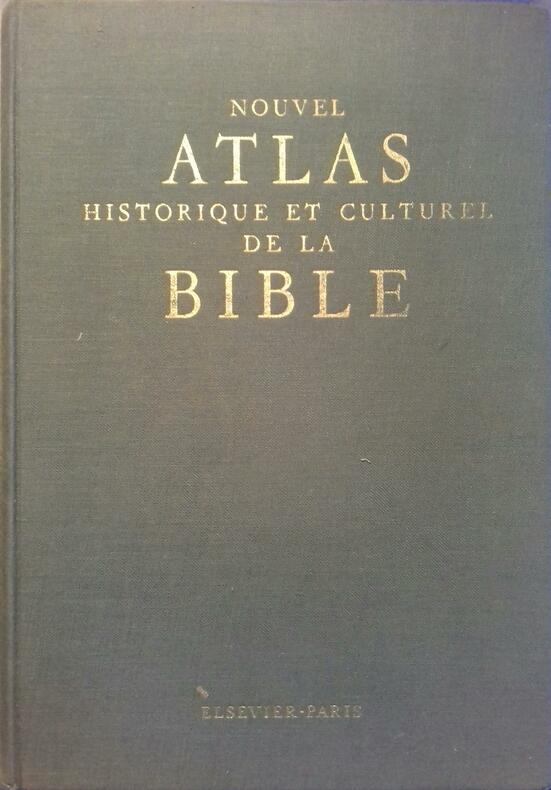
FRAINE J. de
Nouvel atlas historique et culturel de la Bible.
Couverture rigide. Reliure toile de l'éditeur. 274 pages.
Ссылка продавца : 6217
|
|
|
Francois & The Atlas Mountains
Piano Ombre
Imports 2014-03-25. Vinyl. Used:Good. Imports unknown
Ссылка продавца : DADAXB00I16B3Q0
|
|
|
Franz Reitinger
Kleiner Atlas Amerikanischer Überempfindlichkeiten.
Graz/Wien, Ritter Verlag, 2008. origi.Pappband, quer 8°, 335 Seiten.
Ссылка продавца : 40355
|
|
|
FRENCH NATIONALE RAILWAYS
"Brochure dépliante ""Map of France"""
SNCF (SOCIETE NATIONALE DES CHEMINS DE FER FRANCAIS). 1955. In-12. En feuillets. Bon état, Couv. convenable, Dos satisfaisant, Intérieur frais. Dépliant en 8 volets, illustré de quelques dessins et d'un plan bicolore. Texte en anglais. 41 x 42 cm.. . . . Classification Dewey : 912-Atlas, cartes et plans
Ссылка продавца : RO80151533
|
|
|
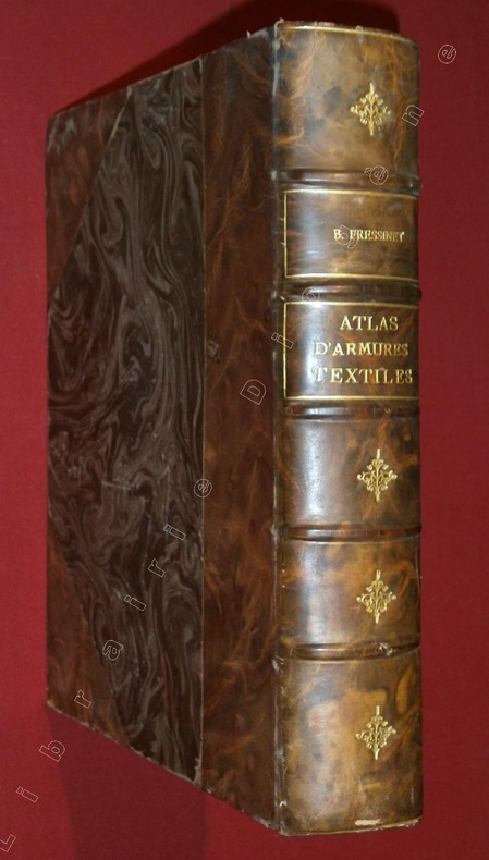
FRESSINET, B.
Atlas d'Armures Textiles par B. Fressinet.
Musée des Tissus de la Ville de Saint-Etienne, 1 volume de 225x270 mm environ, complet des 203 planches, demi-reliure à coins, en veau marbré brun, dos à 5 nerfs portant titres et fers dorés. Des rousseurs, frottements et petites épidermures sur le cuir, sinon bon état.
Ссылка продавца : 81278
|
|
|
FREITAG A.
Atlas du monde chrétien, l'expansion du christianisme à travers les siècles.
Paris/Bruxelles, Les Editions et Ateliers d'art graphique Elsevier, 1959. 26 x 35, 215 pp., très nombreuses cartes en couleurs et nombreuses illustrations en N/B, cartonnage d'édition imprimé + jaquette, bon état (petites traces de papier adhésif sur les pages de garde).
Ссылка продавца : 21521
|
|
|
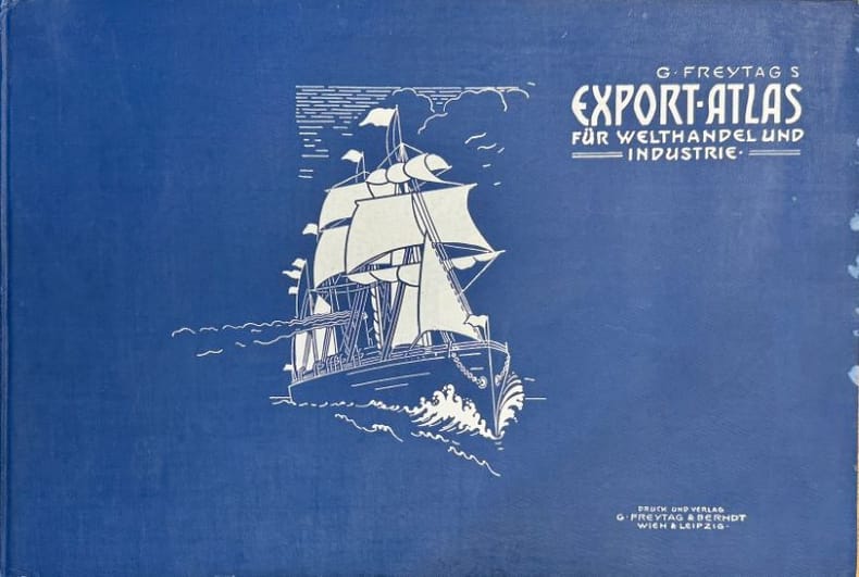
FREYTAG (Gustav).
G. Freytag's Export-Atlas für Welthandel und Industrie. Statistische Darstellung der Ein- und Ausfuhr aller wichtigen Handelsartikel nach ihrem Werte nebst den Konsular-Vertretungen des Deutschen Reichs und Österreich-Ungarns.
Wien G. Freytag & Berndt [1900] 1 vol. relié in-folio oblong, cartonnage percaline bleue illustré de l'éditeur, 28 planches de cartes et statistiques pour les différents pays du monde, et 1 grande carte dépliante des voies de navigation mondiales. Texte en allemand. Petites traces d'humidité en bordure du cartonnage, sinon exemplaire en très bonne condition. Rare.
Ссылка продавца : 119508
|
|
|
FREEDMAN (Lawrence).
La Stratégie mondiale. Guerre et paix à l'ère nucléaire.
Bordas, 1985, in-4°, 192 pp, préface de Thierry de Montbrial, très nombreux tableaux, photos, cartes et planches techniques en noir et en couleurs, chronologie, biblio, index, reliure toile éditeur, jaquette illustrée, bon état (Coll. Grands conflits)
Ссылка продавца : 24962
|
|
|
FREEDMAN Lawrence
La stratégie mondiale. Collection : Guerre et paix à l'ère nucléaire.
Paris, Bordas, 1985. 22 x 28, 192 pp., nombreuses illustrations et cartes en couleurs et en N/B, reliure d'édition pleine toile + jaquette, bon état.
Ссылка продавца : 39401 ISBN : 2040128042
|
|
|
FREMIN / MARIE P. / BERNARD A.
Nouvelle carte de la France, divisée en 69 départements
NON INDIQUE. 1869. In-Plano. Cartonnage d'éditeurs. Etat d'usage, Couv. défraîchie, Dos satisfaisant, Déchirures. Carte dépliante en couleurs de 83/58 cm. Déchirures au niveau des pliures. Tampons Manque un plats de couverture.. . . . Classification Dewey : 912-Atlas, cartes et plans
Ссылка продавца : RO80011096
|
|
|
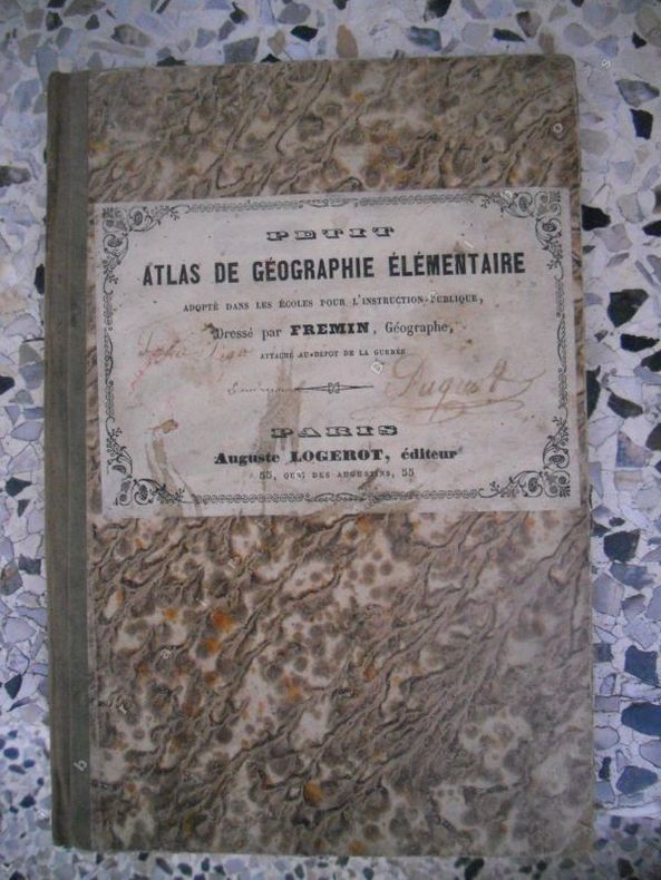
Fremin
Petit atlas de geographie elementaire adopte dans les ecoles pour l'instruction publique - Dresse par Fremin, geographe attache au depot de la guerre
Paris, Auguste Logerot, non date, circa 1850. Format 15x23 cm, cartonnage editeur. Ensemble de 10 cartes colorisees, et montees sur onglets, le proprietaire a ajoute in-fine une carte de la Hte-Marne extraite de l'atlas de Malte-Brun. L'ensemble presente sont lot de defauts inherents au manuels scolaires, mais est bien complet. Etat acceptable.
Ссылка продавца : 34176
|
|
|
Fremin (A.R.)
CARTE ROUTIERE de la FRANCE à l'usage des voyageurs. Nouvelle carte physique et routière de la France indiquant toutes les routes nationales et départementales ; avec les distances comptées en kilomètres ( d'un lieu à un autre. ) les chemins de fer éxécutés et en construction ainsi que les canaux navigables et les principales rivières, d'après les cartes de la Marine, celles des Ponts et Chaussées et des postes.
français Paris, J. Gaultier éditeur, 1900. Carte dépliante ( 68x93,5 cm ) gravée sur acier et tirée en couleurs.; in-12, chemise cartonnée éditeur, papier grenu cerise, demi-toile rouge, titre doré sur le premier plat. Nouvelle édition, ornée en carton, des cartes de Paris, de l'Algérie, et de la Corse. Exemplaire bien conservé malgré des pliures fragiles. Scotch au dos de la carte.
|
|
|
FRENCH MARITIME ATLAS
Le Neptune Francois ou Atlas Nouveau des Cartes Marines. Levees et Gravees par ordre expres du Roy. Pour l'usage de ses armees de Mer
Paris: Hubert Jaillot 1693 but Amsterdam: Pierre Mortier 1693-1700. 3 parts in one volume folio 625 x 505 mm. ENGRAVED TITLE-PAGES TITLE VIGNETTES AND 105 EXCEPTIONALLY FINE CHARTS AND PLATES COLORED BY A CONTEMPORARY HAND HEIGHTENED IN GOLD THROUGHOUT. 19th-century calf gilt gilt edges; preserved in a modern cloth clamshell box. Comprises: Part 1: Le Neptune Francois. Paris: Hubert Jaillot 1693. Engraved allegorical title-page by Jan van Vianen letterpress title-page printed in red and black with fully colored vignette dated 1693 engraved table of comparative nautical scales; title-page and plates from the third part bound in here comprising: letterpress title-page in red and black with fully colored vignette of the coat-of-arms of Amsterdam Suite du Neptune Francois dated 1700 19 exceptionally fine plates of ships only 18 called for by Koeman numbered 1-18 and one unnumbered plate 12 plates of flags; and 30 hand-colored double-page charts of northern and western Europe mainly French coasts and including the world map in Mercator's projection "Carte generale de toutes les Costes du Monde" Shirley 559 engraved and printed by Pierre Mortier in Amsterdam ALL WITH CONTEMPORARY HAND-COLORING AND HEIGHTENED WITH GOLD. Some staining at beginning the heavier coloring occasionally showing through 15 maps with some light chipping and splitting to green color mostly to marginal latitude and longitude grid some backed with tape tiny wormhole to center throughout extending to short worm track on 12 maps affecting images. Koeman M. Mor 1 and 2 mixed issue with some of the 1693 dates removed from the map titles. Part 2: Cartes Marines a l'Usage des Armees du Roy de la Grande Bretagne. gravees et recueillies par le Sr. Romain de Hooghe. Amsterdam: PierreMortier 1693. Letterpess title-page printed in red and black with fully colored vignette 9 engraved charts by de Hooghe 5 double-page of the French and English Channel coasts and a large folding chart of the Mediterranean incorporating finely detailed insets showing ports and harbors ALL WITH CONTEMPORARY HAND-COLORING AND HEIGHTENED WITH GOLD. Tiny wormhole in center affecting images one map with some light chipping and splitting to green coloring. Koeman M. Mor. 5 with some "1693" dates removed from the map titles. Part 3: Atlas Martime. Amsterdam: Pieter Mortier 1693. Engraved allegorical title-page Atlas Maritime. by Romein de Hooghe dated 1693 engraved compass of the winds 33 charts 21 double-page and one folding of Africa Asia and the Americas 10 charts including the Atlantic with northeastern coasts of South America and Africa Central America North America East Coast from the Hudson to Labrador and Canada. ALL WITH CONTEMPORARY HAND-COLORING AND HEIGHTENED WITH GOLD letterpress title-page plates of ships and flags bound in before part one see note above. Tiny wormhole to center throughout extending to short worm track on 23 maps of Africa and Asia affecting images map of "Costes l'Afrique" with southern portion of Portugal where green outline color burned through missing. Koeman M. Mor. 7 the first edition containing 33 charts see note 1. A MAGNIFICENTLY COLORED COPY of one of the most beautiful of all maritime atlases. "The Neptune Franois in two parts and its third part Cartes Marines prepared for the use of William III who required accurate information for his war plans against France. was the most expensive sea-atlas ever published in Amsterdam in the 17th century. Its charts are larger and more lavishly decorated than those of any preceding book of its kind. In 1700 Mortier brought out a third volume with charts of the outer-European waters. Suite du Neptune Francois. Apart from the first volume which had a second edition in 1703 none of the atlases was republished. This magnifient work was intended more as a show-piece than something to be used by the pilots at sea" Koeman. The third part includes 10 maps of the Americas: "Carte Nouvelle de l'Amerique Angloise Contenant La Virginie Mary-Land Caroline Pensilvania Nouvel Iorck N. Iarsey" - "Carte Particuliere de Virginie Maryland Pennsilvanie la Nouvelle Jersey" - "Carte Particuliere de la Caroline" and "Mer du Sud ou Pacifique Contenant l'Isle de Californe les Costes de Mexique du Perou Chili et le Destroit de Magellanique" See Koeman reference above. Phillips Atlases 517. . Paris: Hubert Jaillot, 1693 [but Amsterdam: Pierre Mortier, 1693-1700]. hardcover
Ссылка продавца : 72lib1159

|
|
|
FRENCH MARITIME ATLAS
Suite du Neptune Francois ou Atlas nouveau des cartes Marine
Amsterdam: P. Mortier 1700. Folio 25 x 20 inches. Letterpress title-page 5 pages of preliminaries in French. One double-page and folding chart of the north coast of Africa 22 double page charts and 11 full-page charts all with EXCEPTIONALLY FINE HAND-COLOURING IN FULL one or two creases one or two minor and discreet repairs to verso two maps a bit browned. Modern fine red morocco gilt antique by Trevor Lloyd. Provenance: with the purple ink library stamp of the Bibliotheek Inst. St. Louis. Oudenbosch at the foot of the title-page. The full title: "Suite du Neptune Francois ou Atlas Nouveau des Cartes Marines. Levees par ordre expres des Roys de Portugal. Sous qui on a fait la Decouverte de l'Afrique &c. Et donnees au Public par les soins de Feu Monsieur de D'Ablancourt. Dans lequel on voit la description exacte de toutes les Cotes du Monde du Detroit de Gibraltar de la Mer Oceane Meridionale ou Ethiopiene de la Mer des Indes Orientales & Occidentales &c. Ou sont exactement marquees les routes qu'il faut tenir les Bancs de sables Rochers & Basses d'eau; & generalement tout ce qui concerne la Navigation. Le tout fait sur les Observations et l'experience des plus habiles Ingenieurs et Pilotes. First edition of the third part of Mortier's pirated edition of Jaillot's "Neptune Francois" containing charts of outer-European waters prepared for King Pedro II of Portugal who was at that time supporting France and Spain in the War of Spanish Succession 1701-1714. These spectacularly beautiful maps include a magnificent world map "Carte Generale de Toutes les Costes du Monde et les Pays Nouvellement Decouvert"; fifteen maps of the coast of Africa including a superb double-page and folding map of the north coast and the Mediterranean with three insets of the Strait of Gibralta Algiers and Triplo; two maps of the Red Sea; two maps of the East Indies and one of the Pacific showing the northern coastline of Australia with an inset of the southern coast; and the following maps of the Americas: "Le Golfe de Mexique et les Isles Voisine"; Carte de la Mer Meridional Contenant une partie des Costes de L'Afrique et de L'Amerique Meridionale et les Isles qui les Environs Dresse sue les Relations les plus Nouvelles"; "Carte Nouvelle de L'Amerique Angloise Contenant La Virginie Mary-Land Caroline Pensilvania Nouvelle Iorck N. Iarsey N: France et Les Terres Nouvellement Decouverte"; "Carte Particuliere de Virginie Maryland Pennsilvanie la Nouvelle Jersey"; "Carte Particuliere de Isthmus ou Daien qui comprend le Golfe Panama &c Cartegenaet les Isles Aux Environs"; "Carte General de la Caroline"; "Carte Particuliere de la Caroline"; "Mer du Sud ou Pacifique Contenant l'Isle de Californe les Costes de Mexique du Perou Chili et le Destroit de Magellanique"; "Carte Particuliere de L'Amerique Septentrionale ou sont comris le Detroit de Davids le Droit de Hudseon"; and "Le Canada ou Partie dela Nouvelle France Contenant la Terre de Labrador la Nouvelle France Les Isles de Terre Nuevre de Nostre Dame". "The Neptune Franois. was the most expensive sea-atlas ever published in Amsterdam in the 17th century. Its charts are larger and more lavishly decorated than those of any preceding book of its kind. In 1700 Mortier brought out a third volume with charts of the outer-European waters. Suite du Neptune Francois. Apart from the first volume which had a second edition in 1703 none of the atlases was republished. This magnificent work was intended more as a show-piece than something to be used by the pilots at sea" Koeman. Koeman IV 7. Catalogued by Kate Hunter. Amsterdam: P. Mortier, 1700. unknown
Ссылка продавца : 72lib1167
|
|
|
FRENZEL KONRAD (Hrsg.)
Velhagen & Klasings grosser Volksatlas. Das Jubiläumswerk des Verlages zu seinem hundertjährigen Bestehen.
Bielefeld, lpg., Velhagen & Klasing 1935. 4°. XII/39/112 S. 2- und 6 spaltig, 92 S. farbige Karten. OLeinen, geringe Gebrauchssp., gut erhalten.
Ссылка продавца : 28522AB
|
|
|
Frenzel, Konrad
Velhagen und Klasings Grosser Volks-Atlas. Das Jubiläumswerk des Verlages zu seinem hundertjährigen Bestehen
Bielefeld, Leipzig, Velhagen und Klasing, 1938. 92, 118 Seiten , 33 cm , Leinen
Ссылка продавца : 50639
|
|
|
Friedrich, Ernst. Herausgeber
Minerva Atlas. Handatlas für das Deutsche Volk.
Leipzig., Verlag der Literaturwerke 'Minerva' R. Max Lippold., 1928. Unter besonderer Berücksichtigung von Wirtschaft, Handel und Verkehr. 2. Auflage. XXIII(1) Seiten - Inhaltsverzeichnis, 166 Seiten farbige Karten, Seite 167 - 424(1) Register (Namen-Verzeichnis). Zustand: Schwarzer Lederrücken, rote Leinendeckel - die vorderen Ledereckkanten sind minimal beieben, Titelblatt, Vorwort und Buchschnitt minimal braunfleckig. 4°. OHalbleder.
Ссылка продавца : 051851
|
|
|
Fritsch, Peter
Dermatologie und Venerologie. Lehrbuch und Atlas. Von Peter Fritsch. (Springer-Lehrbuch).
Berlin, Heidelberg, New York u.a.: Springer 1998. XXIV, 959 Seiten. Mit 711 Abbildungen und 295 Tabellen. 4° (25-35 cm). Illustrierter Orig.-Pappband. [Hardcover / fest gebunden].
Ссылка продавца : 101038

|
|
|
FROES, Luis
Lettera annua del Giappone dell’anno MDXCVI. Scritta dal P. Luigi Frois, al R.P. Claudio Acquauiua Generale della Compagnia di Giesù. Tradotta in Italiano dal P. Francesco Mercati Romano della stessa Compagnia. Les missions chrétiennes en Asie au XVIe siècle
Rare relation des missions jésuites au Japon à la fin du XVIe siècle, conservée dans son pur vélin souple de l’époque. In Padova, Appresso Francesco Bolzetta, 1599.Petit in-8 de 124 ff. Relié en plein vélin souple de l’époque, dos lisse avec le titre manuscrit. Chemise et étui de maroquin rouge. Ex libris manuscrit sur le titre.155 x 101 mm.
Ссылка продавца : LCS-224
|
|
|
From "Atlas of Butterflies in Europe and Partly Russian Asian Possessions."
Antique Chromolithograph. Russian Butterflies.
Ca. 1890 Single leaf reverse side blank. Sheets measures 11 by 8 inches 26 by 20 cm. Some minor wear light age toning. Very Good. Postage will be charged at cost multiple prints will be no extra charge for shipping. BG1-3 Left Pile. unknown
Ссылка продавца : 244843

|
|
|
From Bilder Atlas Leipzig Germany.
Antique Steel Engraving. Sacred Places and Objects
Published circa 1870. Single leaf with reverse side blank. Sheet measures 13.5 by 10.5 inches 34 by 78 cm. Some age toning a bit of spotting has been folded once vertically. Very Good. . Soft Cover. Very Good. P1-1. paperback
Ссылка продавца : 251441

|
|
|
From Bilder Atlas Leipzig Germany.
Antique Steel Engraving. Ancient Dress
Published circa 1870. Hand-colored single leaf with reverse side blank. Sheet measures 13.5 by 10.5 inches 34 by 78 cm. Some minor creasing folded once vertically. Very Good. Soft Cover. Very Good. P1-1. paperback
Ссылка продавца : 251240

|
|
|
From E. Von Sydow's Schul Atlas.
Antique Steel Engraving. Map- The Northern Sky
1863 Hand-coloured single leaf with reverse side blank. Vertical fold as issued. Sheets measures 11.5 by 9.5 inches 29 by 24 cm. Some creasing and age toning a bit of spotting. Good. . Soft Cover. Good. P5. paperback
Ссылка продавца : 253200

|
|
|
Fryen, A., P. Liesener, H. Prechtel und F. Schohusen
Harms Niedersachsen in Karte, Bild und Wort. Eine Heimatkunde [mit entnehmbarer Faltkarte]
Frankfurt [u.a.]: Atlantik-Verlag Paul List, 1959. 38 S. ; 27,5 x 20,5 cm ; kart. ;
Ссылка продавца : 123028

|
|
|
FUAT SEZGIN.
Piri Reis and the Pre-Columbian discovery of the American continent by Muslim seafarers.
New English Paperback. Pbo. Oblong large 8vo. (22 x 22 cm). In English. Color and b/w ills. 68 p. Piri Reis and the Pre-Columbian discovery of the American continent by Muslim seafarers.
|
|
|
Fujita, Tsuneo
Zellen und Gewebe : e. REM-Atlas für Mediziner u. Biologen. T. Fujita ; K. Tanaka ; J. Tokunaga. Mit e. Geleitw. von K. A. Rosenbauer. Übers. von M. Niehaus-Osterloh
Stuttgart ; New York : Fischer 1986. XIII, 240 S. : 142 Abb.. ; 27 cm, Eigentümersignatur auf Titelblatt + Ex-Libris-Stempel (Bärchenmotiv) kart., Softcover/Paperback, sonst Exemplar in gutem Erhaltungszustand
Ссылка продавца : 55750

|
|
|
FULLARD HAROLD
PHILIPS' MODERN SCHOOL ATLAS
George Philip & Son Ltd. 1965. In-4. Relié toilé. Bon état, Couv. convenable, Dos satisfaisant, Intérieur frais. 96 + env. 30 pages (Index). Illustré de nombreuses cartes en couleur. Jaquette manquante.. . . . Classification Dewey : 912-Atlas, cartes et plans
Ссылка продавца : RO60111189
|
|
|
Fullard (Hrsg.), Harold and H. C. Darby (Hrsg.)
The University Atlas. Fourteenth Edition
London, George Philip & Son Limited, 1972. 176 S. + NN. 4° Quart, Hardcover/Pappeinband
Ссылка продавца : 106194

|
|
|
Fullard, Harold. Darby, H. C
The University Atlas.
London. Liverpool., George Philip and Son Limited - The London Geographical Institute - Philip, Son and Nephew Limited., 1958. Eight edition. XXIV Seiten (Einführung), 176S. farbige Karten, 87(1)Seiten Index. Zustand: Ausgeschiedenes Bibliotheksexemplar, Einbandränder und -Rücken aufgehellt (lichtrandig), Einbandkanten minimal berieben, Titelblatt mit Institutsstempel. 4°. OPappband.
Ссылка продавца : 041736
|
|
|
FW. BEERS ATLAS OF MONMOUTH COUNTY F. W.
EATONTOWN NEW JERSEY: 1873 MAP
1873. F.W. BEERS ATLAS OF MONMOUTH COUNTY. EATONTOWN MAP 1873. A 13-inch by 24-inch hand-colored map of Eatontown showing Shrewsbury and Ocean Township. $75.00. <br/><br/> unknown
Ссылка продавца : 26083

|
|
|
FW. BEERS ATLAS OF MONMOUTH COUNTY F. W.
LONG BRANCH: 1873 MAP
1873. F.W. BEERS ATLAS OF MONMOUTH COUNTY. LONG BRANCH 1873 MAP. A 13-inch by 24-inch hand-colored map of a portion of Long Branch. $85.00. <br/><br/> unknown
Ссылка продавца : 26084

|
|
|
FW. BEERS ATLAS OF MONMOUTH COUNTY F. W.
MILLSTONE TOWNSHIP MAP 1873
1873. F.W. BEERS ATLAS OF MONMOUTH COUNTY. MILLSTONE TOWNSHIP MAP 1873. A 16-inch by 13-inch hand-colored map of Millstone. $75.00. <br/><br/> unknown
Ссылка продавца : 26040

|
|
|
FW. BEERS ATLAS OF MONMOUTH COUNTY F. W.
SPRING LAKE: REIDS VILLA PARK/ REV. WILLITS
1877. F.W. BEERS ATLAS OF MONMOUTH COUNTY. SPRING LAKE 1877: REIDS VILLA PARK. Upper picture frontal view of Reids Villa Park lower picture frontal view of the residence of Rev. A.A. Willits Spring Lake. Hand-colored. $125.00. <br/><br/> unknown
Ссылка продавца : 26075

|
|
|
FW. BEERS ATLAS OF MONMOUTH COUNTY F. W.
SPRING LAKE: REIDS VILLA PARK/ REV. WILLITS
1877. F.W. BEERS ATLAS OF MONMOUTH COUNTY. SPRING LAKE 1878: REIDS VILLA PARK. Upper picture frontal view of Reids Villa Park lower picture frontal view of the residence of Rev. A.A. Willits Spring Lake. $60.00. <br/><br/> unknown
Ссылка продавца : 26200

|
|
|
FW. BEERS ATLAS OF MONMOUTH COUNTY F. W.
EATONTOWN NEW JERSEY: 1873 MAP
1873. F.W. BEERS ATLAS OF MONMOUTH COUNTY. EATONTOWN MAP 1873. A 13-inch by 24-inch hand-colored map of Eatontown showing Shrewsbury and Ocean Township. $75.00. <br/><br/> unknown books
Ссылка продавца : 26083
|
|
|
FW. BEERS ATLAS OF MONMOUTH COUNTY F. W.
LONG BRANCH: 1873 MAP
1873. F.W. BEERS ATLAS OF MONMOUTH COUNTY. LONG BRANCH 1873 MAP. A 13-inch by 24-inch hand-colored map of a portion of Long Branch. $85.00. <br/><br/> unknown books
Ссылка продавца : 26084
|
|
|
FW. BEERS ATLAS OF MONMOUTH COUNTY F. W.
MILLSTONE TOWNSHIP MAP 1873
1873. F.W. BEERS ATLAS OF MONMOUTH COUNTY. MILLSTONE TOWNSHIP MAP 1873. A 16-inch by 13-inch hand-colored map of Millstone. $75.00. <br/><br/> unknown books
Ссылка продавца : 26040
|
|
|
FW. BEERS ATLAS OF MONMOUTH COUNTY F. W.
SPRING LAKE: REIDS VILLA PARK/ REV. WILLITS
1877. F.W. BEERS ATLAS OF MONMOUTH COUNTY. SPRING LAKE 1878: REIDS VILLA PARK. Upper picture frontal view of Reids Villa Park lower picture frontal view of the residence of Rev. A.A. Willits Spring Lake. $60.00. <br/><br/> unknown books
Ссылка продавца : 26200
|
|
|
FW. BEERS ATLAS OF MONMOUTH COUNTY F. W.
SPRING LAKE: REIDS VILLA PARK/ REV. WILLITS
1877. F.W. BEERS ATLAS OF MONMOUTH COUNTY. SPRING LAKE 1877: REIDS VILLA PARK. Upper picture frontal view of Reids Villa Park lower picture frontal view of the residence of Rev. A.A. Willits Spring Lake. Hand-colored. $125.00. <br/><br/> unknown books
Ссылка продавца : 26075
|
|
|
Fénelon (Paul)
Les Pays de la Loire.
Paris Flammarion 1978 Atlas et géographie de la France moderne. Un volume in-4 relié plein simili brun de l'éditeur sous jaquette illustrée, 501 pages. Bel état.
Ссылка продавца : 1956
|
|
|
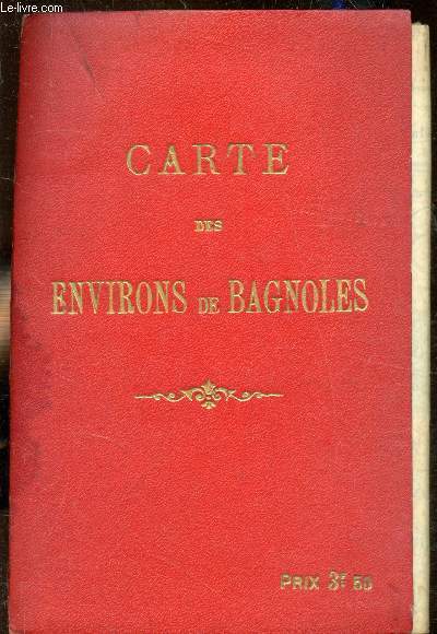
G. Devaux
Carte des environs de Bayonne - 1:50000 + 1 plan de bagnoles.
Devaux. Non daté. In-Plano. Broché. Etat d'usage, Couv. défraîchie, Dos frotté, Intérieur acceptable. Carte des environs de Bayonne - 1:50000 + 1 plan de Bayonne en couleurs. Légère tâche sur le 1er plat. Plan de Bayonne avec légères déchirures.. . . . Classification Dewey : 912-Atlas, cartes et plans
Ссылка продавца : RO80209343
|
|
|
G.PELTIER
CARTE DE L'YSERE à L'AISNE
. NON DATE. In-Folio. En feuillets. Etat d'usage, Couv. convenable, Dos satisfaisant, Intérieur frais. Carte en couleur, mesurant 40cmx59cm, à l'échelle 1:420 000 . Quelques déchirures (altérant un peu la lecture), carte consolidé avec du scotch sur le dos, rousseurs.. . . . Classification Dewey : 912-Atlas, cartes et plans
Ссылка продавца : R240004669
|
|
|
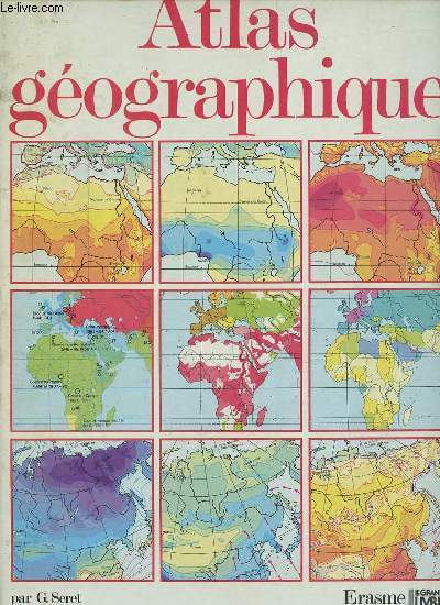
G.Seret & L.Swysen
Atlas géographique.
Erasme / le grand livre du mois. 1986. In-4. Relié. Etat d'usage, Tâchée, Dos satisfaisant, Intérieur frais. 120 pages - nombreuses cartes en couleurs hors texte.. . . . Classification Dewey : 912-Atlas, cartes et plans
Ссылка продавца : R320149429 ISBN : 287127049
|
|
|
Gabriel, Kathryn
Roads to center place. A cultural atlas of Chaco Canyon and the Anasazi. [By Kathryn Gabriel].
Boulder: Johnson Books 1991. 300 Seiten. Mit einigen Abbildungen im Text. Gr. 8° (22,5-25 cm). Orig.-Broschur. [Softcover / Paperback].
Ссылка продавца : 158746

|
|
|
Gaebler (Hrsg.), Eduard
Gaeblers kleiner Hand-Atlas über alle Teile der Erde.
Leipzig, Georg Dollheimer Verlag, 1933. 287 S. + 80 Tafn. + LXXXIV S. Gr.-8° Groß-Oktav, Leinen
Ссылка продавца : 101833

|
|
|
Gaebler Eudard
Neuester Hand-Atlas über alle Teile der Erde mit besonderer Berücksichtigung des gesamten Weltverkehrs
Leipzig (F.A.Berger) 1901 (= 4.Auflage). 4°, illustriertes Originalleinen (Hardcover), 40 S., farbige Karten 4
Ссылка продавца : Khe01233
|
|
|
Gaebler, Eduard
Gaeblers kleiner Hand-Atlas über alle Teile der Erde.
Leipzig, Ed. Gaebler Geographisches Institut, 1935. 304 S. + 88 Tafn. LXXXIV S. Gr.-8° Groß-Oktav, Halbleder
Ссылка продавца : 81977

|
|
|
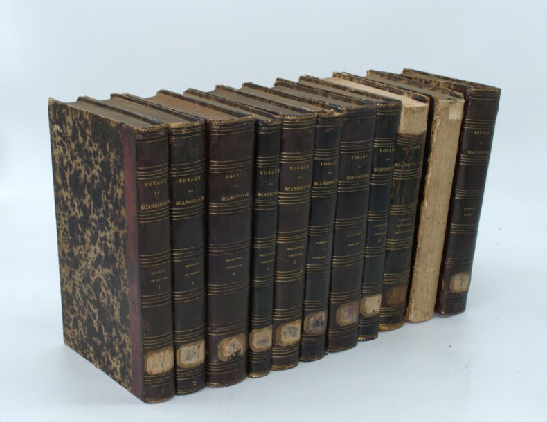
GAIMARD (Paul) ,LOTTIN (V.),MARMIER (X.) ,BRAVAIS (A.),ROBERT (E.), ANGLÉS (R.) , MARTINS (Ch.) , BIARD (Fr.) ,VAHL (J) , LAESTADIUS (L.L.) ,DUROCHER (J.) ,SILJERSTRÖM (P.)(sv) , BOECK (Chr.) ,etc ...
Voyages en Scandinavie, en Laponie, au Spitzberg, et aux Iles Féroé pendant les années 1838-1840 sur la Corvette La Recherche.
Paris, Arthus Bertrand, s.d. (1842-1845). 11 volumes grand in-8 (18, 13 volumes de texte et 5 atlas), relié demi veau aubergine, dos lisse avec titre et tomaison, étiquette au dos, supra libri effacés aux plats, coins usés, dos avec manque (géologie, minéralogie), dos manquant (histoire de la Scandinavie), - Relation du voyage par X. Marmier, 2 vol. (374 pp., 1 pl. ; 458 pp.) - Magnétisme terrestre par V. Lottin, A. Bravais : 3 vol. (563 pp. plus errata ; 448 pp. ; 297 pp. plus table générale détaillée des planches.) - Aurores boréales par V. Lottin, A. Bravais 1 vol. (566 pp., avec 42 figures in texte.) - Géologie, par E. Robert, 2 vol. en 1, (4), 210 pp. ; (4), 308 pp.) - Géologie, Minéralogie par J. Durocher, 1 vol. (482 pp.) - Astronomie et Hydrographie, par V. Lottin, A. Bravais… 1 vol. (531 pp.) - Littérature scandinave, par X. Marmier : 1 vol. (557 pp.) - Histoire de la Scandinavie, par X. Marmier, 1 volume (515 pp.)
Ссылка продавца : PHO-1524
|
|
|
Gail Atlas
Expecting Jesus : A Book of Daily Readings for the Advent Season
CreateSpace Independent Publishing Platform 2013. Paperback. Good. Disclaimer:A copy that has been read but remains in clean condition. All pages are intact and the cover is intact. The spine may show signs of wear. Pages can include limited notes and highlighting and the copy can include previous owner inscriptions. At ThriftBooks our motto is: Read More Spend Less.Dust jacket quality is not guaranteed. CreateSpace Independent Publishing Platform paperback
Ссылка продавца : G1493553755I3N00 ISBN : 1493553755 9781493553754

|
|
 Получить результаты поиска по электронной почте
 Загрузить результаты в формате PDF
  RSS-канал


